Beulah Hill

Heritage Site in Surrey

England

Beulah Hill

South Norwood Methodist Church
South Norwood Methodist Church Credit: Richard Rogerson

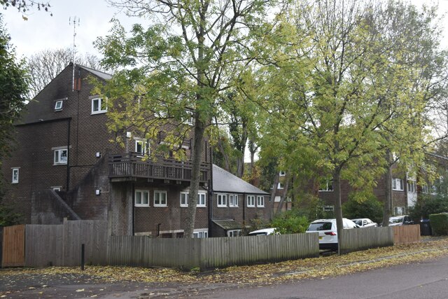
Beulah Hill, located in Surrey, England, is a historic heritage site with a rich cultural significance. Nestled in a picturesque setting, the hill offers breathtaking panoramic views of the surrounding countryside, making it a popular destination for nature lovers and tourists alike.

The origin of the name "Beulah" is believed to have biblical connotations, translating to "the land of peace and beauty." This name aptly describes the serene and tranquil atmosphere that the hill exudes.

The heritage site is adorned with several notable landmarks, including the Victorian Gothic-style All Saints Church. Built in the 19th century, this architectural gem boasts intricate stained glass windows and a majestic bell tower that adds to the charm of the hill.

Another prominent feature of Beulah Hill is the Beulah Spa, a former health resort that thrived in the 19th century. The spa attracted visitors seeking the therapeutic benefits of its mineral-rich waters and lush surroundings. While the spa is no longer operational, remnants of its grandeur can still be seen, with some of the original buildings repurposed for residential use.

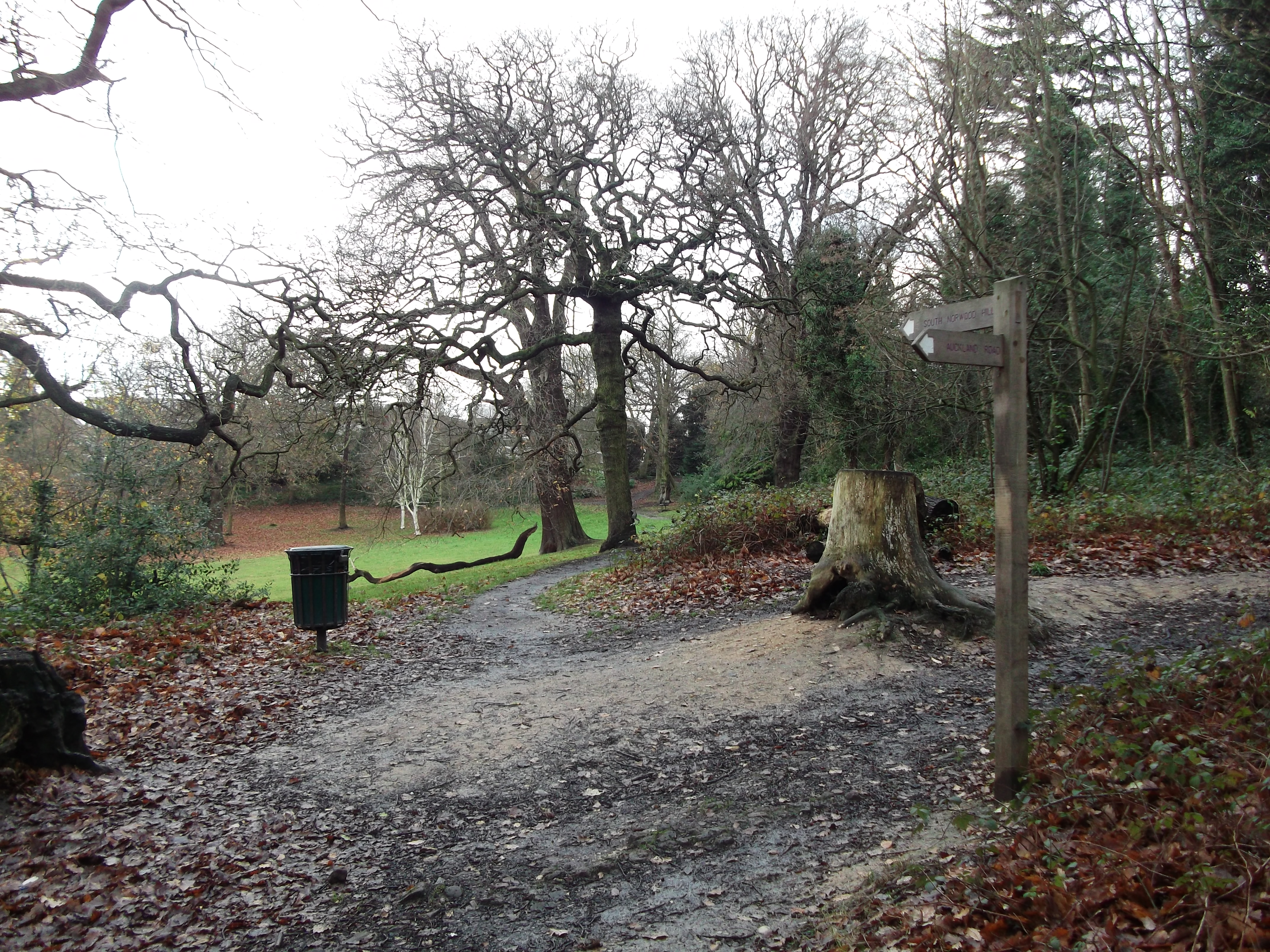
Beulah Hill is also home to a diverse range of flora and fauna, making it a haven for wildlife enthusiasts. The hill is covered with an array of trees, including oak, birch, and beech, providing a habitat for various bird species and small mammals.

In conclusion, Beulah Hill in Surrey is a heritage site that offers a captivating blend of natural beauty, historical landmarks, and a peaceful ambiance. It stands as a testament to the region's rich history and continues to captivate visitors with its scenic vistas and cultural significance.

If you have any feedback on the listing, please let us know in the comments section below.

Beulah Hill Images

Images are sourced within 2km of 51.411/-0.093 or Grid Reference TQ3269. Thanks to Geograph Open Source API. All images are credited.

South Norwood Methodist Church
Railway Bridge, South Norwood The bridge carries the rail line between Elmers End and Crystal Palace  over the A213
Railway Bridge, South Norwood
The bridge carries the rail line between Elmers End and Crystal Palace over the A213
Brigstock Road, Thornton Heath Brigstock Road in Thornton Heath, in the suburbs of south London.
Brigstock Road, Thornton Heath
Brigstock Road in Thornton Heath, in the suburbs of south London.
Grange Road, Upper Norwood Grange Road is a residential road on a hillside in Upper Norwood, in the suburbs of south London.
Grange Road, Upper Norwood
Grange Road is a residential road on a hillside in Upper Norwood, in the suburbs of south London.
Mayday Madness Old Palace Clog performing at The Lakes Café event at South Norwood Lake.
Mayday Madness
Old Palace Clog performing at The Lakes Café event at South Norwood Lake.
Mayday Madness Old Palace Clog performing at The Lakes Café event at South Norwood Lake.
Mayday Madness
Old Palace Clog performing at The Lakes Café event at South Norwood Lake.
Mayday Madness Old Palace Clog performing at The Lakes Café event at South Norwood Lake.
Mayday Madness
Old Palace Clog performing at The Lakes Café event at South Norwood Lake.
Mayday Madness Old Palace Clog performing at The Lakes Café event at South Norwood Lake.
Mayday Madness
Old Palace Clog performing at The Lakes Café event at South Norwood Lake.
Mayday Madness Old Palace Clog performing at The Lakes Café event at South Norwood Lake.
Mayday Madness
Old Palace Clog performing at The Lakes Café event at South Norwood Lake.
Mayday Madness Old Palace Clog performing at The Lakes Café event at South Norwood Lake.
Mayday Madness
Old Palace Clog performing at The Lakes Café event at South Norwood Lake.
Mayday Madness Old Palace Clog performing at The Lakes Café event at South Norwood Lake. At the end of the dance, the dancers depart to reveal the band of five melodeon players.
Mayday Madness
Old Palace Clog performing at The Lakes Café event at South Norwood Lake. At the end of the dance, the dancers depart to reveal the band of five melodeon players.
Path towards Anerley Road, Betts Park
Path in Betts Park
Path in Betts Park
Train passing through Anerley Station
Flats in Auckland Road
Entrance to Stambourne Woodland Walk A path through woodland which leads up to Church Road, Crystal Palace.
Entrance to Stambourne Woodland Walk
A path through woodland which leads up to Church Road, Crystal Palace.
Green Lane, Norbury Green Lane forms part of the short B273 road through Norbury, in the suburbs of south London.
Green Lane, Norbury
Green Lane forms part of the short B273 road through Norbury, in the suburbs of south London.
Camden Gardens, Norbury Camden Gardens is a minor residential road in Norbury, in the suburbs of south London.  The houses are semi-detached.
Camden Gardens, Norbury
Camden Gardens is a minor residential road in Norbury, in the suburbs of south London. The houses are semi-detached.
Show me another place!

Beulah Hill is located at Grid Ref: TQ3269 (Lat: 51.411, Lng: -0.093)

What 3 Words

///moves.shark.take. Near Thornton Heath, London

Nearby Locations

Beulah Hill

Related Wikis

Spa Wood

Spa Wood is an area of ancient woodland in the London Borough of Croydon that was once a part of The Great North Wood. In 2017, the London Wildlife Trust...

Harris Academy Beulah Hill

Harris Academy Beulah Hill is a coeducational secondary school located in the Upper Norwood area of the London Borough of Croydon, England. The school...

Croydon transmitting station

The Croydon transmitting station is a broadcasting and telecommunications facility on Beaulieu Heights in Upper Norwood, London, England (grid reference...

Capital London

Capital London is an Independent Local Radio station owned and operated by the Global media company as part of its national Capital FM Network. As Capital...

Beaulieu Heights

Beaulieu Heights (locally BEW-lə) 16 acres (6.5 ha) is an area of ancient woodland between South Norwood and Upper Norwood in the London Borough of Croydon...

Spurgeon's College

Spurgeon's College is an evangelical Baptist theological college in South Norwood, London, England, United Kingdom. It is affiliated with the Baptist Union...

Grangewood Park

Grangewood Park is an extensive woodland area situated in South Norwood, London. It is managed by the London Borough of Croydon. It is bounded by Grange...

St John the Evangelist, Upper Norwood

The Church of St John the Evangelist is a Church of England church in Upper Norwood, a suburb of South London, in the United Kingdom. It is a Grade II...

Nearby Amenities

Located within 500m of 51.411,-0.093
Crossing
Crossing: uncontrolled
Crossing Ref: zebra
Lat/Long: 51.4138698/-0.092223
Ref GB Tflcid: RWG215345
Traffic Calming: table
Lat/Long: 51.4109074/-0.0938819
Mini Roundabout
Direction: clockwise
Lat/Long: 51.4116363/-0.0932306
Mini Roundabout
Direction: clockwise
Lat/Long: 51.4085215/-0.0984306
Ref GB Tflcid: RWG215271
Traffic Calming: table
Lat/Long: 51.4098535/-0.0956246
Ref GB Tflcid: RWG215261
Traffic Calming: hump
Lat/Long: 51.4102585/-0.0994335
Ref GB Tflcid: RWG215336
Traffic Calming: hump
Lat/Long: 51.412859/-0.0956639
Ref GB Tflcid: RWG215339
Traffic Calming: hump
Lat/Long: 51.4120841/-0.0940004
Ref GB Tflcid: RWG215342
Traffic Calming: cushion
Lat/Long: 51.4112566/-0.0934375
Ref GB Tflcid: RWG203548
Traffic Calming: hump
Lat/Long: 51.4139461/-0.087988
Mini Roundabout
Direction: clockwise
Lat/Long: 51.412722/-0.0864255
Turning Circle
Lat/Long: 51.4095656/-0.0876753
Bus Stop
Upper Beulah Hill
Local Ref: NE
Naptan AtcoCode: 490013929N
Naptan Bearing: N
Public Transport: platform
Lat/Long: 51.4119353/-0.0881049
Post Box
Collection Times: Mo-Fr 09:00; Sa 07:00
Drive Through: no
Operator: Royal Mail
Operator Wikidata: Q638098
Post Box Type: pillar
Ref: CR7 225D
Royal Cypher: GR
Royal Cypher Wikidata: Q33102273
Source: survey
Lat/Long: 51.409789/-0.0956083
Vicky Corner Shop
Addr City: Thornton Heath
Addr Housenumber: 12
Addr Postcode: CR7 8HY
Addr Street: Howberry Road
Fhrs Authority: Croydon
Fhrs Id: 1055764
Fixme: The name of the shop is not at all clear from the shopfront. Simpson's Corner was the name per previous OSM changelog; FHRS and web search results suggest now Vicky Corner Shop.
Old Name: Simpson's Corner
Shop: convenience
Source: survey;fhrs
Survey Date: 2018-09-06
Lat/Long: 51.4077364/-0.0939456
Post Box
Collection Times: Mo-Fr 16:45; Sa 12:00; Su off
Drive Through: no
Operator: Royal Mail
Operator Wikidata: Q638098
Post Box Type: pillar
Ref: CR7 11
Royal Cypher: EIIR
Royal Cypher Wikidata: Q33102113
Source: survey
Lat/Long: 51.4077751/-0.0938892
Bus Stop
South Norwood Hill / All Saints Church
Local Ref: ND
Naptan AtcoCode: 490003242N
Naptan Bearing: N
Naptan CommonName: Beulah Hill All Saints Church
Naptan Indicator: ND
Naptan Verified: no
Public Transport: platform
Lat/Long: 51.4097933/-0.0869585
Bus Stop
Beulah Hill / All Saints Church
Local Ref: SL
Naptan AtcoCode: 490003242S
Naptan Bearing: S
Naptan CommonName: Beulah Hill All Saints Church
Naptan Indicator: SL
Naptan Verified: no
Public Transport: platform
Lat/Long: 51.4109875/-0.0873332
Bus Stop
Beulah Hill
Local Ref: WF
Naptan AtcoCode: 490003957S1
Naptan Bearing: S
Naptan CommonName: Beulah Hill
Naptan Indicator: WF
Naptan Street: SPA HILL
Naptan Verified: no
Public Transport: platform
Lat/Long: 51.4128229/-0.0924386
Bus Stop
Beulah Hill
Local Ref: EG
Naptan AtcoCode: 490003957S2
Naptan Bearing: S
Naptan CommonName: Beulah Hill
Naptan Indicator: EG
Naptan Verified: no
Public Transport: platform
Lat/Long: 51.4131667/-0.0924018
Bus Stop
Beulah Spa
Local Ref: NH
Naptan AtcoCode: 490003959N
Naptan Bearing: N
Naptan CommonName: Beulah Spa
Naptan Indicator: Stop NH
Naptan Street: BEULAH HILL
Naptan Verified: no
Public Transport: platform
Lat/Long: 51.4145288/-0.0928823
Bus Stop
Beulah Spa
Local Ref: SD
Naptan AtcoCode: 490003959S
Naptan Bearing: S
Naptan CommonName: Beulah Spa
Naptan Indicator: SD
Naptan Street: BEULAH HILL
Naptan Verified: no
Public Transport: platform
Lat/Long: 51.4142423/-0.0924448
Bus Stop
Dale Park Road
Naptan AtcoCode: 490005934N1
Naptan Bearing: S
Naptan CommonName: Dale Park Road
Naptan Indicator: Stop
Naptan Verified: no
Public Transport: platform
Lat/Long: 51.4105089/-0.094412
Bus Stop
Dale Park Road
Naptan AtcoCode: 490005934N2
Naptan Bearing: N
Naptan CommonName: Dale Park Road
Naptan Indicator: Stop
Naptan Street: SPA HILL
Naptan Verified: no
Public Transport: platform
Lat/Long: 51.410631/-0.0944592
Bus Stop
Ellery Road
Local Ref: EH
Naptan AtcoCode: 490006488N
Naptan Bearing: N
Naptan CommonName: Ellery Road
Naptan Indicator: EH
Naptan Street: HAROLD ROAD
Naptan Verified: no
Public Transport: platform
Lat/Long: 51.4141947/-0.091733
Bus Stop
Ellery Road
Local Ref: WJ
Naptan AtcoCode: 490006488S
Naptan Bearing: S
Naptan CommonName: Ellery Road
Naptan Indicator: WJ
Naptan Street: HAROLD ROAD
Naptan Verified: no
Public Transport: platform
Lat/Long: 51.4143741/-0.0912539
Bus Stop
Howberry Road
Naptan AtcoCode: 490008408N
Naptan Bearing: N
Naptan CommonName: Howberry Road
Naptan Street: NORTHWOOD ROAD
Naptan Verified: no
Public Transport: platform
Lat/Long: 51.4095702/-0.096235
Bus Stop
Howberry Road
Naptan AtcoCode: 490008408S
Naptan Bearing: N
Naptan CommonName: Howberry Road
Naptan Street: NORTHWOOD ROAD
Naptan Verified: no
Public Transport: platform
Lat/Long: 51.4093489/-0.0963589
Bus Stop
Upper Beulah Hill
Local Ref: SK
Naptan AtcoCode: 490013929S
Naptan Bearing: S
Naptan CommonName: Upper Beulah Hill
Naptan Indicator: SK
Naptan Verified: no
Public Transport: platform
Lat/Long: 51.4126738/-0.0887558
Bus Stop
Upper Beulah Hill
Naptan AtcoCode: 490013929W
Naptan Bearing: W
Naptan CommonName: Upper Beulah Hill
Naptan Indicator: Stop
Naptan Verified: yes
Public Transport: platform
Shelter: no
Lat/Long: 51.4125082/-0.0878114
Bus Stop
All Saints Church
Local Ref: EN
Naptan AtcoCode: 490015128E
Naptan Bearing: E
Naptan CommonName: All Saints Church (Church Rd)
Naptan Indicator: EN
Naptan Verified: no
Public Transport: platform
Lat/Long: 51.411136/-0.0862479
Bus Stop
All Saints Church
Local Ref: WP
Naptan AtcoCode: 490015128S
Naptan Bearing: S
Naptan CommonName: All Saints Church (Church Rd)
Naptan Indicator: WP
Naptan Verified: no
Public Transport: platform
Lat/Long: 51.4108778/-0.0862595
Turning Circle
Lat/Long: 51.4105484/-0.0860858
Post Box
Brand: Royal Mail
Brand Wikidata: Q638098
Collection Times: Mo-Fr 17:30; Sa 11:00
Drive Through: no
Operator: Royal Mail
Operator Wikidata: Q638098
Post Box Design: type_b
Post Box Type: pillar
Ref: SE19 1
Royal Cypher: GR
Royal Cypher Wikidata: Q33102273
Source: survey
Lat/Long: 51.4131547/-0.0900393
Post Box
Brand: Royal Mail
Brand Wikidata: Q638098
Collection Times: Mo-Fr 09:00; Sa 07:00
Drive Through: no
Operator: Royal Mail
Operator Wikidata: Q638098
Post Box Design: type_b
Post Box Type: pillar
Ref: SE19 53
Royal Cypher: GVIR
Royal Cypher Wikidata: Q33102169
Source: survey
Lat/Long: 51.4126474/-0.095012
Post Box
Brand: Royal Mail
Brand Wikidata: Q638098
Collection Times: Mo-Fr 17:30; Sa 12:00
Drive Through: no
Operator: Royal Mail
Operator Wikidata: Q638098
Post Box Design: type_a
Post Box Type: pillar
Ref: SE25 44
Royal Cypher: GR
Royal Cypher Wikidata: Q33102273
Source: survey
Lat/Long: 51.4099139/-0.0870781
Post Box
Collection Times: Mo-Fr 17:30; Sa 11:00
Drive Through: no
Operator: Royal Mail
Operator Wikidata: Q638098
Post Box Design: type_a
Post Box Type: pillar
Ref: SE19 49
Royal Cypher: GR
Royal Cypher Wikidata: Q33102273
Source: survey
Lat/Long: 51.4092779/-0.0920039
Post Box
Brand: Royal Mail
Brand Wikidata: Q638098
Collection Times: Mo-Fr 09:00; Sa 07:00
Drive Through: no
Operator: Royal Mail
Operator Wikidata: Q638098
Post Box Design: type_b
Post Box Type: pillar
Ref: SE19 48D
Royal Cypher: GR
Royal Cypher Wikidata: Q33102273
Source: survey
Lat/Long: 51.4091291/-0.0891142
Ref GB Tflcid: RWG215333
Traffic Calming: hump
Lat/Long: 51.413611/-0.0975469
Ref GB Tflcid: RWG215345
Traffic Calming: table
Lat/Long: 51.4109354/-0.0938346
Crossing
Crossing: marked
Crossing Island: yes
Crossing Ref: zebra
Lat/Long: 51.4077018/-0.0891595
Ref GB Tflcid: RWG215277
Traffic Calming: hump
Lat/Long: 51.4083645/-0.0901892
Greens
Addr City: London
Addr Housenumber: 267
Addr Postcode: SE25 6DP
Addr Street: South Norwood Hill
Addr Suburb: South Norwood
Fhrs Authority: Croydon
Fhrs Id: 712864
Shop: convenience
Lat/Long: 51.4088962/-0.0867496
Addr Housenumber: 22
Addr Street: Spurgeon Road
Survey Date: 2018-07-03
Lat/Long: 51.4141501/-0.093393
Addr Housenumber: 20
Addr Street: Spurgeon Road
Survey Date: 2018-07-03
Lat/Long: 51.4141006/-0.0934129
Addr Housename: Serendpity
Addr Housenumber: 10
Addr Street: Spurgeon Road
Survey Date: 2018-07-03
Lat/Long: 51.4135795/-0.093844
New Way Food & Wine
Addr City: Thornton Heath
Addr Housenumber: 167
Addr Postcode: CR7 8HX
Addr Street: Northwood Road
Fhrs Authority: Croydon
Fhrs Id: 36166
Old Name: SS Food & Wine
Shop: convenience
Source: survey;fhrs
Lat/Long: 51.4085409/-0.0986108
Fast Food
New Silver Sea
Addr City: Thornton Heath
Addr Housenumber: 165
Addr Postcode: CR7 8HX
Addr Street: Northwood Road
Cuisine: chinese
Delivery: yes
Drive Through: no
Fhrs Authority: Croydon
Fhrs Id: 25209
Source: survey;fhrs
Takeaway: yes
Lat/Long: 51.4085149/-0.0986709
Addr City: Thornton Heath
Addr Housenumber: 163
Addr Postcode: CR7 8HX
Addr Street: Northwood Road
Source: survey
Lat/Long: 51.4084938/-0.0987325
P.L. Gauntlett
Addr City: Thornton Heath
Addr Housenumber: 161
Addr Postcode: CR7 8HX
Addr Street: Northwood Road
Fhrs Authority: Croydon
Fhrs Id: 5118
Shop: newsagent
Source: survey;fhrs
Lat/Long: 51.4084726/-0.0987895
Crystal Convenience Store
Shop: convenience
Lat/Long: 51.4098906/-0.0871266
Pharmacy
Day Lewis Pharmacy
Brand: Day Lewis Pharmacy
Brand Wikidata: Q62563772
Dispensing: yes
Healthcare: pharmacy
Lat/Long: 51.4098428/-0.0871185
Cafe
Chave do Douro
Addr City: London
Addr Housenumber: 281
Addr Postcode: SE25 6DP
Addr Street: South Norwood Hill
Addr Suburb: South Norwood
Cuisine: portuguese
Fhrs Id: 1425938
Source Addr: FHRS Open Data
Lat/Long: 51.4097848/-0.0870989
Rambling Rose
Shop: garden_centre
Lat/Long: 51.4097359/-0.0870858
Cafe
Cafe De Niro
Addr City: London
Addr Housenumber: 273
Addr Postcode: SE25 6DP
Addr Street: South Norwood Hill
Addr Suburb: South Norwood
Fhrs Id: 963601
Source Addr: FHRS Open Data
Lat/Long: 51.4094693/-0.0869847
Fast Food
Fryer Brothers
Addr City: London
Addr Housenumber: 271
Addr Postcode: SE25 6DP
Addr Street: South Norwood Hill
Addr Suburb: South Norwood
Cuisine: fish_and_chips
Fhrs Id: 1268130
Source Addr: FHRS Open Data
Lat/Long: 51.4094184/-0.0869798
Premier
Brand: Premier
Brand Wikidata: Q7240340
Brand Wikipedia: en:Premier Stores
Shop: convenience
Website: https://www.premier-stores.co.uk/our-stores/greens-convenience-store
Lat/Long: 51.409336/-0.086952
Mind
Brand: Mind
Brand Wikidata: Q3314763
Brand Wikipedia: en:Mind (charity)
Shop: charity
Lat/Long: 51.409279/-0.0869259
Beau-Style
Shop: dry_cleaning
Lat/Long: 51.4092352/-0.0869227
Launderette
Shop: laundry
Lat/Long: 51.4091935/-0.0869145
Spa Off Licence
Addr City: London
Addr Housenumber: 106
Addr Postcode: SE19 3TZ
Addr Street: Spa Hill
Addr Suburb: Upper Norwood
Fhrs Id: 5632
Shop: convenience
Source Addr: FHRS Open Data
Lat/Long: 51.4111877/-0.093677
Bicycle Parking
Bicycle Parking: stands
Capacity: 6
Lat/Long: 51.4093203/-0.0867874
Generator Method: photovoltaic
Generator Output Electricity: yes
Generator Source: solar
Generator Type: solar_photovoltaic_panel
Location: roof
Power: generator
Lat/Long: 51.409476/-0.0909459
Generator Method: photovoltaic
Generator Output Electricity: yes
Generator Source: solar
Generator Type: solar_photovoltaic_panel
Location: roof
Power: generator
Lat/Long: 51.4094314/-0.0878431
Generator Method: photovoltaic
Generator Output Electricity: yes
Generator Source: solar
Generator Type: solar_photovoltaic_panel
Location: roof
Power: generator
Lat/Long: 51.4096899/-0.0876636
Generator Method: photovoltaic
Generator Output Electricity: yes
Generator Source: solar
Generator Type: solar_photovoltaic_panel
Location: roof
Power: generator
Lat/Long: 51.4125564/-0.0954808
Entrance: yes
Lat/Long: 51.4107941/-0.09307
Turning Circle
Lat/Long: 51.4097151/-0.0912112
Frankie
Tourism: artwork
Lat/Long: 51.4120101/-0.0899159
Natural: spring
Lat/Long: 51.4124721/-0.0905675
Barrier: yes
Lat/Long: 51.4123679/-0.0905773
Woodpecker
Tourism: artwork
Lat/Long: 51.4118849/-0.0906956
Give Way
Direction: forward
Lat/Long: 51.409665/-0.0868901
Cycleway: asl
Direction: backward
Lat/Long: 51.4101737/-0.0869697
Traffic Signals
Traffic Signals: signal
Traffic Signals Direction: backward
Lat/Long: 51.4101285/-0.0869547
Traffic Signals
Traffic Signals: signal
Traffic Signals Direction: backward
Lat/Long: 51.4103224/-0.0868484
Give Way
Direction: forward
Lat/Long: 51.4107674/-0.086367
Crossing
Crossing: marked
Lat/Long: 51.4111306/-0.086147
Addr City: London
Addr Housenumber: 45
Addr Postcode: SE19 3DS
Addr Street: Beulah Hill
Lat/Long: 51.4142152/-0.0928098
Entrance: yes
Lat/Long: 51.4125095/-0.0892495
Entrance: yes
Lat/Long: 51.4125362/-0.0892982
Traffic Calming: hump
Lat/Long: 51.4067539/-0.0946195
Crossing
Crossing: unmarked
Crossing Island: yes
Tactile Paving: yes
Lat/Long: 51.4073048/-0.0893618
Crossing
Crossing: unmarked
Crossing Island: yes
Tactile Paving: yes
Lat/Long: 51.4075429/-0.0890417
Traffic Signals
Traffic Signals: signal
Traffic Signals Direction: forward
Lat/Long: 51.4104542/-0.0870888
Crossing
Crossing: traffic_signals
Lat/Long: 51.4104171/-0.0870609
Crossing
Crossing: traffic_signals
Crossing Island: no
Lat/Long: 51.4101997/-0.0869738
Traffic Signals
Traffic Signals: signal
Traffic Signals Direction: forward
Lat/Long: 51.4102565/-0.0867997
Crossing
Crossing: traffic_signals
Crossing Island: no
Lat/Long: 51.4102229/-0.0868249
Give Way
Direction: backward
Lat/Long: 51.4102094/-0.0887378
Crossing
Crossing: unmarked
Crossing Island: yes
Lat/Long: 51.4112113/-0.0876601
Give Way
Direction: forward
Lat/Long: 51.4112212/-0.0876198
Noexit: yes
Lat/Long: 51.4110797/-0.0881313
Ref GB Tflcid: RWG215334
Traffic Calming: hump
Lat/Long: 51.4133131/-0.0967936
Ref GB Tflcid: RWG203549
Traffic Calming: hump
Lat/Long: 51.4144562/-0.0886689
Ref GB Tflcid: RWG202861
Traffic Calming: cushion
Lat/Long: 51.4126776/-0.0867961
Ref GB Tflcid: RWG203547
Traffic Calming: hump
Lat/Long: 51.4134954/-0.0874374
Ref GB Tflcid: RWG203546
Traffic Calming: hump
Lat/Long: 51.4129885/-0.0867817
Ref GB Tflcid: RWG215337
Traffic Calming: hump
Lat/Long: 51.4127152/-0.0953389
Ref GB Tflcid: RWG217100
Traffic Calming: hump
Lat/Long: 51.4071168/-0.0936949
Ref GB Tflcid: RWG215269
Traffic Calming: hump
Lat/Long: 51.4090055/-0.0972676
Ref GB Tflcid: RWG215270
Traffic Calming: hump
Lat/Long: 51.4094464/-0.0963269
Ref GB Tflcid: RWG215281
Traffic Calming: hump
Lat/Long: 51.4094249/-0.0922087
Ref GB Tflcid: RWG215285
Traffic Calming: hump
Lat/Long: 51.4102325/-0.0943466
Ref GB Tflcid: RWG215268
Traffic Calming: hump
Lat/Long: 51.4087177/-0.0979223
Ref GB Tflcid: RWG215280
Traffic Calming: hump
Lat/Long: 51.4091262/-0.0914165
Ref GB Tflcid: RWG215258
Traffic Calming: hump
Lat/Long: 51.4112599/-0.0999062
Ref GB Tflcid: RWG217092
Traffic Calming: hump
Lat/Long: 51.4074733/-0.092627
Ref GB Tflcid: RWG215267
Traffic Calming: hump
Lat/Long: 51.4087327/-0.0985586
Ref GB Tflcid: RWG217094
Traffic Calming: hump
Lat/Long: 51.4073093/-0.0931413
Ref GB Tflcid: RWG215338
Traffic Calming: hump
Lat/Long: 51.4124096/-0.094674
Ref GB Tflcid: RWG215273
Traffic Calming: hump
Lat/Long: 51.4076802/-0.0919346
Ref GB Tflcid: RWG215278
Traffic Calming: hump
Lat/Long: 51.4089338/-0.0909329
Ref GB Tflcid: RWG215274
Traffic Calming: hump
Lat/Long: 51.4079323/-0.0910583
Ref GB Tflcid: RWG202862
Traffic Calming: cushion
Lat/Long: 51.412533/-0.088003
Ref GB Tflcid: RWG215266
Traffic Calming: hump
Lat/Long: 51.4094594/-0.0989991
Ref GB Tflcid: RWG215275
Traffic Calming: hump
Lat/Long: 51.408148/-0.0902998
Ref GB Tflcid: RWG215283
Traffic Calming: hump
Lat/Long: 51.4098145/-0.0932418
Ref GB Tflcid: RWG203545
Traffic Calming: hump
Lat/Long: 51.4126039/-0.0874109
Ref GB Tflcid: RWG215340
Traffic Calming: hump
Lat/Long: 51.4117621/-0.0934468
Ref GB Tflcid: RWG215259
Traffic Calming: hump
Lat/Long: 51.4106382/-0.0996144
Bicycle Parking
Bicycle Parking: stands
Capacity: 4
Ref GB Tflcid: RWG207331
Lat/Long: 51.408454/-0.0986819
Building: service
Operator: UK Power Networks
Operator Wikidata: Q7864927
Power: substation
Ref: 212436
Substation: minor_distribution
Lat/Long: 51.406985/-0.0923774
Power: transformer
Lat/Long: 51.410122/-0.086512
Spa Wood
Leisure: park
Lat/Long: 51.4117904/-0.0901641
The data included in this document is from www.openstreetmap.org. The data is made available under ODbL.

Have you been to Beulah Hill?

Leave your review of Beulah Hill below (or comments, questions and feedback).