Berrow Hill Camp

Heritage Site in Worcestershire Malvern Hills

England

Berrow Hill Camp

Dinosaur at Martley A rusty dinosaur model opposite the Chantry school in Martley, taken at the Chantry Orchard near the Martley circular walk (note: the path that is shown in the field is not the circular walk).
Dinosaur at Martley Credit: Fabian Musto

Berrow Hill Camp, located in Worcestershire, is a significant heritage site that holds historical and archaeological importance. This Iron Age hillfort dates back to the late Bronze Age, around 700 BC, and was in use until the Roman conquest of Britain in the 1st century AD.

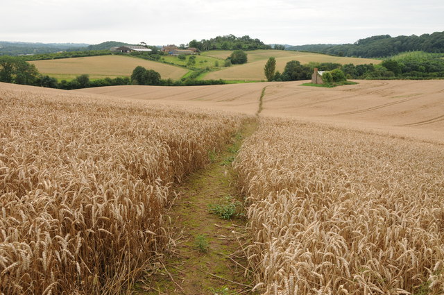
The site is situated on a prominent hilltop, providing strategic advantages for its inhabitants. It covers an area of approximately 10 acres and is enclosed by a series of earthworks, including a double rampart and ditch system. These defensive features were constructed using local materials, mainly earth and timber. The inner rampart still stands at a height of around 4 meters in some places.

Excavations at Berrow Hill Camp have revealed evidence of human occupation throughout its history. Numerous finds, such as pottery, coins, and metalwork, suggest that the site was not only a defensive stronghold but also a thriving community. The discovery of storage pits and grain-drying ovens indicates agricultural activities within the hillfort.

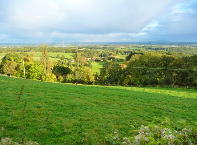
The hillfort's location on the Worcestershire Beacon, one of the highest points in the area, offers breathtaking panoramic views of the surrounding landscape. It is believed that this strategic position allowed its inhabitants to control and monitor the movements of people and resources in the region.

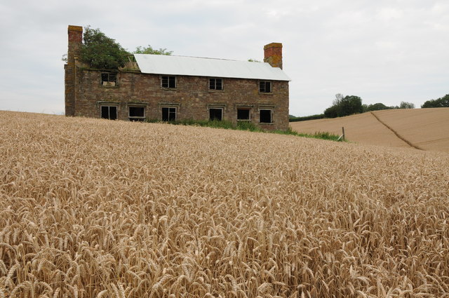
Berrow Hill Camp is open to the public, and visitors can explore the earthworks and gain insight into the lives of its Iron Age inhabitants. The site serves as a valuable resource for historians, archaeologists, and enthusiasts interested in understanding the ancient past of Worcestershire.

If you have any feedback on the listing, please let us know in the comments section below.

Berrow Hill Camp Images

Images are sourced within 2km of 52.225/-2.3753 or Grid Reference SO7458. Thanks to Geograph Open Source API. All images are credited.

Dinosaur at Martley A rusty dinosaur model opposite the Chantry school in Martley, taken at the Chantry Orchard near the Martley circular walk (note: the path that is shown in the field is not the circular walk).
Dinosaur at Martley
A rusty dinosaur model opposite the Chantry school in Martley, taken at the Chantry Orchard near the Martley circular walk (note: the path that is shown in the field is not the circular walk).
Glimpse of Martley Court This grade II listed building was a farmhouse when it was first built in the C17, and it was remodelled in the early C19. This was altered in the late C19 and C20, and was grade II listed in November 1951. This photo showing the southeast side of the house was taken at the churchyard at St. Peter parish church.
Glimpse of Martley Court
This grade II listed building was a farmhouse when it was first built in the C17, and it was remodelled in the early C19. This was altered in the late C19 and C20, and was grade II listed in November 1951. This photo showing the southeast side of the house was taken at the churchyard at St. Peter parish church.
Meadow in the Teme valley Meadow in the Teme valley near Ham Farm.
Meadow in the Teme valley
Meadow in the Teme valley near Ham Farm.
Timber framed barn, Ham Farm A traditional old timber-framed barn at Ham Farm in the Teme valley near Clifton upon Teme.
Timber framed barn, Ham Farm
A traditional old timber-framed barn at Ham Farm in the Teme valley near Clifton upon Teme.
Old farm building, Ham Farm Until recently a partial roof was still intact above the wall on the left of the red-brick building, see: <a href="https://www.geograph.org.uk/photo/62881">SO7359 : Ham Farm</a>
Old farm building, Ham Farm
Until recently a partial roof was still intact above the wall on the left of the red-brick building, see: SO7359 : Ham Farm
Footpath through a wheat field Footpath through a wheat field in the Teme valley with the farm at Tedney House in the near distance.
Footpath through a wheat field
Footpath through a wheat field in the Teme valley with the farm at Tedney House in the near distance.
Abandoned Hillhouse Cottages Now completely surrounded by a crop of wheat, even now Hillhouse Cottages display a robustness.  They echo the feeling that they belong on a windswept Bronte moorland.
Abandoned Hillhouse Cottages
Now completely surrounded by a crop of wheat, even now Hillhouse Cottages display a robustness. They echo the feeling that they belong on a windswept Bronte moorland.
Collin's Green The view from the side of the B4197.
Collin's Green
The view from the side of the B4197.
Berrow Hill Walked north from the pub then made may through tracks or gaps in woodland to gain summit field. Beacon bagged first then headed south to next knoll to bag trig.
Name: Berrow Hill
Hill number: 5377
Height: 183m / 600ft
Area: 38B: West Gloucestershire, Hereford & Worcester
Class: Hu
Grid ref: SO 74462 58607
Summit feature: beacon
Drop: 105m
Col: 78m  SO745595
Berrow Hill
Walked north from the pub then made may through tracks or gaps in woodland to gain summit field. Beacon bagged first then headed south to next knoll to bag trig. Name: Berrow Hill Hill number: 5377 Height: 183m / 600ft Area: 38B: West Gloucestershire, Hereford & Worcester Class: Hu Grid ref: SO 74462 58607 Summit feature: beacon Drop: 105m Col: 78m SO745595
Admiral Rodney (1), Berrow Green near Martley, Worcs A popular pub, with accommodation, on the B4197 road in the small village of Berrow Green.

<a href="https://www.geograph.org.uk/photo/3426621">SO7458 : Admiral Rodney (2) - sign, Berrow Green near Martley, Worcs</a>.
Admiral Rodney (1), Berrow Green near Martley, Worcs
A popular pub, with accommodation, on the B4197 road in the small village of Berrow Green. SO7458 : Admiral Rodney (2) - sign, Berrow Green near Martley, Worcs.
Admiral Rodney (2) - sign, Berrow Green near Martley, Worcs There are several public houses in England named after Admiral Rodney, who was a famous naval figure in the late 18th century. George Brydges Rodney, 1st Baron Rodney, KB (baptised 13 February 1718; died 24 May 1792) is particularly remembered for his commands in the American War of Independence, and especially for his victory over the French at the Battle of the Saintes in 1782. The use of Rodney as a first name for boys was due to the Admiral's fame. It became a popular name at the end of the 18th century.

The sign for this pub, as with most, has changed over the years. The present one, which is fairly recent, is virtually a copy of the well-known portrait by Thomas Gainsborough of 1782. It depicts the Admiral at the Battle of the Saintes, and behind him is the French Fleur de Lys naval ensign from the captured ship "Ville de Paris".

<a href="https://www.geograph.org.uk/photo/3426573">SO7458 : Admiral Rodney (1), Berrow Green near Martley, Worcs</a>.
Admiral Rodney (2) - sign, Berrow Green near Martley, Worcs
There are several public houses in England named after Admiral Rodney, who was a famous naval figure in the late 18th century. George Brydges Rodney, 1st Baron Rodney, KB (baptised 13 February 1718; died 24 May 1792) is particularly remembered for his commands in the American War of Independence, and especially for his victory over the French at the Battle of the Saintes in 1782. The use of Rodney as a first name for boys was due to the Admiral's fame. It became a popular name at the end of the 18th century. The sign for this pub, as with most, has changed over the years. The present one, which is fairly recent, is virtually a copy of the well-known portrait by Thomas Gainsborough of 1782. It depicts the Admiral at the Battle of the Saintes, and behind him is the French Fleur de Lys naval ensign from the captured ship "Ville de Paris". SO7458 : Admiral Rodney (1), Berrow Green near Martley, Worcs.
The Crown (1), Martley, Worcs The Crown is a large and much extended public house and restaurant in the village of Martley, on the B4197 road. Photographed early on a Saturday afternoon, the pub looked firmly closed but apparently on most days it does not open until 6pm, and on Mondays it doesn't open at all.

<a href="https://www.geograph.org.uk/photo/3426691">SO7559 : The Crown (2) - sign, Martley, Worcs</a>.
<a href="https://www.geograph.org.uk/photo/3426723">SO7559 : The Crown (3), Martley, Worcs</a>.
The Crown (1), Martley, Worcs
The Crown is a large and much extended public house and restaurant in the village of Martley, on the B4197 road. Photographed early on a Saturday afternoon, the pub looked firmly closed but apparently on most days it does not open until 6pm, and on Mondays it doesn't open at all. SO7559 : The Crown (2) - sign, Martley, Worcs. SO7559 : The Crown (3), Martley, Worcs.
The Crown (2) - sign, Martley, Worcs The pub is not a Marston's house, according to the brewery website, although it may well sell their beer.

The name of the Crown indicates loyalty to the reigning monarch. It has been used as an inn or pub sign for hundreds of years. In the past, when most people were illiterate, the sign was easily recognised by people. The Crown is almost as popular as the Red Lion as a pub name.

<a href="https://www.geograph.org.uk/photo/3426671">SO7559 : The Crown (1), Martley, Worcs</a>.
<a href="https://www.geograph.org.uk/photo/3426723">SO7559 : The Crown (3), Martley, Worcs</a>.
The Crown (2) - sign, Martley, Worcs
The pub is not a Marston's house, according to the brewery website, although it may well sell their beer. The name of the Crown indicates loyalty to the reigning monarch. It has been used as an inn or pub sign for hundreds of years. In the past, when most people were illiterate, the sign was easily recognised by people. The Crown is almost as popular as the Red Lion as a pub name. SO7559 : The Crown (1), Martley, Worcs. SO7559 : The Crown (3), Martley, Worcs.
The Crown (3), Martley, Worcs Viewed from this side, the considerable extension to the original building can clearly be seen. The pub is adjacent to some farmland. There is currently a very controversial planning application to build fifty one houses on some of this.

<a href="https://www.geograph.org.uk/photo/3426671">SO7559 : The Crown (1), Martley, Worcs</a>.
<a href="https://www.geograph.org.uk/photo/3426691">SO7559 : The Crown (2) - sign, Martley, Worcs</a>.
The Crown (3), Martley, Worcs
Viewed from this side, the considerable extension to the original building can clearly be seen. The pub is adjacent to some farmland. There is currently a very controversial planning application to build fifty one houses on some of this. SO7559 : The Crown (1), Martley, Worcs. SO7559 : The Crown (2) - sign, Martley, Worcs.
Martley Post Office and Off-licence, Martley, Worcs The Post Office and Off-licence is next door to the garage and petrol station, and opposite to the junction of the B4197 and B4204 roads.
Martley Post Office and Off-licence, Martley, Worcs
The Post Office and Off-licence is next door to the garage and petrol station, and opposite to the junction of the B4197 and B4204 roads.
Footpath at Horsham Footpath in the Teme valley at Horsham.
Footpath at Horsham
Footpath in the Teme valley at Horsham.
Hill Top, Horsham No through road passing through converted farm buildings at Hill Top at Horsham.
Hill Top, Horsham
No through road passing through converted farm buildings at Hill Top at Horsham.
A view into Herefordshire A view across the Teme valley to Tedney House which is in a peninsula of Herefordshire within a loop in the River Teme.
A view into Herefordshire
A view across the Teme valley to Tedney House which is in a peninsula of Herefordshire within a loop in the River Teme.
Show me another place!

Berrow Hill Camp is located at Grid Ref: SO7458 (Lat: 52.225, Lng: -2.3753)

Administrative County: Worcestershire

District: Malvern Hills

Police Authority: West Mercia

What 3 Words

///swimsuits.obstruction.blotting. Near Lower Broadheath, Worcestershire

Related Wikis

Berrow Green

Berrow Green is a village in Worcestershire, England. == Berrow Hill Camp == Berrow Green is situated just below Berrow Hill Camp, an Iron Age encampment...

Horsham, Worcestershire

Horsham is a village in Worcestershire, England. Remains of an old Iron Age fort are located within the village. == External links ==

Martley

Martley is a village and civil parish in the Malvern Hills district of the English county of Worcestershire. It is approximately nine miles north-west...

The Chantry School

The Chantry School is a mixed gender secondary school with academy status located in Martley, Worcestershire, England. The school has about 700 students...

Doddenham

Doddenham is a hamlet and civil parish (with Knightwick) in the Malvern Hills district in the county of Worcestershire, England. Doddenham was in the...

Stanford with Orleton

Stanford with Orleton is a civil parish in the Malvern Hills district, in the county of Worcestershire, England. The parish comprises the villages of Stanford...

Ankerdine Hill

Ankerdine Hill is a hill with a summit at 149 metres (489 ft) above sea level, in the civil parish of Doddenham in the Malvern Hills district of Worcestershire...

Whitbourne, Herefordshire

Whitbourne (Anglo-Saxon for "white stream") is a village in Eastern Herefordshire, England on the banks of the River Teme and close to the A44. It is close...

Nearby Amenities

Located within 500m of 52.225,-2.3753
Berrow Green- Newtown Road
Naptan AtcoCode: 2000G070400
Naptan Bearing: N
Naptan BusStopType: CUS
Naptan CommonName: Berrow Green- Newtown Road
Naptan Indicator: Adj
Naptan Landmark: B4197
Naptan NaptanCode: wocdwmpj
Naptan Street: B4197
Naptan Verified: no
Source: naptan_import
Lat/Long: 52.2222577/-2.3701947
Pub
Admiral Rodney
Website: https://www.admiral-rodney.co.uk/
Lat/Long: 52.2228126/-2.3703818
Berrow Green
Place: hamlet
Wikidata: Q4894744
Lat/Long: 52.2228079/-2.3695407
Post Box
Collection Times: Mo-Fr 16:15; Sa 09:30
Post Box Type: lamp
Ref: WR6 384
Royal Cypher: EIIR
Royal Cypher Wikidata: Q33102113
Lat/Long: 52.2225074/-2.3700518
Telephone
Defibrillator
Booth: K6
Colour: green
Defibrillator Location: Inside old phone box in Berrow Green
Emergency: defibrillator
Man Made: telephone_box
Ref GB The Circuit: 965D8545-00E5-452D-8A2C-E2B9EC866FAE
Lat/Long: 52.2224772/-2.3700709
Power: pole
Lat/Long: 52.2290289/-2.373218
Berrow Farm
Power: pole
Transformer: distribution
Voltage Primary: 11000
Lat/Long: 52.229018/-2.3722397
Power: pole
Lat/Long: 52.2283265/-2.3709377
Power: pole
Lat/Long: 52.227634/-2.3706141
Power: pole
Lat/Long: 52.2268148/-2.3709082
Power: pole
Lat/Long: 52.2256833/-2.3680753
Berrow Green North
Power: pole
Transformer: distribution
Voltage Primary: 11000
Lat/Long: 52.2257792/-2.3683605
Power: pole
Lat/Long: 52.2258471/-2.3690816
Power: pole
Lat/Long: 52.2259159/-2.3697865
Power: pole
Lat/Long: 52.2260508/-2.3711904
Power: pole
Lat/Long: 52.2252768/-2.3714845
Power: pole
Lat/Long: 52.2249075/-2.3716589
Power: pole
Lat/Long: 52.2244177/-2.3719072
Power: pole
Lat/Long: 52.2239579/-2.3721421
Berrow Green
Power: pole
Transformer: distribution
Voltage Primary: 11000
Lat/Long: 52.2224995/-2.3711579
Power: pole
Lat/Long: 52.2229222/-2.3721052
Power: pole
Lat/Long: 52.2235007/-2.3723697
Power: pole
Lat/Long: 52.2230272/-2.372618
Power: pole
Lat/Long: 52.2227665/-2.3731855
Power: pole
Lat/Long: 52.2225402/-2.3736584
Berrow Green South
Power: pole
Transformer: distribution
Voltage Primary: 11000
Lat/Long: 52.2209061/-2.3739879
Power: pole
Lat/Long: 52.221318/-2.3742125
Power: pole
Lat/Long: 52.2220622/-2.3746987
Power: pole
Lat/Long: 52.2218576/-2.3751524
Power: pole
Lat/Long: 52.2215226/-2.3759031
Power: pole
Lat/Long: 52.2210166/-2.3766332
The data included in this document is from www.openstreetmap.org. The data is made available under ODbL.

Have you been to Berrow Hill Camp?

Leave your review of Berrow Hill Camp below (or comments, questions and feedback).