Beckley Park

Heritage Site in Oxfordshire

England

Beckley Park

Oxford transmitting station, Beckley A television and radio station.
Oxford transmitting station, Beckley Credit: Robin Webster

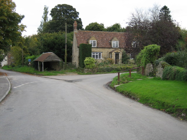
Beckley Park, located in Oxfordshire, England, is a historic heritage site that offers visitors a glimpse into the rich history and natural beauty of the area. The park is spread over an expansive 300-acre estate, encompassing picturesque landscapes, grand buildings, and diverse wildlife.

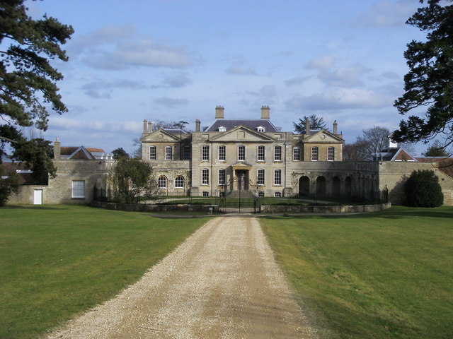
The park's history can be traced back to the 16th century when it was initially owned by the Fiennes family, who later became the Lords Saye and Sele. The centerpiece of the estate is the magnificent Beckley Park House, a Grade II listed building dating back to the 18th century. This imposing mansion features stunning architectural details and elegant interiors, providing visitors with a glimpse into the opulent lifestyle of the past.

Surrounding the house are beautifully landscaped gardens, including terraces, lawns, and a walled garden that boasts a variety of colorful flowers and plants. The park also features a tranquil lake, where visitors can enjoy leisurely walks or indulge in birdwatching, as numerous species of waterfowl and other wildlife call this area home.

Beckley Park is not only a haven for nature enthusiasts but also a popular venue for various events and activities. It regularly hosts weddings, corporate functions, and cultural events, making it a vibrant hub for the local community and visitors alike.

Overall, Beckley Park stands as a testament to the rich heritage and natural splendor of Oxfordshire. Its historic house, stunning gardens, and serene surroundings make it a must-visit destination for those seeking a glimpse into the area's past and a peaceful retreat into nature.

If you have any feedback on the listing, please let us know in the comments section below.

Beckley Park Images

Images are sourced within 2km of 51.798/-1.165 or Grid Reference SP5711. Thanks to Geograph Open Source API. All images are credited.

Oxford transmitting station, Beckley A television and radio station.
Oxford transmitting station, Beckley
A television and radio station.
The Closes, RSPB Otmoor An area of wet grassland. Ot Moor was first drained in 1816 and had been divided up into fields by 1830. Since 1997 the RSPB have been recreating wetlands here.
The Closes, RSPB Otmoor
An area of wet grassland. Ot Moor was first drained in 1816 and had been divided up into fields by 1830. Since 1997 the RSPB have been recreating wetlands here.
Managed land, RSPB Otmoor A lot of shrubs have been cut down to ground level.
Managed land, RSPB Otmoor
A lot of shrubs have been cut down to ground level.
No entry to a conservation area, RSPB Otmoor Ot Moor was first drained in 1816 and had been divided up into fields by 1830. Since 1997 the RSPB have been recreating wetlands here.
No entry to a conservation area, RSPB Otmoor
Ot Moor was first drained in 1816 and had been divided up into fields by 1830. Since 1997 the RSPB have been recreating wetlands here.
Bench with a view of Moorleys, RSPB Otmoor Ot Moor was first drained in 1816 and had been divided up into fields by 1830. Since 1997 the RSPB have been recreating wetlands here.
Bench with a view of Moorleys, RSPB Otmoor
Ot Moor was first drained in 1816 and had been divided up into fields by 1830. Since 1997 the RSPB have been recreating wetlands here.
Large reed-fringed drain, RSPB Otmoor Ot Moor was first drained in 1816 and had been divided up into fields by 1830. Since 1997 the RSPB have been recreating wetlands here.
Large reed-fringed drain, RSPB Otmoor
Ot Moor was first drained in 1816 and had been divided up into fields by 1830. Since 1997 the RSPB have been recreating wetlands here.
Pump house, RSPB Otmoor Ot Moor was first drained in 1816 and had been divided up into fields by 1830. Since 1997 the RSPB have been recreating wetlands here.
Pump house, RSPB Otmoor
Ot Moor was first drained in 1816 and had been divided up into fields by 1830. Since 1997 the RSPB have been recreating wetlands here.
Public bridleway, RSB Otmoor The bridleway follows part of the perimeter of Ot Moor, which was first drained in 1816 and had been divided up into fields by 1830. Since 1997 the RSPB have been recreating wetlands here.
Public bridleway, RSB Otmoor
The bridleway follows part of the perimeter of Ot Moor, which was first drained in 1816 and had been divided up into fields by 1830. Since 1997 the RSPB have been recreating wetlands here.
Common reed along a drain, RSPB Otmoor Ot Moor was first drained in 1816 and had been divided up into fields by 1830. Since 1997 the RSPB have been recreating wetlands here.
Common reed along a drain, RSPB Otmoor
Ot Moor was first drained in 1816 and had been divided up into fields by 1830. Since 1997 the RSPB have been recreating wetlands here.
Bench along a bridleway, RSPB Otmoor Installed in memory of Barbara Joan Austin [1929 - 2004]. Ot Moor was first drained in 1816 and had been divided up into fields by 1830. Since 1997 the RSPB have been recreating wetlands here.
Bench along a bridleway, RSPB Otmoor
Installed in memory of Barbara Joan Austin [1929 - 2004]. Ot Moor was first drained in 1816 and had been divided up into fields by 1830. Since 1997 the RSPB have been recreating wetlands here.
Public bridleway, RSPB Otmoor Along the northern boundary of Moorleys. Ot Moor was first drained in 1816 and had been divided up into fields by 1830. Since 1997 the RSPB have been recreating wetlands here.
Public bridleway, RSPB Otmoor
Along the northern boundary of Moorleys. Ot Moor was first drained in 1816 and had been divided up into fields by 1830. Since 1997 the RSPB have been recreating wetlands here.
Warning signs at a bridleway gate, Ot Moor If the cows don't get you the military might! But not every day or every season.
Warning signs at a bridleway gate, Ot Moor
If the cows don't get you the military might! But not every day or every season.
Bridleway bridge over a silted up drain, Ot Moor On the route of a Roman road. The little bridge probably dates from 1830 or earlier. Ot Moor was first drained in 1816 and had been divided up into fields by 1830. Since 1997 the RSPB have been recreating wetlands here.
Bridleway bridge over a silted up drain, Ot Moor
On the route of a Roman road. The little bridge probably dates from 1830 or earlier. Ot Moor was first drained in 1816 and had been divided up into fields by 1830. Since 1997 the RSPB have been recreating wetlands here.
Public bridleway on the route of a Roman road, Ot Moor Evidence of Roman villas, roads, a temple and a pottery industry have been found near here.
Public bridleway on the route of a Roman road, Ot Moor
Evidence of Roman villas, roads, a temple and a pottery industry have been found near here.
South-east Ot Moor, from the Roman road Looking across the danger area associated with the MoD rifle range.
South-east Ot Moor, from the Roman road
Looking across the danger area associated with the MoD rifle range.
Butts and the danger area, Ot Moor Seen from the public bridleway, which is accessible when the MoD are not practising shooting.
Butts and the danger area, Ot Moor
Seen from the public bridleway, which is accessible when the MoD are not practising shooting.
Silted up drain, from the bridleway bridge, Ot Moor Ot Moor was first drained in 1816 and had been divided up into fields by 1830. Since 1997 the RSPB have been recreating wetlands here.
Silted up drain, from the bridleway bridge, Ot Moor
Ot Moor was first drained in 1816 and had been divided up into fields by 1830. Since 1997 the RSPB have been recreating wetlands here.
Bridleway on the route of a Roman road, near RSPB Otmoor Looking north.
Bridleway on the route of a Roman road, near RSPB Otmoor
Looking north.
Show me another place!

Beckley Park is located at Grid Ref: SP5711 (Lat: 51.798, Lng: -1.165)

What 3 Words

///youngest.beats.wasps. Near Wheatley, Oxfordshire

Nearby Locations

Beckley Park

Related Wikis

Beckley and Stowood

Beckley and Stowood is a civil parish in the South Oxfordshire district of Oxfordshire, England. According to the United Kingdom Census 2011 it had a...

Beckley Park

Beckley Park is an English country house located near the village of Beckley, in Oxfordshire, England. It was built in 1540 by Lord Williams of Thame,...

Woodperry House

Woodperry House is a Grade I listed building in Stanton St John, South Oxfordshire, England. Woodperry was built from 1728 for John Morse, a London goldsmith...

Beckley, Oxfordshire

Beckley is a village in the civil parish of Beckley and Stowood, in the South Oxfordshire district, in the county of Oxfordshire, England. It is about...

Nearby Amenities

Located within 500m of 51.798,-1.165
Barrier: stile
Lat/Long: 51.7995217/-1.1714558
Barrier: stile
Lat/Long: 51.7995577/-1.1657421
Power: pole
Source: Bing
Lat/Long: 51.7977828/-1.169442
Power: pole
Lat/Long: 51.7960839/-1.1609138
Power: pole
Lat/Long: 51.7969547/-1.1591248
Power: pole
Source: Bing
Lat/Long: 51.7972323/-1.166124
Power: pole
Source: Bing
Lat/Long: 51.7976091/-1.1683342
Power: pole
Source: Bing
Lat/Long: 51.7967603/-1.1667561
Power: pole
Source: Bing
Lat/Long: 51.7974166/-1.1672291
Power: pole
Lat/Long: 51.7965467/-1.1600314
Power: pole
Lat/Long: 51.797391/-1.1582503
Power: pole
Lat/Long: 51.7972798/-1.1586258
Power: pole
Lat/Long: 51.7967109/-1.1598115
Power: pole
Source: Bing
Lat/Long: 51.7948748/-1.1693004
Power: pole
Source: Bing
Lat/Long: 51.7953552/-1.1686686
Power: pole
Source: Bing
Lat/Long: 51.794112/-1.1650338
Power: pole
Lat/Long: 51.7960763/-1.1610846
Power: pole
Lat/Long: 51.7958156/-1.1680359
Power: pole
Lat/Long: 51.7974606/-1.1645258
Power: pole
Lat/Long: 51.7979675/-1.1705433
Power: pole
Lat/Long: 51.7979946/-1.1717189
Power: pole
Lat/Long: 51.7947869/-1.1636434
The data included in this document is from www.openstreetmap.org. The data is made available under ODbL.

Have you been to Beckley Park?

Leave your review of Beckley Park below (or comments, questions and feedback).