Ballands Castle

Heritage Site in Somerset South Somerset

England

Ballands Castle

The A303 Taken just north of West Bouton and just south of Bourton.
The A303 Credit: Trevor Harris

Ballands Castle is a historic site located in Somerset, England. This medieval castle dates back to the 14th century and is considered a significant heritage site. The castle is situated in the village of Ballands, surrounded by picturesque countryside, making it a popular tourist attraction.

The castle was originally built as a fortified manor house, designed to provide protection and security for its residents. It consists of a central tower surrounded by a curtain wall, which was later extended to include additional buildings. The castle's architecture is representative of the medieval period, with thick stone walls and narrow windows.

Throughout its history, Ballands Castle has undergone various modifications and renovations. In the 16th century, it was transformed into a grand mansion, reflecting the changing architectural styles of the time. However, during the Civil War in the 17th century, the castle was severely damaged and left in ruins.

Today, visitors can explore the remains of Ballands Castle, which provide fascinating insights into medieval life. The site offers guided tours, allowing visitors to learn about the castle's history and architecture. The surrounding grounds also provide a peaceful setting for leisurely walks and picnics.

Ballands Castle is an important heritage site, preserving a piece of Somerset's medieval history. It offers a unique opportunity for visitors to step back in time and experience the grandeur of a bygone era.

If you have any feedback on the listing, please let us know in the comments section below.

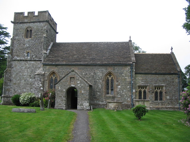
Ballands Castle Images

Images are sourced within 2km of 51.0783/-2.3533 or Grid Reference ST7531. Thanks to Geograph Open Source API. All images are credited.

The A303 Taken just north of West Bouton and just south of Bourton.
The A303
Taken just north of West Bouton and just south of Bourton.
Old Milestone by road, Leigh Common; 20m East entrance Leigh Farm The Milestone is located in tarmac in front of disused building on verge on the North of the road.  Parish of Pen Selwood (South Somerset District). Metal plate attached to stone post, Wincanton iron plate design, erected by the Wincanton turnpike trust in the 19th Century, 12cm stump only. An earlier photograph can be found here: <a title="https://www.geograph.org.uk/photo/6102803" href="https://www.geograph.org.uk/photo/6102803">Link</a> 

Inscription reads:-   
(Wincanton / 2 / Hindon / 12 /) 

Milestone Society National ID: SO_WCHD02
Old Milestone by road, Leigh Common; 20m East entrance Leigh Farm
The Milestone is located in tarmac in front of disused building on verge on the North of the road.  Parish of Pen Selwood (South Somerset District). Metal plate attached to stone post, Wincanton iron plate design, erected by the Wincanton turnpike trust in the 19th Century, 12cm stump only. An earlier photograph can be found here: Link  Inscription reads:- (Wincanton / 2 / Hindon / 12 /) Milestone Society National ID: SO_WCHD02
Bourton : A303 Looking along the A303.
Bourton : A303
Looking along the A303.
Bourton : A303 Heading under the West Bourton Road bridge.
Bourton : A303
Heading under the West Bourton Road bridge.
Bourton : A303 Looking along the A303.
Bourton : A303
Looking along the A303.
Bourton : A303 Layby A layby alongside the A303.
Bourton : A303 Layby
A layby alongside the A303.
A303, eastbound The A303 is a main trunk road running 92 miles between Basingstoke and Honiton. Along with the A30 and M3 it forms a major route between London and the South West. Much of the road is dual carriageway, but some stretches remain single and prone to congestion.

Wikipedia: <span class="nowrap"><a title="http://en.wikipedia.org/wiki/A303_road" rel="nofollow ugc noopener" href="http://en.wikipedia.org/wiki/A303_road">Link</a><img style="margin-left:2px;" alt="External link" title="External link - shift click to open in new window" src="https://s1.geograph.org.uk/img/external.png" width="10" height="10"/></span>
A303, eastbound
The A303 is a main trunk road running 92 miles between Basingstoke and Honiton. Along with the A30 and M3 it forms a major route between London and the South West. Much of the road is dual carriageway, but some stretches remain single and prone to congestion. Wikipedia: LinkExternal link
West Bourton Road Bridge, A303 The A303 is a main trunk road running 92 miles between Basingstoke and Honiton. Along with the A30 and M3 it forms a major route between London and the South West. Much of the road is dual carriageway, but some stretches remain single and prone to congestion.

Wikipedia: <span class="nowrap"><a title="http://en.wikipedia.org/wiki/A303_road" rel="nofollow ugc noopener" href="http://en.wikipedia.org/wiki/A303_road">Link</a><img style="margin-left:2px;" alt="External link" title="External link - shift click to open in new window" src="https://s1.geograph.org.uk/img/external.png" width="10" height="10"/></span>
West Bourton Road Bridge, A303
The A303 is a main trunk road running 92 miles between Basingstoke and Honiton. Along with the A30 and M3 it forms a major route between London and the South West. Much of the road is dual carriageway, but some stretches remain single and prone to congestion. Wikipedia: LinkExternal link
Footbridge, A303 The A303 is a main trunk road running 92 miles between Basingstoke and Honiton. Along with the A30 and M3 it forms a major route between London and the South West. Much of the road is dual carriageway, but some stretches remain single and prone to congestion.

Wikipedia: <span class="nowrap"><a title="http://en.wikipedia.org/wiki/A303_road" rel="nofollow ugc noopener" href="http://en.wikipedia.org/wiki/A303_road">Link</a><img style="margin-left:2px;" alt="External link" title="External link - shift click to open in new window" src="https://s1.geograph.org.uk/img/external.png" width="10" height="10"/></span>
Footbridge, A303
The A303 is a main trunk road running 92 miles between Basingstoke and Honiton. Along with the A30 and M3 it forms a major route between London and the South West. Much of the road is dual carriageway, but some stretches remain single and prone to congestion. Wikipedia: LinkExternal link
Entering Somerset, A303 The A303 is a main trunk road running 92 miles between Basingstoke and Honiton. Along with the A30 and M3 it forms a major route between London and the South West. Much of the road is dual carriageway, but some stretches remain single and prone to congestion.

Wikipedia: <span class="nowrap"><a title="http://en.wikipedia.org/wiki/A303_road" rel="nofollow ugc noopener" href="http://en.wikipedia.org/wiki/A303_road">Link</a><img style="margin-left:2px;" alt="External link" title="External link - shift click to open in new window" src="https://s1.geograph.org.uk/img/external.png" width="10" height="10"/></span>
Entering Somerset, A303
The A303 is a main trunk road running 92 miles between Basingstoke and Honiton. Along with the A30 and M3 it forms a major route between London and the South West. Much of the road is dual carriageway, but some stretches remain single and prone to congestion. Wikipedia: LinkExternal link
B3081 off the A303 The A303 is a main trunk road running 92 miles between Basingstoke and Honiton. Along with the A30 and M3 it forms a major route between London and the South West. Much of the road is dual carriageway, but some stretches remain single and prone to congestion.

Wikipedia: <span class="nowrap"><a title="http://en.wikipedia.org/wiki/A303_road" rel="nofollow ugc noopener" href="http://en.wikipedia.org/wiki/A303_road">Link</a><img style="margin-left:2px;" alt="External link" title="External link - shift click to open in new window" src="https://s1.geograph.org.uk/img/external.png" width="10" height="10"/></span>
B3081 off the A303
The A303 is a main trunk road running 92 miles between Basingstoke and Honiton. Along with the A30 and M3 it forms a major route between London and the South West. Much of the road is dual carriageway, but some stretches remain single and prone to congestion. Wikipedia: LinkExternal link
A303, Leigh Common The A303 is a main trunk road running 92 miles between Basingstoke and Honiton. Along with the A30 and M3 it forms a major route between London and the South West. Much of the road is dual carriageway, but some stretches remain single and prone to congestion.

Wikipedia: <span class="nowrap"><a title="http://en.wikipedia.org/wiki/A303_road" rel="nofollow ugc noopener" href="http://en.wikipedia.org/wiki/A303_road">Link</a><img style="margin-left:2px;" alt="External link" title="External link - shift click to open in new window" src="https://s1.geograph.org.uk/img/external.png" width="10" height="10"/></span>
A303, Leigh Common
The A303 is a main trunk road running 92 miles between Basingstoke and Honiton. Along with the A30 and M3 it forms a major route between London and the South West. Much of the road is dual carriageway, but some stretches remain single and prone to congestion. Wikipedia: LinkExternal link
A wet entry to Wiltshire, A303 The A303 is a main trunk road running 92 miles between Basingstoke and Honiton. Along with the A30 and M3 it forms a major route between London and the South West. Much of the road is dual carriageway, but some stretches remain single and prone to congestion.

Wikipedia: <span class="nowrap"><a title="http://en.wikipedia.org/wiki/A303_road" rel="nofollow ugc noopener" href="http://en.wikipedia.org/wiki/A303_road">Link</a><img style="margin-left:2px;" alt="External link" title="External link - shift click to open in new window" src="https://s1.geograph.org.uk/img/external.png" width="10" height="10"/></span>
A wet entry to Wiltshire, A303
The A303 is a main trunk road running 92 miles between Basingstoke and Honiton. Along with the A30 and M3 it forms a major route between London and the South West. Much of the road is dual carriageway, but some stretches remain single and prone to congestion. Wikipedia: LinkExternal link
West Bourton Road bridge over A303 Seen from a lay-by on the westbound carriageway
West Bourton Road bridge over A303
Seen from a lay-by on the westbound carriageway
A303 bridge over B3081 There is interchange in all directions here, but not via Beech Lane on the left, which is a local road.
A303 bridge over B3081
There is interchange in all directions here, but not via Beech Lane on the left, which is a local road.
B3081 towards Bruton Here running closely parallel to the A303, which is behind the hedge on the left.
B3081 towards Bruton
Here running closely parallel to the A303, which is behind the hedge on the left.
Layby on the A303, West Bourton
Show me another place!

Ballands Castle is located at Grid Ref: ST7531 (Lat: 51.0783, Lng: -2.3533)

Administrative County: Somerset

District: South Somerset

Police Authority: Avon and Somerset

What 3 Words

///failed.spoken.taxi. Near Bourton, Dorset

Related Wikis

Ballands Castle

Ballands Castle was a castle near the village of Penselwood, Somerset, England. == History == Balland Castle was a motte and bailey castle, probably built...

Penselwood

Penselwood is a village and civil parish in the English county of Somerset. It is located 4 miles (6.4 km) north east of Wincanton, 4 miles (6.4 km) south...

Church of St Michael and All Angels, Penselwood

The Anglican Church of St Michael and All Angels in Penselwood, Somerset, England was built in the 15th century. It is a Grade II* listed building. �...

Cockroad Wood Castle

Cockroad Wood Castle was a castle near Wincanton but now in the parish of Charlton Musgrove, Somerset, England. == History == Cockroad Wood Castle was...

Bourton, Dorset

Bourton is a village and civil parish in north Dorset, England, situated north of the A303 road on the border with Somerset and Wiltshire between Mere...

Stavordale Priory

Stavordale Priory near Charlton Musgrove, Somerset, England was built as a priory of Augustinian canons in the 13th century and was converted into a private...

Heath Hill Farm

Heath Hill Farm (grid reference ST757336) is a 20.73 hectare biological Site of Special Scientific Interest near Stourton in Wiltshire, notified in 1997...

Kenwalch's Castle

Kenwalch's Castle is probably an Iron Age hill fort that may have been converted into a Roman fortress, near Penselwood, Somerset, England, 6.6 kilometres...

Nearby Amenities

Located within 500m of 51.0783,-2.3533
Penselwood
Is In: Somerset, England, UK
Place: village
Wikidata: Q1985557
Lat/Long: 51.0803821/-2.3499158
Post Box
Collection Times: Mo-Fr 12:00; Sa 11:30
Drive Through: no
Ref: BA9 103
Lat/Long: 51.0816189/-2.3499984
The data included in this document is from www.openstreetmap.org. The data is made available under ODbL.

Have you been to Ballands Castle?

Leave your review of Ballands Castle below (or comments, questions and feedback).