Aveline's Hole

Heritage Site in Somerset

England

Aveline's Hole

Lay-by on the A38 A regular site of the mobile cafe "Breakfast at Timothy's"
Lay-by on the A38 Credit: Adrian and Janet Quantock

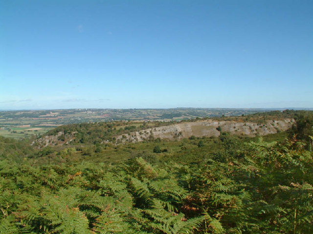
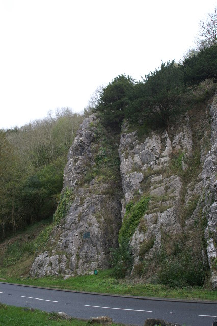
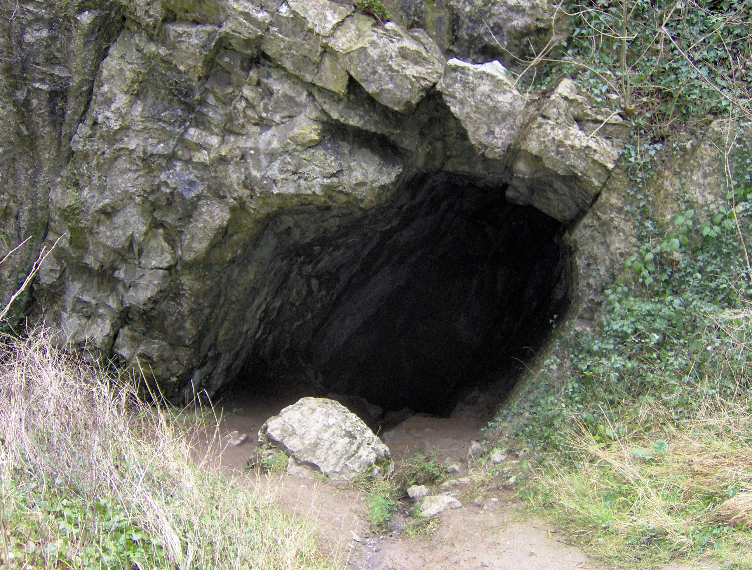
Aveline's Hole, located in Somerset, England, is a significant heritage site with historical and archaeological importance. This limestone cave, situated in the Mendip Hills, has captivated researchers and visitors alike for centuries.

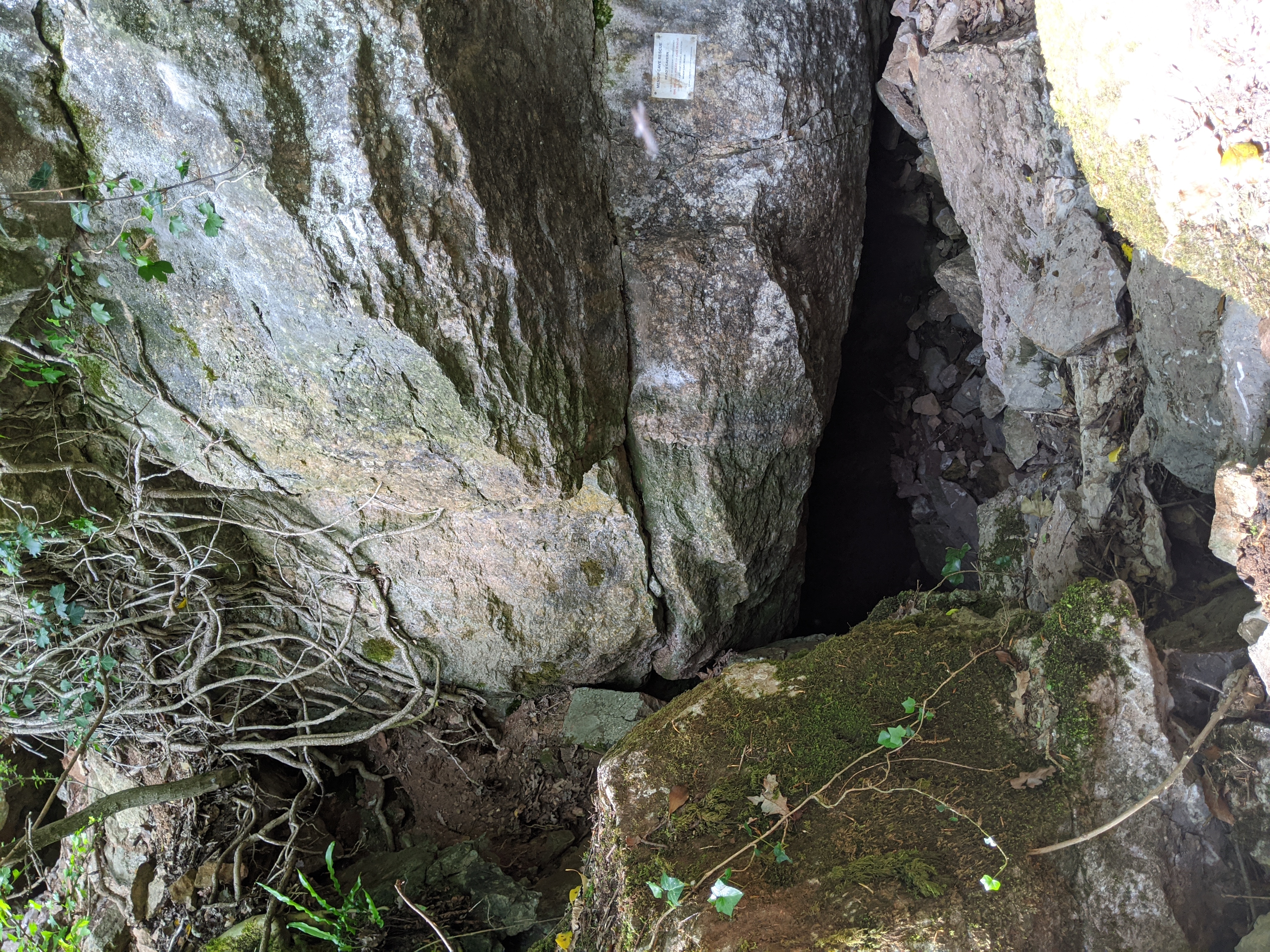
The cave was named after a local landowner, Richard Aveline, who discovered it in 1797 during quarrying operations. The entrance to the cave is a small opening, barely two meters high, leading to a series of interconnected chambers. Archaeological investigations have revealed that Aveline's Hole was inhabited by Paleolithic humans around 10,000 years ago during the late Upper Paleolithic period.

The site is particularly renowned for the discovery of human remains, making it one of the earliest-known burial sites in Britain. Excavations in the 20th century unearthed the skeletal remains of five individuals, with the most significant find being Aveline's Hole Woman, a young woman who was buried there approximately 10,200 years ago. These remains have provided invaluable insights into the lives and burial practices of the people who lived in the area during the Mesolithic period.

Aveline's Hole is also notable for its impressive stalactite formations and evidence of prehistoric animal activity. The cave's chambers are adorned with stunning stalactites, stalagmites, and flowstone formations, which have developed over thousands of years.

Today, Aveline's Hole is open to the public, allowing visitors to explore its intriguing history and marvel at its natural wonders. The site serves as a window into the prehistoric past of Britain, providing a unique glimpse into the lives of our ancient ancestors.

If you have any feedback on the listing, please let us know in the comments section below.

Aveline's Hole Images

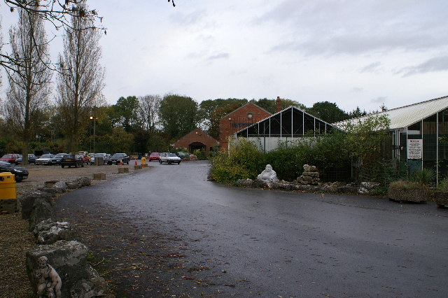
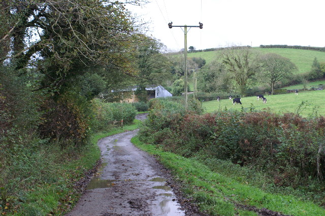
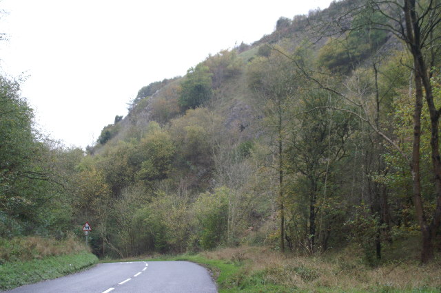
Images are sourced within 2km of 51.323/-2.753 or Grid Reference ST4758. Thanks to Geograph Open Source API. All images are credited.

Lay-by on the A38 A regular site of the mobile cafe "Breakfast at Timothy's"
Lay-by on the A38
A regular site of the mobile cafe "Breakfast at Timothy's"
Burrington Combe The cliffs of Burrington Combe from the lower slopes of Black Down
Burrington Combe
The cliffs of Burrington Combe from the lower slopes of Black Down
On Beacon Batch The view from near the highest point in the Mendips. The Mendip hills are mostly made of limestone, but here older sandstones survive with a decrease in fertility, hence the moorland. The view north is dominated by Blagdon  Lake which supplies Bristol.
On Beacon Batch
The view from near the highest point in the Mendips. The Mendip hills are mostly made of limestone, but here older sandstones survive with a decrease in fertility, hence the moorland. The view north is dominated by Blagdon Lake which supplies Bristol.
Blagdon Water Gardens Retail outlet for pond products, fish etc.
Blagdon Water Gardens
Retail outlet for pond products, fish etc.
Holy Trinity Church Burrington
Middle Ellick Farm
Middle Ellick Farm
Top of Burrington Combe
Rock of Ages Cleft in the rock inspired Rev A M Toplady to write the hymn 'Rock of Ages' after he sheltered here during a storm in 1767.
Rock of Ages
Cleft in the rock inspired Rev A M Toplady to write the hymn 'Rock of Ages' after he sheltered here during a storm in 1767.
Stile above Tynings Farm Looking South
Stile above Tynings Farm
Looking South
Eastern edge of Dolebury Warren
Rowberrow Warren Part of the Mendip Forest, planted in the 1950's
Rowberrow Warren
Part of the Mendip Forest, planted in the 1950's
Footpaths on Blackdown Looking West. The hill in the right background is Worlebury, near Weston-super-Mare. The paths here are criss-crossed by lines of mounds about 1.5metres high ; said to have been made to stop enemy planes landing in WWII.
Footpaths on Blackdown
Looking West. The hill in the right background is Worlebury, near Weston-super-Mare. The paths here are criss-crossed by lines of mounds about 1.5metres high ; said to have been made to stop enemy planes landing in WWII.
The Plume of Feathers Public House at Rickford Interesting pub in a tiny hamlet, the road past it eventually enters a ford, see associated photos!
The Plume of Feathers Public House at Rickford
Interesting pub in a tiny hamlet, the road past it eventually enters a ford, see associated photos!
Ford at Rickford The road in the tiny hamlet of Rickford passes through this ford, although the roads each end are signed as 'No through Roads'. Probably passable by 4 x 4s though.
Ford at Rickford
The road in the tiny hamlet of Rickford passes through this ford, although the roads each end are signed as 'No through Roads'. Probably passable by 4 x 4s though.
Ford at Rickford A view of the other end of the ford
Ford at Rickford
A view of the other end of the ford
Ford at Rickford Another view of the ford
Ford at Rickford
Another view of the ford
Bristol Waterworks building This boilding is at the lower end of a mill pond so presumably houses some flow control valves? An interesting example of architecture for an otherwise utilitarian building.
Bristol Waterworks building
This boilding is at the lower end of a mill pond so presumably houses some flow control valves? An interesting example of architecture for an otherwise utilitarian building.
Church and millpond at Rickford This Church is in a similar style to the Bristol Waterworks building, or should that be the other way around!. What a peaceful setting though....
Church and millpond at Rickford
This Church is in a similar style to the Bristol Waterworks building, or should that be the other way around!. What a peaceful setting though....
Show me another place!

Aveline's Hole is located at Grid Ref: ST4758 (Lat: 51.323, Lng: -2.753)

Unitary Authority: North Somerset

Police Authority: Avon and Somerset

What 3 Words

///blindfold.reference.rear. Near Burrington, Somerset

Related Wikis

Aveline's Hole

Aveline's Hole is a cave at Burrington Combe in the limestone of the Mendip Hills, in Somerset, England. The earliest scientifically dated cemetery in...

Sidcot Swallet

Sidcot Swallet is a cave near Burrington Combe, in the Carboniferous Limestone of the Mendip Hills, in Somerset, England. It was named after the Sidcot...

Goatchurch Cavern

Goatchurch Cavern is a cave on the edge of Burrington Combe in the limestone of the Mendip Hills, in Somerset, England. == Description == Due to early...

Burrington Combe

Burrington Combe is a Carboniferous Limestone gorge near the village of Burrington, on the north side of the Mendip Hills Area of Outstanding Natural Beauty...

Burrington Camp

Burrington Camp, also known as Burrington Ham, is an Iron Age hill fort in the North Somerset district of Somerset, England. The hill fort is situated...

Read's Cavern

Read's Cavern is a cave at Burrington Combe, Somerset, England, in which traces of Iron Age occupation have been found. It lies under Dolbury Hill. Its...

Burrington, Somerset

Burrington is a small village and civil parish in Somerset, England. It is situated in the unitary authority of North Somerset, 5 miles (8.0 km) north...

Burrington railway station

Burrington railway station served the village of Burrington, North Somerset, England, from 1901 to 1950 on the Wrington Vale Light Railway. == History... ==

Nearby Amenities

Located within 500m of 51.323,-2.753
Rock of Ages
Natural: rock
Source: survey
Tourism: attraction
Lat/Long: 51.3254061/-2.7532379
Bus Stop
Rock of Ages
Naptan AtcoCode: 0190NSC31097
Naptan Bearing: S
Naptan CommonName: Rock of Ages
Naptan Crossing: Link Lane
Naptan NaptanCode: wsmgtdt
Naptan Street: The Combe
Naptan Verified: no
Source: naptan_import
Lat/Long: 51.3259114/-2.7527787
Bus Stop
Rock of Ages
Naptan AtcoCode: 0190NSZ01211
Naptan Bearing: S
Naptan CommonName: Rock of Ages
Naptan Crossing: Link Lane
Naptan Indicator: Opp
Naptan NaptanCode: wsmgtdm
Naptan Street: The Combe
Naptan Verified: no
Source: naptan_import
Lat/Long: 51.3259634/-2.7530809
Goatchurch Cavern
Natural: cave_entrance
Source: survey
Survey: gps
Wikidata: Q5575354
Lat/Long: 51.3207926/-2.753767
Sidcot Swallet
Natural: cave_entrance
Source: survey
Survey: gps
Wikidata: Q7508021
Lat/Long: 51.3212418/-2.7540244
Pierre's Pot
Natural: cave_entrance
Source: survey
Survey: gps
Wikidata: Q7191954
Lat/Long: 51.3220063/-2.7528978
Lionel's Hole
Natural: cave_entrance
Source: survey
Survey: gps
Lat/Long: 51.3207387/-2.7481673
Bath Swallet
Natural: cave_entrance
Source: survey
Survey: gps
Lat/Long: 51.3226935/-2.7583643
Rod's Pot
Natural: cave_entrance
Source: survey
Survey: gps
Wikidata: Q7356086
Lat/Long: 51.3224722/-2.7590347
Drunkard's Hole
Natural: cave_entrance
Source: survey
Survey: gps
Lat/Long: 51.3222443/-2.759952
Parking
Lat/Long: 51.3257851/-2.7525875
Natural: sinkhole
Lat/Long: 51.3219017/-2.7531965
Natural: spring
Lat/Long: 51.3207373/-2.7540659
Aveline's Hole (cave)
Natural: cave_entrance
Source: survey
Wikidata: Q790368
Lat/Long: 51.3247045/-2.753308
Barrier: cattle_grid
Lat/Long: 51.3258736/-2.7529268
Toilets
Lat/Long: 51.3259733/-2.7526895
Parking
Lat/Long: 51.3242215/-2.7526382
The data included in this document is from www.openstreetmap.org. The data is made available under ODbL.

Have you been to Aveline's Hole?

Leave your review of Aveline's Hole below (or comments, questions and feedback).