Allington Castle

Heritage Site in Kent Maidstone

England

Allington Castle

Foot crossing on the Medway Valley Walk The Medway Valley Line was built in two stages by the South Eastern Railway. The first stage opened in 1844 was from Paddock Wood following the Medway Valley to Maidstone. In 1856 the line was extended down the Medway Valley to the North Kent Line at Strood (which had opened in 1847). 

This foot crossing is on the latter section and carries the Medway Valley Walk across the line. The next station in this direction is Maidstone Barracks. An old siding to Allington leads off on the right.
Foot crossing on the Medway Valley Walk Credit: Marathon

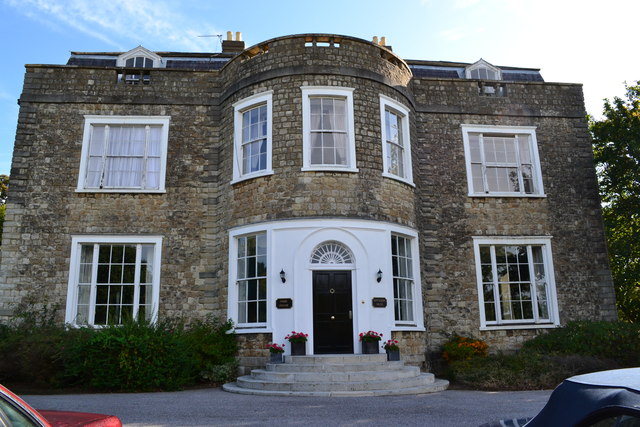
Allington Castle is a historic fortress located in Allington, near Maidstone, Kent, England. This medieval castle is a Grade I listed building and has been recognized as a heritage site for its architectural and historical significance.

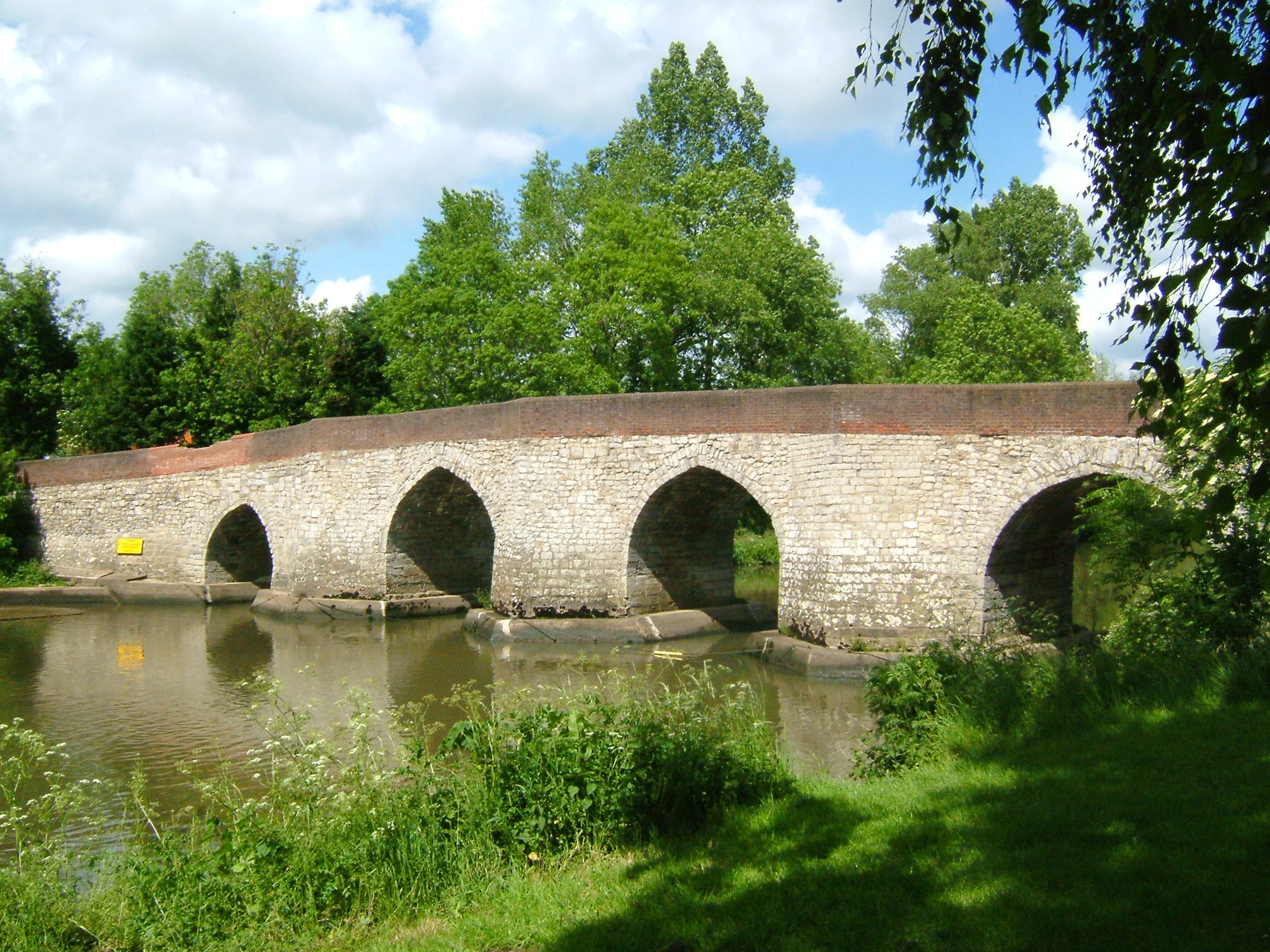
The castle dates back to the 12th century and was originally built by Sir Stephen de Penchester. Over the centuries, it has undergone several modifications and expansions, resulting in its current appearance. The castle stands on the banks of the River Medway, surrounded by a moat, and is accessed through a stone bridge.

The architecture of Allington Castle is a mix of medieval and Tudor styles. The main structure consists of a rectangular keep with four corner towers. The exterior features stone walls and large windows, while the interior boasts grand halls, a courtyard, and a beautiful chapel. The castle's original medieval features, including the drawbridge and portcullis, have been preserved and add to its historical charm.

Throughout its history, Allington Castle has been owned by various notable families, including the Wyatt, Astley, and the Duke of Manchester. It has also been visited by prominent figures such as King Henry VIII and Queen Elizabeth I.

Today, the castle is privately owned and not open to the public. However, it can be admired from the outside during special events or guided tours. Allington Castle stands as a reminder of Kent's rich medieval heritage and continues to captivate visitors with its impressive architecture and historical significance.

If you have any feedback on the listing, please let us know in the comments section below.

Allington Castle Images

Images are sourced within 2km of 51.288/0.517 or Grid Reference TQ7557. Thanks to Geograph Open Source API. All images are credited.

Foot crossing on the Medway Valley Walk The Medway Valley Line was built in two stages by the South Eastern Railway. The first stage opened in 1844 was from Paddock Wood following the Medway Valley to Maidstone. In 1856 the line was extended down the Medway Valley to the North Kent Line at Strood (which had opened in 1847). 

This foot crossing is on the latter section and carries the Medway Valley Walk across the line. The next station in this direction is Maidstone Barracks. An old siding to Allington leads off on the right.
Foot crossing on the Medway Valley Walk
The Medway Valley Line was built in two stages by the South Eastern Railway. The first stage opened in 1844 was from Paddock Wood following the Medway Valley to Maidstone. In 1856 the line was extended down the Medway Valley to the North Kent Line at Strood (which had opened in 1847). This foot crossing is on the latter section and carries the Medway Valley Walk across the line. The next station in this direction is Maidstone Barracks. An old siding to Allington leads off on the right.
View from a foot crossing on The Medway Valley Walk The Medway Valley Line was built in two stages by the South Eastern Railway. The first stage opened in 1844 was from Paddock Wood following the Medway Valley to Maidstone. In 1856 the line was extended down the Medway Valley to the North Kent Line at Strood (which had opened in 1847). 

This foot crossing is on the latter section and carries the Medway Valley Walk across the line. The next station in this direction is Aylesford. The bridge just ahead carries the M20 over the line.
View from a foot crossing on The Medway Valley Walk
The Medway Valley Line was built in two stages by the South Eastern Railway. The first stage opened in 1844 was from Paddock Wood following the Medway Valley to Maidstone. In 1856 the line was extended down the Medway Valley to the North Kent Line at Strood (which had opened in 1847). This foot crossing is on the latter section and carries the Medway Valley Walk across the line. The next station in this direction is Aylesford. The bridge just ahead carries the M20 over the line.
Foot crossing on the Medway Valley Walk The Medway Valley Line was built in two stages by the South Eastern Railway. The first stage opened in 1844 was from Paddock Wood following the Medway Valley to Maidstone. In 1856 the line was extended down the Medway Valley to the North Kent Line at Strood (which had opened in 1847). 

This foot crossing is on the latter section and carries the Medway Valley Walk across the line. The next station to the right is Maidstone Barracks and to the left is Aylesford.
Foot crossing on the Medway Valley Walk
The Medway Valley Line was built in two stages by the South Eastern Railway. The first stage opened in 1844 was from Paddock Wood following the Medway Valley to Maidstone. In 1856 the line was extended down the Medway Valley to the North Kent Line at Strood (which had opened in 1847). This foot crossing is on the latter section and carries the Medway Valley Walk across the line. The next station to the right is Maidstone Barracks and to the left is Aylesford.
The Medway Valley Walk The Medway Valley Walk in the centre of Maidstone passes under the railway, just west of Maidstone East station, ahead. The line from Otford to Maidstone East was opened on 1st June 1874 by the London, Chatham & Dover Railway.
The Medway Valley Walk
The Medway Valley Walk in the centre of Maidstone passes under the railway, just west of Maidstone East station, ahead. The line from Otford to Maidstone East was opened on 1st June 1874 by the London, Chatham & Dover Railway.
Elephant on the Medway Valley Walk This is at the end of Lock Lane near Allington Lock. There were 51 of these 'Elmer's sculptures' in the area and they were to be shortly auctioned off to raise money for the Heart of Kent Hospice.
Elephant on the Medway Valley Walk
This is at the end of Lock Lane near Allington Lock. There were 51 of these 'Elmer's sculptures' in the area and they were to be shortly auctioned off to raise money for the Heart of Kent Hospice.
The Medway Valley Walk crosses the M20 The Medway Valley Walk has come up from Allington Lock before crossing the Medway Valley Line and here crosses the M20 Motorway. The North Downs can be seen in the distance.
The Medway Valley Walk crosses the M20
The Medway Valley Walk has come up from Allington Lock before crossing the Medway Valley Line and here crosses the M20 Motorway. The North Downs can be seen in the distance.
Brewer Street, Maidstone
Railway bridge, A20 The A20 runs from the London Borough of Lewisham to Dover, Kent. It runs through the major towns of Maidstone, Ashford and Folkestone, terminating at the port of Dover.
Railway bridge, A20
The A20 runs from the London Borough of Lewisham to Dover, Kent. It runs through the major towns of Maidstone, Ashford and Folkestone, terminating at the port of Dover.
Entering Maidstone, A20 The A20 runs from the London Borough of Lewisham to Dover, Kent. It runs through the major towns of Maidstone, Ashford and Folkestone, terminating at the port of Dover.
Entering Maidstone, A20
The A20 runs from the London Borough of Lewisham to Dover, Kent. It runs through the major towns of Maidstone, Ashford and Folkestone, terminating at the port of Dover.
Old Maidstone sign
Old Maidstone sign
The Orchards
The Orchards
Dfs, A20
Dfs, A20
The Thomas Wyatt
The Thomas Wyatt
Premier Inn Premier Inn is the largest Hotel chain in the UK, with over 600 budget hotels.
Website: <span class="nowrap"><a title="http://www.premierinn.com/en/" rel="nofollow ugc noopener" href="http://www.premierinn.com/en/">Link</a><img style="margin-left:2px;" alt="External link" title="External link - shift click to open in new window" src="https://s1.geograph.org.uk/img/external.png" width="10" height="10"/></span>
Premier Inn
Premier Inn is the largest Hotel chain in the UK, with over 600 budget hotels. Website: LinkExternal link
Hildenborough Close
Hildenborough Close
A20 The A20 runs from the London Borough of Lewisham to Dover, Kent. It runs through the major towns of Maidstone, Ashford and Folkestone, terminating at the port of Dover.
A20
The A20 runs from the London Borough of Lewisham to Dover, Kent. It runs through the major towns of Maidstone, Ashford and Folkestone, terminating at the port of Dover.
Allington Way
Allington Way
Show me another place!

Allington Castle is located at Grid Ref: TQ7557 (Lat: 51.288, Lng: 0.517)

Administrative County: Kent

District: Maidstone

Police Authority: Kent

What 3 Words

///glory.truck.putty. Near Maidstone, Kent

Related Wikis

Nearby Amenities

Located within 500m of 51.288,0.517
Mini Roundabout
Direction: clockwise
Lat/Long: 51.2843487/0.5170751
Mini Roundabout
Direction: clockwise
Lat/Long: 51.2859173/0.517458
Crossing
Crossing: uncontrolled
Crossing Ref: zebra
Lat/Long: 51.2873317/0.5173125
Mini Roundabout
Direction: clockwise
Lat/Long: 51.2899887/0.5172271
Old Phone: +44 1622 753068
Removed Amenity: telephone
Lat/Long: 51.2872542/0.5171595
Post Box
Post Box Type: pillar
Postal Code: ME14
Ref: ME14 225
Royal Cypher: GR
Lat/Long: 51.2873914/0.5171408
Post Office
Ringlestone Post Office
Addr Country: GB
Addr Postcode: ME14 2LY
Brand: Post Office
Brand Wikidata: Q1783168
Contact Website: https://www.postoffice.co.uk/branch-finder/1899414/ringlestone
Ref Pol Id: 6072
Lat/Long: 51.2873154/0.5169476
Fuel
Esso
Brand: Esso
Brand Wikidata: Q867662
Contact Website: https://www.esso.co.uk/en-gb/find-station/esso-maidstone-essochathamroad-100354979
Lat/Long: 51.292191/0.5170141
Turning Circle
Lat/Long: 51.2868462/0.5154937
Turning Circle
Lat/Long: 51.2916197/0.5160504
Turning Circle
Lat/Long: 51.2910106/0.5161407
Ringlestone
Created By: Potlatch 0.10f
Place: suburb
Source: local_knowledge
Wikidata: Q7334918
Lat/Long: 51.2884197/0.5137904
Parking
Lat/Long: 51.2847948/0.5166276
Lee Heights
Building: yes
Postal Code: ME14 2LD
Lat/Long: 51.2849264/0.5148523
Lee Heights
Building: yes
Postal Code: ME14 2LG
Lat/Long: 51.2849848/0.5158506
Pump Station
Building: yes
Lat/Long: 51.2848745/0.5130292
Finch Hall
Building: yes
Lat/Long: 51.2883582/0.5120049
Place Of Worship
Ringlestone Hall
Religion: christian
Lat/Long: 51.2861571/0.5171831
Traffic Signals
Traffic Signals: signal
Traffic Signals Direction: forward
Lat/Long: 51.2923538/0.5173287
Bus Stop
Springfield County Library
Bus: yes
Naptan AtcoCode: 2400A003470A
Naptan Bearing: N
Naptan CommonName: Springfield County Library
Naptan Indicator: adj
Naptan Landmark: O/S Springfield
Naptan NaptanCode: kntagjma
Naptan PlusbusZoneRef: MSTONEB
Naptan Street: Royal Engineers Road
Naptan Verified: no
Public Transport: platform
Source: naptan_import
Lat/Long: 51.283717/0.5179961
Bus Stop
Moncktons Lane
Bus: yes
Naptan AtcoCode: 2400A003480A
Naptan Bearing: N
Naptan CommonName: Moncktons Lane
Naptan Indicator: adj
Naptan Landmark: Moncktons Lane
Naptan NaptanCode: kntagjmd
Naptan PlusbusZoneRef: MSTONEB
Naptan Street: Ringlestone Road
Naptan Verified: no
Public Transport: platform
Source: naptan_import
Lat/Long: 51.2855551/0.5174226
Bus Stop
Ringlestone Shops
Bus: yes
Naptan AtcoCode: 2400A003490A
Naptan Bearing: N
Naptan CommonName: Shops
Naptan Indicator: opp
Naptan Landmark: Calder Rd
Naptan NaptanCode: kntagjmg
Naptan PlusbusZoneRef: MSTONEB
Naptan Street: Ringlestone Rd
Naptan Verified: no
Public Transport: platform
Source: naptan_import
Lat/Long: 51.2880883/0.5171452
Bus Stop
Calder Road Top
Bus: yes
Naptan AtcoCode: 2400A003500A
Naptan Bearing: E
Naptan CommonName: Calder Road Top
Naptan Indicator: E-bound
Naptan Landmark: Ringlestone Rd
Naptan NaptanCode: kntagjmj
Naptan PlusbusZoneRef: MSTONEB
Naptan Street: Calder Rd
Naptan Verified: no
Public Transport: platform
Source: naptan_import
Lat/Long: 51.2882398/0.5167949
Bus Stop
Egerton Road
Bus: yes
Naptan AtcoCode: 2400A003510A
Naptan Bearing: SE
Naptan CommonName: Egerton Road
Naptan Indicator: opp
Naptan Landmark: Egerton Road
Naptan NaptanCode: kntagjmp
Naptan PlusbusZoneRef: MSTONEB
Naptan Street: Calder Road
Naptan Verified: no
Public Transport: platform
Source: naptan_import
Lat/Long: 51.287756/0.5126783
Bus Stop
Egerton Road
Bus: yes
Naptan AtcoCode: 2400A003520A
Naptan Bearing: N
Naptan CommonName: Egerton Road
Naptan Indicator: adj
Naptan Landmark: Egerton Rd
Naptan NaptanCode: kntagjmt
Naptan PlusbusZoneRef: MSTONEB
Naptan Street: Dickens Rd
Naptan Verified: no
Public Transport: platform
Source: naptan_import
Lat/Long: 51.2888049/0.5126806
Bus Stop
Dickens Road
Bus: yes
Naptan AtcoCode: 2400A003530A
Naptan Bearing: E
Naptan CommonName: Dickens Road
Naptan Indicator: E-bound
Naptan Landmark: Lushington Rd
Naptan NaptanCode: kntagjmw
Naptan PlusbusZoneRef: MSTONEB
Naptan Street: Dickens Rd
Naptan Verified: no
Public Transport: platform
Source: naptan_import
Lat/Long: 51.2900535/0.514427
Bus Stop
Dickens Road Top
Bus: yes
Naptan AtcoCode: 2400A003540A
Naptan Bearing: E
Naptan CommonName: Dickens Road Top
Naptan Indicator: E-bound
Naptan Landmark: Ringlestone Rd
Naptan NaptanCode: kntagjpa
Naptan PlusbusZoneRef: MSTONEB
Naptan Street: Dickens Rd
Naptan Verified: no
Public Transport: platform
Source: naptan_import
Lat/Long: 51.2900296/0.5167924
Bus Stop
Ringlestone Crescent
Bus: yes
Naptan AtcoCode: 2400A003550A
Naptan Bearing: NW
Naptan CommonName: Ringlestone Crescent
Naptan Indicator: adj
Naptan Landmark: Ringlestone Cres
Naptan NaptanCode: kntagjpd
Naptan PlusbusZoneRef: MSTONEB
Naptan Street: Ringlestone Rd
Naptan Verified: no
Public Transport: platform
Source: naptan_import
Lat/Long: 51.29192/0.5172949
Bus Stop
Ringlestone Road Footbridge
Bus: yes
Naptan AtcoCode: 2400A003640A
Naptan Bearing: S
Naptan CommonName: Ringlestone Road Footbridge
Naptan Indicator: S-bound
Naptan Landmark: Sandling Rd
Naptan NaptanCode: kntagjtj
Naptan PlusbusZoneRef: MSTONEB
Naptan Street: Royal Engineers Rd
Naptan Verified: no
Public Transport: platform
Source: naptan_import
Lat/Long: 51.2923146/0.5176059
Bus Stop
Chatham Road
Bus: yes
Naptan AtcoCode: 2400A003650A
Naptan Bearing: S
Naptan CommonName: Chatham Road
Naptan Indicator: S-bound
Naptan Landmark: Dickens Rd
Naptan NaptanCode: kntagjtm
Naptan PlusbusZoneRef: MSTONEB
Naptan Street: Chatham Rd
Naptan Verified: no
Public Transport: platform
Source: naptan_import
Lat/Long: 51.2888783/0.5172171
Bus Stop
Post Office
Bus: yes
Naptan AtcoCode: 2400A003660A
Naptan Bearing: S
Naptan CommonName: Post Office
Naptan Indicator: opp
Naptan Landmark: Calder Rd
Naptan NaptanCode: kntagjtp
Naptan PlusbusZoneRef: MSTONEB
Naptan Street: Ringlestone Rd
Naptan Verified: no
Public Transport: platform
Source: naptan_import
Lat/Long: 51.2870746/0.5174035
Bus Stop
Moncktons Lane
Bus: yes
Naptan AtcoCode: 2400A003670A
Naptan Bearing: S
Naptan CommonName: Moncktons Lane
Naptan Indicator: opp
Naptan Landmark: Moncktons Lane
Naptan NaptanCode: kntagjtw
Naptan PlusbusZoneRef: MSTONEB
Naptan Street: Ringlestone Road
Naptan Verified: no
Public Transport: platform
Source: naptan_import
Lat/Long: 51.2856672/0.5176438
Barrier: lift_gate
Source: survey
Lat/Long: 51.2846775/0.5197706
Traffic Signals
Traffic Signals: signal
Traffic Signals Direction: forward
Lat/Long: 51.2905049/0.5177694
Traffic Signals
Traffic Signals: continuous_green
Traffic Signals Direction: forward
Lat/Long: 51.2904773/0.517866
Crossing
Crossing: traffic_signals
Lat/Long: 51.2853901/0.5181735
Crossing
Crossing: traffic_signals
Lat/Long: 51.2854501/0.5183161
Bench
Colour: gray
Material: wood
Seats: 3
Lat/Long: 51.2840223/0.5142477
Post Box
Operator: Royal Mail
Post Box Type: wall
Ref: ME14 260D
Royal Cypher: GVIR
Royal Cypher Wikidata: Q33102169
Lat/Long: 51.28865/0.5127408
Post Box
Operator: Royal Mail
Post Box Type: wall
Ref: ME14 159D
Royal Cypher: GR
Royal Cypher Wikidata: Q33102273
Lat/Long: 51.2920071/0.5172453
Generator Method: photovoltaic
Generator Output Electricity: yes
Generator Source: solar
Generator Type: solar_photovoltaic_panel
Location: roof
Power: generator
Lat/Long: 51.2879205/0.5153261
Entrance: yes
Lat/Long: 51.2841686/0.5173462
Entrance: yes
Level: 0
Lat/Long: 51.2839197/0.5163484
Entrance: yes
Level: 0
Lat/Long: 51.2836036/0.5165321
Entrance: yes
Level: -1
Lat/Long: 51.2837947/0.5158377
Generator Method: photovoltaic
Generator Output Electricity: yes
Generator Source: solar
Generator Type: solar_photovoltaic_panel
Location: roof
Power: generator
Lat/Long: 51.2884229/0.5123636
Generator Method: photovoltaic
Generator Output Electricity: yes
Generator Source: solar
Generator Type: solar_photovoltaic_panel
Location: roof
Power: generator
Lat/Long: 51.2883214/0.5123596
Generator Method: photovoltaic
Generator Output Electricity: yes
Generator Source: solar
Generator Type: solar_photovoltaic_panel
Location: roof
Power: generator
Lat/Long: 51.2882644/0.5123542
Generator Method: photovoltaic
Generator Output Electricity: yes
Generator Source: solar
Generator Type: solar_photovoltaic_panel
Location: roof
Power: generator
Lat/Long: 51.2883776/0.5122925
Generator Method: photovoltaic
Generator Output Electricity: yes
Generator Source: solar
Generator Type: solar_photovoltaic_panel
Location: roof
Power: generator
Lat/Long: 51.2884598/0.5122925
Generator Method: photovoltaic
Generator Output Electricity: yes
Generator Source: solar
Generator Type: solar_photovoltaic_panel
Location: roof
Power: generator
Lat/Long: 51.2883768/0.5120645
Generator Method: photovoltaic
Generator Output Electricity: yes
Generator Source: solar
Generator Type: solar_photovoltaic_panel
Location: roof
Power: generator
Lat/Long: 51.2883852/0.5119291
Generator Method: photovoltaic
Generator Output Electricity: yes
Generator Source: solar
Generator Type: solar_photovoltaic_panel
Location: roof
Power: generator
Lat/Long: 51.288355/0.5118044
Generator Method: photovoltaic
Generator Output Electricity: yes
Generator Source: solar
Generator Type: solar_photovoltaic_panel
Location: roof
Power: generator
Lat/Long: 51.2882132/0.5117239
Generator Method: photovoltaic
Generator Output Electricity: yes
Generator Source: solar
Generator Type: solar_photovoltaic_panel
Location: roof
Power: generator
Lat/Long: 51.288173/0.511799
Generator Method: photovoltaic
Generator Output Electricity: yes
Generator Source: solar
Generator Type: solar_photovoltaic_panel
Location: roof
Power: generator
Lat/Long: 51.2881277/0.5117078
Generator Method: photovoltaic
Generator Output Electricity: yes
Generator Source: solar
Generator Type: solar_photovoltaic_panel
Location: roof
Power: generator
Lat/Long: 51.2880757/0.5117816
Generator Method: photovoltaic
Generator Output Electricity: yes
Generator Source: solar
Generator Type: solar_photovoltaic_panel
Location: roof
Power: generator
Lat/Long: 51.2880153/0.5117668
Generator Method: photovoltaic
Generator Output Electricity: yes
Generator Source: solar
Generator Type: solar_photovoltaic_panel
Location: roof
Power: generator
Lat/Long: 51.2878157/0.511681
Generator Method: photovoltaic
Generator Output Electricity: yes
Generator Source: solar
Generator Type: solar_photovoltaic_panel
Location: roof
Power: generator
Lat/Long: 51.2878685/0.5118768
Generator Method: photovoltaic
Generator Output Electricity: yes
Generator Source: solar
Generator Type: solar_photovoltaic_panel
Location: roof
Power: generator
Lat/Long: 51.2864284/0.5112585
Generator Method: photovoltaic
Generator Output Electricity: yes
Generator Source: solar
Generator Type: solar_photovoltaic_panel
Location: roof
Power: generator
Lat/Long: 51.2884045/0.5139877
Generator Method: photovoltaic
Generator Output Electricity: yes
Generator Source: solar
Generator Type: solar_photovoltaic_panel
Location: roof
Power: generator
Lat/Long: 51.2884112/0.5140494
Generator Method: photovoltaic
Generator Output Electricity: yes
Generator Source: solar
Generator Type: solar_photovoltaic_panel
Location: roof
Power: generator
Lat/Long: 51.2898672/0.5141661
Generator Method: photovoltaic
Generator Output Electricity: yes
Generator Source: solar
Generator Type: solar_photovoltaic_panel
Location: roof
Power: generator
Lat/Long: 51.2913743/0.5151759
Generator Method: photovoltaic
Generator Output Electricity: yes
Generator Source: solar
Generator Type: solar_photovoltaic_panel
Location: roof
Power: generator
Lat/Long: 51.291324/0.5151518
Generator Method: photovoltaic
Generator Output Electricity: yes
Generator Source: solar
Generator Type: solar_photovoltaic_panel
Location: roof
Power: generator
Lat/Long: 51.2912913/0.5151786
Generator Method: photovoltaic
Generator Output Electricity: yes
Generator Source: solar
Generator Type: solar_photovoltaic_panel
Location: roof
Power: generator
Lat/Long: 51.2913265/0.5152027
Generator Method: photovoltaic
Generator Output Electricity: yes
Generator Source: solar
Generator Type: solar_photovoltaic_panel
Location: roof
Power: generator
Lat/Long: 51.2914624/0.5163923
Generator Method: photovoltaic
Generator Output Electricity: yes
Generator Source: solar
Generator Type: solar_photovoltaic_panel
Location: roof
Power: generator
Lat/Long: 51.290404/0.5157915
Generator Method: photovoltaic
Generator Output Electricity: yes
Generator Source: solar
Generator Type: solar_photovoltaic_panel
Location: roof
Power: generator
Lat/Long: 51.2904031/0.5158612
Generator Method: photovoltaic
Generator Output Electricity: yes
Generator Source: solar
Generator Type: solar_photovoltaic_panel
Location: roof
Power: generator
Lat/Long: 51.2898555/0.5150928
Generator Method: photovoltaic
Generator Output Electricity: yes
Generator Source: solar
Generator Type: solar_photovoltaic_panel
Location: roof
Power: generator
Lat/Long: 51.2865358/0.5151424
Generator Method: photovoltaic
Generator Output Electricity: yes
Generator Source: solar
Generator Type: solar_photovoltaic_panel
Location: roof
Power: generator
Lat/Long: 51.2865609/0.5151866
Crossing
Crossing: unmarked
Lat/Long: 51.2845689/0.5189553
Traffic Signals
Traffic Signals: signal
Traffic Signals Direction: forward
Lat/Long: 51.2903312/0.5176165
Give Way
Direction: forward
Lat/Long: 51.29031/0.5174232
Traffic Signals
Traffic Signals: signal
Traffic Signals Direction: forward
Lat/Long: 51.2924004/0.5171708
Atm
Lat/Long: 51.2873887/0.5169835
Generator Method: photovoltaic
Generator Output Electricity: yes
Generator Source: solar
Generator Type: solar_photovoltaic_panel
Location: roof
Power: generator
Lat/Long: 51.2893103/0.514158
Generator Method: photovoltaic
Generator Output Electricity: yes
Generator Source: solar
Generator Type: solar_photovoltaic_panel
Location: roof
Power: generator
Lat/Long: 51.2888893/0.5140561
Generator Method: photovoltaic
Generator Output Electricity: yes
Generator Source: solar
Generator Type: solar_photovoltaic_panel
Location: roof
Power: generator
Lat/Long: 51.2886234/0.5148701
Generator Method: photovoltaic
Generator Output Electricity: yes
Generator Source: solar
Generator Type: solar_photovoltaic_panel
Location: roof
Power: generator
Lat/Long: 51.2874827/0.5110399
Generator Method: photovoltaic
Generator Output Electricity: yes
Generator Source: solar
Generator Type: solar_photovoltaic_panel
Location: roof
Power: generator
Lat/Long: 51.2847089/0.5134526
Give Way
Direction: forward
Lat/Long: 51.2911835/0.5175738
Entrance: yes
Lat/Long: 51.2897218/0.5128096
The data included in this document is from www.openstreetmap.org. The data is made available under ODbL.

Have you been to Allington Castle?

Leave your review of Allington Castle below (or comments, questions and feedback).