575 Wandsworth Road

Heritage Site in Surrey

England

575 Wandsworth Road

Nine Elms Station, Wandsworth Road On its first day of operation. It is one of two stations on a new Northern Line extension from Kennington, the terminus being Battersea Power Station.
They will serve an area being filled with hideous towers, examples of which can be seen behind, as well as the revamped power station, US Embassy etc.
Nine Elms Station, Wandsworth Road Credit: Stephen Richards

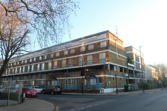
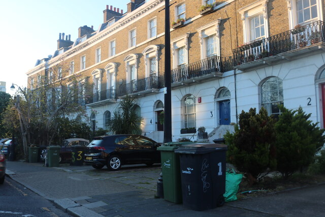
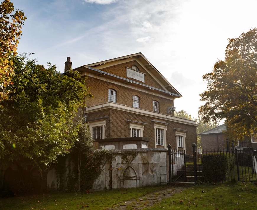
575 Wandsworth Road is a heritage site located in Surrey, England. This historic property is a unique example of an early 19th-century terraced house that has been meticulously preserved and restored to its original condition. It is now managed by the National Trust and is open to the public.

Built in the 1820s, the house features a simple yet elegant Georgian design, with three floors and a basement. The exterior of the building is made of brick, with a front entrance framed by a classical portico. The interior is adorned with intricate woodwork, decorative plaster ceilings, and original period features, showcasing the craftsmanship of the era.

What sets 575 Wandsworth Road apart is its remarkable collection of hand-painted murals created by its former owner, Khadambi Asalache. Asalache, a poet and civil servant, transformed the house over the course of 20 years, covering every surface with his unique and intricate designs. The murals reflect his Kenyan heritage, combining African motifs with Islamic geometric patterns.

Visitors to 575 Wandsworth Road can explore the house and admire the stunning murals, which can be found in every room. The property offers a glimpse into the life and artistic vision of Khadambi Asalache, as well as the history and architectural heritage of the area.

As a heritage site, 575 Wandsworth Road provides a valuable insight into the cultural and artistic contributions of communities that have shaped the history of Surrey.

If you have any feedback on the listing, please let us know in the comments section below.

575 Wandsworth Road Images

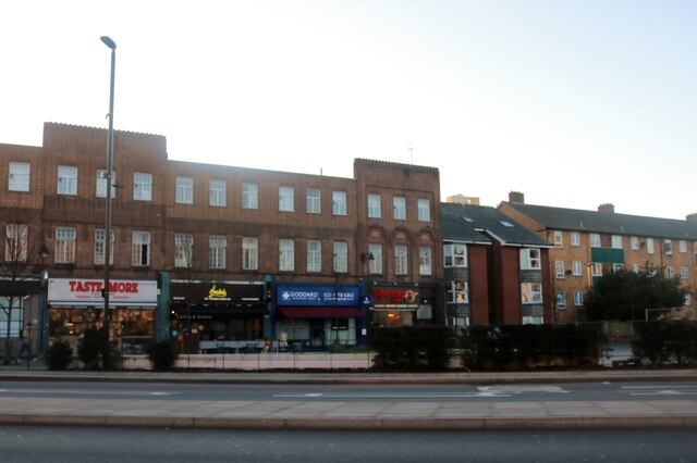
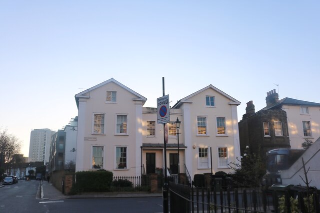
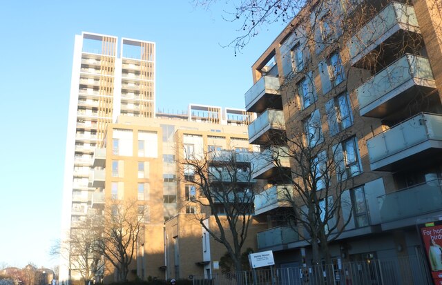
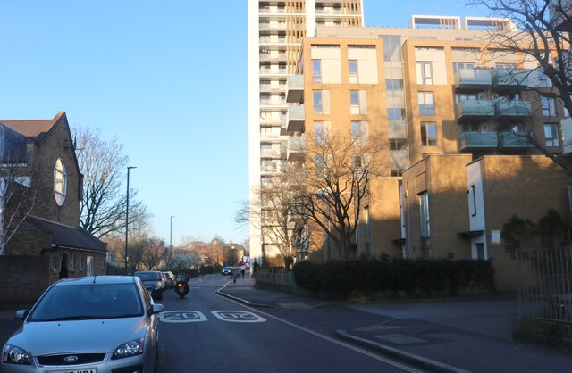
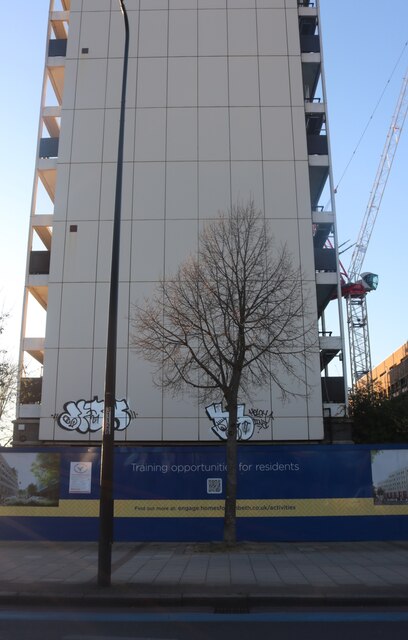
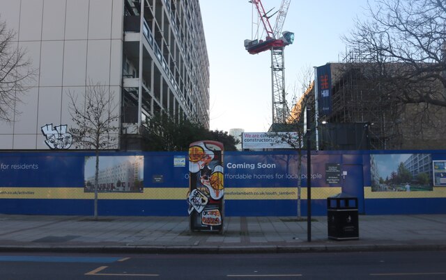
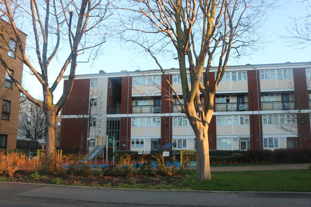
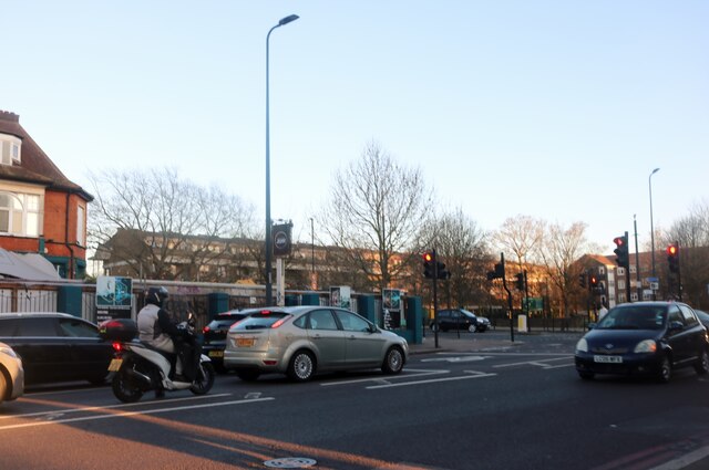
Images are sourced within 2km of 51.47/-0.141 or Grid Reference TQ2976. Thanks to Geograph Open Source API. All images are credited.

Nine Elms Station, Wandsworth Road On its first day of operation. It is one of two stations on a new Northern Line extension from Kennington, the terminus being Battersea Power Station.
They will serve an area being filled with hideous towers, examples of which can be seen behind, as well as the revamped power station, US Embassy etc.
Nine Elms Station, Wandsworth Road
On its first day of operation. It is one of two stations on a new Northern Line extension from Kennington, the terminus being Battersea Power Station. They will serve an area being filled with hideous towers, examples of which can be seen behind, as well as the revamped power station, US Embassy etc.
Interior detail of Nine Elms Station, Wandsworth Road The platforms on the station's first day of operation.
Exterior view: <a href="https://www.geograph.org.uk/photo/6968699">TQ3077 : Nine Elms Station, Wandsworth Road</a>.
Interior detail of Nine Elms Station, Wandsworth Road
The platforms on the station's first day of operation. Exterior view: TQ3077 : Nine Elms Station, Wandsworth Road.
Riverside Garden on the south bank of the Thames facing west
David Bowie mural
David Bowie mural
Norton House, Stockwell
Stockwell Terrace
Stockwell Terrace
South Lambeth Road, Stockwell The circular structure is similar to others outside the Northern Line stations south of the river and appear to be for ventilation and maintenance and not accessible from the surface.
South Lambeth Road, Stockwell
The circular structure is similar to others outside the Northern Line stations south of the river and appear to be for ventilation and maintenance and not accessible from the surface.
Kennington clock tower
South Lambeth Road, Stockwell
Houses on Stockwell Park Road
Flats on Robsart Street, Stockwell
Robsart Street, Stockwell
Tower block on Clapham Road, Kennington
Construction site on Clapham Road, Kennington
Dudley House on Robsart Street, Stockwell
Brixton Road, Stockwell
Brixton Underground Station Brixton is a London Underground station on Brixton Road in Brixton. The station is the southern terminus of the Victoria line. The station is known to have the largest London Underground roundel on the network. It opened in 1971.
Wikipedia: <span class="nowrap"><a title="https://en.wikipedia.org/wiki/Brixton_tube_station" rel="nofollow ugc noopener" href="https://en.wikipedia.org/wiki/Brixton_tube_station">Link</a><img style="margin-left:2px;" alt="External link" title="External link - shift click to open in new window" src="https://s1.geograph.org.uk/img/external.png" width="10" height="10"/></span>
Brixton Underground Station
Brixton is a London Underground station on Brixton Road in Brixton. The station is the southern terminus of the Victoria line. The station is known to have the largest London Underground roundel on the network. It opened in 1971. Wikipedia: LinkExternal link
Show me another place!

575 Wandsworth Road is located at Grid Ref: TQ2976 (Lat: 51.47, Lng: -0.141)

What 3 Words

///text.slate.love. Near Battersea, London

Nearby Locations

575 Wandsworth Road

Related Wikis

575 Wandsworth Road

575 Wandsworth Road, London, was the home of Kenyan poet and civil servant Khadambi Asalache until his death in 2006. Following his death he left it to...

St Paul's Church, Clapham

St Paul's Church is a Church of England parish church in Clapham, London. There has been a church on the site since the 12th century. The current building...

Wandsworth Road railway station

Wandsworth Road railway station (WWR) is a National Rail station between Battersea and Clapham in south London. It is served by London Overground services...

Longhedge Railway Works (Battersea)

Longhedge Railway Works was a locomotive and carriage works built by the London, Chatham and Dover Railway in the borough of Battersea, South London to...

Stewarts Lane

Stewarts Lane is a large railway-servicing facility in Battersea in London, England, founded by the London, Chatham and Dover Railway (LCDR) in 1862, to...

The Bobbin, Clapham

The Bobbin is a pub at 1–3 Lillieshall Road, Clapham, London SW4. It is a Grade II listed building, originally The Tim Bobbin, dating back to the late...

Clapham Town (ward)

Clapham Town is an administrative division of the London Borough of Lambeth, England. The ward contains much of Clapham including part of Clapham Common...

A3036 road

The A3036 is an A road in London, England, running from Waterloo to Wandsworth. == Route == It starts at the southern tip of the County Hall roundabout...

Nearby Amenities

Located within 500m of 51.47,-0.141
Direction: both
Traffic Calming: table
Lat/Long: 51.467385/-0.1434613
Railway: switch
Lat/Long: 51.4716365/-0.1400331
Direction: both
Surface: asphalt
Traffic Calming: cushion
Lat/Long: 51.4714919/-0.1346115
Railway: switch
Lat/Long: 51.4707967/-0.1391543
Railway: switch
Lat/Long: 51.4733871/-0.1427938
Railway: switch
Lat/Long: 51.4730024/-0.1428713
Traffic Calming: hump
Lat/Long: 51.4678331/-0.1417437
Crossing
Crossing: unmarked
Crossing Island: no
Crossing Markings: no
Lat/Long: 51.467776/-0.1404445
Direction: both
Traffic Calming: table
Lat/Long: 51.4698127/-0.138979
Direction: both
Surface: asphalt
Traffic Calming: table
Lat/Long: 51.4683016/-0.1428548
Traffic Calming: table
Lat/Long: 51.4667191/-0.1426989
Direction: both
Surface: asphalt
Traffic Calming: table
Lat/Long: 51.4677595/-0.1424804
Traffic Calming: hump
Lat/Long: 51.467332/-0.1400389
Ref GB Tflcid: RWG100387
Traffic Calming: hump
Lat/Long: 51.4693989/-0.1418733
Turning Circle
Lat/Long: 51.4679288/-0.1351026
Access: no
Barrier: bollard
Bicycle: yes
Bollard: fixed
Foot: yes
Material: metal
Lat/Long: 51.4702416/-0.1391705
Bicycle Parking
Bicycle Parking: stands
Capacity: 4
Covered: no
Source: survey ch
Lat/Long: 51.4702332/-0.1393254
Crossing
Crossing: unmarked
Crossing Markings: no
Lat/Long: 51.4660737/-0.1410975
Barrier: bollard
Lat/Long: 51.4661403/-0.1411124
Bicycle Parking
Bicycle Parking: stands
Capacity: 15
Covered: no
Source: survey ch
Lat/Long: 51.4660529/-0.1416404
Pub
Traders
Created By: Potlatch 0.10f
Note: Ale and Dim Sum
Lat/Long: 51.4661242/-0.1421645
Post Box
Lat/Long: 51.4660139/-0.1409351
Pub
The Calf
Addr City: London
Addr Housenumber: 87
Addr Postcode: SW4 0DR
Addr Street: Rectory Grove
Fhrs Authority: Lambeth
Fhrs Id: 484413
Fhrs Inspectiondate: 2011-12-16
Fhrs Rating: 4
Lat/Long: 51.4655827/-0.1410858
Traffic Calming: hump
Lat/Long: 51.467034/-0.1393717
Bicycle Parking
Created By: Potlatch 0.7b
Lat/Long: 51.4712586/-0.1355845
Post Box
Lat/Long: 51.4680561/-0.1399056
Pub
The Tim Bobbin
Source: local_knowledge
Wikidata: Q26318148
Wikipedia: en:The Bobbin, Clapham
Lat/Long: 51.4663154/-0.1428452
Cafe
Os Golfinhos
Cuisine: portuguese
Lat/Long: 51.471749/-0.135588
Telephone
Booth: KXPlus
Covered: booth
Lat/Long: 51.4715865/-0.1361668
Newspoint
Shop: convenience
Lat/Long: 51.4715739/-0.1359265
Post Box
Lat/Long: 51.4712997/-0.1366076
AVN Convenience Store
Addr City: London
Addr Housenumber: 509-511
Addr Postcode: SW8 4NY
Addr Street: Wandsworth Road
Shop: convenience
Lat/Long: 51.4708065/-0.1377246
Restaurant
Orit Ethiopian Restaurant & Bar
Lat/Long: 51.4708688/-0.1381623
Cafe
Solneve Cafe
Lat/Long: 51.4706364/-0.1382787
Cafe
Savoy Cafe
Lat/Long: 51.4708182/-0.1382967
Cafe
Nicky's Cafe
Lat/Long: 51.4705424/-0.1384834
Cafe
Uncle Tom's Cabin
Addr City: London
Addr Housenumber: 394B
Addr Postcode: SW8 4PH
Addr Street: Wandsworth Road
Fhrs Authority: Lambeth
Fhrs Id: 484670
Fhrs Inspectiondate: 2013-03-18
Fhrs Rating: 3
Lat/Long: 51.4704996/-0.1390395
Telephone
Booth: KXPlus
Covered: booth
Lat/Long: 51.4703067/-0.139531
Pub
Pensbury Arms
Lat/Long: 51.4712492/-0.1380284
Bicycle Parking
Capacity: 6
Lat/Long: 51.4702774/-0.1388851
Crossing
Crossing: marked
Crossing Island: no
Crossing Markings: yes
Crossing Ref: zebra
Tactile Paving: no
Lat/Long: 51.4680945/-0.1378523
Fast Food
Gourmet Burger & Hotdog
Cuisine: burger
Lat/Long: 51.4695471/-0.1408368
Quick Stop Supermarket
Addr City: London
Addr Housenumber: 595-597
Addr Postcode: SW8 3JD
Addr Street: Wandsworth Road
Alt Name: Quick Stop Super Store
Fhrs Authority: Lambeth
Fhrs Id: 484677
Fhrs Inspectiondate: 2007-08-07
Fhrs Rating: 5
Shop: convenience
Lat/Long: 51.4693609/-0.1412175
Fuel
Texaco
Operator: The Co-operative Group
Operator Wikidata: Q117202
Lat/Long: 51.4689152/-0.1428337
The Artesian Well
Addr City: London
Addr Housenumber: 693-695
Addr Postcode: SW8 3JF
Addr Street: Wandsworth Road
Disused Amenity: pub
Fhrs Authority: Lambeth
Fhrs Id: 484679
Fhrs Inspectiondate: 2008-09-06
Fhrs Rating: 5
Lat/Long: 51.4679927/-0.1442705
Bus Stop
Wandsworth Road Station
Bus: yes
Local Ref: L
Naptan AtcoCode: 490001310A
Naptan Bearing: N
Naptan CommonName: Wandsworth Road
Naptan Indicator: L
Naptan Street: WANDSWORTH ROAD
Naptan Verified: no
Public Transport: platform
Ref: 48623
Shelter: yes
Source Ref: naptan
Lat/Long: 51.4702083/-0.139762
Bus Stop
Westbury Street
Bus: yes
Local Ref: C
Naptan AtcoCode: 490001310B
Naptan Bearing: S
Naptan CommonName: Wandsworth Road
Naptan Indicator: C
Naptan Street: WANDSWORTH ROAD
Naptan Verified: no
Public Transport: platform
Ref: 50531
Shelter: no
Source Ref: naptan
Lat/Long: 51.469844/-0.1402994
Bus Stop
Silverthorne Road
Bus: yes
Local Ref: J
Naptan AtcoCode: 490012162E
Naptan Bearing: E
Naptan CommonName: Silverthorne Road Nags Head
Naptan Indicator: Stop J
Naptan Verified: no
Public Transport: platform
Lat/Long: 51.4676902/-0.1454465
Bus Stop
Silverthorne Road
Bus: yes
Local Ref: D
Naptan AtcoCode: 490012162W
Naptan Bearing: W
Naptan CommonName: Silverthorne Road Nags Head
Naptan Indicator: Stop D
Naptan Street: WANDSWORTH ROAD
Naptan Verified: no
Public Transport: platform
Shelter: yes
Lat/Long: 51.4684628/-0.1434573
Bus Stop
St Rule Street
Bus: yes
Local Ref: K
Naptan AtcoCode: 490012940N
Naptan Bearing: N
Naptan CommonName: St.Rule Street
Naptan Indicator: Stop K
Naptan Street: WANDSWORTH ROAD
Naptan Verified: no
Public Transport: platform
Ref: 51113
Shelter: yes
Source Ref: naptan
Lat/Long: 51.469134/-0.1420589
Bus Stop
Union Road
Bus: yes
Local Ref: M
Naptan AtcoCode: 490013908N
Naptan Bearing: N
Naptan CommonName: Union Road Wandsworth Road
Naptan Indicator: Stop M
Naptan Street: WANDSWORTH ROAD
Naptan Verified: no
Public Transport: platform
Shelter: yes
Lat/Long: 51.4719246/-0.1358372
Dickens StreetSt Rule Street
Naptan AtcoCode: 490015955E
Naptan Bearing: E
Naptan CommonName: Dickens StreetSt Rule Street
Naptan Verified: no
Lat/Long: 51.4708295/-0.1455175
Bus Stop
Carey Gardens
Naptan AtcoCode: 490016688E
Naptan Bearing: SE
Naptan CommonName: Carey Gardens
Naptan Indicator: Stop
Naptan Street: STEWARTS ROAD
Naptan Verified: no
Public Transport: platform
Lat/Long: 51.4736392/-0.1380563
Bus Stop
Clyston Street
Local Ref: Y
Naptan AtcoCode: 490016689E
Naptan Bearing: SE
Naptan CommonName: Clyston Street
Naptan Indicator: Stop Y
Naptan Street: STEWARTS ROAD
Naptan Verified: no
Public Transport: platform
Shelter: no
Lat/Long: 51.4723461/-0.1357122
Pub
The Plough Inn
Fixme: closed?
Wikidata: Q27084576
Lat/Long: 51.4681008/-0.1447743
Fast Food
Pizza GoGo
Addr Housenumber: 703
Addr Street: Wandsworth Road
Cuisine: pizza
Takeaway: only
Lat/Long: 51.4678595/-0.1447013
Restaurant
Mongolian Grill
Addr City: London
Addr Housenumber: 29
Addr Postcode: SW4 0HJ
Addr Street: North Street
Cuisine: mongolian
Fhrs Authority: Lambeth
Fhrs Id: 517197
Fhrs Inspectiondate: 2013-02-16
Fhrs Rating: 4
Phone: +44 20 7498 4448
Smoking: no
Website: http://www.mongoliangrill.foodkingdom.com
Lat/Long: 51.4662735/-0.1423649
Crossing
Crossing: uncontrolled
Crossing Island: no
Crossing Ref: zebra
Tactile Paving: yes
Traffic Calming: table
Lat/Long: 51.4656538/-0.1412236
Chelsea Guest House
Designation: Guest House
Tourism: guest_house
Lat/Long: 51.4714201/-0.1372568
Clapham Guest House
Tourism: guest_house
Lat/Long: 51.4682306/-0.1438534
Railway: switch
Lat/Long: 51.4742629/-0.1415066
Railway: switch
Lat/Long: 51.473894/-0.1425834
Railway: switch
Lat/Long: 51.4737722/-0.1427158
Railway: switch
Lat/Long: 51.4729988/-0.1432658
Railway: switch
Lat/Long: 51.4728065/-0.142983
Railway: switch
Lat/Long: 51.4739309/-0.1426673
Railway: switch
Lat/Long: 51.4731446/-0.1430619
Railway: switch
Lat/Long: 51.4729268/-0.1433969
Railway: switch
Lat/Long: 51.4730086/-0.1429704
Railway: switch
Lat/Long: 51.4742765/-0.14264
Railway: switch
Lat/Long: 51.4729652/-0.1432413
Railway: switch
Lat/Long: 51.4727447/-0.1431716
Railway: switch
Lat/Long: 51.4737289/-0.1426748
Railway: switch
Lat/Long: 51.4727931/-0.143185
Railway: switch
Lat/Long: 51.4673491/-0.1353297
Railway: switch
Lat/Long: 51.4706875/-0.1391771
Railway: buffer_stop
Lat/Long: 51.4726894/-0.1410601
Railway: switch
Lat/Long: 51.4677633/-0.1358343
Railway: switch
Lat/Long: 51.4716409/-0.1401319
Railway: switch
Lat/Long: 51.4681641/-0.1362546
Railway: buffer_stop
Lat/Long: 51.4723853/-0.1407678
Wandsworth Road
Public Transport: stop_position
Railway: stop
Train: yes
Lat/Long: 51.47/-0.1384964
Railway: switch
Lat/Long: 51.4722701/-0.1407316
Railway: switch
Lat/Long: 51.4713893/-0.1398772
Crossing
Crossing: traffic_signals
Crossing Island: no
Tactile Paving: yes
Traffic Signals Sound: no
Lat/Long: 51.4712431/-0.1370165
Pub
Prince of Wales
Lat/Long: 51.471497/-0.1349448
Ref GB Tflcid: RWG100468
Traffic Calming: hump
Lat/Long: 51.4702994/-0.1343362
Ref GB Tflcid: RWG100469
Traffic Calming: hump
Lat/Long: 51.4699558/-0.1339528
Railway: switch
Lat/Long: 51.4707034/-0.1391342
Railway: switch
Lat/Long: 51.4711258/-0.1395499
Railway: switch
Lat/Long: 51.4714962/-0.1399024
Railway: switch
Lat/Long: 51.4711176/-0.139475
Bicycle Parking
Bicycle Parking: stands
Capacity: 10
Covered: no
Source: survey ch
Lat/Long: 51.4715946/-0.1360789
Bicycle Parking
Bicycle Parking: stands
Capacity: 10
Covered: no
Source: survey ch
Lat/Long: 51.4718264/-0.1356534
Bicycle Parking
Bicycle Parking: wall_loops
Capacity: 10
Covered: no
Source: survey ch
Lat/Long: 51.4661026/-0.1415622
Bicycle Parking
Bicycle Parking: stands
Capacity: 4
Covered: no
Source: survey ch
Lat/Long: 51.4695547/-0.1409292
Bicycle Parking
Bicycle Parking: stands
Capacity: 4
Covered: no
Source: survey ch
Lat/Long: 51.470487/-0.1386118
Bicycle Parking
Bicycle Parking: stands
Capacity: 4
Covered: no
Source: survey ch
Lat/Long: 51.469303/-0.1413363
Bicycle Parking
Bicycle Parking: stands
Capacity: 2
Covered: no
Source: survey ch
Lat/Long: 51.4706875/-0.1381719
Bicycle Parking
Bicycle Parking: stands
Capacity: 2
Check Date Capacity: 2021-06-19
Covered: no
Source: survey ch
Lat/Long: 51.4707333/-0.1379621
Bicycle Parking
Bicycle Parking: stands
Capacity: 2
Covered: no
Source: survey ch
Lat/Long: 51.4663399/-0.1424419
Bicycle Parking
Bicycle Parking: stands
Capacity: 4
Covered: no
Source: survey ch
Lat/Long: 51.4669749/-0.1427799
Bicycle Parking
Bicycle Parking: stands
Capacity: 2
Covered: no
Source: survey ch
Lat/Long: 51.4665271/-0.1429036
Lambeth City Learning Centre
Addr City: London
Addr Housename: Lambeth CLC
Addr Postcode: SW4 0EL
Addr Street: Rectory Grove
Building: yes
Lat/Long: 51.46577/-0.1413154
Give Way
Direction: forward
Lat/Long: 51.4696969/-0.1457833
Wandsworth Road
Name Ru: Уондсуэрт-Роуд
Naptan AtcoCode: 9100WNDSWRD
Network: London Overground
Network Website: https://www.nationalrail.co.uk/stations/wwr/
Network Wikidata: Q26334
Operator: Transport for London
Public Transport: station
Railway: station
Ref Crs: WWR
Source Network: Sign
Wheelchair: no
Wikidata: Q2472566
Wikipedia: en:Wandsworth Road railway station
Lat/Long: 51.4699602/-0.1384355
Wandsworth Road
Public Transport: stop_position
Railway: stop
Train: yes
Lat/Long: 51.4693411/-0.1377792
Crossing
Crossing: unmarked
Crossing Island: yes
Crossing Markings: no
Tactile Paving: yes
Traffic Calming: table
Lat/Long: 51.4680139/-0.1396542
Traffic Calming: cushion
Lat/Long: 51.4680347/-0.1389926
Direction: both
Surface: asphalt
Traffic Calming: cushion
Lat/Long: 51.4686437/-0.1356256
Traffic Calming: cushion
Lat/Long: 51.4689996/-0.1450786
Traffic Calming: cushion
Lat/Long: 51.4694073/-0.1454632
Crossing
Crossing: uncontrolled
Crossing Island: no
Crossing Ref: zebra
Lat/Long: 51.4696231/-0.1456679
Addr Housenumber: 508
Addr Street: Wandsworth Road
Lat/Long: 51.468634/-0.1435902
Quick Stop Household
Shop: houseware
Lat/Long: 51.4714926/-0.1360837
Quick Stop Food & Wine Supermarket
Shop: convenience
Lat/Long: 51.4715453/-0.1359965
Co-op Food
Brand: Co-op Food
Brand Wikidata: Q3277439
Operator: The Co-operative Group
Operator Wikidata: Q117202
Shop: convenience
Website: https://www.coop.co.uk/store-finder/SW8-3LT/474-488-wandsworth-road
Lat/Long: 51.4690544/-0.1426059
Give Way
Direction: backward
Lat/Long: 51.4736714/-0.1451441
Railway: switch
Lat/Long: 51.4742515/-0.1415515
Give Way
Direction: backward
Lat/Long: 51.4659582/-0.1416393
Demolished Highway: give_way
Lat/Long: 51.4655951/-0.1412542
Crossing
Crossing: uncontrolled
Crossing Ref: zebra
Lat/Long: 51.4666331/-0.1426241
Give Way
Direction: forward
Lat/Long: 51.4665116/-0.1425766
Give Way
Direction: forward
Lat/Long: 51.4702359/-0.1462773
Ref GB Tflcid: RWG100225
Traffic Calming: hump
Lat/Long: 51.470128/-0.1374109
Traffic Calming: choker
Lat/Long: 51.4737153/-0.1384359
Fountain
Lat/Long: 51.4702832/-0.1411118
Vesco News, Food & Wine
Addr Housenumber: 701
Addr Street: Wandsworth Road
Shop: convenience
Lat/Long: 51.4678885/-0.1446301
Crossing
Crossing: unmarked
Crossing Markings: no
Lat/Long: 51.4685843/-0.1430861
Barrier: bollard
Bicycle: no
Bollard: fixed
Foot: yes
Material: metal
Lat/Long: 51.4704012/-0.1432186
Bicycle Rental
Wandsworth Rd, Isley Court
Bicycle Rental: docking_station
Brand: Santander Cycles
Brand Wikidata: Q807961
Capacity: 30
Local: Wandsworth Road
Network: tfl_cycle_hire
Official Name: Wandsworth Rd, Isley Court, Wandsworth Road
Official Ref: 612
Operator: Serco
Operator Wikidata: Q499104
Lat/Long: 51.4693323/-0.1416752
Soul
Shop: hairdresser
Lat/Long: 51.4706834/-0.1386182
Place Of Worship
Kingdom Hall of Jehovah's Witnesses
Addr Housenumber: 121
Addr Street: Heath Road
Denomination: jehovahs_witness
Name En: Kingdom Hall of Jehovah's Witnesses
Religion: christian
Lat/Long: 51.4689/-0.146277
Majestic Hair Design
Shop: hairdresser
Lat/Long: 51.471774/-0.1355411
Telephone
Booth: KXPlus
Covered: booth
Lat/Long: 51.4688537/-0.1428034
Bar
Mist On Rocks
Addr City: London
Addr Housenumber: 518-526
Addr Postcode: SW8 3JX
Addr Street: Wandsworth Road
Fixme: closed?
Wikidata: Q27085204
Lat/Long: 51.4680898/-0.1447461
Bus Stop
Wandsworth Road Station
Bench: yes
Bus: yes
Local Ref: Z
Naptan AtcoCode: 490010921S
Naptan Bearing: W
Naptan CommonName: Pensbury Street
Naptan Street: WANDSWORTH ROAD
Naptan Verified: no
Public Transport: platform
Shelter: yes
Tactile Paving: no
Lat/Long: 51.4709435/-0.1375629
Traffic Calming: cushion
Lat/Long: 51.4685963/-0.1446901
Give Way
Direction: backward
Lat/Long: 51.4660724/-0.1409368
Give Way
Direction: forward
Lat/Long: 51.4660757/-0.141042
Give Way
Direction: backward
Lat/Long: 51.4655763/-0.141308
Ref GB Tflcid: RWG100462
Traffic Calming: hump
Lat/Long: 51.4687995/-0.1350751
Give Way
Direction: forward
Lat/Long: 51.4692529/-0.1342622
Traffic Signals
Traffic Signals: signal
Traffic Signals Direction: forward
Lat/Long: 51.4680785/-0.1444467
Cycleway: asl
Direction: forward
Lat/Long: 51.4681047/-0.1443861
Cycleway: asl
Direction: forward
Lat/Long: 51.4680675/-0.144119
Traffic Signals
Traffic Signals: signal
Traffic Signals Direction: forward
Lat/Long: 51.4680262/-0.144078
Traffic Signals
Traffic Signals: signal
Traffic Signals Direction: backward
Lat/Long: 51.4682844/-0.1439991
Cycleway: asl
Direction: backward
Lat/Long: 51.4682558/-0.1440578
Traffic Signals
Traffic Signals: signal
Traffic Signals Direction: backward
Lat/Long: 51.4682877/-0.1443415
Give Way
Direction: backward
Lat/Long: 51.4691592/-0.1451534
Give Way
Direction: forward
Lat/Long: 51.4691084/-0.1452577
The Plough Brewery
Office: yes
Lat/Long: 51.4681911/-0.1445764
Give Way
Direction: forward
Lat/Long: 51.468708/-0.1477816
Give Way
Direction: backward
Lat/Long: 51.4690685/-0.1468631
Traffic Calming: bump
Lat/Long: 51.4692993/-0.1435049
Traffic Calming: hump
Lat/Long: 51.4674772/-0.1422599
Traffic Calming: bump
Lat/Long: 51.4712172/-0.1342485
Traffic Signals
Traffic Signals: signal
Traffic Signals Direction: forward
Lat/Long: 51.4722364/-0.1356923
Traffic Signals
Traffic Signals: signal
Traffic Signals Direction: backward
Lat/Long: 51.472186/-0.135238
Traffic Signals
Traffic Signals: signal
Traffic Signals Direction: forward
Lat/Long: 51.471969/-0.1356003
Cycleway: asl
Direction: forward
Lat/Long: 51.4719953/-0.1355547
Cycleway: asl
Direction: forward
Lat/Long: 51.4722145/-0.1356623
Cycleway: asl
Direction: backward
Lat/Long: 51.4721564/-0.1352902
Bicycle Rental
Heath Road
Bicycle Rental: docking_station
Brand: Santander Cycles
Brand Wikidata: Q807961
Capacity: 27
Local: Battersea
Network: tfl_cycle_hire
Official Name: Heath Road, Battersea
Official Ref: 677
Operator: Serco
Operator Wikidata: Q499104
Lat/Long: 51.4687296/-0.1463346
Sparkle Nails & Beauty
Shop: beauty
Lat/Long: 51.4718069/-0.1354718
Flutter Me
Addr City: London
Addr Housenumber: 513
Addr Postcode: SW8 4NY
Addr Street: Wandsworth Road
Shop: beauty
Lat/Long: 51.470759/-0.137825
Fixme: continue
Lat/Long: 51.4687195/-0.1443538
Fixme: verify connection
Lat/Long: 51.4685435/-0.1441507
Fixme: continue
Lat/Long: 51.46898/-0.1447225
Parking
Lat/Long: 51.4717568/-0.1372545
Direction: both
Surface: asphalt
Traffic Calming: hump
Lat/Long: 51.4684723/-0.1347827
Traffic Calming: bump
Lat/Long: 51.4696869/-0.1369625
Traffic Calming: bump
Lat/Long: 51.4692139/-0.1365797
Shop: convenience
Lat/Long: 51.4661718/-0.1376797
Traffic Calming: hump
Lat/Long: 51.4668827/-0.1392767
Give Way
Direction: forward
Lat/Long: 51.4672703/-0.1389762
Bicycle Rental
Stewart's Road
Bicycle Rental: docking_station
Brand: Santander Cycles
Brand Wikidata: Q807961
Capacity: 28
Local: Wandsworth Road
Network: tfl_cycle_hire
Official Name: Stewart's Road, Wandsworth Road
Official Ref: 714
Operator: Serco
Operator Wikidata: Q499104
Lat/Long: 51.4731113/-0.1372169
Crossing
Crossing: unmarked
Crossing Markings: no
Lat/Long: 51.4686061/-0.143024
Bag Books
Addr City: London
Addr Housenumber: 1
Addr Postcode: SW8 4UB
Addr Street: Stewart Court
Office: association
Opening Hours: Mo-Fr 09:00-17:00
Phone: +44 20 7627 0444
Website: http://www.bagbooks.org/
Lat/Long: 51.4723135/-0.1364321
Cafe
Beans and Bubbles
Addr City: London
Addr Housenumber: 527-529
Addr Postcode: SW8 4PA
Addr Street: Wandsworth Road
Cuisine: italian;coffee_shop;pizza;pastry;prosecco
Indoor Seating: yes
Opening Hours: Mo-Fr 07:00-14:00
Outdoor Seating: no
Payment Cash: no
Payment Credit Cards: yes
Payment Debit Cards: yes
Website: https://www.beansandbubbles.co.uk/
Lat/Long: 51.4703464/-0.1389667
Fast Food
Kam's Chicken
Lat/Long: 51.4702236/-0.1392673
Defibrillator
Emergency: defibrillator
Lat/Long: 51.4721965/-0.1461469
St Rule Street Auto
Shop: car_repair
Lat/Long: 51.4692806/-0.1422452
Traffic Calming: table
Lat/Long: 51.4678269/-0.1408846
Railway: railway_crossing
Lat/Long: 51.4709803/-0.1394635
Wandsworth Road Junction
Railway: junction
Lat/Long: 51.4706949/-0.139155
Railway: railway_crossing
Lat/Long: 51.4718986/-0.1403775
Factory Junction
Railway: junction
Lat/Long: 51.4716376/-0.140081
Direction: both
Surface: asphalt
Traffic Calming: hump
Lat/Long: 51.4687913/-0.1383974
Access: no
Barrier: block
Bicycle: yes
Foot: yes
Tfl Id: RWG100206
Lat/Long: 51.4698271/-0.1426025
Access: no
Barrier: bollard
Bicycle: no
Bollard: fixed
Foot: yes
Material: metal
Tfl Id: RWG100176
Lat/Long: 51.4685889/-0.1430344
Give Way
Direction: forward
Lat/Long: 51.4659603/-0.1399025
Bicycle Parking
Bicycle Parking: Plantlocker
Capacity: 2
Lat/Long: 51.4689766/-0.1423682
Bicycle Parking
Bicycle Parking: stands
Capacity: 24
Lat/Long: 51.4699121/-0.1428178
Bicycle Parking
Bicycle Parking: stands
Capacity: 2
Lat/Long: 51.4681504/-0.1444263
Bicycle Parking
Bicycle Parking: stands
Capacity: 4
Lat/Long: 51.4679628/-0.146362
Bicycle Parking
Access: private
Bicycle Parking: shed
Capacity: 6
On Carriageway: yes
Operator: cyclehoop
Ref: Bikehangar 539
Lat/Long: 51.469011/-0.1364624
Bicycle Parking
Access: private
Bicycle Parking: shed
Capacity: 6
On Carriageway: yes
Operator: cyclehoop
Ref: Bikehangar 168
Lat/Long: 51.4680593/-0.1385662
Bicycle Parking
Bicycle Parking: stands
Capacity: 7
Lat/Long: 51.4684317/-0.1370203
Bicycle Parking
Access: private
Bicycle Parking: shed
Capacity: 6
On Carriageway: yes
Operator: cyclehoop
Ref: Bikehangar 540
Lat/Long: 51.4700143/-0.137373
Bicycle Parking
Bicycle Parking: stands
Capacity: 6
Lat/Long: 51.4714202/-0.1368629
Bicycle Parking
Bicycle Parking: stands
Capacity: 2
Lat/Long: 51.4667931/-0.1426938
Bicycle Parking
Bicycle Parking: stands
Capacity: 6
Lat/Long: 51.4666009/-0.1425257
Bicycle Parking
Bicycle Parking: stands
Capacity: 2
Lat/Long: 51.4668403/-0.1427292
Bicycle Parking
Bicycle Parking: Plantlocker
Capacity: 2
Lat/Long: 51.47029/-0.1391707
Bicycle Parking
Bicycle Parking: Plantlocker
Capacity: 2
Lat/Long: 51.4702272/-0.1391992
Bicycle Parking
Access: private
Bicycle Parking: shed
Capacity: 6
On Carriageway: yes
Operator: cyclehoop
Ref: Bikehangar 541
Lat/Long: 51.4705319/-0.1379351
Bicycle Parking
Bicycle Parking: stands
Capacity: 2
Lat/Long: 51.4694517/-0.1411796
Bicycle Parking
Bicycle Parking: stands
Capacity: 2
Lat/Long: 51.4702556/-0.1390938
Traffic Calming: hump
Lat/Long: 51.4697867/-0.1423239
Direction: both
Surface: asphalt
Traffic Calming: cushion
Lat/Long: 51.4719024/-0.1351676
Traffic Calming: cushion
Lat/Long: 51.473149/-0.1371651
Traffic Calming: hump
Lat/Long: 51.4737842/-0.1377209
Traffic Calming: hump
Lat/Long: 51.4729285/-0.1364067
Traffic Calming: cushion
Lat/Long: 51.4727206/-0.1364339
Traffic Calming: hump
Lat/Long: 51.4671381/-0.1399159
Traffic Calming: hump
Lat/Long: 51.4705305/-0.1340998
Traffic Calming: hump
Lat/Long: 51.4684294/-0.1414745
Traffic Calming: hump
Lat/Long: 51.4706495/-0.1347597
Traffic Calming: hump
Lat/Long: 51.4689678/-0.1393232
Traffic Calming: hump
Lat/Long: 51.4686652/-0.1391403
Traffic Calming: hump
Lat/Long: 51.4669581/-0.1397996
Direction: both
Surface: asphalt
Traffic Calming: hump
Lat/Long: 51.4692699/-0.1386675
Traffic Calming: hump
Lat/Long: 51.4671669/-0.1391711
Traffic Calming: hump
Lat/Long: 51.4675902/-0.1429362
Traffic Calming: hump
Lat/Long: 51.4675001/-0.1373112
Traffic Calming: hump
Lat/Long: 51.4695486/-0.1383426
Traffic Calming: hump
Lat/Long: 51.4685762/-0.1358775
Traffic Calming: hump
Lat/Long: 51.4695855/-0.141481
Traffic Calming: hump
Lat/Long: 51.4695296/-0.1415985
Direction: both
Surface: asphalt
Traffic Calming: bump
Lat/Long: 51.4707483/-0.1408117
Traffic Calming: hump
Lat/Long: 51.4707746/-0.1410718
Direction: both
Surface: asphalt
Traffic Calming: bump
Lat/Long: 51.4704912/-0.1398836
Traffic Calming: bump
Lat/Long: 51.469488/-0.1436164
Traffic Calming: hump
Lat/Long: 51.4692073/-0.1450182
Traffic Calming: hump
Lat/Long: 51.469444/-0.1443579
Traffic Calming: choker
Lat/Long: 51.4698839/-0.1363235
Crossing
Crossing: unmarked
Crossing Island: no
Crossing Markings: no
Tactile Paving: yes
Traffic Calming: table
Lat/Long: 51.4680466/-0.1376673
Crossing
Crossing: unmarked
Crossing Island: no
Crossing Markings: no
Tactile Paving: yes
Traffic Calming: table
Lat/Long: 51.4682316/-0.136948
Crossing
Crossing: unmarked
Crossing Island: no
Crossing Markings: no
Tactile Paving: no
Traffic Calming: table
Lat/Long: 51.4681436/-0.138052
Crossing
Crossing: unmarked
Crossing Island: yes
Crossing Markings: no
Traffic Calming: table
Lat/Long: 51.4691666/-0.1341408
Addr City: London
Addr Housenumber: 525a
Addr Postcode: SW8 4PA
Addr Street: Wandsworth Road
Lat/Long: 51.4705307/-0.1384529
Addr City: London
Addr Housenumber: 525
Addr Postcode: SW8 4PA
Addr Street: Wandsworth Road
Lat/Long: 51.4705457/-0.1384154
Addr City: London
Addr Housenumber: 523
Addr Postcode: SW8 4PA
Addr Street: Wandsworth Road
Lat/Long: 51.4705683/-0.1383577
Addr City: London
Addr Housenumber: 521
Addr Postcode: SW8 4PA
Addr Street: Wandsworth Road
Lat/Long: 51.4705984/-0.1382867
Addr City: London
Addr Housenumber: 519
Addr Postcode: SW8 4PA
Addr Street: Wandsworth Road
Lat/Long: 51.4706259/-0.1382169
Addr City: London
Addr Housenumber: 517
Addr Postcode: SW8 4PA
Addr Street: Wandsworth Road
Lat/Long: 51.4706527/-0.1381499
Addr City: London
Addr Housenumber: 515
Addr Postcode: SW8 4NY
Addr Street: Wandsworth Road
Lat/Long: 51.4707479/-0.1378803
Addr City: London
Addr Housenumber: 475
Addr Postcode: SW8 4NX
Addr Street: Wandsworth Road
Lat/Long: 51.4714821/-0.1360424
Addr City: London
Addr Housenumber: 473
Addr Postcode: SW8 4NX
Addr Street: Wandsworth Road
Lat/Long: 51.471517/-0.1359775
Addr City: London
Addr Housenumber: 471
Addr Postcode: SW8 4NX
Addr Street: Wandsworth Road
Lat/Long: 51.4715519/-0.1359126
Addr City: London
Addr Housenumber: 469
Addr Postcode: SW8 4NX
Addr Street: Wandsworth Road
Lat/Long: 51.4715868/-0.1358477
Addr City: London
Addr Housenumber: 467
Addr Postcode: SW8 4NX
Addr Street: Wandsworth Road
Lat/Long: 51.4716217/-0.1357828
Addr City: London
Addr Housenumber: 465
Addr Postcode: SW8 4NX
Addr Street: Wandsworth Road
Lat/Long: 51.4716566/-0.1357179
Addr City: London
Addr Housenumber: 463
Addr Postcode: SW8 4NX
Addr Street: Wandsworth Road
Lat/Long: 51.4716916/-0.135653
Addr City: London
Addr Housenumber: 461
Addr Postcode: SW8 4NX
Addr Street: Wandsworth Road
Lat/Long: 51.4717265/-0.1355881
Addr City: London
Addr Housenumber: 459
Addr Postcode: SW8 4NX
Addr Street: Wandsworth Road
Lat/Long: 51.4717614/-0.1355232
Addr City: London
Addr Housenumber: 477
Addr Postcode: SW8 4NX
Addr Street: Wandsworth Road
Lat/Long: 51.4714471/-0.1361074
Addr City: London
Addr Housenumber: 457
Addr Postcode: SW8 4NX
Addr Street: Wandsworth Road
Lat/Long: 51.4717963/-0.1354583
Addr City: London
Addr Housenumber: 455
Addr Postcode: SW8 4NX
Addr Street: Wandsworth Road
Lat/Long: 51.4718155/-0.1353724
Traffic Calming: cushion
Lat/Long: 51.466977/-0.1356491
Traffic Calming: cushion
Lat/Long: 51.467864/-0.1366956
Traffic Signals
Traffic Signals Direction: backward
Lat/Long: 51.4719645/-0.1352602
Give Way
Direction: backward
Lat/Long: 51.4682522/-0.1369607
Yes
Access: yes
Barrier: planter
Emergency: yes
Material: wood
Motor Vehicle: no
Note: Larkhall Rise Bridge closed to all motor vehicles except emergency services
Operator: London Borough of Lambeth
Website: https://quietway5.commonplace.is/schemes/proposals/5-larkhall-rise-bridge/details
Lat/Long: 51.4683116/-0.1368867
Crossing
Crossing: marked
Crossing Island: no
Tactile Paving: yes
Lat/Long: 51.4728776/-0.1366925
Give Way
Direction: backward
Lat/Long: 51.4727686/-0.1366121
575 Wandsworth Road
Addr City: London
Addr Housenumber: 575
Addr Postcode: SW8 3JD
Addr Street: Wandsworth Road
Email: 575wandsworthroad@nationaltrust.org.uk
Fee: yes
Phone: +44 344 249 1895
Tourism: attraction
Website: https://www.nationaltrust.org.uk/575-wandsworth-road#Overview
Wheelchair: no
Lat/Long: 51.4697018/-0.1406549
Crossing
Crossing: unmarked
Traffic Calming: table
Lat/Long: 51.4660312/-0.141899
Crossing
Crossing: unmarked
Crossing Island: yes
Crossing Markings: no
Tactile Paving: yes
Lat/Long: 51.4680521/-0.1400219
Crossing
Crossing: unmarked
Crossing Markings: no
Traffic Calming: table
Lat/Long: 51.4680947/-0.1388912
Traffic Calming: cushion
Lat/Long: 51.4675161/-0.1363878
Give Way
Direction: forward
Lat/Long: 51.4669221/-0.136874
Traffic Calming: hump
Lat/Long: 51.4670506/-0.1370213
Traffic Calming: hump
Lat/Long: 51.4665653/-0.1366862
Telephone
Booth: K2
Covered: booth
Listed Status: Grade II
Lat/Long: 51.4697882/-0.1459597
Traffic Calming: cushion
Lat/Long: 51.4698173/-0.1458367
Bar
Distortion Brewing Co
Addr City: London
Addr Housename: Distortion Brewery
Addr Housenumber: 647
Addr Postcode: SW8 3DH
Addr Street: Portslade Road
Brewery: yes;various;Bitburger
Opening Hours: Th 17:00-22:00; Fr 16:00-23:00; Sa 13:00-23:00; Su 14:00-20:00
Website: https://distortionbrewing.co.uk/
Wheelchair: yes
Lat/Long: 51.4707294/-0.1393461
Give Way
Direction: backward
Lat/Long: 51.4715634/-0.147384
Stewarts Lane Depot
Railway: yard
Lat/Long: 51.472007/-0.1443096
Give Way
Direction: backward
Lat/Long: 51.4680303/-0.1400134
Bicycle Parking
Access: private
Bicycle Parking: shed
Capacity: 6
Operator: cyclehoop
Ref: Bikehangar 2489
Lat/Long: 51.4678129/-0.1367061
Bicycle Parking
Access: private
Bicycle Parking: shed
Capacity: 6
Operator: cyclehoop
Ref: Bikehangar 2488
Lat/Long: 51.4675984/-0.1374522
Bicycle Parking
Access: private
Bicycle Parking: shed
Capacity: 6
Operator: cyclehoop
Ref: Bikehangar 1335
Lat/Long: 51.4692385/-0.1462748
Traffic Calming: choker
Lat/Long: 51.4673351/-0.1434024
Give Way
Direction: forward
Lat/Long: 51.4673705/-0.1435001
Give Way
Direction: backward
Lat/Long: 51.4674021/-0.1434185
Give Way
Direction: forward
Lat/Long: 51.4677435/-0.1425377
Give Way
Direction: backward
Lat/Long: 51.4677739/-0.1424246
Give Way
Direction: forward
Lat/Long: 51.467767/-0.1404198
Traffic Calming: hump
Lat/Long: 51.4684343/-0.1422489
Give Way
Direction: forward
Lat/Long: 51.4683137/-0.1428011
Give Way
Direction: backward
Lat/Long: 51.4687165/-0.144885
Give Way
Direction: backward
Lat/Long: 51.4671611/-0.1359888
Give Way
Direction: forward
Lat/Long: 51.4698021/-0.1390313
Crossing
Crossing: unmarked
Traffic Calming: table
Lat/Long: 51.4717391/-0.1362207
Give Way
Direction: forward
Lat/Long: 51.4717223/-0.1361958
Give Way
Direction: backward
Lat/Long: 51.4714182/-0.1365493
Crossing
Crossing: unmarked
Traffic Calming: table
Lat/Long: 51.4713877/-0.136515
Traffic Signals
Traffic Signals: signal
Traffic Signals Direction: forward
Lat/Long: 51.4712201/-0.1370709
Traffic Signals
Traffic Signals: signal
Traffic Signals Direction: backward
Lat/Long: 51.4712664/-0.1369632
Give Way
Direction: backward
Lat/Long: 51.470012/-0.1479803
Give Way
Direction: forward
Lat/Long: 51.4700768/-0.1479531
Give Way
Direction: backward
Lat/Long: 51.4699001/-0.1473006
Give Way
Direction: backward
Lat/Long: 51.470459/-0.1477347
Give Way
Direction: backward
Lat/Long: 51.4714341/-0.1471825
Crossing
Crossing: unmarked
Lat/Long: 51.4714572/-0.1471192
Traffic Calming: cushion
Lat/Long: 51.4707747/-0.1467057
Give Way
Direction: backward
Lat/Long: 51.4705955/-0.146517
Traffic Calming: cushion
Lat/Long: 51.4703493/-0.1463387
Give Way
Direction: forward
Lat/Long: 51.4695129/-0.1456324
Give Way
Direction: backward
Lat/Long: 51.469552/-0.1455328
Tactile Paving: yes
Lat/Long: 51.4696056/-0.1457244
Tactile Paving: yes
Lat/Long: 51.4696342/-0.1456319
Give Way
Direction: backward
Lat/Long: 51.4674842/-0.1459218
Give Way
Direction: backward
Lat/Long: 51.4697658/-0.1450647
Give Way
Direction: forward
Lat/Long: 51.4697835/-0.1466186
Give Way
Direction: forward
Lat/Long: 51.4667335/-0.1426578
Give Way
Direction: backward
Lat/Long: 51.4661348/-0.139135
Give Way
Direction: backward
Lat/Long: 51.4680734/-0.1376802
Give Way
Direction: forward
Lat/Long: 51.4681111/-0.1380393
Give Way
Direction: backward
Lat/Long: 51.4680694/-0.1388833
Give Way
Direction: forward
Lat/Long: 51.4690303/-0.1422383
Crossing
Crossing: unmarked
Crossing Markings: no
Lat/Long: 51.4690459/-0.1422529
Crossing
Lat/Long: 51.4697062/-0.1408123
Give Way
Direction: forward
Lat/Long: 51.4685995/-0.1430986
Give Way
Lat/Long: 51.4707302/-0.138069
Crossing
Crossing: unmarked
Lat/Long: 51.4707107/-0.1380486
Give Way
Direction: forward
Lat/Long: 51.4704304/-0.1391349
Give Way
Direction: forward
Lat/Long: 51.4700572/-0.140112
Noexit: yes
Lat/Long: 51.4698407/-0.141347
Crossing
Crossing: unmarked
Lat/Long: 51.4673606/-0.1435251
Crossing
Crossing: unmarked
Lat/Long: 51.4674286/-0.1435056
Crossing
Crossing: unmarked
Lat/Long: 51.4674152/-0.1433849
Crossing
Crossing: unmarked
Lat/Long: 51.4673263/-0.1433902
Crossing
Crossing: unmarked
Crossing Markings: no
Lat/Long: 51.466503/-0.1426012
Crossing
Crossing: traffic_signals
Crossing Ref: puffin
Lat/Long: 51.4681262/-0.1443364
Crossing
Crossing: traffic_signals
Crossing Ref: puffin
Lat/Long: 51.4681032/-0.1441543
Crossing
Crossing: traffic_signals
Crossing Ref: puffin
Lat/Long: 51.4682508/-0.1443028
Crossing
Crossing: traffic_signals
Crossing Ref: puffin
Lat/Long: 51.4682319/-0.1441069
Crossing
Crossing: unmarked
Lat/Long: 51.4667497/-0.1426142
Give Way
Direction: forward
Lat/Long: 51.4664384/-0.1384216
Railway: switch
Lat/Long: 51.4679956/-0.1361976
Crossing
Crossing: unmarked
Crossing Markings: no
Lat/Long: 51.4671516/-0.1360094
Pub
Old Town Tavern
Addr Housenumber: 29
Addr Street: North Street
Cuisine: mexican
Note: 20 beers on tap, wines and bar food
Opening Hours: Mo 17:00-22:00; Tu-Th 17:00-00:00; Fr, Sa 14:00-02:00; Su 12:00-23:00
Phone: +44 20 7642 8642
Website: https://www.oldtowntavern.co.uk/
Lat/Long: 51.4661168/-0.1421957
Give Way
Direction: backward
Lat/Long: 51.469191/-0.1341905
Bicycle: yes
Colour Text: white
Operator: Lambeth Council
Traffic Sign: GB:1057
Traffic Sign Direction: forward
Lat/Long: 51.4710231/-0.1344899
Bicycle: yes
Colour Text: white
Operator: Lambeth Council
Traffic Sign: GB:1057
Traffic Sign Direction: forward
Lat/Long: 51.4711555/-0.1341669
Give Way
Direction: forward
Lat/Long: 51.471091/-0.1340228
Give Way
Direction: backward
Lat/Long: 51.4710358/-0.1341131
Bicycle: yes
Colour Text: white
Operator: Lambeth Council
Traffic Sign: GB:1057
Traffic Sign Direction: backward
Lat/Long: 51.4714618/-0.1345719
Bicycle: yes
Colour Text: white
Operator: Lambeth Council
Traffic Sign: GB:1057
Traffic Sign Direction: backward
Lat/Long: 51.4716126/-0.1347707
Bicycle: yes
Colour Text: white
Operator: Lambeth Council
Traffic Sign: GB:1057
Traffic Sign Direction: backward
Lat/Long: 51.471737/-0.1354814
Bicycle: yes
Colour Text: white
Operator: Lambeth Council
Traffic Sign: GB:1057
Traffic Sign Direction: forward
Lat/Long: 51.4718427/-0.1350864
Cycleway: asl
Direction: backward
Lat/Long: 51.471988/-0.1352964
Crossing
Lat/Long: 51.4720046/-0.1353238
Crossing
Lat/Long: 51.4721381/-0.1353187
Crossing
Lat/Long: 51.4720146/-0.1355211
Crossing
Lat/Long: 51.4721286/-0.1355303
Give Way
Direction: forward
Lat/Long: 51.4687052/-0.1351963
Crossing
Crossing: unmarked
Crossing Markings: no
Lat/Long: 51.4686843/-0.1351684
Bicycle: yes
Colour Text: white
Operator: Lambeth Council
Traffic Sign: GB:1057
Traffic Sign Direction: backward
Lat/Long: 51.4685704/-0.1349584
Bicycle: yes
Colour Text: white
Fixme: Pls fix location!
Operator: Lambeth Council
Traffic Sign: GB:1057
Traffic Sign Direction: both
Lat/Long: 51.4680123/-0.1357234
Bicycle: yes
Colour Text: white
Operator: Lambeth Council
Traffic Sign: GB:1057
Traffic Sign Direction: forward
Lat/Long: 51.4686545/-0.1351179
Crossing
Lat/Long: 51.4717572/-0.1348631
Crossing
Lat/Long: 51.4714625/-0.1344745
Crossing
Crossing: unmarked
Lat/Long: 51.4710348/-0.1341147
Crossing
Lat/Long: 51.4716299/-0.134885
Access: no
Barrier: bollard
Bicycle: yes
Bollard: fixed
Foot: yes
Material: metal
Lat/Long: 51.4702554/-0.1391231
Access: no
Barrier: bollard
Bicycle: yes
Bollard: fixed
Foot: yes
Material: metal
Lat/Long: 51.4702342/-0.1391868
Crossing
Button Operated: yes
Crossing: traffic_signals
Crossing Island: no
Kerb: flush
Tactile Paving: yes
Traffic Signals Sound: yes
Traffic Signals Vibration: yes
Lat/Long: 51.4703347/-0.1392479
Traffic Signals
Traffic Signals: signal
Traffic Signals Direction: backward
Lat/Long: 51.4703499/-0.1392054
Traffic Signals
Traffic Signals: signal
Traffic Signals Direction: forward
Lat/Long: 51.4703127/-0.1393063
Traffic Calming: choker
Lat/Long: 51.4698648/-0.1389769
Access: no
Barrier: bollard
Bollard: fixed
Foot: yes
Material: wood
Lat/Long: 51.4698741/-0.1390221
Access: no
Barrier: bollard
Bicycle: yes
Bollard: fixed
Foot: yes
Material: metal
Lat/Long: 51.4702491/-0.1391442
Colour Text: white
Operator: Lambeth Council
Traffic Sign: GB:1057
Traffic Sign Direction: forward
Lat/Long: 51.4702216/-0.1391362
Colour Text: white
Operator: Lambeth Council
Traffic Sign: GB:1057
Traffic Sign Direction: backward
Lat/Long: 51.4701339/-0.139072
Colour Text: white
Operator: Lambeth Council
Traffic Sign: GB:1057
Traffic Sign Direction: forward
Lat/Long: 51.4697303/-0.1389337
Colour Text: white
Operator: Lambeth Council
Traffic Sign: GB:1057
Traffic Sign Direction: backward
Lat/Long: 51.4693668/-0.1387239
Colour Text: white
Operator: Lambeth Council
Traffic Sign: GB:1057
Traffic Sign Direction: forward
Lat/Long: 51.4690535/-0.1385454
Colour Text: white
Operator: Lambeth Council
Traffic Sign: GB:1057
Traffic Sign Direction: backward
Lat/Long: 51.4684127/-0.1381899
Colour Text: white
Operator: Lambeth Council
Traffic Sign: GB:1057
Traffic Sign Direction: backward
Lat/Long: 51.4681993/-0.1380776
Crossing
Lat/Long: 51.469654/-0.1388199
Barrier: kerb
Kerb: lowered
Lat/Long: 51.4710275/-0.1362367
Give Way
Direction: forward
Lat/Long: 51.4703374/-0.1353257
Crossing
Crossing: unmarked
Crossing Markings: no
Lat/Long: 51.4692864/-0.1343087
Barrier: kerb
Kerb: lowered
Lat/Long: 51.4694589/-0.134576
Barrier: kerb
Kerb: lowered
Lat/Long: 51.4702315/-0.1353948
Direction: both
Surface: asphalt
Traffic Calming: hump
Lat/Long: 51.4705601/-0.1356589
Barrier: kerb
Kerb: lowered
Lat/Long: 51.4706197/-0.1358068
Barrier: kerb
Kerb: lowered
Lat/Long: 51.4712946/-0.1364907
Crossing
Crossing: unmarked
Lat/Long: 51.4703511/-0.1353008
Traffic Calming: choker
Lat/Long: 51.4693436/-0.1343847
Colour Text: white
Operator: Lambeth Council
Traffic Sign: GB:1057
Traffic Sign Direction: forward
Lat/Long: 51.4692403/-0.1343194
Colour Text: white
Operator: Lambeth Council
Traffic Sign: GB:1057
Traffic Sign Direction: backward
Lat/Long: 51.4693392/-0.1343807
Colour Text: white
Operator: Lambeth Council
Traffic Sign: GB:1057
Traffic Sign Direction: backward
Lat/Long: 51.4693956/-0.1344384
Colour Text: white
Operator: Lambeth Council
Traffic Sign: GB:1057
Traffic Sign Direction: both
Lat/Long: 51.4696637/-0.1347167
Colour Text: white
Operator: Lambeth Council
Traffic Sign: GB:1057
Traffic Sign Direction: backward
Lat/Long: 51.4701632/-0.1352432
Colour Text: white
Operator: Lambeth Council
Traffic Sign: GB:1057
Traffic Sign Direction: both
Lat/Long: 51.4702766/-0.1353575
Colour Text: white
Operator: Lambeth Council
Traffic Sign: GB:1057
Traffic Sign Direction: backward
Lat/Long: 51.470388/-0.1354745
Colour Text: white
Operator: Lambeth Council
Traffic Sign: GB:1057
Traffic Sign Direction: both
Lat/Long: 51.4710175/-0.1361357
Colour Text: white
Operator: Lambeth Council
Traffic Sign: GB:1057
Traffic Sign Direction: forward
Lat/Long: 51.4703809/-0.143214
Artwork Type: sculpture
Material: iron
Tourism: artwork
Lat/Long: 51.4704166/-0.1431723
Barrier: bollard
Bicycle: no
Bollard: fixed
Foot: yes
Material: metal
Lat/Long: 51.4704094/-0.1431933
Barrier: bollard
Bicycle: no
Bollard: fixed
Foot: yes
Material: metal
Lat/Long: 51.4704049/-0.1432629
Barrier: bollard
Bicycle: no
Bollard: fixed
Foot: yes
Material: metal
Lat/Long: 51.4703977/-0.1432926
Barrier: bollard
Bicycle: no
Bollard: fixed
Foot: yes
Material: metal
Lat/Long: 51.4705041/-0.1431292
Barrier: bollard
Bicycle: no
Bollard: fixed
Foot: yes
Material: metal
Lat/Long: 51.4704977/-0.1431467
Barrier: bollard
Bicycle: no
Bollard: fixed
Foot: yes
Material: metal
Lat/Long: 51.470485/-0.1431384
Barrier: bollard
Bicycle: no
Bollard: fixed
Foot: yes
Material: metal
Lat/Long: 51.4704786/-0.1431316
Barrier: bollard
Bicycle: no
Bollard: fixed
Foot: yes
Material: metal
Lat/Long: 51.4704711/-0.1431248
Barrier: bollard
Bicycle: no
Bollard: fixed
Foot: yes
Material: metal
Lat/Long: 51.4704181/-0.1432361
Colour Text: white
Operator: Lambeth Council
Traffic Sign: GB:1057
Traffic Sign Direction: forward
Lat/Long: 51.4704229/-0.1431054
Direction: both
Surface: asphalt
Traffic Calming: bump
Lat/Long: 51.4705605/-0.1397209
Direction: both
Surface: asphalt
Traffic Calming: bump
Lat/Long: 51.4704394/-0.1402487
Direction: both
Surface: asphalt
Traffic Calming: bump
Lat/Long: 51.4706335/-0.1404759
Direction: both
Surface: asphalt
Traffic Calming: bump
Lat/Long: 51.4706626/-0.1409742
Direction: both
Surface: asphalt
Traffic Calming: bump
Lat/Long: 51.4706553/-0.1411505
Direction: both
Surface: asphalt
Traffic Calming: bump
Lat/Long: 51.4705265/-0.1412655
Direction: both
Surface: asphalt
Traffic Calming: bump
Lat/Long: 51.4704448/-0.1414445
Barrier: cycle_barrier
Lat/Long: 51.4680586/-0.1464824
Colour Text: white
Operator: Lambeth Council
Traffic Sign: GB:1057
Traffic Sign Direction: forward
Lat/Long: 51.4705878/-0.1415149
Colour Text: white
Operator: Lambeth Council
Traffic Sign: GB:1057
Traffic Sign Direction: backward
Lat/Long: 51.4705238/-0.1414341
Colour Text: white
Operator: Lambeth Council
Traffic Sign: GB:1057
Traffic Sign Direction: backward
Lat/Long: 51.4705128/-0.1412965
Colour Text: white
Operator: Lambeth Council
Traffic Sign: GB:1057
Traffic Sign Direction: backward
Lat/Long: 51.4707352/-0.1408366
Colour Text: white
Operator: Lambeth Council
Traffic Sign: GB:1057
Traffic Sign Direction: forward
Lat/Long: 51.4705311/-0.1403593
Colour Text: white
Operator: Lambeth Council
Traffic Sign: GB:1057
Traffic Sign Direction: backward
Lat/Long: 51.470443/-0.1400009
Colour Text: white
Operator: Lambeth Council
Traffic Sign: GB:1057
Traffic Sign Direction: forward
Lat/Long: 51.4705372/-0.1397756
Cycleway: asl
Direction: backward
Lat/Long: 51.4682686/-0.144321
Direction: forward
Surface: asphalt
Traffic Calming: bump
Lat/Long: 51.4691187/-0.134411
Crossing
Crossing: unmarked
Crossing Markings: no
Lat/Long: 51.4687057/-0.1353836
Give Way
Direction: backward
Lat/Long: 51.4679792/-0.139388
Bicycle: yes
Colour Arrow: white
Colour Back: blue
Colour Text: white
Cycle Network: GB:London Cycle Network
Description: London Cycle Network sign. indicating to cross the staggered junction (into Hannington Road) for Clapham Common (½ mile) via LCN3
Destination: Clapham Common
Direction: 55
Guide Type: destination
Information: guidepost
Operator: Lambeth Council
Tourism: information
Lat/Long: 51.4665931/-0.14531
Bicycle: yes
Colour Arrow: white
Colour Back: blue
Colour Text: white
Cycle Network: GB:London Cycle Network
Description: London Cycle Network sign. indicating a right turn into North Street for Clapham Village via LCN3
Destination: Clapham Village
Direction: 240
Guide Type: destination
Information: guidepost
Operator: Lambeth Council
Tourism: information
Lat/Long: 51.467085/-0.1443295
Bicycle: yes
Colour Arrow: white
Colour Back: blue
Colour Text: white
Cycle Network: GB:London Cycle Network
Description: London Cycle Network sign. indicating to continue along Turret Grove for Clapham Common via LCN3
Destination: Clapham Common
Direction: 70
Guide Type: destination
Information: guidepost
Operator: Lambeth Council
Tourism: information
Lat/Long: 51.4676811/-0.1425756
Bicycle: yes
Colour Arrow: white
Colour Back: blue
Colour Text: white
Cycle Network: GB:London Cycle Network
Description: London Cycle Network sign, seems to be indicating to head north on Rectory Grove for Wandsworth Road rail station.
Destination: Wandsworth Road rail station
Direction: 140
Guide Type: destination
Information: guidepost
Note: this sign is in a rather odd place! probably the intention is for cyclists to then use Braeburn Avenue for Wandsworth Road station
Operator: Lambeth Council
Tourism: information
Lat/Long: 51.4677093/-0.1404901
Bicycle: yes
Colour Arrow: white
Colour Back: blue
Colour Text: white
Cycle Network: GB:London Cycle Network
Description: London Cycle Network sign. indicating a left turn to Clapham Village via LCN3
Destination: Clapham Village
Direction: 90
Guide Type: destination
Information: guidepost
Note: seems to be indicating to bear left on Rectory Grove for Clapham Village. This may be an error as LCN3 actually turns right on Turret Grove
Operator: Lambeth Council
Tourism: information
Lat/Long: 51.4679645/-0.1395712
Crossing
Crossing: unmarked
Tactile Paving: yes
Lat/Long: 51.4704569/-0.1391619
Access: no
Barrier: bollard
Bollard: fixed
Foot: yes
Material: metal
Lat/Long: 51.4704345/-0.1392123
Access: no
Barrier: bollard
Bollard: fixed
Foot: yes
Material: metal
Lat/Long: 51.4704056/-0.1392275
Access: no
Barrier: bollard
Bicycle: no
Bollard: fixed
Foot: yes
Material: metal
Tfl Id: RWG100176
Lat/Long: 51.4685853/-0.1430442
Access: no
Barrier: bollard
Bicycle: no
Bollard: fixed
Foot: yes
Material: metal
Tfl Id: RWG100176
Lat/Long: 51.4685724/-0.1431008
Traffic Calming: choker
Lat/Long: 51.4685919/-0.1430924
Access: no
Barrier: bollard
Bollard: fixed
Foot: yes
Lat/Long: 51.4683641/-0.1428419
Access: no
Barrier: bollard
Bollard: fixed
Foot: yes
Lat/Long: 51.4683527/-0.1427931
Access: no
Barrier: bollard
Bollard: fixed
Foot: yes
Lat/Long: 51.4682813/-0.1429206
Access: no
Barrier: bollard
Bollard: fixed
Foot: yes
Lat/Long: 51.4682492/-0.1428955
Access: no
Barrier: bollard
Bollard: fixed
Foot: yes
Lat/Long: 51.4682327/-0.142884
Access: no
Barrier: bollard
Bollard: fixed
Foot: yes
Lat/Long: 51.4682991/-0.1429328
Access: no
Barrier: bollard
Bollard: fixed
Foot: yes
Material: plastic
Lat/Long: 51.4678231/-0.1424545
Access: no
Barrier: bollard
Bollard: fixed
Foot: yes
Material: plastic
Lat/Long: 51.467806/-0.1424184
Access: no
Barrier: bollard
Bollard: fixed
Foot: yes
Material: plastic
Lat/Long: 51.4677402/-0.1423734
Access: no
Barrier: bollard
Bollard: fixed
Foot: yes
Material: plastic
Lat/Long: 51.467717/-0.1423792
Access: no
Barrier: bollard
Bollard: fixed
Foot: yes
Material: plastic
Lat/Long: 51.467694/-0.1425463
Access: no
Barrier: bollard
Bollard: fixed
Foot: yes
Material: plastic
Lat/Long: 51.4676873/-0.1425053
Access: no
Barrier: bollard
Bollard: fixed
Foot: yes
Material: plastic
Lat/Long: 51.4677939/-0.1425742
Access: no
Barrier: bollard
Bollard: fixed
Foot: yes
Material: plastic
Lat/Long: 51.467767/-0.1425846
Crossing
Lat/Long: 51.4685728/-0.1360794
Barrier: kerb
Kerb: flush
Tactile Paving: yes
Lat/Long: 51.468215/-0.1370065
Barrier: kerb
Kerb: flush
Tactile Paving: yes
Lat/Long: 51.46824/-0.1368967
Access: no
Barrier: bollard
Bollard: fixed
Foot: yes
Material: metal
Lat/Long: 51.4682542/-0.1369121
Access: no
Barrier: bollard
Bollard: fixed
Foot: yes
Material: metal
Lat/Long: 51.4682271/-0.1368944
Bicycle: yes
Colour Arrow: white
Colour Back: blue;#93d50a
Colour Text: white
Description: London Cycleways sign indicating a leftturn into Clapham Manor Street to Clapham Common (4 mins) via C5.
Destination: Clapham Common
Direction: backward
Guide Type: destination
Information: guidepost
Operator: TfL
Time: 00:04
Tourism: information
Lat/Long: 51.4681309/-0.1373724
Bicycle: yes
Colour Arrow: white
Colour Back: blue;#93d50a
Colour Text: white
Description: London Cycleways sign indicating a right turn into Larkhall Rise to Stockwell (4 mins) via C5.
Destination: Stockwell
Direction: 160
Guide Type: destination
Information: guidepost
Operator: TfL
Time: 00:04
Tourism: information
Lat/Long: 51.468165/-0.1377272
Access: no
Barrier: bollard
Bollard: fixed
Material: metal
Lat/Long: 51.4655345/-0.1413358
Waste Basket
Lat/Long: 51.4660057/-0.1416643
Crossing
Crossing: unmarked
Crossing Markings: no
Lat/Long: 51.465978/-0.1415856
Shop: convenience
Lat/Long: 51.4667045/-0.1425153
Fast Food
North Street Deli
Cuisine: sandwich
Lat/Long: 51.4666649/-0.1424793
Restaurant
Addr Housename: Cher
Addr Housenumber: 22
Addr Street: North Street
Cuisine: thai
Lat/Long: 51.466591/-0.1424115
North Steet Potters
Addr Housenumber: 24
Addr Street: North Street
Shop: pottery
Lat/Long: 51.466622/-0.1424475
Shop: art
Lat/Long: 51.4669778/-0.1427452
Healthcare: physiotherapist
Lat/Long: 51.4669467/-0.1427209
Fast Food
Cuisine: indian
Lat/Long: 51.4669184/-0.1427007
Healthcare: podiatrist
Lat/Long: 51.4668913/-0.1426764
Leisure: fitness_centre
Lat/Long: 51.4668352/-0.1426245
Crossing
Crossing: unmarked
Lat/Long: 51.4656413/-0.1414249
Crossing
Crossing: unmarked
Crossing Markings: no
Lat/Long: 51.4669327/-0.1368295
Crossing
Crossing: unmarked
Lat/Long: 51.4697909/-0.139066
Crossing
Crossing: unmarked
Lat/Long: 51.4697634/-0.1389522
Ref GB Tflcid: RWG055257
Traffic Calming: cushion
Lat/Long: 51.4712241/-0.1470673
Ref GB Tflcid: RWG100212
Traffic Calming: cushion
Lat/Long: 51.4664589/-0.1407712
Ref GB Tflcid: RWG100370
Traffic Calming: hump
Lat/Long: 51.4684089/-0.1412523
Inscription: Cubbit Terr. R/O 14
Operator: UK Power Networks
Operator Wikidata: Q7864927
Power: substation
Ref: 92368
Substation: minor_distribution
Lat/Long: 51.4672526/-0.1395185
Inscription: 18-36 Cubbit Terr.
Operator: UK Power Networks
Operator Wikidata: Q7864927
Power: substation
Ref: 92369
Substation: minor_distribution
Lat/Long: 51.4667415/-0.1390093
Tactile Paving: yes
Lat/Long: 51.4680509/-0.1396611
Tactile Paving: yes
Lat/Long: 51.4679668/-0.1396453
Crossing
Crossing: unmarked
Crossing Markings: no
Lat/Long: 51.4660693/-0.1408999
Crossing
Crossing: unmarked
Crossing Island: no
Crossing Markings: no
Lat/Long: 51.4677334/-0.1404973
Crossing
Crossing: unmarked
Crossing Island: no
Crossing Markings: no
Tactile Paving: yes
Traffic Calming: table
Lat/Long: 51.4679563/-0.1393823
The data included in this document is from www.openstreetmap.org. The data is made available under ODbL.

Have you been to 575 Wandsworth Road?

Leave your review of 575 Wandsworth Road below (or comments, questions and feedback).