Arden

Area in Warwickshire Stratford-on-Avon

England

Arden

New Road at the junction of Stratford Road
New Road at the junction of Stratford Road Credit: David Howard

Arden is a picturesque area located in Warwickshire, England. It is known for its stunning landscapes, charming countryside, and historical significance. Spanning over 100 square miles, Arden is an area of outstanding natural beauty that attracts locals and tourists alike.

The region is characterized by rolling hills, lush green fields, and ancient woodland, providing visitors with ample opportunities for outdoor activities such as hiking, cycling, and horse riding. The Arden Way, a long-distance footpath, winds through the area, offering breathtaking views and a chance to explore the idyllic countryside.

Arden is also renowned for its rich history and cultural heritage. It is believed to be the birthplace of William Shakespeare, England's greatest playwright, and is home to several important historical sites related to his life and works. The Royal Shakespeare Theatre, located in the nearby town of Stratford-upon-Avon, attracts theater enthusiasts from all over the world.

In addition to its natural and cultural attractions, Arden boasts a number of charming villages and market towns, each with its own unique character and charm. These include Alcester, Henley-in-Arden, and Studley, which offer a range of amenities, quaint shops, and traditional pubs.

Overall, Arden offers a perfect blend of natural beauty, history, and rural charm. Whether you are seeking tranquility in nature, exploring historical landmarks, or immersing yourself in the local culture, Arden is a destination that never fails to enchant visitors.

If you have any feedback on the listing, please let us know in the comments section below.
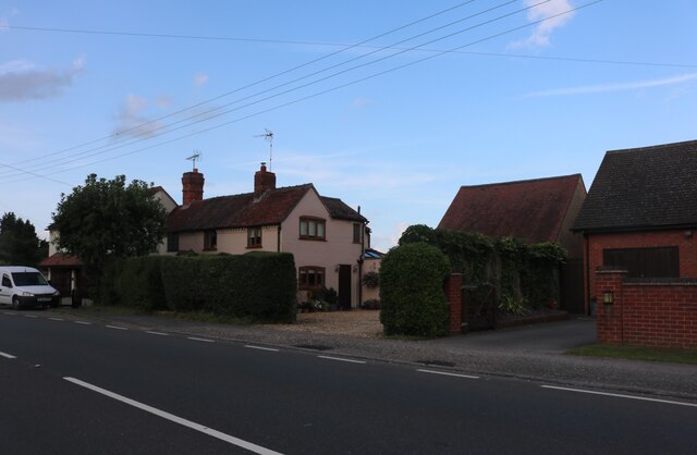
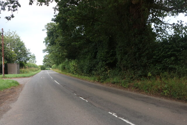
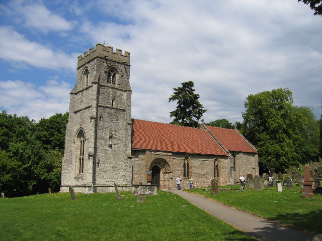
Arden Images

Images are sourced within 2km of 52.291975/-1.780141 or Grid Reference SP1566. Thanks to Geograph Open Source API. All images are credited.

New Road at the junction of Stratford Road
Railway bridge on New Road, Henley in Arden
Stratford Road, Wootton Wawen
Bridge Cottage, Henley in Arden
Display of flowers on Stratford Road, Henley in Arden
Stratford Road, Henley in Arden At the junction of Warwick Road
Stratford Road, Henley in Arden
At the junction of Warwick Road
Layby on the A3400 South of Henley-in-Arden.
Layby on the A3400
South of Henley-in-Arden.
Bridge Cottage on Stratford Road, Henley-in-Arden
George House, High Street, Henley-in-Arden
Millfield Court, Henley-in-Arden
The Finest Catch fish restaurant (closed) On Liveridge Hill, north of Henley-on-Arden.
The Finest Catch fish restaurant (closed)
On Liveridge Hill, north of Henley-on-Arden.
House at the junction of Liveridge Hill and Tanworth Lane
Glenhurst Road, Henley in Arden
Trees by Glenhurst Road, Henley in Arden
Henley Road east of Ullenhall
Beaudesert, St. Nicholas's Church: Southern aspect
Beaudesert, St. Nicholas's Church: The nave
Show me another place!

Arden is located at Grid Ref: SP1566 (Lat: 52.291975, Lng: -1.780141)

Administrative County: Warwickshire

District: Stratford-on-Avon

Police Authority: Warwickshire

Also known as: Forest of Arden

What 3 Words

///surpassed.swaps.tram. Near Henley in Arden, Warwickshire

Related Wikis

Henley-in-Arden

Henley-in-Arden (also known as simply Henley) is a town and civil parish in the Stratford-on-Avon District in Warwickshire, England. The town takes its...

Arden Way

The Arden Way is waymarked by the Heart of England Way Association and forms a circular walk to be enjoyed with the rest of Heart of England Way and the...

Beaudesert, Warwickshire

Beaudesert (pronounced ) is a village, civil parish and former manor in the Stratford-on-Avon district of Warwickshire, England, immediately east across...

Henley-in-Arden railway station

Henley-in-Arden is a railway station serving the town of Henley-in-Arden, Warwickshire, England. It is on the North Warwickshire Line between Birmingham...

Henley-in-Arden School

Henley-in-Arden School is a mixed secondary school located in Henley-in-Arden in the English county of Warwickshire.Previously a community school administered...

Beaudesert Castle

Beaudesert Castle was on a high mound overlooking the village of Beaudesert to the east of Henley-in-Arden, Warwickshire (grid reference SP15606613). It...

Venture Academy

Venture Academy (formerly Arden Fields School) is a coeducational special school located in Henley-in-Arden, Warwickshire, England. The school admits pupils...

Henley Sidings

Henley Sidings is a 1.4-hectare (3.5-acre) nature reserve near Henley-in-Arden in the county of Warwickshire, England. It is managed by the Warwickshire...

Nearby Amenities

Located within 500m of 52.291975,-1.780141
Henley-in-Arden
Naptan AtcoCode: 9100HENLYIA
Network: National Rail
Network Website: https://www.nationalrail.co.uk/stations/hnl/
Network Wikidata: Q26334
Public Transport: station
Railway: station
Ref Crs: HNL
Wikidata: Q2185706
Wikipedia: en:Henley-in-Arden railway station
Lat/Long: 52.2914546/-1.7839992
Traffic Signals
Source: bing
Lat/Long: 52.2876664/-1.7803435
Maxheight: 3.7
Source: survey
Lat/Long: 52.2930592/-1.7839337
Henley-in-Arden
Is In: Warwickshire
Place: town
Wikidata: Q2734845
Lat/Long: 52.290713/-1.780685
Fire Station
Henley in Arden
Addr City: Henley-in-Arden
Addr Street: Station Road
Operator: Warwickshire Fire and Rescue Service
Operator Wikidata: Q7971234
Lat/Long: 52.29402/-1.7799566
Disused Amenity: police
Lat/Long: 52.2939694/-1.7796307
Cafe
Dolce Caffe
Addr City: Henley-in-Arden
Addr Housenumber: 86b
Addr Postcode: B95 5BY
Addr Street: High Street
Fhrs Id: 850891
Lat/Long: 52.2929904/-1.780032
Pharmacy
Henley Pharmacy
Addr City: Henley-in-Arden
Addr Housenumber: 135
Addr Postcode: B95 5AZ
Addr Street: High Street
Fhrs Id: 595821
Healthcare: pharmacy
Operator: Dudley Taylor Pharmacies Ltd.
Source: survey
Lat/Long: 52.2925078/-1.7799733
Bus Stop
Tudor Dairies
Bus: yes
Naptan AtcoCode: 4200F027500
Naptan Bearing: N
Naptan CommonName: Tudor Dairies
Naptan Indicator: Adj
Naptan Landmark: Tudor Dairies
Naptan NaptanCode: wardgmwd
Naptan Street: High Street
Naptan Verified: no
Public Transport: platform
Source: naptan_import
Lat/Long: 52.2899244/-1.7803215
Bus Stop
Yew Tree Gardens
Bus: yes
Naptan AtcoCode: 4200F027600
Naptan Bearing: N
Naptan CommonName: Yew Tree Gardens
Naptan Crossing: Yew Tree Gardens
Naptan Indicator: Opp
Naptan NaptanCode: wardgmwg
Naptan Street: Brook End Drive
Naptan Verified: no
Public Transport: platform
Source: naptan_import
Lat/Long: 52.2893592/-1.7837761
Bus Stop
Three Tuns
Bus: yes
Naptan AtcoCode: 4200F027700
Naptan Bearing: N
Naptan CommonName: Three Tuns
Naptan Indicator: Opp
Naptan Landmark: Three Tuns
Naptan NaptanCode: wardgmwj
Naptan Street: High Street
Naptan Verified: no
Public Transport: platform
Source: naptan_import
Lat/Long: 52.2936386/-1.7796283
Bus Stop
Three Tuns
Bus: yes
Naptan AtcoCode: 4200F027800
Naptan Bearing: S
Naptan CommonName: Three Tuns
Naptan Indicator: Adj
Naptan Landmark: Three Tuns
Naptan NaptanCode: wardgmwm
Naptan Street: High Street
Naptan Verified: no
Public Transport: platform
Source: naptan_import
Lat/Long: 52.2937564/-1.7793266
Bus Stop
Arden Road
Bus: yes
Naptan AtcoCode: 4200F084600
Naptan Bearing: W
Naptan CommonName: Arden Road
Naptan Crossing: Arden Road
Naptan Indicator: Nr
Naptan NaptanCode: waratmdg
Naptan Street: Castle Road
Naptan Verified: no
Public Transport: platform
Source: naptan_import
Lat/Long: 52.2906345/-1.7734334
Bus Stop
Warwick Road
Bus: yes
Naptan AtcoCode: 4200F170200
Naptan Bearing: N
Naptan CommonName: Warwick Road
Naptan Crossing: Warwick Road
Naptan Indicator: Nr
Naptan NaptanCode: warampma
Naptan Street: High Street
Naptan Verified: no
Public Transport: platform
Source: naptan_import
Lat/Long: 52.2883976/-1.7803466
Bus Stop
Henley-in-Arden
Bus: yes
Naptan AtcoCode: 2000G516898
Naptan Bearing: N
Naptan BusStopType: CUS
Naptan CommonName: Henley-in-Arden
Naptan Indicator: Adj
Naptan Landmark: Rail Station
Naptan NaptanCode: wocdpwtd
Naptan Street: Station
Naptan Verified: no
Public Transport: platform
Source: naptan_import
Lat/Long: 52.2910945/-1.7838556
Noexit: yes
Lat/Long: 52.2914441/-1.7757063
Crossing
Crossing: traffic_signals
Lat/Long: 52.2927828/-1.7800196
Traffic Signals
Source: bing
Lat/Long: 52.2876108/-1.780783
Pub
The Three Tuns
Source: survey
Lat/Long: 52.293682/-1.7791958
Traffic Signals
Source: bing
Lat/Long: 52.2875176/-1.7805616
Grit Bin
Source: survey
Lat/Long: 52.292011/-1.7788452
Telephone
Defibrillator
Booth: KX100
Covered: booth
Defibrillator Location: inside old phone box on High Street, Henley in Arden - next to old police station
Emergency: defibrillator
Man Made: telephone_box
Lat/Long: 52.2940355/-1.7794932
Post Depot
Henley-in-Arden Delivery Office
Addr City: Henley-in-Arden
Addr Street: Station Road
Operator: Royal Mail
Operator Type: private
Operator Wikidata: Q638098
Lat/Long: 52.2941042/-1.7811175
Designation: Electrical sub station
Power: substation
Source: Local Knowlege
Substation: minor_distribution
Lat/Long: 52.2947759/-1.7812826
Give Way
Source: bing
Lat/Long: 52.2905014/-1.7755947
Barrier: kissing_gate
Lat/Long: 52.2918403/-1.7768317
Henley-in-Arden
Public Transport: stop_position
Railway: stop
Train: yes
Lat/Long: 52.2914352/-1.7840229
Railway: switch
Lat/Long: 52.2922796/-1.7839013
Railway: switch
Lat/Long: 52.2926463/-1.78395
Pub
Nags Head
Lat/Long: 52.2913714/-1.7799349
Post Box
Brand: Royal Mail
Brand Wikidata: Q638098
Brand Wikipedia: en:Royal Mail
Collection Times: Mo-Fr 17:00; Sa 11:00
Note: both apertures have a separate ref
Operator: Royal Mail
Operator Wikidata: Q638098
Post Box Apertures: 2
Post Box Type: pillar
Ref: B95 245;B95 2450
Royal Cypher: EIIR
Royal Cypher Wikidata: Q33102113
Source: survey
Lat/Long: 52.2921006/-1.7802263
Cafe
Costa
Brand: Costa
Brand Wikidata: Q608845
Brand Wikipedia: en:Costa Coffee
Cuisine: coffee_shop
Fhrs Id: 565221
Operator: HSBC
Source: survey
Takeaway: yes
Lat/Long: 52.2935651/-1.7797942
Toilets
Lat/Long: 52.2938925/-1.7801753
Pub
The Black Swan
Source: OS_OpenData_StreetView
Lat/Long: 52.2961457/-1.7781924
Shelter
Shelter Type: public_transport
Source: Bing
Lat/Long: 52.2915772/-1.784081
Library
Henley Community Library
Wikidata: Q55113079
Lat/Long: 52.2931243/-1.7792328
Beaudesert
Place: quarter
Wikidata: Q4877443
Wikipedia: en:Beaudesert, Warwickshire
Lat/Long: 52.2911801/-1.7751896
Bench
Source: survey
Lat/Long: 52.2879574/-1.7780083
Bench
Source: survey
Lat/Long: 52.287989/-1.7779368
Bench
Source: survey
Lat/Long: 52.2879522/-1.7779516
Cafe
Henley Ice Cream
Addr City: Henley-in-Arden
Addr Housenumber: 152
Addr Postcode: B95 5BS
Addr Street: High Street
Cuisine: ice_cream
Email: henleyicecream@hotmail.com
Fax: +44 1564 792510
Phone: +44 1564 795172
Website: https://www.henleyicecream.co.uk/
Lat/Long: 52.2902277/-1.7804702
Henley-in-Arden Heritage Centre
Addr City: Henley-in-Arden
Addr Housename: Joseph Hardy House
Addr Housenumber: 150
Addr Postcode: B95 5BS
Addr Street: High Street
Email: admin@heritagehenley.org.uk
Fee: no
Operator: The Joseph Hardy Charitable Trust
Phone: +44 1564 795919
Tourism: museum
Website: http://www.heritagehenley.org.uk
Lat/Long: 52.2903358/-1.7804463
Barrier: kissing_gate
Source: survey
Lat/Long: 52.2915377/-1.785899
Turning Circle
Source: Warwicks CC 2013 Aerial Imagery
Lat/Long: 52.2882742/-1.7763335
Post Box
Brand: Royal Mail
Brand Wikidata: Q638098
Brand Wikipedia: en:Royal Mail
Collection Times: Mo-Fr 09:00; Sa 07:00
Operator: Royal Mail
Operator Wikidata: Q638098
Post Box Type: pillar
Ref: B95 776D
Royal Cypher: GVIR
Royal Cypher Wikidata: Q33102169
Source: survey
Lat/Long: 52.2947831/-1.7790487
Post Box
Brand: Royal Mail
Brand Wikidata: Q638098
Brand Wikipedia: en:Royal Mail
Collection Times: Mo-Fr 09:00; Sa 07:00
Operator: Royal Mail
Operator Wikidata: Q638098
Post Box Type: pillar
Ref: B95 775D
Royal Cypher: GVIR
Royal Cypher Wikidata: Q33102169
Source: survey
Lat/Long: 52.2898977/-1.7803218
Defibrillator
Defibrillator Location: In entrance to shop on right side
Emergency: defibrillator
Source: West Midlands Ambulance Service FOI request
Lat/Long: 52.2919486/-1.7802838
Post Box
Brand: Royal Mail
Brand Wikidata: Q638098
Brand Wikipedia: en:Royal Mail
Collection Times: Mo-Fr 09:00; Sa 07:00
Operator: Royal Mail
Operator Wikidata: Q638098
Post Box Type: pillar
Ref: B95 1097D
Royal Cypher: GVIR
Royal Cypher Wikidata: Q33102169
Source: survey
Lat/Long: 52.2895519/-1.7834289
Tissington Opticians
Addr City: Henley-in-Arden
Addr Housenumber: 133
Addr Postcode: B95 5AU
Addr Street: High Street
Shop: optician
Source: survey
Lat/Long: 52.2925691/-1.7799622
The Myton Hospices
Addr City: Henley-in-Arden
Addr Housenumber: 133a
Addr Street: High Street
Operator: The Myton Hospices
Shop: charity
Source: survey
Website: https://www.mytonhospice.org/shops/henley-in-arden/
Lat/Long: 52.2926091/-1.7799428
Brian Tovey Gallery
Addr City: Henley-in-Arden
Addr Housenumber: 131
Addr Postcode: B95 5AU
Addr Street: High Street
Shop: art
Source: survey
Lat/Long: 52.2926788/-1.7799261
Studio 34
Addr City: Henley-in-Arden
Addr Housenumber: 86
Addr Postcode: B95 5BY
Addr Street: High Street
Shop: clothes
Website: https://www.studio34.uk.com/
Lat/Long: 52.2929566/-1.780047
Restaurant
Arden Tandoori
Addr City: Henley-in-Arden
Addr Housenumber: 137
Addr Postcode: B95 5AU
Addr Street: High Street
Cuisine: indian
Source: survey
Website: https://ardentandoori.co.uk/
Lat/Long: 52.2924508/-1.7799842
Bench
Backrest: yes
Source: survey
Lat/Long: 52.2922055/-1.7762025
Barrier: kissing_gate
Lat/Long: 52.2938743/-1.7756838
Veterinary
Severn Veterinary Centre
Addr City: Henley-in-Arden
Addr Housenumber: 20a
Addr Postcode: B95 5AN
Addr Street: High Street
Source: survey
Lat/Long: 52.2955906/-1.7787544
Restaurant
La Dolce Piazza
Addr City: Henley-in-Arden
Addr Housenumber: 30
Addr Postcode: B95 5AN
Addr Street: High Street
Cuisine: italian
Source: survey
Website: http://www.ladolcepiazza-henley.co.uk/
Lat/Long: 52.2953258/-1.7788703
Restaurant
Sans Oriental Restaurant
Addr City: Henley-in-Arden
Addr Housenumber: 71a
Addr Postcode: B95 5AT
Addr Street: High Street
Cuisine: chinese
Fhrs Id: 503081
Source: survey
Lat/Long: 52.294739/-1.7787564
Bench
Backrest: yes
Lat/Long: 52.2895095/-1.778003
Bench
Backrest: yes
Lat/Long: 52.2897115/-1.777746
Post Office
Henley-In-Arden Post Office
Addr City: Henley-in-Arden
Addr Housenumber: 104
Addr Postcode: B95 5BY
Addr Street: High Street
Brand: Post Office
Brand Wikidata: Q1783168
Opening Hours Post Office: Mo-Su 06:00-22:00
Ref Pol Id: 11593
Source: pol_branch_list_2018-02
Website: https://www.postoffice.co.uk/branch-finder/2892464/henley-in-arden
Lat/Long: 52.29211/-1.7806
Crossing
Crossing: traffic_signals
Lat/Long: 52.2917867/-1.7801231
Barrier: kissing_gate
Lat/Long: 52.2944558/-1.7769772
Generator Method: photovoltaic
Generator Output Electricity: yes
Generator Source: solar
Generator Type: solar_photovoltaic_panel
Location: roof
Power: generator
Lat/Long: 52.2926415/-1.7826229
Generator Method: photovoltaic
Generator Output Electricity: yes
Generator Source: solar
Generator Type: solar_photovoltaic_panel
Location: roof
Power: generator
Lat/Long: 52.2900937/-1.7837723
C&J
Shop: hairdresser
Source: survey
Lat/Long: 52.2911391/-1.7800064
The White Hair & Beauty Company
Shop: hairdresser
Source: survey
Lat/Long: 52.29109/-1.7800204
Bella Cappelli
Shop: hairdresser
Source: survey
Lat/Long: 52.2913366/-1.7802845
Bella Diva
Shop: hairdresser
Source: survey
Lat/Long: 52.29147/-1.7799541
Shop: vacant
Lat/Long: 52.2916206/-1.7802539
Henley Butchers & Deli
Shop: butcher
Source: survey
Lat/Long: 52.2920335/-1.7802998
Disused Shop: yes
Old Name: Peter Clarke
Lat/Long: 52.2936652/-1.7797295
Telecom: exchange
Lat/Long: 52.2941007/-1.7812148
William James 1771-1837 Railway Promoter
Historic: memorial
Material: p
Memorial: plaque
Lat/Long: 52.2895033/-1.7803583
Bicycle Parking
Bicycle Parking: stands
Capacity: 8
Covered: yes
Lat/Long: 52.2912622/-1.7838846
Power: pole
Source: bing
Lat/Long: 52.2929062/-1.7852003
Power: pole
Source: bing
Lat/Long: 52.2927735/-1.786252
Traffic Signals
Source: bing
Lat/Long: 52.2878468/-1.7804638
Henley-in-Arden
Public Transport: stop_position
Railway: stop
Train: yes
Lat/Long: 52.2914303/-1.7839681
Elevator
Source: survey
Lat/Long: 52.2918647/-1.7840579
Elevator
Source: survey
Lat/Long: 52.2918597/-1.7838329
Cafe
Henley Kitchen & Bakery
Source: survey
Lat/Long: 52.2927858/-1.7801996
Fire Hydrant
Emergency: fire_hydrant
Fire Hydrant Type: underground
Source: survey
Lat/Long: 52.2904439/-1.7791334
Wadsworths Solicitors
Office: lawyer
Lat/Long: 52.2927177/-1.7799072
Cycleway: asl
Source: survey
Lat/Long: 52.2874868/-1.7805684
Cycleway: asl
Source: survey
Lat/Long: 52.287604/-1.7808151
Cycleway: asl
Source: survey
Lat/Long: 52.287663/-1.7802921
Cycleway: asl
Source: survey
Lat/Long: 52.287873/-1.7804557
Generator Method: photovoltaic
Generator Output Electricity: yes
Generator Source: solar
Generator Type: solar_photovoltaic_panel
Location: roof
Power: generator
Lat/Long: 52.2891872/-1.7764619
Generator Method: photovoltaic
Generator Output Electricity: yes
Generator Source: solar
Generator Type: solar_photovoltaic_panel
Location: roof
Power: generator
Lat/Long: 52.2935396/-1.7817056
Power: pole
Source: bing
Lat/Long: 52.2952613/-1.7844763
Power: pole
Source: bing
Lat/Long: 52.2955172/-1.7842282
Fire Hydrant
Emergency: fire_hydrant
Fire Hydrant Type: underground
Source: survey
Lat/Long: 52.2963218/-1.7801754
Power: pole
Source: bing
Lat/Long: 52.2937906/-1.7748137
Power: pole
Source: bing
Lat/Long: 52.2953999/-1.7754762
Power: pole
Source: bing
Lat/Long: 52.2947962/-1.7744449
Fire Hydrant
Emergency: fire_hydrant
Fire Hydrant Type: underground
Source: survey
Lat/Long: 52.2936528/-1.7793667
Charging Station
Capacity: 2
Source: survey
Lat/Long: 52.2934396/-1.7795062
Charging Station
Capacity: 2
Source: survey
Lat/Long: 52.2934757/-1.7794901
Charging Station
Capacity: 2
Source: survey
Lat/Long: 52.2935117/-1.7794713
Charging Station
Capacity: 2
Source: survey
Lat/Long: 52.2935544/-1.7794418
Give Way
Source: bing
Lat/Long: 52.2904899/-1.7739004
Generator Method: photovoltaic
Generator Output Electricity: yes
Generator Source: solar
Generator Type: solar_photovoltaic_panel
Location: roof
Power: generator
Lat/Long: 52.2913881/-1.7772002
Generator Method: photovoltaic
Generator Output Electricity: yes
Generator Source: solar
Generator Type: solar_photovoltaic_panel
Location: roof
Power: generator
Lat/Long: 52.2913778/-1.7771439
Bearley Junction
Historic Railway: junction
Railway: site
Lat/Long: 52.2933697/-1.7839367
Historic: market_cross
Wikidata: Q17643739
Lat/Long: 52.2929647/-1.7797748
The data included in this document is from www.openstreetmap.org. The data is made available under ODbL.

Have you been to Arden?

Leave your review of Arden below (or comments, questions and feedback).