Wythburn

Settlement in Cumberland Allerdale

England

Wythburn

A591 near Stockhow Bridge
A591 near Stockhow Bridge Credit: Colin Pyle

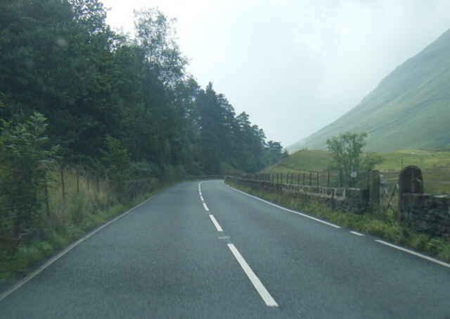
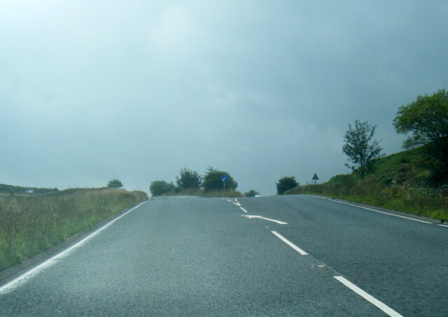
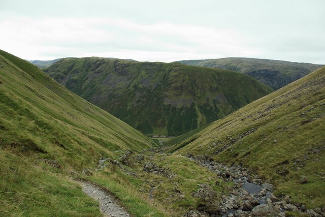
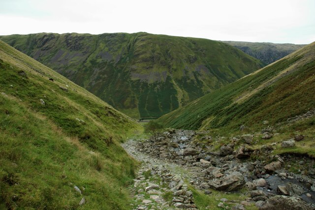
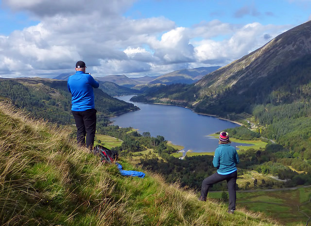
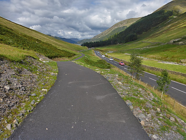
Wythburn is a small village located in the county of Cumberland, in northwestern England. Situated on the eastern side of the Lake District National Park, it lies in a picturesque valley surrounded by stunning natural beauty. The village is nestled between the towering peaks of Helvellyn and High Seat, offering residents and visitors breathtaking views of the surrounding mountains and valleys.

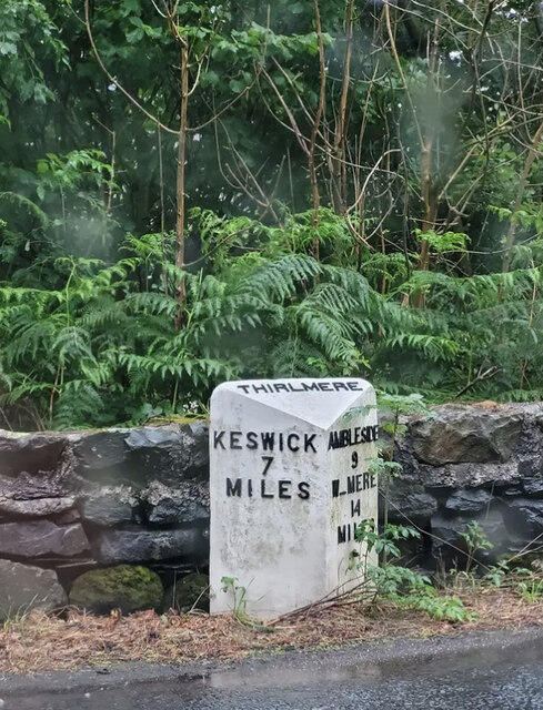
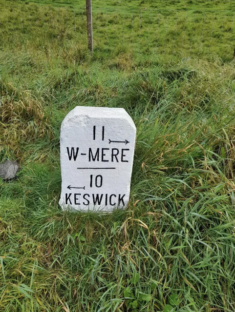
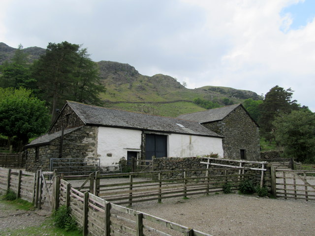
With a population of around 100 people, Wythburn is a close-knit community that thrives on the charm and tranquility of its surroundings. The village is primarily residential, with a scattering of traditional stone cottages and a few local amenities, including a small chapel. The nearest town, Keswick, is approximately 10 miles away, providing access to a wider range of services and facilities.

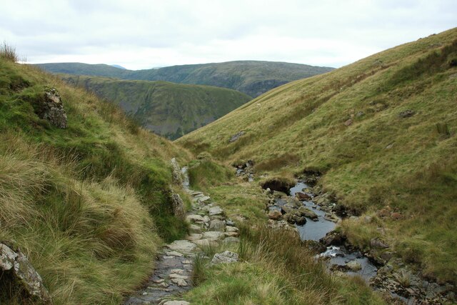
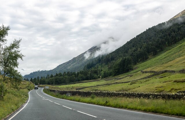
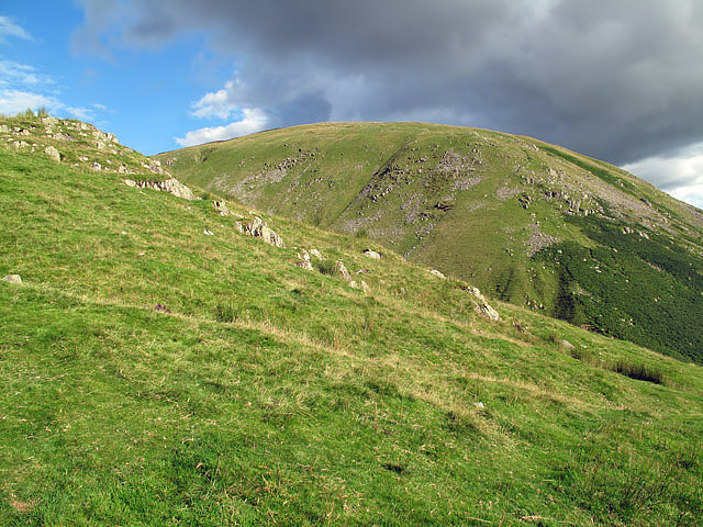
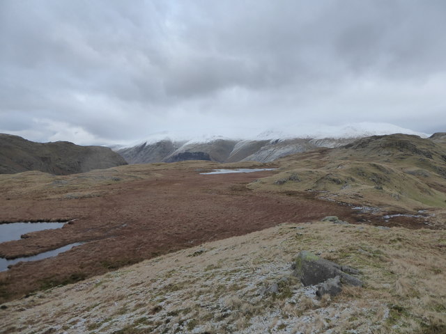
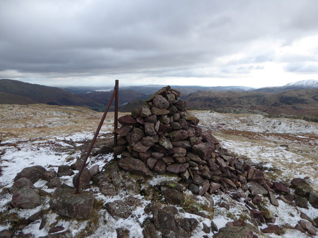
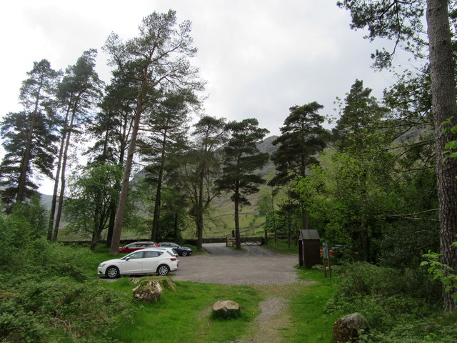
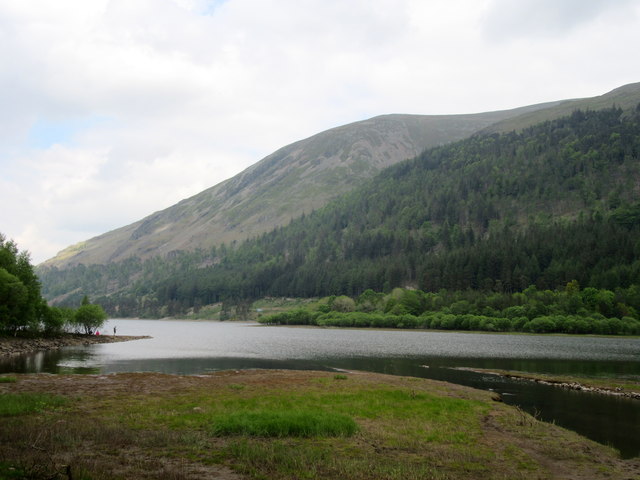
Wythburn is renowned for its access to outdoor activities, attracting nature enthusiasts, hikers, and climbers from far and wide. The village is a popular starting point for those looking to explore the nearby fells, including the challenging ascent of Helvellyn, one of England's highest peaks. Additionally, Wythburn is home to Thirlmere Reservoir, a stunning body of water that offers opportunities for fishing, boating, and leisurely walks along its shores.

Despite its remote location, Wythburn's proximity to the Lake District's main attractions ensures a steady stream of tourists throughout the year. The village offers a peaceful retreat for those seeking to immerse themselves in nature's beauty and escape the hustle and bustle of modern life.

If you have any feedback on the listing, please let us know in the comments section below.

Wythburn Images

Images are sourced within 2km of 54.506404/-3.0480865 or Grid Reference NY3212. Thanks to Geograph Open Source API. All images are credited.

A591 near Stockhow Bridge
A591 at Dunmail Rise
A sad sight for sure By 1968 the AA starting phasing out its sentry boxes and by 2002 all AA phones were decommissioned due to the widespread ownership of mobile phones. Today there are believed to be 19 surviving examples in-situ, just 2% of boxes installed. Looks like this could be reduced to 18 unless this one is classified as a listed building (which some are).
A sad sight for sure
By 1968 the AA starting phasing out its sentry boxes and by 2002 all AA phones were decommissioned due to the widespread ownership of mobile phones. Today there are believed to be 19 surviving examples in-situ, just 2% of boxes installed. Looks like this could be reduced to 18 unless this one is classified as a listed building (which some are).
Footpath beside Raise Beck The popular route between Dunmail Raise and Grisedale Tarn follows the course of Raise Beck for much of its course.
Footpath beside Raise Beck
The popular route between Dunmail Raise and Grisedale Tarn follows the course of Raise Beck for much of its course.
Footpath alongside Raise Beck The footpath between Dunmail Raise and Grisedale Tarn alongside Raise Beck.
Footpath alongside Raise Beck
The footpath between Dunmail Raise and Grisedale Tarn alongside Raise Beck.
Footpath descending from Grisedale Tarn to Dunmail Raise The well used route for pedestrians between Dunmail Raise and Grisedale Tarn.
Footpath descending from Grisedale Tarn to Dunmail Raise
The well used route for pedestrians between Dunmail Raise and Grisedale Tarn.
Dunmail Raise View looking north from Dunmail Raise.
Dunmail Raise
View looking north from Dunmail Raise.
Old Milepost by the A591, Wythburn, Dunmail Raise Parish Ambleside casting by the A591, in parish of Dunmail Raise (Allerdale District), Wythburn, against wall. An earlier photograph can be found here: <a title="https://www.geograph.org.uk/photo/6043491" href="https://www.geograph.org.uk/photo/6043491">Link</a>

Inscription reads:- : KESWICK / 9 / MILES : : DUNMAIL / RAISE : : AMBLESIDE / 7 / W_MERE / 12 / MILES :

Milestone Society National ID: CU_KWWM09
Old Milepost by the A591, Wythburn, Dunmail Raise Parish
Ambleside casting by the A591, in parish of Dunmail Raise (Allerdale District), Wythburn, against wall. An earlier photograph can be found here: Link Inscription reads:- : KESWICK / 9 / MILES : : DUNMAIL / RAISE : : AMBLESIDE / 7 / W_MERE / 12 / MILES : Milestone Society National ID: CU_KWWM09
Old Milestone by the A591, Pass of Dunmail Raise, Lakes parish Carved stone post by the A591, in parish of Lakes (South Lakeland District), top of pass, on grass verge in lay-by, on East side of road. Windermere stone, erected by the Ambleside turnpike trust in the 19th century. 

Inscription reads:-
11
{arrow->}
W-MERE
----
10
{<-arrow}
KESWICK
---- 

Milestone Society National ID: WE_KWWM10.
Old Milestone by the A591, Pass of Dunmail Raise, Lakes parish
Carved stone post by the A591, in parish of Lakes (South Lakeland District), top of pass, on grass verge in lay-by, on East side of road. Windermere stone, erected by the Ambleside turnpike trust in the 19th century. Inscription reads:- 11 {arrow->} W-MERE ---- 10 {<-arrow} KESWICK ---- Milestone Society National ID: WE_KWWM10.
Reggie Knot at Dunmail On the east side of the Pass of Dunmail with Seat Sandal in the background.
Reggie Knot at Dunmail
On the east side of the Pass of Dunmail with Seat Sandal in the background.
Steel Fell Helm Crag, Gibson Knott, Calf Crag, Steel Fell and Butharlyp Howe with Smudge on a warmish grey day.
Name: Steel Fell [Dead Pike - Steel Fell]
Hill number: 2466
Height: 553m / 1814ft
Parent (Ma/M): 2396  High Raise [High Raise (High White Stones)]
Section: 34B: Lake District - Central &amp;amp; Western Fells
Area: Lake District - Central Fells
County/UA: Cumbria (CoU)
Class: Dewey, Wainwright, Birkett, Synge, Fellranger
Grid ref: NY 31943 11154
Summit feature: cairn
Drop: 80m
Col: 473m  NY304110  
Observations: cairn 80m E at NY 32023 11167 is 2m lower
Survey: Abney level
Steel Fell
Helm Crag, Gibson Knott, Calf Crag, Steel Fell and Butharlyp Howe with Smudge on a warmish grey day. Name: Steel Fell [Dead Pike - Steel Fell] Hill number: 2466 Height: 553m / 1814ft Parent (Ma/M): 2396 High Raise [High Raise (High White Stones)] Section: 34B: Lake District - Central & Western Fells Area: Lake District - Central Fells County/UA: Cumbria (CoU) Class: Dewey, Wainwright, Birkett, Synge, Fellranger Grid ref: NY 31943 11154 Summit feature: cairn Drop: 80m Col: 473m NY304110 Observations: cairn 80m E at NY 32023 11167 is 2m lower Survey: Abney level
Tarns on Steel Fell
Tarns on Steel Fell
Summit Cairn, Steel Fell
Car park at Stockhow Bridge
Stenkin
Stenkin
The southern end of Thirlmere
Hill walkers on Steel Fell These fell walkers at the north end of Steel Fell are taking in the view down Thirlmere Reservoir on a lovely September afternoon.
Hill walkers on Steel Fell
These fell walkers at the north end of Steel Fell are taking in the view down Thirlmere Reservoir on a lovely September afternoon.
A multi-user trail at Dunmail Raise This new tarmac trail on the west side of the A591 was constructed on an existing right of way and is for the use of cyclists, walkers and horse riders. The work was carried out in conjunction with the reinstatement of a section of the A591 after serious flooding in December 2015 when part of the road was washed away. The road between Keswick and Ambleside was closed for six months.
A multi-user trail at Dunmail Raise
This new tarmac trail on the west side of the A591 was constructed on an existing right of way and is for the use of cyclists, walkers and horse riders. The work was carried out in conjunction with the reinstatement of a section of the A591 after serious flooding in December 2015 when part of the road was washed away. The road between Keswick and Ambleside was closed for six months.
Show me another place!

Wythburn is located at Grid Ref: NY3212 (Lat: 54.506404, Lng: -3.0480865)

Administrative County: Cumbria

District: Allerdale

Police Authority: Cumbria

What 3 Words

///monument.sidelined.shun. Near Ambleside, Cumbria

Nearby Locations

Wythburn

Related Wikis

St John's, Castlerigg and Wythburn

St John's, Castlerigg and Wythburn is a civil parish in Allerdale district, Cumbria, England. In the 2011 census it was recorded as having a population...
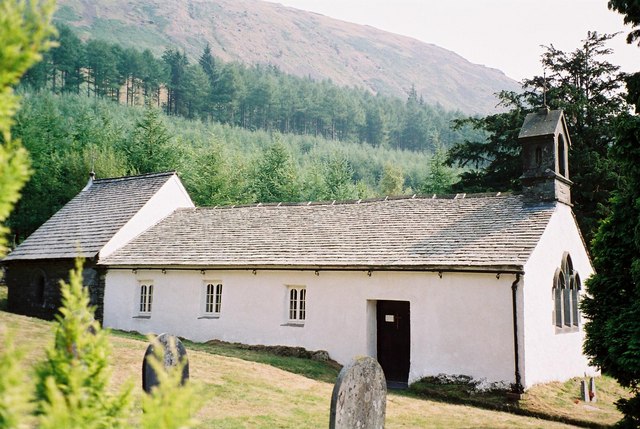
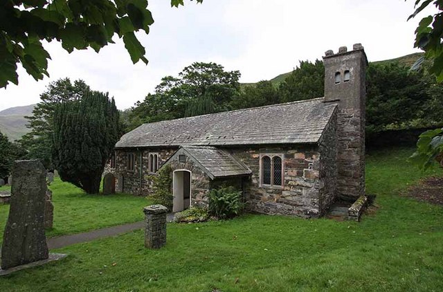
Wythburn Church

Wythburn Church is located in an isolated position by the A591 road on the east bank of Thirlmere, Cumbria, England. It is an active Anglican church in...

Dunmail Raise

Dunmail Raise is the name of a large cairn in the English Lake District, which may have been an old boundary marker. It has given its name to the mountain...

A591 road

The A591 is a major road in Cumbria, which lies almost entirely within the Lake District national park. A 2009 poll by satellite navigation firm Garmin...

Nearby Amenities

Located within 500m of 54.506404,-3.0480865
Bus Stop
Amboth turn
Bus: yes
Naptan AtcoCode: 090002500726
Naptan Bearing: N
Naptan BusStopType: MKD
Naptan CommonName: Amboth turn
Naptan Indicator: at
Naptan Landmark: Stockhow Bridge
Naptan LocalityCode: E0005118
Naptan NaptanCode: cumagpda
Naptan Street: A591
Naptan Verified: no
Public Transport: platform
Ref: cumagpda
Source: naptan_import
Lat/Long: 54.5072105/-3.0441235
Bus Stop
Amboth Turn
Bus: yes
Naptan AtcoCode: 090002500727
Naptan Bearing: S
Naptan BusStopType: MKD
Naptan CommonName: Amboth Turn
Naptan Indicator: opp
Naptan Landmark: Stockhow Bridge
Naptan LocalityCode: E0005118
Naptan NaptanCode: cumagpdg
Naptan Street: A591
Naptan Verified: no
Public Transport: platform
Ref: cumagpdg
Source: naptan_import
Lat/Long: 54.5068539/-3.04379
Steel End
Place: locality
Lat/Long: 54.5058889/-3.0488585
Wythburn
Place: locality
Lat/Long: 54.5080877/-3.0485111
Stenkin
Place: locality
Lat/Long: 54.5086989/-3.0523014
Amboth turn
Bus: yes
Public Transport: stop_position
Lat/Long: 54.5072222/-3.0439668
Amboth Turn
Bus: yes
Public Transport: stop_position
Lat/Long: 54.5068581/-3.0438397
Give Way
Direction: forward
Lat/Long: 54.5070973/-3.0439893
Description: Plaque inset in the wall
Historic: memorial
Lat/Long: 54.5047175/-3.0434694
Information: guidepost
Tourism: information
Lat/Long: 54.5071178/-3.0507595
Information: guidepost
Tourism: information
Lat/Long: 54.5074744/-3.0500076
Information: guidepost
Tourism: information
Lat/Long: 54.507104/-3.0438551
The data included in this document is from www.openstreetmap.org. The data is made available under ODbL.

Have you been to Wythburn?

Leave your review of Wythburn below (or comments, questions and feedback).