Worthington

Settlement in Lancashire

England

Worthington

Standish in the fog Fire Station Road, Pole Street, junction.
Standish in the fog Credit: Richard Webb

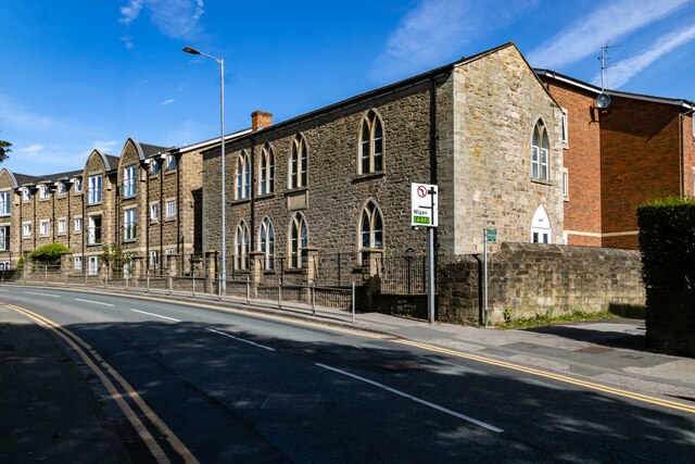
Worthington is a small village located in the county of Lancashire, England. Situated approximately 6 miles northeast of the bustling town of Wigan, Worthington is nestled in the beautiful West Pennine Moors, offering breathtaking views of the surrounding countryside.

With a population of around 1,500 residents, Worthington has a close-knit community that prides itself on its rich history and natural beauty. The village dates back to the 12th century and still retains a charming and traditional character, with many historic buildings and landmarks to explore.

One such landmark is the Parish Church of St. Oswald, a Grade I listed building that dates back to the 14th century. Its stunning architecture and beautiful stained glass windows attract visitors and locals alike. Additionally, Worthington Hall, a manor house from the 17th century, adds to the village's historical allure.

The village offers a range of amenities to cater to its residents' needs. These include a primary school, a post office, a local pub, and a small convenience store. The surrounding area provides ample opportunities for outdoor activities, with numerous walking trails and cycling routes available for nature enthusiasts.

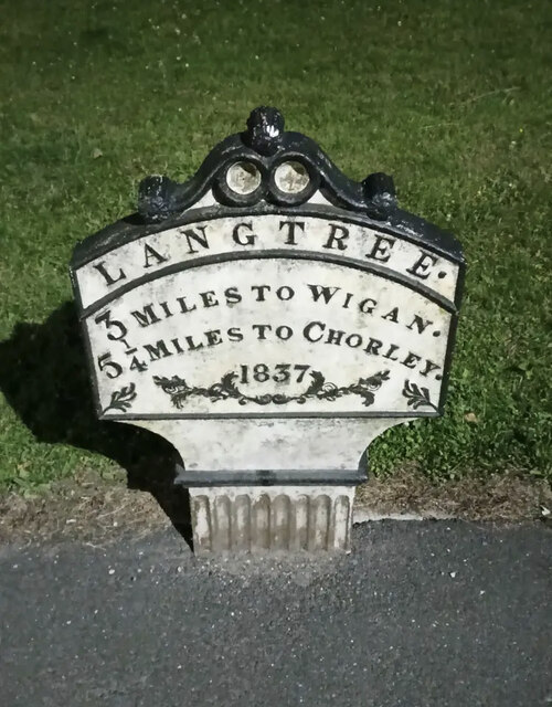
Worthington's location makes it an ideal base for exploring the wider Lancashire region. Nearby attractions include Haigh Hall Country Park, Wigan Pier, and the bustling city of Manchester, which can be reached within a 30-minute drive.

In conclusion, Worthington is a picturesque village in Lancashire that offers a peaceful and idyllic lifestyle, steeped in history and surrounded by stunning natural landscapes.

If you have any feedback on the listing, please let us know in the comments section below.
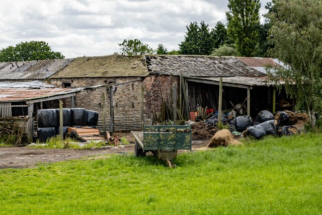
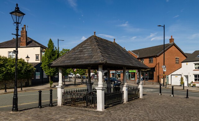
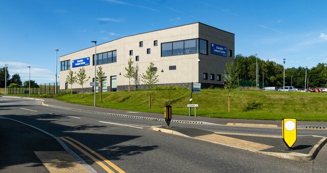
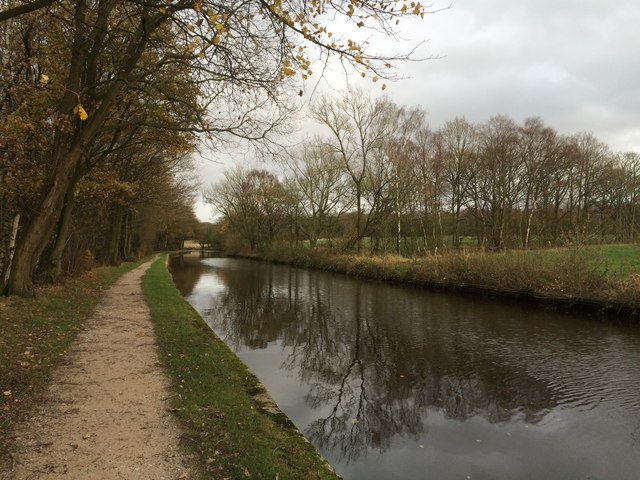
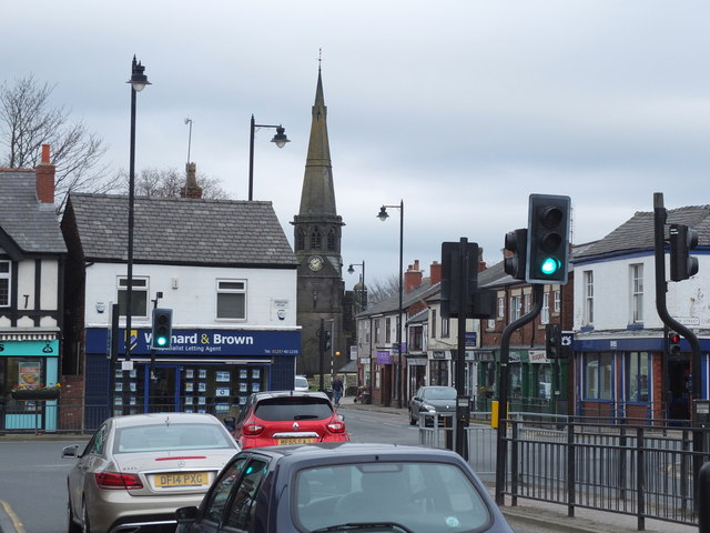
Worthington Images

Images are sourced within 2km of 53.583823/-2.637877 or Grid Reference SD5709. Thanks to Geograph Open Source API. All images are credited.

Standish in the fog Fire Station Road, Pole Street, junction.
Standish in the fog
Fire Station Road, Pole Street, junction.
Worthington Hall Farm buildings at Worthington Hall.
Worthington Hall
Farm buildings at Worthington Hall.
Standish Market place in Standish.
Standish
Market place in Standish.
Disused Tip Reclamation work on a disused tip at Standish.
Disused Tip
Reclamation work on a disused tip at Standish.
Standish Leisure Centre
Old Chapel Old chapel in Standish.
Old Chapel
Old chapel in Standish.
Old Milepost by the A5106, Chorley Road, Standish parish Cast iron post by the A5106, in parish of STANDISH (WIGAN District), Chorley Road; Worthington; opposite junction with Devon Drive, on grassed area, on East side of road. Wigan fan iron casting, erected by the Wigan & Preston (south of Yarrow) turnpike trust in the 19th century. An earlier photograph can be found here <a title="https://www.geograph.org.uk/photo/6049856" href="https://www.geograph.org.uk/photo/6049856">Link</a>.

Inscription reads:-
LANGTREE.
3 MILES TO WIGAN.
5¼ MILES TO CHORLEY.
1837
Maker:-
HAIGH FOUNDRY

Grade II listed. 
List Entry Number: 1228467 <span class="nowrap"><a title="https://historicengland.org.uk/listing/the-list/list-entry/1228467" rel="nofollow ugc noopener" href="https://historicengland.org.uk/listing/the-list/list-entry/1228467">Link</a><img style="margin-left:2px;" alt="External link" title="External link - shift click to open in new window" src="https://s1.geograph.org.uk/img/external.png" width="10" height="10"/></span>

Milestone Society National ID: LA_WGCY03.
Old Milepost by the A5106, Chorley Road, Standish parish
Cast iron post by the A5106, in parish of STANDISH (WIGAN District), Chorley Road; Worthington; opposite junction with Devon Drive, on grassed area, on East side of road. Wigan fan iron casting, erected by the Wigan & Preston (south of Yarrow) turnpike trust in the 19th century. An earlier photograph can be found here Link. Inscription reads:- LANGTREE. 3 MILES TO WIGAN. 5¼ MILES TO CHORLEY. 1837 Maker:- HAIGH FOUNDRY Grade II listed. List Entry Number: 1228467 LinkExternal link Milestone Society National ID: LA_WGCY03.
Redundant railway bridge supports Across the River Douglas for a mineral railway serving the works at Leyland Mill further down the river.
Redundant railway bridge supports
Across the River Douglas for a mineral railway serving the works at Leyland Mill further down the river.
Steps of Sicklefield Climbing out of the valley of the River Douglas at Brock Mill
Steps of Sicklefield
Climbing out of the valley of the River Douglas at Brock Mill
Old Lane The pedestrian only part of the lane approaching Wigan Lane.
Old Lane
The pedestrian only part of the lane approaching Wigan Lane.
Old Lane A cul-de-sac with pedestrian only access into Wigan Lane
Old Lane
A cul-de-sac with pedestrian only access into Wigan Lane
Renovation work on Elmfield Road property The property is marked on OS maps as a care home but no signage was visible so is the work a conversion or refurbishment?
Renovation work on Elmfield Road property
The property is marked on OS maps as a care home but no signage was visible so is the work a conversion or refurbishment?
Footpath on the west side of Worthington Lakes
Worthington Lakes
Worthington Lakes
Leeds-Liverpool Canal
Box Junction at School Lane and Green Lane, Standish
Junction of the B5239 and the A49 in Standish
Show me another place!

Worthington is located at Grid Ref: SD5709 (Lat: 53.583823, Lng: -2.637877)

Unitary Authority: Wigan

Police Authority: Greater Manchester

What 3 Words

///already.cork.raft. Near Adlington, Lancashire

Related Wikis

Worthington, Greater Manchester

Worthington is a civil parish within the Metropolitan Borough of Wigan, in Greater Manchester, England, about four miles (6.4 km) north of Wigan. The parish...
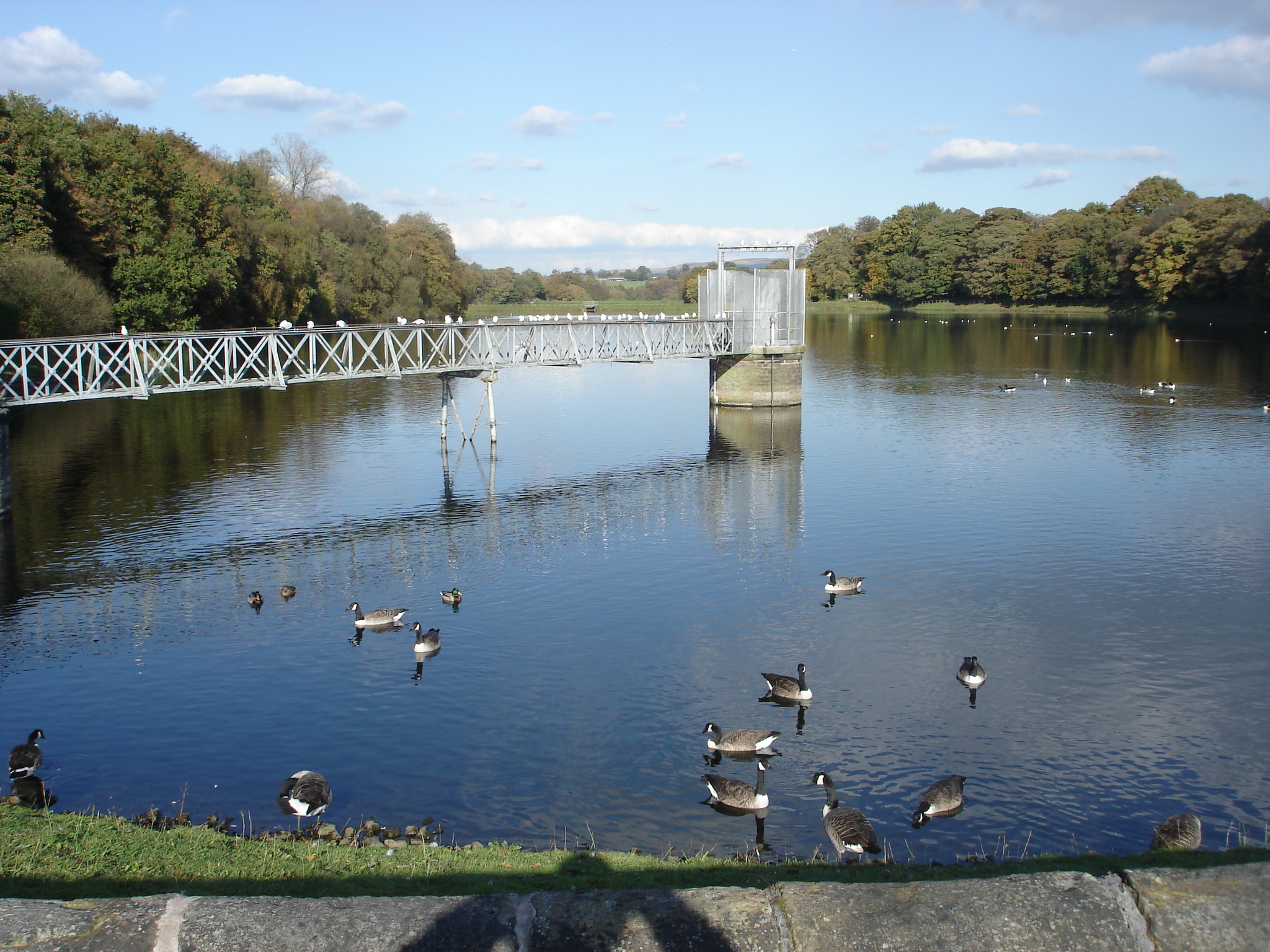
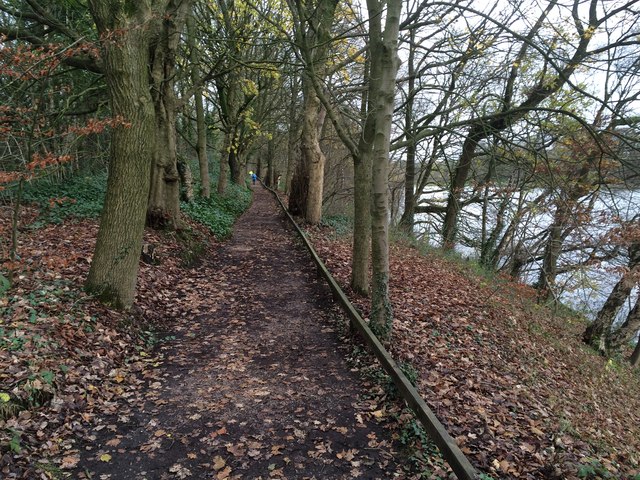
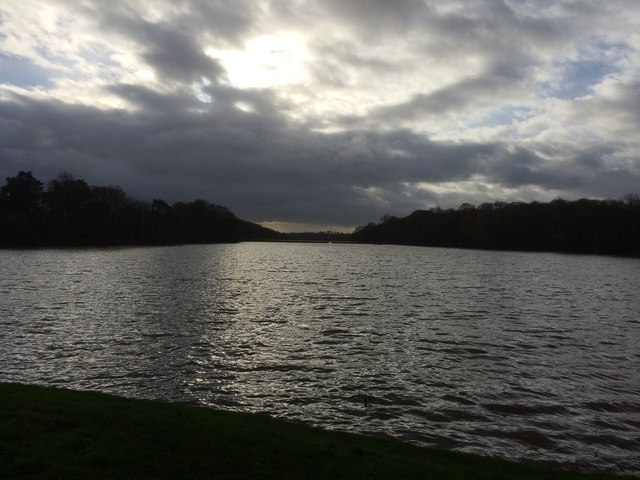
Worthington Lakes

Worthington Lakes is a series of three reservoirs in the north of the borough of Wigan, Greater Manchester (from south to north: Worthington, Arley and...

Red Rock railway station

Red Rock railway station stood in Red Rock, a hamlet between Standish and Haigh, originally in Lancashire now within Greater Manchester, England. The railway...

Standish railway station

Standish railway station is a closed railway station in Standish, England, situated where the line bridged Rectory Lane (the B5239). Standish was in the...

Nearby Amenities

Located within 500m of 53.583823,-2.637877
Mini Roundabout
Direction: clockwise
Lat/Long: 53.586073/-2.6374062
Standish Junction
Railway: junction
Lat/Long: 53.5866139/-2.641821
Bus Stop
Chorley Road/Rowston Rise
Bus: yes
Naptan AtcoCode: 1800WK00011
Naptan Bearing: NW
Naptan CommonName: Chorley Road/Rowston Rise
Naptan Indicator: O/s House 8
Naptan Landmark: HOUSE 8
Naptan NaptanCode: manpmdmg
Naptan PlusbusZoneRef: MNCRPIC
Naptan ShortCommonName: Rowston Rise
Naptan Street: CHORLEY ROAD
Naptan Verified: no
Network: TfGM
Public Transport: platform
Source: naptan_import
Lat/Long: 53.5820555/-2.6377368
Bus Stop
Red Rock Lane/Mayflower Cottages
Bus: yes
Naptan AtcoCode: 1800WK11111
Naptan Bearing: W
Naptan CommonName: Red Rock Lane/Mayflower Cottages
Naptan Indicator: Garden Cen Opp
Naptan Landmark: GARDEN CEN OPP
Naptan NaptanCode: mantgtwp
Naptan PlusbusZoneRef: MNCRPIC
Naptan ShortCommonName: Mayflower Cottage
Naptan Street: RED ROCK LANE
Naptan Verified: no
Network: TfGM
Public Transport: platform
Source: naptan_import
Lat/Long: 53.583516/-2.6361613
Bus Stop
Red Rock Lane/Mayflower Cottages
Bus: yes
Naptan AtcoCode: 1800WK22551
Naptan Bearing: E
Naptan CommonName: Red Rock Lane/Mayflower Cottages
Naptan Indicator: Garden Cen Opp
Naptan Landmark: GARDEN CEN OPP
Naptan NaptanCode: manpwmdm
Naptan PlusbusZoneRef: MNCRPIC
Naptan ShortCommonName: Mayflower Cottage
Naptan Street: RED ROCK LANE
Naptan Verified: no
Network: TfGM
Public Transport: platform
Source: naptan_import
Lat/Long: 53.5836328/-2.636163
Bus Stop
Chorley Road/Devon Drive
Bus: yes
Naptan AtcoCode: 1800WK22561
Naptan Bearing: S
Naptan CommonName: Chorley Road/Devon Drive
Naptan Indicator: Car Park
Naptan Landmark: HOUSE 17
Naptan NaptanCode: manpwmdp
Naptan PlusbusZoneRef: MNCRPIC
Naptan ShortCommonName: Devon Drive
Naptan Street: CHORLEY ROAD
Naptan Verified: no
Network: TfGM
Public Transport: platform
Source: naptan_import
Lat/Long: 53.5847387/-2.637796
Bus Stop
Chorley Road/Devon Drive
Bus: yes
Naptan AtcoCode: 1800WK22571
Naptan Bearing: N
Naptan CommonName: Chorley Road/Devon Drive
Naptan Indicator: Caravan Sales
Naptan Landmark: CARAVAN SALES
Naptan NaptanCode: manpwmdt
Naptan PlusbusZoneRef: MNCRPIC
Naptan ShortCommonName: Devon Drive
Naptan Street: CHORLEY ROAD
Naptan Verified: no
Network: TfGM
Public Transport: platform
Shelter: no
Source: naptan_import
Lat/Long: 53.5849558/-2.6379319
Bus Stop
Chorley Road/Rectory Lane
Bus: yes
Naptan AtcoCode: 1800WK22591
Naptan Bearing: S
Naptan CommonName: Chorley Road/Rectory Lane
Naptan Indicator: Dyers Mill
Naptan Landmark: DYERS MILL
Naptan NaptanCode: manpwmga
Naptan PlusbusZoneRef: MNCRPIC
Naptan ShortCommonName: Rectory Lane
Naptan Street: CHORLEY ROAD
Naptan Verified: no
Network: TfGM
Public Transport: platform
Source: naptan_import
Lat/Long: 53.5857383/-2.6374636
Bus Stop
Rectory Lane/Brookside Road
Bus: yes
Naptan AtcoCode: 1800WK22601
Naptan Bearing: NW
Naptan CommonName: Rectory Lane/Brookside Road
Naptan Indicator: Os House 85
Naptan Landmark: HOUSE 1
Naptan NaptanCode: manpwmgd
Naptan PlusbusZoneRef: MNCRPIC
Naptan ShortCommonName: Brookside Road
Naptan Street: RECTORY LANE
Naptan Verified: no
Network: TfGM
Public Transport: platform
Source: naptan_import
Lat/Long: 53.5867275/-2.6407415
Parking
Lat/Long: 53.5839331/-2.6316057
Turning Circle
Lat/Long: 53.5839744/-2.6361888
Turning Circle
Lat/Long: 53.581258/-2.6375006
Power: substation
Ref: 102131
Lat/Long: 53.5852404/-2.6390874
Generator Method: photovoltaic
Generator Output Electricity: yes
Generator Source: solar
Generator Type: solar_photovoltaic_panel
Location: roof
Power: generator
Lat/Long: 53.5835556/-2.6390636
Generator Method: photovoltaic
Generator Output Electricity: yes
Generator Source: solar
Generator Type: solar_photovoltaic_panel
Location: roof
Power: generator
Lat/Long: 53.5835673/-2.6391284
Direction: S
Generator Method: photovoltaic
Generator Output Electricity: yes
Generator Solar Modules: 12
Generator Source: solar
Generator Type: solar_photovoltaic_panel
Location: roof
Power: generator
Lat/Long: 53.5845608/-2.6389577
Direction: S
Generator Method: photovoltaic
Generator Output Electricity: yes
Generator Solar Modules: 16
Generator Source: solar
Generator Type: solar_photovoltaic_panel
Location: roof
Power: generator
Lat/Long: 53.5842814/-2.6388544
Generator Method: photovoltaic
Generator Output Electricity: yes
Generator Source: solar
Generator Type: solar_photovoltaic_panel
Location: roof
Power: generator
Lat/Long: 53.5856613/-2.6397821
Railway: signal
Railway Signal Direction: forward
Railway Signal Main: GB-NR:main
Railway Signal Main Design: individual
Railway Signal Main Form: light
Railway Signal Main States: red;green;yellow;flashing_yellow;double_yellow;flashing_double_yellow
Railway Signal Operator: Network Rail
Railway Signal Position: left
Ref: WN 4
Lat/Long: 53.5814205/-2.6405743
Worthington Water Treatment Works
Man Made: water_works
Operator: United Utilities
Lat/Long: 53.5874262/-2.6349002
Lakeside Cottages
Place: neighbourhood
Lat/Long: 53.5858372/-2.63475
Mayflower Cottages
Place: neighbourhood
Lat/Long: 53.5844949/-2.6353106
Hair by Vision
Shop: hairdresser
Lat/Long: 53.585945/-2.6376897
Ford: yes
Lat/Long: 53.5814238/-2.6432614
Crossing
Crossing: uncontrolled
Crossing Island: no
Crossing Markings: dots
Tactile Paving: yes
Lat/Long: 53.5838055/-2.6375461
Crossing
Crossing: uncontrolled
Crossing Island: no
Crossing Markings: dots
Tactile Paving: yes
Lat/Long: 53.5837622/-2.6375669
Crossing
Crossing: pavement
Lat/Long: 53.5839831/-2.6379641
Crossing
Crossing: uncontrolled
Crossing Island: no
Crossing Markings: dots
Tactile Paving: yes
Lat/Long: 53.5839402/-2.6378042
Crossing
Crossing: uncontrolled
Crossing Island: no
Crossing Markings: dots
Tactile Paving: yes
Lat/Long: 53.5839267/-2.6379025
Crossing
Crossing: uncontrolled
Crossing Island: no
Crossing Markings: dots
Tactile Paving: yes
Lat/Long: 53.5836787/-2.6378108
Crossing
Crossing: uncontrolled
Crossing Island: no
Crossing Markings: dots
Tactile Paving: yes
Lat/Long: 53.5836923/-2.6379024
Milestone
Description: Grade II listed historic Milestone. 3 miles to Wigan. 5 1/4 miles to Chorley.
Lat/Long: 53.5853451/-2.6376307
Addr Housenumber: 117
Addr Street: Chorley Road
Lat/Long: 53.5795939/-2.6365151
Addr Housenumber: 8
Addr Street: Rowton Rise
Lat/Long: 53.5820655/-2.6382611
Direction: SSW
Generator Method: photovoltaic
Generator Output Electricity: yes
Generator Solar Modules: 16
Generator Source: solar
Generator Type: solar_photovoltaic_panel
Location: roof
Power: generator
Lat/Long: 53.5815623/-2.6372714
Direction: 195
Generator Method: photovoltaic
Generator Output Electricity: yes
Generator Solar Modules: 8
Generator Source: solar
Generator Type: solar_photovoltaic_panel
Location: roof
Power: generator
Lat/Long: 53.5835426/-2.6390019
Direction: 195
Generator Method: photovoltaic
Generator Output Electricity: yes
Generator Solar Modules: 8
Generator Source: solar
Generator Type: solar_photovoltaic_panel
Location: roof
Power: generator
Lat/Long: 53.5835545/-2.6390905
Addr Housenumber: 17
Addr Street: Devon Drive
Fixme: location approx
Lat/Long: 53.5851128/-2.6382849
Grit Bin
Lat/Long: 53.5819037/-2.63764
Direction: 255
Generator Method: photovoltaic
Generator Output Electricity: yes
Generator Solar Modules: 12
Generator Source: solar
Generator Type: solar_photovoltaic_panel
Location: roof
Power: generator
Lat/Long: 53.5810917/-2.6358083
Description: Lancashire Way and National Cycle Route 55
Information: route_marker
Tourism: information
Lat/Long: 53.5841404/-2.6311851
The data included in this document is from www.openstreetmap.org. The data is made available under ODbL.

Have you been to Worthington?

Leave your review of Worthington below (or comments, questions and feedback).