Worcester Park

Settlement in Surrey Epsom and Ewell

England

Worcester Park

Service station on London Road, Sutton Petrol 182.9p
Diesel 194.9p.
Service station on London Road, Sutton Credit: JThomas

Worcester Park is a suburban town located in the county of Surrey, England. Situated approximately 10 miles southwest of Central London, it falls within the borough of Sutton. The town is bordered by the areas of Kingston upon Thames, New Malden, and Cheam, offering a convenient location with excellent transport links.

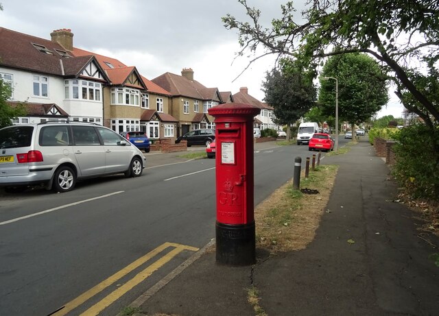
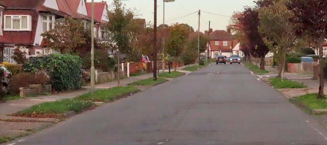
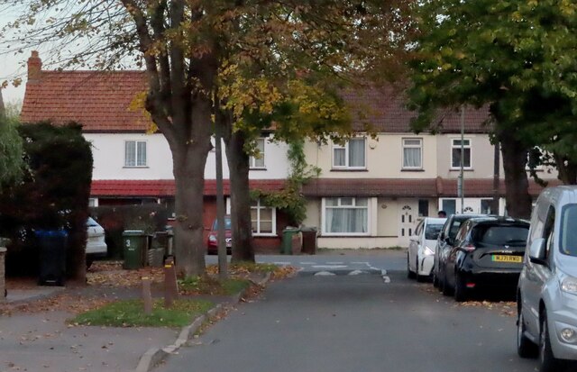
Worcester Park is primarily a residential area, known for its leafy streets and quiet suburban atmosphere. It offers a mix of housing options, ranging from Victorian and Edwardian houses to modern developments, catering to a diverse range of residents. Families, young professionals, and retirees are all drawn to the area, thanks to its good schools, green spaces, and close proximity to amenities.

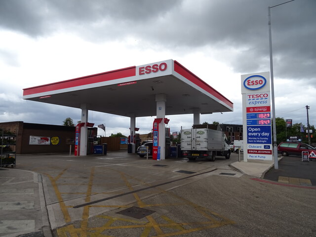
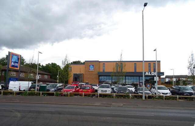
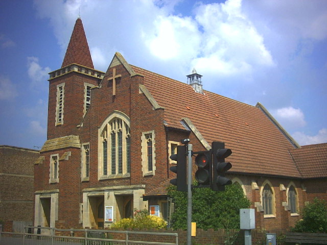
The town center of Worcester Park features a range of shops, restaurants, and cafes, providing residents with all the essentials they need. There are also several supermarkets and convenience stores for convenient shopping. For a wider selection of retail options, the nearby towns of Kingston upon Thames and Sutton offer larger shopping centers and high street brands.

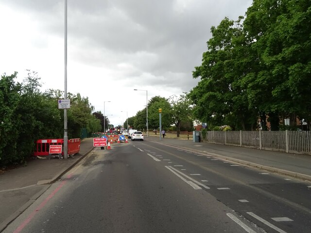
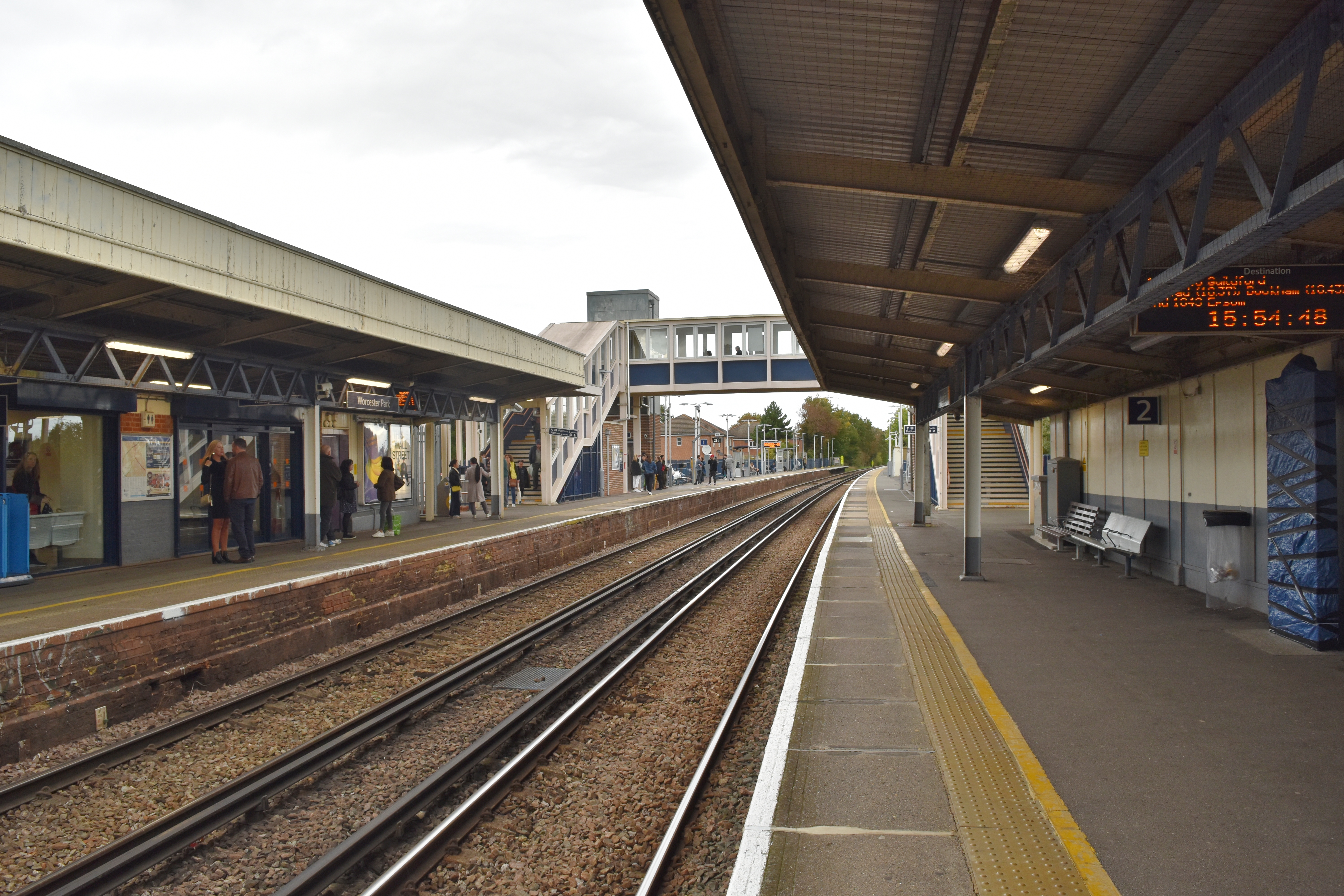
Worcester Park is well-connected by public transportation, with a train station that provides regular services to Central London. The journey to London Waterloo takes approximately 25 minutes, making it a popular choice for commuters. Additionally, several bus routes connect the town to neighboring areas.

The area is surrounded by beautiful green spaces, including the expansive Nonsuch Park and the picturesque Hogsmill River. These provide opportunities for outdoor activities such as walking, jogging, and picnicking. Worcester Park also boasts a number of sports facilities, including tennis courts and a golf course.

Overall, Worcester Park offers a peaceful and well-connected suburban lifestyle, making it an attractive place to live within the Surrey area.

If you have any feedback on the listing, please let us know in the comments section below.

Worcester Park Images

Images are sourced within 2km of 51.37503/-0.24889671 or Grid Reference TQ2165. Thanks to Geograph Open Source API. All images are credited.

Service station on London Road, Sutton Petrol 182.9p
Diesel 194.9p.
Service station on London Road, Sutton
Petrol 182.9p Diesel 194.9p.
Aldi supermarket on London Road, Sutton
Roadworks on London Road (A24), Sutton
The Cricket Lounge, Sutton Authentic Indian Dining & Cocktail Bar on London Road.
The Cricket Lounge, Sutton
Authentic Indian Dining & Cocktail Bar on London Road.
The Nonsuch Inn JD Wetherspoon public house on London Road.
The Nonsuch Inn
JD Wetherspoon public house on London Road.
Houses on The Spinney
Bus stop and shelter on London Road (A24), Sutton
Houses on London Road (A24), Sutton
House on London Road (A24), Sutton
London Road (A24), Sutton The old Stone Street Roman Road.
London Road (A24), Sutton
The old Stone Street Roman Road.
George V postbox on London Road, North Cheam Postbox No. SM3 136.
George V postbox on London Road, North Cheam
Postbox No. SM3 136.
George V postbox on Wickham Avenue, Sutton Postbox No. SM3 163.
See <a href="https://www.geograph.org.uk/photo/7243672">TQ2364 : Wickham Avenue, Sutton</a> for context.
George V postbox on Wickham Avenue, Sutton
Postbox No. SM3 163. See TQ2364 : Wickham Avenue, Sutton for context.
Wickham Avenue, Sutton Showing position of Postbox No. SM3 163.
See <a href="https://www.geograph.org.uk/photo/7243670">TQ2364 : George V postbox on Wickham Avenue, Sutton</a> for postbox.
Wickham Avenue, Sutton
Showing position of Postbox No. SM3 163. See TQ2364 : George V postbox on Wickham Avenue, Sutton for postbox.
Kingston Road heading to Ewell
Park Avenue West in Stoneleigh
London Road entering North Cheam
Suburban houses in Palmer Avenue
Newbolt Avenue approaching Malden Road
Show me another place!

Worcester Park is located at Grid Ref: TQ2165 (Lat: 51.37503, Lng: -0.24889671)

Administrative County: Surrey

District: Epsom and Ewell

Police Authority: Surrey

What 3 Words

///blast.strut.expect. Near Cheam, London

Related Wikis

Worcester Park

Worcester Park is a suburban town in South West London, England. It lies in the London boroughs of Sutton and Kingston, and partly in the Surrey borough...

Worcester Park railway station

Worcester Park railway station serves the Worcester Park area in south-west London, England. It is 10 miles 53 chains (17.2 km) down the line from London...

Worcester Park F.C.

Worcester Park Football Club is a football club based in Worcester Park in the London Borough of Sutton, England. Part of the Worcester Park Athletic Club...

Worcester Park House

Worcester Park House, built in 1607, whose ruins are in Surrey, in the United Kingdom, was one of the residences of the 4th Earl of Worcester, who was...

Chessington Hall

Chessington Hall was a country house in Chessington, England. It is important in literary history as the home of Samuel Crisp (1707–1783), a close friend...

Stoneleigh, Surrey

Stoneleigh is a suburban area southwest of London, situated in the north of the Epsom and Ewell borough in the county of Surrey, England. It is situated...

Stoneleigh railway station

Stoneleigh railway station is in the Epsom and Ewell district of Surrey, England. The station is served by South Western Railway and is currently in Travelcard...

The Station, Stoneleigh

The Station is a Grade II listed public house at Stoneleigh Broadway, Stoneleigh, Epsom, Surrey. It was originally opened in November 1935 as "The Stoneleigh...

Related Videos

Nonsuch Palace | Nonsuch Park |Cheam|Walking Tour|London|

A walking tour to Nonsuch Park in Cheam(South London)

Walking Slow Ways route from Ewell to Motspur Park

This Slow Ways walking route from Ewell Village to Motspur Park passes through Nonsuch Park, Cuddington Recreation Ground, ...

Walking the London Road from Bourne Hall, Surrey to Sutton, London - Part 1 - Slow TV

After doing some recent countryside-based videos it's time for a change. For this video I'm going to follow one road and see what's ...

Nearby Amenities

Located within 500m of 51.37503,-0.24889671
Turning Circle
Lat/Long: 51.3750765/-0.2557609
Post Box
Collection Times: Mo-Fr 17:45; Sa 12:15
Operator: Royal Mail
Operator Wikidata: Q638098
Post Box Type: pillar
Ref: KT4 58
Royal Cypher: GR
Royal Cypher Wikidata: Q33102273
Lat/Long: 51.3770826/-0.2426702
Noexit: yes
Lat/Long: 51.3742747/-0.2433345
Post Box
Collection Times: Mo-Fr 17:30; Sa 12:00
Operator: Royal Mail
Operator Wikidata: Q638098
Post Box Type: pillar
Ref: KT4 225
Royal Cypher: GR
Royal Cypher Wikidata: Q33102273
Lat/Long: 51.3750543/-0.2439217
Noexit: yes
Lat/Long: 51.3789607/-0.2508616
Noexit: yes
Lat/Long: 51.3789394/-0.2508995
Noexit: yes
Lat/Long: 51.3725711/-0.2447042
Noexit: yes
Lat/Long: 51.3723844/-0.2446921
Noexit: yes
Lat/Long: 51.3716243/-0.2446701
Noexit: yes
Lat/Long: 51.3718415/-0.2452217
Noexit: yes
Lat/Long: 51.3747957/-0.2452762
Noexit: yes
Lat/Long: 51.3745237/-0.2452459
Noexit: yes
Lat/Long: 51.3747424/-0.2468253
Noexit: yes
Lat/Long: 51.3743219/-0.2467956
Noexit: yes
Lat/Long: 51.3741664/-0.2467453
Noexit: yes
Lat/Long: 51.373257/-0.246662
Noexit: yes
Lat/Long: 51.3729991/-0.246671
Noexit: yes
Lat/Long: 51.3722597/-0.2467244
Noexit: yes
Lat/Long: 51.3720739/-0.2467279
Noexit: yes
Lat/Long: 51.3715948/-0.2467667
Noexit: yes
Lat/Long: 51.3710797/-0.2470717
Noexit: yes
Lat/Long: 51.3709373/-0.2464212
Noexit: yes
Lat/Long: 51.371695/-0.2452378
Noexit: yes
Lat/Long: 51.3714548/-0.2446758
Noexit: yes
Lat/Long: 51.3748202/-0.2483055
Noexit: yes
Lat/Long: 51.3743613/-0.2482742
Noexit: yes
Lat/Long: 51.3742191/-0.2482681
Noexit: yes
Lat/Long: 51.373946/-0.2482492
Noexit: yes
Lat/Long: 51.373804/-0.2482441
Noexit: yes
Lat/Long: 51.373443/-0.2482212
Noexit: yes
Lat/Long: 51.3732946/-0.2482084
Noexit: yes
Lat/Long: 51.3726274/-0.2482381
Noexit: yes
Lat/Long: 51.3725318/-0.2482481
Noexit: yes
Lat/Long: 51.3719459/-0.2482609
Noexit: yes
Lat/Long: 51.3743211/-0.2497451
Noexit: yes
Lat/Long: 51.3729211/-0.2497323
Noexit: yes
Lat/Long: 51.3728106/-0.2497066
Noexit: yes
Lat/Long: 51.3720021/-0.2494899
Noexit: yes
Lat/Long: 51.3712873/-0.2492357
Noexit: yes
Lat/Long: 51.3713047/-0.2488649
Noexit: yes
Lat/Long: 51.3712072/-0.248001
Noexit: yes
Lat/Long: 51.3710773/-0.2471749
Turning Circle
Lat/Long: 51.3747254/-0.2551551
Turning Circle
Lat/Long: 51.3778267/-0.2495849
Post Box
Collection Times: Mo-Fr 17:30; Sa 12:00
Operator: Royal Mail
Operator Wikidata: Q638098
Post Box Type: pillar
Ref: KT4 40
Royal Cypher: GR
Royal Cypher Wikidata: Q33102273
Lat/Long: 51.3769976/-0.2549263
Post Box
Check Date Collection Times: 2022-11-19
Collection Times: Mo-Fr 09:00; Sa 07:00
Operator: Royal Mail
Operator Wikidata: Q638098
Post Box Type: pillar
Ref: KT4 266D
Royal Cypher: GR
Royal Cypher Wikidata: Q33102273
Lat/Long: 51.3782506/-0.2482775
Post Box
Collection Times: Mo-Fr 09:00; Sa 07:00
Operator: Royal Mail
Operator Wikidata: Q638098
Post Box Type: pillar
Ref: KT4 331D
Royal Cypher: GR
Royal Cypher Wikidata: Q33102273
Lat/Long: 51.3727397/-0.2547493
Post Box
Collection Times: Mo-Fr 09:00; Sa 07:00
Operator: Royal Mail
Operator Wikidata: Q638098
Post Box Type: pillar
Ref: KT4 324D
Royal Cypher: GVIR
Royal Cypher Wikidata: Q33102169
Lat/Long: 51.3750446/-0.2522598
Cuddington
Place: quarter
Lat/Long: 51.3764891/-0.2554486
Noexit: yes
Lat/Long: 51.3706792/-0.2470587
Noexit: yes
Lat/Long: 51.3712746/-0.2486918
Noexit: yes
Lat/Long: 51.3712326/-0.2482491
Power: substation
Substation: minor_distribution
Lat/Long: 51.3756523/-0.2525303
Power: substation
Ref: 123095
Substation: minor_distribution
Lat/Long: 51.3775883/-0.2507821
Noexit: yes
Lat/Long: 51.3743942/-0.2452393
Power: substation
Substation: minor_distribution
Lat/Long: 51.3730934/-0.2498139
Power: substation
Substation: minor_distribution
Lat/Long: 51.3751343/-0.2483713
Power: substation
Substation: minor_distribution
Lat/Long: 51.375065/-0.2447836
Power: substation
Substation: minor_distribution
Lat/Long: 51.3793906/-0.2496604
Noexit: yes
Lat/Long: 51.3724221/-0.2432174
Noexit: yes
Lat/Long: 51.3733037/-0.2432627
Noexit: yes
Lat/Long: 51.3730662/-0.2432541
Noexit: yes
Lat/Long: 51.3741278/-0.2433104
Post Box
Collection Times: Mo-Fr 09:00; Sa 07:00
Operator: Royal Mail
Operator Wikidata: Q638098
Post Box Type: pillar
Ref: KT4 315D
Royal Cypher: EIIR
Royal Cypher Wikidata: Q33102113
Lat/Long: 51.3713634/-0.2461477
Noexit: yes
Lat/Long: 51.3709203/-0.2469681
Noexit: yes
Lat/Long: 51.3709215/-0.2466835
Noexit: yes
Lat/Long: 51.3708987/-0.2464489
Turning Circle
Lat/Long: 51.3748197/-0.2549615
Fire Hydrant
Emergency: fire_hydrant
Fire Hydrant Type: underground
Water Source: main
Lat/Long: 51.3747573/-0.2550397
Ref GB Tflcid: RWG134033
Traffic Calming: hump
Lat/Long: 51.3752345/-0.244109
Ref GB Tflcid: RWG134021
Traffic Calming: hump
Lat/Long: 51.3775109/-0.2445678
Ref GB Tflcid: RWG134040
Traffic Calming: hump
Lat/Long: 51.373367/-0.2439764
Ref GB Tflcid: RWG134036
Traffic Calming: hump
Lat/Long: 51.3746821/-0.2440217
Ref GB Tflcid: RWG134058
Traffic Calming: hump
Lat/Long: 51.3748622/-0.2431313
Ref GB Tflcid: RWG134022
Traffic Calming: hump
Lat/Long: 51.3784064/-0.2445419
Ref GB Tflcid: RWG134056
Traffic Calming: hump
Lat/Long: 51.3743533/-0.2423678
Ref GB Tflcid: RWG134027
Traffic Calming: hump
Lat/Long: 51.3757203/-0.2442765
The data included in this document is from www.openstreetmap.org. The data is made available under ODbL.

Have you been to Worcester Park?

Leave your review of Worcester Park below (or comments, questions and feedback).