Windy Harbour

Settlement in Staffordshire Staffordshire Moorlands

England

Windy Harbour

View from Ellastone Road at Windy Harbour Looking north east with the low buildings of Moorend Farm in the centre ahead. A plume of smoke is coming from the cement works at Cauldon with its enormous limestone quarry eating up Cauldon Low - the high area to the right of the shot. On the left emerging from behind a tree is the row of cottages on Stony Lane, Moorend which are also seen in <a href="https://www.geograph.org.uk/photo/2966784">SK0648 : Terraced houses at Stony Lane, Moorend</a> and <a href="https://www.geograph.org.uk/photo/4458833">SK0648 : Terraced houses on Stony Lane</a>
View from Ellastone Road at Windy Harbour Credit: Trevor Harris

Windy Harbour is a small village located in the county of Staffordshire, England. Situated in the Staffordshire Moorlands district, it is nestled amidst the picturesque countryside and offers residents and visitors a tranquil and idyllic setting.

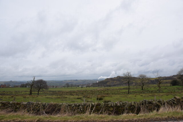
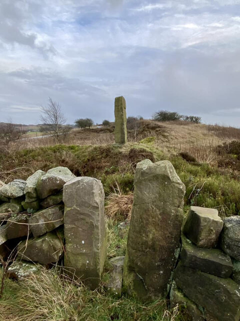
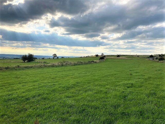
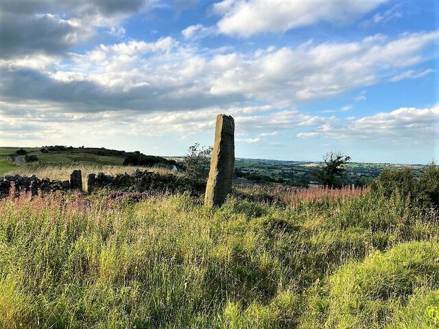
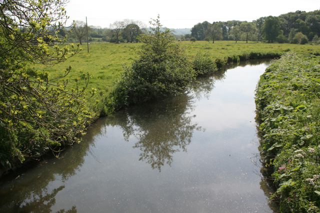
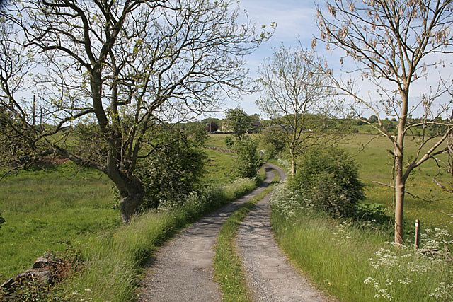
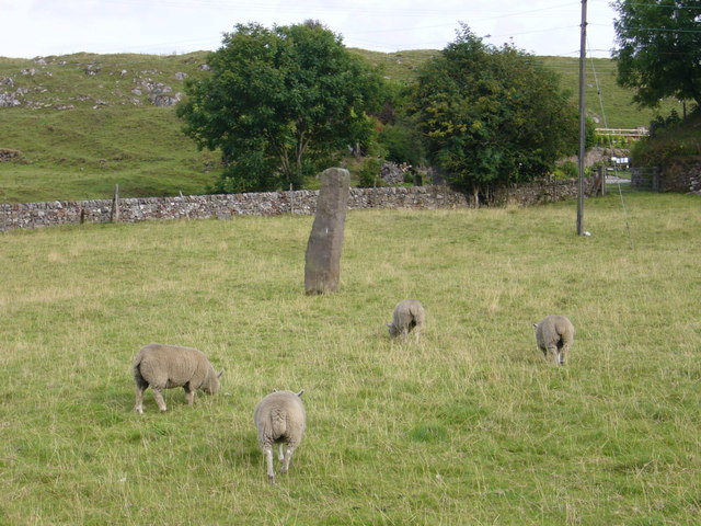
The village is known for its breathtaking natural scenery, with rolling hills, lush green fields, and dense woodlands encompassing the area. It is a popular destination for nature lovers and outdoor enthusiasts, providing numerous opportunities for hiking, cycling, and exploring the surrounding countryside.

Despite its small size, Windy Harbour offers a range of amenities to its residents. The village has a local pub, which serves as a social hub for the community, providing a place for locals to gather and unwind. Additionally, there is a small convenience store that caters to the daily needs of the villagers.

The close-knit community in Windy Harbour is known for its friendly and welcoming atmosphere. Residents take pride in their village and actively participate in community events and activities, fostering a strong sense of unity.

For those seeking a peaceful and rural lifestyle, Windy Harbour provides an ideal setting. The village offers a variety of housing options, including traditional cottages and modern homes, allowing individuals and families to find a place to call home that suits their preferences.

Overall, Windy Harbour in Staffordshire offers a serene and picturesque environment, coupled with a close-knit community, making it an appealing destination for those seeking a tranquil countryside lifestyle.

If you have any feedback on the listing, please let us know in the comments section below.

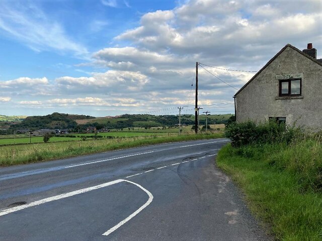
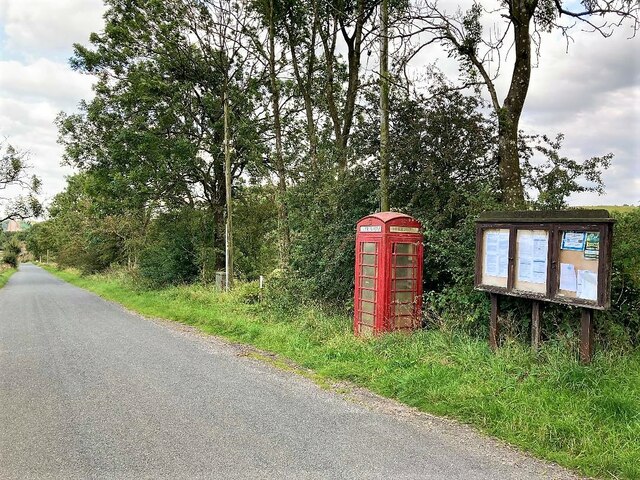
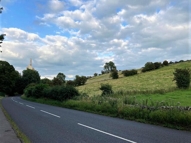
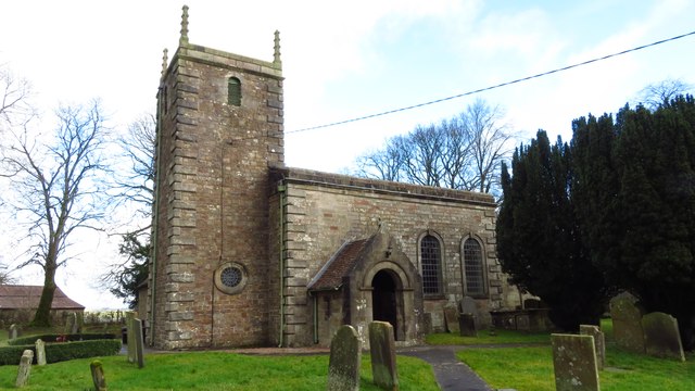
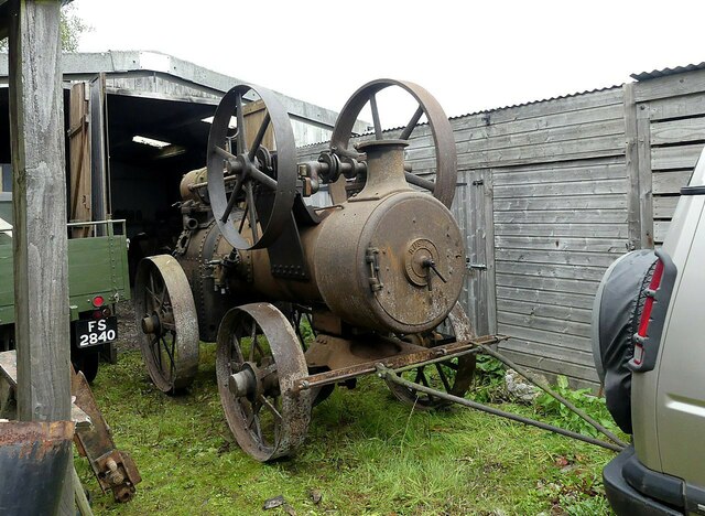
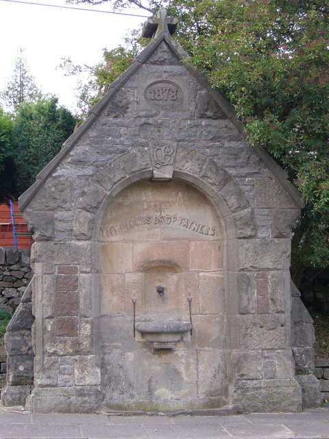
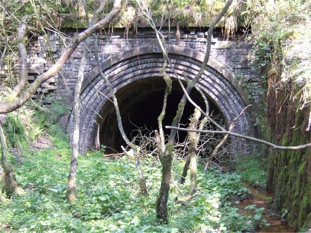
Windy Harbour Images

Images are sourced within 2km of 53.034779/-1.9079795 or Grid Reference SK0648. Thanks to Geograph Open Source API. All images are credited.

View from Ellastone Road at Windy Harbour Looking north east with the low buildings of Moorend Farm in the centre ahead. A plume of smoke is coming from the cement works at Cauldon with its enormous limestone quarry eating up Cauldon Low - the high area to the right of the shot. On the left emerging from behind a tree is the row of cottages on Stony Lane, Moorend which are also seen in <a href="https://www.geograph.org.uk/photo/2966784">SK0648 : Terraced houses at Stony Lane, Moorend</a> and <a href="https://www.geograph.org.uk/photo/4458833">SK0648 : Terraced houses on Stony Lane</a>
View from Ellastone Road at Windy Harbour
Looking north east with the low buildings of Moorend Farm in the centre ahead. A plume of smoke is coming from the cement works at Cauldon with its enormous limestone quarry eating up Cauldon Low - the high area to the right of the shot. On the left emerging from behind a tree is the row of cottages on Stony Lane, Moorend which are also seen in SK0648 : Terraced houses at Stony Lane, Moorend and SK0648 : Terraced houses on Stony Lane
Waymarker Stone and Stile at Windyway Cross On Staffordshire footpath Cotton 32 looking SE, the view NW is <a href="https://www.geograph.org.uk/photo/2966886">SK0548 : Footpath junction near the standing / guide stone</a>. The Stone was used as a guide to the packhorse route over dryer ground, explained in <span class="nowrap"><a title="https://churnet-valley.guide/heritage/windyway-cross?fbclid=IwAR0E02aCH-ARG-sH6i2Y7BAZwZqp3X6NmC6uE-vPdJT660MHIvJJ8O8xUjE" rel="nofollow ugc noopener" href="https://churnet-valley.guide/heritage/windyway-cross?fbclid=IwAR0E02aCH-ARG-sH6i2Y7BAZwZqp3X6NmC6uE-vPdJT660MHIvJJ8O8xUjE">Link</a><img style="margin-left:2px;" alt="External link" title="External link - shift click to open in new window" src="https://s1.geograph.org.uk/img/external.png" width="10" height="10"/></span> .
Copper was transported from Ecton to the smelting works at Whiston <span class="nowrap"><a title="https://maps.nls.uk/geo/explore/#zoom=17.0&lat=53.02201&lon=-1.94133&layers=168&b=1&marker=53.022080313486065,-1.941266188458469" rel="nofollow ugc noopener" href="https://maps.nls.uk/geo/explore/#zoom=17.0&lat=53.02201&lon=-1.94133&layers=168&b=1&marker=53.022080313486065,-1.941266188458469">Link</a><img style="margin-left:2px;" alt="External link" title="External link - shift click to open in new window" src="https://s1.geograph.org.uk/img/external.png" width="10" height="10"/></span> which became disused around 1880/98.

Milestone Society National ID: ST_XIPS
Waymarker Stone and Stile at Windyway Cross
On Staffordshire footpath Cotton 32 looking SE, the view NW is SK0548 : Footpath junction near the standing / guide stone. The Stone was used as a guide to the packhorse route over dryer ground, explained in LinkExternal link . Copper was transported from Ecton to the smelting works at Whiston LinkExternal link which became disused around 1880/98. Milestone Society National ID: ST_XIPS
Grazing Land on Ipstones Edge Looking towards Black Heath from a spot close to the old copper route waymarker stone. The views from Ipstones Edge are outstanding and the Welsh mountains can be discerned on a good day.
Grazing Land on Ipstones Edge
Looking towards Black Heath from a spot close to the old copper route waymarker stone. The views from Ipstones Edge are outstanding and the Welsh mountains can be discerned on a good day.
Waymarker Stone at Windywaycross This impressive stone stands at 8 feet high and was originally used to guide pack horse trains over drier ground from the copper mines at Ecton to the smelting works at Whiston.  It was more cost effective to bring the copper ore to Whiston, where coal for smelting was available from the Foxt and Kingsley coalfields than to transport coal to the Ecton Copper Mine, as it took about four tons of coal to smelt one ton of copper ore. The white gable end of Windywaycross House can be deciphered in the distance to the left of the stone.
Waymarker Stone at Windywaycross
This impressive stone stands at 8 feet high and was originally used to guide pack horse trains over drier ground from the copper mines at Ecton to the smelting works at Whiston. It was more cost effective to bring the copper ore to Whiston, where coal for smelting was available from the Foxt and Kingsley coalfields than to transport coal to the Ecton Copper Mine, as it took about four tons of coal to smelt one ton of copper ore. The white gable end of Windywaycross House can be deciphered in the distance to the left of the stone.
Road Junction Overlooking Cauldon The Casey is seen joining Ellastone Road here with Cauldon Low on the horizon. The dwelling on the right is Moorland Cottage.
Road Junction Overlooking Cauldon
The Casey is seen joining Ellastone Road here with Cauldon Low on the horizon. The dwelling on the right is Moorland Cottage.
Telephone Box and Notice Board at Moorend Located on Stoney Lane at the western edge of the grid square.
Telephone Box and Notice Board at Moorend
Located on Stoney Lane at the western edge of the grid square.
Main Road near Cauldon Looking east with one of the chimneys associated with the cement works visible.
Main Road near Cauldon
Looking east with one of the chimneys associated with the cement works visible.
Cauldon - St Mary & St Laurence Church
Back to Claymills -1, the start of the journey This Ruston-Proctor portable engine originally worked at Claymills Pumping Station. The Trust which now runs the engines at Claymills celebrated 30 years of work in October 2023, and as part of the celebrations the owner loaned the engine for display at the October 2023 steam weekend. Here it is seen coming out of storage ready for the journey to Claymills.
Back to Claymills -1, the start of the journey
This Ruston-Proctor portable engine originally worked at Claymills Pumping Station. The Trust which now runs the engines at Claymills celebrated 30 years of work in October 2023, and as part of the celebrations the owner loaned the engine for display at the October 2023 steam weekend. Here it is seen coming out of storage ready for the journey to Claymills.
River Hamps near Winkhill
The lane to Broomyshaw
Standing stone and sheep opposite The Cross public house at Hoften's Cross near Cauldon. Not marked on the map but the stone may well be Bronze Age or thereabouts.
Standing stone and sheep
opposite The Cross public house at Hoften's Cross near Cauldon. Not marked on the map but the stone may well be Bronze Age or thereabouts.
Drinking fountain a rather urban looking drinking fountain beside the main road through Cauldon, Staffordshire. Inscriptions are: "1878", "CB" monogram - presumably the benefactor and "thy clouds drop fatness" - Psalm 65 v 12 in the 1662 Book of Common Prayer version.
Drinking fountain
a rather urban looking drinking fountain beside the main road through Cauldon, Staffordshire. Inscriptions are: "1878", "CB" monogram - presumably the benefactor and "thy clouds drop fatness" - Psalm 65 v 12 in the 1662 Book of Common Prayer version.
Entrance to Trubshaw's Tunnel Trubshaw's Tunnel was dug for the 1847 Caldon Low railway. The railway was a self-acting inclined plane, where empty wagons travelling upward were attached by a cable via a brake drum at the top of the plane to wagons loaded with limestone travelling downwards.
Entrance to Trubshaw's Tunnel
Trubshaw's Tunnel was dug for the 1847 Caldon Low railway. The railway was a self-acting inclined plane, where empty wagons travelling upward were attached by a cable via a brake drum at the top of the plane to wagons loaded with limestone travelling downwards.
Crushing plant at Caldon Low Quarry The hill from which this quarry derives its name - Caldon Low - is indeed spelt differently from the local village, Cauldon. The stone quarried here does have a reddish colouring, giving a distinctive colour to the quarry buildings.
Crushing plant at Caldon Low Quarry
The hill from which this quarry derives its name - Caldon Low - is indeed spelt differently from the local village, Cauldon. The stone quarried here does have a reddish colouring, giving a distinctive colour to the quarry buildings.
Cauldon Lowe This is the main street through Cauldon Lowe village.  The village is set high up on the Staffordshire moorlands.  Just over the road to the north are the massive Cauldonlow limestone quarries.
Cauldon Lowe
This is the main street through Cauldon Lowe village. The village is set high up on the Staffordshire moorlands. Just over the road to the north are the massive Cauldonlow limestone quarries.
Industrial Units at Moorside near Cauldon Lowe These industrial units are at Moorside near the village of Cauldon Lowe in the Staffordshire moorlands.  The high location enjoys extensive views over the moorlands towards Cheadle.
Industrial Units at Moorside near Cauldon Lowe
These industrial units are at Moorside near the village of Cauldon Lowe in the Staffordshire moorlands. The high location enjoys extensive views over the moorlands towards Cheadle.
Lane Head Farm Lane Head farm at Lanehead just off the A52 between Ashbourne and Leek in the Staffordshire moorlands.
Lane Head Farm
Lane Head farm at Lanehead just off the A52 between Ashbourne and Leek in the Staffordshire moorlands.
Show me another place!

Windy Harbour is located at Grid Ref: SK0648 (Lat: 53.034779, Lng: -1.9079795)

Administrative County: Staffordshire

District: Staffordshire Moorlands

Police Authority: Staffordshire

What 3 Words

///dull.fattest.camcorder. Near Cheadle, Staffordshire

Nearby Locations

Windy Harbour Moorend

Related Wikis

Broomyshaw

Broomyshaw is a village in Staffordshire, England. Population details for the 2011 census can be found under Waterhouses, Staffordshire

Caldon Low Halt railway station

Caldon Low Halt railway station was a railway station near the hamlet of Cauldon, Staffordshire. It was opened by the North Staffordshire Railway (NSR...

Cauldon

Cauldon or Caldon is a village and former civil parish, 19 miles (31 km) north east of Stafford, now in the parish of Waterhouses, in the Staffordshire...

Cotton College

Cotton College was a Roman Catholic boarding school in Cotton, Staffordshire, United Kingdom. It was also known as Saint Wilfrid's College. The school...

Nearby Amenities

Located within 500m of 53.034779,-1.9079795
Bus Stop
Green Man PH
Bus: yes
Naptan AtcoCode: 3800C814100
Naptan Bearing: NW
Naptan CommonName: Green Man PH
Naptan Indicator: Adj
Naptan Landmark: Green Man PH
Naptan Street: Ellastone Rd
Naptan Verified: no
Public Transport: platform
Source: naptan_import
Lat/Long: 53.0316565/-1.904908
Bus Stop
Green Man PH
Bus: yes
Naptan AtcoCode: 3800C814101
Naptan Bearing: SE
Naptan BusStopType: CUS
Naptan CommonName: Green Man PH
Naptan Indicator: Adj
Naptan Landmark: Green Man PH
Naptan Street: Ellastone Rd
Naptan Verified: no
Public Transport: platform
Source: naptan_import
Lat/Long: 53.0317103/-1.9047289
Power: pole
Lat/Long: 53.0379054/-1.9029897
Power: pole
Lat/Long: 53.0372538/-1.9046634
Power: pole
Lat/Long: 53.0369732/-1.9053474
Power: pole
Lat/Long: 53.0363329/-1.9069997
Power: pole
Lat/Long: 53.0357781/-1.9084159
Power: pole
Lat/Long: 53.0354942/-1.909132
Power: pole
Lat/Long: 53.03442/-1.9118518
Power: pole
Lat/Long: 53.0338636/-1.9132492
Power: pole
Lat/Long: 53.0329732/-1.9140726
Power: pole
Lat/Long: 53.0379796/-1.9030595
Power: pole
Lat/Long: 53.0373909/-1.904591
Power: pole
Lat/Long: 53.0368925/-1.9058517
Power: pole
Lat/Long: 53.0364055/-1.907064
Power: pole
Lat/Long: 53.035841/-1.9085151
Power: pole
Lat/Long: 53.0355652/-1.9091857
Power: pole
Lat/Long: 53.0350039/-1.9105858
Power: pole
Lat/Long: 53.0344861/-1.9119403
Power: pole
Lat/Long: 53.0339345/-1.9133323
Power: pole
Lat/Long: 53.0330022/-1.9141987
Power: pole
Lat/Long: 53.0380231/-1.9032016
Power: pole
Lat/Long: 53.0374393/-1.9047144
Power: pole
Lat/Long: 53.0368506/-1.9061869
Power: pole
Lat/Long: 53.0364764/-1.9071499
Power: pole
Lat/Long: 53.0359168/-1.9085848
Power: pole
Lat/Long: 53.0356506/-1.9092715
Power: pole
Lat/Long: 53.0345636/-1.9119859
Power: pole
Lat/Long: 53.0340087/-1.9134396
Power: pole
Lat/Long: 53.0330377/-1.9143301
Power: pole
Lat/Long: 53.0322635/-1.9091159
Power: pole
Lat/Long: 53.031957/-1.9086868
Power: pole
Lat/Long: 53.0314522/-1.9079921
Power: pole
Lat/Long: 53.0309521/-1.9072866
Power: pole
Lat/Long: 53.0304198/-1.9065571
Addr Housename: Meadowcroft
Lat/Long: 53.0360419/-1.9023561
The data included in this document is from www.openstreetmap.org. The data is made available under ODbL.

Have you been to Windy Harbour?

Leave your review of Windy Harbour below (or comments, questions and feedback).