Meerbrook

Settlement in Staffordshire Staffordshire Moorlands

England

Meerbrook

Middle Hulme Farm C17th farmhouse with later additions, which is listed grade II.
Middle Hulme Farm Credit: Eirian Evans

Meerbrook is a charming village located in the county of Staffordshire, England. Situated in the picturesque Staffordshire Moorlands district, the village is surrounded by stunning natural beauty, making it a popular destination for tourists and nature enthusiasts.

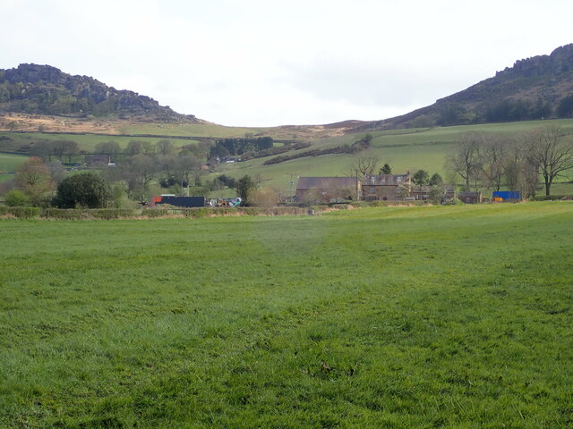
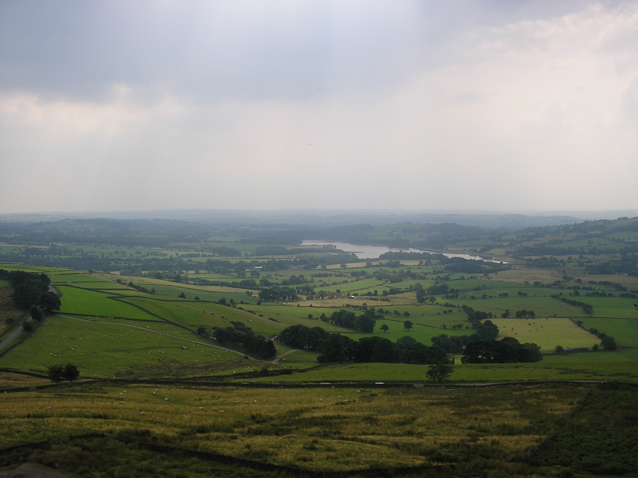
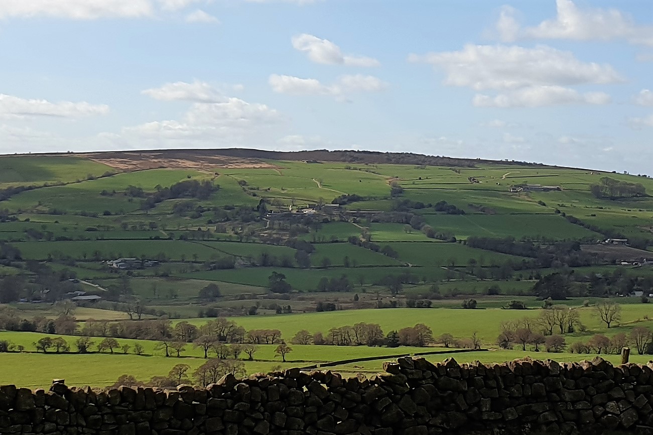
The village is nestled within the Staffordshire Peak District, offering residents and visitors the opportunity to explore a diverse range of landscapes, including lush green valleys, rolling hills, and serene lakes. One of the most prominent features of Meerbrook is the nearby Tittesworth Reservoir, a large body of water that provides breathtaking views and a variety of outdoor activities such as fishing, boating, and walking trails.

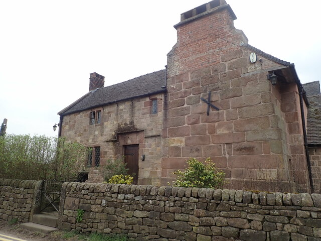
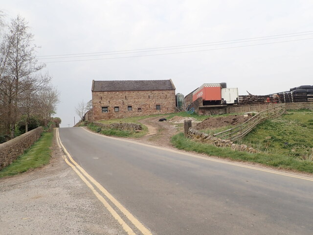
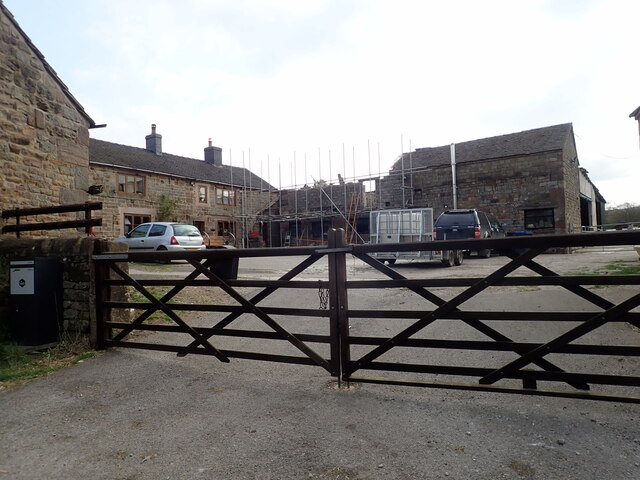
The village itself exudes a quintessentially English charm, with traditional stone-built houses, a village green, and a small but vibrant community. There are a handful of local amenities, including a primary school, a village hall, and a quaint church, which add to the village's sense of community.

Meerbrook is also known for its close proximity to the famous Roaches, a rocky ridge offering stunning panoramic views of the surrounding countryside. This natural landmark attracts climbers and hikers from all over the country, who come to test their skills and take in the breathtaking vistas.

Overall, Meerbrook is a delightful village that offers a tranquil and idyllic setting for those seeking to escape the hustle and bustle of city life. Its natural beauty, community spirit, and proximity to the stunning Staffordshire Peak District make it a truly special place to visit or call home.

If you have any feedback on the listing, please let us know in the comments section below.

Meerbrook Images

Images are sourced within 2km of 53.142171/-2.019851 or Grid Reference SJ9860. Thanks to Geograph Open Source API. All images are credited.

Middle Hulme Farm C17th farmhouse with later additions, which is listed grade II.
Middle Hulme Farm
C17th farmhouse with later additions, which is listed grade II.
Large barn at Middle Hulme Farm
Building work at Middle Hulme Farm
Footpath heading west from Whitty Lane Near Middle Hulme Farm
Footpath heading west from Whitty Lane
Near Middle Hulme Farm
View north-east towards The Roaches and Hen Cloud
Tricky stile on a Staffordshire Moorland Walk
View to the Roaches on Staffordshire Moorland Walk
Two become one Two alder trees melding into one on the Staffordshire Moors
Two become one
Two alder trees melding into one on the Staffordshire Moors
Footpath signpost At a crossing of paths
Footpath signpost
At a crossing of paths
Stone barn Standing alone in a field near Meerbrook
Stone barn
Standing alone in a field near Meerbrook
Boardwalk through marshy ground South of Frith Bottom
Boardwalk through marshy ground
South of Frith Bottom
Frith Bottom farmhouse Grade II listed farmhouse built in the early C18 with later additions/alterations
Frith Bottom farmhouse
Grade II listed farmhouse built in the early C18 with later additions/alterations
Suffolk Sheep in Staffordshire In a  field north of Meerbrook
Suffolk Sheep in Staffordshire
In a field north of Meerbrook
Put out to pasture Not much mileage left in this old tractor
Put out to pasture
Not much mileage left in this old tractor
Two gritstone pillars at a field's edge
Lower Lee Farm On the outskirts of Meerbrook
Lower Lee Farm
On the outskirts of Meerbrook
Church of St Matthew, Meerbrook Grade II* parish church
Church of St Matthew, Meerbrook
Grade II* parish church
The Lazy Trout, Meerbrook
Show me another place!

Meerbrook is located at Grid Ref: SJ9860 (Lat: 53.142171, Lng: -2.019851)

Administrative County: Staffordshire

District: Staffordshire Moorlands

Police Authority: Staffordshire

What 3 Words

///reputable.mute.collected. Near Leek, Staffordshire

Nearby Locations

Meerbrook

Related Wikis

Meerbrook

Meerbrook (grid reference SJ989609) is a small village in North Staffordshire, on the River Churnet at the edge of the Peak District National Park. It...

Leekfrith

Leekfrith is a civil parish in the Staffordshire Moorlands, in Staffordshire, England, north of the town of Leek. The population of the civil parish at...

Tittesworth reservoir

Tittesworth Reservoir is a water storage reservoir near Leek, Staffordshire, England, fed by the River Churnet. The reservoir and associated water treatment...

Gun (Staffordshire)

Gun is a hill at the southern end of the Peak District, overlooking the town of Leek in the Staffordshire Moorlands. The hill is mainly moorland with some...

Tittesworth

Tittesworth is a civil parish in the Staffordshire Moorlands, in Staffordshire, England. It extends from the edge of the town of Leek in the south-west...
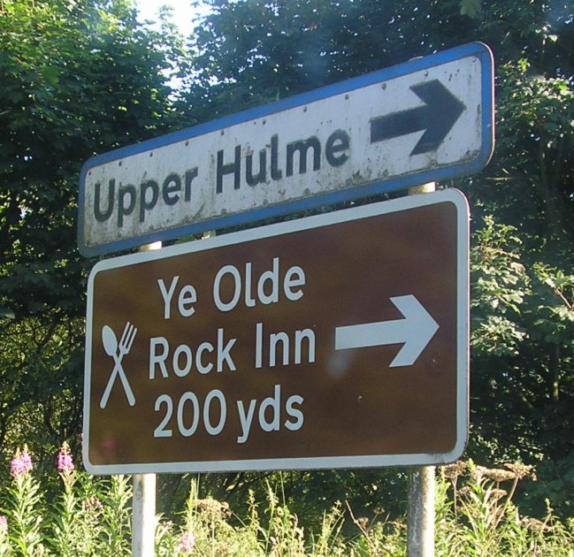
Upper Hulme

Upper Hulme is a hamlet in North Staffordshire, between the historic market town of Leek and the spa town of Buxton. It is clustered around a redundant...

Abbey Green, Staffordshire Moorlands

Abbey Green is a village near Leek in the English county of Staffordshire. The village is close to the site of Dieulacres Abbey. The abbey was founded...

Dieulacres Abbey

Dieulacres Abbey was a Cistercian monastery established by Ranulf, Earl of Chester at Poulton in Cheshire. It moved to the present site at Abbey Green...

Nearby Amenities

Located within 500m of 53.142171,-2.019851
Bus Stop
Post Cottage
Naptan AtcoCode: 3800C842001
Naptan Bearing: W
Naptan CommonName: Post Cottage
Naptan Indicator: Adj
Naptan Landmark: Post Cottage
Naptan Street: Main Rd
Naptan Verified: no
Source: naptan_import
Lat/Long: 53.1440435/-2.0166547
Pub
The Lazy Trout
Description Floor: tiles
Ele: 211
Operator: Freehouse
Outdoor Seating: yes
Parking: yes
Real Ale: 2 from marstons 2 local
Lat/Long: 53.1440233/-2.0161318
Meerbrook
Place: village
Lat/Long: 53.1445482/-2.0183488
Barrier: stile
Material: wood
Source: survey;gps
Stile: stepover
Lat/Long: 53.1453131/-2.0229071
Addr Housename: Old School
Source: survey
Lat/Long: 53.1441476/-2.0168167
Telephone
Booth: K6
Covered: booth
Listed Status: Grade II
Operator: BT
Phone: +44 1538300311
Lat/Long: 53.1440554/-2.0171231
Post Box
Check Date Collection Times: 2022-05-07
Collection Times: Mo-Fr 10:00; Sa 09:00
Post Box Type: wall
Ref: ST13 736
Royal Cypher: GR
Royal Cypher Wikidata: Q33102273
Lat/Long: 53.1441126/-2.0167157
Barrier: stile
Steps: 1
Stile: stepover
Lat/Long: 53.1446846/-2.0217694
Addr Housename: 2 Lea Cottage
Lat/Long: 53.1442225/-2.016426
Bench
Source: survey;gps
Lat/Long: 53.1441084/-2.0177714
Barrier: stile
Stile: squeezer
Lat/Long: 53.1392616/-2.0244747
Barrier: stile
Steps: 1
Stile: stepover
Lat/Long: 53.143397/-2.0222791
Barrier: stile
Steps: 1
Stile: stepover
Lat/Long: 53.1424688/-2.0227115
Barrier: stile
Steps: 0
Stile: stepover
Lat/Long: 53.1426386/-2.0224573
Barrier: stile
Steps: 0
Stile: stepover
Lat/Long: 53.1426158/-2.0225089
Barrier: stile
Steps: 1
Stile: stepover
Lat/Long: 53.1438326/-2.0220222
Bench
Backrest: yes
Lat/Long: 53.144048/-2.0174314
Bench
Backrest: yes
Lat/Long: 53.1390889/-2.0157783
Waste Basket
Lat/Long: 53.142143/-2.0125915
Information: board
Tourism: information
Lat/Long: 53.1440438/-2.0173593
Waste Basket
Lat/Long: 53.1440372/-2.0172197
Information: guidepost
Tourism: information
Lat/Long: 53.1424692/-2.014023
West Bird Hide
Leisure: bird_hide
Lat/Long: 53.1432234/-2.0131885
Waste Basket
Waste: dog_excrement
Lat/Long: 53.1423198/-2.0140863
The data included in this document is from www.openstreetmap.org. The data is made available under ODbL.

Have you been to Meerbrook?

Leave your review of Meerbrook below (or comments, questions and feedback).