Whiteley

Settlement in Hampshire Fareham

England

Whiteley

Newly built houses in Brunel Way, Whiteley The houses are complete and occupied, but the road surface is still in need of some attention.
Newly built houses in Brunel Way, Whiteley Credit: David Martin

Located in the county of Hampshire, Whiteley is a modern purpose-built town situated between Southampton and Portsmouth in the south of England. Developed in the early 1990s, it was initially established as a housing development to accommodate the growing population of nearby cities. Over the years, Whiteley has evolved into a vibrant and self-sustained community.

The town boasts a range of amenities, including a large shopping center named Whiteley Village, which consists of numerous retail outlets, restaurants, cafes, and a cinema. This shopping center acts as a focal point for both residents and visitors, offering a variety of popular high street brands and a diverse dining scene.

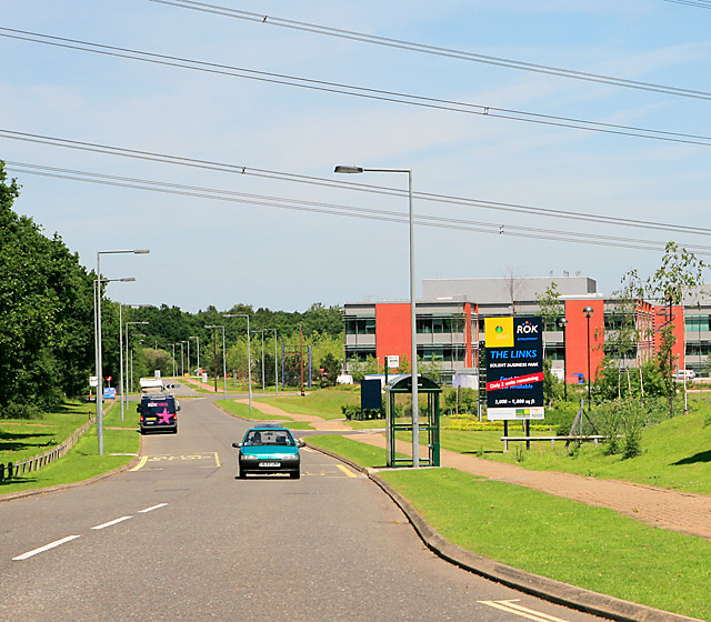
Whiteley is also known for its thriving business park, attracting a number of national and international companies. The park provides employment opportunities for local residents, contributing significantly to the town's economy. Additionally, Whiteley is home to a number of office spaces, making it a popular destination for businesses of all sizes.

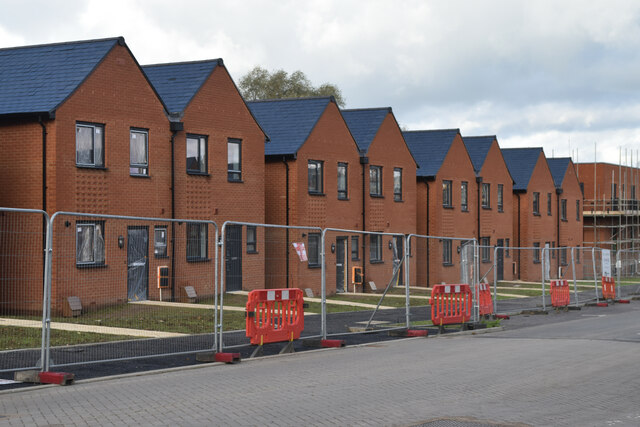
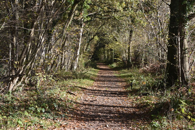
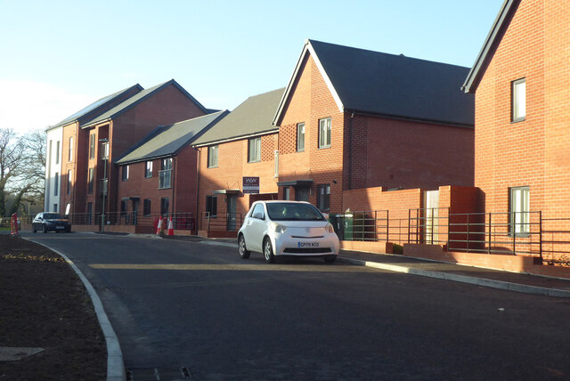
In terms of residential areas, Whiteley offers a mix of housing options, including apartments, townhouses, and detached houses. The town is known for its well-maintained green spaces, parks, and playgrounds, providing ample opportunities for outdoor activities and recreational pursuits. The community is also served by several schools, ensuring access to quality education for families in the area.

With its convenient location and excellent transport links, Whiteley offers easy access to major cities and attractions in the region. The town is well-connected via road and rail networks, with nearby motorways providing connections to London and other major cities. Overall, Whiteley combines modern infrastructure, a range of amenities, and a strong community spirit, making it an attractive place to live, work, and visit.

If you have any feedback on the listing, please let us know in the comments section below.
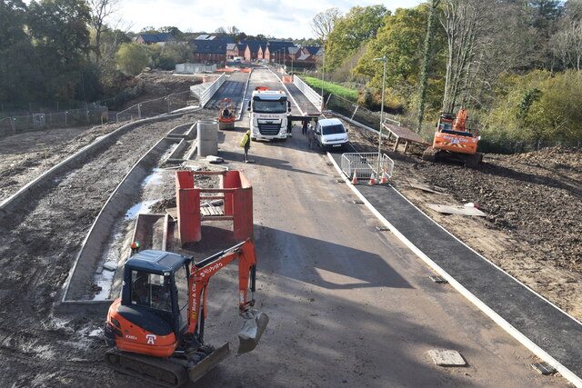
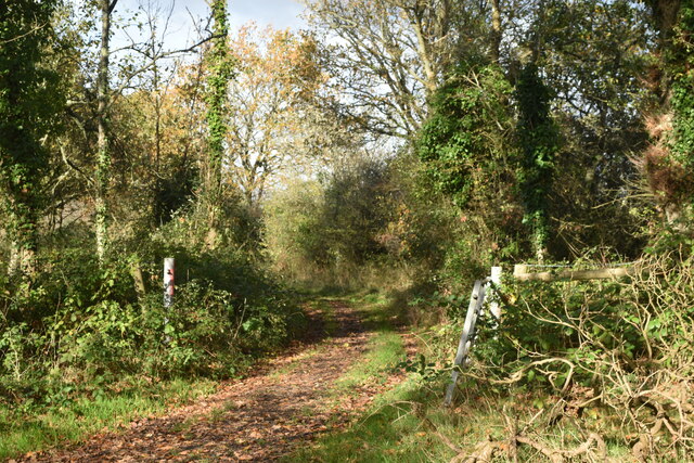
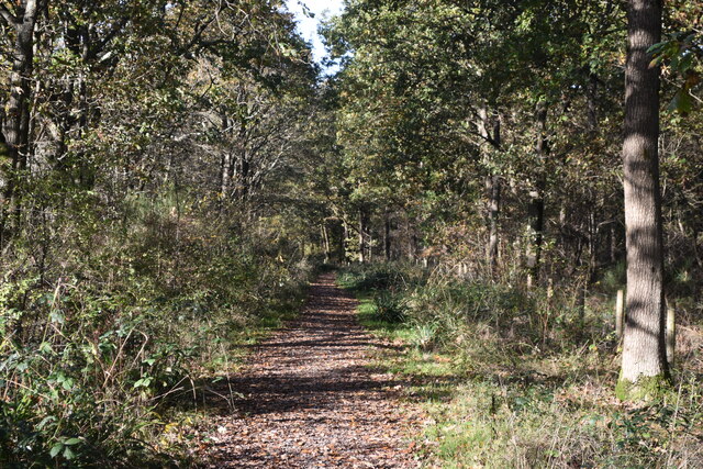
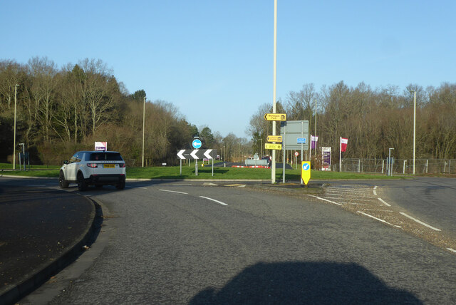
Whiteley Images

Images are sourced within 2km of 50.881415/-1.2573328 or Grid Reference SU5209. Thanks to Geograph Open Source API. All images are credited.

Newly built houses in Brunel Way, Whiteley The houses are complete and occupied, but the road surface is still in need of some attention.
Newly built houses in Brunel Way, Whiteley
The houses are complete and occupied, but the road surface is still in need of some attention.
New housing construction on Glassfield Road, Whiteley These houses are on a section of Glassfield Road that is still in full possession of the developers.
New housing construction on Glassfield Road, Whiteley
These houses are on a section of Glassfield Road that is still in full possession of the developers.
Footpath towards Glassfield Road Pre-existing right of way, increasingly surrounded by new housing development.
Footpath towards Glassfield Road
Pre-existing right of way, increasingly surrounded by new housing development.
New housing nearing completion on Bluebell Way, Whiteley
Tree-lined footpath, Whiteley
New road under construction, Whiteley Taken from a temporary footbridge enabling the footpath to pass over the area controlled by the developers.
New road under construction, Whiteley
Taken from a temporary footbridge enabling the footpath to pass over the area controlled by the developers.
New road under construction, Whiteley Taken from a temporary footbridge enabling the footpath to pass over the area controlled by the developers.
New road under construction, Whiteley
Taken from a temporary footbridge enabling the footpath to pass over the area controlled by the developers.
Drainage work on Whiteley Way The contractors are working on a balancing pond and drainage beside this newly-constructed section of Whiteley Way. The present extent of new housing is visible in the distance. Photo taken from a temporary footbridge enabling the footpath to pass over the area controlled by the developers.
Drainage work on Whiteley Way
The contractors are working on a balancing pond and drainage beside this newly-constructed section of Whiteley Way. The present extent of new housing is visible in the distance. Photo taken from a temporary footbridge enabling the footpath to pass over the area controlled by the developers.
Track branching away from footpath, Whiteley
Footpath adjacent to Whiteley Way
Whiteley Farm roundabout on Whiteley Way Whiteley Way, straight on, is not yet a through route, eventually coming to a public end at a building site.
Whiteley Farm roundabout on Whiteley Way
Whiteley Way, straight on, is not yet a through route, eventually coming to a public end at a building site.
New houses on a new road, Whiteley Way A greenfield housing development.
New houses on a new road, Whiteley Way
A greenfield housing development.
New construction zone on Whiteley Way The photographer is standing very close to <a href="https://www.geograph.org.uk/photo/7343752">SU5310 : New road under construction, Whiteley</a>, taken 14 months earlier from a temporary footbridge above the location of the speed hump.
New construction zone on Whiteley Way
The photographer is standing very close to SU5310 : New road under construction, Whiteley, taken 14 months earlier from a temporary footbridge above the location of the speed hump.
Houses seen across balancing pond beside Whiteley Way
Houses on Bluebell Way
Sales office at Woodlands Chase A Taylor Wimpey development within the Whiteley Meadows construction zone.
Sales office at Woodlands Chase
A Taylor Wimpey development within the Whiteley Meadows construction zone.
Business units at Parkway, Whiteley
Footpath into Lee Ground Coppice
Show me another place!

Whiteley is located at Grid Ref: SU5209 (Lat: 50.881415, Lng: -1.2573328)

Administrative County: Hampshire

District: Fareham

Police Authority: Hampshire

What 3 Words

///toast.hospitals.fury. Near Botley, Hampshire

Related Wikis

Whiteley

Whiteley is a community of (planned) 6,500 homes in the county of Hampshire, England, near Fareham. The development straddles the boundary between two...

Swanwick, Hampshire

Swanwick () is a village in Hampshire, England, east of the River Hamble and north of the M27 motorway. The village is located within the borough of...

Swanwick railway station

Swanwick railway station is a railway station in Fareham, Hampshire, England. Despite its name, it is actually located in Park Gate, one mile south of...

College of Air Traffic Control

The College of Air Traffic Control or CATC is the main British non-military training establishment for air traffic control (ATC). It also trains people...

Nearby Amenities

Located within 500m of 50.881415,-1.2573328
Traffic Calming: island
Lat/Long: 50.8792661/-1.2530994
Traffic Calming: cushion
Lat/Long: 50.8830715/-1.2624167
Crossing
Tactile Paving: no
Traffic Calming: table
Lat/Long: 50.8858623/-1.2581837
Barrier: bollard
Bicycle: yes
Foot: yes
Material: wood
Lat/Long: 50.8800693/-1.251145
Traffic Calming: cushion
Lat/Long: 50.8824746/-1.2504429
Crossing
Lat/Long: 50.8845137/-1.2537018
Whiteley
Place: village
Lat/Long: 50.8843891/-1.2524697
Crossing
Button Operated: yes
Crossing: traffic_signals
Lat/Long: 50.8808103/-1.255502
Crossing
Lat/Long: 50.8831282/-1.2529163
Bus Stop
Yew Tree Drive
Bench: yes
Naptan AtcoCode: 1900HA040139
Naptan Bearing: W
Naptan CommonName: Yew Tree Drive
Naptan Crossing: Opp Sweethills Crescent
Naptan NaptanCode: hamdmgmp
Naptan PlusbusZoneRef: FAREHAM
Naptan Street: Yew Tree Drive
Naptan Verified: no
Shelter: yes
Source: naptan_import
Lat/Long: 50.8828059/-1.2633774
Bus Stop
Hispano Avenue
Bench: no
Naptan AtcoCode: 1900HA040140
Naptan Bearing: SE
Naptan CommonName: Hispano Avenue
Naptan Crossing: Opp Hispano Avenue
Naptan NaptanCode: hamdmjda
Naptan PlusbusZoneRef: FAREHAM
Naptan ShortCommonName: Whiteley Primary School
Naptan Street: Yew Tree Drive
Naptan Verified: no
Shelter: no
Source: naptan_import
Lat/Long: 50.882033/-1.2588673
Bus Stop
Rookery Avenue
Bench: no
Naptan AtcoCode: 1900HA040142
Naptan Bearing: S
Naptan CommonName: Rookery Avenue
Naptan Crossing: Rookery Avenue
Naptan NaptanCode: hamdmjtp
Naptan PlusbusZoneRef: FAREHAM
Naptan Street: Yew Tree Drive
Naptan Verified: no
Shelter: no
Source: naptan_import
Lat/Long: 50.879591/-1.2541743
Bus Stop
Rookery Avenue
Naptan AtcoCode: 1900HA040143
Naptan Bearing: N
Naptan BusStopType: CUS
Naptan CommonName: Rookery Avenue
Naptan Crossing: Rookery Avenue
Naptan NaptanCode: hamdmjtg
Naptan PlusbusZoneRef: FAREHAM
Naptan Street: Yew Tree Drive
Naptan Verified: no
Source: naptan_import
Lat/Long: 50.8795695/-1.2543082
Bus Stop
Solent Hotel
Bench: no
Naptan AtcoCode: 1900HA040144
Naptan Bearing: W
Naptan CommonName: Solent Hotel
Naptan NaptanCode: hamdmpag
Naptan PlusbusZoneRef: FAREHAM
Naptan Street: Rookery Avenue
Naptan Verified: no
Shelter: no
Source: naptan_import
Lat/Long: 50.8792626/-1.2521572
Bus Stop
Whiteley Primary School
Bench: yes
Bus: yes
Naptan AtcoCode: 1900HAA09447
Naptan Bearing: SE
Naptan CommonName: Whiteley Primary School
Naptan Crossing: Gull Coppice
Naptan Landmark: Spar & Shops
Naptan NaptanCode: hamjdtmd
Naptan PlusbusZoneRef: FAREHAM
Naptan Street: Yew Tree Drive
Naptan Verified: no
Note: This bench is green in colour.
Public Transport: platform
Shelter: yes
Source: naptan_import; survey
Lat/Long: 50.8813771/-1.2569553
Bus Stop
Whiteley Primary School
Bench: yes
Naptan AtcoCode: 1900HAA13458
Naptan Bearing: NW
Naptan CommonName: Whiteley Primary School
Naptan Landmark: Spar Shop
Naptan NaptanCode: hamdmjgd
Naptan PlusbusZoneRef: FAREHAM
Naptan Street: Yew Tree Drive
Naptan Verified: no
Shelter: yes
Source: naptan_import
Lat/Long: 50.8816575/-1.2581773
Bus Stop
Buchan Avenue
Bench: yes
Naptan AtcoCode: 1900HAA13461
Naptan Bearing: S
Naptan CommonName: Buchan Avenue
Naptan Crossing: Opp Steinbeck Close
Naptan NaptanCode: hamdmjaw
Naptan PlusbusZoneRef: FAREHAM
Naptan Street: Sweethills Crescent
Naptan Verified: no
Shelter: yes
Source: naptan_import
Lat/Long: 50.8848145/-1.258751
Crossing
Crossing Island: yes
Lat/Long: 50.8813558/-1.2570786
Traffic Calming: cushion
Lat/Long: 50.8827169/-1.2641208
Post Box
Collection Plate: CP8
Collection Times: Mo-Fr 16:45; Sa 12:15
Last Checked: 2021-03-16
Operator: Royal Mail
Post Box Type: pillar
Ref: PO15 180
Royal Cypher: EIIR
Royal Cypher Wikidata: Q33102113
Source: survey
Lat/Long: 50.8811976/-1.2576348
Post Box
Collection Times: Mo-Fr 09:00; Sa 07:00
Ref: PO15 147D
Lat/Long: 50.8842991/-1.2590846
Post Box
Check Date: 2021-04-24
Collection Times: Mo-Fr 09:00; Sa 07:00
Operator: Royal Mail
Post Box Design: type_m
Post Box Type: lamp
Ref: PO15 143
Royal Cypher: EIIR
Royal Cypher Wikidata: Q33102113
Lat/Long: 50.8824464/-1.2605266
Post Office
Whiteley Post Office
Addr City: Fareham
Addr Country: GB
Addr County: Hampshire
Addr Housename: Gull Coppice
Addr Postcode: PO15 7LA
Addr Street: Yew Tree Drive
Addr Village: Whiteley
Brand: Post Office
Brand Wikidata: Q1783168
Contact Website: https://www.postoffice.co.uk/branch-finder/2379376/whiteley
Opening Hours: Mo-Su 07:00-22:00
Operator: Co-op Food
Ref Pol Id: 23636
Lat/Long: 50.8812661/-1.2578903
Crossing
Crossing Island: yes
Lat/Long: 50.8831108/-1.2617986
Crossing
Crossing Island: yes
Lat/Long: 50.8831795/-1.26183
Crossing
Crossing: uncontrolled
Lat/Long: 50.8844333/-1.2578773
Bicycle Parking
Capacity: 12
Lat/Long: 50.8805192/-1.2579531
Whiteley Walks
Board Type: nature
Information: board
Operator: Hampshire County Council / Fareham Borough Council / Winchester City Council
Source: survey
Tourism: information
Lat/Long: 50.8822423/-1.254122
Bicycle Parking
Capacity: 12
Lat/Long: 50.8807921/-1.2569865
Traffic Calming: cushion
Lat/Long: 50.8823792/-1.2599855
Entrance: yes
Lat/Long: 50.8850377/-1.2536077
Hinge: horizontal
Man Made: street_cabinet
Operator: Openreach
Street Cabinet: telecom
Lat/Long: 50.8847713/-1.2536173
Traffic Calming: cushion
Lat/Long: 50.880498/-1.2549638
Traffic Calming: cushion
Lat/Long: 50.8825531/-1.2513292
Traffic Calming: cushion
Lat/Long: 50.8827951/-1.2522621
Traffic Calming: cushion
Lat/Long: 50.8832913/-1.2531997
Traffic Calming: cushion
Lat/Long: 50.8840508/-1.253726
Crossing
Lat/Long: 50.8805361/-1.2510405
Crossing
Lat/Long: 50.8816061/-1.2502952
Traffic Calming: island
Lat/Long: 50.8816038/-1.2578004
Traffic Calming: cushion
Lat/Long: 50.8816784/-1.2580065
Traffic Calming: island
Lat/Long: 50.8826823/-1.2607662
Traffic Calming: cushion
Lat/Long: 50.8827149/-1.2608424
Traffic Calming: island
Lat/Long: 50.8827445/-1.2639851
Barrier: cycle_barrier
Foot: yes
Lat/Long: 50.882865/-1.2613187
Crossing
Crossing Island: yes
Lat/Long: 50.8828967/-1.2632946
Traffic Calming: cushion
Lat/Long: 50.8819125/-1.2586702
Traffic Calming: choker
Lat/Long: 50.8820638/-1.2591134
Traffic Calming: cushion
Lat/Long: 50.8821016/-1.259222
Traffic Calming: cushion
Lat/Long: 50.8829276/-1.2631513
Crossing
Crossing Island: yes
Lat/Long: 50.8830038/-1.2613905
Crossing
Crossing Island: yes
Lat/Long: 50.883049/-1.2613148
Board Type: notice
Information: board
Tourism: information
Lat/Long: 50.8844709/-1.2535991
Board Type: map
Information: board
Tourism: information
Lat/Long: 50.8845264/-1.253525
Traffic Calming: cushion
Lat/Long: 50.8795793/-1.2542366
Traffic Calming: cushion
Lat/Long: 50.8800119/-1.2544633
Traffic Calming: cushion
Lat/Long: 50.8812464/-1.2567489
Traffic Calming: island
Lat/Long: 50.8813813/-1.2571593
Traffic Calming: cushion
Lat/Long: 50.8814867/-1.2574654
Traffic Calming: island
Lat/Long: 50.8824624/-1.2601864
Board Type: notice
Direction: 35
Information: board
Tourism: information
Lat/Long: 50.8824797/-1.260565
Hinge: horizontal
Man Made: street_cabinet
Operator: Virgin Media
Ref: S60460/402
Street Cabinet: telecom
Lat/Long: 50.8835943/-1.2538256
Hinge: horizontal
Man Made: street_cabinet
Operator: Virgin Media
Ref: S60460/401
Street Cabinet: telecom
Lat/Long: 50.8832691/-1.253243
Hinge: horizontal
Man Made: street_cabinet
Operator: Openreach
Ref: S1/11
Street Cabinet: telecom
Lat/Long: 50.8838246/-1.2535066
Hinge: horizontal
Man Made: street_cabinet
Operator: Virgin Media
Ref: S60460/414
Street Cabinet: telecom
Lat/Long: 50.882218/-1.2521807
Hinge: horizontal
Man Made: street_cabinet
Operator: Openreach
Ref: S1/27
Street Cabinet: telecom
Lat/Long: 50.8822687/-1.2520753
Hinge: horizontal
Man Made: street_cabinet
Operator: Openreach
Ref: S1/19
Street Cabinet: telecom
Lat/Long: 50.883196/-1.2529133
Hinge: horizontal
Man Made: street_cabinet
Operator: Virgin Media
Ref: S60460/416
Street Cabinet: telecom
Lat/Long: 50.8804525/-1.2511409
Barrier: bollard
Bicycle: yes
Foot: yes
Lat/Long: 50.8805743/-1.250884
Barrier: bollard
Bicycle: yes
Foot: yes
Lat/Long: 50.8805824/-1.2509455
Hinge: horizontal
Man Made: street_cabinet
Operator: Virgin Media
Ref: S60460/412
Street Cabinet: telecom
Lat/Long: 50.8810432/-1.2505606
Hinge: horizontal
Man Made: street_cabinet
Operator: Virgin Media
Ref: S60460/413
Street Cabinet: telecom
Lat/Long: 50.881708/-1.2513906
Hinge: horizontal
Man Made: street_cabinet
Operator: Openreach
Street Cabinet: telecom
Lat/Long: 50.8817578/-1.2513378
Barrier: bollard
Bicycle: yes
Foot: yes
Lat/Long: 50.8833753/-1.2514033
Defibrillator
Emergency: defibrillator
Indoor: yes
Ref GB The Circuit: 0F358FF1-FC02-4F07-AACB-AE5B00E169E1
Lat/Long: 50.8806312/-1.258072
Bench
Lat/Long: 50.883579/-1.2604995
Bench
Backrest: yes
Material: wood
Lat/Long: 50.8829444/-1.2636779
Hinge: horizontal
Man Made: street_cabinet
Operator: Openreach
Ref: S1/86
Street Cabinet: telecom
Lat/Long: 50.8851206/-1.2564354
Hinge: horizontal
Man Made: street_cabinet
Operator: Virgin Media
Ref: S60460/214
Street Cabinet: telecom
Lat/Long: 50.8855296/-1.2557932
Hinge: horizontal
Man Made: street_cabinet
Operator: Openreach
Ref: S1/13
Street Cabinet: telecom
Lat/Long: 50.8855486/-1.2557556
Hinge: horizontal
Man Made: street_cabinet
Operator: Openreach
Ref: S1/24
Street Cabinet: telecom
Lat/Long: 50.8844092/-1.2591228
Hinge: horizontal
Man Made: street_cabinet
Operator: Openreach
Ref: S1/12
Street Cabinet: telecom
Lat/Long: 50.885827/-1.25653
Hinge: horizontal
Man Made: street_cabinet
Operator: Openreach
Ref: S1/56
Street Cabinet: telecom
Lat/Long: 50.8854244/-1.2582135
Barrier: kissing_gate
Lat/Long: 50.8824156/-1.2538054
Barrier: kissing_gate
Lat/Long: 50.8841861/-1.2552943
Waste Basket
Colour: black
Covered: yes
Note: This litter bin has a stubber plate.
Source: survey
Waste: litter;dog_excrement
Lat/Long: 50.881383/-1.2570272
Waste Basket
Colour: green
Covered: yes
Note: This bin is for dog waste only and is not for litter.
Source: survey
Waste: dog_excrement
Lat/Long: 50.8808662/-1.2554337
Waste Basket
Colour: black
Covered: yes
Note: This bin has a stubber plate.
Source: survey
Lat/Long: 50.8812209/-1.2576719
Waste Basket
Colour: black
Covered: yes
Source: survey
Waste: litter;dog_excrement
Lat/Long: 50.880576/-1.257722
Waste Basket
Colour: black
Covered: yes
Note: This litter bin has a stubber plate.
Source: survey
Lat/Long: 50.8813683/-1.2575634
Bench
Backrest: yes
Colour: brown
Source: survey
Lat/Long: 50.8806225/-1.2577011
Bench
Backrest: yes
Colour: brown
Source: survey
Lat/Long: 50.8807738/-1.2578707
Bench
Backrest: yes
Colour: brown
Source: survey
Lat/Long: 50.8805935/-1.2575648
Bench
Backrest: yes
Colour: brown
Source: survey
Lat/Long: 50.8806093/-1.257626
Bench
Backrest: yes
Colour: brown
Source: survey
Lat/Long: 50.880576/-1.257633
Bench
Backrest: yes
Colour: brown
Source: survey
Lat/Long: 50.8808144/-1.2578549
Waste Basket
Colour: green
Covered: yes
Operator: Winchester City Council
Source: survey
Waste: litter;dog_excrement
Lat/Long: 50.8825014/-1.2537688
Information: board
Tourism: information
Lat/Long: 50.8841548/-1.2553021
Playground: swing
Lat/Long: 50.8775914/-1.2601757
Barrier: block
Lat/Long: 50.8795525/-1.2512422
Barrier: block
Lat/Long: 50.8795806/-1.2510993
The data included in this document is from www.openstreetmap.org. The data is made available under ODbL.

Have you been to Whiteley?

Leave your review of Whiteley below (or comments, questions and feedback).