Western Downs

Settlement in Staffordshire Stafford

England

Western Downs

Strawberry fields forever! Giant polytunnels housing strawberry plants, just ready for harvesting.
Strawberry fields forever! Credit: Eirian Evans

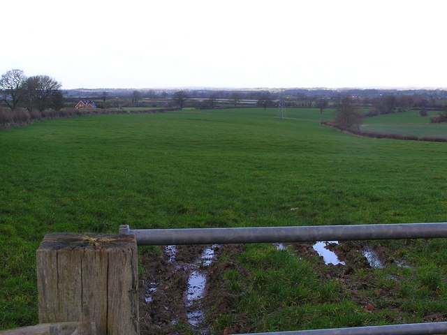
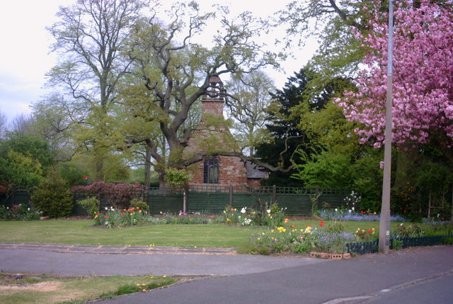
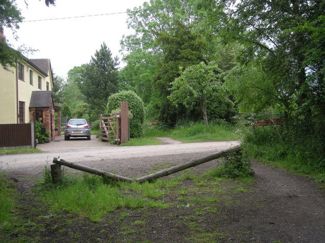
Western Downs is a charming village located in the county of Staffordshire in the United Kingdom. Situated in the heart of the country, it is nestled amidst picturesque landscapes and rolling hills, offering residents and visitors a tranquil environment to escape the hustle and bustle of urban life.

The village is known for its rich history and is home to several historic landmarks and buildings. One such notable attraction is the St. Mary's Church, a beautiful medieval church that dates back to the 13th century. Its stunning architecture and serene atmosphere make it a popular spot for both locals and tourists.

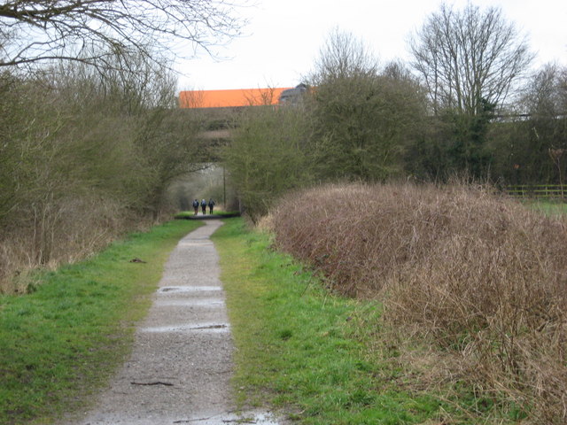
Western Downs is also a haven for nature enthusiasts, with its proximity to the stunning Peak District National Park. The park offers endless opportunities for outdoor activities such as hiking, cycling, and birdwatching, allowing visitors to immerse themselves in the area's natural beauty.

In terms of amenities, Western Downs boasts a range of facilities to cater to its residents' needs. The village has a well-stocked local convenience store, a primary school, and a community center that hosts various events and activities throughout the year.

The community in Western Downs is known for its warmth and friendliness, with residents taking pride in maintaining a close-knit and welcoming atmosphere. This sense of community is further fostered through regular events and gatherings, such as the annual village fete and Christmas market.

Overall, Western Downs offers a peaceful and idyllic setting for those seeking a slower pace of life, while still being well-connected to larger towns and cities in the area. Its rich history, natural beauty, and strong community spirit make it a truly special place to live or visit in Staffordshire.

If you have any feedback on the listing, please let us know in the comments section below.

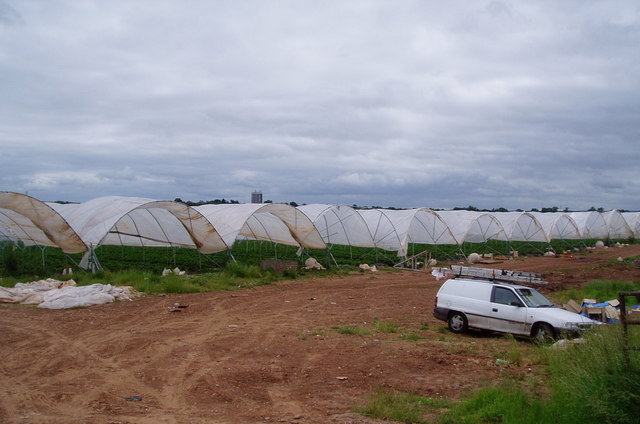
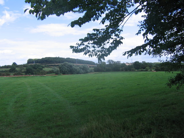
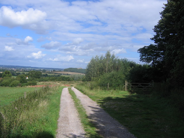
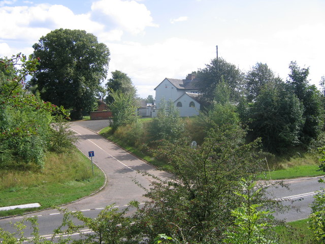
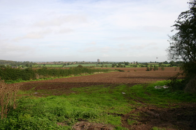
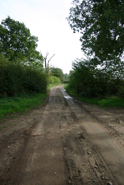
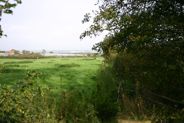
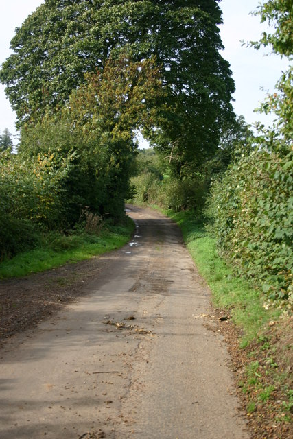
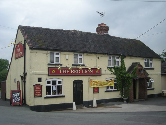
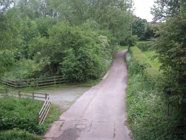
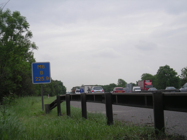
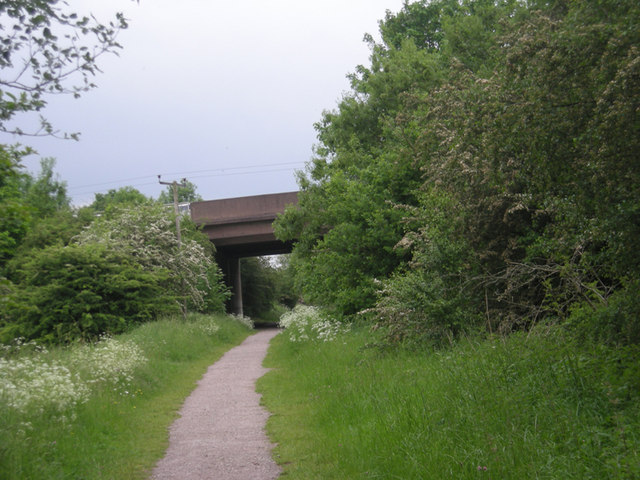
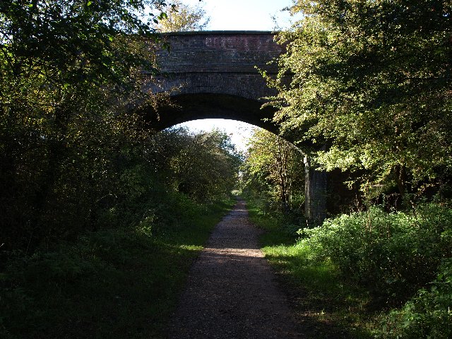
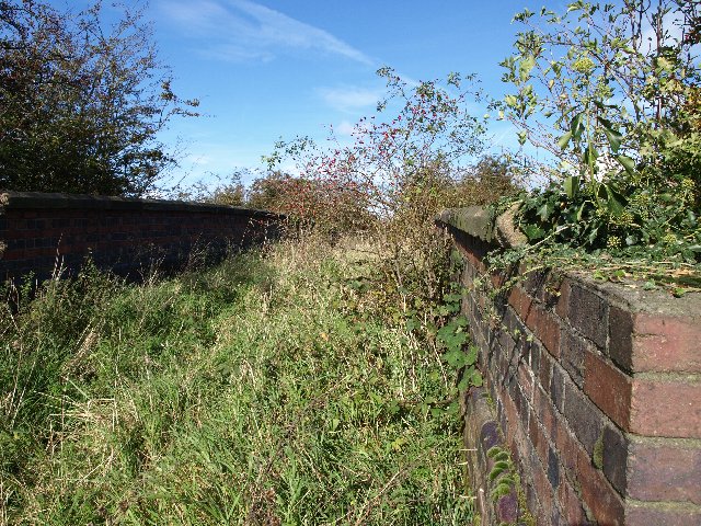
Western Downs Images

Images are sourced within 2km of 52.792741/-2.1463544 or Grid Reference SJ9021. Thanks to Geograph Open Source API. All images are credited.

Strawberry fields forever! Giant polytunnels housing strawberry plants, just ready for harvesting.
Strawberry fields forever!
Giant polytunnels housing strawberry plants, just ready for harvesting.
Grassy Field Looking across fields near Derrington, across the M6 ,which is this side of the pylon line to Stafford Castle, just poking above the trees.
Grassy Field
Looking across fields near Derrington, across the M6 ,which is this side of the pylon line to Stafford Castle, just poking above the trees.
Track at Bury Ring The earthworks of the iron age hill fort of Bury Ring is in the trees to the right, while a later generation of fort (but still very old), that of Stafford Castle, can be seen in the woods in the distance.
Track at Bury Ring
The earthworks of the iron age hill fort of Bury Ring is in the trees to the right, while a later generation of fort (but still very old), that of Stafford Castle, can be seen in the woods in the distance.
Billington Looking from the road to Bury Ring earthworks to Billington Farm across the A518
Billington
Looking from the road to Bury Ring earthworks to Billington Farm across the A518
Fields off Billington Bank, Stafford A view of fields from an unnamed lane off the brow of Billington bank near Stafford. On the horizon in the distance is 'The Keep', a block of flats on the Highfields Estate in Stafford. There used to be a second block but that was brought down and new housing built.
Fields off Billington Bank, Stafford
A view of fields from an unnamed lane off the brow of Billington bank near Stafford. On the horizon in the distance is 'The Keep', a block of flats on the Highfields Estate in Stafford. There used to be a second block but that was brought down and new housing built.
Unnamed Lane to Leese Farm At the end of this unnamed lane is a public footpath and Leese Farm which can just be seen (the two white features are the windows!).
Unnamed Lane to Leese Farm
At the end of this unnamed lane is a public footpath and Leese Farm which can just be seen (the two white features are the windows!).
A Field next to Billington Bank, Stafford This field is next to Billington Bank (A518) which is just beyond the distant hedge. Over the other side of the road are cold frames which produce strawberries for supermarkets.
A Field next to Billington Bank, Stafford
This field is next to Billington Bank (A518) which is just beyond the distant hedge. Over the other side of the road are cold frames which produce strawberries for supermarkets.
Un-named Lane off Billington Bank, Stafford This lane is leading to the A518, Billington Bank near Stafford.
Un-named Lane off Billington Bank, Stafford
This lane is leading to the A518, Billington Bank near Stafford.
Leese Farm from Thorneyfields Lane
St Matthews Church, Derrington A view of St Matthews Church, Derrington, from St Matthews Drive by the junction of Church Lane. (I was at work when I spied this view, which was so 'captivating' as I drove past that I had to stop, reverse my car, and take a picture - as well as soak up the view for a few minutes!).
St Matthews Church, Derrington
A view of St Matthews Church, Derrington, from St Matthews Drive by the junction of Church Lane. (I was at work when I spied this view, which was so 'captivating' as I drove past that I had to stop, reverse my car, and take a picture - as well as soak up the view for a few minutes!).
Way for the Millennium The WFTM route goes west under the M6. This part of the route, Stafford to Gnosall, is easy walking/riding along the route of an old railway. Nearer to Newport the route is not so well maintained.
Way for the Millennium
The WFTM route goes west under the M6. This part of the route, Stafford to Gnosall, is easy walking/riding along the route of an old railway. Nearer to Newport the route is not so well maintained.
The old level crossing
The Red Lion
The Red Lion
Viewed from a bridge
M6 south This was taken from behind a crash barrier & concrete parapet.
M6 south
This was taken from behind a crash barrier & concrete parapet.
M6 over the old railway line
Accommodation Bridge Stafford - Newport Railway
Accommodation Bridge, Stafford - Newport Railway Long abandoned? A bridge from nowhere to nowhere...
Accommodation Bridge, Stafford - Newport Railway
Long abandoned? A bridge from nowhere to nowhere...
Show me another place!

Western Downs is located at Grid Ref: SJ9021 (Lat: 52.792741, Lng: -2.1463544)

Administrative County: Staffordshire

District: Stafford

Police Authority: Staffordshire

What 3 Words

///elaborate.unless.zebra. Near Stafford, Staffordshire

Nearby Locations

Western Downs

Related Wikis

Stafford Castle

Stafford Castle is an ancient Grade II listed castle situated two miles west of the town of Stafford in Staffordshire, England. From the time of the Norman...

King Edward VI High School, Stafford

King Edward VI High School is a coeducational secondary school and sixth form located in the Highfields area of Stafford, England. The school's sixth form...

Stafford Rural District

Stafford Rural District was a rural district in the county of Staffordshire. It was created in 1894 and abolished in 1974 by virtue of the Local Government...

Aston, Stafford

Aston is a hamlet in the county of Staffordshire, England. Aston was recorded in the Domesday Book as Estone. == References ==

A518 road

The A518 is a road in the Midlands, United Kingdom. == Route == It runs from Uttoxeter, Staffordshire to Telford, Shropshire via Stafford and Newport....

Stafford Town F.C.

Stafford Town Football Club is an English football club based in Stafford. The club's senior men's team play in the North West Counties League Division...

Berry Ring

Berry Ring (also known as Bury Ring) is an Iron Age hillfort in Staffordshire, England, lying some two miles southwest of the county town of Stafford,...

Derrington

Derrington is a village west of the town of Stafford, in Staffordshire, England. For population details from the 2011 Census see under Seighford. Derrington...

Nearby Amenities

Located within 500m of 52.792741,-2.1463544
Traffic Signals
Traffic Signals: signal
Lat/Long: 52.7939766/-2.14701
Bus Stop
Carisbrooke Drive
Bus: yes
Naptan AtcoCode: 3800C712100
Naptan Bearing: SE
Naptan CommonName: Carisbrooke Drive
Naptan Indicator: Opp
Naptan Landmark: Carisbrooke Drive
Naptan PlusbusZoneRef: STAFFRD
Naptan Street: Sundown Drive
Naptan Verified: no
Public Transport: platform
Source: naptan_import
Lat/Long: 52.7904843/-2.1406543
Bus Stop
Oak Tree Close
Bus: yes
Naptan AtcoCode: 3800C712101
Naptan Bearing: NW
Naptan CommonName: Oak Tree Close
Naptan Indicator: Opp
Naptan Landmark: Oak Tree Close
Naptan Street: Sundown Drive
Naptan Verified: no
Public Transport: platform
Source: naptan_import
Lat/Long: 52.7904107/-2.1420183
Bus Stop
Thorneyfields Lane
Bus: yes
Naptan AtcoCode: 3800C726501
Naptan Bearing: NE
Naptan CommonName: Thorneyfields Lane
Naptan Indicator: Opp
Naptan Landmark: Thorneyfields Lane
Naptan NaptanCode: stadagaj
Naptan PlusbusZoneRef: STAFFRD
Naptan Street: Castle Bank
Naptan Verified: no
Public Transport: platform
Shelter: yes
Source: naptan_import
Lat/Long: 52.7955693/-2.1433402
Bus Stop
Thorneyfields Lane
Bus: yes
Naptan AtcoCode: 3800C726502
Naptan Bearing: SW
Naptan CommonName: Thorneyfields Lane
Naptan Indicator: Adj
Naptan Landmark: Thorneyfields Lane
Naptan NaptanCode: stadagam
Naptan PlusbusZoneRef: STAFFRD
Naptan Street: Castle Bank
Naptan Verified: no
Public Transport: platform
Source: naptan_import
Lat/Long: 52.7950827/-2.1442285
Bus Stop
Sundown Drive
Bus: yes
Naptan AtcoCode: 3800C726601
Naptan Bearing: SW
Naptan CommonName: Sundown Drive
Naptan Indicator: Opp
Naptan Landmark: Sundown Drive
Naptan NaptanCode: stadagap
Naptan Street: Castle Bank
Naptan Verified: no
Public Transport: platform
Source: naptan_import
Lat/Long: 52.7937757/-2.1471309
Bus Stop
Sundown Drive
Bus: yes
Naptan AtcoCode: 3800C726602
Naptan Bearing: NE
Naptan CommonName: Sundown Drive
Naptan Indicator: Opp
Naptan Landmark: Sundown Drive
Naptan NaptanCode: stadagat
Naptan Street: Castle Bank
Naptan Verified: no
Public Transport: platform
Source: naptan_import
Lat/Long: 52.7939553/-2.1472501
Bus Stop
Clarendon Drive
Bus: yes
Naptan AtcoCode: 3800C729201
Naptan Bearing: SW
Naptan CommonName: Clarendon Drive
Naptan Indicator: Opp
Naptan Landmark: Clarendon Dr
Naptan PlusbusZoneRef: STAFFRD
Naptan Street: Whittingham Dr
Naptan Verified: no
Public Transport: platform
Source: naptan_import
Lat/Long: 52.7931548/-2.140218
Bus Stop
Clarendon Drive
Bus: yes
Naptan AtcoCode: 3800C729202
Naptan Bearing: NE
Naptan CommonName: Clarendon Drive
Naptan Indicator: Adj
Naptan Landmark: Clarendon Dr
Naptan PlusbusZoneRef: STAFFRD
Naptan Street: Whittingham Drive
Naptan Verified: no
Public Transport: platform
Source: naptan_import
Lat/Long: 52.7931904/-2.1404999
Bus Stop
Orwell Drive
Bus: yes
Naptan AtcoCode: 3800C729301
Naptan Bearing: SW
Naptan CommonName: Orwell Drive
Naptan Indicator: Adj
Naptan Landmark: Orwell Drive
Naptan PlusbusZoneRef: STAFFRD
Naptan Street: Whittingham Drive
Naptan Verified: no
Public Transport: platform
Source: naptan_import
Lat/Long: 52.7924617/-2.1409572
Bus Stop
Orwell Drive
Bus: yes
Naptan AtcoCode: 3800C729302
Naptan Bearing: NE
Naptan CommonName: Orwell Drive
Naptan Indicator: Opp
Naptan Landmark: Orwell Dr
Naptan PlusbusZoneRef: STAFFRD
Naptan Street: Whittingham Drive
Naptan Verified: no
Public Transport: platform
Source: naptan_import
Lat/Long: 52.7922811/-2.1416092
Bus Stop
Kimberley Way
Bus: yes
Naptan AtcoCode: 3800C729401
Naptan Bearing: SW
Naptan CommonName: Kimberley Way
Naptan Indicator: Opp
Naptan Landmark: Kimberley Way
Naptan PlusbusZoneRef: STAFFRD
Naptan Street: Whittingham Dr
Naptan Verified: no
Public Transport: platform
Source: naptan_import
Lat/Long: 52.7918397/-2.1423789
Bus Stop
Keld Avenue
Bus: yes
Naptan AtcoCode: 3800C729402
Naptan Bearing: NE
Naptan CommonName: Keld Avenue
Naptan Indicator: Opp
Naptan Landmark: Keld Av
Naptan PlusbusZoneRef: STAFFRD
Naptan Street: Whittingham Drive
Naptan Verified: no
Public Transport: platform
Source: naptan_import
Lat/Long: 52.7914976/-2.1428078
Turning Circle
Lat/Long: 52.7911756/-2.1408378
Barrier: cycle_barrier
Lat/Long: 52.7934528/-2.1411537
Power: tower
Lat/Long: 52.7896601/-2.1495488
Power: tower
Lat/Long: 52.791627/-2.1498466
Power: tower
Lat/Long: 52.793556/-2.1522227
Power: tower
Lat/Long: 52.7950578/-2.1503796
Stafford Castle
Power: substation
Ref: 61433
Lat/Long: 52.7956042/-2.1433636
Barrier: cycle_barrier
Lat/Long: 52.7931379/-2.1432834
Barrier: cycle_barrier
Lat/Long: 52.7932808/-2.1423549
Barrier: cycle_barrier
Lat/Long: 52.7933163/-2.1421835
Traffic Signals
Traffic Signals: signal
Traffic Signals Direction: forward
Lat/Long: 52.7938708/-2.1466119
Post Box
Post Box Type: pillar
Ref: ST16 4
Royal Cypher: GVIR
Royal Cypher Wikidata: Q33102169
Lat/Long: 52.7954752/-2.1433933
Bench
Lat/Long: 52.7964223/-2.144989
Bench
Lat/Long: 52.7964651/-2.1450452
Entrance: main
Lat/Long: 52.7961586/-2.1450654
Generator Method: photovoltaic
Generator Orientation: 260
Generator Output Electricity: yes
Generator Place: roof
Generator Solar Modules: 3
Generator Source: solar
Generator Type: solar_photovoltaic_panel
Location: roof
Power: generator
Lat/Long: 52.7928104/-2.1427122
Generator Method: photovoltaic
Generator Orientation: 170
Generator Output Electricity: yes
Generator Place: roof
Generator Solar Modules: 8
Generator Source: solar
Generator Type: solar_photovoltaic_panel
Location: roof
Power: generator
Lat/Long: 52.7927893/-2.1426263
Waste Basket
Lat/Long: 52.7934734/-2.1408098
Playground: swing
Lat/Long: 52.7932597/-2.140783
Playground: swing
Lat/Long: 52.7933359/-2.1406462
Playground: springy
Lat/Long: 52.7934365/-2.1407119
Playground: roundabout
Lat/Long: 52.7933497/-2.1408715
Playground: structure
Lat/Long: 52.7933387/-2.1407602
Bench
Lat/Long: 52.7934056/-2.1408299
Speed Camera
Lat/Long: 52.7912882/-2.146986
Speed Camera
Lat/Long: 52.791494/-2.146882
Traffic Signals
Traffic Signals: signal
Lat/Long: 52.7940471/-2.1465534
Barrier: fence
Lat/Long: 52.7911322/-2.1394888
The data included in this document is from www.openstreetmap.org. The data is made available under ODbL.

Have you been to Western Downs?

Leave your review of Western Downs below (or comments, questions and feedback).