Vauxhall

Settlement in Shropshire

England

Vauxhall

United Reformed Church Benchmark Ordnance Survey Benchmark cut into United Reformed Church on Wellington Road, Newport, Shropshire. It was last verified by the OS in 1961
United Reformed Church Benchmark Credit: Anthony Rowley

Vauxhall is a small village located in the county of Shropshire, England. Situated approximately 6 miles north of the county town of Shrewsbury, Vauxhall is nestled within a picturesque rural landscape, surrounded by rolling hills and farmland.

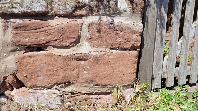
The village is known for its quaint and charming atmosphere, with traditional stone-built houses lining its streets. Vauxhall is home to a close-knit community of residents, who take pride in maintaining the village's historic character.

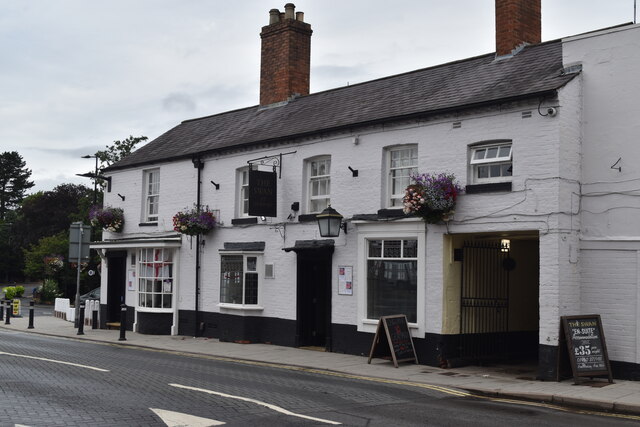
Despite its small size, Vauxhall offers a range of amenities to its residents. These include a local village hall, where various community events and gatherings take place, as well as a village pub that serves as a social hub for locals and visitors alike.

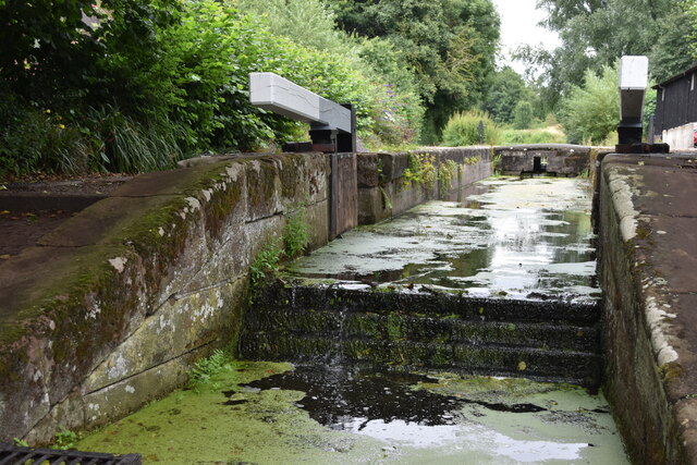
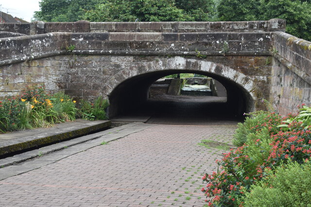
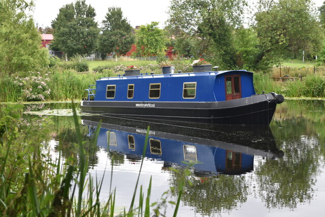
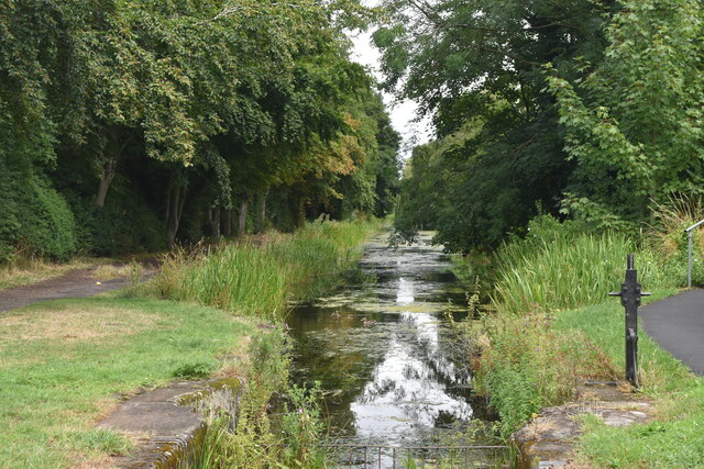
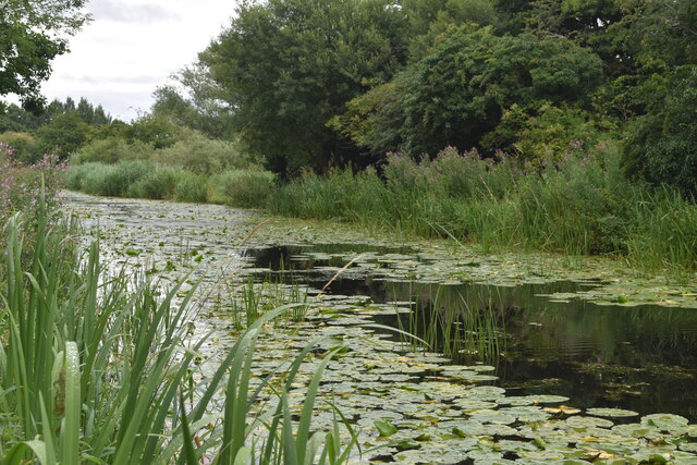
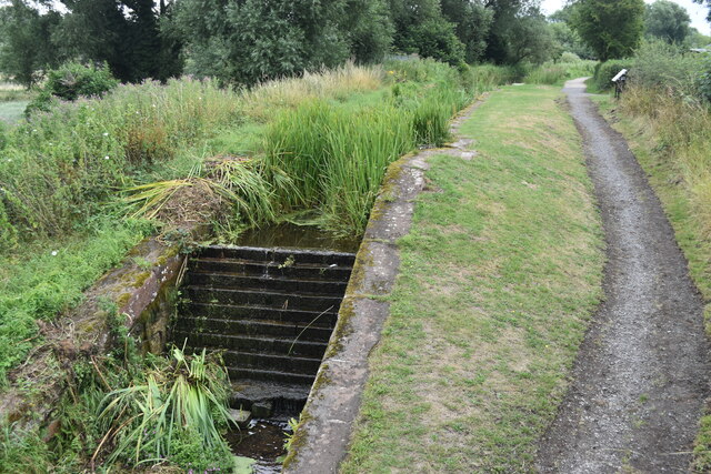
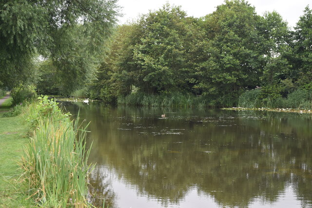
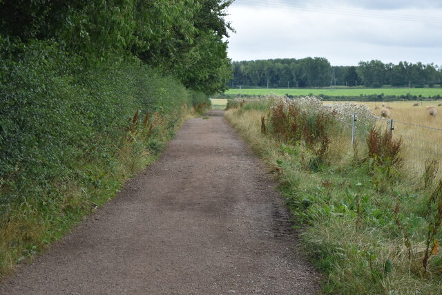
The surrounding countryside offers ample opportunities for outdoor activities, with numerous walking and cycling trails crisscrossing the area. Vauxhall is also within close proximity to the River Severn, providing opportunities for fishing and boating enthusiasts.

For those seeking a taste of history and culture, Vauxhall is conveniently located near several historical attractions. The nearby town of Shrewsbury is home to a wealth of medieval architecture, including Shrewsbury Castle and the famous Shrewsbury Abbey.

In summary, Vauxhall is a charming village in Shropshire, offering a peaceful rural lifestyle with easy access to both natural beauty and historical attractions.

If you have any feedback on the listing, please let us know in the comments section below.
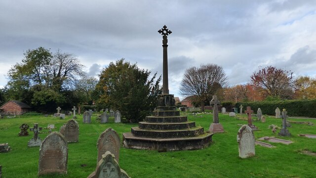
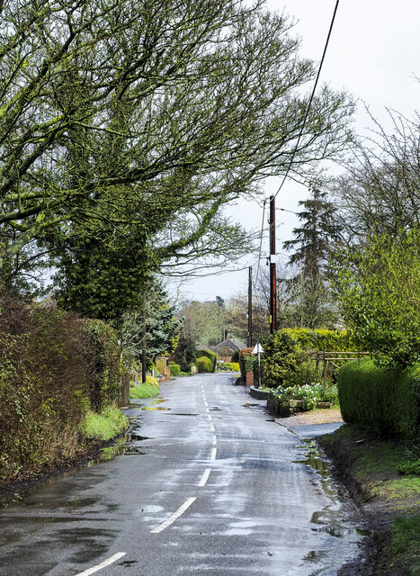
Vauxhall Images

Images are sourced within 2km of 52.765602/-2.3915984 or Grid Reference SJ7318. Thanks to Geograph Open Source API. All images are credited.

United Reformed Church Benchmark Ordnance Survey Benchmark cut into United Reformed Church on Wellington Road, Newport, Shropshire. It was last verified by the OS in 1961
United Reformed Church Benchmark
Ordnance Survey Benchmark cut into United Reformed Church on Wellington Road, Newport, Shropshire. It was last verified by the OS in 1961
Benchmark No.54 High Street, Newport The Ordnance Survey Benchmark cut into the wall of No.54 High Street, Newport, Shropshire. It is eroded and slightly obscured by masonry paint. It was last verified by the OS in 1961
Benchmark No.54 High Street, Newport
The Ordnance Survey Benchmark cut into the wall of No.54 High Street, Newport, Shropshire. It is eroded and slightly obscured by masonry paint. It was last verified by the OS in 1961
Salters Court School Benchmark The school is on Salter's Lane, Newport, Shropshire. The Benchmark is accessible from the roadside pavement. The Benchmark was last verified by the OS in 1961
Salters Court School Benchmark
The school is on Salter's Lane, Newport, Shropshire. The Benchmark is accessible from the roadside pavement. The Benchmark was last verified by the OS in 1961
Lion Inn, Edgmond The Ordnance Survey Datum Line Benchmark cut into the Lion Inn, Edgmond, Shropshire. The Crow's Foot arrow has been destroyed but the Datum Line remains. It has been exposed from under several coats of masonry paint during renovation of the pub.
Lion Inn, Edgmond
The Ordnance Survey Datum Line Benchmark cut into the Lion Inn, Edgmond, Shropshire. The Crow's Foot arrow has been destroyed but the Datum Line remains. It has been exposed from under several coats of masonry paint during renovation of the pub.
Sunnyside, High Street, Edgmond The OS Benchmark cut into sandstone garden wall of the Sunnyside property on High Street, Edgmond Shropshire. The OS historical maps indicate that it was cut into the wall before 1882
Sunnyside, High Street, Edgmond
The OS Benchmark cut into sandstone garden wall of the Sunnyside property on High Street, Edgmond Shropshire. The OS historical maps indicate that it was cut into the wall before 1882
Former lock by Town Bridge, Newport
Town Bridge, Newport At this point the former Shrewsbury and Newport Canal has been reduced to a narrow ornamental channel.
Town Bridge, Newport
At this point the former Shrewsbury and Newport Canal has been reduced to a narrow ornamental channel.
Nowhere to go Narrowboat in former Newport Canal Basin, on an isolated section of the former Shrewsbury and Newport Canal.
Nowhere to go
Narrowboat in former Newport Canal Basin, on an isolated section of the former Shrewsbury and Newport Canal.
The Swan at Newport
The Swan at Newport
Former Fisher's Lock, Shrewsbury and Newport Canal
Lily pads on the former Shrewsbury and Newport Canal
Former Tickethouse Lock
Former Edgmond Basin, Shrewsbury and Newport Canal
Footpath on track south of Edgmond
The Last Inn Benchmark The Ordnance Survey Datum Line Benchmark cut into the Last Inn public house on the Wellington Road, Church Aston, Telford. Only the Datum Line is still present, there is no indication of the usual broad arrow. The Benchmark was cot in 1925.
The Last Inn Benchmark
The Ordnance Survey Datum Line Benchmark cut into the Last Inn public house on the Wellington Road, Church Aston, Telford. Only the Datum Line is still present, there is no indication of the usual broad arrow. The Benchmark was cot in 1925.
Church of St Peter, Edgmond <span class="nowrap"><a title="https://historicengland.org.uk/listing/the-list/list-entry/1054183?section=official-list-entry" rel="nofollow ugc noopener" href="https://historicengland.org.uk/listing/the-list/list-entry/1054183?section=official-list-entry">Link</a><img style="margin-left:2px;" alt="External link" title="External link - shift click to open in new window" src="https://s1.geograph.org.uk/img/external.png" width="10" height="10"/></span>
Church of St Peter, Edgmond
Churchyard Cross, Edgmond
Newport Road, Edgmond Newport Road at a bend heading out of Edgmond towards Newport.
Newport Road, Edgmond
Newport Road at a bend heading out of Edgmond towards Newport.
Show me another place!

Vauxhall is located at Grid Ref: SJ7318 (Lat: 52.765602, Lng: -2.3915984)

Unitary Authority: Telford and Wrekin

Police Authority: West Merica

What 3 Words

///replaying.splendid.browsers. Near Newport, Shropshire

Nearby Locations

Pool Covert Vauxhall

Related Wikis

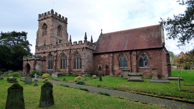
St Peter and Paul Church, Newport

St. Peter and St. Paul Roman Catholic Church is a parish of the Roman Catholic Church in Newport, Shropshire, England. The parish covers Newport and the...

Newport Girls' High School

Newport Girls' High School is an all-girls grammar school with academy status in Newport, Shropshire, England. The school was opened in the 1919 by a...

Haberdashers' Adams

Haberdashers' Adams Grammar School is a selective grammar school for high-achieving boys aged 11-18 and girls aged 16-18 with state boarding for boys only...

Castle House School

Haberdashers' Castle House School is an independent preparatory day school for boys and girls, first established in 1944, at Chetwynd End, Newport, Shropshire...

Related Videos

Walking The Stafford To Newport Greenway (3) Gnosall To Newport

The third and final part of my walk along the Stafford to Newport Greenway. Continuing from the A518 at the village of Gnosall and ...

Условия проживания на работе в Великобритании

В данном видео показываю, какие условия нам предоставил работодатель, сколько это стоит, некоторые важные моменты ...

Не уезжайте работать в Великобританию, посмотрите, как тут живут обычные рабочие: плюсы и минусы

Показываю наши домики на колёсах. Нас четверо ребят с Урала поселили в таком. Показываю, как мы живём. На какие ...

Обучение работе на ферме в Великобритании

Кратко рассказываю, чему нас научили на первоначальном обучении на ферме в Великобритании. Подписывали кучу ...

Nearby Amenities

Located within 500m of 52.765602,-2.3915984
Bus Stop
Bus: yes
Public Transport: platform
Lat/Long: 52.7634258/-2.3870729
Bus Stop
Bus: yes
Public Transport: platform
Lat/Long: 52.7634761/-2.386688
Bus Stop
Bus: yes
Public Transport: platform
Lat/Long: 52.7664268/-2.3897589
Bus Stop
Bus: yes
Public Transport: platform
Lat/Long: 52.7660495/-2.3903058
Turning Circle
Turning Circle: hammer
Lat/Long: 52.7653943/-2.3857397
Turning Circle
Turning Circle: knuckle
Lat/Long: 52.7656744/-2.385434
Generator Method: photovoltaic
Generator Output Electricity: yes
Generator Source: solar
Generator Type: solar_photovoltaic_panel
Location: roof
Power: generator
Lat/Long: 52.7625671/-2.3870292
Generator Method: photovoltaic
Generator Output Electricity: yes
Generator Source: solar
Generator Type: solar_photovoltaic_panel
Location: roof
Power: generator
Lat/Long: 52.7640116/-2.3868817
Generator Method: photovoltaic
Generator Output Electricity: yes
Generator Source: solar
Generator Type: solar_photovoltaic_panel
Location: roof
Power: generator
Lat/Long: 52.7639564/-2.3867583
Generator Method: photovoltaic
Generator Output Electricity: yes
Generator Source: solar
Generator Type: solar_photovoltaic_panel
Location: roof
Power: generator
Lat/Long: 52.7653571/-2.3866671
Generator Method: photovoltaic
Generator Output Electricity: yes
Generator Source: solar
Generator Type: solar_photovoltaic_panel
Location: roof
Power: generator
Lat/Long: 52.7653636/-2.3875576
Generator Method: photovoltaic
Generator Output Electricity: yes
Generator Source: solar
Generator Type: solar_photovoltaic_panel
Location: roof
Power: generator
Lat/Long: 52.7661101/-2.3863748
Generator Method: photovoltaic
Generator Output Electricity: yes
Generator Source: solar
Generator Type: solar_photovoltaic_panel
Location: roof
Power: generator
Lat/Long: 52.7665662/-2.3857659
Generator Method: photovoltaic
Generator Output Electricity: yes
Generator Source: solar
Generator Type: solar_photovoltaic_panel
Location: roof
Power: generator
Lat/Long: 52.7664623/-2.3859081
Generator Method: photovoltaic
Generator Output Electricity: yes
Generator Source: solar
Generator Type: solar_photovoltaic_panel
Location: roof
Power: generator
Lat/Long: 52.7662594/-2.3861602
Generator Method: photovoltaic
Generator Output Electricity: yes
Generator Source: solar
Generator Type: solar_photovoltaic_panel
Location: roof
Power: generator
Lat/Long: 52.7679894/-2.3896042
Generator Method: photovoltaic
Generator Output Electricity: yes
Generator Source: solar
Generator Type: solar_photovoltaic_panel
Location: roof
Power: generator
Lat/Long: 52.7693558/-2.3874986
Generator Method: photovoltaic
Generator Output Electricity: yes
Generator Source: solar
Generator Type: solar_photovoltaic_panel
Location: roof
Power: generator
Lat/Long: 52.7686832/-2.3886251
Power: tower
Lat/Long: 52.7647153/-2.3949764
Power: pole
Lat/Long: 52.764665/-2.3964972
Power: pole
Lat/Long: 52.7643583/-2.3963255
Power: pole
Lat/Long: 52.7650659/-2.3951749
Power: pole
Lat/Long: 52.7651081/-2.3950166
Power: pole
Lat/Long: 52.765642/-2.3955182
Power: pole
Lat/Long: 52.765655/-2.3942602
Power: pole
Lat/Long: 52.7662798/-2.3958964
Power: pole
Lat/Long: 52.7668381/-2.3973287
Power: pole
Lat/Long: 52.7662039/-2.3934576
Power: pole
Lat/Long: 52.7666812/-2.3928043
Power: pole
Lat/Long: 52.7671502/-2.3921257
Power: pole
Lat/Long: 52.7677913/-2.3912165
Power: pole
Lat/Long: 52.7685086/-2.3902026
Power: pole
Lat/Long: 52.7688055/-2.3897868
Power: pole
Lat/Long: 52.7688266/-2.3897547
Power: pole
Lat/Long: 52.7645054/-2.3979536
Power: pole
Lat/Long: 52.7641335/-2.39781
Power: pole
Lat/Long: 52.7648329/-2.3951188
Noexit: yes
Lat/Long: 52.7656538/-2.3856639
Turning Circle
Turning Circle: hammer
Lat/Long: 52.7683072/-2.3873284
The data included in this document is from www.openstreetmap.org. The data is made available under ODbL.

Have you been to Vauxhall?

Leave your review of Vauxhall below (or comments, questions and feedback).