Urgha

Settlement in Inverness-shire

Scotland

Urgha

Dam and footbridge. Lochannan Lacasdail The wooden footbridge almost certainly replaces a former stone bridge which carried the road. There is now a modern road bridge out of shot on the right.
Dam and footbridge. Lochannan Lacasdail Credit: Richard Dorrell

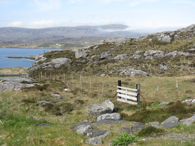
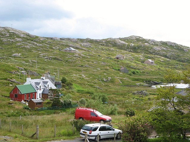
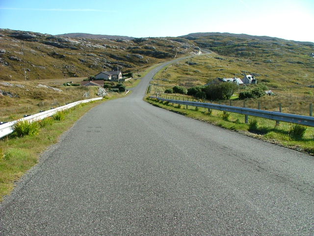
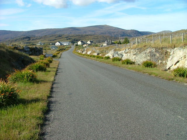
Urgha is a small village located in Inverness-shire, Scotland. Situated on the Isle of Harris, it is part of the Outer Hebrides, a picturesque archipelago known for its stunning landscapes and rich cultural heritage. With a population of approximately 100 residents, Urgha offers a close-knit community and a tranquil atmosphere.

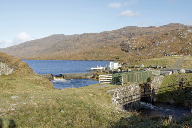
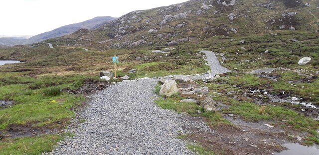
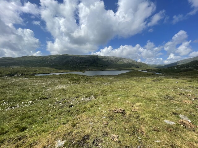
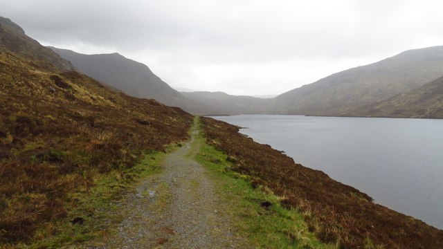
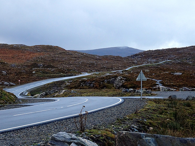
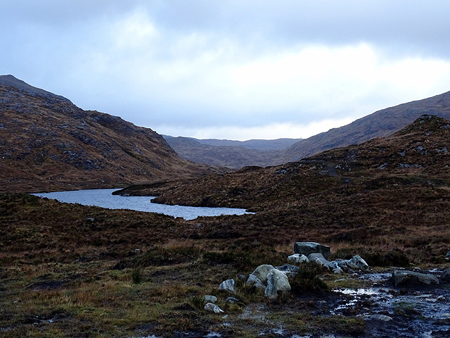
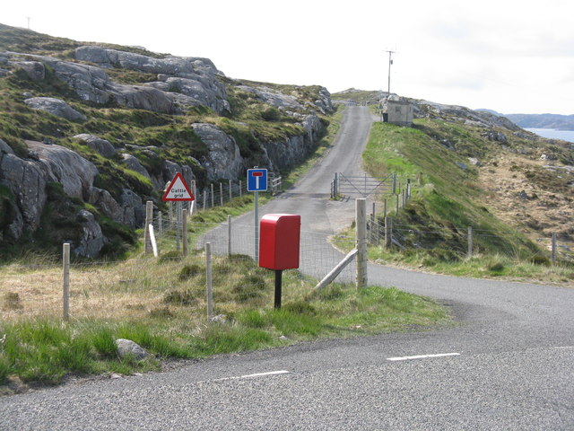
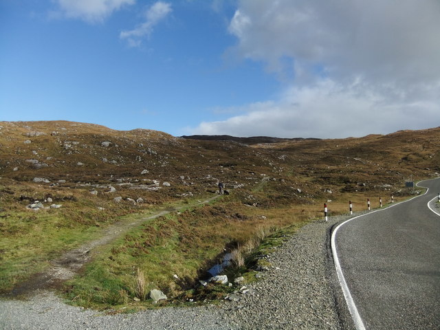
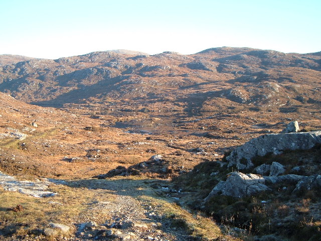
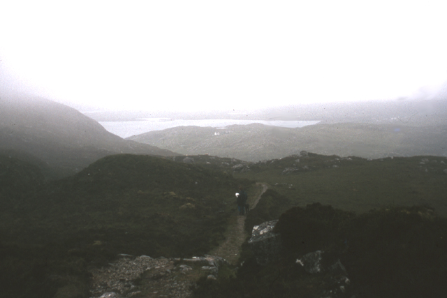
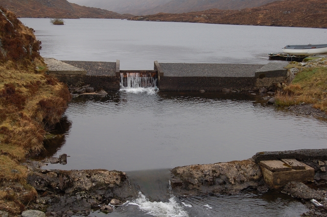
The village is surrounded by breathtaking natural beauty, characterized by rolling hills, rocky cliffs, and pristine beaches. It is an ideal destination for outdoor enthusiasts, offering opportunities for hiking, birdwatching, and fishing. The nearby Loch Urgha is a popular spot for anglers seeking trout and salmon.

Urgha is also known for its historical significance. The village is home to a number of ancient archaeological sites, including standing stones and chambered cairns, providing a glimpse into the area's captivating past. The nearby ruins of St. Clement's Church, dating back to the 16th century, add to the village's historical charm.

Despite its small size, Urgha boasts a vibrant community spirit. The village has a community center that serves as a hub for social gatherings and events. The locals take great pride in preserving their Gaelic heritage, and traditional music and dance are often celebrated.

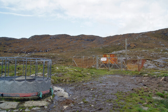
Facilities in Urgha are limited, with a small shop catering to basic needs. However, visitors can find a wider range of amenities in the nearby town of Tarbert, just a short drive away.

In conclusion, Urgha is a secluded and picturesque village nestled in the heart of the Outer Hebrides. Its stunning natural surroundings, rich historical heritage, and strong community spirit make it an idyllic destination for those seeking a peaceful and authentic Scottish experience.

If you have any feedback on the listing, please let us know in the comments section below.

Urgha Images

Images are sourced within 2km of 57.900874/-6.7699584 or Grid Reference NB1700. Thanks to Geograph Open Source API. All images are credited.

Dam and footbridge. Lochannan Lacasdail The wooden footbridge almost certainly replaces a former stone bridge which carried the road. There is now a modern road bridge out of shot on the right.
Dam and footbridge. Lochannan Lacasdail
The wooden footbridge almost certainly replaces a former stone bridge which carried the road. There is now a modern road bridge out of shot on the right.
Explosives store The sign on the fence reads 'Explosives Store', though the rickety looking building within looks like it has seen better days, so I doubt any explosives are stored there now, and I have to wonder why they were ever there is the first place.
Explosives store
The sign on the fence reads 'Explosives Store', though the rickety looking building within looks like it has seen better days, so I doubt any explosives are stored there now, and I have to wonder why they were ever there is the first place.
Path around Lochanan Lacasdail This path looks brand new.
Path around Lochanan Lacasdail
This path looks brand new.
Harris Landscape Geocaching is a type of global treasure hunt of people looking for caches, or hidden stashes of objects. Geocaching may also be described as a series of hide-and-seek games, where hiders provide online clues for seekers. Seekers use global positioning system (GPS) devices to find hidden caches
Harris Landscape
Geocaching is a type of global treasure hunt of people looking for caches, or hidden stashes of objects. Geocaching may also be described as a series of hide-and-seek games, where hiders provide online clues for seekers. Seekers use global positioning system (GPS) devices to find hidden caches
A wet afternoon looking north along Hebridean Way beside Lochannan Lacasdail
Bends in the road On the road from Scalpay to Tarbert.
Bends in the road
On the road from Scalpay to Tarbert.
Lochanan Lacasdail A seiries of lochs which extend a lot further than suggested by this image.
Lochanan Lacasdail
A seiries of lochs which extend a lot further than suggested by this image.
Post box at Urgha Beag At the turn off from the Scalpay road to Urgha Beag. Looking out to Bàgh Urgha Beag.
Post box at Urgha Beag
At the turn off from the Scalpay road to Urgha Beag. Looking out to Bàgh Urgha Beag.
Rocky hillside at Urgha Beag Looking out over Bàgh Urgha Beag.
Rocky hillside at Urgha Beag
Looking out over Bàgh Urgha Beag.
Urgha road end With post box, road signs and cattle grid.
Urgha road end
With post box, road signs and cattle grid.
Path to Reinigeadal
Path to Reinigeadal
View North East over Glen Lacasdail Picture taken on a frosty morning from the bottom of the footpath that leads up Gleann Lacasdail (where it intersects the main road to Scalpay). The lake is very still, showing the reflections of the hillside.
View North East over Glen Lacasdail
Picture taken on a frosty morning from the bottom of the footpath that leads up Gleann Lacasdail (where it intersects the main road to Scalpay). The lake is very still, showing the reflections of the hillside.
Old path to Reinigeadal, Harris Old path to Reinigeadal, Harris, looking back towards Tarbert. This path was the only route to the community of Reinigeadal until a road was built approaching it from the north.
Old path to Reinigeadal, Harris
Old path to Reinigeadal, Harris, looking back towards Tarbert. This path was the only route to the community of Reinigeadal until a road was built approaching it from the north.
Dam on Loch Lacasdail A small dam at the south of the loch.
Dam on Loch Lacasdail
A small dam at the south of the loch.
Car ramp near Urgha Beag Several of these outdoor concrete car ramps are to be found in seemingly unlikely roadside locations in Harris.  They were apparently built as part of a Job Creation scheme in the late 20th century, and are available for public use.  The example in the photo is situated on the minor road from Tarbert to Scalpay, near its junction with the road to Urgha.
Car ramp near Urgha Beag
Several of these outdoor concrete car ramps are to be found in seemingly unlikely roadside locations in Harris. They were apparently built as part of a Job Creation scheme in the late 20th century, and are available for public use. The example in the photo is situated on the minor road from Tarbert to Scalpay, near its junction with the road to Urgha.
Urgha Beag Urgha Beag consists of a handful of crofts on the minor road running between Tarbert and the island of Scalpay.
Urgha Beag
Urgha Beag consists of a handful of crofts on the minor road running between Tarbert and the island of Scalpay.
Houses at Oban A small settlement on the Tarbert to Scalpay road.
Houses at Oban
A small settlement on the Tarbert to Scalpay road.
Looking Towards Tarbert On the Scalpay to Tarbert road.
Looking Towards Tarbert
On the Scalpay to Tarbert road.
Show me another place!

Urgha is located at Grid Ref: NB1700 (Lat: 57.900874, Lng: -6.7699584)

Unitary Authority: Na h-Eileanan an Iar

Police Authority: Highlands and Islands

What 3 Words

///places.lessening.playing. Near Tarbert, Na h-Eileanan Siar

Related Wikis

Harris distillery

Harris distillery is a Scotch whisky and Gin distillery in Tarbert on the Isle of Harris, Scotland. The distillery was the first legal distillery ever...

Tarbert, Harris

Tarbert (Scottish Gaelic: An Tairbeart [ən̪ˠ ˈt̪ɛrʲɛbərˠʃt̪]) is the main community on Harris in the Western Isles of Scotland. The name means "isthmus...

Sgeotasaigh

Scotasay (Scottish Gaelic: Sgeotasaigh) is small island in the Outer Hebrides of Scotland. It lies 1 kilometre (0.6 miles) off the east coast of Harris...

Harris, Outer Hebrides

Harris (Scottish Gaelic: Na Hearadh, pronounced [nə ˈhɛɾəɣ] ) is the southern and more mountainous part of Lewis and Harris, the largest island in the...

East Loch Tarbert

East Loch Tarbert (Scottish Gaelic: Loch an Tairbeairt) is a sea loch that lies to the east of Harris in the Outer Hebrides of Scotland. The loch contains...

Ardhasaig

Ardhasaig (Scottish Gaelic: Àird Àsaig) is a settlement on the western coast of north Harris, in the Outer Hebrides, Scotland. Ardhasaig is also within...

Rèinigeadal

Rèinigeadal (or Rhenigidale) is a small settlement in Harris, in the Western Isles in Scotland. It is situated on the east coast of Harris 8 kilometres...

Bun Abhainn Eadarra

Bun Abhainn Eadarra or Bunavoneadar is a hamlet adjacent to the Loch Bun Abhainn Eadarra, on the south shore of North Harris, in the Outer Hebrides, Scotland...

Nearby Amenities

Located within 500m of 57.900874,-6.7699584
Passing Place
Lat/Long: 57.9010953/-6.7695985
Bus Stop
Urgha
Bus: yes
Naptan AtcoCode: 6010731874
Naptan Bearing: N
Naptan CommonName: Urgha
Naptan Indicator: Turn
Naptan Landmark: Turn
Naptan NaptanCode: 94723679
Naptan Street: Turn
Naptan Verified: no
Public Transport: platform
Source: naptan_import
Lat/Long: 57.9007807/-6.7701138
Bus Stop
Urgha
Naptan AtcoCode: 6010731885
Naptan Bearing: SE
Naptan CommonName: Urgha
Naptan Indicator: Village
Naptan Landmark: Village
Naptan NaptanCode: 94724362
Naptan Street: Village
Naptan Verified: no
Source: naptan_import
Lat/Long: 57.9004538/-6.7781943
Barrier: cattle_grid
Source: survey
Lat/Long: 57.9004455/-6.7696403
Barrier: cattle_grid
Source: survey
Lat/Long: 57.9017218/-6.7688802
Passing Place
Lat/Long: 57.9021242/-6.7682642
Passing Place
Lat/Long: 57.9030959/-6.7669583
Post Box
Collection Times: Mo-Fr 09:45; Sa 09:45
Operator: Royal Mail
Post Box Type: lamp
Ref: HS3 109
Royal Cypher: scottish_crown
Source: survey
Lat/Long: 57.9008484/-6.7697945
Urgha Beag
Place: hamlet
Lat/Long: 57.9012313/-6.7779318
Bagh Urgha Beag
Natural: bay
Lat/Long: 57.897824/-6.7753071
Barrier: cattle_grid
Lat/Long: 57.9015472/-6.7759749
Barrier: cattle_grid
Lat/Long: 57.9013298/-6.7753072
Passing Place
Lat/Long: 57.898354/-6.7659004
Passing Place
Lat/Long: 57.9029585/-6.7634315
Material: wood
Power: pole
Lat/Long: 57.8987254/-6.7651021
Material: wood
Power: pole
Lat/Long: 57.8983876/-6.7629403
Material: wood
Power: pole
Lat/Long: 57.8985458/-6.7639541
Material: wood
Power: pole
Lat/Long: 57.8990504/-6.7671594
Material: wood
Power: pole
Lat/Long: 57.8989079/-6.7662555
Material: wood
Power: pole
Lat/Long: 57.89925/-6.7683208
Power: pole
Lat/Long: 57.8974525/-6.7645281
Power: pole
Lat/Long: 57.8972785/-6.7652656
Power: pole
Lat/Long: 57.8983994/-6.7710769
Power: pole
Lat/Long: 57.8988002/-6.7716403
Power: pole
Lat/Long: 57.8991961/-6.7722186
Power: pole
Lat/Long: 57.8994376/-6.7725674
Power: pole
Lat/Long: 57.900145/-6.7736629
Power: pole
Lat/Long: 57.900538/-6.7743453
Power: pole
Lat/Long: 57.9009365/-6.7750249
Power: pole
Lat/Long: 57.9011483/-6.7745845
Power: pole
Lat/Long: 57.900946/-6.7735162
Power: pole
Lat/Long: 57.9004681/-6.7722654
Power: pole
Lat/Long: 57.8998993/-6.7708038
Power: pole
Lat/Long: 57.8994795/-6.7695768
Power: pole
Lat/Long: 57.9011554/-6.7766459
Power: pole
Lat/Long: 57.9015709/-6.7756017
Power: pole
Lat/Long: 57.9019443/-6.7761335
Power: pole
Lat/Long: 57.9018148/-6.7777276
Power: pole
Lat/Long: 57.9005126/-6.7765397
Power: pole
Lat/Long: 57.9002896/-6.7772988
Passing Place
Lat/Long: 57.8995727/-6.7694977
Power: pole
Lat/Long: 57.8997741/-6.7730392
Passing Place
Lat/Long: 57.9029754/-6.7655262
Barrier: cattle_grid
Lat/Long: 57.8975752/-6.7665104
Passing Place
Lat/Long: 57.8983346/-6.7674831
Passing Place
Lat/Long: 57.8984347/-6.7686817
The data included in this document is from www.openstreetmap.org. The data is made available under ODbL.

Have you been to Urgha?

Leave your review of Urgha below (or comments, questions and feedback).