University

Settlement in Lancashire

England

University

Metrolink tram in Piccadilly Gardens – 1992 The sign on the right shows the original logo and branding. The tram is heading towards Piccadilly Station.
Metrolink tram in Piccadilly Gardens – 1992 Credit: Alan Murray-Rust

University of Lancashire is a public research university located in Preston, Lancashire, England. Established in 1828 as the Institution for the Diffusion of Knowledge, it received its university status in 1992. The university has multiple campuses, with the main campus situated in the city center of Preston.

The University of Lancashire offers a wide range of undergraduate and postgraduate programs across various disciplines, including arts, sciences, business, engineering, and health sciences. It is known for its strong emphasis on research and has been consistently ranked highly in national and international league tables.

The university boasts state-of-the-art facilities, including modern lecture theaters, laboratories, and research centers. It has invested significantly in recent years to provide students with a vibrant and innovative learning environment. The campus also offers a range of amenities, including libraries, sports facilities, accommodation options, and social spaces.

Lancashire is a culturally diverse institution, attracting a diverse student body from around the world. With a reputation for academic excellence, it aims to provide a supportive and inclusive environment for all its students. The university also has a strong focus on employability, offering career guidance, internships, and work placement opportunities to enhance students' prospects upon graduation.

Overall, University of Lancashire is a leading educational institution that combines academic rigor with a supportive and inclusive environment. It continues to strive for excellence in teaching, research, and student experience, making it an attractive choice for students seeking a quality education in the heart of Lancashire.

If you have any feedback on the listing, please let us know in the comments section below.
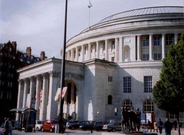
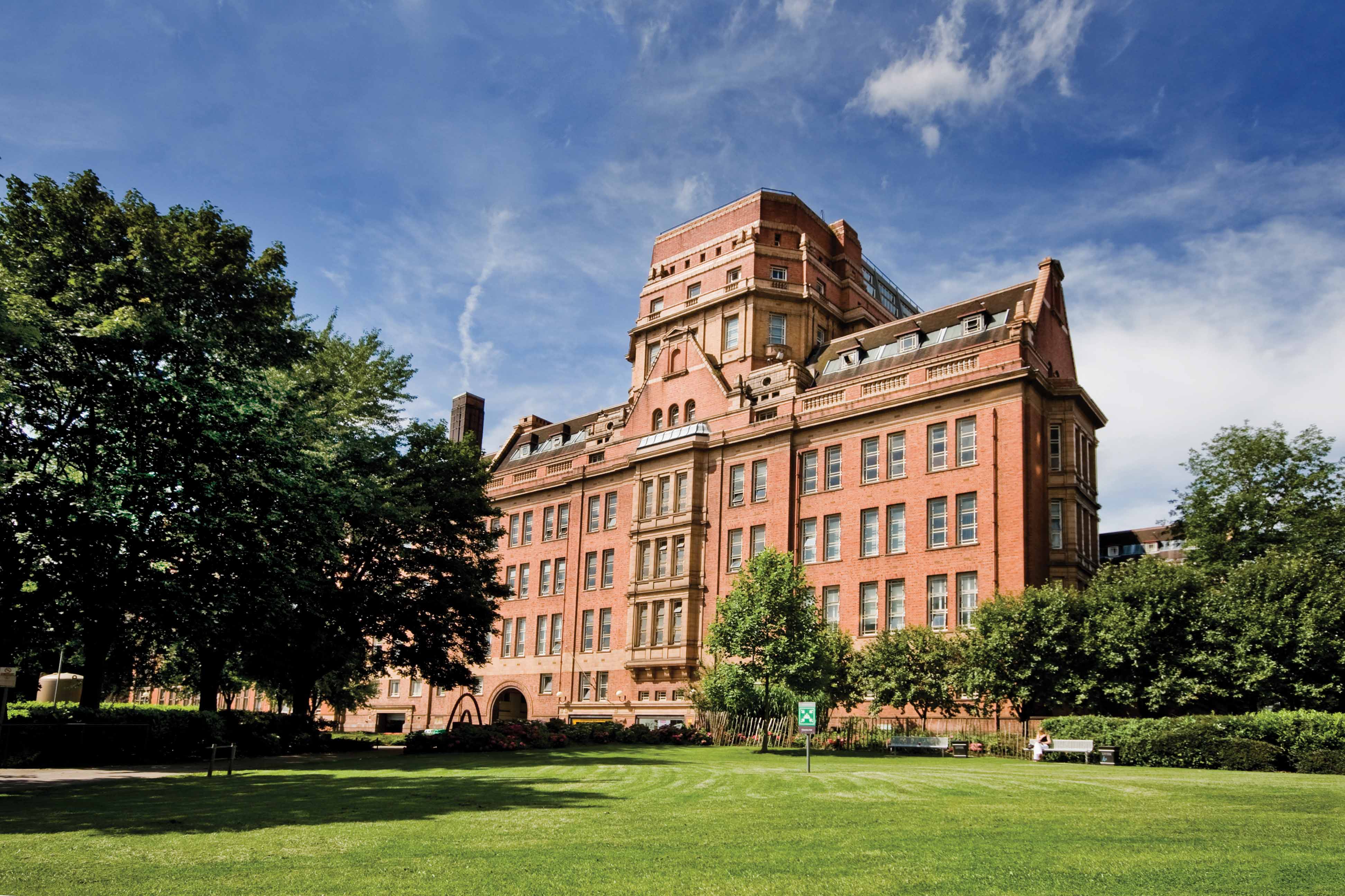
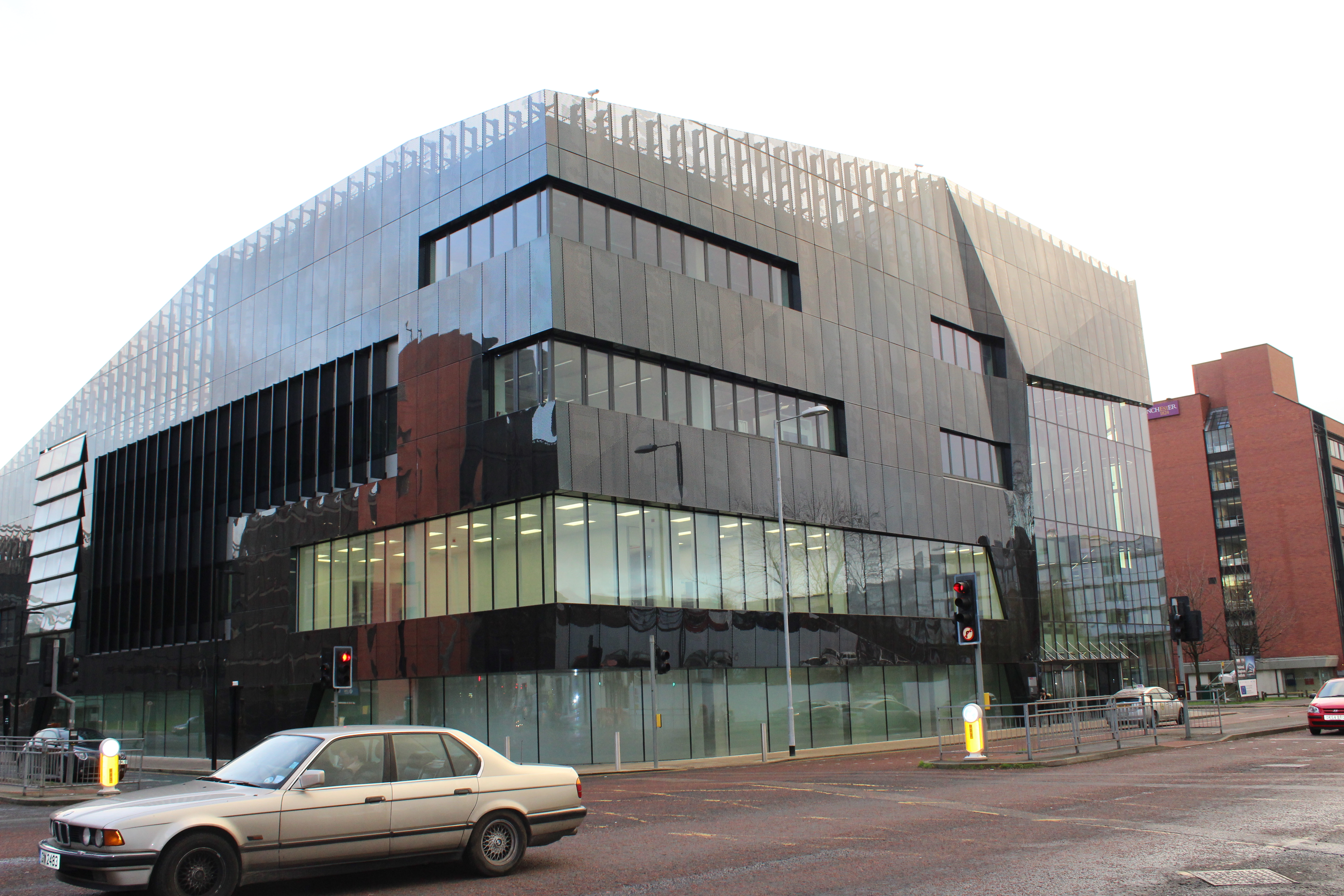
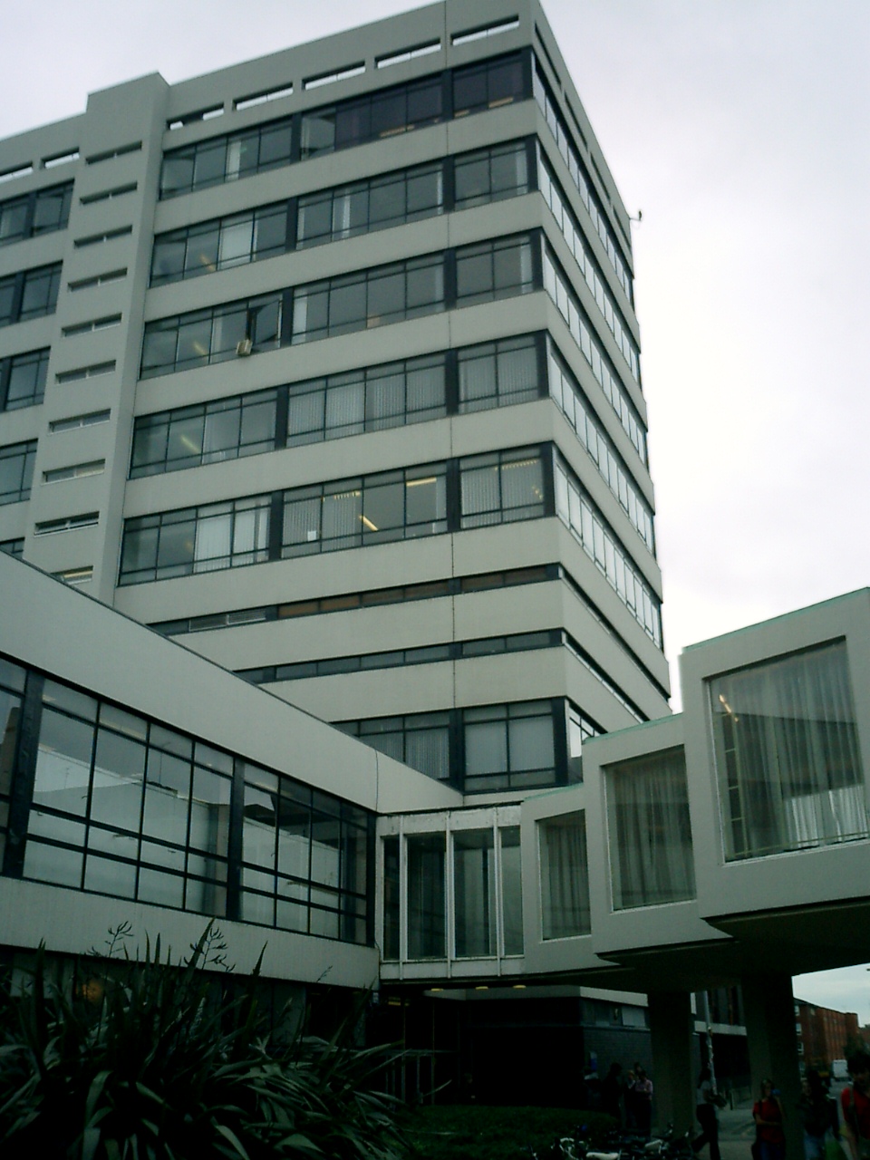
University Images

Images are sourced within 2km of 53.468416/-2.2355763 or Grid Reference SJ8496. Thanks to Geograph Open Source API. All images are credited.

Metrolink tram in Piccadilly Gardens – 1992 The sign on the right shows the original logo and branding. The tram is heading towards Piccadilly Station.
Metrolink tram in Piccadilly Gardens – 1992
The sign on the right shows the original logo and branding. The tram is heading towards Piccadilly Station.
Metrolink tram at Shudehill – 1992 Taken from the vantage point of the Arndale Centre multi-storey car park. The green space upper left is now occupied by Shudehill Interchange bus station.
Metrolink tram at Shudehill – 1992
Taken from the vantage point of the Arndale Centre multi-storey car park. The green space upper left is now occupied by Shudehill Interchange bus station.
Metrolink trams 1015 and 1004 passing in High Street – 1992 Taken from the vantage point of the Arndale Centre multi-storey car park. Both the Midland Bank and Debenhams have since disappeared from the scene.
Metrolink trams 1015 and 1004 passing in High Street – 1992
Taken from the vantage point of the Arndale Centre multi-storey car park. Both the Midland Bank and Debenhams have since disappeared from the scene.
Corporation St, Manchester For a few months in 2004/5, Manchester was home to a "big wheel". This picture, taken from one of the gondolas of the wheel, shows the upper levels of the Urbis Museum (ski-jump type structure) and the Printworks shopping/entertainment complex. The Printworks was for many years a major headquarters for printing national newspapers.
Corporation St, Manchester
For a few months in 2004/5, Manchester was home to a "big wheel". This picture, taken from one of the gondolas of the wheel, shows the upper levels of the Urbis Museum (ski-jump type structure) and the Printworks shopping/entertainment complex. The Printworks was for many years a major headquarters for printing national newspapers.
Under Manchester streets Approaching lock 85 on the Rochdale Canal via the towpath. This part of the Rochdale Canal lies beneath Piccadilly, Manchester, a busy city street. Thousands walk above here daily, never realising what lies below. At this point a high rise office block has also been built over the canal.
Under Manchester streets
Approaching lock 85 on the Rochdale Canal via the towpath. This part of the Rochdale Canal lies beneath Piccadilly, Manchester, a busy city street. Thousands walk above here daily, never realising what lies below. At this point a high rise office block has also been built over the canal.
Piccadilly Village, Manchester Here, on the banks of the Ashton Canal, is an interesting development incorporating both the old and the new. Many examples of industrial, canalside apparatus have been retained, along with the branches and basins that served the original warehouses and factories.
Piccadilly Village, Manchester
Here, on the banks of the Ashton Canal, is an interesting development incorporating both the old and the new. Many examples of industrial, canalside apparatus have been retained, along with the branches and basins that served the original warehouses and factories.
Welcome to Trafford - Nr Man Utd Stadium where the A56 meets the A5014
CIS Building, Manchester The headquarters of the Co-operative Insurance Society.
CIS Building, Manchester
The headquarters of the Co-operative Insurance Society.
Ancoats Locks, Ashton Canal Lock 1 of the Ashton Canal at Ancoats in Manchester.
Ancoats Locks, Ashton Canal
Lock 1 of the Ashton Canal at Ancoats in Manchester.
Rochdale Canal, Canal Street, Manchester Lock 87 of the Rochdale Canal alongside Canal Street in Manchester.
Rochdale Canal, Canal Street, Manchester
Lock 87 of the Rochdale Canal alongside Canal Street in Manchester.
Canal Street, Manchester Cafe life in Canal Street, Manchester, alongside the Rochdale Canal.
Canal Street, Manchester
Cafe life in Canal Street, Manchester, alongside the Rochdale Canal.
Castlefield Canal Basin, Manchester Castlefield Basin was the terminus of the Bridgewater Canal and the wharves were at one time used for unloading coal and timber. It is now a fashionable venue, with pubs and canalside apartments alongside the canal heritage.
Castlefield Canal Basin, Manchester
Castlefield Basin was the terminus of the Bridgewater Canal and the wharves were at one time used for unloading coal and timber. It is now a fashionable venue, with pubs and canalside apartments alongside the canal heritage.
Railway Viaducts at Castlefield, Manchester Three railway viaducts stride across the junction of the Bridgewater Canal and the Staffordshire Arm at Castlefield, Manchester.
Railway Viaducts at Castlefield, Manchester
Three railway viaducts stride across the junction of the Bridgewater Canal and the Staffordshire Arm at Castlefield, Manchester.
Coronation Street, the outdoor set at Granada Studios, Castlefield, Manchester Taken on a group tour of Granada Studios
Coronation Street, the outdoor set at Granada Studios, Castlefield, Manchester
Taken on a group tour of Granada Studios
Manchester Cathedral
Faulkner Street, Chinatown, Manchester
Alan Turing Memorial, Sackville Park, Manchester Sackville Park is beside Canal Street
Alan Turing Memorial, Sackville Park, Manchester
Sackville Park is beside Canal Street
Central Library, St. Peter's Square, Manchester
Show me another place!

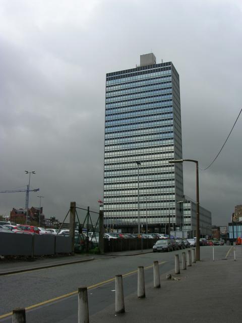
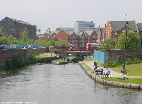
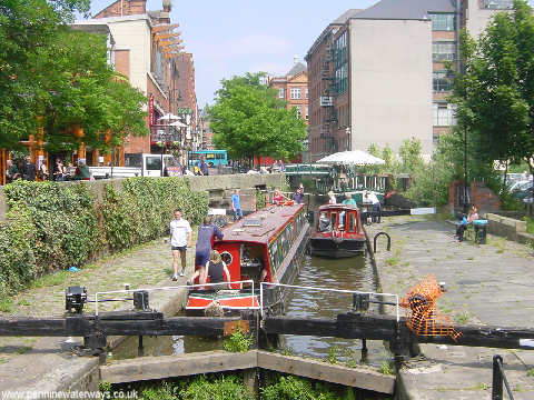
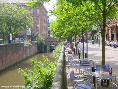
University is located at Grid Ref: SJ8496 (Lat: 53.468416, Lng: -2.2355763)

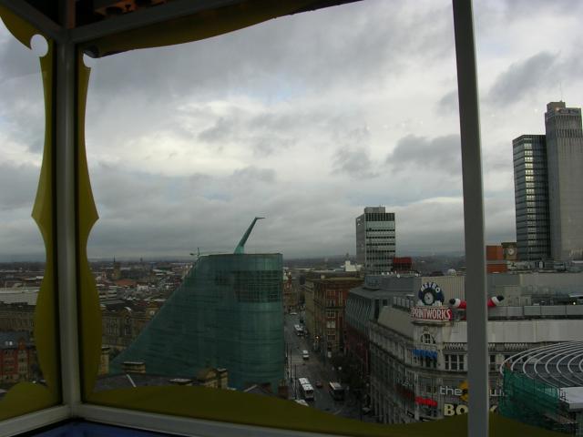
Unitary Authority: Manchester

Police Authority: Greater Manchester

What 3 Words

///hurls.habit.sits. Near Hulme, Manchester

Nearby Locations

Infirmary University

Related Wikis

Royal Northern College of Music

The Royal Northern College of Music (RNCM) is a conservatoire located in Manchester, England. It is one of four conservatoires associated with the Associated...

Manchester Aquatics Centre

The Manchester Aquatics Centre, abbreviated MAC, is a public aquatics sports facility south of the city centre of Manchester, England, north of the main...

Alliance Manchester Business School

Alliance Manchester Business School (Alliance MBS) is the business school of the University of Manchester in Manchester, England. It is one of the oldest...

Department of Computer Science, University of Manchester

The Department of Computer Science at the University of Manchester is the longest established department of Computer Science in the United Kingdom and...

Department of Materials, University of Manchester

The Department of Materials, at the University of Manchester is an academic and research department specialising in Materials Science and Engineering and...

National Graphene Institute

The National Graphene Institute is a research institute and building at the University of Manchester that is focused on the research of graphene. Construction...

Arthur Lewis Building

The Arthur Lewis Building, which is named after the economist Arthur Lewis, is part of the University of Manchester's campus. It is located west of Oxford...

Manchester School of Architecture

The Manchester School of Architecture (MSA) is a School of Architecture, jointly administered by The University of Manchester and the Manchester Metropolitan...

Nearby Amenities

Located within 500m of 53.468416,-2.2355763
Traffic Signals
Source: bing
Traffic Signals: signal
Traffic Signals Direction: backward
Lat/Long: 53.4682404/-2.2353892
Motorway Junction
Cambridge Street Junction
Lat/Long: 53.4714356/-2.2388162
Traffic Signals
Traffic Signals: signal
Lat/Long: 53.4691916/-2.2333494
Traffic Signals
Traffic Signals: signal
Traffic Signals Direction: backward
Lat/Long: 53.4689089/-2.2405076
Give Way
Lat/Long: 53.4721669/-2.2343909
Mini Roundabout
Direction: clockwise
Lat/Long: 53.469947/-2.2312546
Traffic Signals
Traffic Signals: signal
Lat/Long: 53.4691141/-2.2332799
Entrance: main
Lat/Long: 53.4646254/-2.2352778
Entrance: main
Lat/Long: 53.4644285/-2.2336035
Pub
Kro Bar
Addr Housenumber: 325
Addr Street: Oxford Road
Cuisine: Danish
Diet Vegan: yes
Diet Vegetarian: yes
Phone: +44 161 274 3100
Postal Code: M13 9PG
Real Ale: yes
Wheelchair: no
Lat/Long: 53.4649043/-2.2319692
Crossing
Crossing: traffic_signals
Crossing Island: no
Tactile Paving: yes
Lat/Long: 53.4667626/-2.2341721
Traffic Signals
Traffic Signals: signal
Traffic Signals Direction: backward
Lat/Long: 53.4648335/-2.2323193
Traffic Calming: hump
Lat/Long: 53.4667353/-2.2423413
Traffic Calming: hump
Lat/Long: 53.4661488/-2.2420194
Noexit: yes
Lat/Long: 53.465894/-2.24152
Traffic Calming: hump
Lat/Long: 53.4674176/-2.2427167
Traffic Calming: hump
Lat/Long: 53.4675563/-2.241985
Bar
The Footage
Addr City: Manchester
Addr Housename: The Footage
Addr Postcode: M1 7DZ
Addr Street: Grosvenor Street
Operator: Stonegate
Operator Wikidata: Q7619176
Website: https://www.crafted-social.co.uk/footage-manchester
Wheelchair: no
Lat/Long: 53.4701576/-2.2368846
Pub
Sandbar
Addr City: Manchester
Addr Country: GB
Addr Housenumber: 120
Addr Postcode: M1 7HL
Addr Street: Grosvenor Street
Air Conditioning: no
Camra: yes
Internet Access: wlan
Internet Access Fee: no
Opening Hours: Su-We 12:00-00:00; Th 12:00-01:00; Fr-Sa 12:00-00:20; PH
Real Ale: yes
Real Cider: yes
Smoking: no
Website: https://sandbarmanchester.co.uk/
Lat/Long: 53.4706825/-2.2359568
Restaurant
Peace Garden
Addr City: Manchester
Addr Housenumber: 57
Addr Postcode: M15 6PQ
Addr Street: Booth Street West
Cuisine: chinese
Opening Hours: Su-Th 12:00-22:00; Fr,Sa 12:00-22:30
Phone: +44161 226 6990
Website: https://www.peacegarden-restaurant.com/
Lat/Long: 53.4671454/-2.2391457
Pharmacy
Faith Pharmacy
Addr City: Manchester
Addr Housenumber: 59
Addr Postcode: M15 6PQ
Addr Street: Booth Street West
Healthcare: pharmacy
Opening Hours: Mo-Fr 09:00-18:30; Sa 10:00-13:00
Phone: +441612 328044
Website: https://faithpharmacyhulme.co.uk/
Lat/Long: 53.4671257/-2.2392921
Clinic
Cornbrook Medical Centre
Addr City: Manchester
Addr Housenumber: 63
Addr Postcode: M15 6PR
Addr Street: Booth Street West
Healthcare: clinic
Healthcare Speciality: general
Opening Hours: Mo-Fr 08:00-18:30
Operator: NHS
Operator Type: public
Operator Wikidata: Q918396
Phone: +44161 872 8129
Website: https://www.boundarymedicalpractice.co.uk/
Lat/Long: 53.467012/-2.2397275
Pub
The Flour and Flagon
Addr City: Manchester
Addr Postcode: M1 7HL
Addr Street: Grosvenor Street
Food: yes
Operator: Stonegate
Operator Wikidata: Q7619176
Toilets Wheelchair: yes
Website: https://www.flourandflagon.co.uk/manchester
Wheelchair: yes
Lat/Long: 53.4705235/-2.2364887
Bus Stop
Chorlton upon Medlock, Higher Cambridge Street / outside Dental Hosp
Bench: yes
Bin: yes
Bus: yes
Lit: yes
Naptan AtcoCode: 1800SB31571
Naptan Bearing: NW
Naptan Landmark: SCHOOL
Naptan NaptanCode: MANGTPMP
Naptan Street: Hr Cambridge Street
Network: TfGM
Operator: TfGM
Public Transport: platform
Shelter: yes
Tactile Paving: no
Lat/Long: 53.4659675/-2.2380157
The Manchester Museum
Fee: no
Tourism: museum
Website: https://www.museum.manchester.ac.uk/
Wheelchair: yes
Wikidata: Q2087619
Wikipedia: de:Manchester Museum
Lat/Long: 53.4664071/-2.2342428
Library
Main Library, University of Manchester
Wheelchair: yes
Lat/Long: 53.4644321/-2.235482
Tesco Express
Addr City: Manchester
Addr Housename: Oxford House
Addr Postcode: M1 7ED
Addr Street: Oxford Road
Brand: Tesco Express
Brand Wikidata: Q98456772
Brand Wikipedia: en:Tesco
Check Date Opening Hours: 2023-01-20
Contact Website: https://www.tesco.com/store-locator/manchester/oxford-house
Opening Hours: Mo-Su 07:00-23:00
Shop: convenience
Source: Observation
Wheelchair: yes
Lat/Long: 53.4720297/-2.2383937
Crossing
Crossing: unmarked
Lat/Long: 53.471597/-2.234423
Crossing
Bicycle: yes
Crossing: traffic_signals
Crossing Island: yes
Crossing Ref: toucan
Tactile Paving: yes
Lat/Long: 53.4681454/-2.2306451
Noexit: yes
Lat/Long: 53.468252/-2.2287882
Bus Stop
Brunswick, Upper Brook Street / near Brunswick Street
Bench: yes
Bin: no
Bus: yes
Naptan AtcoCode: 1800EB01751
Naptan Bearing: SE
Naptan CommonName: Upper Brook Street/Brunswick Street
Naptan Indicator: Opp University
Naptan Landmark: GARAGE
Naptan NaptanCode: manadgja
Naptan PlusbusZoneRef: MNCRPIC
Naptan ShortCommonName: Brunswick Street
Naptan Street: Upper Brook Street
Naptan Verified: no
Network: TfGM
Operator: TfGM
Public Transport: platform
Shelter: yes
Source: naptan_import
Lat/Long: 53.4679085/-2.2301411
Bar
Deaf Institute
Addr City: Manchester
Addr Housenumber: 135
Addr Postcode: M1 7HE
Addr Street: Grosvenor Street
Internet Access: wlan
Internet Access Fee: no
Website: https://www.thedeafinstitute.co.uk/
Wheelchair: no
Lat/Long: 53.4702657/-2.2365417
Bus Stop
Chorlton upon Medlock, Upper Brook Street / near Grosvenor Street
Bench: yes
Bin: yes
Bus: yes
Lit: yes
Naptan AtcoCode: 1800EB01731
Naptan Bearing: SE
Naptan CommonName: Upper Brook Street/Grosvenor Street
Naptan Indicator: Opp Science Ctr
Naptan Landmark: GARAGE
Naptan NaptanCode: manadgdt
Naptan PlusbusZoneRef: MNCRPIC
Naptan ShortCommonName: Grosvenor Street
Naptan Street: Upper Brook Street
Naptan Verified: no
Network: TfGM
Operator: TfGM
Public Transport: platform
Shelter: yes
Source: naptan_import
Tactile Paving: no
Lat/Long: 53.4707966/-2.2335408
Bus Stop
Chorlton upon Medlock, Upper Brook Street / opposite Booth Street East
Bench: yes
Bin: no
Bus: yes
Naptan AtcoCode: 1800EB01741
Naptan Bearing: SE
Naptan CommonName: Upper Brook Street/Booth Street East
Naptan Indicator: Os Islamic Cnr
Naptan Landmark: ISLAMIC ACADEMY
Naptan NaptanCode: manadgdw
Naptan PlusbusZoneRef: MNCRPIC
Naptan ShortCommonName: Booth Street East
Naptan Street: Upper Brook Street
Naptan Verified: no
Network: TfGM
Operator: TfGM
Public Transport: platform
Shelter: yes
Source: naptan_import
Lat/Long: 53.4690327/-2.2314996
Bus Stop
Brunswick St/Upper Brook St
Bus: yes
Naptan AtcoCode: 1800EB02581
Naptan Bearing: SW
Naptan CommonName: Brunswick St/Upper Brook St
Naptan Indicator: House 93
Naptan Landmark: HOUSE 93
Naptan NaptanCode: manadgwp
Naptan PlusbusZoneRef: MNCRPIC
Naptan ShortCommonName: Upper Brook St
Naptan Street: Brunswick Street
Naptan Verified: no
Network: TfGM
Public Transport: platform
Source: naptan_import
Lat/Long: 53.4673908/-2.2284004
Bus Stop
Chorlton upon Medlock, Booth Street West / adjacent Cambridge Street
Bus: yes
Naptan AtcoCode: 1800SB09271
Naptan Bearing: E
Naptan CommonName: Booth St West/Cambridge St
Naptan Indicator: Hopton Court
Naptan Landmark: VICTORIA HALLS
Naptan NaptanCode: mangpmpa
Naptan PlusbusZoneRef: MNCRPIC
Naptan ShortCommonName: Cambridge St
Naptan Street: Booth Street West
Naptan Verified: no
Network: TfGM
Operator: TfGM
Public Transport: platform
Source: naptan_import
Lat/Long: 53.4671264/-2.2400505
Bus Stop
Chorlton upon Medlock, Booth Street West / near Cambridge Street
Bench: no
Bin: yes
Bus: yes
Lit: yes
Naptan AtcoCode: 1800SB09291
Naptan Bearing: W
Naptan CommonName: Booth St West/Cambridge St
Naptan Indicator: Gamecock Pub
Naptan Landmark: HEALTH CENTRE
Naptan NaptanCode: mangpmpd
Naptan PlusbusZoneRef: MNCRPIC
Naptan ShortCommonName: Cambridge St
Naptan Street: Booth Street West
Naptan Verified: no
Network: TfGM
Operator: TfGM
Public Transport: platform
Shelter: no
Source: naptan_import
Tactile Paving: no
Lat/Long: 53.4670449/-2.2397567
Bus Stop
Hulme, Boundary Lane / opposite Trinity High School
Bus: yes
Naptan AtcoCode: 1800SB09521
Naptan Bearing: N
Naptan CommonName: Boundary Lane/Trinity High School
Naptan Indicator: Opp School
Naptan Landmark: Trinity CoE High School
Naptan NaptanCode: mangpmpt
Naptan PlusbusZoneRef: MNCRPIC
Naptan ShortCommonName: Trinity HS
Naptan Street: BOUNDARY LANE
Naptan Verified: no
Network: TfGM
Operator: TfGM
Public Transport: platform
Source: naptan_import
Lat/Long: 53.4657737/-2.2406181
Bus Stop
Chorlton upon Medlock, Higher Cambridge Street / near Booth Street West
Bus: yes
Naptan AtcoCode: 1800SB31541
Naptan Bearing: SE
Naptan CommonName: Higher Cambridge St/Booth St West
Naptan Indicator: Opp School
Naptan Landmark: Car Park
Naptan NaptanCode: mangtpmd
Naptan PlusbusZoneRef: MNCRPIC
Naptan ShortCommonName: Booth St West
Naptan Street: Higher Cambridge Street
Naptan Verified: no
Network: TfGM
Operator: TfGM
Public Transport: platform
Source: naptan_import
Lat/Long: 53.4669801/-2.2386945
Bus Stop
Chorlton upon Medlock, Higher Cambridge Street / outside Dental Hospital
Bench: yes
Bin: no
Bus: yes
Lit: no
Naptan AtcoCode: 1800SB31561
Naptan Bearing: SE
Naptan CommonName: Higher Cambridge St/Dental Hospital
Naptan Indicator: Dental Hospital
Naptan Landmark: HOSPITAL
Naptan NaptanCode: mangtpmj
Naptan PlusbusZoneRef: MNCRPIC
Naptan ShortCommonName: Dental Hospital
Naptan Street: Hr Cambridge Street
Naptan Verified: no
Network: TfGM
Operator: TfGM
Public Transport: platform
Shelter: yes
Source: naptan_import
Tactile Paving: no
Lat/Long: 53.4648416/-2.2365803
Bus Stop
Brunswick, Upper Brook Street / adjacent Brunswick Street
Bus: yes
Naptan AtcoCode: 1800SB13481
Naptan Bearing: NW
Naptan CommonName: Upper Brook Street/Brunswick Street
Naptan Indicator: Nt Uni Building
Naptan Landmark: UNIVERSITY
Naptan NaptanCode: mangpwpw
Naptan PlusbusZoneRef: MNCRPIC
Naptan ShortCommonName: Brunswick Street
Naptan Street: Upper Brook Street
Naptan Verified: no
Network: TfGM
Operator: TfGM
Public Transport: platform
Source: naptan_import
Lat/Long: 53.4665985/-2.229074
Bus Stop
Chorlton upon Medlock, Upper Brook Street / near Booth Street East
Bench: no
Bin: no
Bus: yes
Lit: yes
Naptan AtcoCode: 1800SB13991
Naptan Bearing: NW
Naptan CommonName: Upper Brook Street/Booth Street East
Naptan Indicator: Opp Portman
Naptan Landmark: SCIENCE Centre
Naptan NaptanCode: mangpwtj
Naptan PlusbusZoneRef: MNCRPIC
Naptan ShortCommonName: Booth Street East
Naptan Street: Upper Brook Street
Naptan Verified: no
Network: TfGM
Operator: TfGM
Public Transport: platform
Shelter: no
Source: naptan_import
Tactile Paving: no
Lat/Long: 53.4697435/-2.2328056
Bus Stop
Chorlton upon Medlock, Stretford Road / opposite Boundary Lane
Bench: no
Bus: yes
Naptan AtcoCode: 1800SB15471
Naptan Bearing: E
Naptan CommonName: Stretford Road/Boundary Lane
Naptan Indicator: Arch Pub
Naptan Landmark: CAVENDISH PLACE
Naptan NaptanCode: mangtdwm
Naptan PlusbusZoneRef: MNCRPIC
Naptan ShortCommonName: Boundary Lane
Naptan Street: STRETFORD ROAD
Naptan Verified: no
Network: TfGM
Operator: TfGM
Public Transport: platform
Shelter: yes
Source: naptan_import
Lat/Long: 53.4686691/-2.2426885
Bus Stop
Chorlton upon Medlock, Oxford Road / University Shopping Centre (Stop F)
Bus: yes
Local Ref: E
Naptan AtcoCode: 1800SB30621
Naptan Bearing: SE
Naptan CommonName: Oxford Rd/University Shopping Ctr
Naptan Indicator: Stop F
Naptan Landmark: ST PETER HOUSE
Naptan NaptanCode: MANGTMGP
Naptan PlusbusZoneRef: MNCRPIC
Naptan ShortCommonName: Shopping Centre
Naptan Street: OXFORD ROAD
Naptan Verified: no
Network: TfGM
Operator: TfGM
Public Transport: platform
Ref: F
Source: naptan_import
Lat/Long: 53.4675442/-2.23469
Bus Stop
Chorlton upon Medlock, Oxford Road / near All Saints
Bench: yes
Bin: yes
Bus: yes
Lit: no
Naptan AtcoCode: 1800SB04561
Naptan Bearing: NW
Naptan CommonName: Oxford Road/All Saints
Naptan Indicator: Nr University
Naptan Landmark: GROSVENOR Square
Naptan NaptanCode: mangpgwm
Naptan Notes: INDICATOR AMENDED
Naptan PlusbusZoneRef: MNCRPIC
Naptan ShortCommonName: All Saints
Naptan Street: OXFORD ROAD
Naptan Verified: no
Network: TfGM
Operator: TfGM
Public Transport: platform
Shelter: yes
Source: naptan_import
Tactile Paving: no
Lat/Long: 53.4708822/-2.237923
Bus Stop
Chorlton upon Medlock, Oxford Road / adjacent All Saints
Bench: yes
Bin: no
Bus: yes
Lit: no
Naptan AtcoCode: 1800SB04581
Naptan Bearing: NW
Naptan CommonName: Oxford Road/All Saints
Naptan Indicator: Op Park
Naptan Landmark: GROSVENOR Square
Naptan NaptanCode: mangpgwt
Naptan PlusbusZoneRef: MNCRPIC
Naptan ShortCommonName: All Saints
Naptan Street: OXFORD ROAD
Naptan Verified: no
Network: TfGM
Operator: TfGM
Public Transport: platform
Shelter: yes
Source: naptan_import
Tactile Paving: no
Lat/Long: 53.4704565/-2.2375668
Bus Stop
Chorlton upon Medlock, Oxford Road / near Aquatics Centre
Bench: yes
Bin: no
Bus: yes
Lit: yes
Naptan AtcoCode: 1800SB30611
Naptan Bearing: SE
Naptan CommonName: Oxford Road/Aquatics Centre
Naptan Indicator: All Saints
Naptan Landmark: AQUATICS CENTRE
Naptan NaptanCode: mangtmgm
Naptan PlusbusZoneRef: MNCRPIC
Naptan ShortCommonName: Aquatics Centre
Naptan Street: OXFORD ROAD
Naptan Verified: no
Network: TfGM
Operator: TfGM
Public Transport: platform
Shelter: yes
Source: naptan_import
Tactile Paving: yes
Lat/Long: 53.4694837/-2.2364339
Bus Stop
Chorlton upon Medlock, Oxford Road / University Shopping Centre (Stop C)
Bench: yes
Bin: yes
Bus: yes
Local Ref: D
Naptan AtcoCode: 1800SB30631
Naptan Bearing: NW
Naptan CommonName: Oxford Rd/University Shopping Ctr
Naptan Indicator: Stop D
Naptan Landmark: PRECINCT CENTRE
Naptan NaptanCode: mangtmgt
Naptan PlusbusZoneRef: MNCRPIC
Naptan ShortCommonName: Shopping Centre
Naptan Street: OXFORD ROAD
Naptan Verified: no
Network: TfGM
Operator: TfGM
Public Transport: platform
Ref: C
Shelter: yes
Source: naptan_import
Lat/Long: 53.467477/-2.2348722
Bus Stop
Chorlton upon Medlock, Oxford Road / at University of Manchester
Bench: yes
Bin: no
Bus: yes
Lit: yes
Naptan AtcoCode: 1800SB30651
Naptan Bearing: NW
Naptan CommonName: Oxford Road/University
Naptan Indicator: Man Univ Union
Naptan Landmark: STUDENT UNION
Naptan NaptanCode: mangtmja
Naptan PlusbusZoneRef: MNCRPIC
Naptan ShortCommonName: University
Naptan Street: OXFORD ROAD
Naptan Verified: no
Network: TfGM
Operator: TfGM
Public Transport: platform
Shelter: yes
Tactile Paving: no
Lat/Long: 53.4645544/-2.2321615
Bus Stop
Chorlton upon Medlock, Booth Street West / College of Music (Stop B)
Bus: yes
Local Ref: B
Naptan AtcoCode: 1800SB31121
Naptan Bearing: W
Naptan CommonName: Booth St West/College of Music
Naptan Indicator: Stop B
Naptan Landmark: PRECINCT CENTRE
Naptan NaptanCode: mangtmwd
Naptan PlusbusZoneRef: MNCRPIC
Naptan ShortCommonName: College of Music
Naptan Street: Booth Street West
Naptan Verified: no
Network: TfGM
Operator: TfGM
Public Transport: platform
Ref: B
Source: naptan_import
Lat/Long: 53.4680403/-2.2364331
Bus Stop
Chorlton upon Medlock, Booth Street West / College of Music (Stop A)
Bench: yes
Bus: yes
Local Ref: A
Naptan AtcoCode: 1800SB31141
Naptan Bearing: E
Naptan CommonName: Booth St West/College of Music
Naptan Indicator: Stop A
Naptan Landmark: MUSIC COLLEGE
Naptan NaptanCode: mangtmwj
Naptan PlusbusZoneRef: MNCRPIC
Naptan ShortCommonName: College of Music
Naptan Street: Booth Street West
Naptan Verified: no
Network: TfGM
Operator: TfGM
Public Transport: platform
Ref: A
Shelter: yes
Source: naptan_import
Lat/Long: 53.4681565/-2.2367802
Bus Stop
Chorlton upon Medlock, Higher Cambridge Street / near Cavendish Street
Bench: no
Bin: no
Bus: yes
Lit: yes
Naptan AtcoCode: 1800SB31181
Naptan Bearing: NW
Naptan CommonName: Cambridge Street/Cavendish Street
Naptan Indicator: Near Ta Centre
Naptan Landmark: CAMBRIDGE HALL
Naptan NaptanCode: mangtmwm
Naptan PlusbusZoneRef: MNCRPIC
Naptan ShortCommonName: Cavendish Street
Naptan Street: Hr Cambridge Street
Naptan Verified: no
Network: TfGM
Operator: TfGM
Public Transport: platform
Shelter: no
Source: naptan_import
Tactile Paving: no
Lat/Long: 53.4682074/-2.2400208
Bus Stop
Chorlton upon Medlock, Cambridge Street / opposite Cavendish Street
Bench: no
Bin: no
Bus: yes
Naptan AtcoCode: 1800SB31191
Naptan Bearing: SE
Naptan CommonName: Cambridge Street/Cavendish Street
Naptan Indicator: Opp Church Inn
Naptan Landmark: CHURCH INN
Naptan NaptanCode: mangtmwp
Naptan PlusbusZoneRef: MNCRPIC
Naptan ShortCommonName: Cavendish Street
Naptan Street: Cambridge Street
Naptan Verified: no
Network: TfGM
Operator: TfGM
Public Transport: platform
Shelter: no
Source: naptan_import
Lat/Long: 53.469378/-2.240824
Hillcourt Street Cycles
Addr City: Manchester
Addr Country: GB
Addr Housenumber: 2
Addr Postcode: M1 7HU
Addr Street: Hillcourt Street
Shop: bicycle
Website: https://www.hillcourtstreetcycles.co.uk/
Lat/Long: 53.4707939/-2.2361206
Fast Food
Domino's
Addr City: Manchester
Addr Housenumber: 129
Addr Postcode: M1 7HE
Addr Street: Grosvenor Street
Branch: Manchester - All Saints
Brand: Domino's
Brand Wikidata: Q839466
Brand Wikipedia: en:Domino's Pizza
Contact Website: https://www.dominos.co.uk/pizza-near-me/manchester/129-grosvenor-street
Cuisine: pizza
Diet Vegetarian: yes
Opening Hours: Mo-Su 11:00-03:00
Takeaway: yes
Lat/Long: 53.4703708/-2.2362025
Noexit: yes
Lat/Long: 53.4716278/-2.2335005
Turning Circle
Lat/Long: 53.4717254/-2.2333937
Noexit: yes
Lat/Long: 53.4714337/-2.2304484
Noexit: yes
Lat/Long: 53.4698308/-2.2284096
Noexit: yes
Lat/Long: 53.4682843/-2.2374435
Noexit: yes
Lat/Long: 53.4680064/-2.2282649
Noexit: yes
Lat/Long: 53.4718182/-2.2313963
Library
Sir Kenneth Green Library
Designation: University Library
Source: Student
Toilets Wheelchair: yes
Wheelchair: yes
Lat/Long: 53.4708814/-2.2390103
Crossing
Crossing: traffic_signals
Crossing Island: yes
Crossing Ref: puffin
Tactile Paving: yes
Lat/Long: 53.4693744/-2.2324494
Traffic Signals
Traffic Signals: signal
Traffic Signals Direction: forward
Lat/Long: 53.4696184/-2.2320015
Restaurant
Umami
Addr City: Manchester
Addr Housenumber: 149-153
Addr Postcode: M1 7EE
Addr Street: Oxford Road
Cuisine: asian
Lat/Long: 53.469953/-2.2366947
Barrier: bollard
Bicycle: yes
Bollard: rising
Foot: yes
Motor Vehicle: private
Lat/Long: 53.4708272/-2.2348593
Fast Food
Subway
Addr City: Manchester
Addr Housenumber: 149-153
Addr Postcode: M1 7EE
Addr Street: Oxford Road
Brand: Subway
Brand Wikidata: Q244457
Brand Wikipedia: en:Subway (restaurant)
Contact Website: https://restaurants.subway.com/united-kingdom/en/manchester/149-oxford-road
Cuisine: sandwich
Drive In: no
Drive Through: no
Takeaway: yes
Wheelchair: yes
Lat/Long: 53.4699093/-2.2366555
Traffic Signals
Lat/Long: 53.4649732/-2.2324699
Motorway Junction
Downing Street Junction
Lat/Long: 53.4722315/-2.2346768
Motorway Junction
Sackville Street Junction
Lat/Long: 53.4723503/-2.2344237
Restaurant
Noodle Emoji
Addr City: Manchester
Addr Housename: Noodle Emoji
Addr Postcode: M15 6AD
Addr Street: Higher Cambridge Street
Cuisine: chinese
Opening Hours: We-Mo 16:00-22:30
Source Name: survey
Lat/Long: 53.4673691/-2.2393687
Spar
Addr City: Manchester
Addr Housename: Spar
Addr Postcode: M15 6AD
Addr Street: Higher Cambridge Street
Brand: Spar
Brand Wikidata: Q610492
Brand Wikipedia: en:SPAR (retailer)
Opening Hours: Mo-Sa 07:00-23:00; Su 08:00-23:00
Shop: convenience
Source: Local knowledge
Website: https://www.spar.co.uk/store-locator/hal23492-spar-hulme/
Lat/Long: 53.4677379/-2.2396581
Bar
Union Bar
Toilets: yes
Toilets Wheelchair: yes
Wheelchair: yes
Lat/Long: 53.464377/-2.232517
Fast Food
Dixy Chicken
Addr City: Manchester
Addr Housenumber: 135
Addr Postcode: M1 7DY
Addr Street: Oxford Road
Brand: Dixy Chicken
Brand Wikidata: Q5285003
Check Date Opening Hours: 2023-07-30
Cuisine: chicken
Diet Halal: yes
Opening Hours Signed: no
Takeaway: yes
Lat/Long: 53.4703959/-2.2370935
Entrance: yes
Lat/Long: 53.4687167/-2.2351131
Telephone
Defibrillator
Booth: ST6
Check Date: 2023-12-11
Defibrillator Location: below phone on back of advertising screen
Emergency: defibrillator
Indoor: no
Not Ref GB The Circuit: BC9E4C8F-B616-48E0-B124-B05100C838DF
Lat/Long: 53.471839/-2.238796
Govin's News
Addr City: Manchester
Addr Housenumber: 129
Addr Postcode: M1 7DY
Addr Street: Oxford Road
Shop: convenience
Lat/Long: 53.4705601/-2.2372396
Entrance: yes
Lat/Long: 53.4685324/-2.2348485
Waste Basket
Check Date: 2023-07-30
Lat/Long: 53.4720373/-2.2386145
Barrier: entrance
Lat/Long: 53.4677176/-2.2343467
Theatre
John Thaw Studio Theatre
Lat/Long: 53.4661286/-2.2356531
Fast Food
Grand Daddy's Diner
Addr City: Manchester
Addr Housenumber: 133A
Addr Postcode: M1 7HE
Addr Street: Grosvenor Street
Check Date Opening Hours: 2023-07-30
Diet Vegetarian: yes
Opening Hours Signed: no
Lat/Long: 53.4703059/-2.2364261
Bar
The Bread Shed
Operator: Stonegate
Operator Wikidata: Q7619176
Website: https://www.bread-shed.co.uk/manchester
Lat/Long: 53.470633/-2.2364414
Traffic Signals
Lat/Long: 53.4673281/-2.2390894
Traffic Signals
Source: bing
Traffic Signals: signal
Traffic Signals Direction: forward
Lat/Long: 53.4685108/-2.2352187
Traffic Signals
Source: bing
Traffic Signals: signal
Traffic Signals Direction: backward
Lat/Long: 53.468654/-2.2357759
Bicycle Parking
Bicycle Parking: stands
Capacity: 10
Covered: no
Lat/Long: 53.4702453/-2.2374152
Cafe
Milk & Honey
Lat/Long: 53.4679358/-2.2343955
Cafe
The Cafe at the Museum
Lat/Long: 53.4665464/-2.2343342
Cafe
Homes4u
Cuisine: sandwich
Lat/Long: 53.4721463/-2.2385334
Restaurant
Tai Wu
Addr City: Manchester
Addr Country: GB
Addr Housenumber: 81-97
Addr Postcode: M13 9TX
Addr Street: Upper Brook Street
Cuisine: chinese
Lat/Long: 53.4676334/-2.2296347
Noexit: yes
Lat/Long: 53.4687848/-2.2412795
Barrier: bollard
Lat/Long: 53.4703651/-2.2393003
Barrier: entrance
Note: Museum entrance
Lat/Long: 53.466113/-2.2342466
Noexit: yes
Lat/Long: 53.4681315/-2.2382904
Crossing
Lat/Long: 53.4667287/-2.2373132
Entrance: main
Lat/Long: 53.4691131/-2.2298717
Visitor's Centre
Designation: Visitor's Centre
Source: www.manchester.ac.uk
Tourism: information
Lat/Long: 53.4668081/-2.2338062
Post Box
Collection Times: Mo-Fr 17:15; Sa 12:00
Lat/Long: 53.4647422/-2.2324241
The Corner Store
Addr City: Manchester
Addr Housenumber: 94-97
Addr Postcode: M1 7HL
Addr Street: Grosvenor Street
Currency GBP: yes
Currency XBT: yes
Payment Lightning: yes
Payment Lightning Contactless: yes
Payment Onchain: no
Shop: variety_store
Survey Date: 2023-11-06
Lat/Long: 53.4710753/-2.2347318
Noexit: yes
Lat/Long: 53.4675909/-2.2284919
Noexit: yes
Lat/Long: 53.4720338/-2.2327957
W. H. Lung
Addr City: Manchester
Addr Country: GB
Addr Housenumber: 81-97
Addr Postcode: M13 9TX
Addr Street: Upper Brook Street
Opening Hours: Mo-Su 09:30-19:00; Su 11:00-18:00
Shop: wholesale
Website: https://whlungmcr.com/
Wheelchair: yes
Lat/Long: 53.467559/-2.229488
Barrier: lift_gate
Bicycle: permissive
Foot: permissive
Motor Vehicle: private
Lat/Long: 53.4651855/-2.233045
Noexit: yes
Lat/Long: 53.4712847/-2.2332142
Noexit: yes
Lat/Long: 53.4694901/-2.2292053
Post Box
Collection Times: Mo-Fr 18:30; Sa 12:00
Drive Through: no
Post Box Design: type_b
Post Box Type: pillar
Ref: M1 862
Royal Cypher: GR
Royal Cypher Wikidata: Q33102273
Lat/Long: 53.471854/-2.232177
Noexit: yes
Lat/Long: 53.4679668/-2.2405717
Noexit: yes
Lat/Long: 53.4680501/-2.2401913
Noexit: yes
Lat/Long: 53.4664517/-2.241798
Bicycle Parking
Bicycle Parking: stands
Capacity: 6
Check Date Capacity: 2023-08-28
Covered: no
Fee: no
Lat/Long: 53.472005/-2.238939
Bicycle Parking
Bicycle Parking: stands
Capacity: 8
Check Date Capacity: 2023-07-30
Covered: no
Fee: no
Lat/Long: 53.472087/-2.238662
Bake & Bite
Shop: bakery
Lat/Long: 53.471401/-2.237947
Bicycle Parking
Bicycle Parking: stands
Capacity: 32
Covered: yes
Fee: no
Lat/Long: 53.467959/-2.234694
Bicycle Parking
Capacity: 30
Lat/Long: 53.466394/-2.235415
Bicycle Parking
Bicycle Parking: stands
Capacity: 40
Covered: no
Fee: no
Lat/Long: 53.466318/-2.235784
Bicycle Parking
Bicycle Parking: stands
Capacity: 8
Covered: no
Fee: no
Lat/Long: 53.466012/-2.236361
Recycling
Check Date: 2023-07-30
Recycling Batteries: no
Recycling Cans: yes
Recycling Cardboard: yes
Recycling Clothes: no
Recycling Glass: no
Recycling Glass Bottles: no
Recycling Green Waste: no
Recycling Paper: yes
Recycling Plastic: no
Recycling Scrap Metal: no
Recycling Type: container
Lat/Long: 53.46586/-2.237162
Bicycle Parking
Bicycle Parking: wall_loops
Capacity: 4
Covered: no
Fee: no
Lat/Long: 53.465812/-2.236938
MuPrint
Addr City: Manchester
Addr Housename: MuPrint
Addr Postcode: M15 6AD
Addr Street: Higher Cambridge Street
Check Date Opening Hours: 2023-07-30
Opening Hours Signed: no
Shop: copyshop
Source: survey
Lat/Long: 53.4675998/-2.2395346
Bench
Backrest: yes
Check Date: 2021-01-25
Material: metal
Source: survey
Lat/Long: 53.4655103/-2.2322409
Bench
Backrest: yes
Check Date: 2021-01-25
Material: metal
Source: survey
Lat/Long: 53.4655949/-2.2323541
Bench
Backrest: yes
Check Date: 2021-01-25
Material: metal
Source: survey
Lat/Long: 53.4656472/-2.232405
Waste Basket
Check Date: 2021-01-25
Source: survey
Lat/Long: 53.4658021/-2.2324075
Barrier: bollard
Source: survey
Lat/Long: 53.4658379/-2.2324254
Barrier: bollard
Source: survey
Lat/Long: 53.4658467/-2.2324054
Barrier: bollard
Source: survey
Lat/Long: 53.465851/-2.2323843
Barrier: bollard
Source: survey
Lat/Long: 53.4658548/-2.2323664
Bicycle Parking
Bicycle Parking: stands
Capacity: 20
Covered: no
Source: survey
Lat/Long: 53.4660932/-2.2325213
Post Box
Operator: Royal Mail
Operator Wikidata: Q638098
Source: survey
Lat/Long: 53.4669995/-2.2342731
Bicycle Parking
Bicycle Parking: stands
Covered: no
Lat/Long: 53.4663861/-2.2335043
Street Lamp
Lat/Long: 53.4663462/-2.23408
Bench
Backrest: yes
Mapillary: 291424522610390
Source: survey
Survey Date: 2017-06-19
Lat/Long: 53.4666194/-2.2343725
Bench
Source: survey
Lat/Long: 53.4666344/-2.2344526
Bench
Backrest: yes
Flickr: https://www.flickr.com/photos/60665572@N02/34077706656
Source: survey
Survey Date: 2017-04-18
Lat/Long: 53.4666683/-2.2343988
Bench
Source: survey
Lat/Long: 53.4666903/-2.2345052
Bench
Source: survey
Lat/Long: 53.4667279/-2.2344347
Street Lamp
Source: survey
Lat/Long: 53.466825/-2.2343924
Street Lamp
Source: survey
Lat/Long: 53.4671058/-2.2346857
Waste Basket
Check Date: 2023-02-18
Lat/Long: 53.4677528/-2.2350957
Street Lamp
Lat/Long: 53.4678716/-2.237006
Bicycle Parking
Lat/Long: 53.4679231/-2.2368093
Bicycle Parking
Bicycle Parking: stands
Capacity: 20
Covered: no
Lat/Long: 53.4711233/-2.236445
Social Facility
Social Facility: food_bank
Wheelchair: yes
Lat/Long: 53.4646976/-2.2315326
Post Box
Collection Times: Mo-Fr 17:00, Sa 12:00
Post Box Type: pillar
Ref: M13 83
Royal Cypher: EVIIR
Royal Cypher Wikidata: Q33102324
Lat/Long: 53.4689579/-2.2358515
Street Lamp
Lat/Long: 53.4715857/-2.2367959
Street Lamp
Lat/Long: 53.4716448/-2.2387566
Street Lamp
Lat/Long: 53.4712609/-2.2401944
Street Lamp
Lat/Long: 53.4722628/-2.2337447
Barrier: lift_gate
Bicycle: permissive
Foot: permissive
Motor Vehicle: private
Lat/Long: 53.4660442/-2.2366933
Barrier: kerb
Wheelchair: no
Lat/Long: 53.467805/-2.2382683
Barrier: bollard
Bicycle: yes
Bollard: rising
Foot: yes
Motor Vehicle: private
Lat/Long: 53.4693568/-2.2335224
Post Box
Collection Times: Mo-Fr 18:30, Sa 12:00
Post Box Design: type_a
Post Box Type: pillar
Ref: M1 142
Royal Cypher: EIIR
Royal Cypher Wikidata: Q33102113
Lat/Long: 53.4707464/-2.2375086
Entrance: yes
Lat/Long: 53.4680178/-2.2310789
Addr City: Manchester
Addr Housenumber: 127A
Addr Postcode: M1 7DY
Addr Street: Oxford Road
Cuisine: falafel
Shop: vacant
Lat/Long: 53.4706019/-2.2372853
Atm
Addr City: Manchester
Addr Country: GB
Addr Housename: The Corner Store
Addr Housenumber: 94
Addr Postcode: M1 7HL
Addr Street: Grosvenor Street
Cash In: no
Operator: SatoshiPoint
Website: https://satoshipoint.com
Lat/Long: 53.4710947/-2.2347504
Traffic Calming: island
Lat/Long: 53.4679693/-2.241584
Bicycle Repair Station
Service Bicycle Pump: yes
Lat/Long: 53.4645472/-2.233026
Barrier: lift_gate
Motor Vehicle: private
Lat/Long: 53.4685842/-2.2329648
Barrier: lift_gate
Bicycle: yes
Foot: yes
Motor Vehicle: private
Lat/Long: 53.4687737/-2.2339101
Entrance: yes
Lat/Long: 53.47173/-2.2404238
Cafe
Christie's Bistro
Lat/Long: 53.4652239/-2.2337176
Entrance: yes
Lat/Long: 53.4714842/-2.2409321
Entrance: yes
Lat/Long: 53.4715996/-2.2401866
Sackville Street Junction
Junction: yes
Lat/Long: 53.472295/-2.2356557
Traffic Signals
Traffic Signals: signal
Traffic Signals Direction: forward
Lat/Long: 53.4725754/-2.2357728
Give Way
Direction: forward
Lat/Long: 53.472292/-2.2353528
Barrier: bollard
Bollard: fixed
Lat/Long: 53.4691713/-2.240313
Barrier: bollard
Bollard: fixed
Lat/Long: 53.4691065/-2.2405178
Entrance: yes
Lat/Long: 53.469317/-2.2402425
Entrance: yes
Lat/Long: 53.4691086/-2.2400521
Noexit: yes
Lat/Long: 53.4698264/-2.2396146
Entrance: yes
Lat/Long: 53.4703949/-2.2398949
Check Date: 2023-07-30
Information: map
Tourism: information
Lat/Long: 53.4691399/-2.2404692
Information: map
Tourism: information
Lat/Long: 53.4687677/-2.2371215
Entrance: yes
Lat/Long: 53.4692877/-2.2374034
Entrance: yes
Lat/Long: 53.4709168/-2.2383563
Barrier: bollard
Lat/Long: 53.469419/-2.239564
Bus Stop
Chorlton upon Medlock, Oxford Road / University Shopping Centre (Stop E)
Bench: yes
Bin: no
Bus: yes
Local Ref: F
Naptan AtcoCode: 1800SB17091
Naptan Bearing: SE
Naptan Landmark: KILBURN BUILD'G
Naptan NaptanCode: MANTJTJD
Naptan Street: Oxford Road
Network: TfGM
Operator: TfGM
Public Transport: platform
Ref: E
Shelter: yes
Lat/Long: 53.4672308/-2.2344189
Bicycle Parking
Bicycle Parking: stands
Lat/Long: 53.4665627/-2.2362334
Barrier: lift_gate
Bicycle: yes
Foot: yes
Motor Vehicle: private
Lat/Long: 53.4657117/-2.2374915
Access: yes
Entrance: main
Wheelchair: yes
Lat/Long: 53.4668842/-2.2305392
Entrance: main
Lat/Long: 53.4667391/-2.2315264
Entrance: yes
Lat/Long: 53.4667086/-2.2333082
Entrance: yes
Lat/Long: 53.466908/-2.2339171
Entrance: main
Lat/Long: 53.4665614/-2.2301427
Entrance: main
Wheelchair: yes
Lat/Long: 53.4660339/-2.2306231
Bench
Backrest: no
Lat/Long: 53.4646807/-2.234119
Bench
Backrest: no
Lat/Long: 53.4646372/-2.2339431
Bench
Backrest: no
Lat/Long: 53.4645977/-2.2341342
Cafe
Pi in the Sky
Wheelchair: yes
Lat/Long: 53.4680587/-2.2317029
Food Court
Hatch
Cuisine: street_food
Description: Located under the elevated road
Website: https://hatchmcr.com/
Wheelchair: yes
Lat/Long: 53.4716379/-2.2381988
Cafe
Small World Café
Description: Freshly cooked lunches Halal and Vegetarian options
Opening Hours: Mo-Fr
Lat/Long: 53.4648024/-2.2318351
Addr City: Manchester
Addr Country: GB
Addr Housenumber: 37
Addr Postcode: M15 6DE
Addr Street: Conmere Square
Lat/Long: 53.4700846/-2.2424864
Addr City: Manchester
Addr Country: GB
Addr Housenumber: 39
Addr Postcode: M15 6DE
Addr Street: Conmere Square
Lat/Long: 53.4700388/-2.2424534
Addr City: Manchester
Addr Country: GB
Addr Housenumber: 41
Addr Postcode: M15 6DE
Addr Street: Conmere Square
Lat/Long: 53.4699976/-2.2424179
Addr City: Manchester
Addr Country: GB
Addr Housenumber: 43
Addr Postcode: M15 6DE
Addr Street: Conmere Square
Lat/Long: 53.4699587/-2.2423784
Addr City: Manchester
Addr Country: GB
Addr Housenumber: 45
Addr Postcode: M15 6DE
Addr Street: Conmere Square
Lat/Long: 53.4699175/-2.2423441
Addr City: Manchester
Addr Country: GB
Addr Housenumber: 47
Addr Postcode: M15 6DE
Addr Street: Conmere Square
Lat/Long: 53.4701043/-2.2424154
Addr City: Manchester
Addr Country: GB
Addr Housenumber: 49
Addr Postcode: M15 6DE
Addr Street: Conmere Square
Lat/Long: 53.4700627/-2.2423779
Addr City: Manchester
Addr Country: GB
Addr Housenumber: 51
Addr Postcode: M15 6DE
Addr Street: Conmere Square
Lat/Long: 53.47002/-2.2423449
Addr City: Manchester
Addr Country: GB
Addr Housenumber: 53
Addr Postcode: M15 6DE
Addr Street: Conmere Square
Lat/Long: 53.46998/-2.2423087
Addr City: Manchester
Addr Country: GB
Addr Housenumber: 55
Addr Postcode: M15 6DE
Addr Street: Conmere Square
Lat/Long: 53.4699418/-2.2422712
Addr City: Manchester
Addr Country: GB
Addr Housenumber: 60
Addr Postcode: M15 6DF
Addr Street: Loxford Street
Lat/Long: 53.4698413/-2.2420973
Addr City: Manchester
Addr Country: GB
Addr Housenumber: 62
Addr Postcode: M15 6DF
Addr Street: Loxford Street
Lat/Long: 53.4698559/-2.2420559
Addr City: Manchester
Addr Country: GB
Addr Housenumber: 64
Addr Postcode: M15 6DF
Addr Street: Loxford Street
Lat/Long: 53.4698686/-2.2420139
Addr City: Manchester
Addr Country: GB
Addr Housenumber: 66
Addr Postcode: M15 6DF
Addr Street: Loxford Street
Lat/Long: 53.4698809/-2.2419751
Addr City: Manchester
Addr Country: GB
Addr Housenumber: 68
Addr Postcode: M15 6DF
Addr Street: Loxford Street
Lat/Long: 53.4698932/-2.2419331
Addr City: Manchester
Addr Country: GB
Addr Housenumber: 70
Addr Postcode: M15 6DF
Addr Street: Loxford Street
Lat/Long: 53.4699036/-2.2418962
Addr City: Manchester
Addr Country: GB
Addr Housenumber: 85
Addr Postcode: M15 6HF
Addr Street: Newcastle Street
Lat/Long: 53.4687763/-2.2430998
Addr City: Manchester
Addr Country: GB
Addr Housenumber: 87
Addr Postcode: M15 6HF
Addr Street: Newcastle Street
Lat/Long: 53.4687846/-2.2430567
Addr City: Manchester
Addr Country: GB
Addr Housenumber: 91
Addr Postcode: M15 6HF
Addr Street: Newcastle Street
Lat/Long: 53.4687391/-2.2430774
Addr City: Manchester
Addr Country: GB
Addr Housenumber: 93
Addr Postcode: M15 6HF
Addr Street: Newcastle Street
Lat/Long: 53.4687465/-2.2430295
Addr City: Manchester
Addr Country: GB
Addr Housenumber: 95
Addr Postcode: M15 6HF
Addr Street: Newcastle Street
Lat/Long: 53.4687039/-2.2430812
Addr City: Manchester
Addr Country: GB
Addr Housenumber: 97
Addr Postcode: M15 6HF
Addr Street: Newcastle Street
Lat/Long: 53.4687218/-2.242983
Addr City: Manchester
Addr Country: GB
Addr Housenumber: 99
Addr Postcode: M15 6HF
Addr Street: Newcastle Street
Lat/Long: 53.4686758/-2.2430568
Addr City: Manchester
Addr Country: GB
Addr Housenumber: 101
Addr Postcode: M15 6HF
Addr Street: Newcastle Street
Lat/Long: 53.468691/-2.2429684
Cafe
Admo Coffee Shop
Addr City: Manchester
Addr Street: Stretford Road
Cuisine: coffee_shop
Lat/Long: 53.4686671/-2.2429531
Hulme Express
Addr City: Manchester
Addr Street: Stretford Road
Shop: supermarket
Lat/Long: 53.4686473/-2.2430414
Addr City: Manchester
Addr Country: GB
Addr Housenumber: 20
Addr Postcode: M15 6AS
Addr Street: Wilmott Street
Lat/Long: 53.4688756/-2.242423
Addr City: Manchester
Addr Country: GB
Addr Housenumber: 1
Addr Postcode: M15 6DA
Addr Street: Knowles Place
Lat/Long: 53.4691142/-2.2427046
Addr City: Manchester
Addr Country: GB
Addr Housenumber: 3
Addr Postcode: M15 6DA
Addr Street: Knowles Place
Lat/Long: 53.4691381/-2.2427242
Addr City: Manchester
Addr Country: GB
Addr Housenumber: 5
Addr Postcode: M15 6DA
Addr Street: Knowles Place
Lat/Long: 53.4691604/-2.2427464
Addr City: Manchester
Addr Country: GB
Addr Housenumber: 7
Addr Postcode: M15 6DA
Addr Street: Knowles Place
Lat/Long: 53.4691843/-2.2427635
Addr City: Manchester
Addr Country: GB
Addr Housenumber: 9
Addr Postcode: M15 6DA
Addr Street: Knowles Place
Lat/Long: 53.4692087/-2.2427822
Addr City: Manchester
Addr Country: GB
Addr Housenumber: 11
Addr Postcode: M15 6DA
Addr Street: Knowles Place
Lat/Long: 53.4692336/-2.2428095
Addr City: Manchester
Addr Country: GB
Addr Housenumber: 13
Addr Postcode: M15 6DA
Addr Street: Knowles Place
Lat/Long: 53.4692656/-2.242842
Addr City: Manchester
Addr Country: GB
Addr Housenumber: 15
Addr Postcode: M15 6DA
Addr Street: Knowles Place
Lat/Long: 53.4692884/-2.2428599
Addr City: Manchester
Addr Country: GB
Addr Housenumber: 17
Addr Postcode: M15 6DA
Addr Street: Knowles Place
Lat/Long: 53.4693138/-2.2428829
Addr City: Manchester
Addr Country: GB
Addr Housenumber: 19
Addr Postcode: M15 6DA
Addr Street: Knowles Place
Lat/Long: 53.4693387/-2.2429051
Addr City: Manchester
Addr Country: GB
Addr Housenumber: 21
Addr Postcode: M15 6DA
Addr Street: Knowles Place
Lat/Long: 53.4693697/-2.2429316
Addr City: Manchester
Addr Country: GB
Addr Housenumber: 23
Addr Postcode: M15 6DA
Addr Street: Knowles Place
Lat/Long: 53.4693941/-2.2429529
Addr City: Manchester
Addr Country: GB
Addr Housenumber: 2
Addr Postcode: M15 6DA
Addr Street: Knowles Place
Lat/Long: 53.4692655/-2.2422666
Addr City: Manchester
Addr Country: GB
Addr Housenumber: 4
Addr Postcode: M15 6DA
Addr Street: Knowles Place
Lat/Long: 53.4692854/-2.2422832
Addr City: Manchester
Addr Country: GB
Addr Housenumber: 6
Addr Postcode: M15 6DA
Addr Street: Knowles Place
Lat/Long: 53.4693071/-2.2422995
Addr City: Manchester
Addr Country: GB
Addr Housenumber: 8
Addr Postcode: M15 6DA
Addr Street: Knowles Place
Lat/Long: 53.4693308/-2.2423186
Addr City: Manchester
Addr Country: GB
Addr Housenumber: 10
Addr Postcode: M15 6DA
Addr Street: Knowles Place
Lat/Long: 53.4693522/-2.2423386
Addr City: Manchester
Addr Country: GB
Addr Housenumber: 12
Addr Postcode: M15 6DA
Addr Street: Knowles Place
Lat/Long: 53.469374/-2.24236
Addr City: Manchester
Addr Country: GB
Addr Housenumber: 14
Addr Postcode: M15 6DA
Addr Street: Knowles Place
Lat/Long: 53.4694068/-2.2423925
Addr City: Manchester
Addr Country: GB
Addr Housenumber: 16
Addr Postcode: M15 6DA
Addr Street: Knowles Place
Lat/Long: 53.4694292/-2.2424111
Addr City: Manchester
Addr Country: GB
Addr Housenumber: 18
Addr Postcode: M15 6DA
Addr Street: Knowles Place
Lat/Long: 53.4694537/-2.2424308
Addr City: Manchester
Addr Country: GB
Addr Housenumber: 20
Addr Postcode: M15 6DA
Addr Street: Knowles Place
Lat/Long: 53.4694768/-2.2424516
Addr City: Manchester
Addr Country: GB
Addr Housenumber: 22
Addr Postcode: M15 6DA
Addr Street: Knowles Place
Lat/Long: 53.4695043/-2.2424758
Addr City: Manchester
Addr Country: GB
Addr Housenumber: 24
Addr Postcode: M15 6DA
Addr Street: Knowles Place
Lat/Long: 53.4695254/-2.2424933
Addr City: Manchester
Addr Country: GB
Addr Housenumber: 2
Addr Postcode: M15 6BZ
Addr Street: Matham Walk
Lat/Long: 53.4696652/-2.2420365
Addr City: Manchester
Addr Country: GB
Addr Housenumber: 4
Addr Postcode: M15 6BZ
Addr Street: Matham Walk
Lat/Long: 53.4696453/-2.24202
Addr City: Manchester
Addr Country: GB
Addr Housenumber: 6
Addr Postcode: M15 6BZ
Addr Street: Matham Walk
Lat/Long: 53.4696235/-2.242004
Addr City: Manchester
Addr Country: GB
Addr Housenumber: 8
Addr Postcode: M15 6BZ
Addr Street: Matham Walk
Lat/Long: 53.4695998/-2.2419851
Addr City: Manchester
Addr Country: GB
Addr Housenumber: 10
Addr Postcode: M15 6BZ
Addr Street: Matham Walk
Lat/Long: 53.4695782/-2.2419653
Addr City: Manchester
Addr Country: GB
Addr Housenumber: 12
Addr Postcode: M15 6BZ
Addr Street: Matham Walk
Lat/Long: 53.4695564/-2.2419441
Addr City: Manchester
Addr Country: GB
Addr Housenumber: 14
Addr Postcode: M15 6BZ
Addr Street: Matham Walk
Lat/Long: 53.4695235/-2.2419119
Addr City: Manchester
Addr Country: GB
Addr Housenumber: 16
Addr Postcode: M15 6BZ
Addr Street: Matham Walk
Lat/Long: 53.469501/-2.2418935
Addr City: Manchester
Addr Country: GB
Addr Housenumber: 18
Addr Postcode: M15 6BZ
Addr Street: Matham Walk
Lat/Long: 53.4694765/-2.241874
Addr City: Manchester
Addr Country: GB
Addr Housenumber: 20
Addr Postcode: M15 6BZ
Addr Street: Matham Walk
Lat/Long: 53.4694533/-2.2418534
Addr City: Manchester
Addr Country: GB
Addr Housenumber: 22
Addr Postcode: M15 6BZ
Addr Street: Matham Walk
Lat/Long: 53.4694257/-2.2418295
Addr City: Manchester
Addr Country: GB
Addr Housenumber: 24
Addr Postcode: M15 6BZ
Addr Street: Matham Walk
Lat/Long: 53.4694045/-2.2418122
Addr City: Manchester
Addr Country: GB
Addr Housenumber: 2
Addr Postcode: M15 6BF
Addr Street: Broomwood Walk
Lat/Long: 53.4691668/-2.2420918
Addr City: Manchester
Addr Country: GB
Addr Housenumber: 4
Addr Postcode: M15 6BF
Addr Street: Broomwood Walk
Lat/Long: 53.469142/-2.2420704
Addr City: Manchester
Addr Country: GB
Addr Housenumber: 6
Addr Postcode: M15 6BF
Addr Street: Broomwood Walk
Lat/Long: 53.4691194/-2.2420473
Addr City: Manchester
Addr Country: GB
Addr Housenumber: 8
Addr Postcode: M15 6BF
Addr Street: Broomwood Walk
Lat/Long: 53.4690917/-2.2420247
Addr City: Manchester
Addr Country: GB
Addr Housenumber: 10
Addr Postcode: M15 6BF
Addr Street: Broomwood Walk
Lat/Long: 53.4690644/-2.2419995
Addr City: Manchester
Addr Country: GB
Addr Housenumber: 12
Addr Postcode: M15 6BF
Addr Street: Broomwood Walk
Lat/Long: 53.4690378/-2.2419744
Addr City: Manchester
Addr Country: GB
Addr Housenumber: 2
Addr Postcode: M15 6BJ
Addr Street: Elmdale Walk
Lat/Long: 53.4693058/-2.241638
Addr City: Manchester
Addr Country: GB
Addr Housenumber: 4
Addr Postcode: M15 6BJ
Addr Street: Elmdale Walk
Lat/Long: 53.469283/-2.2416188
Addr City: Manchester
Addr Country: GB
Addr Housenumber: 6
Addr Postcode: M15 6BJ
Addr Street: Elmdale Walk
Lat/Long: 53.4692604/-2.2415958
Addr City: Manchester
Addr Country: GB
Addr Housenumber: 8
Addr Postcode: M15 6BJ
Addr Street: Elmdale Walk
Lat/Long: 53.4692327/-2.2415732
Addr City: Manchester
Addr Country: GB
Addr Housenumber: 12
Addr Postcode: M15 6BJ
Addr Street: Elmdale Walk
Lat/Long: 53.4691789/-2.2415228
Addr City: Manchester
Addr Country: GB
Addr Housenumber: 10
Addr Postcode: M15 6BJ
Addr Street: Elmdale Walk
Lat/Long: 53.4692101/-2.2415519
Addr City: Manchester
Addr Country: GB
Addr Housenumber: 2
Addr Postcode: M15 6BU
Addr Street: Dalesman Walk
Lat/Long: 53.4689131/-2.2420113
Addr City: Manchester
Addr Country: GB
Addr Housenumber: 4
Addr Postcode: M15 6BU
Addr Street: Dalesman Walk
Lat/Long: 53.4689244/-2.2419616
Addr City: Manchester
Addr Country: GB
Addr Housenumber: 6
Addr Postcode: M15 6BU
Addr Street: Dalesman Walk
Lat/Long: 53.468934/-2.2419138
Addr City: Manchester
Addr Country: GB
Addr Housenumber: 8
Addr Postcode: M15 6BU
Addr Street: Dalesman Walk
Lat/Long: 53.4689434/-2.2418707
Addr City: Manchester
Addr Country: GB
Addr Housenumber: 10
Addr Postcode: M15 6BU
Addr Street: Dalesman Walk
Lat/Long: 53.4689526/-2.2418255
Addr City: Manchester
Addr Country: GB
Addr Housenumber: 12
Addr Postcode: M15 6BU
Addr Street: Dalesman Walk
Lat/Long: 53.4689625/-2.2417765
Addr City: Manchester
Addr Country: GB
Addr Housenumber: 14
Addr Postcode: M15 6BU
Addr Street: Dalesman Walk
Lat/Long: 53.4689704/-2.2417351
Addr City: Manchester
Addr Country: GB
Addr Housenumber: 16
Addr Postcode: M15 6BU
Addr Street: Dalesman Walk
Lat/Long: 53.4689795/-2.241686
Addr City: Manchester
Addr Country: GB
Addr Housenumber: 18
Addr Postcode: M15 6BU
Addr Street: Dalesman Walk
Lat/Long: 53.4689871/-2.2416387
Addr City: Manchester
Addr Country: GB
Addr Housenumber: 20
Addr Postcode: M15 6BU
Addr Street: Dalesman Walk
Lat/Long: 53.468997/-2.2415887
Addr City: Manchester
Addr Country: GB
Addr Housenumber: 22
Addr Postcode: M15 6BU
Addr Street: Dalesman Walk
Lat/Long: 53.4690062/-2.2415422
Addr City: Manchester
Addr Country: GB
Addr Housenumber: 24
Addr Postcode: M15 6BU
Addr Street: Dalesman Walk
Lat/Long: 53.4690138/-2.2415009
Addr City: Manchester
Addr Country: GB
Addr Housenumber: 26
Addr Postcode: M15 6BU
Addr Street: Dalesman Walk
Lat/Long: 53.4690237/-2.2414518
Addr City: Manchester
Addr Country: GB
Addr Housenumber: 28
Addr Postcode: M15 6BU
Addr Street: Dalesman Walk
Lat/Long: 53.4690323/-2.2414019
Addr City: Manchester
Addr Country: GB
Addr Housenumber: 44
Addr Postcode: M15 4BQ
Addr Street: Cavendish Street
Lat/Long: 53.4690242/-2.2411971
Best-one
Addr City: Manchester
Addr Country: GB
Addr Housenumber: 44
Addr Postcode: M15 4BQ
Addr Street: Cavendish Street
Brand: Best-one
Brand Wikidata: Q4896532
Brand Wikipedia: en:Best-one
Contact Website: https://stores.best-one.co.uk/best-one-7f2feb7f753e
Shop: convenience
Lat/Long: 53.4689897/-2.2411733
Atm
Check Date: 2021-12-13
Currency GBP: yes
Lat/Long: 53.4689786/-2.2412142
Addr City: Manchester
Addr Country: GB
Addr Housenumber: 42
Addr Postcode: M15 4BQ
Addr Street: Cavendish Street
Lat/Long: 53.4690716/-2.2409699
Noexit: yes
Lat/Long: 53.4649482/-2.2401664
Cafe
Arthurs brew
Lat/Long: 53.4668382/-2.2355786
Co-op Food
Addr City: Manchester
Addr Country: GB
Addr Housename: Unit 12
Addr Housenumber: 12
Addr Postcode: M15 6PB
Addr Street: Manchester Business School
Brand: Co-op Food
Brand Wikidata: Q3277439
Brand Wikipedia: en:Co-op Food
Opening Hours: Mo-Su 06:00-23:00
Operator: The Co-operative Group
Operator Wikidata: Q117202
Shop: supermarket
Website: https://www.coop.co.uk/store-finder/M13-9GP/booth-street-west
Lat/Long: 53.4681398/-2.2355844
Fast Food
Pret A Manger
Brand: Pret A Manger
Brand Wikidata: Q2109109
Brand Wikipedia: en:Pret a Manger
Cuisine: sandwich
Short Name: Pret
Takeaway: yes
Lat/Long: 53.4678725/-2.2353454
Crossing
Crossing: traffic_signals
Crossing Ref: puffin
Lat/Long: 53.4724726/-2.2354531
Crossing
Crossing: traffic_signals
Crossing Ref: puffin
Lat/Long: 53.4723445/-2.2353188
Traffic Signals
Traffic Signals: signal
Traffic Signals Direction: forward
Lat/Long: 53.4723746/-2.2352873
Give Way
Direction: forward
Lat/Long: 53.4697429/-2.2387378
Give Way
Direction: backward
Lat/Long: 53.4696396/-2.2386509
Give Way
Direction: backward
Lat/Long: 53.4694277/-2.2397364
Give Way
Direction: forward
Lat/Long: 53.4692896/-2.2396096
Barrier: yes
Lat/Long: 53.4692964/-2.2305389
Noexit: yes
Lat/Long: 53.4682712/-2.230435
Bicycle Parking
Covered: no
Lat/Long: 53.4679362/-2.2311466
Bicycle Parking
Bicycle Parking: stands
Capacity: 8
Covered: no
Lat/Long: 53.4651378/-2.2327746
Waste Basket
Lat/Long: 53.4653321/-2.2325231
Waste Basket
Lat/Long: 53.4651318/-2.2323176
Waste Basket
Lat/Long: 53.4658395/-2.2326109
Bicycle Parking
Bicycle Parking: stands
Capacity: 44
Covered: no
Lat/Long: 53.4660156/-2.2320206
Waste Basket
Lat/Long: 53.4654894/-2.2325397
Traffic Calming: hump
Lat/Long: 53.4705043/-2.2324435
Traffic Calming: hump
Lat/Long: 53.4710187/-2.2310151
Restaurant
Korean Fusion Café
Cuisine: korean
Website: http://www.eatgoody.co.uk
Lat/Long: 53.4707126/-2.2361371
Utility
Shop: houseware
Lat/Long: 53.468015/-2.2354729
Blackwells
Addr Country: GB
Brand: Blackwell's
Brand Wikidata: Q2905612
Brand Wikipedia: en:Blackwell's
Contact Website: https://blackwells.co.uk/bookshop/home
Shop: books
Lat/Long: 53.4674313/-2.2362177
Cafe
Caffè Nero
Brand: Caffè Nero
Brand Wikidata: Q675808
Brand Wikipedia: en:Caffè Nero
Contact Website: https://caffenero.com/uk/store/manchester-university-blackwells-770/
Cuisine: coffee_shop
Takeaway: yes
Lat/Long: 53.4674724/-2.2362441
Fast Food
Five Guys
Brand: Five Guys
Brand Wikidata: Q1131810
Brand Wikipedia: en:Five Guys
Contact Website: https://restaurants.fiveguys.co.uk/north-west/unit-4
Cuisine: burger
Official Name: Five Guys Burgers and Fries
Takeaway: yes
Lat/Long: 53.4675239/-2.2359248
Bicycle Parking
Access: permit
Bicycle Parking: anchors
Covered: yes
Operator: Univesity of Manchester
Lat/Long: 53.4715407/-2.2386907
Entrance: yes
Lat/Long: 53.4682879/-2.2333635
Barrier: bollard
Bicycle: no
Foot: designated
Lat/Long: 53.4680043/-2.2414485
Barrier: bollard
Bicycle: no
Foot: designated
Lat/Long: 53.4683839/-2.2401876
Pub
Brewdog Outpost Manchester
Addr City: Manchester
Addr Country: GB
Addr Housenumber: 144
Addr Postcode: M13 9GP
Addr Street: Oxford Road
Air Conditioning: yes
Brand: BrewDog
Brand Wikidata: Q911367
Brand Wikipedia: en:BrewDog
Brewery: yes;various
Outdoor Seating: yes
Lat/Long: 53.4677435/-2.23523
Crossing
Crossing: traffic_signals
Crossing Island: yes
Crossing Ref: puffin
Tactile Paving: yes
Lat/Long: 53.4672102/-2.2295508
Crossing
Crossing: traffic_signals
Crossing Island: no
Tactile Paving: yes
Lat/Long: 53.4685407/-2.2356734
Crossing
Button Operated: yes
Crossing: traffic_signals
Crossing Island: yes
Tactile Paving: yes
Traffic Signals Sound: yes
Lat/Long: 53.4684023/-2.2358308
Crossing
Button Operated: yes
Crossing: traffic_signals
Crossing Island: yes
Tactile Paving: yes
Traffic Signals Sound: yes
Lat/Long: 53.4683306/-2.2357676
Crossing
Button Operated: yes
Crossing: traffic_signals
Crossing Island: no
Tactile Paving: yes
Traffic Signals Sound: yes
Lat/Long: 53.4683118/-2.2354585
Bus Stop
Chorlton upon Medlock, Higher Cambridge Street / near Boundary Street West
Bench: no
Bin: no
Bus: yes
Lit: yes
Naptan AtcoCode: 1800SB18311
Naptan Bearing: SE
Naptan Landmark: STUDENT UNION
Naptan NaptanCode: MANTWJWA
Naptan Street: Hr Cambridge Street
Network: TfGM
Operator: TfGM
Public Transport: platform
Shelter: no
Tactile Paving: no
Lat/Long: 53.4681846/-2.2397929
Crossing
Crossing: traffic_signals
Crossing Island: no
Crossing Ref: pelican
Kerb: flush
Tactile Paving: yes
Lat/Long: 53.4659509/-2.2335147
Bus Stop
Chorlton upon Medlock, Oxford Road / University Shopping Centre (Stop D)
Bench: yes
Bus: yes
Naptan AtcoCode: 1800SB18731
Naptan Bearing: NW
Naptan Landmark: PRECINCT CENTRE
Naptan NaptanCode: MANTWPWM
Naptan Street: Oxford Road
Network: TfGM
Operator: TfGM
Public Transport: platform
Ref: D
Shelter: yes
Lat/Long: 53.4672687/-2.234696
Bus Stop
Manchester City Centre, Oxford Road / near Mancunian Way
Bench: no
Bin: no
Bus: yes
Lit: yes
Naptan AtcoCode: 1800SB18791
Naptan Bearing: SE
Naptan Landmark: Oxford House
Naptan NaptanCode: MANTWTDT
Naptan Street: Oxford Road
Network: TfGM
Operator: TfGM
Public Transport: platform
Shelter: yes
Tactile Paving: no
Lat/Long: 53.471996/-2.2387122
Bus Stop
Chorlton upon Medlock, Oxford Road / outside Aquatics Centre
Bench: yes
Bin: no
Bus: yes
Lit: no
Naptan AtcoCode: 1800SB18801
Naptan Bearing: SE
Naptan Landmark: Aquatics Centre
Naptan NaptanCode: MANTWTDP
Naptan Street: Oxford Road
Network: TfGM
Operator: TfGM
Public Transport: platform
Shelter: yes
Tactile Paving: yes
Lat/Long: 53.4698173/-2.2367404
Crossing
Lat/Long: 53.4716683/-2.2328136
Cycleway: asl
Direction: forward
Width: 12
Lat/Long: 53.4725434/-2.2357366
Pub
ÖL
Microbrewery: yes
Lat/Long: 53.471746/-2.2382829
Cafe
Takk
Cuisine: coffee_shop
Lat/Long: 53.4717799/-2.2381255
Restaurant
FUKU
Cuisine: asian
Lat/Long: 53.4716894/-2.2382369
Restaurant
Oh My Cheesecake
Lat/Long: 53.4717228/-2.238091
Fast Food
Grandad's Sausages
Lat/Long: 53.4717512/-2.2379382
Biscuit and Brew
Shop: pastry
Lat/Long: 53.4715852/-2.2381582
Restaurant
Abeja Tapas Bar
Lat/Long: 53.4716692/-2.238052
Restaurant
T'arricrii
Cuisine: italian
Lat/Long: 53.4716995/-2.237898
Restaurant
Hanoi 75
Cuisine: asian
Lat/Long: 53.4716172/-2.2380125
Restaurant
MorMor
Lat/Long: 53.4716452/-2.2378418
Fast Food
Parmogeddon
Lat/Long: 53.4717815/-2.2377933
Restaurant
KBOM
Lat/Long: 53.4717278/-2.2377599
Restaurant
Herbivorous
Lat/Long: 53.4716678/-2.2376916
Suzy Loves Milo
Shop: clothes
Lat/Long: 53.4715318/-2.2381212
Shy Seagull
Shop: jewelry
Lat/Long: 53.471558/-2.2380032
O’Donnell Moonshine
Shop: beverages
Lat/Long: 53.4715771/-2.2378948
Toucan Avenue
Shop: tattoo
Lat/Long: 53.471609/-2.2376749
Sneaker Pharm
Shop: shoes
Lat/Long: 53.4716231/-2.237573
Volume One Comics
Shop: books
Lat/Long: 53.4716838/-2.237544
Industry
Shop: hairdresser
Lat/Long: 53.4717438/-2.2375805
The Portland Barbers
Shop: hairdresser
Lat/Long: 53.4718025/-2.2376127
It's a Nail Thing
Beauty: nails
Shop: beauty
Lat/Long: 53.4715956/-2.2377854
Butterfly Effect Lashes
Shop: beauty
Lat/Long: 53.4716333/-2.2374796
South Entrance
Door: revolving
Entrance: main
Lat/Long: 53.4693473/-2.2343522
North Entrance
Door: revolving
Entrance: main
Lat/Long: 53.4707645/-2.2350509
Entrance: yes
Parking: multi-storey
Lat/Long: 53.4722683/-2.2357938
Traffic Signals
Traffic Signals: signal
Traffic Signals Direction: forward
Lat/Long: 53.47241/-2.2353747
Crossing
Crossing: traffic_signals
Crossing Ref: puffin
Lat/Long: 53.4723876/-2.235414
Crossing
Crossing: traffic_signals
Crossing Ref: puffin
Lat/Long: 53.4722153/-2.235581
Cycleway: asl
Direction: forward
Width: 4
Lat/Long: 53.4721833/-2.2355461
Crossing
Crossing: traffic_signals
Crossing Ref: puffin
Lat/Long: 53.4723181/-2.2354533
Crossing
Crossing: traffic_signals
Crossing Ref: puffin
Lat/Long: 53.4724986/-2.2358599
Crossing
Crossing: traffic_signals
Crossing Ref: puffin
Lat/Long: 53.4725147/-2.235695
Crossing
Crossing: traffic_signals
Crossing Island: yes
Crossing Ref: toucan
Tactile Paving: yes
Lat/Long: 53.4712473/-2.2342252
Crossing
Crossing: traffic_signals
Crossing Ref: toucan
Tactile Paving: yes
Lat/Long: 53.4712281/-2.2344686
Traffic Signals
Traffic Signals: signal
Lat/Long: 53.4721529/-2.2355127
Crossing
Crossing: traffic_signals
Crossing Island: yes
Crossing Ref: puffin
Tactile Paving: yes
Lat/Long: 53.4722422/-2.2355038
Cycleway: asl
Direction: forward
Width: 4
Lat/Long: 53.4722121/-2.235476
Traffic Signals
Traffic Signals: signal
Traffic Signals Direction: forward
Lat/Long: 53.4721828/-2.2354474
Cycleway: asl
Direction: forward
Width: 12
Lat/Long: 53.4712849/-2.2342702
Traffic Signals
Traffic Signals: signal
Traffic Signals Direction: forward
Lat/Long: 53.4713121/-2.2343024
Cycleway: asl
Direction: forward
Width: 7
Lat/Long: 53.4710184/-2.2341772
Traffic Signals
Traffic Signals: signal
Traffic Signals Direction: forward
Lat/Long: 53.4709958/-2.2341425
Crossing
Crossing: traffic_signals
Crossing Island: yes
Crossing Ref: puffin
Tactile Paving: yes
Lat/Long: 53.4710333/-2.2341965
Crossing
Crossing: traffic_signals
Crossing Island: yes
Crossing Ref: puffin
Tactile Paving: yes
Lat/Long: 53.4711485/-2.2341129
Crossing
Crossing: traffic_signals
Crossing Island: yes
Crossing Ref: toucan
Tactile Paving: yes
Lat/Long: 53.4712349/-2.2340466
Crossing
Crossing: traffic_signals
Crossing Island: yes
Crossing Ref: toucan
Tactile Paving: yes
Lat/Long: 53.4711736/-2.2339746
Crossing
Button Operated: yes
Crossing: traffic_signals
Crossing Island: no
Tactile Paving: yes
Traffic Signals Sound: yes
Lat/Long: 53.4709332/-2.2348158
Barrier: kerb
Kerb: lowered
Tactile Paving: yes
Lat/Long: 53.4709808/-2.2348552
Traffic Signals
Traffic Signals: signal
Traffic Signals Direction: forward
Lat/Long: 53.4702712/-2.2369322
Cycleway: asl
Direction: forward
Width: 3
Lat/Long: 53.4702555/-2.2369766
Cycleway: asl
Direction: forward
Lat/Long: 53.4702985/-2.2372693
Traffic Signals
Traffic Signals: signal
Traffic Signals Direction: forward
Lat/Long: 53.4703292/-2.2372968
Cycleway: asl
Lat/Long: 53.4700833/-2.2370772
Traffic Signals
Traffic Signals: signal
Lat/Long: 53.470055/-2.2370514
Crossing
Crossing: unmarked
Crossing Island: yes
Crossing Markings: no
Tactile Paving: yes
Lat/Long: 53.4701531/-2.2373104
Crossing
Button Operated: yes
Crossing: traffic_signals
Crossing Island: no
Tactile Paving: yes
Traffic Signals Sound: yes
Traffic Signals Vibration: no
Lat/Long: 53.4701298/-2.237119
Crossing
Button Operated: yes
Crossing: traffic_signals
Crossing Island: no
Tactile Paving: yes
Traffic Signals Sound: yes
Traffic Signals Vibration: no
Lat/Long: 53.4702794/-2.2372528
Crossing
Button Operated: yes
Crossing: traffic_signals
Crossing Island: yes
Tactile Paving: yes
Traffic Signals Sound: yes
Traffic Signals Vibration: no
Lat/Long: 53.4702442/-2.2370179
Traffic Signals
Traffic Signals: signal
Traffic Signals Direction: forward
Lat/Long: 53.4701183/-2.2374364
Traffic Signals
Traffic Signals: signal
Traffic Signals Direction: forward
Lat/Long: 53.4683616/-2.2359566
Cycleway: asl
Direction: forward
Width: 7
Lat/Long: 53.4683755/-2.2359094
Cycleway: asl
Direction: forward
Width: 7
Lat/Long: 53.4684904/-2.235278
Cycleway: asl
Direction: backward
Width: 5
Lat/Long: 53.4682782/-2.2354267
Crossing
Crossing: traffic_signals
Tactile Paving: yes
Traffic Signals Sound: yes
Lat/Long: 53.4685361/-2.2354063
Cycleway: asl
Direction: backward
Width: 5
Lat/Long: 53.4648632/-2.2323508
Cycleway: asl
Direction: forward
Width: 5
Lat/Long: 53.4650837/-2.232604
Traffic Signals
Traffic Signals: signal
Traffic Signals Direction: forward
Lat/Long: 53.4651117/-2.2326374
Cycleway: asl
Direction: backward
Width: 4
Lat/Long: 53.4650622/-2.2322217
Traffic Signals
Traffic Signals: signal
Traffic Signals Direction: backward
Lat/Long: 53.4650759/-2.2321808
Crossing
Crossing: traffic_signals
Crossing Island: no
Crossing Ref: pelican
Tactile Paving: yes
Lat/Long: 53.4650547/-2.2325694
Bicycle Parking
Bicycle Parking: stands
Capacity: 50
Covered: yes
Lat/Long: 53.4706916/-2.235344
Bicycle Parking
Bicycle Parking: stands
Capacity: 6
Covered: no
Lat/Long: 53.4706931/-2.2362158
Bicycle Parking
Bicycle Parking: stands
Capacity: 10
Covered: no
Lat/Long: 53.470757/-2.2355398
Bicycle Repair Station
Service Bicycle Pump: no
Lat/Long: 53.4690746/-2.2404696
Bicycle Rental
Manchester Museum
Bicycle Rental: docking_station
Capacity: 11
Email: support@beryl.cc
Fee: yes
Network: tfgm_cycle_hire
Operator: Beryl
Operator Wikidata: Q106575369
Payment App: yes
Payment Cash: no
Payment Credit Cards: no
Payment Cryptocurrencies: no
Payment Debit Cards: no
Payment Electronic Purses: no
Phone: +44 20 3003 5044
Ref Gbfs: beryl_greater_manchester:2993
Rental: city_bike;ebike
Website: https://beryl.cc/scheme/greater-manchester
Lat/Long: 53.4660417/-2.2337265
Bicycle Rental
Dover Street
Bicycle Rental: docking_station
Capacity: 20
Email: support@beryl.cc
Fee: yes
Network: tfgm_cycle_hire
Operator: Beryl
Operator Wikidata: Q106575369
Payment App: yes
Payment Cash: no
Payment Credit Cards: no
Payment Cryptocurrencies: no
Payment Debit Cards: no
Payment Electronic Purses: no
Phone: +44 20 3003 5044
Ref Gbfs: beryl_greater_manchester:2999
Rental: city_bike;ebike
Website: https://beryl.cc/scheme/greater-manchester
Lat/Long: 53.4651783/-2.2320489
Cycleway: asl
Direction: forward
Width: 9
Lat/Long: 53.4686216/-2.2357462
Traffic Signals
Traffic Signals: signal
Traffic Signals Direction: forward
Lat/Long: 53.4671059/-2.2290826
Cycleway: asl
Direction: forward
Width: 5
Lat/Long: 53.4670726/-2.2290953
Cycleway: asl
Direction: forward
Width: 5
Lat/Long: 53.4671399/-2.2291479
Traffic Signals
Traffic Signals: signal
Traffic Signals Direction: forward
Lat/Long: 53.4671606/-2.2290974
Crossing
Crossing: traffic_signals
Crossing Island: yes
Crossing Ref: puffin
Tactile Paving: yes
Lat/Long: 53.4672032/-2.2291885
Crossing
Crossing: traffic_signals
Crossing Ref: puffin
Tactile Paving: yes
Lat/Long: 53.4671329/-2.2291672
Crossing
Crossing: traffic_signals
Crossing Island: yes
Crossing Ref: puffin
Tactile Paving: yes
Lat/Long: 53.4670462/-2.2291022
Crossing
Crossing: traffic_signals
Crossing Island: yes
Crossing Ref: puffin
Tactile Paving: yes
Lat/Long: 53.466988/-2.2293007
Cycleway: asl
Direction: backward
Width: 11
Lat/Long: 53.466955/-2.2292631
Traffic Signals
Traffic Signals: signal
Traffic Signals Direction: backward
Lat/Long: 53.4669282/-2.229231
Cycleway: asl
Direction: forward
Width: 11
Lat/Long: 53.4672586/-2.229604
Traffic Signals
Traffic Signals: signal
Traffic Signals Direction: forward
Lat/Long: 53.467294/-2.2296443
Cycleway: asl
Direction: forward
Width: 3
Lat/Long: 53.4696282/-2.2323838
Traffic Signals
Traffic Signals: signal
Traffic Signals Direction: forward
Lat/Long: 53.4696609/-2.2324233
Cycleway: asl
Direction: backward
Width: 11
Lat/Long: 53.4692952/-2.2319938
Traffic Signals
Traffic Signals: signal
Traffic Signals Direction: backward
Lat/Long: 53.4692648/-2.2319578
Crossing
Crossing: traffic_signals
Crossing Island: yes
Crossing Ref: puffin
Tactile Paving: yes
Lat/Long: 53.4695044/-2.2324985
Crossing
Crossing: traffic_signals
Crossing Island: yes
Crossing Ref: puffin
Tactile Paving: yes
Lat/Long: 53.4695737/-2.2323179
Crossing
Crossing: traffic_signals
Crossing Island: yes
Crossing Ref: puffin
Tactile Paving: yes
Lat/Long: 53.4694476/-2.2324456
Crossing
Crossing: unmarked
Crossing Island: yes
Crossing Markings: no
Tactile Paving: yes
Lat/Long: 53.4693298/-2.2320335
Cycleway: asl
Direction: forward
Width: 5
Lat/Long: 53.4695998/-2.2320445
Cycleway: asl
Direction: forward
Width: 3
Lat/Long: 53.4694426/-2.2324914
Traffic Signals
Traffic Signals: signal
Traffic Signals Direction: forward
Lat/Long: 53.4694314/-2.232535
Cycleway: asl
Direction: forward
Width: 3
Lat/Long: 53.469469/-2.2325323
Traffic Signals
Traffic Signals: signal
Traffic Signals Direction: forward
Lat/Long: 53.4694474/-2.2325636
Telephone
Booth: KXPlus
Check Date: 2021-09-08
Covered: booth
Lat/Long: 53.4698568/-2.2386307
Telephone
Booth: KXPlus
Check Date: 2021-09-08
Covered: booth
Lat/Long: 53.4698604/-2.2386509
Crossing
Crossing: marked
Lat/Long: 53.4697846/-2.2387757
Crossing
Button Operated: yes
Crossing: traffic_signals
Crossing Island: no
Tactile Paving: yes
Traffic Signals Sound: yes
Traffic Signals Vibration: yes
Lat/Long: 53.4711937/-2.2380695
Bicycle Parking
Bicycle Parking: stands
Capacity: 8
Covered: no
Lat/Long: 53.471087/-2.2380943
Crossing
Crossing: marked
Lat/Long: 53.4705928/-2.2377248
Bench
Lat/Long: 53.4700492/-2.237928
Bench
Lat/Long: 53.4700684/-2.2378717
Bench
Lat/Long: 53.4701195/-2.2377148
Waste Basket
Lat/Long: 53.4699894/-2.2380836
Bench
Lat/Long: 53.4699814/-2.2381292
Bench
Lat/Long: 53.4699638/-2.2381949
Bench
Lat/Long: 53.469892/-2.2384188
Bicycle Parking
Bicycle Parking: stands
Capacity: 40
Covered: no
Lat/Long: 53.4696421/-2.2390344
Bicycle Parking
Bicycle Parking: stands
Capacity: 24
Covered: no
Lat/Long: 53.4695343/-2.2389982
Waste Basket
Lat/Long: 53.4703175/-2.2383464
Waste Basket
Lat/Long: 53.4704396/-2.2384564
Cafe
Connect Cafe
Brand: Food on Campus
Cuisine: coffee_shop;sandwich
Indoor: yes
Level: 2
Opening Hours: Mo-Fr 08:00-16:00
Operator: The University of Manchester
Outdoor Seating: no
Lat/Long: 53.4700581/-2.2342268
Cafe
Collaborate
Brand: Food on Campus
Cuisine: international;coffee_shop;regional
Indoor: yes
Level: 0
Opening Hours: Mo-Fr 08:00-17:00
Operator: The University of Manchester
Outdoor Seating: no
Lat/Long: 53.4693817/-2.2340411
Crossing
Crossing: unmarked
Lat/Long: 53.468824/-2.2347509
Restaurant
Cuisine: breakfast;lunch;coffee
Lat/Long: 53.4674842/-2.2360504
Door: automatic
Entrance: yes
Wheelchair: yes
Lat/Long: 53.4648256/-2.2335295
Door: automatic
Entrance: yes
Wheelchair: yes
Lat/Long: 53.4646925/-2.2334244
Door: automatic
Entrance: yes
Wheelchair: yes
Lat/Long: 53.4647627/-2.2334798
Door: revolving
Entrance: yes
Wheelchair: no
Lat/Long: 53.464654/-2.2333165
Entrance: yes
Wheelchair: yes
Lat/Long: 53.464644/-2.233349
Covered: no
Leisure: picnic_table
Lat/Long: 53.4646531/-2.2336175
Covered: no
Leisure: picnic_table
Lat/Long: 53.4646666/-2.2335603
Covered: no
Leisure: picnic_table
Lat/Long: 53.4646249/-2.2335959
Covered: no
Leisure: picnic_table
Lat/Long: 53.464643/-2.2335352
Covered: no
Leisure: picnic_table
Lat/Long: 53.4648046/-2.2337348
Covered: no
Leisure: picnic_table
Lat/Long: 53.4648202/-2.2336753
Covered: no
Leisure: picnic_table
Lat/Long: 53.4647775/-2.2337149
Covered: no
Leisure: picnic_table
Lat/Long: 53.4647917/-2.2336595
Waste Basket
Lat/Long: 53.4647703/-2.2336491
Waste Basket
Lat/Long: 53.4646827/-2.2335782
Bus Stop
Manchester City Centre, Oxford Road / near Oxford House
Bench: yes
Bin: no
Bus: yes
Lit: no
Naptan AtcoCode: 1800SB04931
Naptan NaptanCode: MANGPJPA
Network: TfGM
Operator: TfGM
Public Transport: platform
Shelter: yes
Tactile Paving: no
Lat/Long: 53.4716733/-2.2384197
Eighth Day Vegan Shop
Addr City: Manchester
Addr Housenumber: 111
Addr Postcode: M1 7DU
Addr Street: Oxford Road
Description: Meat-free food shop offering veggie, vegan, organic and Fairtrade food, as well as various health products and make-up
Diet Vegan: only
Level: 0
Opening Hours: Mo-Sa 09:30-17:30
Phone: +44 161 273 4878
Shop: health_food
Website: http://8thday.coop
Lat/Long: 53.4710705/-2.2377073
Traffic Signals
Traffic Signals: signal
Lat/Long: 53.4712441/-2.2340065
Traffic Signals
Traffic Signals: signal
Lat/Long: 53.4711951/-2.2339195
East Entrance
Access: no
Door: revolving
Entrance: main
Lat/Long: 53.4696571/-2.2338957
Entrance: yes
Lat/Long: 53.4693754/-2.2331034
Entrance: yes
Lat/Long: 53.4708916/-2.2346513
Barrier: kerb
Kerb: lowered
Tactile Paving: yes
Lat/Long: 53.4705821/-2.2377637
Barrier: kerb
Kerb: lowered
Tactile Paving: yes
Lat/Long: 53.470194/-2.2373547
Barrier: kerb
Kerb: lowered
Tactile Paving: yes
Lat/Long: 53.4701133/-2.2372755
Barrier: kerb
Kerb: lowered
Tactile Paving: yes
Lat/Long: 53.4701023/-2.2372035
Barrier: kerb
Kerb: lowered
Tactile Paving: yes
Lat/Long: 53.4711585/-2.2382166
Barrier: kerb
Kerb: lowered
Tactile Paving: yes
Lat/Long: 53.471225/-2.237977
Barrier: kerb
Kerb: lowered
Tactile Paving: yes
Lat/Long: 53.472209/-2.2388166
Crossing
Crossing: unmarked
Tactile Paving: yes
Lat/Long: 53.4722642/-2.2388629
Barrier: kerb
Kerb: lowered
Tactile Paving: yes
Lat/Long: 53.4723023/-2.2388968
Barrier: kerb
Kerb: lowered
Tactile Paving: yes
Lat/Long: 53.4709497/-2.2379795
Barrier: kerb
Kerb: lowered
Tactile Paving: yes
Lat/Long: 53.4706029/-2.2376893
Barrier: kerb
Kerb: lowered
Tactile Paving: yes
Lat/Long: 53.4703893/-2.2375106
Crossing
Crossing: unmarked
Lat/Long: 53.470379/-2.2375428
Barrier: kerb
Kerb: lowered
Tactile Paving: yes
Lat/Long: 53.4703703/-2.23757
Crossing
Crossing: unmarked
Lat/Long: 53.4709401/-2.2380117
Barrier: kerb
Kerb: lowered
Tactile Paving: yes
Lat/Long: 53.4709314/-2.2380404
Barrier: kerb
Kerb: lowered
Tactile Paving: yes
Lat/Long: 53.4716516/-2.2384
Barrier: kerb
Kerb: lowered
Tactile Paving: yes
Lat/Long: 53.4721071/-2.2388129
Crossing
Crossing: marked
Crossing Island: no
Tactile Paving: yes
Lat/Long: 53.4718664/-2.2385519
Crossing
Crossing: unmarked
Crossing Island: yes
Tactile Paving: yes
Lat/Long: 53.4721173/-2.2387782
Crossing
Crossing: unmarked
Crossing Island: yes
Tactile Paving: yes
Lat/Long: 53.47166/-2.2383704
Barrier: kerb
Kerb: lowered
Tactile Paving: yes
Lat/Long: 53.4711716/-2.2379167
Crossing
Crossing: unmarked
Tactile Paving: yes
Lat/Long: 53.4711495/-2.2378913
Barrier: kerb
Kerb: lowered
Tactile Paving: yes
Lat/Long: 53.4711308/-2.2378699
Barrier: kerb
Kerb: lowered
Tactile Paving: yes
Lat/Long: 53.4703207/-2.2371251
Crossing
Button Operated: yes
Crossing: traffic_signals
Crossing Island: yes
Lat/Long: 53.4702433/-2.2373528
Barrier: kerb
Kerb: lowered
Tactile Paving: yes
Lat/Long: 53.4702305/-2.2373864
Barrier: kerb
Kerb: lowered
Tactile Paving: yes
Lat/Long: 53.4703023/-2.2370639
Crossing
Button Operated: yes
Crossing: traffic_signals
Lat/Long: 53.4702737/-2.237046
Barrier: kerb
Kerb: lowered
Tactile Paving: yes
Lat/Long: 53.4702048/-2.2369774
Barrier: kerb
Kerb: lowered
Tactile Paving: yes
Lat/Long: 53.4701724/-2.2369919
Crossing
Crossing: unmarked
Tactile Paving: yes
Lat/Long: 53.4708538/-2.2348814
Barrier: kerb
Kerb: lowered
Tactile Paving: yes
Lat/Long: 53.4704817/-2.2360288
Crossing
Crossing: unmarked
Crossing Island: no
Tactile Paving: yes
Lat/Long: 53.4704521/-2.2361224
Barrier: kerb
Kerb: lowered
Tactile Paving: yes
Lat/Long: 53.4704397/-2.2361747
Barrier: kerb
Kerb: lowered
Tactile Paving: yes
Lat/Long: 53.4708226/-2.234977
Barrier: kerb
Kerb: lowered
Tactile Paving: yes
Lat/Long: 53.4705367/-2.2362916
Crossing
Crossing: unmarked
Tactile Paving: yes
Lat/Long: 53.470561/-2.2362219
Barrier: kerb
Kerb: lowered
Tactile Paving: yes
Lat/Long: 53.4705713/-2.2361929
Barrier: kerb
Kerb: lowered
Tactile Paving: yes
Lat/Long: 53.4708859/-2.2347759
Crossing
Crossing: unmarked
Crossing Markings: no
Tactile Paving: yes
Lat/Long: 53.4690066/-2.2362389
Barrier: kerb
Kerb: lowered
Tactile Paving: yes
Lat/Long: 53.4689642/-2.2362013
Crossing
Crossing: unmarked
Crossing Markings: no
Tactile Paving: yes
Lat/Long: 53.4692572/-2.2334136
Barrier: kerb
Kerb: lowered
Tactile Paving: yes
Lat/Long: 53.4685787/-2.2354444
Barrier: kerb
Kerb: lowered
Tactile Paving: yes
Lat/Long: 53.4685898/-2.2355174
Crossing
Crossing: unmarked
Tactile Paving: yes
Lat/Long: 53.4706317/-2.2355677
Barrier: kerb
Kerb: lowered
Tactile Paving: yes
Lat/Long: 53.4706388/-2.2355451
Barrier: kerb
Kerb: lowered
Tactile Paving: yes
Lat/Long: 53.4706092/-2.2356388
Barrier: kerb
Kerb: lowered
Tactile Paving: yes
Lat/Long: 53.4692239/-2.2335097
Barrier: kerb
Kerb: lowered
Tactile Paving: yes
Lat/Long: 53.4692957/-2.2333077
Barrier: kerb
Kerb: lowered
Tactile Paving: yes
Lat/Long: 53.4685056/-2.2358132
Waste Basket
Material: metal
Operator: The University of Manchester
Waste: mixed;recycling
Lat/Long: 53.4693024/-2.2343218
Waste Basket
Material: metal
Operator: The University of Manchester
Waste: mixed;recycling
Lat/Long: 53.4692265/-2.2344735
Waste Basket
Material: metal
Operator: The University of Manchester
Waste: mixed;recycling
Lat/Long: 53.4690181/-2.2342668
Waste Basket
Material: metal
Operator: The University of Manchester
Waste: mixed;recycling
Lat/Long: 53.468894/-2.2346444
Waste Basket
Material: metal
Operator: The University of Manchester
Waste: mixed;recycling
Lat/Long: 53.4690587/-2.2349132
Waste Basket
Material: metal
Waste: mixed;recycling
Lat/Long: 53.4696217/-2.2328146
Waste Basket
Material: metal
Waste: mixed;recycling
Lat/Long: 53.4698071/-2.2330384
Waste Basket
Material: metal
Waste: mixed;recycling
Lat/Long: 53.4700248/-2.2333539
Waste Basket
Material: metal
Waste: mixed;recycling
Lat/Long: 53.4698323/-2.2333312
Cafe
Café Change
Construction: yes
Opening Hours: Mo-Fr 08:30-15:30
Lat/Long: 53.4705834/-2.2353647
Barrier: kerb
Kerb: lowered
Tactile Paving: yes
Lat/Long: 53.4684306/-2.2353119
Barrier: kerb
Kerb: lowered
Tactile Paving: yes
Lat/Long: 53.4683461/-2.2353442
Barrier: kerb
Kerb: lowered
Lat/Long: 53.4677089/-2.2348323
Barrier: kerb
Kerb: lowered
Lat/Long: 53.4671701/-2.2343665
Crossing
Crossing: traffic_signals
Tactile Paving: yes
Traffic Signals Sound: yes
Lat/Long: 53.468466/-2.2353436
Barrier: kerb
Kerb: lowered
Tactile Paving: yes
Lat/Long: 53.4682742/-2.2355837
Barrier: kerb
Kerb: lowered
Tactile Paving: yes
Lat/Long: 53.468291/-2.2357292
Barrier: kerb
Kerb: lowered
Tactile Paving: yes
Lat/Long: 53.4684307/-2.2358589
Barrier: kerb
Kerb: lowered
Lat/Long: 53.466725/-2.2343139
Barrier: kerb
Kerb: lowered
Lat/Long: 53.4667885/-2.2340714
Barrier: kerb
Kerb: lowered
Lat/Long: 53.4675508/-2.2349351
Barrier: kerb
Kerb: lowered
Lat/Long: 53.4670972/-2.234551
Barrier: kerb
Kerb: lowered
Lat/Long: 53.4674866/-2.2346481
Barrier: kerb
Kerb: lowered
Lat/Long: 53.4675007/-2.2346014
Barrier: kerb
Kerb: lowered
Lat/Long: 53.4673043/-2.2347261
Barrier: kerb
Kerb: lowered
Lat/Long: 53.4672813/-2.2348033
Barrier: kerb
Kerb: lowered
Lat/Long: 53.4675273/-2.2350029
Barrier: kerb
Kerb: lowered
Lat/Long: 53.4670735/-2.2346209
Barrier: kerb
Kerb: lowered
Lat/Long: 53.4677257/-2.2347829
Barrier: kerb
Kerb: lowered
Lat/Long: 53.4671893/-2.2343098
Stop
Lat/Long: 53.4685308/-2.2327632
Barrier: bollard
Lat/Long: 53.4681182/-2.2322243
Parking Entrance
Lat/Long: 53.4686631/-2.2325245
Parking Entrance
Lat/Long: 53.4686282/-2.2324935
Traffic Signals
Traffic Signals: signal
Lat/Long: 53.469226/-2.23324
Parking Entrance
Lat/Long: 53.4685594/-2.2324323
Give Way
Lat/Long: 53.468539/-2.2325182
Parking Entrance
Lat/Long: 53.4685966/-2.2324653
Give Way
Lat/Long: 53.4685725/-2.2325661
Traffic Signals
Traffic Signals: signal
Lat/Long: 53.4691507/-2.2331701
Barrier: lift_gate
Lat/Long: 53.4684426/-2.2326918
Barrier: lift_gate
Lat/Long: 53.4684243/-2.2325969
Crossing
Crossing: marked
Crossing Markings: yes
Tactile Paving: yes
Lat/Long: 53.4687506/-2.2328941
Bicycle Parking
Bicycle Parking: stands
Covered: no
Lat/Long: 53.4690802/-2.2349139
Crossing
Crossing: unmarked
Tactile Paving: yes
Lat/Long: 53.4685989/-2.2329127
Nightclub
LA Lounge
Addr City: Manchester
Addr Housenumber: 94
Addr Postcode: M1 7HL
Addr Street: Grosvenor Street
Lat/Long: 53.4710937/-2.2346674
Mac & PC Centre
Addr City: Manchester
Addr Housenumber: 96-98
Addr Postcode: M1 7HL
Addr Street: Grosvenor Street
Shop: computer
Lat/Long: 53.4710405/-2.2348546
CompuDOS
Addr City: Manchester
Addr Postcode: M1 7HL
Addr Street: Grosvenor Street
Shop: computer
Lat/Long: 53.4706457/-2.2360798
Parking Entrance
Parking: multi-storey
Lat/Long: 53.4661003/-2.2369544
Parking Entrance
Parking: multi-storey
Lat/Long: 53.4661355/-2.2369863
Parking Entrance
Parking: multi-storey
Lat/Long: 53.4661695/-2.237017
Parking Entrance
Parking: multi-storey
Lat/Long: 53.4662017/-2.2370461
Crossing
Lat/Long: 53.4666894/-2.2377393
Boulder
Natural: rock
Lat/Long: 53.4657244/-2.2343235
Barrier: lift_gate
Bicycle: permissive
Foot: permissive
Motor Vehicle: private
Lat/Long: 53.4650745/-2.233211
Cafe
Eighth Day
Addr City: Manchester
Addr Housenumber: 113
Addr Postcode: M1 7DU
Addr Street: Oxford Road
Diet Vegan: only
Level: -1
Opening Hours: Mo-Fr 09:30-17:30; Sa 09:30-17:30
Shop: convenience
Toilets: customers
Lat/Long: 53.4710031/-2.2376452
Fast Food
Popolino's
Addr City: Manchester
Addr Housenumber: 119
Addr Postcode: M1 7DU
Addr Street: Oxford Road
Cuisine: pizza
Lat/Long: 53.470809/-2.2374646
Johnny Roadhouse Music
Addr City: Manchester
Addr Housenumber: 123
Addr Postcode: M1 7DU
Addr Street: Oxford Road
Opening Hours: Mo-Sa 09:30-17:30
Shop: music
Source: knowledge, shop's website
Lat/Long: 53.4707157/-2.2373805
Restaurant
Babylon
Addr City: Manchester
Addr Housenumber: 125
Addr Postcode: M1 7DU
Addr Street: Oxford Road
Lat/Long: 53.4706653/-2.2373342
Entrance: yes
Wheelchair: yes
Lat/Long: 53.4662349/-2.2340033
Cafe
Takk
Cuisine: coffee_shop
Lat/Long: 53.4676408/-2.2355549
Cafe
Yi Fang Tea
Brand: Yi Fang Tea
Brand En: Yi Fang Tea
Brand Wikidata: Q66196395
Brand Zh: 一芳水果茶
Cuisine: bubble_tea
Name En: Yi Fang Tea
Name Zh: 一芳水果茶
Takeaway: yes
Lat/Long: 53.4679473/-2.2354123
Disused Amenity: shop
Lat/Long: 53.4673808/-2.2363747
Restaurant
The Laureate
Lat/Long: 53.4674174/-2.2382295
Bar
The Graduate
Lat/Long: 53.467298/-2.238175
Cafe
Greenhouse Cafe
Check Date Opening Hours: 2023-07-30
Opening Hours Signed: no
Lat/Long: 53.4674975/-2.2319487
Entrance: yes
Lat/Long: 53.4677735/-2.2341781
Entrance: yes
Lat/Long: 53.4682911/-2.2349543
Entrance: yes
Lat/Long: 53.4684422/-2.2347611
Place Of Worship
St Peter's House
Lat/Long: 53.4679642/-2.2343714
Cafe
The Hive Café
Lat/Long: 53.4675182/-2.2377769
Cafe
Café 65
Lat/Long: 53.4672272/-2.2372236
Restaurant
The Mill
Lat/Long: 53.4673739/-2.2367368
Crossing
Crossing: unmarked
Lat/Long: 53.4709379/-2.2349585
Crossing
Crossing: unmarked
Tactile Paving: yes
Lat/Long: 53.4709476/-2.2349674
Parking Entrance
Lat/Long: 53.4699201/-2.2355102
Parking Entrance
Lat/Long: 53.4700032/-2.2355838
Fast Food
Archie's
Addr City: Manchester
Addr Housenumber: 115
Addr Postcode: M1 7DU
Addr Street: Oxford Road
Cuisine: burger
Lat/Long: 53.4708989/-2.2375473
Fast Food
Wok Noodle Box
Addr City: Manchester
Addr Housenumber: 117
Addr Postcode: M1 7DU
Addr Street: Oxford Road
Cuisine: noodle
Lat/Long: 53.4708649/-2.2375141
Addr City: Manchester
Addr Housenumber: 117
Addr Postcode: M1 7DU
Addr Street: Oxford Road
Lat/Long: 53.4708493/-2.2375002
Fast Food
Pizza Co
Addr City: Manchester
Addr Housenumber: 121
Addr Postcode: M1 7DU
Addr Street: Oxford Road
Cuisine: pizza
Lat/Long: 53.4707567/-2.2374324
Barbers
Addr City: Manchester
Addr Housenumber: 127
Addr Postcode: M1 7DY
Addr Street: Oxford Road
Shop: hairdresser
Lat/Long: 53.4706241/-2.2373091
Thai Spa Massage
Addr City: Manchester
Addr Housenumber: 127
Addr Postcode: M1 7DY
Addr Street: Oxford Road
Shop: massage
Lat/Long: 53.4706302/-2.2372892
Ice Cream
Ice Stone Gelato
Addr City: Manchester
Addr Housenumber: 131
Addr Postcode: M1 7DY
Addr Street: Oxford Road
Lat/Long: 53.4705114/-2.2371878
Fast Food
Pizza Hut Express
Addr City: Manchester
Addr Housenumber: 133
Addr Postcode: M1 7DY
Addr Street: Oxford Road
Brand: Pizza Hut
Brand Wikidata: Q191615
Cuisine: pizza
Diet Vegetarian: yes
Opening Hours: Mo-Su 11:00-04:00
Takeaway: yes
Lat/Long: 53.4704514/-2.2371418
Gong Cha
Addr City: Manchester
Addr Housenumber: 149-153
Addr Postcode: M1 7EE
Addr Street: Oxford Road
Shop: tea
Lat/Long: 53.4698608/-2.236609
Fast Food
Wang
Addr City: Manchester
Addr Housenumber: 131
Addr Postcode: M1 7HE
Addr Street: Grosvenor Street
Check Date Opening Hours: 2023-07-30
Diet Vegetarian: yes
Opening Hours Signed: no
Lat/Long: 53.4703321/-2.2363387
Addr City: Manchester
Addr Housenumber: 68
Addr Postcode: M1 7EW
Addr Street: Grosvenor Street
Lat/Long: 53.4715744/-2.2332002
Barrier: kerb
Kerb: lowered
Tactile Paving: no
Lat/Long: 53.4714578/-2.2334759
Noexit: yes
Lat/Long: 53.4716416/-2.2334485
Addr City: Manchester
Addr Housenumber: 62
Addr Postcode: M1 7EW
Addr Street: Grosvenor Street
Lat/Long: 53.4717737/-2.2326965
Addr City: Manchester
Addr Housenumber: 60
Addr Postcode: M1 7EW
Addr Street: Grosvenor Street
Lat/Long: 53.4717961/-2.2326244
Addr City: Manchester
Addr Housenumber: 58
Addr Postcode: M1 7EW
Addr Street: Grosvenor Street
Lat/Long: 53.4718182/-2.2325558
Addr City: Manchester
Addr Housenumber: 56
Addr Postcode: M1 7EW
Addr Street: Grosvenor Street
Lat/Long: 53.4718385/-2.2324928
Addr City: Manchester
Addr Housenumber: 54
Addr Postcode: M1 7EW
Addr Street: Grosvenor Street
Lat/Long: 53.4718606/-2.2324211
Addr City: Manchester
Addr Housenumber: 52
Addr Postcode: M1 7EW
Addr Street: Grosvenor Street
Lat/Long: 53.4718814/-2.2323586
Addr City: Manchester
Addr Housenumber: 50
Addr Postcode: M1 7EW
Addr Street: Grosvenor Street
Lat/Long: 53.4719053/-2.2322855
Noexit: yes
Lat/Long: 53.470848/-2.2299802
Traffic Calming: hump
Lat/Long: 53.47082/-2.2294294
Give Way
Direction: backward
Lat/Long: 53.4708051/-2.2294742
Noexit: yes
Lat/Long: 53.4703298/-2.229545
Addr City: Manchester
Addr Housenumber: 37-72
Addr Postcode: M1 7EG
Addr Street: Lampourt Court
Lat/Long: 53.4721099/-2.2334399
Addr City: Manchester
Addr Housenumber: 1-36
Addr Postcode: M1 7EQ
Addr Street: Lampourt Court
Lat/Long: 53.4720644/-2.233393
Addr City: Manchester
Addr Housenumber: 1
Addr Postcode: M1 7FN
Addr Street: Litcham Close
Lat/Long: 53.4720763/-2.232425
Addr City: Manchester
Addr Housenumber: 3
Addr Postcode: M1 7FN
Addr Street: Litcham Close
Lat/Long: 53.4721166/-2.232458
Addr City: Manchester
Addr Housenumber: 5
Addr Postcode: M1 7FN
Addr Street: Litcham Close
Lat/Long: 53.472158/-2.2324921
Addr City: Manchester
Addr Housenumber: 7
Addr Postcode: M1 7FN
Addr Street: Litcham Close
Lat/Long: 53.4721991/-2.2325307
Addr City: Manchester
Addr Housenumber: 3
Addr Postcode: M1 7FW
Addr Street: Mancroft Walk
Lat/Long: 53.4722298/-2.2331786
Addr City: Manchester
Addr Housenumber: 17
Addr Postcode: M1 7FW
Addr Street: Mancroft Walk
Lat/Long: 53.4722027/-2.2331547
Addr City: Manchester
Addr Housenumber: 5
Addr Postcode: M1 7FW
Addr Street: Mancroft Walk
Lat/Long: 53.4722511/-2.2331066
Addr City: Manchester
Addr Housenumber: 19
Addr Postcode: M1 7FW
Addr Street: Mancroft Walk
Lat/Long: 53.4722241/-2.2330827
Addr City: Manchester
Addr Housenumber: 7
Addr Postcode: M1 7FW
Addr Street: Mancroft Walk
Lat/Long: 53.4722731/-2.2330272
Addr City: Manchester
Addr Housenumber: 21
Addr Postcode: M1 7FW
Addr Street: Mancroft Walk
Lat/Long: 53.4722461/-2.2330033
Addr City: Manchester
Addr Housenumber: 9
Addr Postcode: M1 7FW
Addr Street: Mancroft Walk
Lat/Long: 53.4722956/-2.2329579
Addr City: Manchester
Addr Housenumber: 23
Addr Postcode: M1 7FW
Addr Street: Mancroft Walk
Lat/Long: 53.4722685/-2.232934
Addr City: Manchester
Addr Housenumber: 11
Addr Postcode: M1 7FW
Addr Street: Mancroft Walk
Lat/Long: 53.4723336/-2.2328385
Addr City: Manchester
Addr Housenumber: 25
Addr Postcode: M1 7FW
Addr Street: Mancroft Walk
Lat/Long: 53.4723066/-2.2328146
Addr City: Manchester
Addr Housenumber: 13
Addr Postcode: M1 7FW
Addr Street: Mancroft Walk
Lat/Long: 53.4723547/-2.2327707
Addr City: Manchester
Addr Housenumber: 27
Addr Postcode: M1 7FW
Addr Street: Mancroft Walk
Lat/Long: 53.4723277/-2.2327468
Addr City: Manchester
Addr Housenumber: 15
Addr Postcode: M1 7FW
Addr Street: Mancroft Walk
Lat/Long: 53.4723767/-2.2327014
Addr City: Manchester
Addr Housenumber: 29
Addr Postcode: M1 7FW
Addr Street: Mancroft Walk
Lat/Long: 53.4723497/-2.2326775
Barrier: bollard
Lat/Long: 53.4724252/-2.2331737
Traffic Signals
Traffic Signals: signal
Traffic Signals Direction: forward
Lat/Long: 53.4689914/-2.2409
Cycleway: asl
Direction: forward
Lat/Long: 53.4692273/-2.2407919
Traffic Signals
Traffic Signals: signal
Traffic Signals Direction: forward
Lat/Long: 53.4692551/-2.2408176
Cycleway: asl
Direction: forward
Lat/Long: 53.4690036/-2.2408584
Cycleway: asl
Direction: backward
Lat/Long: 53.4689412/-2.2405354
Manchester Technology Centre
Addr City: Manchester
Addr Housename: Manchester Technology Centre
Addr Postcode: M1 7EF
Addr Street: Oxford Road
Office: yes
Lat/Long: 53.4721677/-2.2382994
Place Of Worship
Manchester Islamic Centre
Addr City: Manchester
Addr Housenumber: 5
Addr Postcode: M1 7HB
Addr Street: Sidney Street
Religion: muslim
Lat/Long: 53.4711527/-2.2371229
Addr City: Manchester
Addr Housename: All Saints View
Addr Housenumber: 126
Addr Postcode: M1 7XN
Addr Street: York Street
Lat/Long: 53.4703291/-2.23616
Noexit: yes
Lat/Long: 53.4720014/-2.2317455
Addr City: Manchester
Addr Housenumber: 2
Addr Postcode: M1 7FN
Addr Street: Litcham Close
Lat/Long: 53.4719632/-2.231981
Addr City: Manchester
Addr Housenumber: 4
Addr Postcode: M1 7FN
Addr Street: Litcham Close
Lat/Long: 53.471998/-2.2320147
Addr City: Manchester
Addr Housenumber: 6
Addr Postcode: M1 7FN
Addr Street: Litcham Close
Lat/Long: 53.4720352/-2.2320488
Noexit: yes
Lat/Long: 53.4721385/-2.2320812
Noexit: yes
Lat/Long: 53.472167/-2.2321073
Noexit: yes
Lat/Long: 53.4722228/-2.2321542
Noexit: yes
Lat/Long: 53.4722475/-2.2321798
Noexit: yes
Lat/Long: 53.4723307/-2.2322564
Noexit: yes
Lat/Long: 53.4723455/-2.2323063
Noexit: yes
Lat/Long: 53.4724013/-2.2323608
Noexit: yes
Lat/Long: 53.4724255/-2.2323838
Noexit: yes
Lat/Long: 53.472469/-2.2324187
Addr City: Manchester
Addr Housenumber: 1
Addr Postcode: M1 7JN
Addr Street: Merrow Walk
Lat/Long: 53.47218/-2.2319238
Addr City: Manchester
Addr Housenumber: 19
Addr Postcode: M1 7JN
Addr Street: Merrow Walk
Lat/Long: 53.4721608/-2.2319828
Addr City: Manchester
Addr Housenumber: 21
Addr Postcode: M1 7JN
Addr Street: Merrow Walk
Lat/Long: 53.4722035/-2.2320155
Addr City: Manchester
Addr Housenumber: 3
Addr Postcode: M1 7JN
Addr Street: Merrow Walk
Lat/Long: 53.4722227/-2.2319564
Addr City: Manchester
Addr Housenumber: 23
Addr Postcode: M1 7JN
Addr Street: Merrow Walk
Lat/Long: 53.4722438/-2.2320532
Addr City: Manchester
Addr Housenumber: 5
Addr Postcode: M1 7JN
Addr Street: Merrow Walk
Lat/Long: 53.472263/-2.2319941
Addr City: Manchester
Addr Housenumber: 25
Addr Postcode: M1 7JN
Addr Street: Merrow Walk
Lat/Long: 53.4722855/-2.2320971
Addr City: Manchester
Addr Housenumber: 7
Addr Postcode: M1 7JN
Addr Street: Merrow Walk
Lat/Long: 53.4723047/-2.232038
Addr City: Manchester
Addr Housenumber: 27
Addr Postcode: M1 7JN
Addr Street: Merrow Walk
Lat/Long: 53.4723502/-2.232151
Addr City: Manchester
Addr Housenumber: 9
Addr Postcode: M1 7JN
Addr Street: Merrow Walk
Lat/Long: 53.4723694/-2.232092
Addr City: Manchester
Addr Housenumber: 29
Addr Postcode: M1 7JN
Addr Street: Merrow Walk
Lat/Long: 53.4723887/-2.2321841
Addr City: Manchester
Addr Housenumber: 11
Addr Postcode: M1 7JN
Addr Street: Merrow Walk
Lat/Long: 53.4724079/-2.2321251
Addr City: Manchester
Addr Housenumber: 31
Addr Postcode: M1 7JN
Addr Street: Merrow Walk
Lat/Long: 53.4724309/-2.232218
Traffic Calming: hump
Lat/Long: 53.472489/-2.2327791
Traffic Calming: hump
Lat/Long: 53.4724463/-2.2325793
Noexit: yes
Lat/Long: 53.472021/-2.2316803
Noexit: yes
Lat/Long: 53.4720341/-2.2316396
Noexit: yes
Lat/Long: 53.4720526/-2.2315794
Addr City: Manchester
Addr Housenumber: 48
Addr Postcode: M1 7EW
Addr Street: Grosvenor Street
Lat/Long: 53.4720377/-2.2317048
Addr City: Manchester
Addr Housenumber: 46
Addr Postcode: M1 7EW
Addr Street: Grosvenor Street
Lat/Long: 53.4720578/-2.2316433
Addr City: Manchester
Addr Housenumber: 44
Addr Postcode: M1 7EW
Addr Street: Grosvenor Street
Lat/Long: 53.4720752/-2.2315823
Noexit: yes
Lat/Long: 53.4720882/-2.2314544
Noexit: yes
Lat/Long: 53.4721016/-2.2314106
Noexit: yes
Lat/Long: 53.4721288/-2.2313248
Addr City: Manchester
Addr Housenumber: 42
Addr Postcode: M1 7EW
Addr Street: Grosvenor Street
Lat/Long: 53.4721108/-2.2314878
Addr City: Manchester
Addr Housenumber: 40
Addr Postcode: M1 7EW
Addr Street: Grosvenor Street
Lat/Long: 53.4721324/-2.2314219
Entrance: yes
Lat/Long: 53.4642302/-2.2335903
Entrance: yes
Lat/Long: 53.4642941/-2.2333542
Entrance: yes
Lat/Long: 53.4643559/-2.234993
Entrance: yes
Lat/Long: 53.4642869/-2.2352522
Community Centre
The Proud Place
Addr City: Manchester
Addr Housenumber: 49-51
Addr Postcode: M1 7HB
Addr Street: Sidney Street
Changing Table: yes
Changing Table Count: 1
Changing Table Fee: no
Changing Table Location: wheelchair_toilet
Community Centre: youth_centre
Email: info@theproudtrust.org
Level: 2
Operator: The Proud Trust
Phone: +44 161 660 3347
Toilets: yes
Toilets Wheelchair: designated
Website: https://theproudtrust.org/
Wheelchair: designated
Lat/Long: 53.4711767/-2.23737
Bicycle Rental
University Shopping Centre
Bicycle Rental: docking_station
Capacity: 14
Email: support@beryl.cc
Fee: yes
Network: tfgm_cycle_hire
Operator: Beryl
Operator Wikidata: Q106575369
Payment App: yes
Payment Cash: no
Payment Credit Cards: no
Payment Cryptocurrencies: no
Payment Debit Cards: no
Payment Electronic Purses: no
Phone: +44 20 3003 5044
Ref Gbfs: beryl_greater_manchester:3001
Rental: city_bike;ebike
Website: https://beryl.cc/scheme/greater-manchester
Lat/Long: 53.467239/-2.235462
Bicycle Rental
Rosamond Street West
Bicycle Rental: docking_station
Capacity: 5
Email: support@beryl.cc
Fee: yes
Network: tfgm_cycle_hire
Operator: Beryl
Operator Wikidata: Q106575369
Payment App: yes
Payment Cash: no
Payment Credit Cards: no
Payment Cryptocurrencies: no
Payment Debit Cards: no
Payment Electronic Purses: no
Phone: +44 20 3003 5044
Ref Gbfs: beryl_greater_manchester:3057
Rental: city_bike;ebike
Website: https://beryl.cc/scheme/greater-manchester
Lat/Long: 53.469023/-2.236341
Bicycle Rental
HATCH
Bicycle Rental: docking_station
Capacity: 6
Email: support@beryl.cc
Fee: yes
Network: tfgm_cycle_hire
Operator: Beryl
Operator Wikidata: Q106575369
Payment App: yes
Payment Cash: no
Payment Credit Cards: no
Payment Cryptocurrencies: no
Payment Debit Cards: no
Payment Electronic Purses: no
Phone: +44 20 3003 5044
Ref Gbfs: beryl_greater_manchester:3050
Rental: city_bike;ebike
Website: https://beryl.cc/scheme/greater-manchester
Lat/Long: 53.47136/-2.238042
Bicycle Rental
All Saints Park I
Bicycle Rental: docking_station
Capacity: 20
Email: support@beryl.cc
Fee: yes
Network: tfgm_cycle_hire
Operator: Beryl
Operator Wikidata: Q106575369
Payment App: yes
Payment Cash: no
Payment Credit Cards: no
Payment Cryptocurrencies: no
Payment Debit Cards: no
Payment Electronic Purses: no
Phone: +44 20 3003 5044
Ref Gbfs: beryl_greater_manchester:3008
Rental: city_bike;ebike
Website: https://beryl.cc/scheme/greater-manchester
Lat/Long: 53.470612/-2.237661
Bicycle Rental
MMU - Cambridge Hall
Bicycle Rental: docking_station
Capacity: 7
Email: support@beryl.cc
Fee: yes
Network: tfgm_cycle_hire
Operator: Beryl
Operator Wikidata: Q106575369
Payment App: yes
Payment Cash: no
Payment Credit Cards: no
Payment Cryptocurrencies: no
Payment Debit Cards: no
Payment Electronic Purses: no
Phone: +44 20 3003 5044
Ref Gbfs: beryl_greater_manchester:2992
Rental: city_bike;ebike
Website: https://beryl.cc/scheme/greater-manchester
Lat/Long: 53.469117/-2.240329
Bicycle Rental
Grosvenor Street
Bicycle Rental: docking_station
Capacity: 8
Email: support@beryl.cc
Fee: yes
Network: tfgm_cycle_hire
Operator: Beryl
Operator Wikidata: Q106575369
Payment App: yes
Payment Cash: no
Payment Credit Cards: no
Payment Cryptocurrencies: no
Payment Debit Cards: no
Payment Electronic Purses: no
Phone: +44 20 3003 5044
Ref Gbfs: beryl_greater_manchester:3048
Rental: city_bike;ebike
Website: https://beryl.cc/scheme/greater-manchester
Lat/Long: 53.470822/-2.235363
Bicycle Rental
Bonsall Street
Bicycle Rental: docking_station
Capacity: 7
Email: support@beryl.cc
Fee: yes
Network: tfgm_cycle_hire
Operator: Beryl
Operator Wikidata: Q106575369
Payment App: yes
Payment Cash: no
Payment Credit Cards: no
Payment Cryptocurrencies: no
Payment Debit Cards: no
Payment Electronic Purses: no
Phone: +44 20 3003 5044
Ref Gbfs: beryl_greater_manchester:4155
Rental: city_bike;ebike
Website: https://beryl.cc/scheme/greater-manchester
Lat/Long: 53.467967/-2.241854
Bicycle Rental
Freeman Square
Bicycle Rental: docking_station
Capacity: 8
Email: support@beryl.cc
Fee: yes
Network: tfgm_cycle_hire
Operator: Beryl
Operator Wikidata: Q106575369
Payment App: yes
Payment Cash: no
Payment Credit Cards: no
Payment Cryptocurrencies: no
Payment Debit Cards: no
Payment Electronic Purses: no
Phone: +44 20 3003 5044
Ref Gbfs: beryl_greater_manchester:4057
Rental: city_bike;ebike
Website: https://beryl.cc/scheme/greater-manchester
Lat/Long: 53.466784/-2.24082
Noexit: yes
Lat/Long: 53.4674339/-2.2403279
Noexit: yes
Lat/Long: 53.4673922/-2.2405612
Noexit: yes
Lat/Long: 53.4674287/-2.2396993
Door: revolving
Entrance: yes
Level: 0
Wheelchair: no
Lat/Long: 53.4707019/-2.2389697
Door: revolving
Entrance: yes
Level: 0
Wheelchair: no
Lat/Long: 53.4707083/-2.2389486
Door: hinged
Entrance: yes
Level: 0
Wheelchair: yes
Lat/Long: 53.4707549/-2.238836
University
Manchester School of Art
Wikidata: Q15244503
Wikipedia: en:Manchester School of Art
Lat/Long: 53.4688465/-2.2384192
Trinity Sports Centre
Leisure: sports_centre
Lat/Long: 53.4647541/-2.2391634
Noexit: yes
Lat/Long: 53.4645478/-2.2392932
Noexit: yes
Lat/Long: 53.4649431/-2.2400034
Noexit: yes
Lat/Long: 53.4641872/-2.2380566
Noexit: yes
Lat/Long: 53.4645481/-2.2367638
Noexit: yes
Lat/Long: 53.4646541/-2.2386844
Parking Entrance
Access: private
Layer: -1
Parking: underground
Lat/Long: 53.4644829/-2.2390349
Bench
Lat/Long: 53.4663194/-2.2317498
Bench
Lat/Long: 53.4663752/-2.2317312
Bicycle Parking
Lat/Long: 53.4664309/-2.2318945
Fast Food
House Of Habesha
Addr Street: Oxford Road
Opening Hours: Mo-We, Su 12:00-21:00; Th-Sa 12:00-22:00
Website: https://houseofhabesha.com
Lat/Long: 53.4719066/-2.2383028
Addr City: Manchester
Addr Housenumber: 1
Addr Postcode: M1 7FQ
Addr Street: Newman Street
Lat/Long: 53.4724261/-2.2386133
Entrance: main
Lat/Long: 53.4640986/-2.2364156
Place Of Worship
The Salvation Army Church & Community Hub
Addr City: Manchester
Addr Housenumber: 71
Addr Postcode: M13 9UB
Addr Street: Grosvenor Street
Denomination: salvation_army
Religion: christian
Lat/Long: 53.471314/-2.2330411
Turning Circle
Lat/Long: 53.4711761/-2.2324635
Give Way
Direction: forward
Lat/Long: 53.4709457/-2.2311583
Addr City: Manchester
Addr Housenumber: 8
Addr Postcode: M13 9UX
Addr Street: Wadesmill Walk
Source: code-point_open;aerial imagery
Lat/Long: 53.4715676/-2.232434
Addr City: Manchester
Addr Housenumber: 6
Addr Postcode: M13 9UX
Addr Street: Wadesmill Walk
Source: code-point_open;aerial imagery
Lat/Long: 53.4714961/-2.2323773
Addr City: Manchester
Addr Housenumber: 2
Addr Postcode: M13 9UX
Addr Street: Wadesmill Walk
Source: code-point_open;aerial imagery
Lat/Long: 53.4715682/-2.2321474
Addr City: Manchester
Addr Housenumber: 4
Addr Postcode: M13 9UX
Addr Street: Wadesmill Walk
Source: code-point_open;aerial imagery
Lat/Long: 53.4716402/-2.2322083
Addr City: Manchester
Addr Housenumber: 61
Addr Postcode: M13 9UB
Addr Street: Grosvenor Street
Source: code-point_open;aerial imagery
Lat/Long: 53.4716924/-2.2321014
Addr City: Manchester
Addr Housenumber: 59
Addr Postcode: M13 9UB
Addr Street: Grosvenor Street
Source: code-point_open;aerial imagery
Lat/Long: 53.4717179/-2.232033
Noexit: yes
Lat/Long: 53.4717175/-2.2317726
Social Centre
Wai Yin Society
Addr City: Manchester
Addr Housename: Shueng Lok Well Being Centre
Addr Postcode: M13 9WX
Addr Street: Justin Close
Operator: Wai Yin Society
Operator Type: community
Website: https://www.waiyin.org.uk/
Lat/Long: 53.4710277/-2.2326588
Noexit: yes
Lat/Long: 53.4710877/-2.2325729
Noexit: yes
Lat/Long: 53.4710109/-2.2322357
Noexit: yes
Lat/Long: 53.4707962/-2.2298275
Traffic Calming: hump
Lat/Long: 53.4714728/-2.2316685
Addr City: Manchester
Addr Housenumber: 13
Addr Postcode: M13 9UX
Addr Street: Wadesmill Walk
Source: code-point_open;aerial imagery
Lat/Long: 53.4713375/-2.2325205
Addr City: Manchester
Addr Housenumber: 11
Addr Postcode: M13 9UX
Addr Street: Wadesmill Walk
Source: code-point_open;aerial imagery
Lat/Long: 53.4713642/-2.2324365
Addr City: Manchester
Addr Housenumber: 9
Addr Postcode: M13 9UX
Addr Street: Wadesmill Walk
Source: code-point_open;aerial imagery
Lat/Long: 53.4713967/-2.2323187
Addr City: Manchester
Addr Housenumber: 7
Addr Postcode: M13 9UX
Addr Street: Wadesmill Walk
Source: code-point_open;aerial imagery
Lat/Long: 53.471446/-2.2321709
Addr City: Manchester
Addr Housenumber: 5
Addr Postcode: M13 9UX
Addr Street: Wadesmill Walk
Source: code-point_open;aerial imagery
Lat/Long: 53.4714807/-2.2320501
Addr City: Manchester
Addr Housenumber: 3
Addr Postcode: M13 9UX
Addr Street: Wadesmill Walk
Source: code-point_open;aerial imagery
Lat/Long: 53.4715172/-2.2319409
Addr City: Manchester
Addr Housenumber: 1
Addr Postcode: M13 9UX
Addr Street: Wadesmill Walk
Source: code-point_open;aerial imagery
Lat/Long: 53.4715409/-2.2318642
Noexit: yes
Lat/Long: 53.4706587/-2.2325334
Noexit: yes
Lat/Long: 53.4706883/-2.2324573
Noexit: yes
Lat/Long: 53.4707164/-2.2323813
Noexit: yes
Lat/Long: 53.4707504/-2.2322979
Noexit: yes
Lat/Long: 53.470781/-2.2322218
Addr City: Manchester
Addr Housenumber: 46
Addr Postcode: M13 9UU
Addr Street: Hanworth Close
Source: code-point_open;aerial imagery
Lat/Long: 53.4706811/-2.2325943
Addr City: Manchester
Addr Housenumber: 44
Addr Postcode: M13 9UU
Addr Street: Hanworth Close
Source: code-point_open;aerial imagery
Lat/Long: 53.4707056/-2.2325118
Addr City: Manchester
Addr Housenumber: 42
Addr Postcode: M13 9UU
Addr Street: Hanworth Close
Source: code-point_open;aerial imagery
Lat/Long: 53.4707389/-2.2324284
Addr City: Manchester
Addr Housenumber: 40
Addr Postcode: M13 9UU
Addr Street: Hanworth Close
Source: code-point_open;aerial imagery
Lat/Long: 53.4707673/-2.2323507
Addr City: Manchester
Addr Housenumber: 38
Addr Postcode: M13 9UU
Addr Street: Hanworth Close
Source: code-point_open;aerial imagery
Lat/Long: 53.470802/-2.2322722
Noexit: yes
Lat/Long: 53.4710341/-2.2314911
Noexit: yes
Lat/Long: 53.4709954/-2.2316095
Noexit: yes
Lat/Long: 53.4709574/-2.2317518
Addr City: Manchester
Addr Housenumber: 36
Addr Postcode: M13 9UU
Addr Street: Hanworth Close
Source: code-point_open;aerial imagery
Lat/Long: 53.4709967/-2.2317365
Addr City: Manchester
Addr Housenumber: 34
Addr Postcode: M13 9UU
Addr Street: Hanworth Close
Source: code-point_open;aerial imagery
Lat/Long: 53.4710361/-2.2315966
Addr City: Manchester
Addr Housenumber: 32
Addr Postcode: M13 9UU
Addr Street: Hanworth Close
Source: code-point_open;aerial imagery
Lat/Long: 53.471072/-2.231494
Addr City: Manchester
Addr Housenumber: 2
Addr Postcode: M13 9WY
Addr Street: Stockland Close
Source: code-point_open;aerial imagery
Lat/Long: 53.4713663/-2.231713
Addr City: Manchester
Addr Housenumber: 4
Addr Postcode: M13 9WY
Addr Street: Stockland Close
Source: code-point_open;aerial imagery
Lat/Long: 53.4713141/-2.2316653
Addr City: Manchester
Addr Housenumber: 6
Addr Postcode: M13 9WY
Addr Street: Stockland Close
Source: code-point_open;aerial imagery
Lat/Long: 53.4712627/-2.2316191
Addr City: Manchester
Addr Housenumber: 8
Addr Postcode: M13 9WY
Addr Street: Stockland Close
Source: code-point_open;aerial imagery
Lat/Long: 53.4712109/-2.2315783
Addr City: Manchester
Addr Flats: 1-72
Addr Housename: Silkin Court
Addr Postcode: M13 9UY
Addr Street: Silkin Close
Lat/Long: 53.4717275/-2.2313759
Noexit: yes
Lat/Long: 53.4714421/-2.2314805
Noexit: yes
Lat/Long: 53.4714103/-2.231451
Noexit: yes
Lat/Long: 53.4713661/-2.231419
Noexit: yes
Lat/Long: 53.471331/-2.2313779
Noexit: yes
Lat/Long: 53.4712715/-2.2313352
Addr City: Manchester
Addr Housenumber: 9
Addr Postcode: M13 9WY
Addr Street: Stockland Close
Source: code-point_open;aerial imagery
Lat/Long: 53.4713051/-2.2312981
Addr City: Manchester
Addr Housenumber: 7
Addr Postcode: M13 9WY
Addr Street: Stockland Close
Source: code-point_open;aerial imagery
Lat/Long: 53.4713409/-2.2313366
Addr City: Manchester
Addr Housenumber: 5
Addr Postcode: M13 9WY
Addr Street: Stockland Close
Source: code-point_open;aerial imagery
Lat/Long: 53.4713788/-2.2313675
Addr City: Manchester
Addr Housenumber: 3
Addr Postcode: M13 9WY
Addr Street: Stockland Close
Source: code-point_open;aerial imagery
Lat/Long: 53.4714163/-2.2314043
Addr City: Manchester
Addr Housenumber: 1
Addr Postcode: M13 9WY
Addr Street: Stockland Close
Source: code-point_open;aerial imagery
Lat/Long: 53.4714573/-2.2314399
Noexit: yes
Lat/Long: 53.4711216/-2.2311856
Noexit: yes
Lat/Long: 53.4711605/-2.2310729
Noexit: yes
Lat/Long: 53.4712001/-2.2309556
Noexit: yes
Lat/Long: 53.4712324/-2.2308336
Addr City: Manchester
Addr Housenumber: 30
Addr Postcode: M13 9UU
Addr Street: Hanworth Close
Source: code-point_open;aerial imagery
Lat/Long: 53.4711524/-2.2312439
Addr City: Manchester
Addr Housenumber: 28
Addr Postcode: M13 9UU
Addr Street: Hanworth Close
Source: code-point_open;aerial imagery
Lat/Long: 53.4711866/-2.2311263
Addr City: Manchester
Addr Housenumber: 26
Addr Postcode: M13 9UU
Addr Street: Hanworth Close
Source: code-point_open;aerial imagery
Lat/Long: 53.4712256/-2.2310015
Addr City: Manchester
Addr Housenumber: 24
Addr Postcode: M13 9UU
Addr Street: Hanworth Close
Source: code-point_open;aerial imagery
Lat/Long: 53.4712651/-2.2308812
Noexit: yes
Lat/Long: 53.471626/-2.2307582
Noexit: yes
Lat/Long: 53.4715623/-2.2307051
Noexit: yes
Lat/Long: 53.4715098/-2.2306601
Noexit: yes
Lat/Long: 53.4714569/-2.2306145
Noexit: yes
Lat/Long: 53.4714089/-2.2305643
Addr City: Manchester
Addr Housenumber: 2
Addr Postcode: M13 9UZ
Addr Street: Milnrow Close
Source: code-point_open;aerial imagery
Lat/Long: 53.4715865/-2.2307772
Addr City: Manchester
Addr Housenumber: 4
Addr Postcode: M13 9UZ
Addr Street: Milnrow Close
Source: code-point_open;aerial imagery
Lat/Long: 53.4715353/-2.2307319
Addr City: Manchester
Addr Housenumber: 6
Addr Postcode: M13 9UZ
Addr Street: Milnrow Close
Source: code-point_open;aerial imagery
Lat/Long: 53.4714849/-2.2306872
Addr City: Manchester
Addr Housenumber: 8
Addr Postcode: M13 9UZ
Addr Street: Milnrow Close
Source: code-point_open;aerial imagery
Lat/Long: 53.4714339/-2.2306432
Addr City: Manchester
Addr Housenumber: 10
Addr Postcode: M13 9UZ
Addr Street: Milnrow Close
Source: code-point_open;aerial imagery
Lat/Long: 53.4713825/-2.2305962
Noexit: yes
Lat/Long: 53.4712462/-2.2305509
Noexit: yes
Lat/Long: 53.4712846/-2.2304356
Noexit: yes
Lat/Long: 53.4713205/-2.2303256
Noexit: yes
Lat/Long: 53.4713616/-2.2302063
Noexit: yes
Lat/Long: 53.4713951/-2.2300889
Addr City: Manchester
Addr Housenumber: 22
Addr Postcode: M13 9LD
Addr Street: Hanworth Close
Source: code-point_open;aerial imagery
Lat/Long: 53.4712677/-2.2306128
Addr City: Manchester
Addr Housenumber: 20
Addr Postcode: M13 9LD
Addr Street: Hanworth Close
Source: code-point_open;aerial imagery
Lat/Long: 53.4713127/-2.2304765
Addr City: Manchester
Addr Housenumber: 18
Addr Postcode: M13 9LD
Addr Street: Hanworth Close
Source: code-point_open;aerial imagery
Lat/Long: 53.4713429/-2.2303671
Addr City: Manchester
Addr Housenumber: 16
Addr Postcode: M13 9LD
Addr Street: Hanworth Close
Source: code-point_open;aerial imagery
Lat/Long: 53.4713828/-2.230247
Addr City: Manchester
Addr Housenumber: 14
Addr Postcode: M13 9LD
Addr Street: Hanworth Close
Source: code-point_open;aerial imagery
Lat/Long: 53.4714131/-2.2301391
Addr City: Manchester
Addr Housenumber: 1A
Addr Postcode: M13 9YS
Addr Street: Statham Road
Source: code-point_open;aerial imagery
Lat/Long: 53.4715589/-2.2302514
Addr City: Manchester
Addr Housenumber: 1B
Addr Postcode: M13 9YS
Addr Street: Statham Road
Source: code-point_open;aerial imagery
Lat/Long: 53.4715995/-2.2302829
Addr City: Manchester
Addr Housenumber: 1C
Addr Postcode: M13 9YS
Addr Street: Statham Road
Source: code-point_open;aerial imagery
Lat/Long: 53.4716412/-2.230319
Noexit: yes
Lat/Long: 53.4717067/-2.2305106
Noexit: yes
Lat/Long: 53.4717355/-2.2305334
Noexit: yes
Lat/Long: 53.4704919/-2.2299112
Noexit: yes
Lat/Long: 53.468563/-2.2308924
Noexit: yes
Lat/Long: 53.4680976/-2.2289178
Noexit: yes
Lat/Long: 53.4718363/-2.2372298
Noexit: yes
Lat/Long: 53.4719417/-2.2377043
Entrance: yes
Lat/Long: 53.4720316/-2.2366688
Give Way
Direction: forward
Lat/Long: 53.4679487/-2.2395326
Give Way
Direction: backward
Lat/Long: 53.4678875/-2.239673
Noexit: yes
Lat/Long: 53.4682356/-2.2413085
Noexit: yes
Lat/Long: 53.4681703/-2.2412501
Traffic Calming: island
Lat/Long: 53.46808/-2.2417691
Traffic Signals
Traffic Signals: signal
Lat/Long: 53.4676346/-2.2412952
Give Way
Direction: forward
Lat/Long: 53.4674475/-2.2410449
University Barracks
Addr City: Manchester
Addr Housename: University Barracks
Addr Postcode: M15 6DH
Addr Street: Boundary Lane
Military: office
Lat/Long: 53.4683821/-2.2406394
Addr City: Manchester
Addr Housenumber: 71
Addr Postcode: M15 6BN
Addr Street: Cavendish Street
Lat/Long: 53.4687612/-2.2414291
Restaurant
Azuma
Addr City: Manchester
Addr Housenumber: 73
Addr Postcode: M15 6BN
Addr Street: Cavendish Street
Cuisine: korean
Lat/Long: 53.4687012/-2.2416582
Addr City: Manchester
Addr Housename: The Old Bank
Addr Housenumber: 71
Addr Postcode: M15 6JD
Addr Street: Boundary Lane
Lat/Long: 53.4685955/-2.2417433
Noexit: yes
Lat/Long: 53.4686962/-2.2410851
Noexit: yes
Lat/Long: 53.4687844/-2.2407979
Addr City: Manchester
Addr Housename: Needham Court
Addr Housenumber: 51
Addr Postcode: M15 6BB
Addr Street: Cavendish Street
Lat/Long: 53.468847/-2.2410466
Give Way
Direction: forward
Lat/Long: 53.4679389/-2.2421927
Give Way
Direction: forward
Lat/Long: 53.4677965/-2.242926
Noexit: yes
Lat/Long: 53.4682224/-2.242288
Noexit: yes
Lat/Long: 53.4681808/-2.2424906
Noexit: yes
Lat/Long: 53.4681413/-2.2427304
Addr City: Manchester
Addr Flats: N1-N8
Addr Housename: Oxford Court
Addr Housenumber: 29
Addr Postcode: M15 6DQ
Addr Street: Stretford Road
Source: code-point_open;aerial imagery
Lat/Long: 53.4684409/-2.2430091
Addr City: Manchester
Addr Flats: P1-P8
Addr Housename: Oxford Court
Addr Housenumber: 27
Addr Postcode: M15 6DQ
Addr Street: Stretford Road
Source: code-point_open;aerial imagery
Lat/Long: 53.468489/-2.242775
Addr City: Manchester
Addr Flats: Q1-Q8
Addr Housename: Oxford Court
Addr Housenumber: 25
Addr Postcode: M15 6DQ
Addr Street: Stretford Road
Source: code-point_open;aerial imagery
Lat/Long: 53.4685348/-2.2425264
Addr City: Manchester
Addr Housename: Oxford Court
Addr Housenumber: 23
Addr Postcode: M15 6DD
Addr Street: Stretford Road
Source: code-point_open;aerial imagery
Lat/Long: 53.4685918/-2.2422195
Addr City: Manchester
Addr Flats: A1-A8
Addr Housename: Oxford Court
Addr Housenumber: 70
Addr Postcode: M15 6DN
Addr Street: Boundary Lane
Source: code-point_open;aerial imagery
Lat/Long: 53.4685129/-2.2422488
Addr City: Manchester
Addr Flats: B1-B8
Addr Housename: Oxford Court
Addr Housenumber: 72
Addr Postcode: M15 6DN
Addr Street: Boundary Lane
Source: code-point_open;aerial imagery
Lat/Long: 53.4683946/-2.2421456
Addr City: Manchester
Addr Flats: C1-C8
Addr Housename: Oxford Court
Addr Housenumber: 74
Addr Postcode: M15 6DN
Addr Street: Boundary Lane
Source: code-point_open;aerial imagery
Lat/Long: 53.4682626/-2.2420424
Addr City: Manchester
Addr Flats: E1-E8
Addr Housename: Oxford Court
Addr Housenumber: 2
Addr Postcode: M15 6DG
Addr Street: Bonsall Street
Source: code-point_open;aerial imagery
Lat/Long: 53.4681029/-2.2421512
Addr City: Manchester
Addr Flats: F1-F8
Addr Housename: Oxford Court
Addr Housenumber: 4
Addr Postcode: M15 6DG
Addr Street: Bonsall Street
Source: code-point_open;aerial imagery
Lat/Long: 53.4680614/-2.2423872
Addr City: Manchester
Addr Flats: G1-G8
Addr Housename: Oxford Court
Addr Housenumber: 6
Addr Postcode: M15 6DG
Addr Street: Bonsall Street
Source: code-point_open;aerial imagery
Lat/Long: 53.4680223/-2.2426165
Addr City: Manchester
Addr Flats: H1-H4
Addr Housename: Oxford Court
Addr Housenumber: 62
Addr Postcode: M15 6DL
Addr Street: Epping Street
Source: code-point_open;aerial imagery
Lat/Long: 53.4680638/-2.242917
Addr City: Manchester
Addr Flats: J1-J8
Addr Housename: Oxford Court
Addr Housenumber: 60
Addr Postcode: M15 6DL
Addr Street: Epping Street
Source: code-point_open;aerial imagery
Lat/Long: 53.4681388/-2.2429585
Give Way
Direction: forward
Lat/Long: 53.4674089/-2.2427599
Give Way
Direction: backward
Lat/Long: 53.4674258/-2.2426734
Give Way
Direction: forward
Lat/Long: 53.467549/-2.2420239
Give Way
Direction: backward
Lat/Long: 53.468097/-2.2416894
Noexit: yes
Lat/Long: 53.4677467/-2.2408527
Addr City: Manchester
Addr Housename: Rosamond House
Addr Housenumber: 28
Addr Postcode: M15 6AD
Addr Street: Higher Cambridge Street
Addr Unit: Block D
Source: code-point_open;aerial imagery
Lat/Long: 53.4681227/-2.2400096
Addr City: Manchester
Addr Housename: Rosamond House
Addr Housenumber: 28
Addr Postcode: M15 6AD
Addr Street: Higher Cambridge Street
Addr Unit: Block E
Source: code-point_open;aerial imagery
Lat/Long: 53.4678875/-2.2399703
Addr City: Manchester
Addr Housename: Rosamond House
Addr Housenumber: 28
Addr Postcode: M15 6AD
Addr Street: Higher Cambridge Street
Addr Unit: Block F
Source: code-point_open;aerial imagery
Lat/Long: 53.4678347/-2.2401314
Addr City: Manchester
Addr Housename: Rosamond House
Addr Housenumber: 28
Addr Postcode: M15 6AD
Addr Street: Higher Cambridge Street
Addr Unit: Block G
Source: code-point_open;aerial imagery
Lat/Long: 53.4677742/-2.2403264
Addr City: Manchester
Addr Housename: Rosamond House
Addr Housenumber: 28
Addr Postcode: M15 6AD
Addr Street: Higher Cambridge Street
Addr Unit: Block C
Source: code-point_open;aerial imagery
Lat/Long: 53.4682127/-2.2400999
Addr City: Manchester
Addr Housename: Rosamond House
Addr Housenumber: 28
Addr Postcode: M15 6AD
Addr Street: Higher Cambridge Street
Addr Unit: Blocks A & B
Source: code-point_open;aerial imagery
Lat/Long: 53.4681231/-2.2403871
Addr City: Manchester
Addr Housename: Rosamond House
Addr Housenumber: 28
Addr Postcode: M15 6AD
Addr Street: Higher Cambridge Street
Addr Unit: Reception
Source: code-point_open;aerial imagery
Lat/Long: 53.4679385/-2.2398547
Noexit: yes
Lat/Long: 53.4676162/-2.2402082
Noexit: yes
Lat/Long: 53.4675871/-2.2402987
Traffic Calming: island
Lat/Long: 53.4672692/-2.2392642
Give Way
Direction: backward
Lat/Long: 53.4669006/-2.2408661
Give Way
Direction: backward
Lat/Long: 53.4668761/-2.240694
Addr City: Manchester
Addr Housename: Briarfield Hall
Addr Housenumber: 12
Addr Postcode: M15 6EB
Addr Street: Rosamond Street West
Addr Unit: Block G
Source: code-point_open;aerial imagery
Lat/Long: 53.4676538/-2.2407039
Addr City: Manchester
Addr Housename: Briarfield Hall
Addr Housenumber: 14
Addr Postcode: M15 6EB
Addr Street: Rosamond Street West
Addr Unit: Block F
Source: code-point_open;aerial imagery
Lat/Long: 53.4675921/-2.240906
Addr City: Manchester
Addr Housename: Briarfield Hall
Addr Housenumber: 83
Addr Postcode: M15 6EH
Addr Street: Boundary Lane
Addr Unit: Block E
Source: code-point_open;aerial imagery
Lat/Long: 53.4676847/-2.2411367
Addr City: Manchester
Addr Housename: Briarfield Hall
Addr Housenumber: 81
Addr Postcode: M15 6EH
Addr Street: Boundary Lane
Addr Unit: Block D
Source: code-point_open;aerial imagery
Lat/Long: 53.4678132/-2.241256
Addr City: Manchester
Addr Housename: Briarfield Hall
Addr Housenumber: 10
Addr Postcode: M15 6EB
Addr Street: Rosamond Street West
Addr Unit: Block H
Source: code-point_open;aerial imagery
Lat/Long: 53.4677758/-2.2405918
Addr City: Manchester
Addr Housename: Briarfield Hall
Addr Housenumber: 6
Addr Postcode: M15 6EB
Addr Street: Rosamond Street West
Addr Unit: Block B
Source: code-point_open;aerial imagery
Lat/Long: 53.4679839/-2.240905
Addr City: Manchester
Addr Housename: Briarfield Hall
Addr Housenumber: 4
Addr Postcode: M15 6EB
Addr Street: Rosamond Street West
Addr Unit: Block A
Source: code-point_open;aerial imagery
Lat/Long: 53.4680534/-2.2406705
Addr City: Manchester
Addr Housename: Briarfield Hall
Addr Housenumber: 8
Addr Postcode: M15 6EB
Addr Street: Rosamond Street West
Addr Unit: Block C
Source: code-point_open;aerial imagery
Lat/Long: 53.4679299/-2.2411366
Traffic Calming: island
Lat/Long: 53.4674133/-2.2388221
Give Way
Direction: forward
Lat/Long: 53.4674336/-2.2412087
Give Way
Direction: backward
Lat/Long: 53.4672832/-2.2417863
Traffic Calming: hump
Lat/Long: 53.4673069/-2.2416743
Traffic Calming: hump
Lat/Long: 53.4674024/-2.2413145
Traffic Calming: hump
Lat/Long: 53.466995/-2.2416771
Traffic Calming: hump
Lat/Long: 53.4668686/-2.2410312
Traffic Calming: hump
Lat/Long: 53.4668097/-2.2413356
Traffic Calming: hump
Lat/Long: 53.4668053/-2.2419806
Noexit: yes
Lat/Long: 53.4675157/-2.2416359
Noexit: yes
Lat/Long: 53.4675887/-2.2418406
Noexit: yes
Lat/Long: 53.4676912/-2.2418949
Noexit: yes
Lat/Long: 53.4678132/-2.2419647
Addr City: Manchester
Addr Housenumber: 1B
Addr Postcode: M15 6DR
Addr Street: Bonsall Street
Source: code-point_open;aerial imagery
Lat/Long: 53.4678937/-2.2419546
Premier Vic Convenience Store
Addr City: Manchester
Addr Housenumber: 1A
Addr Postcode: M15 6DR
Addr Street: Bonsall Street
Brand: Premier
Brand Wikidata: Q7240340
Shop: convenience
Source: code-point_open;aerial imagery
Lat/Long: 53.4679172/-2.2418127
Addr City: Manchester
Addr Housenumber: 14A
Addr Postcode: M15 6XL
Addr Street: Fenwick Street
Source: code-point_open;aerial imagery
Lat/Long: 53.467842/-2.2419806
Addr City: Manchester
Addr Housenumber: 14B
Addr Postcode: M15 6XL
Addr Street: Fenwick Street
Source: code-point_open;aerial imagery
Lat/Long: 53.4678517/-2.2419267
Addr City: Manchester
Addr Housenumber: 14C
Addr Postcode: M15 6XL
Addr Street: Fenwick Street
Source: code-point_open;aerial imagery
Lat/Long: 53.4678595/-2.2418835
Addr City: Manchester
Addr Housenumber: 14D
Addr Postcode: M15 6XL
Addr Street: Fenwick Street
Source: code-point_open;aerial imagery
Lat/Long: 53.4678673/-2.2418481
Addr City: Manchester
Addr Housenumber: 12
Addr Postcode: M15 6XL
Addr Street: Fenwick Street
Source: code-point_open;aerial imagery
Lat/Long: 53.4677297/-2.241959
Addr City: Manchester
Addr Housenumber: 10
Addr Postcode: M15 6XL
Addr Street: Fenwick Street
Source: code-point_open;aerial imagery
Lat/Long: 53.4676238/-2.2419059
Addr City: Manchester
Addr Housenumber: 8
Addr Postcode: M15 6XL
Addr Street: Fenwick Street
Source: code-point_open;aerial imagery
Lat/Long: 53.4675202/-2.2418473
Addr City: Manchester
Addr Housenumber: 82
Addr Postcode: M15 6FD
Addr Street: Boundary Lane
Source: code-point_open;aerial imagery
Lat/Long: 53.4678169/-2.24165
Addr City: Manchester
Addr Housenumber: 84
Addr Postcode: M15 6FD
Addr Street: Boundary Lane
Source: code-point_open;aerial imagery
Lat/Long: 53.4677572/-2.2416002
Addr City: Manchester
Addr Housenumber: 86
Addr Postcode: M15 6FD
Addr Street: Boundary Lane
Source: code-point_open;aerial imagery
Lat/Long: 53.4677225/-2.2415648
Addr City: Manchester
Addr Housenumber: 88
Addr Postcode: M15 6FD
Addr Street: Boundary Lane
Source: code-point_open;aerial imagery
Lat/Long: 53.4676572/-2.241509
Addr City: Manchester
Addr Housenumber: 90
Addr Postcode: M15 6FD
Addr Street: Boundary Lane
Source: code-point_open;aerial imagery
Lat/Long: 53.4675876/-2.2414427
Addr City: Manchester
Addr Housenumber: 92
Addr Postcode: M15 6FD
Addr Street: Boundary Lane
Source: code-point_open;aerial imagery
Lat/Long: 53.4675497/-2.241409
Addr City: Manchester
Addr Housenumber: 2
Addr Postcode: M15 6TB
Addr Street: Millbeck Street
Source: code-point_open;aerial imagery
Lat/Long: 53.4674517/-2.2414745
Addr City: Manchester
Addr Housenumber: 4
Addr Postcode: M15 6TB
Addr Street: Millbeck Street
Source: code-point_open;aerial imagery
Lat/Long: 53.4674207/-2.2415701
Addr City: Manchester
Addr Housenumber: 6
Addr Postcode: M15 6TB
Addr Street: Millbeck Street
Source: code-point_open;aerial imagery
Lat/Long: 53.467388/-2.2417046
Give Way
Direction: backward
Lat/Long: 53.4664108/-2.2406836
Give Way
Direction: forward
Lat/Long: 53.4667435/-2.242299
Give Way
Direction: backward
Lat/Long: 53.4667271/-2.2423853
Give Way
Direction: forward
Lat/Long: 53.466157/-2.241978
Give Way
Direction: backward
Lat/Long: 53.4709833/-2.231222
Addr City: Manchester
Addr Housenumber: 1
Addr Postcode: M13 9HG
Addr Street: Mawson Road
Source: code-point_open;aerial imagery
Lat/Long: 53.470923/-2.2309625
Addr City: Manchester
Addr Housenumber: 3
Addr Postcode: M13 9HG
Addr Street: Mawson Road
Source: code-point_open;aerial imagery
Lat/Long: 53.4708373/-2.2308169
Addr City: Manchester
Addr Housenumber: 5
Addr Postcode: M13 9HG
Addr Street: Mawson Road
Source: code-point_open;aerial imagery
Lat/Long: 53.4707569/-2.2306937
Addr City: Manchester
Addr Housenumber: 7
Addr Postcode: M13 9HG
Addr Street: Mawson Road
Source: code-point_open;aerial imagery
Lat/Long: 53.4706861/-2.2305758
Addr City: Manchester
Addr Housenumber: 9
Addr Postcode: M13 9HG
Addr Street: Mawson Road
Source: code-point_open;aerial imagery
Lat/Long: 53.4706184/-2.230464
Addr City: Manchester
Addr Housenumber: 11
Addr Postcode: M13 9HG
Addr Street: Mawson Road
Source: code-point_open;aerial imagery
Lat/Long: 53.4705452/-2.2303319
Addr City: Manchester
Addr Housenumber: 13
Addr Postcode: M13 9HG
Addr Street: Mawson Road
Source: code-point_open;aerial imagery
Lat/Long: 53.4704671/-2.2302079
Addr City: Manchester
Addr Housenumber: 15
Addr Postcode: M13 9HG
Addr Street: Mawson Road
Source: code-point_open;aerial imagery
Lat/Long: 53.4703903/-2.2300788
Addr City: Manchester
Addr Housenumber: 17
Addr Postcode: M13 9HG
Addr Street: Mawson Road
Source: code-point_open;aerial imagery
Lat/Long: 53.4703231/-2.2299385
Addr City: Manchester
Addr Housenumber: 19
Addr Postcode: M13 9HG
Addr Street: Mawson Road
Source: code-point_open;aerial imagery
Lat/Long: 53.4702608/-2.229781
Addr City: Manchester
Addr Housenumber: 21
Addr Postcode: M13 9HG
Addr Street: Mawson Road
Source: code-point_open;aerial imagery
Lat/Long: 53.4702209/-2.2296184
Addr City: Manchester
Addr Housenumber: 23
Addr Postcode: M13 9HG
Addr Street: Mawson Road
Source: code-point_open;aerial imagery
Lat/Long: 53.4701919/-2.2294598
Noexit: yes
Lat/Long: 53.4708054/-2.2301555
Noexit: yes
Lat/Long: 53.4708373/-2.2301998
Noexit: yes
Lat/Long: 53.4708725/-2.2302507
Noexit: yes
Lat/Long: 53.4709044/-2.2302977
Noexit: yes
Lat/Long: 53.4709427/-2.2303983
Noexit: yes
Lat/Long: 53.470981/-2.2304465
Noexit: yes
Lat/Long: 53.4710632/-2.2305317
Addr City: Manchester
Addr Housenumber: 2
Addr Postcode: M13 9UT
Addr Street: Hursthead Walk
Source: code-point_open;aerial imagery
Lat/Long: 53.4710297/-2.2305966
Addr City: Manchester
Addr Housenumber: 18
Addr Postcode: M13 9UT
Addr Street: Hursthead Walk
Source: code-point_open;aerial imagery
Lat/Long: 53.4710139/-2.2306258
Addr City: Manchester
Addr Housenumber: 20
Addr Postcode: M13 9UT
Addr Street: Hursthead Walk
Source: code-point_open;aerial imagery
Lat/Long: 53.4709786/-2.2305678
Addr City: Manchester
Addr Housenumber: 4
Addr Postcode: M13 9UT
Addr Street: Hursthead Walk
Source: code-point_open;aerial imagery
Lat/Long: 53.4709944/-2.2305386
Addr City: Manchester
Addr Housenumber: 22
Addr Postcode: M13 9UT
Addr Street: Hursthead Walk
Source: code-point_open;aerial imagery
Lat/Long: 53.470947/-2.2305165
Addr City: Manchester
Addr Housenumber: 6
Addr Postcode: M13 9UT
Addr Street: Hursthead Walk
Source: code-point_open;aerial imagery
Lat/Long: 53.4709628/-2.2304873
Addr City: Manchester
Addr Housenumber: 24
Addr Postcode: M13 9UT
Addr Street: Hursthead Walk
Source: code-point_open;aerial imagery
Lat/Long: 53.4709176/-2.230459
Addr City: Manchester
Addr Housenumber: 8
Addr Postcode: M13 9UT
Addr Street: Hursthead Walk
Source: code-point_open;aerial imagery
Lat/Long: 53.4709334/-2.2304298
Addr City: Manchester
Addr Housenumber: 26
Addr Postcode: M13 9UT
Addr Street: Hursthead Walk
Source: code-point_open;aerial imagery
Lat/Long: 53.4708596/-2.2303652
Addr City: Manchester
Addr Housenumber: 10
Addr Postcode: M13 9UT
Addr Street: Hursthead Walk
Source: code-point_open;aerial imagery
Lat/Long: 53.4708754/-2.230336
Addr City: Manchester
Addr Housenumber: 28
Addr Postcode: M13 9UT
Addr Street: Hursthead Walk
Source: code-point_open;aerial imagery
Lat/Long: 53.4708249/-2.230313
Addr City: Manchester
Addr Housenumber: 12
Addr Postcode: M13 9UT
Addr Street: Hursthead Walk
Source: code-point_open;aerial imagery
Lat/Long: 53.4708407/-2.2302838
Addr City: Manchester
Addr Housenumber: 30
Addr Postcode: M13 9UT
Addr Street: Hursthead Walk
Source: code-point_open;aerial imagery
Lat/Long: 53.4707896/-2.2302519
Addr City: Manchester
Addr Housenumber: 14
Addr Postcode: M13 9UT
Addr Street: Hursthead Walk
Source: code-point_open;aerial imagery
Lat/Long: 53.4708054/-2.2302227
Addr City: Manchester
Addr Housenumber: 32
Addr Postcode: M13 9UT
Addr Street: Hursthead Walk
Source: code-point_open;aerial imagery
Lat/Long: 53.4707559/-2.2301988
Addr City: Manchester
Addr Housenumber: 16
Addr Postcode: M13 9UT
Addr Street: Hursthead Walk
Source: code-point_open;aerial imagery
Lat/Long: 53.4707717/-2.2301696
Addr City: Manchester
Addr Housenumber: 9
Addr Postcode: M13 9LD
Addr Street: Hanworth Close
Source: code-point_open;aerial imagery
Lat/Long: 53.471149/-2.2302625
Addr City: Manchester
Addr Housenumber: 7
Addr Postcode: M13 9LD
Addr Street: Hanworth Close
Source: code-point_open;aerial imagery
Lat/Long: 53.4711738/-2.230187
Addr City: Manchester
Addr Housenumber: 5
Addr Postcode: M13 9LD
Addr Street: Hanworth Close
Source: code-point_open;aerial imagery
Lat/Long: 53.4711949/-2.2301216
Addr City: Manchester
Addr Housenumber: 3
Addr Postcode: M13 9LD
Addr Street: Hanworth Close
Source: code-point_open;aerial imagery
Lat/Long: 53.471227/-2.2300168
Addr City: Manchester
Addr Housenumber: 1
Addr Postcode: M13 9LD
Addr Street: Hanworth Close
Source: code-point_open;aerial imagery
Lat/Long: 53.4712485/-2.2299467
Noexit: yes
Lat/Long: 53.4711198/-2.2298417
Noexit: yes
Lat/Long: 53.4710974/-2.2298249
Noexit: yes
Lat/Long: 53.4710363/-2.229774
Noexit: yes
Lat/Long: 53.4710108/-2.2297505
Noexit: yes
Lat/Long: 53.4709517/-2.2296969
Noexit: yes
Lat/Long: 53.4709234/-2.2296734
Noexit: yes
Lat/Long: 53.4708643/-2.2296231
Noexit: yes
Lat/Long: 53.4708408/-2.2296037
Addr City: Manchester
Addr Housenumber: 67
Addr Postcode: M13 9UD
Addr Street: Skerry Close
Source: code-point_open;aerial imagery
Lat/Long: 53.471114/-2.2298809
Addr City: Manchester
Addr Housenumber: 65
Addr Postcode: M13 9UD
Addr Street: Skerry Close
Source: code-point_open;aerial imagery
Lat/Long: 53.4710761/-2.2298487
Addr City: Manchester
Addr Housenumber: 63
Addr Postcode: M13 9UD
Addr Street: Skerry Close
Source: code-point_open;aerial imagery
Lat/Long: 53.471035/-2.2298098
Addr City: Manchester
Addr Housenumber: 61
Addr Postcode: M13 9UD
Addr Street: Skerry Close
Source: code-point_open;aerial imagery
Lat/Long: 53.4709947/-2.2297763
Addr City: Manchester
Addr Housenumber: 59
Addr Postcode: M13 9UD
Addr Street: Skerry Close
Source: code-point_open;aerial imagery
Lat/Long: 53.4709476/-2.229738
Addr City: Manchester
Addr Housenumber: 57
Addr Postcode: M13 9UD
Addr Street: Skerry Close
Source: code-point_open;aerial imagery
Lat/Long: 53.4709025/-2.2297025
Addr City: Manchester
Addr Housenumber: 55
Addr Postcode: M13 9UD
Addr Street: Skerry Close
Source: code-point_open;aerial imagery
Lat/Long: 53.4708606/-2.2296629
Addr City: Manchester
Addr Housenumber: 53
Addr Postcode: M13 9UD
Addr Street: Skerry Close
Source: code-point_open;aerial imagery
Lat/Long: 53.4708183/-2.229624
Noexit: yes
Lat/Long: 53.4707388/-2.2299292
Addr City: Manchester
Addr Housenumber: 2
Addr Postcode: M13 9US
Addr Street: Deanwater Close
Source: code-point_open;aerial imagery
Lat/Long: 53.4707437/-2.2298478
Noexit: yes
Lat/Long: 53.4707076/-2.2299671
Noexit: yes
Lat/Long: 53.4706022/-2.2300234
Noexit: yes
Lat/Long: 53.4705804/-2.2300588
Addr City: Manchester
Addr Housenumber: 4
Addr Postcode: M13 9US
Addr Street: Deanwater Close
Source: code-point_open;aerial imagery
Lat/Long: 53.4706555/-2.2299835
Addr City: Manchester
Addr Housenumber: 6
Addr Postcode: M13 9US
Addr Street: Deanwater Close
Source: code-point_open;aerial imagery
Lat/Long: 53.4706218/-2.2300401
Addr City: Manchester
Addr Housenumber: 8
Addr Postcode: M13 9US
Addr Street: Deanwater Close
Source: code-point_open;aerial imagery
Lat/Long: 53.4705854/-2.2300985
Addr City: Manchester
Addr Housenumber: 25
Addr Postcode: M13 9UD
Addr Street: Skerry Close
Source: code-point_open;aerial imagery
Lat/Long: 53.4706433/-2.2295748
Addr City: Manchester
Addr Housenumber: 51
Addr Postcode: M13 9UD
Addr Street: Skerry Close
Source: code-point_open;aerial imagery
Lat/Long: 53.4706261/-2.2296036
Addr City: Manchester
Addr Housenumber: 49
Addr Postcode: M13 9UD
Addr Street: Skerry Close
Source: code-point_open;aerial imagery
Lat/Long: 53.4705788/-2.2295155
Addr City: Manchester
Addr Housenumber: 23
Addr Postcode: M13 9UD
Addr Street: Skerry Close
Source: code-point_open;aerial imagery
Lat/Long: 53.470596/-2.2294866
Addr City: Manchester
Addr Housenumber: 47
Addr Postcode: M13 9UD
Addr Street: Skerry Close
Source: code-point_open;aerial imagery
Lat/Long: 53.4705457/-2.2294571
Addr City: Manchester
Addr Housenumber: 21
Addr Postcode: M13 9UD
Addr Street: Skerry Close
Source: code-point_open;aerial imagery
Lat/Long: 53.4705629/-2.2294283
Addr City: Manchester
Addr Housenumber: 45
Addr Postcode: M13 9UD
Addr Street: Skerry Close
Source: code-point_open;aerial imagery
Lat/Long: 53.4705142/-2.2294015
Addr City: Manchester
Addr Housenumber: 19
Addr Postcode: M13 9UD
Addr Street: Skerry Close
Source: code-point_open;aerial imagery
Lat/Long: 53.4705313/-2.2293726
Addr City: Manchester
Addr Housenumber: 43
Addr Postcode: M13 9UD
Addr Street: Skerry Close
Source: code-point_open;aerial imagery
Lat/Long: 53.4704814/-2.2293411
Addr City: Manchester
Addr Housenumber: 17
Addr Postcode: M13 9UD
Addr Street: Skerry Close
Source: code-point_open;aerial imagery
Lat/Long: 53.4704986/-2.2293123
Addr City: Manchester
Addr Housenumber: 41
Addr Postcode: M13 9UD
Addr Street: Skerry Close
Source: code-point_open;aerial imagery
Lat/Long: 53.4704471/-2.2292801
Addr City: Manchester
Addr Housenumber: 15
Addr Postcode: M13 9UD
Addr Street: Skerry Close
Source: code-point_open;aerial imagery
Lat/Long: 53.4704643/-2.2292513
Addr City: Manchester
Addr Housenumber: 39
Addr Postcode: M13 9UD
Addr Street: Skerry Close
Source: code-point_open;aerial imagery
Lat/Long: 53.4704156/-2.2292271
Addr City: Manchester
Addr Housenumber: 13
Addr Postcode: M13 9UD
Addr Street: Skerry Close
Source: code-point_open;aerial imagery
Lat/Long: 53.4704327/-2.2291983
Addr City: Manchester
Addr Housenumber: 37
Addr Postcode: M13 9UD
Addr Street: Skerry Close
Source: code-point_open;aerial imagery
Lat/Long: 53.4703852/-2.2291748
Addr City: Manchester
Addr Housenumber: 11
Addr Postcode: M13 9UD
Addr Street: Skerry Close
Source: code-point_open;aerial imagery
Lat/Long: 53.4704024/-2.229146
Addr City: Manchester
Addr Housenumber: 35
Addr Postcode: M13 9UD
Addr Street: Skerry Close
Source: code-point_open;aerial imagery
Lat/Long: 53.4703545/-2.2291198
Addr City: Manchester
Addr Housenumber: 9
Addr Postcode: M13 9UD
Addr Street: Skerry Close
Source: code-point_open;aerial imagery
Lat/Long: 53.4703717/-2.229091
Addr City: Manchester
Addr Housenumber: 33
Addr Postcode: M13 9UD
Addr Street: Skerry Close
Source: code-point_open;aerial imagery
Lat/Long: 53.4703038/-2.229032
Addr City: Manchester
Addr Housenumber: 7
Addr Postcode: M13 9UD
Addr Street: Skerry Close
Source: code-point_open;aerial imagery
Lat/Long: 53.470321/-2.2290032
Addr City: Manchester
Addr Housenumber: 31
Addr Postcode: M13 9UD
Addr Street: Skerry Close
Source: code-point_open;aerial imagery
Lat/Long: 53.4702715/-2.228975
Addr City: Manchester
Addr Housenumber: 5
Addr Postcode: M13 9UD
Addr Street: Skerry Close
Source: code-point_open;aerial imagery
Lat/Long: 53.4702886/-2.2289462
Addr City: Manchester
Addr Housenumber: 29
Addr Postcode: M13 9UD
Addr Street: Skerry Close
Source: code-point_open;aerial imagery
Lat/Long: 53.4702384/-2.228916
Addr City: Manchester
Addr Housenumber: 3
Addr Postcode: M13 9UD
Addr Street: Skerry Close
Source: code-point_open;aerial imagery
Lat/Long: 53.4702555/-2.2288872
Addr City: Manchester
Addr Housenumber: 27
Addr Postcode: M13 9UD
Addr Street: Skerry Close
Source: code-point_open;aerial imagery
Lat/Long: 53.4702064/-2.2288597
Addr City: Manchester
Addr Housenumber: 1
Addr Postcode: M13 9UD
Addr Street: Skerry Close
Source: code-point_open;aerial imagery
Lat/Long: 53.4702236/-2.2288308
Give Way
Direction: backward
Lat/Long: 53.4708339/-2.2293974
Noexit: yes
Lat/Long: 53.4706307/-2.2289963
Noexit: yes
Lat/Long: 53.4706491/-2.2290312
Noexit: yes
Lat/Long: 53.4706998/-2.2291117
Noexit: yes
Lat/Long: 53.4707201/-2.2291425
Noexit: yes
Lat/Long: 53.4707748/-2.2292216
Noexit: yes
Lat/Long: 53.470796/-2.2292491
Addr City: Manchester
Addr Housenumber: 26
Addr Postcode: M13 9UD
Addr Street: Skerry Close
Source: code-point_open;aerial imagery
Lat/Long: 53.4707491/-2.2291203
Addr City: Manchester
Addr Housenumber: 28
Addr Postcode: M13 9UD
Addr Street: Skerry Close
Source: code-point_open;aerial imagery
Lat/Long: 53.4707847/-2.229178
Addr City: Manchester
Addr Housenumber: 30
Addr Postcode: M13 9UD
Addr Street: Skerry Close
Source: code-point_open;aerial imagery
Lat/Long: 53.470819/-2.2292289
Traffic Calming: hump
Lat/Long: 53.4700845/-2.2287812
Noexit: yes
Lat/Long: 53.4695114/-2.23135
Noexit: yes
Lat/Long: 53.4693477/-2.2314978
Addr City: Manchester
Addr Postcode: M13 9AJ
Addr Street: Chorlton Terrace
Lat/Long: 53.469441/-2.2314043
Traffic Calming: hump
Lat/Long: 53.4689231/-2.2291189
Traffic Calming: hump
Lat/Long: 53.469405/-2.2283553
Noexit: yes
Lat/Long: 53.468411/-2.2376528
Parking Entrance
Parking: underground
Lat/Long: 53.4678897/-2.236767
Traffic Calming: island
Lat/Long: 53.4665327/-2.2382481
Entrance: main
Lat/Long: 53.4677758/-2.238368
Parking
Access: private
Layer: -1
Parking: underground
Lat/Long: 53.4679792/-2.2385493
Addr City: Manchester
Addr Housename: Rosamond House
Addr Housenumber: 28
Addr Postcode: M15 6AD
Addr Street: Higher Cambridge Street
Addr Unit: Block H
Source: code-point_open;aerial imagery
Lat/Long: 53.4676494/-2.2401614
Addr City: Manchester
Addr Housename: Rosamond House
Addr Housenumber: 28
Addr Postcode: M15 6AD
Addr Street: Higher Cambridge Street
Addr Unit: Block J
Source: code-point_open;aerial imagery
Lat/Long: 53.4677216/-2.2399591
Addr City: Manchester
Addr Housename: Rosamond House
Addr Housenumber: 28
Addr Postcode: M15 6AD
Addr Street: Higher Cambridge Street
Addr Unit: Block K
Source: code-point_open;aerial imagery
Lat/Long: 53.4677532/-2.2398539
Addr City: Manchester
Addr Housename: Rosamond House
Addr Housenumber: 28
Addr Postcode: M15 6AD
Addr Street: Higher Cambridge Street
Addr Unit: Block L
Source: code-point_open;aerial imagery
Lat/Long: 53.4676695/-2.2395979
Addr City: Manchester
Addr Housename: Rosamond House
Addr Housenumber: 28
Addr Postcode: M15 6AD
Addr Street: Higher Cambridge Street
Addr Unit: Block M
Source: code-point_open;aerial imagery
Lat/Long: 53.4675267/-2.2394784
Addr City: Manchester
Addr Housename: Rosamond House
Addr Housenumber: 28
Addr Postcode: M15 6AD
Addr Street: Higher Cambridge Street
Addr Unit: Block N
Source: code-point_open;aerial imagery
Lat/Long: 53.4673455/-2.2394165
Addr City: Manchester
Addr Housename: Rosamond House
Addr Housenumber: 28
Addr Postcode: M15 6AD
Addr Street: Higher Cambridge Street
Addr Unit: Block P
Source: code-point_open;aerial imagery
Lat/Long: 53.4673009/-2.2395621
Addr City: Manchester
Addr Housename: Rosamond House
Addr Housenumber: 28
Addr Postcode: M15 6AD
Addr Street: Higher Cambridge Street
Addr Unit: Block R
Source: code-point_open;aerial imagery
Lat/Long: 53.4672339/-2.2397875
Entrance: main
Lat/Long: 53.4673259/-2.2405687
Noexit: yes
Lat/Long: 53.4667912/-2.2405101
Addr City: Manchester
Addr Housename: Hopton Court
Addr Postcode: M15 6EP
Addr Street: Booth Street West
Source: code-point_open;aerial imagery
Lat/Long: 53.4673164/-2.2403595
Noexit: yes
Lat/Long: 53.4671009/-2.2413666
Addr City: Manchester
Addr Housenumber: 1
Addr Postcode: M15 6TB
Addr Street: Millbeck Street
Source: code-point_open;aerial imagery
Lat/Long: 53.4672699/-2.2413481
Addr City: Manchester
Addr Housenumber: 3
Addr Postcode: M15 6TB
Addr Street: Millbeck Street
Source: code-point_open;aerial imagery
Lat/Long: 53.4672263/-2.2415044
Addr City: Manchester
Addr Housenumber: 94
Addr Postcode: M15 6FD
Addr Street: Boundary Lane
Source: code-point_open;aerial imagery
Lat/Long: 53.4672728/-2.241219
Addr City: Manchester
Addr Housenumber: 96
Addr Postcode: M15 6FD
Addr Street: Boundary Lane
Source: code-point_open;aerial imagery
Lat/Long: 53.4671923/-2.24117
Addr City: Manchester
Addr Housenumber: 98
Addr Postcode: M15 6FD
Addr Street: Boundary Lane
Source: code-point_open;aerial imagery
Lat/Long: 53.4671195/-2.2411229
Addr City: Manchester
Addr Housenumber: 100
Addr Postcode: M15 6FD
Addr Street: Boundary Lane
Source: code-point_open;aerial imagery
Lat/Long: 53.4670402/-2.2410828
Addr City: Manchester
Addr Housenumber: 102
Addr Postcode: M15 6FD
Addr Street: Boundary Lane
Source: code-point_open;aerial imagery
Lat/Long: 53.4669723/-2.2410468
Addr City: Manchester
Addr Housenumber: 2
Addr Postcode: M15 6XJ
Addr Street: Freeman Square
Source: code-point_open;aerial imagery
Lat/Long: 53.4669375/-2.2411635
Addr City: Manchester
Addr Housenumber: 4
Addr Postcode: M15 6XJ
Addr Street: Freeman Square
Source: code-point_open;aerial imagery
Lat/Long: 53.4669229/-2.2412441
Addr City: Manchester
Addr Housenumber: 6
Addr Postcode: M15 6XJ
Addr Street: Freeman Square
Source: code-point_open;aerial imagery
Lat/Long: 53.4669028/-2.2413637
Addr City: Manchester
Addr Housenumber: 8
Addr Postcode: M15 6XJ
Addr Street: Freeman Square
Source: code-point_open;aerial imagery
Lat/Long: 53.4668773/-2.2414642
Noexit: yes
Lat/Long: 53.4672101/-2.2422088
Noexit: yes
Lat/Long: 53.4672891/-2.2423795
Addr City: Manchester
Addr Housenumber: 1
Addr Postcode: M15 6SS
Addr Street: Salutation Street
Source: code-point_open;aerial imagery
Lat/Long: 53.4674347/-2.2421066
Addr City: Manchester
Addr Housenumber: 3
Addr Postcode: M15 6SS
Addr Street: Salutation Street
Source: code-point_open;aerial imagery
Lat/Long: 53.467409/-2.2422491
Addr City: Manchester
Addr Housenumber: 5
Addr Postcode: M15 6SS
Addr Street: Salutation Street
Source: code-point_open;aerial imagery
Lat/Long: 53.4673902/-2.2423454
Addr City: Manchester
Addr Housenumber: 7
Addr Postcode: M15 6SS
Addr Street: Salutation Street
Source: code-point_open;aerial imagery
Lat/Long: 53.4673622/-2.2424863
Noexit: yes
Lat/Long: 53.4671605/-2.2421812
Addr City: Manchester
Addr Housenumber: 9
Addr Postcode: M15 6XL
Addr Street: Fenwick Street
Source: code-point_open;aerial imagery
Lat/Long: 53.4673177/-2.2420105
Addr City: Manchester
Addr Housenumber: 7
Addr Postcode: M15 6XL
Addr Street: Fenwick Street
Source: code-point_open;aerial imagery
Lat/Long: 53.467269/-2.241987
Addr City: Manchester
Addr Housenumber: 5
Addr Postcode: M15 6XL
Addr Street: Fenwick Street
Source: code-point_open;aerial imagery
Lat/Long: 53.4672264/-2.2419647
Addr City: Manchester
Addr Housenumber: 3
Addr Postcode: M15 6XL
Addr Street: Fenwick Street
Source: code-point_open;aerial imagery
Lat/Long: 53.4671828/-2.24194
Addr City: Manchester
Addr Housenumber: 1
Addr Postcode: M15 6XL
Addr Street: Fenwick Street
Source: code-point_open;aerial imagery
Lat/Long: 53.4671351/-2.2419138
Addr City: Manchester
Addr Housenumber: 2
Addr Postcode: M15 6XL
Addr Street: Fenwick Street
Source: code-point_open;aerial imagery
Lat/Long: 53.4670372/-2.2415423
Addr City: Manchester
Addr Housenumber: 4
Addr Postcode: M15 6XL
Addr Street: Fenwick Street
Source: code-point_open;aerial imagery
Lat/Long: 53.467108/-2.2415799
Addr City: Manchester
Addr Housenumber: 6
Addr Postcode: M15 6XL
Addr Street: Fenwick Street
Source: code-point_open;aerial imagery
Lat/Long: 53.4671533/-2.2416032
Noexit: yes
Lat/Long: 53.467089/-2.2421611
Noexit: yes
Lat/Long: 53.4669712/-2.2421141
Addr City: Manchester
Addr Housenumber: 58
Addr Postcode: M15 6LF
Addr Street: Epping Street
Source: code-point_open;aerial imagery
Lat/Long: 53.4672154/-2.2424529
Addr City: Manchester
Addr Housenumber: 56
Addr Postcode: M15 6LF
Addr Street: Epping Street
Source: code-point_open;aerial imagery
Lat/Long: 53.4671617/-2.2424255
Addr City: Manchester
Addr Housenumber: 54
Addr Postcode: M15 6LF
Addr Street: Epping Street
Source: code-point_open;aerial imagery
Lat/Long: 53.4670642/-2.2423715
Addr City: Manchester
Addr Housenumber: 52
Addr Postcode: M15 6LF
Addr Street: Epping Street
Source: code-point_open;aerial imagery
Lat/Long: 53.4669989/-2.2423326
Addr City: Manchester
Addr Housenumber: 10
Addr Postcode: M15 6XJ
Addr Street: Freeman Square
Source: code-point_open;aerial imagery
Lat/Long: 53.4670153/-2.2418292
Addr City: Manchester
Addr Housenumber: 12
Addr Postcode: M15 6XJ
Addr Street: Freeman Square
Source: code-point_open;aerial imagery
Lat/Long: 53.4670042/-2.2419044
Addr City: Manchester
Addr Housenumber: 14
Addr Postcode: M15 6XJ
Addr Street: Freeman Square
Source: code-point_open;aerial imagery
Lat/Long: 53.46699/-2.2419787
Addr City: Manchester
Addr Housenumber: 16
Addr Postcode: M15 6XJ
Addr Street: Freeman Square
Source: code-point_open;aerial imagery
Lat/Long: 53.4668952/-2.2420044
Addr City: Manchester
Addr Housenumber: 18
Addr Postcode: M15 6XJ
Addr Street: Freeman Square
Source: code-point_open;aerial imagery
Lat/Long: 53.4668794/-2.2420663
Addr City: Manchester
Addr Housenumber: 20
Addr Postcode: M15 6XJ
Addr Street: Freeman Square
Source: code-point_open;aerial imagery
Lat/Long: 53.4668441/-2.2421902
Addr City: Manchester
Addr Housenumber: 61
Addr Postcode: M15 6LF
Addr Street: Epping Street
Source: code-point_open;aerial imagery
Lat/Long: 53.4674761/-2.2428976
Addr City: Manchester
Addr Housenumber: 63
Addr Postcode: M15 6LF
Addr Street: Epping Street
Source: code-point_open;aerial imagery
Lat/Long: 53.4676117/-2.2429836
Noexit: yes
Lat/Long: 53.4669244/-2.2426447
Addr City: Manchester
Addr Housenumber: 2
Addr Postcode: M15 6PN
Addr Street: Poynton Street
Source: code-point_open;aerial imagery
Lat/Long: 53.4667661/-2.242567
Addr City: Manchester
Addr Housenumber: 51
Addr Postcode: M15 6LF
Addr Street: Epping Street
Source: code-point_open;aerial imagery
Lat/Long: 53.466883/-2.2425838
Noexit: yes
Lat/Long: 53.4670276/-2.2426977
Addr City: Manchester
Addr Housenumber: 9
Addr Postcode: M15 6SS
Addr Street: Salutation Street
Source: code-point_open;aerial imagery
Lat/Long: 53.4673076/-2.2428763
Addr City: Manchester
Addr Housenumber: 53
Addr Postcode: M15 6LF
Addr Street: Epping Street
Source: code-point_open;aerial imagery
Lat/Long: 53.4670765/-2.2426966
Addr City: Manchester
Addr Housenumber: 55
Addr Postcode: M15 6LF
Addr Street: Epping Street
Source: code-point_open;aerial imagery
Lat/Long: 53.4671436/-2.2427372
Addr City: Manchester
Addr Housenumber: 57
Addr Postcode: M15 6LF
Addr Street: Epping Street
Source: code-point_open;aerial imagery
Lat/Long: 53.467212/-2.2427718
MSV Housing Manchester Foyer
Addr City: Manchester
Addr Housenumber: 61
Addr Postcode: M15 6PP
Addr Street: Booth Street West
Office: association
Phone: +44161 226 4211
Website: https://www.msvhousing.co.uk/
Lat/Long: 53.4670696/-2.2394874
Go Local
Addr City: Manchester
Addr Housenumber: 40-42
Addr Postcode: M15 6AN
Addr Street: Higher Cambridge Street
Branch: Go Local Extra Higher Cambridge Street
Brand: Go Local
Brand Wikidata: Q120634011
Shop: convenience
Lat/Long: 53.466891/-2.238846
Noexit: yes
Lat/Long: 53.466785/-2.2392538
Noexit: yes
Lat/Long: 53.4668327/-2.2390843
Noexit: yes
Lat/Long: 53.4668309/-2.2399261
Noexit: yes
Lat/Long: 53.4667902/-2.2396352
Noexit: yes
Lat/Long: 53.4666849/-2.2394492
Noexit: yes
Lat/Long: 53.4666129/-2.2396829
Noexit: yes
Lat/Long: 53.4664919/-2.2403588
Noexit: yes
Lat/Long: 53.4665282/-2.2392916
Noexit: yes
Lat/Long: 53.4666972/-2.2400255
Addr City: Manchester
Addr Flats: 1-90
Addr Housename: Cooper House
Addr Postcode: M15 6DX
Addr Street: Camelford Close
Lat/Long: 53.4666254/-2.2395722
Barrier: bollard
Lat/Long: 53.4661503/-2.2404214
Traffic Calming: hump
Lat/Long: 53.4662708/-2.2413996
Traffic Calming: hump
Lat/Long: 53.4663885/-2.2407977
Noexit: yes
Lat/Long: 53.4664475/-2.2416135
Addr City: Manchester
Addr Housenumber: 9
Addr Postcode: M15 6XJ
Addr Street: Freeman Square
Source: code-point_open;aerial imagery
Lat/Long: 53.4666954/-2.2415598
Addr City: Manchester
Addr Housenumber: 11
Addr Postcode: M15 6XJ
Addr Street: Freeman Square
Source: code-point_open;aerial imagery
Lat/Long: 53.4666996/-2.2416869
Addr City: Manchester
Addr Housenumber: 13
Addr Postcode: M15 6XJ
Addr Street: Freeman Square
Source: code-point_open;aerial imagery
Lat/Long: 53.4667207/-2.2417963
Addr City: Manchester
Addr Housenumber: 15
Addr Postcode: M15 6XJ
Addr Street: Freeman Square
Source: code-point_open;aerial imagery
Lat/Long: 53.4667252/-2.2419403
Addr City: Manchester
Addr Flats: 1-13
Addr Housenumber: 17
Addr Postcode: M15 6XJ
Addr Street: Freeman Square
Source: code-point_open;aerial imagery
Lat/Long: 53.4667096/-2.2420343
Addr City: Manchester
Addr Housenumber: 48
Addr Postcode: M15 6LF
Addr Street: Epping Street
Source: code-point_open;aerial imagery
Lat/Long: 53.4665775/-2.2420976
Addr City: Manchester
Addr Housenumber: 46
Addr Postcode: M15 6LF
Addr Street: Epping Street
Source: code-point_open;aerial imagery
Lat/Long: 53.4665059/-2.2420643
Addr City: Manchester
Addr Housenumber: 44
Addr Postcode: M15 6LF
Addr Street: Epping Street
Source: code-point_open;aerial imagery
Lat/Long: 53.4664326/-2.2420246
Addr City: Manchester
Addr Housenumber: 42
Addr Postcode: M15 6LF
Addr Street: Epping Street
Source: code-point_open;aerial imagery
Lat/Long: 53.4663624/-2.2419831
Addr City: Manchester
Addr Housenumber: 40
Addr Postcode: M15 6LF
Addr Street: Epping Street
Source: code-point_open;aerial imagery
Lat/Long: 53.4662894/-2.2419475
Noexit: yes
Lat/Long: 53.4665409/-2.2412067
Addr City: Manchester
Addr Housenumber: 14
Addr Postcode: M15 6RS
Addr Street: Ruby Street
Source: code-point_open;aerial imagery
Lat/Long: 53.466326/-2.2416157
Addr City: Manchester
Addr Housenumber: 12
Addr Postcode: M15 6RS
Addr Street: Ruby Street
Source: code-point_open;aerial imagery
Lat/Long: 53.4663484/-2.2414993
Addr City: Manchester
Addr Housenumber: 10
Addr Postcode: M15 6RS
Addr Street: Ruby Street
Source: code-point_open;aerial imagery
Lat/Long: 53.4663714/-2.2413769
Addr City: Manchester
Addr Housenumber: 8
Addr Postcode: M15 6RS
Addr Street: Ruby Street
Source: code-point_open;aerial imagery
Lat/Long: 53.4663975/-2.2412428
Addr City: Manchester
Addr Housenumber: 6
Addr Postcode: M15 6RS
Addr Street: Ruby Street
Source: code-point_open;aerial imagery
Lat/Long: 53.4664323/-2.2410787
Addr City: Manchester
Addr Housenumber: 4
Addr Postcode: M15 6RS
Addr Street: Ruby Street
Source: code-point_open;aerial imagery
Lat/Long: 53.4664491/-2.2409734
Addr City: Manchester
Addr Flats: A-E
Addr Housenumber: 2
Addr Postcode: M15 6RS
Addr Street: Ruby Street
Source: code-point_open;aerial imagery
Lat/Long: 53.4664627/-2.240907
Addr City: Manchester
Addr Housenumber: 7
Addr Postcode: M15 6XJ
Addr Street: Freeman Square
Source: code-point_open;aerial imagery
Lat/Long: 53.4665449/-2.2413615
Addr City: Manchester
Addr Housenumber: 5
Addr Postcode: M15 6XJ
Addr Street: Freeman Square
Source: code-point_open;aerial imagery
Lat/Long: 53.4666399/-2.2414185
Addr City: Manchester
Addr Flats: A-E
Addr Housenumber: 3
Addr Postcode: M15 6XJ
Addr Street: Freeman Square
Source: code-point_open;aerial imagery
Lat/Long: 53.4667122/-2.2413253
Addr City: Manchester
Addr Housenumber: 1
Addr Postcode: M15 6XJ
Addr Street: Freeman Square
Source: code-point_open;aerial imagery
Lat/Long: 53.4667433/-2.2411671
Addr City: Manchester
Addr Flats: A-E
Addr Housenumber: 104
Addr Postcode: M15 6FD
Addr Street: Boundary Lane
Source: code-point_open;aerial imagery
Lat/Long: 53.4667116/-2.2409516
Addr City: Manchester
Addr Housenumber: 106
Addr Postcode: M15 6FD
Addr Street: Boundary Lane
Source: code-point_open;aerial imagery
Lat/Long: 53.4666638/-2.2409042
Addr City: Manchester
Addr Housenumber: 108
Addr Postcode: M15 6FD
Addr Street: Boundary Lane
Source: code-point_open;aerial imagery
Lat/Long: 53.4665922/-2.2408582
Addr City: Manchester
Addr Housenumber: 110
Addr Postcode: M15 6FD
Addr Street: Boundary Lane
Source: code-point_open;aerial imagery
Lat/Long: 53.4665066/-2.2408289
Addr City: Manchester
Addr Housenumber: 2
Addr Postcode: M13 9TH
Addr Street: Helmshore Walk
Source: code-point_open;aerial imagery
Lat/Long: 53.4699918/-2.2290053
Addr City: Manchester
Addr Housenumber: 20
Addr Postcode: M13 9TH
Addr Street: Helmshore Walk
Source: code-point_open;aerial imagery
Lat/Long: 53.4699812/-2.2290234
Addr City: Manchester
Addr Housenumber: 22
Addr Postcode: M13 9TH
Addr Street: Helmshore Walk
Source: code-point_open;aerial imagery
Lat/Long: 53.4699235/-2.2289352
Addr City: Manchester
Addr Housenumber: 4
Addr Postcode: M13 9TH
Addr Street: Helmshore Walk
Source: code-point_open;aerial imagery
Lat/Long: 53.4699357/-2.2289161
Addr City: Manchester
Addr Housenumber: 24
Addr Postcode: M13 9TH
Addr Street: Helmshore Walk
Source: code-point_open;aerial imagery
Lat/Long: 53.4698885/-2.228879
Addr City: Manchester
Addr Housenumber: 6
Addr Postcode: M13 9TH
Addr Street: Helmshore Walk
Source: code-point_open;aerial imagery
Lat/Long: 53.4699006/-2.22886
Addr City: Manchester
Addr Housenumber: 26
Addr Postcode: M13 9TH
Addr Street: Helmshore Walk
Source: code-point_open;aerial imagery
Lat/Long: 53.4698585/-2.2288232
Addr City: Manchester
Addr Housenumber: 8
Addr Postcode: M13 9TH
Addr Street: Helmshore Walk
Source: code-point_open;aerial imagery
Lat/Long: 53.4698706/-2.2288042
Addr City: Manchester
Addr Housenumber: 28
Addr Postcode: M13 9TH
Addr Street: Helmshore Walk
Source: code-point_open;aerial imagery
Lat/Long: 53.4698264/-2.2287613
Addr City: Manchester
Addr Housenumber: 10
Addr Postcode: M13 9TH
Addr Street: Helmshore Walk
Source: code-point_open;aerial imagery
Lat/Long: 53.4698385/-2.2287423
Addr City: Manchester
Addr Housenumber: 30
Addr Postcode: M13 9TH
Addr Street: Helmshore Walk
Source: code-point_open;aerial imagery
Lat/Long: 53.4697924/-2.2287087
Addr City: Manchester
Addr Housenumber: 12
Addr Postcode: M13 9TH
Addr Street: Helmshore Walk
Source: code-point_open;aerial imagery
Lat/Long: 53.4698045/-2.2286896
Addr City: Manchester
Addr Housenumber: 32
Addr Postcode: M13 9TH
Addr Street: Helmshore Walk
Source: code-point_open;aerial imagery
Lat/Long: 53.4697605/-2.2286454
Addr City: Manchester
Addr Housenumber: 14
Addr Postcode: M13 9TH
Addr Street: Helmshore Walk
Source: code-point_open;aerial imagery
Lat/Long: 53.4697727/-2.2286264
Addr City: Manchester
Addr Housenumber: 34
Addr Postcode: M13 9TH
Addr Street: Helmshore Walk
Source: code-point_open;aerial imagery
Lat/Long: 53.4697274/-2.2285932
Addr City: Manchester
Addr Housenumber: 16
Addr Postcode: M13 9TH
Addr Street: Helmshore Walk
Source: code-point_open;aerial imagery
Lat/Long: 53.4697395/-2.2285742
Noexit: yes
Lat/Long: 53.4695566/-2.2284212
Addr City: Manchester
Addr Housenumber: 38
Addr Postcode: M13 9TH
Addr Street: Helmshore Walk
Source: code-point_open;aerial imagery
Lat/Long: 53.4696509/-2.2284752
Addr City: Manchester
Addr Housenumber: 48
Addr Postcode: M13 9TH
Addr Street: Helmshore Walk
Source: code-point_open;aerial imagery
Lat/Long: 53.4696402/-2.2284584
Addr City: Manchester
Addr Housenumber: 50
Addr Postcode: M13 9TH
Addr Street: Helmshore Walk
Source: code-point_open;aerial imagery
Lat/Long: 53.4696938/-2.2283669
Addr City: Manchester
Addr Housenumber: 40
Addr Postcode: M13 9TH
Addr Street: Helmshore Walk
Source: code-point_open;aerial imagery
Lat/Long: 53.4697046/-2.2283836
Noexit: yes
Lat/Long: 53.4693526/-2.2286331
Noexit: yes
Lat/Long: 53.469394/-2.2285584
Noexit: yes
Lat/Long: 53.469433/-2.2284929
Noexit: yes
Lat/Long: 53.4694746/-2.2284208
Addr City: Manchester
Addr Housenumber: 14
Addr Postcode: M13 9UL
Addr Street: Balsam Close
Source: code-point_open;aerial imagery
Lat/Long: 53.4694764/-2.228471
Addr City: Manchester
Addr Housenumber: 16
Addr Postcode: M13 9UL
Addr Street: Balsam Close
Source: code-point_open;aerial imagery
Lat/Long: 53.4694364/-2.228537
Addr City: Manchester
Addr Housenumber: 18
Addr Postcode: M13 9UL
Addr Street: Balsam Close
Source: code-point_open;aerial imagery
Lat/Long: 53.4693975/-2.228607
Addr City: Manchester
Addr Housenumber: 20
Addr Postcode: M13 9UL
Addr Street: Balsam Close
Source: code-point_open;aerial imagery
Lat/Long: 53.4693534/-2.22868
Addr City: Manchester
Addr Housenumber: 3
Addr Postcode: M13 9TF
Addr Street: Haymans Walk
Source: code-point_open;aerial imagery
Lat/Long: 53.4695707/-2.2288068
Addr City: Manchester
Addr Housenumber: 5
Addr Postcode: M13 9TF
Addr Street: Haymans Walk
Source: code-point_open;aerial imagery
Lat/Long: 53.4696297/-2.228908
Noexit: yes
Lat/Long: 53.4694521/-2.2293484
Barrier: cycle_barrier
Lat/Long: 53.4692565/-2.2301731
Addr City: Manchester
Addr Housenumber: 7
Addr Postcode: M13 9TF
Addr Street: Haymans Walk
Source: code-point_open;aerial imagery
Lat/Long: 53.4697305/-2.2291456
Addr City: Manchester
Addr Housenumber: 9
Addr Postcode: M13 9TF
Addr Street: Haymans Walk
Source: code-point_open;aerial imagery
Lat/Long: 53.469681/-2.2292429
Addr City: Manchester
Addr Housenumber: 11
Addr Postcode: M13 9TF
Addr Street: Haymans Walk
Source: code-point_open;aerial imagery
Lat/Long: 53.4696291/-2.2293347
Addr City: Manchester
Addr Housenumber: 13
Addr Postcode: M13 9TF
Addr Street: Haymans Walk
Source: code-point_open;aerial imagery
Lat/Long: 53.4695721/-2.2294467
Place Of Worship
International Pentecostal City Mission Church
Addr City: Manchester
Addr Housenumber: 34
Addr Postcode: M15 6EJ
Addr Street: Epping Street
Denomination: pentecostal
Religion: christian
Lat/Long: 53.4660725/-2.241805
Noexit: yes
Lat/Long: 53.466156/-2.2410108
Noexit: yes
Lat/Long: 53.4660737/-2.2414445
Addr City: Manchester
Addr Housenumber: 9
Addr Postcode: M15 6RS
Addr Street: Ruby Street
Source: code-point_open;aerial imagery
Lat/Long: 53.4661458/-2.2415167
Addr City: Manchester
Addr Housenumber: 7
Addr Postcode: M15 6RS
Addr Street: Ruby Street
Source: code-point_open;aerial imagery
Lat/Long: 53.4661676/-2.2413998
Addr City: Manchester
Addr Housenumber: 5
Addr Postcode: M15 6RS
Addr Street: Ruby Street
Source: code-point_open;aerial imagery
Lat/Long: 53.4661912/-2.241286
Addr City: Manchester
Addr Housenumber: 3
Addr Postcode: M15 6RS
Addr Street: Ruby Street
Source: code-point_open;aerial imagery
Lat/Long: 53.4662154/-2.2411559
Addr City: Manchester
Addr Housenumber: 1
Addr Postcode: M15 6RS
Addr Street: Ruby Street
Source: code-point_open;aerial imagery
Lat/Long: 53.4662747/-2.2409841
Addr City: Manchester
Addr Housenumber: 112
Addr Postcode: M15 6FD
Addr Street: Boundary Lane
Source: code-point_open;aerial imagery
Lat/Long: 53.4662419/-2.2408022
Noexit: yes
Lat/Long: 53.4688955/-2.2280823
Noexit: yes
Lat/Long: 53.4689984/-2.2285193
Noexit: yes
Lat/Long: 53.4691724/-2.2283827
Noexit: yes
Lat/Long: 53.4689445/-2.2282693
Noexit: yes
Lat/Long: 53.4686677/-2.2282363
Addr City: Manchester
Addr Housenumber: 6
Addr Postcode: M13 9XT
Addr Street: Rudcroft Close
Source: code-point_open;aerial imagery
Lat/Long: 53.4691317/-2.2281618
Noexit: yes
Lat/Long: 53.4692678/-2.2281783
Noexit: yes
Lat/Long: 53.4693289/-2.2282823
Addr City: Manchester
Addr Housenumber: 4
Addr Postcode: M13 9XT
Addr Street: Rudcroft Close
Source: code-point_open;aerial imagery
Lat/Long: 53.46923/-2.2281687
Addr City: Manchester
Addr Housenumber: 2
Addr Postcode: M13 9XT
Addr Street: Rudcroft Close
Source: code-point_open;aerial imagery
Lat/Long: 53.4692863/-2.2282613
Noexit: yes
Lat/Long: 53.4691898/-2.2284558
Noexit: yes
Lat/Long: 53.4691416/-2.2285398
Noexit: yes
Lat/Long: 53.4691063/-2.2286124
Addr City: Manchester
Addr Housenumber: 23
Addr Postcode: M13 9UL
Addr Street: Balsam Close
Source: code-point_open;aerial imagery
Lat/Long: 53.4691519/-2.228456
Addr City: Manchester
Addr Housenumber: 25
Addr Postcode: M13 9UL
Addr Street: Balsam Close
Source: code-point_open;aerial imagery
Lat/Long: 53.4691158/-2.2285302
Addr City: Manchester
Addr Housenumber: 27
Addr Postcode: M13 9UL
Addr Street: Balsam Close
Source: code-point_open;aerial imagery
Lat/Long: 53.4690793/-2.2286049
Noexit: yes
Lat/Long: 53.4688234/-2.2285554
Noexit: yes
Lat/Long: 53.4688669/-2.2286248
Noexit: yes
Lat/Long: 53.4689124/-2.2286821
Noexit: yes
Lat/Long: 53.4689503/-2.2287504
Addr City: Manchester
Addr Housenumber: 1
Addr Postcode: M13 9XZ
Addr Street: Hardshaw Close
Source: code-point_open;aerial imagery
Lat/Long: 53.4689854/-2.2287225
Addr City: Manchester
Addr Housenumber: 3
Addr Postcode: M13 9XZ
Addr Street: Hardshaw Close
Source: code-point_open;aerial imagery
Lat/Long: 53.4689375/-2.2286632
Addr City: Manchester
Addr Housenumber: 5
Addr Postcode: M13 9XZ
Addr Street: Hardshaw Close
Source: code-point_open;aerial imagery
Lat/Long: 53.4688938/-2.2286004
Addr City: Manchester
Addr Housenumber: 7
Addr Postcode: M13 9XZ
Addr Street: Hardshaw Close
Source: code-point_open;aerial imagery
Lat/Long: 53.4688511/-2.2285393
Addr City: Manchester
Addr Housenumber: 20
Addr Postcode: M13 9XZ
Addr Street: Hardshaw Close
Source: code-point_open;aerial imagery
Lat/Long: 53.4687891/-2.2283618
Addr City: Manchester
Addr Housenumber: 18
Addr Postcode: M13 9XZ
Addr Street: Hardshaw Close
Source: code-point_open;aerial imagery
Lat/Long: 53.4687362/-2.2284624
Addr City: Manchester
Addr Housenumber: 16
Addr Postcode: M13 9XZ
Addr Street: Hardshaw Close
Source: code-point_open;aerial imagery
Lat/Long: 53.4687002/-2.2285341
Addr City: Manchester
Addr Housenumber: 14
Addr Postcode: M13 9XZ
Addr Street: Hardshaw Close
Source: code-point_open;aerial imagery
Lat/Long: 53.4686627/-2.2286077
Addr City: Manchester
Addr Housenumber: 12
Addr Postcode: M13 9XZ
Addr Street: Hardshaw Close
Source: code-point_open;aerial imagery
Lat/Long: 53.4685262/-2.2285943
Addr City: Manchester
Addr Housenumber: 10
Addr Postcode: M13 9XZ
Addr Street: Hardshaw Close
Source: code-point_open;aerial imagery
Lat/Long: 53.468583/-2.2286821
Addr City: Manchester
Addr Housenumber: 8
Addr Postcode: M13 9XZ
Addr Street: Hardshaw Close
Source: code-point_open;aerial imagery
Lat/Long: 53.4686367/-2.2287607
Addr City: Manchester
Addr Housenumber: 6
Addr Postcode: M13 9XZ
Addr Street: Hardshaw Close
Source: code-point_open;aerial imagery
Lat/Long: 53.4686733/-2.2289278
Addr City: Manchester
Addr Housenumber: 4
Addr Postcode: M13 9XZ
Addr Street: Hardshaw Close
Source: code-point_open;aerial imagery
Lat/Long: 53.4687123/-2.2289848
Addr City: Manchester
Addr Housenumber: 2
Addr Postcode: M13 9XZ
Addr Street: Hardshaw Close
Source: code-point_open;aerial imagery
Lat/Long: 53.4687572/-2.2290511
Noexit: yes
Lat/Long: 53.468169/-2.228966
Addr City: Manchester
Addr Housename: Linford Gardens
Addr Housenumber: 114
Addr Postcode: M15 6FD
Addr Street: Boundary Lane
Source: code-point_open;aerial imagery
Lat/Long: 53.4659042/-2.2406774
Addr City: Manchester
Addr Housename: Linford Gardens
Addr Housenumber: 114
Addr Postcode: M15 6FD
Addr Street: Boundary Lane
Source: code-point_open;aerial imagery
Lat/Long: 53.465483/-2.2412694
Noexit: yes
Lat/Long: 53.4654601/-2.2410767
Noexit: yes
Lat/Long: 53.465304/-2.2405787
Addr City: Manchester
Addr Housenumber: 9
Addr Postcode: M15 6FJ
Addr Street: Epsley Close
Source: code-point_open;aerial imagery
Lat/Long: 53.465361/-2.2410999
Addr City: Manchester
Addr Housenumber: 7
Addr Postcode: M15 6FJ
Addr Street: Epsley Close
Source: code-point_open;aerial imagery
Lat/Long: 53.4653775/-2.2410075
Addr City: Manchester
Addr Housenumber: 5
Addr Postcode: M15 6FJ
Addr Street: Epsley Close
Source: code-point_open;aerial imagery
Lat/Long: 53.4653981/-2.2409081
Addr City: Manchester
Addr Housenumber: 3
Addr Postcode: M15 6FJ
Addr Street: Epsley Close
Source: code-point_open;aerial imagery
Lat/Long: 53.4654183/-2.240808
Addr City: Manchester
Addr Housenumber: 1
Addr Postcode: M15 6FJ
Addr Street: Epsley Close
Source: code-point_open;aerial imagery
Lat/Long: 53.4654353/-2.2407133
Place Of Worship
St Augustine's Catholic Church
Addr City: Manchester
Addr Housename: St Augustine's Catholic Church
Addr Postcode: M15 6BW
Addr Street: Grosvenor Square
Denomination: catholic
Religion: christian
Source: OS OpenData StreetView
Wikidata: Q26671556
Lat/Long: 53.4700376/-2.2392761
Addr City: Manchester
Addr Housename: Clitherow House
Addr Postcode: M15 6BY
Addr Street: Lower Chatham Street
Source: aerial imagery;code-point_open
Lat/Long: 53.4697967/-2.2398794
Noexit: yes
Lat/Long: 53.4697566/-2.239572
Place Of Worship
Cavendish Prayer Rooms
Addr City: Manchester
Addr Housename: Cavendish Hall of Residence
Addr Postcode: M15 6BG
Addr Street: Cavendish Street
Religion: muslim
Lat/Long: 53.4695658/-2.2394377
Addr City: Manchester
Addr Housename: Cambridge North Hall
Addr Housenumber: 41
Addr Postcode: M15 6TT
Addr Street: Cavendish Street
Lat/Long: 53.469365/-2.2402823
Addr City: Manchester
Addr Housename: Cambridge South Hall
Addr Housenumber: 62
Addr Postcode: M15 6UU
Addr Street: Cavendish Street
Lat/Long: 53.4690665/-2.2400221
Give Way
Lat/Long: 53.4688018/-2.2391698
Noexit: yes
Lat/Long: 53.4686296/-2.2280739
Addr City: Manchester
Addr Housenumber: 9
Addr Postcode: M13 9YG
Addr Street: Arkley Street
Source: code-point_open;aerial imagery
Lat/Long: 53.4686094/-2.2281352
Noexit: yes
Lat/Long: 53.4685721/-2.2281939
Noexit: yes
Lat/Long: 53.4684036/-2.2285732
Noexit: yes
Lat/Long: 53.4683172/-2.2283025
Addr City: Manchester
Addr Housenumber: 7
Addr Postcode: M13 9YG
Addr Street: Arkley Street
Source: code-point_open;aerial imagery
Lat/Long: 53.468529/-2.2282655
Addr City: Manchester
Addr Housenumber: 5
Addr Postcode: M13 9YG
Addr Street: Arkley Street
Source: code-point_open;aerial imagery
Lat/Long: 53.4684765/-2.2283682
Addr City: Manchester
Addr Housenumber: 3
Addr Postcode: M13 9YG
Addr Street: Arkley Street
Source: code-point_open;aerial imagery
Lat/Long: 53.4684251/-2.2284751
Noexit: yes
Lat/Long: 53.4728068/-2.2351695
Addr City: Manchester
Addr Housenumber: 11
Addr Postcode: M13 9TW
Addr Street: Sefton Close
Source: code-point_open;aerial imagery
Lat/Long: 53.4683621/-2.2280225
Addr City: Manchester
Addr Housenumber: 13
Addr Postcode: M13 9TW
Addr Street: Sefton Close
Source: code-point_open;aerial imagery
Lat/Long: 53.4684184/-2.2281066
Noexit: yes
Lat/Long: 53.4677637/-2.2281905
Addr City: Manchester
Addr Housenumber: 74-80
Addr Postcode: M13 9SQ
Addr Street: Frances Street
Source: code-point_open;aerial imagery
Lat/Long: 53.4680171/-2.2284282
Noexit: yes
Lat/Long: 53.4671079/-2.2286452
Bicycle Parking
Bicycle Parking: stands
Capacity: 4
Covered: no
Lat/Long: 53.4711871/-2.2376728
Bicycle Parking
Bicycle Parking: stands
Capacity: 11
Covered: no
Lat/Long: 53.4712277/-2.2377913
Addr City: Manchester
Addr Housenumber: 91
Addr Postcode: M13 9SR
Addr Street: Brunswick Street
Source: aerial imagery;code-point_open
Lat/Long: 53.4673734/-2.2282522
Addr City: Manchester
Addr Housenumber: 93
Addr Postcode: M13 9SR
Addr Street: Brunswick Street
Source: aerial imagery;code-point_open
Lat/Long: 53.4673372/-2.2283403
Addr City: Manchester
Addr Housenumber: 95
Addr Postcode: M13 9SR
Addr Street: Brunswick Street
Source: aerial imagery;code-point_open
Lat/Long: 53.4673067/-2.228432
Addr City: Manchester
Addr Housenumber: 97
Addr Postcode: M13 9SR
Addr Street: Brunswick Street
Source: aerial imagery;code-point_open
Lat/Long: 53.4672778/-2.2285184
Addr City: Manchester
Addr Housenumber: 99
Addr Postcode: M13 9SR
Addr Street: Brunswick Street
Source: aerial imagery;code-point_open
Lat/Long: 53.467242/-2.2286059
Addr City: Manchester
Addr Housenumber: 101
Addr Postcode: M13 9SR
Addr Street: Brunswick Street
Source: aerial imagery;code-point_open
Lat/Long: 53.4672111/-2.2286993
Addr City: Manchester
Addr Housenumber: 103
Addr Postcode: M13 9SR
Addr Street: Brunswick Street
Source: aerial imagery;code-point_open
Lat/Long: 53.4671795/-2.2287922
Addr City: Manchester
Addr Housenumber: 2-46
Addr Postcode: M15 6HQ
Addr Street: Burlington Street
Source: aerial imagery;code-point_open
Lat/Long: 53.4644464/-2.2365699
Addr City: Manchester
Addr Housenumber: 48-70
Addr Postcode: M15 6HQ
Addr Street: Burlington Street
Source: aerial imagery;code-point_open
Lat/Long: 53.4642859/-2.237161
Addr City: Manchester
Addr Housenumber: 72-94
Addr Postcode: M15 6HQ
Addr Street: Burlington Street
Source: aerial imagery;code-point_open
Lat/Long: 53.4641722/-2.2376773
The data included in this document is from www.openstreetmap.org. The data is made available under ODbL.

Have you been to University?

Leave your review of University below (or comments, questions and feedback).