Underhill

Settlement in Staffordshire

England

Underhill

Former colliery railway - Hilton Main South of the Bognop Road level crossing.
Former colliery railway - Hilton Main Credit: John M

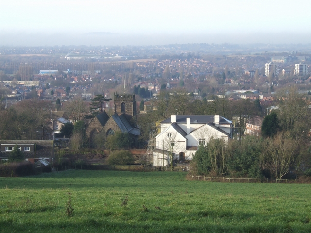
Underhill is a small village located in the county of Staffordshire, England. Situated in the West Midlands region, it is nestled in a picturesque countryside setting, surrounded by rolling hills and lush green fields. The village is conveniently located about 6 miles north of the county town of Stafford, and is easily accessible via the A518 road.

The village of Underhill is known for its tranquility and peaceful atmosphere, making it a popular destination for those seeking a quiet retreat from the bustling city life. It boasts a close-knit community, with a population of around 500 residents, who take pride in maintaining the village's charm and character.

Historically, Underhill has ancient origins, with evidence of human settlement dating back to the Bronze Age. The village is home to several well-preserved historical buildings, including St. Mary's Church, a Grade II listed building that dates back to the 12th century. This church serves as a reminder of the village's rich heritage and provides a focal point for the local community.

In terms of amenities, Underhill offers a range of facilities to cater to the needs of its residents. These include a village hall, a local pub, a primary school, and a small convenience store. The village is also well-connected by public transport, with regular bus services running to nearby towns and cities.

Overall, Underhill, Staffordshire, offers a peaceful and idyllic setting, combined with a strong sense of community and historical significance, making it an attractive place to live or visit for those seeking a quiet and rural lifestyle.

If you have any feedback on the listing, please let us know in the comments section below.
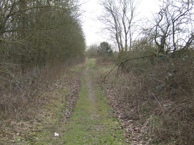
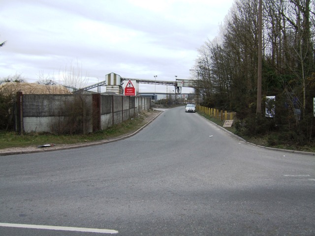
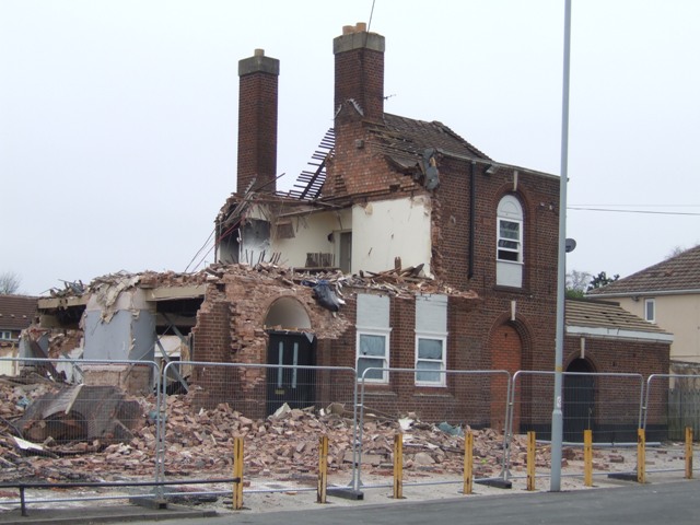
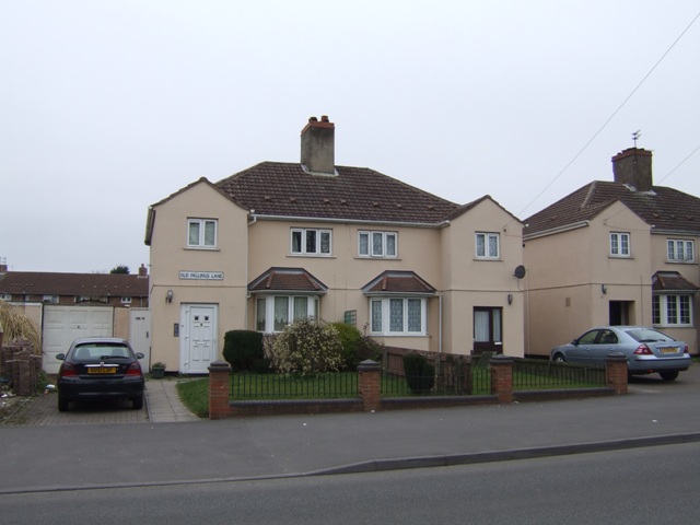
Underhill Images

Images are sourced within 2km of 52.621135/-2.0971676 or Grid Reference SJ9302. Thanks to Geograph Open Source API. All images are credited.

Former colliery railway - Hilton Main South of the Bognop Road level crossing.
Former colliery railway - Hilton Main
South of the Bognop Road level crossing.
Former colliery railway - Hilton Main Looking across the level crossing on Bognop Road into the colliery site at Hilton Main.
Former colliery railway - Hilton Main
Looking across the level crossing on Bognop Road into the colliery site at Hilton Main.
Last days of the New Highcroft The locally listed public house on the 1930s council estate is being demolished to make way for a care home. Local residents are pleased to see it go.<a href="https://www.geograph.org.uk/photo/458309">SJ9201 : The New Highcroft, Old Fallings, Wolverhampton</a>
Last days of the New Highcroft
The locally listed public house on the 1930s council estate is being demolished to make way for a care home. Local residents are pleased to see it go.SJ9201 : The New Highcroft, Old Fallings, Wolverhampton
Council Housing - Old Fallings Lane Late 1920s housing on the edge of the Bushbury Estate.
Council Housing - Old Fallings Lane
Late 1920s housing on the edge of the Bushbury Estate.
Re-branded outlet at 'The Scotlands' Compare and contrast with <a href="https://www.geograph.org.uk/photo/426874">SJ9301 : Not an open invitation at 'The Scotlands'</a> and <a href="https://www.geograph.org.uk/photo/1572796">SJ9301 : Invitation withdrawn at The Scotlands?</a>.
Re-branded outlet at 'The Scotlands'
Moreton School - Bushbury Hill One of two new junior schools to be built this year. The all timber design is similar to the award winning scheme in Blakenhall. The ridge of Bushbury Hill is a finger of open fields with views out into South Staffordshire and Shropshire. The original Bushbury Hill School was built to serve the council estates of Low Hill of the late 1920s and early 1930s. I am told that the school was opened around 1934 by minor royalty.
Moreton School - Bushbury Hill
One of two new junior schools to be built this year. The all timber design is similar to the award winning scheme in Blakenhall. The ridge of Bushbury Hill is a finger of open fields with views out into South Staffordshire and Shropshire. The original Bushbury Hill School was built to serve the council estates of Low Hill of the late 1920s and early 1930s. I am told that the school was opened around 1934 by minor royalty.
Council Housing - Old Fallings Lane Concrete houses dating from late 1920s.
Council Housing - Old Fallings Lane
Concrete houses dating from late 1920s.
Demolishing The New Highcroft at Old Fallings, Wolverhampton See also <a href="https://www.geograph.org.uk/photo/458309">SJ9201 : The New Highcroft, Old Fallings, Wolverhampton</a>
Demolishing The New Highcroft at Old Fallings, Wolverhampton
Demolishing The New Highcroft at Old Fallings, Wolverhampton See also <a href="https://www.geograph.org.uk/photo/458309">SJ9201 : The New Highcroft, Old Fallings, Wolverhampton</a>
Demolishing The New Highcroft at Old Fallings, Wolverhampton
Roundabout At Newbolds Taken from the tower of Our Lady Of Perpetual Succour RC Church
Roundabout At Newbolds
Taken from the tower of Our Lady Of Perpetual Succour RC Church
Old Fallings United Reformed Church Taken from the tower of Our Lady Of Perpetual Succour RC Church
Old Fallings United Reformed Church
Taken from the tower of Our Lady Of Perpetual Succour RC Church
Moseley Gate The front gated entrance to Moseley Old Hall.
Moseley Gate
The front gated entrance to Moseley Old Hall.
Moseley Wall Moseley Old Hall front elevation viewed from Moseley Old Hall Lane.
Moseley Wall
Moseley Old Hall front elevation viewed from Moseley Old Hall Lane.
Moseley Old Hall The Knot garden to the side elevation of Moseley Old Hall.
Moseley Old Hall
The Knot garden to the side elevation of Moseley Old Hall.
Behind Moseley Rear elevation of Moseley Old Hall.
Behind Moseley
Rear elevation of Moseley Old Hall.
Moseley Knot Knot garden to the side of Moseley Old Hall.
Moseley Knot
Knot garden to the side of Moseley Old Hall.
Moseley Old Hall Front elevation.
Moseley Old Hall
Front elevation.
Show me another place!

Underhill is located at Grid Ref: SJ9302 (Lat: 52.621135, Lng: -2.0971676)

Unitary Authority: Wolverhampton

Police Authority: West Midlands

What 3 Words

///gave.having.refuse. Near Featherstone, Staffordshire

Related Wikis

Scotlands Estate

The Scotlands Estate is a residential area of Wolverhampton, West Midlands, England. The area was built between 1935 and 1937 as council housing to rehouse...

Moreton School

Moreton School is a co-educational secondary school located one-mile north east of Wolverhampton City Centre in the West Midlands of England. The school...

Scotlands

The Scotlands is a residential area of Wolverhampton, West Midlands (formerly Staffordshire), England. It predominantly consists of council houses built...

Bushbury

Bushbury is a suburban village and ward in the City of Wolverhampton in the West Midlands, England. It lies two miles north-east of Wolverhampton city...

Nearby Amenities

Located within 500m of 52.621135,-2.0971676
Bus Stop
Underhill Lane / Westcroft Ave
Bus: yes
Naptan AtcoCode: 43000762901
Naptan Bearing: NW
Naptan BusStopType: CUS
Naptan CommonName: Westcroft Ave
Naptan Indicator: opp
Naptan NaptanCode: nwmtdamg
Naptan PlusbusZoneRef: BHAMNWS
Naptan Status: ACT
Naptan StopType: BCT
Naptan Street: UNDERHILL LANE
Naptan Towards: Fordhouses
Naptan Verified: no
Public Transport: platform
Route Ref: 65
Source: WMCA
Lat/Long: 52.6186875/-2.0958934
Bus Stop
Underhill Lane / Westcroft Ave
Bus: yes
Naptan AtcoCode: 43000762902
Naptan Bearing: SE
Naptan BusStopType: CUS
Naptan CommonName: Westcroft Ave
Naptan Indicator: adj
Naptan NaptanCode: nwmtdamj
Naptan PlusbusZoneRef: BHAMNWS
Naptan Status: ACT
Naptan StopType: BCT
Naptan Street: UNDERHILL LANE
Naptan Towards: Wednesfield
Naptan Verified: no
Public Transport: platform
Route Ref: 65
Source: WMCA
Lat/Long: 52.6189481/-2.0959973
Bus Stop
Tennyson Rd / Keats Rd
Bus: yes
Naptan AtcoCode: 43000769001
Naptan Bearing: W
Naptan BusStopType: MKD
Naptan CommonName: Keats Rd
Naptan Indicator: before
Naptan NaptanCode: nwmjmwpt
Naptan PlusbusZoneRef: BHAMNWS
Naptan Status: ACT
Naptan StopType: BCT
Naptan Street: TENNYSON RD
Naptan Towards: Wolverhampton
Naptan Verified: no
Public Transport: platform
Route Ref: 11
Source: WMCA
Lat/Long: 52.6192582/-2.0983922
Bus Stop
Tennyson Rd / Keats Rd
Bus: yes
Naptan AtcoCode: 43000769002
Naptan Bearing: E
Naptan BusStopType: MKD
Naptan CommonName: Keats Rd
Naptan Indicator: after
Naptan NaptanCode: nwmtgagd
Naptan PlusbusZoneRef: BHAMNWS
Naptan Status: ACT
Naptan StopType: BCT
Naptan Street: TENNYSON RD
Naptan Towards: Underhill
Naptan Verified: no
Public Transport: platform
Route Ref: 11
Source: WMCA
Lat/Long: 52.6191974/-2.0989817
Bus Stop
Cannock Rd / Pear Tree Lane
Bus: yes
Naptan AtcoCode: 43000769401
Naptan Bearing: SW
Naptan BusStopType: MKD
Naptan CommonName: Pear Tree Lane
Naptan Indicator: adj
Naptan NaptanCode: nwmjmwtm
Naptan PlusbusZoneRef: BHAMNWS
Naptan Status: ACT
Naptan StopType: BCT
Naptan Street: CANNOCK RD
Naptan Towards: Wolverhampton
Naptan Verified: no
Public Transport: platform
Route Ref: 70;70A
Source: WMCA
Lat/Long: 52.6169446/-2.0957008
Bus Stop
Cannock Rd / Pear Tree Lane
Bus: yes
Naptan AtcoCode: 43000769402
Naptan Bearing: NE
Naptan BusStopType: MKD
Naptan CommonName: Pear Tree Lane
Naptan Indicator: opp
Naptan NaptanCode: nwmjmwtp
Naptan PlusbusZoneRef: BHAMNWS
Naptan Status: ACT
Naptan StopType: BCT
Naptan Street: CANNOCK RD
Naptan Towards: Cannock
Naptan Verified: no
Public Transport: platform
Route Ref: 70;70A
Source: WMCA
Lat/Long: 52.6167004/-2.096214
Bus Stop
Cannock Rd / Old Hampton Lane
Bus: yes
Naptan AtcoCode: 43000769501
Naptan Bearing: NE
Naptan BusStopType: MKD
Naptan CommonName: Old Hampton Lane
Naptan Indicator: opp
Naptan NaptanCode: nwmjmwtw
Naptan PlusbusZoneRef: BHAMNWS
Naptan Status: ACT
Naptan StopType: BCT
Naptan Street: CANNOCK RD
Naptan Towards: Cannock
Naptan Verified: no
Public Transport: platform
Route Ref: 70;70A
Source: WMCA
Lat/Long: 52.619733/-2.0924392
Bus Stop
Cannock Rd / Old Hampton Lane
Bus: yes
Naptan AtcoCode: 43000769502
Naptan Bearing: SW
Naptan BusStopType: MKD
Naptan CommonName: Old Hampton Lane
Naptan Indicator: adj
Naptan NaptanCode: nwmjpada
Naptan PlusbusZoneRef: BHAMNWS
Naptan Status: ACT
Naptan StopType: BCT
Naptan Street: CANNOCK RD
Naptan Towards: Wolverhampton
Naptan Verified: no
Public Transport: platform
Route Ref: 70;70A
Source: WMCA
Lat/Long: 52.6195082/-2.0925421
Bus Stop
Westcroft Ave / Wildtree Avenue
NaPTANAreaCode: 43000769801
Bus: yes
Naptan AtcoCode: 43000769801
Naptan Bearing: E
Naptan BusStopType: MKD
Naptan CommonName: Wildtree Avenue
Naptan Indicator: adj
Naptan Landmark: Talisman
Naptan NaptanCode: nwmjpadp
Naptan PlusbusZoneRef: BHAMNWS
Naptan Status: ACT
Naptan StopType: BCT
Naptan Street: WESTCROFT AVE
Naptan Towards: Wolverhampton
Naptan Verified: no
Public Transport: platform
Route Ref: 11
Shelter: yes
Shelter Ref: 102032
Source: WMCA
Lat/Long: 52.6189655/-2.0967359
Bus Stop
Edge Hill / Wildtree Avenue
NaPTANAreaCode: 43000770001
Bus: yes
Naptan AtcoCode: 43000770001
Naptan Bearing: W
Naptan BusStopType: MKD
Naptan CommonName: Wildtree Avenue
Naptan Indicator: before
Naptan NaptanCode: nwmtgmpw
Naptan PlusbusZoneRef: BHAMNWS
Naptan Status: ACT
Naptan StopType: BCT
Naptan Street: EDGE HILL
Naptan Towards: Wolverhampton
Naptan Verified: no
Public Transport: platform
Route Ref: 11
Shelter: yes
Shelter Ref: 102042
Source: WMCA
Lat/Long: 52.6202416/-2.0973444
Crossing
Crossing: uncontrolled
Source: bing
Lat/Long: 52.6197708/-2.0964612
Bus Stop
Wood Hayes Road
Bus: yes
Naptan AtcoCode: 3800C690301
Naptan Bearing: N
Naptan CommonName: Wood Hayes Road
Naptan Indicator: Opp
Naptan Landmark: Wood Hayes Rd
Naptan Street: Cannock Road
Naptan Verified: no
Public Transport: platform
Source: naptan_import
Lat/Long: 52.6232682/-2.0908486
Bus Stop
Wood Hayes Road
Bus: yes
Naptan AtcoCode: 3800C690302
Naptan Bearing: S
Naptan CommonName: Cannock Road
Naptan Indicator: Adj 227
Naptan Landmark: o/s no 227
Naptan Street: Cannock Road
Naptan Verified: no
Public Transport: platform
Source: naptan_import
Lat/Long: 52.6228489/-2.0906098
Turning Circle
Source: bing
Lat/Long: 52.6225356/-2.0976486
Restaurant
Berry Brook Farmhouse Inn
Diet Vegan: yes
Diet Vegetarian: yes
Operator: Farmhouse Inns
Smoking: outside
Takeaway: yes
Toilets: yes
Toilets Access: customers
Toilets Wheelchair: designated
Wheelchair: yes
Lat/Long: 52.6167608/-2.095434
Bushbury Hill
Place: locality
Source: OS_OpenData_StreetView
Lat/Long: 52.6210282/-2.1032467
Speed Camera
Maxspeed: 30 mph
Lat/Long: 52.6169955/-2.0957505
Speed Camera
Maxspeed: 40 mph
Lat/Long: 52.620642/-2.0916499
Generator Method: photovoltaic
Generator Output Electricity: yes
Generator Source: solar
Generator Type: solar_photovoltaic_panel
Location: roof
Power: generator
Lat/Long: 52.6215148/-2.1009663
Generator Method: photovoltaic
Generator Output Electricity: yes
Generator Source: solar
Generator Type: solar_photovoltaic_panel
Location: roof
Power: generator
Lat/Long: 52.6211712/-2.100057
Generator Method: photovoltaic
Generator Output Electricity: yes
Generator Source: solar
Generator Type: solar_photovoltaic_panel
Location: roof
Power: generator
Lat/Long: 52.6210963/-2.0998585
Generator Method: photovoltaic
Generator Output Electricity: yes
Generator Source: solar
Generator Type: solar_photovoltaic_panel
Location: roof
Power: generator
Lat/Long: 52.6214692/-2.0989385
Generator Method: photovoltaic
Generator Output Electricity: yes
Generator Source: solar
Generator Type: solar_photovoltaic_panel
Location: roof
Power: generator
Lat/Long: 52.6215848/-2.0992014
Generator Method: photovoltaic
Generator Output Electricity: yes
Generator Source: solar
Generator Type: solar_photovoltaic_panel
Location: roof
Power: generator
Lat/Long: 52.6217607/-2.098099
Generator Method: photovoltaic
Generator Output Electricity: yes
Generator Source: solar
Generator Type: solar_photovoltaic_panel
Location: roof
Power: generator
Lat/Long: 52.6223379/-2.0974378
Generator Method: photovoltaic
Generator Output Electricity: yes
Generator Source: solar
Generator Type: solar_photovoltaic_panel
Location: roof
Power: generator
Lat/Long: 52.6222679/-2.0983028
Generator Method: photovoltaic
Generator Output Electricity: yes
Generator Source: solar
Generator Type: solar_photovoltaic_panel
Location: roof
Power: generator
Lat/Long: 52.6222248/-2.0981821
Generator Method: photovoltaic
Generator Output Electricity: yes
Generator Source: solar
Generator Type: solar_photovoltaic_panel
Location: roof
Power: generator
Lat/Long: 52.6221954/-2.0980775
Generator Method: photovoltaic
Generator Output Electricity: yes
Generator Source: solar
Generator Type: solar_photovoltaic_panel
Location: roof
Power: generator
Lat/Long: 52.6204873/-2.0973641
Generator Method: photovoltaic
Generator Output Electricity: yes
Generator Source: solar
Generator Type: solar_photovoltaic_panel
Location: roof
Power: generator
Lat/Long: 52.6188753/-2.0980319
Generator Method: photovoltaic
Generator Output Electricity: yes
Generator Source: solar
Generator Type: solar_photovoltaic_panel
Location: roof
Power: generator
Lat/Long: 52.6173934/-2.0976725
Generator Method: photovoltaic
Generator Output Electricity: yes
Generator Source: solar
Generator Type: solar_photovoltaic_panel
Location: roof
Power: generator
Lat/Long: 52.6173738/-2.0938826
The data included in this document is from www.openstreetmap.org. The data is made available under ODbL.

Have you been to Underhill?

Leave your review of Underhill below (or comments, questions and feedback).