Tuckswood

Settlement in Norfolk Norwich

England

Tuckswood

Venta Icenorum Roman town wall <span class="nowrap"><a title="https://historicengland.org.uk/listing/the-list/list-entry/1021463?section=official-list-entry" rel="nofollow ugc noopener" href="https://historicengland.org.uk/listing/the-list/list-entry/1021463?section=official-list-entry">Link</a><img style="margin-left:2px;" alt="External link" title="External link - shift click to open in new window" src="https://s1.geograph.org.uk/img/external.png" width="10" height="10"/></span>
Venta Icenorum Roman town wall Credit: Sandy Gerrard

Tuckswood is a suburb located in the city of Norwich, Norfolk, England. Situated in the south-eastern part of the city, it is approximately 2 miles away from the city center. Tuckswood is a residential area that mainly consists of housing estates and is known for its quiet and family-friendly atmosphere.

The suburb offers a range of amenities and facilities to its residents. It has a local shopping center known as Tuckswood Shopping Centre, which houses a variety of shops, including grocery stores, pharmacies, and a post office, providing convenience for everyday needs. For recreational activities, Tuckswood offers a local park called Tuckswood Recreation Ground, which has green spaces, playgrounds, and sports facilities, making it an ideal spot for families and individuals to relax and engage in outdoor activities.

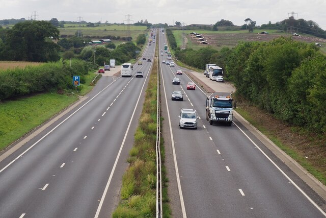
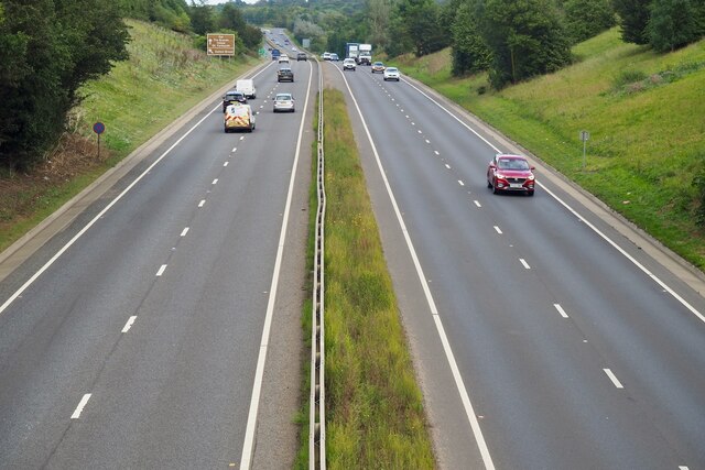
Tuckswood is well-connected to the rest of Norwich and surrounding areas through a network of roads and public transportation. The area is served by several bus routes, providing easy access to the city center and other parts of Norwich. The nearby A146 road also connects Tuckswood to the wider road network, facilitating commuting within Norfolk and beyond.

The suburb benefits from its proximity to various amenities and attractions. The Norwich City Football Club's Carrow Road stadium is within a short distance, making it a popular destination for football enthusiasts. Additionally, Tuckswood is close to the Norfolk and Norwich University Hospital, ensuring convenient access to healthcare services for residents.

Overall, Tuckswood offers a peaceful residential environment with a range of amenities and good connectivity, making it an attractive place to live within the vibrant city of Norwich.

If you have any feedback on the listing, please let us know in the comments section below.
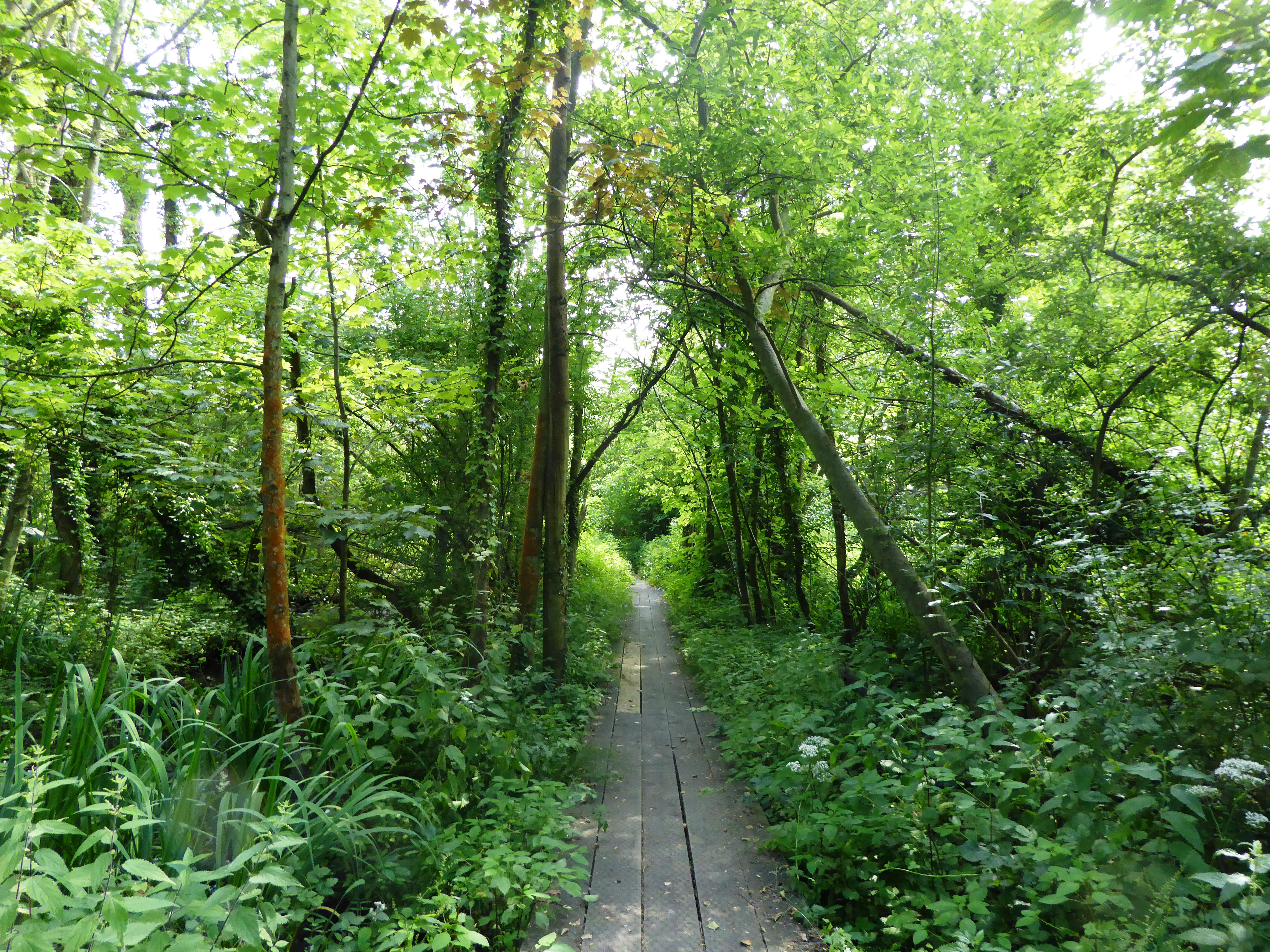
Tuckswood Images

Images are sourced within 2km of 52.602387/1.2831058 or Grid Reference TG2205. Thanks to Geograph Open Source API. All images are credited.

Venta Icenorum Roman town wall <span class="nowrap"><a title="https://historicengland.org.uk/listing/the-list/list-entry/1021463?section=official-list-entry" rel="nofollow ugc noopener" href="https://historicengland.org.uk/listing/the-list/list-entry/1021463?section=official-list-entry">Link</a><img style="margin-left:2px;" alt="External link" title="External link - shift click to open in new window" src="https://s1.geograph.org.uk/img/external.png" width="10" height="10"/></span>
Venta Icenorum Roman town wall
Tower Roller Mills In TG2207 by just a few metres, this appears to be one of two mills on the site. The tower in the background is in TG2307 and is called Peafield Mill. See <a href="https://www.geograph.org.uk/photo/6309716">TG2307 : Peafield Mill in Lakenham</a> for pictures of it, plus an extensive history. The other side of the building shown here is also in that picture.
The Woodrow family seem to have owned both mills.
Both buildings are now residential.
Tower Roller Mills
In TG2207 by just a few metres, this appears to be one of two mills on the site. The tower in the background is in TG2307 and is called Peafield Mill. See TG2307 : Peafield Mill in Lakenham for pictures of it, plus an extensive history. The other side of the building shown here is also in that picture. The Woodrow family seem to have owned both mills. Both buildings are now residential.
Marston Lane, Eaton This view is looking roughly west along Marston Lane, a pleasant amble from the Ipswich Road eventually to the Newmarket Road. There is a benchmark <a href="https://www.geograph.org.uk/photo/7054771">TG2105 : Benchmark behind the ivy</a> on the wall on the left - about 5 brick lengths in from the wooden fencing and 5 rows up. It required a good deal of ivy removal to reveal it.
Marston Lane, Eaton
This view is looking roughly west along Marston Lane, a pleasant amble from the Ipswich Road eventually to the Newmarket Road. There is a benchmark TG2105 : Benchmark behind the ivy on the wall on the left - about 5 brick lengths in from the wooden fencing and 5 rows up. It required a good deal of ivy removal to reveal it.
Benchmark behind the ivy This benchmark is on a barn a little way along Marston Lane from the Ipswich Road <a href="https://www.geograph.org.uk/photo/7054766">TG2105 : Marston Lane, Eaton</a>. <span class="nowrap"><a title="https://www.bench-marks.org.uk/bm160752" rel="nofollow ugc noopener" href="https://www.bench-marks.org.uk/bm160752">Link</a><img style="margin-left:2px;" alt="External link" title="External link - shift click to open in new window" src="https://s1.geograph.org.uk/img/external.png" width="10" height="10"/></span>
Benchmark behind the ivy
This benchmark is on a barn a little way along Marston Lane from the Ipswich Road TG2105 : Marston Lane, Eaton. LinkExternal link
Stoke Road bridge over the River Tas, Norwich
Eaton, Neatmarket, Hall Road: Car park serving B and Q and other outlets
Eaton, Neatmarket, Hall Road: Porsche car showroom
The A47 west approaching junction with A140
47-69 Newmarket Road, Norwich An attractive composition, a terrace set back from the road behind a green space with a central pediment. Built c1830-40. Grade II listed.
47-69 Newmarket Road, Norwich
An attractive composition, a terrace set back from the road behind a green space with a central pediment. Built c1830-40. Grade II listed.
Detail of 51 Newmarket Road, Norwich A Doric doorcase on this terrace <a href="https://www.geograph.org.uk/photo/7449931">TG2207 : 47-69 Newmarket Road, Norwich</a>.
Detail of 51 Newmarket Road, Norwich
A Doric doorcase on this terrace TG2207 : 47-69 Newmarket Road, Norwich.
77-81 Newmarket Road, Norwich A group of three houses, built c1840-45, each with a Greek Doric porch (<a href="https://www.geograph.org.uk/photo/7449937">TG2207 : Detail of 81 Newmarket Road, Norwich</a>). Grade II listed.
77-81 Newmarket Road, Norwich
A group of three houses, built c1840-45, each with a Greek Doric porch (TG2207 : Detail of 81 Newmarket Road, Norwich). Grade II listed.
Detail of 81 Newmarket Road, Norwich One of the Greek Doric porches in this group <a href="https://www.geograph.org.uk/photo/7449935">TG2207 : 77-81 Newmarket Road, Norwich</a>.
Detail of 81 Newmarket Road, Norwich
One of the Greek Doric porches in this group TG2207 : 77-81 Newmarket Road, Norwich.
Keswick: A47 bridge over the Ipswich Road roundabout
The A47 Looking south west from Stoke Road.
The A47
Looking south west from Stoke Road.
The A47 Looking north east from Stoke Road.
The A47
Looking north east from Stoke Road.
Substation and pylons
Stoke Road bridge over the River Tas and railway Why cross one obstacle when you can cross two!
Stoke Road bridge over the River Tas and railway
Why cross one obstacle when you can cross two!
Fenced path to a kissing gate Very strange arrangement on the Boudicca Way. Leading north east from Stoke Road.
Fenced path to a kissing gate
Very strange arrangement on the Boudicca Way. Leading north east from Stoke Road.
Show me another place!

Tuckswood is located at Grid Ref: TG2205 (Lat: 52.602387, Lng: 1.2831058)

Administrative County: Norfolk

District: Norwich

Police Authority: Norfolk

What 3 Words

///nation.good.cigar. Near Cringleford, Norfolk

Nearby Locations

Tuckswood

Related Wikis

University Technical College Norfolk

University Technical College Norfolk is a University Technical College in Old Hall Road, Norwich, with a focus on the engineering and health sectors.It...

Brundall Church Fen

Brundall Church Fen is a 2.8-hectare (6.9-acre) Local Nature Reserve Norfolk. It is owned by Brundall Parish Council and managed by Brundall Parish...

Danby Wood

Danby Wood is a 3.9-hectare (9.6-acre) Local Nature Reserve on the southern outskirts of Norwich in Norfolk. It is owned and managed by Norwich City Council...

Marston Marsh

Marston Marsh is a Local Nature Reserve in southwest Norwich, Norfolk, England. == References == == External links == "Map of Marston Marshes". Local Nature...

Nearby Amenities

Located within 500m of 52.602387,1.2831058
Post Box
Collection Times: Mo-Fr 09:00; Sa 07:00
Operator: Royal Mail
Post Box Type: pillar
Ref: NR4 408D
Royal Cypher: EIIR
Royal Cypher Wikidata: Q33102113
Lat/Long: 52.6037918/1.2846601
Post Box
Brand: Royal Mail
Brand Wikidata: Q638098
Collection Times: Mo-Fr 09:00; Sa 07:00
Operator: Royal Mail
Operator Wikidata: Q638098
Post Box Type: lamp
Ref: NR4 402D
Royal Cypher: EIIR
Royal Cypher Wikidata: Q33102113
Lat/Long: 52.6024048/1.2802276
Crossing
Crossing: unmarked
Lat/Long: 52.6016869/1.2801841
Barrier: bollard
Lat/Long: 52.601761/1.2796504
Barrier: bollard
Lat/Long: 52.6016519/1.2808439
Barrier: bollard
Lat/Long: 52.6017997/1.2818192
Crossing
Crossing: uncontrolled
Tactile Paving: no
Lat/Long: 52.6009229/1.2810176
Barrier: bollard
Bollard: removable
Colour: grey
Material: metal
Lat/Long: 52.6056158/1.2804176
Give Way
Lat/Long: 52.6031689/1.28428
Crossing
Crossing: uncontrolled
Tactile Paving: yes
Lat/Long: 52.60102/1.2815649
Traffic Signals
Lat/Long: 52.6003042/1.2782967
Crossing
Crossing: traffic_signals
Crossing Ref: toucan
Tactile Paving: yes
Lat/Long: 52.6003848/1.278183
Crossing
Crossing: unmarked
Crossing Island: yes
Tactile Paving: no
Lat/Long: 52.6002704/1.2794437
Crossing
Crossing: unmarked
Crossing Island: yes
Tactile Paving: yes
Lat/Long: 52.6006774/1.2808291
Crossing
Crossing: uncontrolled
Tactile Paving: yes
Lat/Long: 52.6010813/1.2815018
Crossing
Bicycle: yes
Crossing Island: yes
Lat/Long: 52.6051023/1.285974
Tuckswood
Place: suburb
Lat/Long: 52.605921/1.2827526
Barrier: cycle_barrier
Lat/Long: 52.6021485/1.2784477
Barrier: bollard
Bicycle: yes
Bollard: fixed
Foot: yes
Lat/Long: 52.6024852/1.2786609
Communication Mobile Phone: yes
Man Made: mast
Material: metal
Operator: Three UK;EE;O2-UK;Vodafone UK
Tower Construction: lattice
Tower Type: communication
Lat/Long: 52.6047961/1.2873255
Crossing
Crossing: uncontrolled
Tactile Paving: yes
Lat/Long: 52.6011703/1.2821689
Crossing
Crossing: uncontrolled
Tactile Paving: yes
Lat/Long: 52.6012431/1.2821667
Give Way
Direction: backward
Lat/Long: 52.6008592/1.2858017
Watkin Road, opp
Naptan AtcoCode: 2900N12280
Naptan Bearing: E
Naptan BusStopType: CUS
Naptan CommonName: Watkin Road
Naptan Indicator: opp
Naptan Landmark: No. 1 Locksley Road
Naptan Locality: Tuckswood
Naptan NaptanCode: nfodjgmd
Naptan PlusbusZoneRef: NRCH
Naptan ShortCommonName: Locksley Road
Naptan Street: Locksley Road
Naptan Verified: no
Source: naptan_import
Lat/Long: 52.6047506/1.2795655
Bus Stop
Tuckswood / Hall Road
Bench: yes
Bin: yes
Bus: yes
Lit: yes
Naptan AtcoCode: 2900N12480
Naptan Bearing: SW
Naptan CommonName: Robin Hood Road
Naptan Indicator: opp
Naptan Landmark: Robin Hood Road
Naptan Locality: Tuckswood
Naptan NaptanCode: nfodjwmp
Naptan PlusbusZoneRef: NRCH
Naptan Street: Hall Road
Public Transport: platform
Shelter: no
Source: naptan_import;survey
Tactile Paving: yes
Lat/Long: 52.6060733/1.2869251
Bus Stop
Tuckswood / Robin Hood Road
Bench: yes
Bin: yes
Bus: yes
Lit: yes
Naptan AtcoCode: 2900N12481
Naptan Bearing: NE
Naptan CommonName: Robin Hood Road
Naptan Indicator: adj
Naptan Locality: Tuckswood
Naptan NaptanCode: nfodjwmt
Naptan PlusbusZoneRef: NRCH
Naptan Street: Hall Road
Public Transport: platform
Shelter: yes
Source: naptan_import;survey
Tactile Paving: yes
Lat/Long: 52.6058116/1.2865065
Bus Stop
Tuckswood / Hall Road
Bus: yes
Naptan AtcoCode: 2900N12482
Naptan Bearing: SW
Naptan CommonName: Bessemer Road
Naptan Indicator: adj
Naptan Landmark: Locksley Road
Naptan Locality: Tuckswood
Naptan NaptanCode: nfodjwmw
Naptan PlusbusZoneRef: NRCH
Naptan Street: Hall Road
Public Transport: platform
Shelter: no
Source: naptan_import;survey
Lat/Long: 52.603945/1.2850718
Bus Stop
Tuckswood / Locksley Road
Bench: yes
Bin: yes
Bus: yes
Naptan AtcoCode: 2900N12483
Naptan Bearing: NE
Naptan CommonName: Bessemer Road
Naptan Indicator: opp
Naptan Landmark: Locksley Road
Naptan Locality: Tuckswood
Naptan NaptanCode: nfodjwpa
Naptan PlusbusZoneRef: NRCH
Naptan Street: Hall Road
Public Transport: platform
Shelter: yes
Source: naptan_import;survey
Lat/Long: 52.6042394/1.2851311
Fountains Road
Naptan AtcoCode: 2900N12484
Naptan Bearing: SW
Naptan BusStopType: MKD
Naptan CommonName: Fountains Road
Naptan Indicator: opp
Naptan Landmark: Fountains Road
Naptan Locality: Tuckswood
Naptan NaptanCode: nfodjwpd
Naptan PlusbusZoneRef: NRCH
Naptan Street: Hall Road
Physically Present: no
Source: naptan_import;survey
Lat/Long: 52.6014186/1.28202
Bus Stop
Norwich / Hall Road
Bench: yes
Bin: yes
Bus: yes
Naptan AtcoCode: 2900N12485
Naptan Bearing: NE
Naptan CommonName: Fountains Road
Naptan Indicator: adj
Naptan Landmark: Fountains Road
Naptan Latitude: 52.6014614
Naptan Locality: Tuckswood
Naptan Longitude: 1.2817421
Naptan NaptanCode: nfodjwpg
Naptan PlusbusZoneRef: NRCH
Naptan Street: Hall Road
Public Transport: platform
Shelter: yes
Source: naptan_import;survey
Tactile Paving: yes
Lat/Long: 52.6016834/1.2821368
Bus Stop
Locksley Road, opp
Bus: yes
Naptan AtcoCode: 2900N12486
Naptan Bearing: N
Naptan CommonName: Locksley Road
Naptan Indicator: opp
Naptan Locality: Tuckswood
Naptan NaptanCode: nfodjwpj
Naptan PlusbusZoneRef: NRCH
Naptan Street: Ipswich Road
Naptan Verified: no
Public Transport: platform
Shelter: yes
Source: naptan_import
Lat/Long: 52.605817/1.2790543
Bus Stop
No 5, adj
Bench: no
Bin: no
Bus: yes
Lit: yes
Naptan AtcoCode: 2900N12493
Naptan Bearing: NW
Naptan CommonName: No 5
Naptan Indicator: adj
Naptan Landmark: No. 5
Naptan Locality: Tuckswood
Naptan NaptanCode: nfodjwtm
Naptan PlusbusZoneRef: NRCH
Naptan ShortCommonName: Robin Hood Road
Naptan Street: Robin Hood Road
Naptan Verified: no
Public Transport: platform
Shelter: no
Source: naptan_import
Tactile Paving: yes
Lat/Long: 52.6063446/1.2859171
Bus Stop
Barn Close, opp
Bus: yes
Naptan AtcoCode: 2900N12499
Naptan Bearing: SE
Naptan CommonName: Barn Close
Naptan Indicator: opp
Naptan Landmark: Hall Road
Naptan Locality: Tuckswood
Naptan NaptanCode: nfodmadm
Naptan PlusbusZoneRef: NRCH
Naptan ShortCommonName: Locksley Road
Naptan Street: Locksley Road
Naptan Verified: no
Public Transport: platform
Source: naptan_import
Lat/Long: 52.6044011/1.2837348
Bus Stop
Holiday Inn, opp
Naptan AtcoCode: 2900N12712
Naptan Bearing: N
Naptan BusStopType: CUS
Naptan CommonName: Holiday Inn
Naptan Indicator: opp
Naptan Landmark: Holiday Inn
Naptan Locality: Tuckswood
Naptan NaptanCode: nfodmpmd
Naptan PlusbusZoneRef: NRCH
Naptan ShortCommonName: Ipswich Road
Naptan Street: Ipswich Road
Naptan Verified: no
Shelter: no
Source: naptan_import
Lat/Long: 52.6014816/1.2780951
Bus Stop
Holiday Inn, adj
Naptan AtcoCode: 2900N12713
Naptan Bearing: S
Naptan BusStopType: CUS
Naptan CommonName: Holiday Inn
Naptan Indicator: adj
Naptan Landmark: Holiday Inn Hotel
Naptan Locality: Tuckswood
Naptan NaptanCode: nfodmpmg
Naptan PlusbusZoneRef: NRCH
Naptan ShortCommonName: Ipswich Road
Naptan Street: Ipswich Road
Naptan Verified: no
Shelter: no
Source: naptan_import
Lat/Long: 52.6012176/1.2782083
Bus Stop
Locksley Road, adj
Bus: yes
Naptan AtcoCode: 2900N12714
Naptan Bearing: S
Naptan CommonName: Locksley Road
Naptan Indicator: adj
Naptan Locality: Tuckswood
Naptan NaptanCode: nfodmpmj
Naptan PlusbusZoneRef: NRCH
Naptan Street: Ipswich Road
Naptan Verified: no
Public Transport: platform
Source: naptan_import
Lat/Long: 52.6052108/1.2791863
Bus Stop
Watkin Road, adj
Bus: yes
Naptan AtcoCode: 2900N12756
Naptan Bearing: W
Naptan CommonName: Watkin Road
Naptan Indicator: adj
Naptan Landmark: No 4 Locksley Road
Naptan Locality: Tuckswood
Naptan NaptanCode: nfogmwta
Naptan PlusbusZoneRef: NRCH
Naptan ShortCommonName: Locksley Road
Naptan Street: Locksley Road
Naptan Verified: no
Public Transport: platform
Source: naptan_import
Lat/Long: 52.6045931/1.279406
Ipswich Road/Hall Road CCTV Camera
Man Made: surveillance
Note: Demountable CCTV camera. Mounted to a street light. Forward Vision MIC1-400 aluminium range.
Surveillance: traffic
Url: http://sites.google.com/site/norwichpolicecctv/
Lat/Long: 52.6002222/1.2780168
Crossing
Crossing: traffic_signals
Crossing Ref: toucan
Tactile Paving: yes
Lat/Long: 52.6005528/1.2777887
Cycleway: asl
Lat/Long: 52.6006024/1.2779774
Crossing
Crossing: traffic_signals
Crossing Ref: toucan
Tactile Paving: yes
Lat/Long: 52.6003119/1.2782263
Traffic Signals
Lat/Long: 52.6002273/1.2777565
Crossing
Crossing: traffic_signals
Crossing Ref: toucan
Tactile Paving: yes
Lat/Long: 52.6005757/1.2779684
Traffic Signals
Lat/Long: 52.6002378/1.2776669
Barrier: cycle_barrier
Lat/Long: 52.6017752/1.2819721
Crossing
Crossing: uncontrolled
Crossing Island: no
Tactile Paving: no
Lat/Long: 52.6020874/1.2823545
Give Way
Lat/Long: 52.6048053/1.2858056
Crossing
Crossing: uncontrolled
Tactile Paving: yes
Lat/Long: 52.6014013/1.2819454
Crossing
Crossing: unmarked
Crossing Island: yes
Tactile Paving: yes
Lat/Long: 52.6023637/1.2830877
Waste Basket
Check Date: 2021-04-26
Lat/Long: 52.6016397/1.2820691
Waste Basket
Colour: green
Material: plastic
Lat/Long: 52.6041959/1.2850946
Barrier: bollard
Bollard: fixed
Height: 1
Lat/Long: 52.6017551/1.2820822
Waste Basket
Colour: green
Material: plastic
Lat/Long: 52.605759/1.2863565
Crossing
Button Operated: yes
Crossing: traffic_signals
Crossing Island: yes
Crossing Ref: toucan
Tactile Paving: yes
Traffic Signals Sound: no
Traffic Signals Vibration: yes
Lat/Long: 52.6018633/1.2824279
Crossing
Crossing: unmarked
Crossing Island: no
Tactile Paving: no
Lat/Long: 52.6061457/1.2867134
Barrier: lift_gate
Lat/Long: 52.5997965/1.2793356
Barrier: lift_gate
Lat/Long: 52.5999237/1.2796921
Crossing
Crossing: traffic_signals
Crossing Ref: toucan
Pedestrian Sensor: yes
Tactile Paving: yes
Lat/Long: 52.6017434/1.2782787
Traffic Signals
Lat/Long: 52.6006459/1.2779876
Waste Basket
Lat/Long: 52.602734/1.2759965
No 5, opp
Naptan AtcoCode: 2900N1003
Naptan Bearing: E
Naptan BusStopType: CUS
Naptan CommonName: No 5
Naptan Indicator: opp
Naptan Locality: Tuckswood
Naptan NaptanCode: nfogtjpt
Naptan Street: Robin Hood Road
Naptan Verified: no
Source: naptan_import
Lat/Long: 52.6064265/1.2859527
Spirit Health Club
Addr City: Norwich
Addr Country: GB
Addr Postcode: NR4 6EP
Addr Street: Ipswich Road
Check Date: 2024-02-11
Email: spirit.norwich@ihg.com
Fixme: Needs to be positioned based on survey
Leisure: fitness_centre
Opening Hours: Mo-Fr 06:30-22:00; Sa-Su 07:00-22:00
Phone: +44 1603 508216
Website: https://www.spirithealthclubs.co.uk/clubs/norwich
Lat/Long: 52.6009914/1.2790267
Crossing
Crossing: unmarked
Crossing Island: yes
Lat/Long: 52.6035793/1.2787385
Crossing
Crossing: unmarked
Crossing Island: yes
Lat/Long: 52.6047995/1.2790167
Crossing
Crossing: uncontrolled
Tactile Paving: yes
Lat/Long: 52.6014254/1.2818029
Crossing
Crossing: uncontrolled
Tactile Paving: yes
Lat/Long: 52.6007712/1.2849314
Crossing
Crossing: uncontrolled
Crossing Ref: zebra
Lat/Long: 52.6012591/1.2848121
Danby Wood Local Nature Reserve
Board Type: nature
Check Date: 2021-07-09
Information: board
Tourism: information
Lat/Long: 52.6027635/1.2759446
Give Way
Lat/Long: 52.602459/1.2850263
Give Way
Lat/Long: 52.6061465/1.2865888
Give Way
Lat/Long: 52.6062053/1.2866406
Barrier: bollard
Lat/Long: 52.6015894/1.2813065
Entrance: yes
Lat/Long: 52.6040312/1.2857001
Give Way
Lat/Long: 52.6061253/1.2867823
Crossing
Crossing: unmarked
Lat/Long: 52.6065264/1.2851177
Give Way
Lat/Long: 52.6002889/1.2799709
Give Way
Lat/Long: 52.6039882/1.2849048
Give Way
Lat/Long: 52.6043907/1.2854326
Give Way
Lat/Long: 52.6031439/1.2876852
Give Way
Lat/Long: 52.6039919/1.2883611
GAP Plant & Tool Hire
Addr City: Norwich
Addr Country: GB
Addr Place: Norwich Livestock Market
Addr Postcode: NR4 6DW
Addr Street: Hall Road
Brand: GAP
Email: norwich.hiredesk@gap-group.co.uk
Fax: +44 1603 453139
Opening Hours: Mo-Fr 07:30-17:00; Sa-Su closed
Operator: GAP Group
Phone: +44 1603 456055
Shop: hardware_rental
Website: https://www.gap-group.co.uk/contact-us/find-a-depot/41-norwich-plant-tools
Lat/Long: 52.5998416/1.282863
Norwich VOC Trailer Park
Operator: Royal Mail
Place: locality
Lat/Long: 52.6050329/1.2883962
Camera Mount: pole
Camera Type: dome
Check Date: 2023-09-22
Man Made: surveillance
Surveillance: outdoor
Surveillance Type: camera
Surveillance Zone: parking
Lat/Long: 52.604714/1.288961
Grit Bin
Colour: yellow
Lat/Long: 52.6046496/1.2886673
Defibrillator
Defibrillator Location: On exterior wall of Ipswich Road Community Hub, facing the A140 Ipswich Road.
Emergency: defibrillator
Fixme: Check precise location
Lat/Long: 52.6038364/1.2785031
Give Way
Lat/Long: 52.6004057/1.2804893
Give Way
Lat/Long: 52.6012037/1.2828355
Construction
Construction: crossing
Lat/Long: 52.6017372/1.2834039
Turning Circle
Lat/Long: 52.6015619/1.2833539
Give Way
Direction: backward
Lat/Long: 52.6023522/1.2807712
Give Way
Lat/Long: 52.6024941/1.2797613
Give Way
Lat/Long: 52.6023301/1.2813308
Give Way
Lat/Long: 52.6020243/1.2825385
Give Way
Direction: forward
Lat/Long: 52.6008646/1.285536
Give Way
Direction: forward
Lat/Long: 52.6008446/1.2853142
Give Way
Direction: forward
Lat/Long: 52.6008182/1.2850567
Give Way
Direction: forward
Lat/Long: 52.6007873/1.284792
Give Way
Direction: forward
Lat/Long: 52.600773/1.2845687
Give Way
Lat/Long: 52.601174/1.284234
Give Way
Lat/Long: 52.601152/1.2840228
Give Way
Lat/Long: 52.6011276/1.2837727
Give Way
Lat/Long: 52.6011064/1.2835458
Give Way
Lat/Long: 52.6010876/1.2833311
Crossing
Crossing: uncontrolled
Crossing Island: no
Tactile Paving: yes
Lat/Long: 52.6031741/1.2842683
Crossing
Crossing: uncontrolled
Tactile Paving: yes
Lat/Long: 52.6043963/1.285414
Waste Basket
Lat/Long: 52.6054387/1.2815807
Waste Basket
Lat/Long: 52.6061597/1.2829939
Waste Basket
Lat/Long: 52.6065834/1.2806447
Waste Basket
Colour: green
Material: plastic
Lat/Long: 52.6018377/1.282191
Waste Basket
Lat/Long: 52.6057501/1.281504
Waste Basket
Colour: green
Material: plastic
Lat/Long: 52.5989812/1.2784642
Waste Basket
Colour: green
Material: plastic
Lat/Long: 52.6057698/1.2788063
Waste Basket
Lat/Long: 52.606397/1.280777
Waste Basket
Lat/Long: 52.6028762/1.2896892
Waste Basket
Colour: green
Material: plastic
Lat/Long: 52.6055264/1.2794191
Waste Basket
Lat/Long: 52.6029133/1.2758929
Waste Basket
Colour: green
Material: plastic
Lat/Long: 52.6010984/1.2901293
Waste Basket
Lat/Long: 52.6049041/1.2773908
Waste Basket
Lat/Long: 52.6062543/1.2814906
Waste Basket
Lat/Long: 52.6060996/1.2797119
Bicycle Parking
Bicycle Parking: stands
Capacity: 6
Covered: no
Lat/Long: 52.6027246/1.2758513
Bench
Lat/Long: 52.6018163/1.2798154
Grit Bin
Lat/Long: 52.6018021/1.2819011
Grit Bin
Lat/Long: 52.602471/1.2788469
Bicycle Rental
University Technical College Norfolk
Capacity: 10
Email: support@beryl.cc
Fee: yes
Network: Beryl - Norwich
Operator: Beryl
Operator Wikidata: Q106575369
Payment App: yes
Payment Cash: no
Payment Credit Cards: no
Payment Cryptocurrencies: no
Payment Debit Cards: no
Payment Electronic Purses: no
Phone: +44 20 3003 5044
Ref Gbfs: beryl_norwich:5185
Rental: city_bike;ebike;escooter
Website: https://beryl.cc/scheme/norwich
Lat/Long: 52.598763/1.279071
Defibrillator
Defibrillator Location: Just inside the main entrance of B&Q, on the right-hand side as you enter the store
Emergency: defibrillator
Indoor: yes
Lat/Long: 52.6007644/1.2852596
Entrance: main
Lat/Long: 52.6006233/1.2840482
Entrance: main
Lat/Long: 52.6006814/1.2846783
Entrance: main
Lat/Long: 52.6007823/1.2853117
Colour: grey
Communication Mobile Phone: yes
Man Made: mast
Material: metal
Operator: EE
Tower Construction: freestanding
Tower Type: communication
Lat/Long: 52.6001144/1.2799139
Give Way
Lat/Long: 52.6001857/1.2801014
Crossing
Crossing: unmarked
Kerb: flush
Tactile Paving: yes
Lat/Long: 52.600271/1.2799797
The data included in this document is from www.openstreetmap.org. The data is made available under ODbL.

Have you been to Tuckswood?

Leave your review of Tuckswood below (or comments, questions and feedback).