Meadow Head

Settlement in Derbyshire

England

Meadow Head

parkrun: it's good to be back parkrun returned to England on 24th July, 2021 after a gap of 16 months during the Covid-19 restrictions but the return was delayed until 31st July at Millhouses Park because of another event there the previous week. 

207 runners, joggers and walkers are here setting off on the first of three laps on this 5k route at Millhouses Park.
parkrun: it's good to be back Credit: Graham Hogg

Meadow Head is a charming village located in the county of Derbyshire, England. Situated in the southern part of the county, it lies on the outskirts of the bustling city of Sheffield, making it an ideal residential area for those seeking a peaceful countryside lifestyle with easy access to urban amenities.

The village is surrounded by picturesque rolling hills and meadows, offering residents breathtaking views and ample opportunities for outdoor activities such as hiking, cycling, and horse riding. The nearby Peak District National Park is a popular destination for nature enthusiasts and offers a wide range of recreational activities.

Meadow Head boasts a close-knit community, with a population of approximately 1,500 residents. The village is home to a primary school, which provides education for local children up to the age of 11. Additionally, there are a few local businesses, including a convenience store, a post office, and a cozy village pub, where locals and visitors can enjoy a pint of traditional ale.

Transportation in Meadow Head is convenient, with regular bus services connecting the village to nearby towns and cities. The village is also well-connected by road, with easy access to the M1 motorway, making it an ideal location for commuters.

Overall, Meadow Head offers a tranquil and idyllic setting for residents, with its beautiful surroundings, strong sense of community, and convenient amenities.

If you have any feedback on the listing, please let us know in the comments section below.
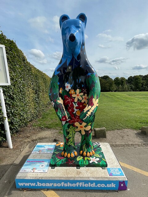
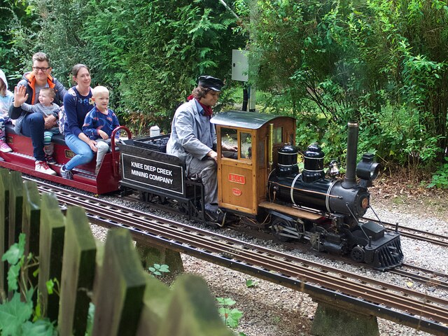
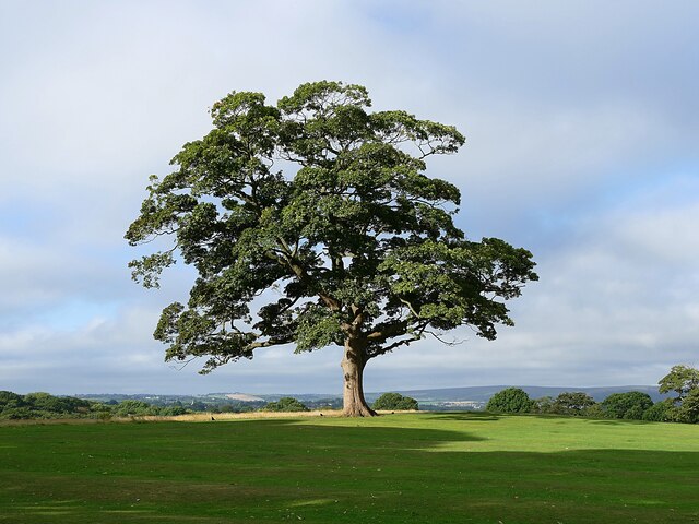
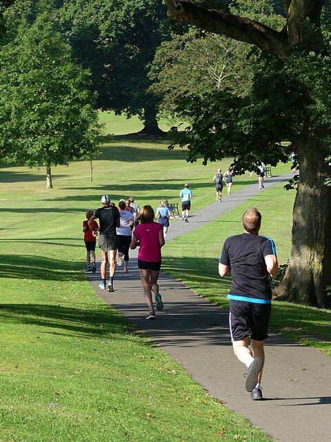
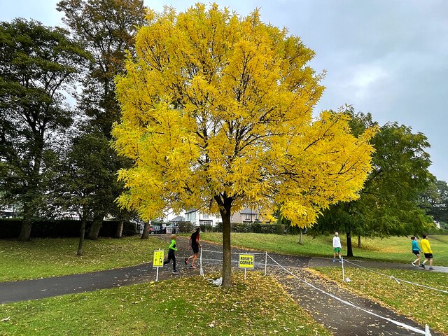
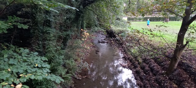
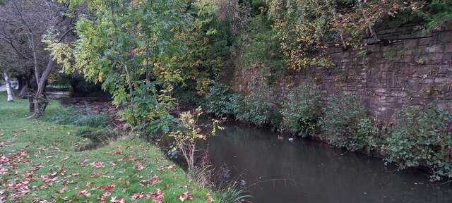
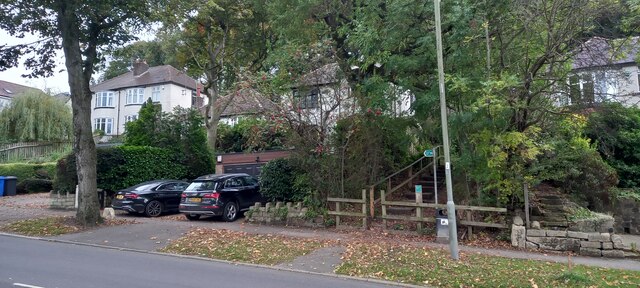
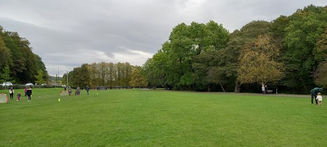
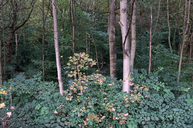
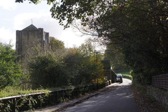
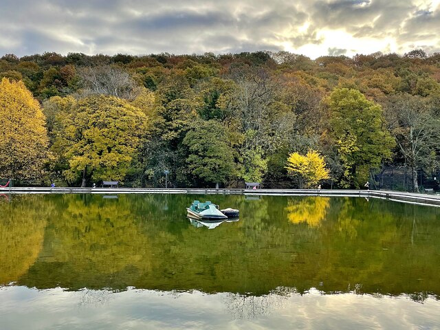
Meadow Head Images

Images are sourced within 2km of 53.335127/-1.483372 or Grid Reference SK3482. Thanks to Geograph Open Source API. All images are credited.

parkrun: it's good to be back parkrun returned to England on 24th July, 2021 after a gap of 16 months during the Covid-19 restrictions but the return was delayed until 31st July at Millhouses Park because of another event there the previous week. 

207 runners, joggers and walkers are here setting off on the first of three laps on this 5k route at Millhouses Park.
parkrun: it's good to be back
parkrun returned to England on 24th July, 2021 after a gap of 16 months during the Covid-19 restrictions but the return was delayed until 31st July at Millhouses Park because of another event there the previous week. 207 runners, joggers and walkers are here setting off on the first of three laps on this 5k route at Millhouses Park.
Bears of Sheffield: #57 Beartanical #57 of 61 big bear sculptures, this one was decorated by Vanessa Scott and is located in Graves Park.

Beartantical was inspired by the artist's many adventures and relaxing days spent exploring the hills and woodland surrounding the city, and the afternoons she has spent gazing at the beautiful star shaped plants at the botanical gardens.
Bears of Sheffield: #57 Beartanical
#57 of 61 big bear sculptures, this one was decorated by Vanessa Scott and is located in Graves Park. Beartantical was inspired by the artist's many adventures and relaxing days spent exploring the hills and woodland surrounding the city, and the afternoons she has spent gazing at the beautiful star shaped plants at the botanical gardens.
Knee Deep Creek Mining Company locomotive 'Ella' Hauling passengers on one of the regular open days of the Sheffield & District Society of Model & Experimental Engineers at the Abbeydale Miniature Railway. 'Ella' was built in 1991 and is one of the society's oldest locos.
Knee Deep Creek Mining Company locomotive 'Ella'
Hauling passengers on one of the regular open days of the Sheffield & District Society of Model & Experimental Engineers at the Abbeydale Miniature Railway. 'Ella' was built in 1991 and is one of the society's oldest locos.
Sycamore tree in Graves Park One of my favourite trees and I can't resist a photo when I pass by!
Sycamore tree in Graves Park
One of my favourite trees and I can't resist a photo when I pass by!
Graves parkrunners Participants in the 405th Graves parkrun on a downhill section which comes as something of a relief from the hills that precede it.
Graves parkrunners
Participants in the 405th Graves parkrun on a downhill section which comes as something of a relief from the hills that precede it.
Autumn colour at Rosie's Corner On the course of Millhouses parkrun, the corner is named for the volunteer who is often stationed here to guide runners who on their third and final lap must turn sharp right to the finish line.
Autumn colour at Rosie's Corner
On the course of Millhouses parkrun, the corner is named for the volunteer who is often stationed here to guide runners who on their third and final lap must turn sharp right to the finish line.
River Sheaf at Abbey Dale, Sheffield
River Sheaf, Millhouses Park, Beauchief, Sheffield
Footpath off Bocking Lane, Beauchief, Sheffield
Millhouses Park, Beauchief, Sheffield
Chancet Wood, Beauchief, Sheffield
Beauchief Abbey
Beauchief Abbey
Archer Road, Sheffield
Hutcliffe Road, Sheffield
Brexit Bonus, Sainsbury's, Archer Road, Sheffield Sainsbury's are doing their best to make it look as though the shelves aren't empty, but crisps and other potato products have been especially badly hit by supply chain problems in 2021. Apparently, a lot of our crisps come from Ireland. Yes, really, we can't even get crisps from Ireland when we were promised that everything would be better after Brexit.
Brexit Bonus, Sainsbury's, Archer Road, Sheffield
Sainsbury's are doing their best to make it look as though the shelves aren't empty, but crisps and other potato products have been especially badly hit by supply chain problems in 2021. Apparently, a lot of our crisps come from Ireland. Yes, really, we can't even get crisps from Ireland when we were promised that everything would be better after Brexit.
Autumn scene at the boating lake Most of the boats on the boating lake at Millhouses Park have been put into their winter storage
Autumn scene at the boating lake
Most of the boats on the boating lake at Millhouses Park have been put into their winter storage
Autumn scene at the boating lake Most of the boats on the boating lake at Millhouses Park have been put into their winter storage
Autumn scene at the boating lake
Most of the boats on the boating lake at Millhouses Park have been put into their winter storage
Autumn colour in Ecclesall Woods  The southern edge of the wood where it meets Abbeydale Road South
Autumn colour in Ecclesall Woods
The southern edge of the wood where it meets Abbeydale Road South
Show me another place!

Meadow Head is located at Grid Ref: SK3482 (Lat: 53.335127, Lng: -1.483372)

Unitary Authority: Sheffield

Police Authority: South Yorkshire

What 3 Words

///castle.circle.ranch. Near Dronfield, Derbyshire

Related Wikis

Beauchief and Greenhill

Beauchief and Greenhill ward—which includes the districts of Batemoor, Beauchief, Chancet Wood, Greenhill, Jordanthorpe, Lowedges and Meadowhead—is one...

Graves Park

Graves Park is a large parkland area in the South of Sheffield, between the districts of Norton, Woodseats and Meadowhead. The park was developed by Alderman...

Beauchief Abbey

Beauchief Abbey is a medieval monastic house now serving as a parish church in the southern suburbs of Sheffield, England. == History == The abbey was...

A6102 road

The A6102 is a 4 digit A road in South Yorkshire, England. == Route == It begins in the Greenhill area of Sheffield, at a junction with the A61 (at the...

Nearby Amenities

Located within 500m of 53.335127,-1.483372
Traffic Signals
Crossing: no
Traffic Signals Direction: backward
Lat/Long: 53.3339061/-1.4794625
Crossing
Crossing: unmarked
Crossing Island: yes
Tactile Paving: yes
Lat/Long: 53.3379388/-1.4881086
Crossing
Crossing: uncontrolled
Crossing Island: yes
Tactile Paving: yes
Lat/Long: 53.3374174/-1.4892025
Turning Circle
Lat/Long: 53.3374931/-1.4861042
Post Box
Collection Times: Mo-Fr 17:00, Sa 12:00
Post Box Type: pillar
Ref: S8 369
Royal Cypher: GR
Royal Cypher Wikidata: Q33102273
Lat/Long: 53.3390796/-1.4823329
Crossing
Check Date Crossing: 2020-10-13
Crossing: uncontrolled
Crossing Island: no
Crossing Ref: zebra
Tactile Paving: yes
Lat/Long: 53.3392504/-1.4830658
Crossing
Check Date Crossing: 2020-10-13
Crossing: uncontrolled
Crossing Island: no
Crossing Ref: zebra
Tactile Paving: yes
Lat/Long: 53.3390086/-1.4852877
Turning Circle
Lat/Long: 53.3352449/-1.4896137
Bus Stop
Meadowhead/Charles Ashmore Road
Bench: no
Bin: no
Bus: yes
Lit: no
Naptan AtcoCode: 370021757
Naptan Bearing: SE
Naptan CommonName: Meadowhead/Charles Ashmore Road
Naptan Indicator: 21757
Naptan Landmark: Graves Park
Naptan PlusbusZoneRef: ROTHCEN
Naptan Street: Meadowhead
Naptan Verified: no
Public Transport: platform
Shelter: no
Source: naptan_import
Tactile Paving: yes
Lat/Long: 53.3327808/-1.4777467
Bus Stop
Meadowhead/Charles Ashmore Road
Bench: yes
Bin: yes
Bus: yes
Naptan AtcoCode: 370021758
Naptan Bearing: NW
Naptan CommonName: Meadowhead/Charles Ashmore Road
Naptan Indicator: 21758
Naptan Landmark: Park Gates
Naptan PlusbusZoneRef: ROTHCEN
Naptan Street: Meadowhead
Naptan Verified: no
Public Transport: platform
Shelter: yes
Source: naptan_import
Tactile Paving: yes
Lat/Long: 53.3324332/-1.4775623
Bus Stop
Abbey Brook Drive/Chancet Wood
Alt Name: Abbey Brook Drive/Chancet Wood
Bench: no
Bus: yes
Naptan AltCommonName: Abbey Brook Drive/Chancet Wood
Naptan AtcoCode: 370021760
Naptan Bearing: S
Naptan CommonName: Abbey Brook Drive/Chancet Wood
Naptan Indicator: 21760
Naptan Landmark: Opposite Wooded Valley
Naptan PlusbusZoneRef: ROTHCEN
Naptan Street: Abbey Brook Drive
Naptan Verified: no
Public Transport: platform
Shelter: no
Source: naptan_import
Tactile Paving: no
Lat/Long: 53.3329374/-1.4839533
Bus Stop
Abbey Brook Drive/Chancet Wood
Alt Name: Abbey Brook Drive/Chancet Wood
Bench: no
Bus: yes
Naptan AltCommonName: Abbey Brook Drive/Chancet Wood
Naptan AtcoCode: 370021761
Naptan Bearing: N
Naptan CommonName: Abbey Brook Drive/Chancet Wood
Naptan Indicator: 21761
Naptan Landmark: Woods/Opposite Old Folks Homes
Naptan PlusbusZoneRef: ROTHCEN
Naptan Street: Abbey Brook Drive
Naptan Verified: no
Public Transport: platform
Shelter: no
Source: naptan_import
Tactile Paving: no
Lat/Long: 53.3331628/-1.4841008
Bus Stop
Abbey Brook Drive/Chancet Wood Drive
Bench: no
Bus: yes
Naptan AtcoCode: 370021762
Naptan Bearing: NW
Naptan CommonName: Abbey Brook Drive/Chancet Wood Drive
Naptan Indicator: 21762
Naptan Landmark: OUTSIDE NO. 21 - 25/BRIERLEY F
Naptan PlusbusZoneRef: ROTHCEN
Naptan Street: Abbey Brook Drive
Naptan Verified: no
Public Transport: platform
Shelter: no
Source: naptan_import
Tactile Paving: no
Lat/Long: 53.3321276/-1.4837529
Bus Stop
Abbey Brook Drive/Chancet Wood Drive
Bench: yes
Bus: yes
Naptan AtcoCode: 370021763
Naptan Bearing: SE
Naptan CommonName: Abbey Brook Drive/Chancet Wood Drive
Naptan Indicator: 21763
Naptan Landmark: OUTSIDE NO. 2 - 40/OPPOSITE NO
Naptan PlusbusZoneRef: ROTHCEN
Naptan Street: Abbey Brook Drive
Naptan Verified: no
Public Transport: platform
Shelter: yes
Source: naptan_import
Tactile Paving: no
Lat/Long: 53.3320256/-1.4830483
Bus Stop
Greenhill Avenue/Chancet Wood Drive
Bench: no
Bus: yes
Naptan AtcoCode: 370021777
Naptan Bearing: SE
Naptan CommonName: Greenhill Avenue/Chancet Wood Drive
Naptan Indicator: 21777
Naptan Landmark: Opposite Annesley Road
Naptan PlusbusZoneRef: ROTHCEN
Naptan Street: Greenhill Avenue
Naptan Verified: no
Public Transport: platform
Shelter: no
Source: naptan_import
Tactile Paving: yes
Lat/Long: 53.3309932/-1.4834546
Bus Stop
Greenhill Avenue/Humphrey Road
Alt Name: Greenhill Avenue/Humphrey Road
Bench: yes
Bus: yes
Naptan AltCommonName: Greenhill Avenue/Humphrey Road
Naptan AtcoCode: 370021778
Naptan Bearing: W
Naptan CommonName: Greenhill Avenue/Humphrey Road
Naptan Indicator: 21778
Naptan Landmark: Opposite 71/73
Naptan PlusbusZoneRef: ROTHCEN
Naptan Street: Greenhill Avenue
Naptan Verified: no
Public Transport: platform
Shelter: yes
Source: naptan_import
Tactile Paving: no
Lat/Long: 53.3310705/-1.4842123
Bus Stop
Greenhill Avenue/Bocking Lane
Bench: yes
Bus: yes
Naptan AtcoCode: 370021779
Naptan Bearing: NW
Naptan CommonName: Greenhill Avenue/Bocking Lane
Naptan Indicator: 21779
Naptan Landmark: ROAD JUNCTION
Naptan PlusbusZoneRef: ROTHCEN
Naptan Street: Greenhill Avenue
Naptan Verified: no
Public Transport: platform
Shelter: yes
Source: naptan_import
Tactile Paving: yes
Lat/Long: 53.332439/-1.4871879
Bus Stop
Greenhill Avenue/Bocking Lane
Bench: no
Bus: yes
Naptan AtcoCode: 370021780
Naptan Bearing: SE
Naptan CommonName: Greenhill Avenue/Bocking Lane
Naptan Indicator: 21780
Naptan Landmark: Opposite 122c102/Grassed Area
Naptan PlusbusZoneRef: ROTHCEN
Naptan Street: Greenhill Avenue
Naptan Verified: no
Public Transport: platform
Shelter: no
Source: naptan_import
Tactile Paving: yes
Lat/Long: 53.3324371/-1.4867524
Bus Stop
Bocking Lane/Greenhill Avenue
Bench: no
Bus: yes
Naptan AtcoCode: 370021781
Naptan Bearing: NW
Naptan CommonName: Bocking Lane/Greenhill Avenue
Naptan Indicator: 21781
Naptan Landmark: Opposite 39/41
Naptan PlusbusZoneRef: ROTHCEN
Naptan Street: Bocking Lane
Naptan Verified: no
Public Transport: platform
Shelter: no
Source: naptan_import
Tactile Paving: no
Lat/Long: 53.3334712/-1.4889325
Bus Stop
Abbey Lane/Turning Circle
Alt Name: Abbey Lane/Turning Circle
Bench: yes
Bin: no
Bus: yes
Lit: yes
Naptan AltCommonName: Abbey Lane/Turning Circle
Naptan AtcoCode: 370021432
Naptan Bearing: NE
Naptan CommonName: Abbey Lane/Turning Circle
Naptan Indicator: 21432
Naptan Landmark: Timetable Also Attached
Naptan PlusbusZoneRef: ROTHCEN
Naptan Street: Abbey Lane
Naptan Verified: no
Public Transport: platform
Shelter: yes
Source: naptan_import
Tactile Paving: yes
Lat/Long: 53.3372524/-1.4897233
Bus Stop
Abbey Lane/Cemetery
Bench: no
Bus: yes
Naptan AtcoCode: 370021433
Naptan Bearing: SW
Naptan CommonName: Abbey Lane/Cemetery
Naptan Indicator: 21433
Naptan Landmark: Cemetery
Naptan PlusbusZoneRef: ROTHCEN
Naptan Street: Abbey Lane
Naptan Verified: no
Public Transport: platform
Shelter: no
Source: naptan_import
Tactile Paving: yes
Lat/Long: 53.33718/-1.4895228
Bus Stop
Abbey Lane/Roxton Road
Alt Name: Abbey Lane/Roxton Road
Bench: no
Bus: yes
Naptan AltCommonName: Abbey Lane/Roxton Road
Naptan AtcoCode: 370021434
Naptan Bearing: SW
Naptan CommonName: Abbey Lane/Roxton Road
Naptan Indicator: 21434
Naptan Landmark: OUTSIDE NO. 65
Naptan PlusbusZoneRef: ROTHCEN
Naptan Street: Abbey Lane
Naptan Verified: no
Public Transport: platform
Shelter: no
Source: naptan_import
Tactile Paving: no
Lat/Long: 53.338444/-1.4868844
Bus Stop
Abbey Lane/Linden Avenue
Bench: no
Bin: no
Bus: yes
Lit: no
Naptan AtcoCode: 370021435
Naptan Bearing: NE
Naptan CommonName: Abbey Lane/Linden Avenue
Naptan Indicator: 21435
Naptan Landmark: OPPOSITE NO. 59/61
Naptan PlusbusZoneRef: ROTHCEN
Naptan Street: Abbey Lane
Naptan Verified: no
Public Transport: platform
Shelter: no
Source: naptan_import
Tactile Paving: no
Lat/Long: 53.338763/-1.486439
Bus Stop
Abbey Lane/Linden Avenue
Alt Name: Abbey Lane/Linden Avenue
Bench: yes
Bin: no
Bus: yes
Lit: yes
Naptan AltCommonName: Abbey Lane/Linden Avenue
Naptan AtcoCode: 370021436
Naptan Bearing: N
Naptan CommonName: Abbey Lane/Linden Avenue
Naptan Indicator: 21436
Naptan Landmark: Outside Abbey Lane J & I Prima
Naptan PlusbusZoneRef: ROTHCEN
Naptan Street: Abbey Lane
Naptan Verified: no
Public Transport: platform
Shelter: yes
Source: naptan_import
Tactile Paving: no
Lat/Long: 53.3389715/-1.4847556
Bus Stop
Abbey Lane/Camping Lane
Bench: no
Bin: no
Bus: yes
Lit: no
Naptan AtcoCode: 370021437
Naptan Bearing: N
Naptan CommonName: Abbey Lane/Camping Lane
Naptan Indicator: 21437
Naptan Landmark: Layby
Naptan PlusbusZoneRef: ROTHCEN
Naptan Street: Abbey Lane
Naptan Verified: no
Public Transport: platform
Shelter: no
Source: naptan_import
Tactile Paving: no
Lat/Long: 53.3391395/-1.4847101
Bus Stop
Abbey Lane/Mitchell Road
Alt Name: Abbey Lane/Mitchell Road
Bench: no
Bin: no
Bus: yes
Lit: no
Naptan AltCommonName: Abbey Lane/Mitchell Road
Naptan AtcoCode: 370021438
Naptan Bearing: N
Naptan CommonName: Abbey Lane/Mitchell Road
Naptan Indicator: 21438
Naptan Landmark: OUTSIDE NO. 22
Naptan PlusbusZoneRef: ROTHCEN
Naptan Street: Abbey Lane
Naptan Verified: no
Public Transport: platform
Shelter: no
Source: naptan_import
Tactile Paving: yes
Lat/Long: 53.3391915/-1.4823085
Bus Stop
Meadowhead/Abbey Lane
Bench: yes
Bin: no
Bus: yes
Naptan AtcoCode: 370021439
Naptan Bearing: N
Naptan CommonName: Meadowhead/Abbey Lane
Naptan Indicator: 21439
Naptan Landmark: 21439
Naptan PlusbusZoneRef: ROTHCEN
Naptan Street: Meadowhead
Naptan Verified: no
Public Transport: platform
Shelter: yes
Source: naptan_import
Tactile Paving: yes
Lat/Long: 53.33844/-1.4821748
Bus Stop
Meadowhead/St Thomas Church
Alt Name: Meadowhead/St Thomas Church
Bench: no
Bin: no
Bus: yes
Naptan AltCommonName: Meadowhead/St Thomas Church
Naptan AtcoCode: 370021445
Naptan Bearing: N
Naptan CommonName: Meadowhead/St Thomas Church
Naptan Indicator: 21445
Naptan Landmark: St Thomass Church
Naptan PlusbusZoneRef: ROTHCEN
Naptan Street: Meadowhead
Naptan Verified: no
Public Transport: platform
Shelter: no
Source: naptan_import
Tactile Paving: yes
Lat/Long: 53.3374581/-1.481691
Bus Stop
Meadowhead/Cobnar Wood
Alt Name: Meadowhead/Cobnar Wood
Bench: yes
Bin: yes
Bus: yes
Naptan AltCommonName: Meadowhead/Cobnar Wood
Naptan AtcoCode: 370021446
Naptan Bearing: N
Naptan CommonName: Meadowhead/Cobnar Wood
Naptan Indicator: 21446
Naptan Landmark: COBNAR WOOD POWERMINSTER
Naptan PlusbusZoneRef: ROTHCEN
Naptan Street: Meadowhead
Naptan Verified: no
Public Transport: platform
Shelter: yes
Source: naptan_import
Tactile Paving: yes
Lat/Long: 53.3356405/-1.481156
Bus Stop
Meadowhead/Cobnar Wood
Alt Name: Meadowhead/Cobnar Wood
Bench: yes
Bin: yes
Bus: yes
Naptan AltCommonName: Meadowhead/Cobnar Wood
Naptan AtcoCode: 370021447
Naptan Bearing: S
Naptan CommonName: Meadowhead/Cobnar Wood
Naptan Indicator: 21447
Naptan Landmark: OPPOSITE POWERMINSTER LTD/WOOD
Naptan PlusbusZoneRef: ROTHCEN
Naptan Street: Meadowhead
Naptan Verified: no
Public Transport: platform
Shelter: yes
Source: naptan_import
Tactile Paving: yes
Lat/Long: 53.3356672/-1.4808573
Bus Stop
Meadowhead/Roxton Avenue
Alt Name: Meadowhead/Roxton Avenue
Bench: yes
Bin: no
Bus: yes
Naptan AltCommonName: Meadowhead/Roxton Avenue
Naptan AtcoCode: 370021448
Naptan Bearing: NW
Naptan CommonName: Meadowhead/Roxton Avenue
Naptan Indicator: 21448
Naptan Landmark: 21448
Naptan PlusbusZoneRef: ROTHCEN
Naptan Street: Meadowhead
Naptan Verified: no
Public Transport: platform
Shelter: yes
Source: naptan_import
Tactile Paving: yes
Lat/Long: 53.334007/-1.4797807
Bus Stop
Meadowhead/Roxton Avenue
Alt Name: Meadowhead/Roxton Avenue
Bench: yes
Bin: no
Bus: yes
Naptan AltCommonName: Meadowhead/Roxton Avenue
Naptan AtcoCode: 370023711
Naptan Bearing: SE
Naptan CommonName: Meadowhead/Roxton Avenue
Naptan Indicator: 23711
Naptan Landmark: Opposite Petrol Station
Naptan PlusbusZoneRef: ROTHCEN
Naptan Street: Meadowhead
Naptan Verified: no
Public Transport: platform
Shelter: yes
Source: naptan_import
Tactile Paving: yes
Lat/Long: 53.3336546/-1.4789912
Bus Stop
Bocking Lane/Greenhill Avenue
Bench: no
Bus: yes
Naptan AtcoCode: 370026717
Naptan Bearing: SE
Naptan CommonName: Bocking Lane/Greenhill Avenue
Naptan Indicator: 26717
Naptan Landmark: Hardstanding Outside Nos 33/35
Naptan PlusbusZoneRef: ROTHCEN
Naptan Street: Bocking Lane
Naptan Verified: no
Public Transport: platform
Shelter: no
Source: naptan_import
Tactile Paving: no
Lat/Long: 53.3339778/-1.4896623
Bus Stop
Bocking Lane/Greenhill Avenue
Bench: yes
Bus: yes
Naptan AtcoCode: 370021791
Naptan Bearing: NE
Naptan CommonName: Bocking Lane/Greenhill Avenue
Naptan Indicator: 21791
Naptan Landmark: Road Junction
Naptan PlusbusZoneRef: ROTHCEN
Naptan Street: Bocking Lane
Naptan Verified: no
Public Transport: platform
Shelter: yes
Source: naptan_import
Tactile Paving: no
Lat/Long: 53.332572/-1.4878391
Bus Stop
Bocking Lane/Westwick Road
Alt Name: Bocking Lane/Westwick Road
Bench: no
Bus: yes
Naptan AltCommonName: Bocking Lane/Westwick Road
Naptan AtcoCode: 370021792
Naptan Bearing: SW
Naptan CommonName: Bocking Lane/Westwick Road
Naptan Indicator: 21792
Naptan Landmark: Opposite 84a
Naptan PlusbusZoneRef: ROTHCEN
Naptan Street: Bocking Lane
Naptan Verified: no
Public Transport: platform
Shelter: no
Source: naptan_import
Tactile Paving: no
Lat/Long: 53.3321712/-1.4879377
Bus Stop
Abbey Brook Drive/Abbey Brook Close
Alt Name: Abbey Brook Drive/Abbey Brook Close
Bench: yes
Bus: yes
Naptan AltCommonName: Abbey Brook Drive/Abbey Brook Close
Naptan AtcoCode: 370023575
Naptan Bearing: SE
Naptan CommonName: Abbey Brook Drive/Abbey Brook Close
Naptan Indicator: 23575
Naptan Landmark: Turning Circle
Naptan PlusbusZoneRef: ROTHCEN
Naptan Street: Abbey Brook Drive
Naptan Verified: no
Public Transport: platform
Shelter: yes
Source: naptan_import
Tactile Paving: no
Lat/Long: 53.3344272/-1.4854671
Recycling
Location: overground
Recycling Cans: yes
Recycling Clothes: yes
Recycling Glass: no
Recycling Glass Bottles: yes
Recycling Paper: yes
Recycling Type: container
Lat/Long: 53.3342174/-1.4813786
Turning Circle
Source: Bing
Lat/Long: 53.3361218/-1.4863038
Bicycle Parking
Bicycle Parking: stands
Capacity: 6
Covered: yes
Operator: Morrisons
Lat/Long: 53.3350375/-1.4825746
Barrier: bollard
Lat/Long: 53.3354149/-1.4849031
Crossing
Bicycle: yes
Button Operated: yes
Crossing: traffic_signals
Crossing Island: yes
Crossing Ref: toucan
Tactile Paving: yes
Traffic Signals Sound: no
Traffic Signals Vibration: yes
Lat/Long: 53.3389609/-1.482098
Traffic Signals
Lat/Long: 53.3388293/-1.4820346
Crossing
Button Operated: yes
Crossing: traffic_signals
Crossing Island: yes
Tactile Paving: yes
Traffic Signals Sound: no
Traffic Signals Vibration: yes
Lat/Long: 53.3390677/-1.4817728
Crossing
Bicycle: yes
Button Operated: yes
Crossing: traffic_signals
Crossing Island: yes
Crossing Ref: toucan
Tactile Paving: yes
Traffic Signals Sound: no
Traffic Signals Vibration: yes
Lat/Long: 53.3390542/-1.4819833
Crossing
Crossing: unmarked
Crossing Island: yes
Tactile Paving: yes
Lat/Long: 53.338038/-1.4817851
Meadowhead/St Thomas Church
Bus: yes
Public Transport: stop_position
Lat/Long: 53.3374892/-1.4814832
D. G. Autos
Shop: car_repair
Lat/Long: 53.3393771/-1.4833253
Crossing
Crossing: unmarked
Crossing Island: no
Tactile Paving: yes
Lat/Long: 53.3337321/-1.4794236
Turning Circle
Source: Bing
Lat/Long: 53.3357805/-1.4869751
Turning Circle
Source: Bing
Lat/Long: 53.3349092/-1.4870368
Turning Circle
Source: Bing
Lat/Long: 53.3344553/-1.4847655
Turning Circle
Source: Bing
Lat/Long: 53.3344639/-1.4862858
Turning Circle
Source: Bing
Lat/Long: 53.3338281/-1.4835151
Turning Circle
Source: Bing
Lat/Long: 53.3340411/-1.4853283
Turning Circle
Source: Bing
Lat/Long: 53.3336647/-1.4846041
Turning Circle
Source: Bing
Lat/Long: 53.3316081/-1.4811467
Turning Circle
Source: Bing
Lat/Long: 53.3318692/-1.4800765
Turning Circle
Source: Bing
Lat/Long: 53.3318458/-1.4809631
Turning Circle
Source: Bing
Lat/Long: 53.332087/-1.4813103
Meadowhead/Cobnar Wood
Bus: yes
Public Transport: stop_position
Lat/Long: 53.3356328/-1.4809554
Meadowhead/Abbey Lane
Bus: yes
Public Transport: stop_position
Lat/Long: 53.3384733/-1.4820229
Crossing
Check Date Crossing: 2020-10-13
Crossing: unmarked
Crossing Island: no
Tactile Paving: no
Lat/Long: 53.3381586/-1.4873489
Abbey Lane/Linden Avenue
Bus: yes
Public Transport: stop_position
Lat/Long: 53.3387395/-1.4864128
Restaurant
Spoon
Addr City: Sheffield
Addr Country: GB
Addr Housenumber: 20
Addr Postcode: S8 0BL
Addr Street: Abbey Lane
Addr Unit: 1
Cuisine: regional
Diet Gluten Free: yes
Fhrs Id: 437509
Opening Hours: Mo-Th 09:00-16:00; Fr,Sa 09:00-23:00; Su 10:00-15:00
Outdoor Seating: yes
Phone: +44 114 274 0014
Website: https://www.spoon-cafebistro.co.uk/
Wheelchair: limited
Lat/Long: 53.3394264/-1.4832986
Cafe
Think Sandwich
Addr City: Sheffield
Addr Country: GB
Addr Housenumber: 18
Addr Postcode: S8 0BL
Addr Street: Abbey Lane
Fhrs Id: 438183
Lat/Long: 53.3393622/-1.4830453
Empire Barbers
Shop: hairdresser
Lat/Long: 53.3391072/-1.4837116
Blooms
Addr City: Sheffield
Addr Housenumber: 27
Addr Postcode: S8 0BJ
Addr Street: Abbey Lane
Phone: +44 114 235 9909
Shop: florist
Website: https://bloomssheffield.co.uk/
Lat/Long: 53.33913/-1.4835525
Hoopers
Shop: hairdresser
Lat/Long: 53.3390798/-1.4839795
Diane Lukeman Designs
Addr City: Sheffield
Addr Housenumber: 25
Addr Postcode: S8 0BJ
Addr Street: Abbey Lane
Phone: +44 114 2747001
Shop: kitchen
Lat/Long: 53.33914/-1.4834348
Skin Expert
Shop: yes
Lat/Long: 53.3391226/-1.4836051
Vanity
Shop: beauty
Lat/Long: 53.3390898/-1.4838887
Traffic Signals
Lat/Long: 53.3390505/-1.4815578
Traffic Signals
Lat/Long: 53.3390759/-1.4820663
Man Made: mast
Tower Type: communication
Lat/Long: 53.336698/-1.4842291
Addr City: Sheffield
Addr Housenumber: 18
Addr Street: Meadowhead
Survey Date: 2014-02-18
Lat/Long: 53.3384322/-1.4822237
Addr City: Sheffield
Addr Housenumber: 20
Addr Street: Meadowhead
Survey Date: 2014-02-18
Lat/Long: 53.3384016/-1.4822131
Addr City: Sheffield
Addr Housenumber: 22
Addr Street: Meadowhead
Survey Date: 2014-02-18
Lat/Long: 53.3383441/-1.4821801
Addr City: Sheffield
Addr Housenumber: 24
Addr Street: Meadowhead
Survey Date: 2014-02-18
Lat/Long: 53.3383065/-1.4821673
Addr City: Sheffield
Addr Housenumber: 26
Addr Street: Meadowhead
Survey Date: 2014-02-18
Lat/Long: 53.3382483/-1.4821449
Addr City: Sheffield
Addr Housenumber: 28
Addr Street: Meadowhead
Survey Date: 2014-02-18
Lat/Long: 53.3382131/-1.4821278
Addr City: Sheffield
Addr Housenumber: 29
Addr Street: Meadowhead
Survey Date: 2014-02-18
Lat/Long: 53.3375931/-1.4811057
Addr City: Sheffield
Addr Housenumber: 30
Addr Street: Meadowhead
Survey Date: 2014-02-18
Lat/Long: 53.338151/-1.4820888
Addr City: Sheffield
Addr Housenumber: 31
Addr Street: Meadowhead
Survey Date: 2014-02-18
Lat/Long: 53.3374834/-1.4810531
Addr City: Sheffield
Addr Housenumber: 32
Addr Street: Meadowhead
Survey Date: 2014-02-18
Lat/Long: 53.3380958/-1.4820626
Addr City: Sheffield
Addr Country: GB
Addr Housenumber: 33
Addr Street: Meadowhead
Survey Date: 2014-02-18
Lat/Long: 53.3373997/-1.4810142
Addr City: Sheffield
Addr Housenumber: 35
Addr Street: Meadowhead
Survey Date: 2014-02-18
Lat/Long: 53.3372735/-1.4809835
Addr City: Sheffield
Addr Country: GB
Addr Housenumber: 37
Addr Street: Meadowhead
Survey Date: 2014-02-18
Lat/Long: 53.3371816/-1.4809649
Addr City: Sheffield
Addr Housenumber: 39
Addr Street: Meadowhead
Survey Date: 2014-02-18
Lat/Long: 53.3370881/-1.4809365
Addr City: Sheffield
Addr Housenumber: 41
Addr Street: Meadowhead
Survey Date: 2014-02-18
Lat/Long: 53.3369961/-1.4809202
Car Rental
Waggon and Horses Car Rental
Lat/Long: 53.3335582/-1.4792928
Golf: pin
Ref: 2
Lat/Long: 53.3338514/-1.4762168
Golf: pin
Ref: 3
Lat/Long: 53.3340684/-1.4773004
Golf: pin
Ref: 4
Lat/Long: 53.33436/-1.478329
Golf: pin
Ref: 5
Lat/Long: 53.3340356/-1.478848
Golf: pin
Ref: 8
Lat/Long: 53.3338074/-1.4769396
Golf: pin
Ref: 6
Lat/Long: 53.3334398/-1.478211
Golf: pin
Ref: 7
Lat/Long: 53.3340356/-1.4783397
Traffic Signals
Crossing: no
Lat/Long: 53.335393/-1.480739
Post Box
Collection Times: Mo-Fr 09:00, Sa 07:00
Post Box Type: pillar
Ref: S8 1167
Lat/Long: 53.33472/-1.4857771
Post Box
Collection Times: Mo-Fr 09:00; Sa 07:00
Post Box Type: lamp
Ref: S8 1111D
Royal Cypher: EIIR
Royal Cypher Wikidata: Q33102113
Lat/Long: 53.3320982/-1.4817863
Entrance: yes
Lat/Long: 53.3352517/-1.481877
Post Box
Collection Times: Mo-Fr 16:30; Sa 11:30
Indoor: yes
Post Box Type: pillar
Ref: S8 1625
Royal Cypher: EIIR
Royal Cypher Wikidata: Q33102113
Lat/Long: 53.3353108/-1.4819107
Hype
Shop: hairdresser
Wheelchair: limited
Lat/Long: 53.3388663/-1.4814877
Post Office
Abbey Lane Post Office
Addr City: Sheffield
Addr Country: GB
Addr Housenumber: 5-9
Addr Postcode: S8 0BJ
Addr Street: Abbey Lane
Brand: Post Office
Brand Wikidata: Q1783168
Opening Hours: Mo-Su 07:00-22:00
Operator: Spar
Ref Pol Id: 23364
Website: https://www.postoffice.co.uk/branch-finder/5623405/abbey-lane
Lat/Long: 53.3390472/-1.4824464
Access: yes
Leisure: playground
Lat/Long: 53.3351572/-1.484103
Abbey Lane/Mitchell Road
Bus: yes
Public Transport: stop_position
Lat/Long: 53.339164/-1.4823306
Abbey Lane/Camping Lane
Bus: yes
Public Transport: stop_position
Lat/Long: 53.3390738/-1.4846907
Abbey Lane/Linden Avenue
Bus: yes
Public Transport: stop_position
Lat/Long: 53.3390651/-1.4847799
Abbey Lane/Roxton Road
Bus: yes
Public Transport: stop_position
Lat/Long: 53.3384847/-1.4869516
Abbey Lane/Turning Circle
Bus: yes
Public Transport: stop_position
Lat/Long: 53.3371936/-1.4896398
Abbey Lane/Cemetery
Bus: yes
Public Transport: stop_position
Lat/Long: 53.3372212/-1.489586
Bocking Lane/Greenhill Avenue
Bus: yes
Public Transport: stop_position
Lat/Long: 53.3338992/-1.4897739
Bocking Lane/Greenhill Avenue
Bus: yes
Public Transport: stop_position
Lat/Long: 53.3335162/-1.4888959
Bocking Lane/Greenhill Avenue
Bus: yes
Public Transport: stop_position
Lat/Long: 53.3325517/-1.487766
Bocking Lane/Westwick Road
Bus: yes
Public Transport: stop_position
Lat/Long: 53.3321795/-1.4879984
Meadowhead/Cobnar Wood
Bus: yes
Public Transport: stop_position
Lat/Long: 53.3356574/-1.4809688
Meadowhead/Roxton Avenue
Bus: yes
Public Transport: stop_position
Lat/Long: 53.3340533/-1.4796377
Meadowhead/Roxton Avenue
Bus: yes
Public Transport: stop_position
Lat/Long: 53.3336158/-1.4790929
Meadowhead/Charles Ashmore Road
Bus: yes
Public Transport: stop_position
Lat/Long: 53.3327534/-1.4778162
Meadowhead/Charles Ashmore Road
Bus: yes
Public Transport: stop_position
Lat/Long: 53.3324914/-1.4774254
Crossing
Crossing: unmarked
Tactile Paving: yes
Lat/Long: 53.3387655/-1.4817421
Crossing
Button Operated: yes
Crossing: traffic_signals
Crossing Island: yes
Tactile Paving: yes
Traffic Signals Sound: no
Traffic Signals Vibration: yes
Lat/Long: 53.3390078/-1.4816429
Traffic Signals
Crossing: no
Lat/Long: 53.3351303/-1.4805445
Crossing
Button Operated: yes
Crossing: traffic_signals
Crossing Island: yes
Crossing Ref: pelican
Tactile Paving: yes
Traffic Signals Sound: no
Traffic Signals Vibration: yes
Lat/Long: 53.3351056/-1.4805235
Crossing
Button Operated: yes
Crossing: traffic_signals
Crossing Island: yes
Crossing Ref: pelican
Tactile Paving: yes
Traffic Signals Sound: no
Traffic Signals Vibration: yes
Lat/Long: 53.3351518/-1.4807453
Crossing
Crossing: unmarked
Crossing Island: yes
Tactile Paving: yes
Lat/Long: 53.3351714/-1.4808811
Crossing
Crossing: unmarked
Crossing Island: yes
Tactile Paving: yes
Lat/Long: 53.3352424/-1.4809803
Traffic Signals
Crossing: no
Lat/Long: 53.3352208/-1.4810635
Traffic Signals
Crossing: no
Lat/Long: 53.3351159/-1.4807108
Traffic Signals
Crossing: no
Lat/Long: 53.3350471/-1.48081
Traffic Signals
Crossing: no
Traffic Signals Direction: forward
Lat/Long: 53.3338466/-1.4793801
Crossing
Button Operated: yes
Crossing: traffic_signals
Crossing Island: yes
Tactile Paving: yes
Traffic Signals Sound: yes
Traffic Signals Vibration: yes
Lat/Long: 53.3338786/-1.4794274
Entrance: yes
Lat/Long: 53.3352169/-1.4820149
Grit Bin
Operator: Sheffield City Council
Operator Type: government
Operator Wikidata: Q7492609
Seasonal: no
Lat/Long: 53.3378291/-1.4818112
Grit Bin
Operator: Sheffield City Council
Operator Type: government
Operator Wikidata: Q7492609
Seasonal: no
Lat/Long: 53.3343402/-1.4835804
Grit Bin
Operator: Sheffield City Council
Operator Type: government
Operator Wikidata: Q7492609
Seasonal: no
Lat/Long: 53.3314428/-1.487054
Grit Bin
Operator: Sheffield City Council
Operator Type: government
Operator Wikidata: Q7492609
Seasonal: no
Lat/Long: 53.3377816/-1.4832986
Grit Bin
Operator: Sheffield City Council
Operator Type: government
Operator Wikidata: Q7492609
Seasonal: no
Lat/Long: 53.3346905/-1.4856035
Grit Bin
Operator: Sheffield City Council
Operator Type: government
Operator Wikidata: Q7492609
Seasonal: no
Lat/Long: 53.3357989/-1.4904557
Grit Bin
Operator: Sheffield City Council
Operator Type: government
Operator Wikidata: Q7492609
Seasonal: no
Lat/Long: 53.3382331/-1.4817012
Grit Bin
Operator: Sheffield City Council
Operator Type: government
Operator Wikidata: Q7492609
Seasonal: no
Lat/Long: 53.3318995/-1.4824987
Grit Bin
Operator: Sheffield City Council
Operator Type: government
Operator Wikidata: Q7492609
Seasonal: no
Lat/Long: 53.3351465/-1.4850574
Grit Bin
Operator: Sheffield City Council
Operator Type: government
Operator Wikidata: Q7492609
Seasonal: no
Lat/Long: 53.3324331/-1.4811558
Grit Bin
Operator: Sheffield City Council
Operator Type: government
Operator Wikidata: Q7492609
Seasonal: no
Lat/Long: 53.3313823/-1.4855381
Grit Bin
Operator: Sheffield City Council
Operator Type: government
Operator Wikidata: Q7492609
Seasonal: no
Lat/Long: 53.333619/-1.478949
Grit Bin
Operator: Sheffield City Council
Operator Type: government
Operator Wikidata: Q7492609
Seasonal: no
Lat/Long: 53.3378141/-1.4824872
Grit Bin
Operator: Sheffield City Council
Operator Type: government
Operator Wikidata: Q7492609
Seasonal: no
Lat/Long: 53.3375897/-1.486725
Grit Bin
Operator: Sheffield City Council
Operator Type: government
Operator Wikidata: Q7492609
Seasonal: no
Lat/Long: 53.3358114/-1.4808295
Grit Bin
Operator: Sheffield City Council
Operator Type: government
Operator Wikidata: Q7492609
Seasonal: no
Lat/Long: 53.3307937/-1.4845242
Gallery 33
Shop: jewelry
Lat/Long: 53.3390962/-1.4837913
Waste Basket
Lat/Long: 53.3393299/-1.4828502
Bench
Lat/Long: 53.3393345/-1.4828372
The data included in this document is from www.openstreetmap.org. The data is made available under ODbL.

Have you been to Meadow Head?

Leave your review of Meadow Head below (or comments, questions and feedback).