The Groves

Settlement in Yorkshire

England

The Groves

River Ouse from Lendal Bridge Looking upstream towards Scarborough Bridge.
River Ouse from Lendal Bridge Credit: DS Pugh

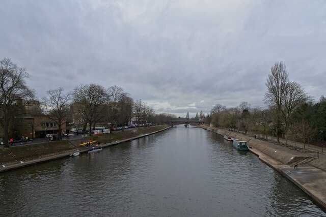
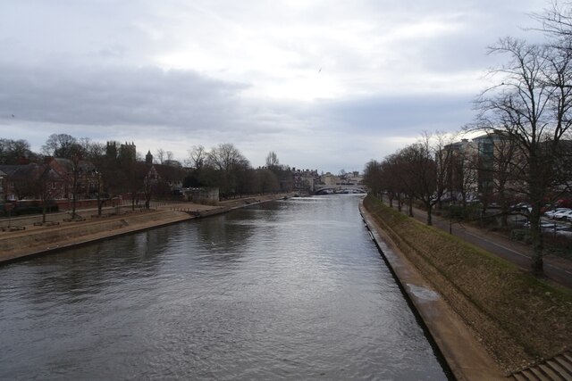
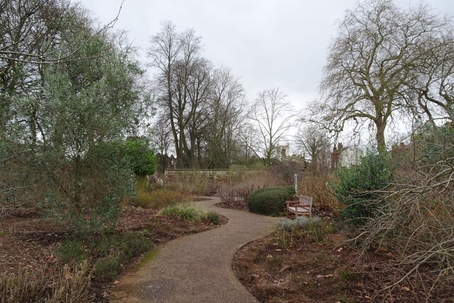
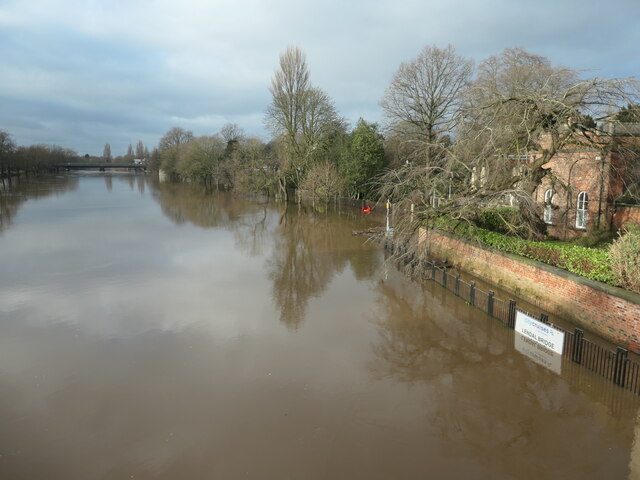
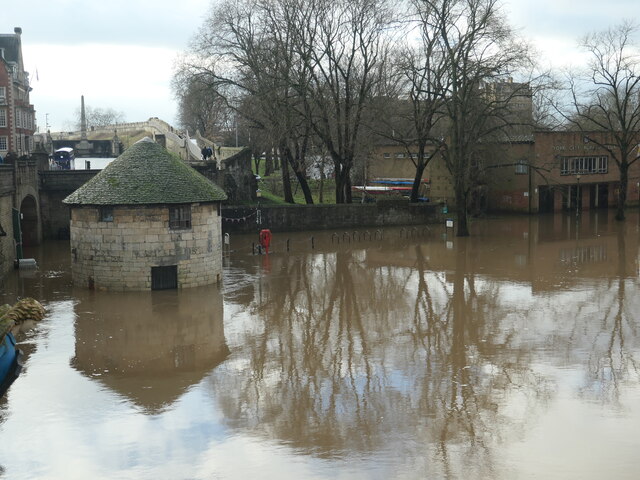
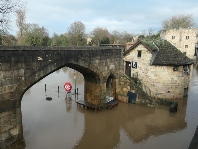
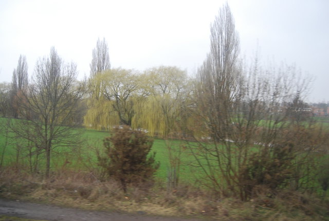
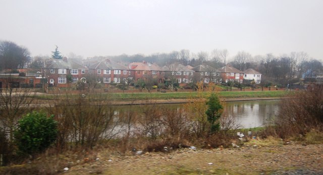
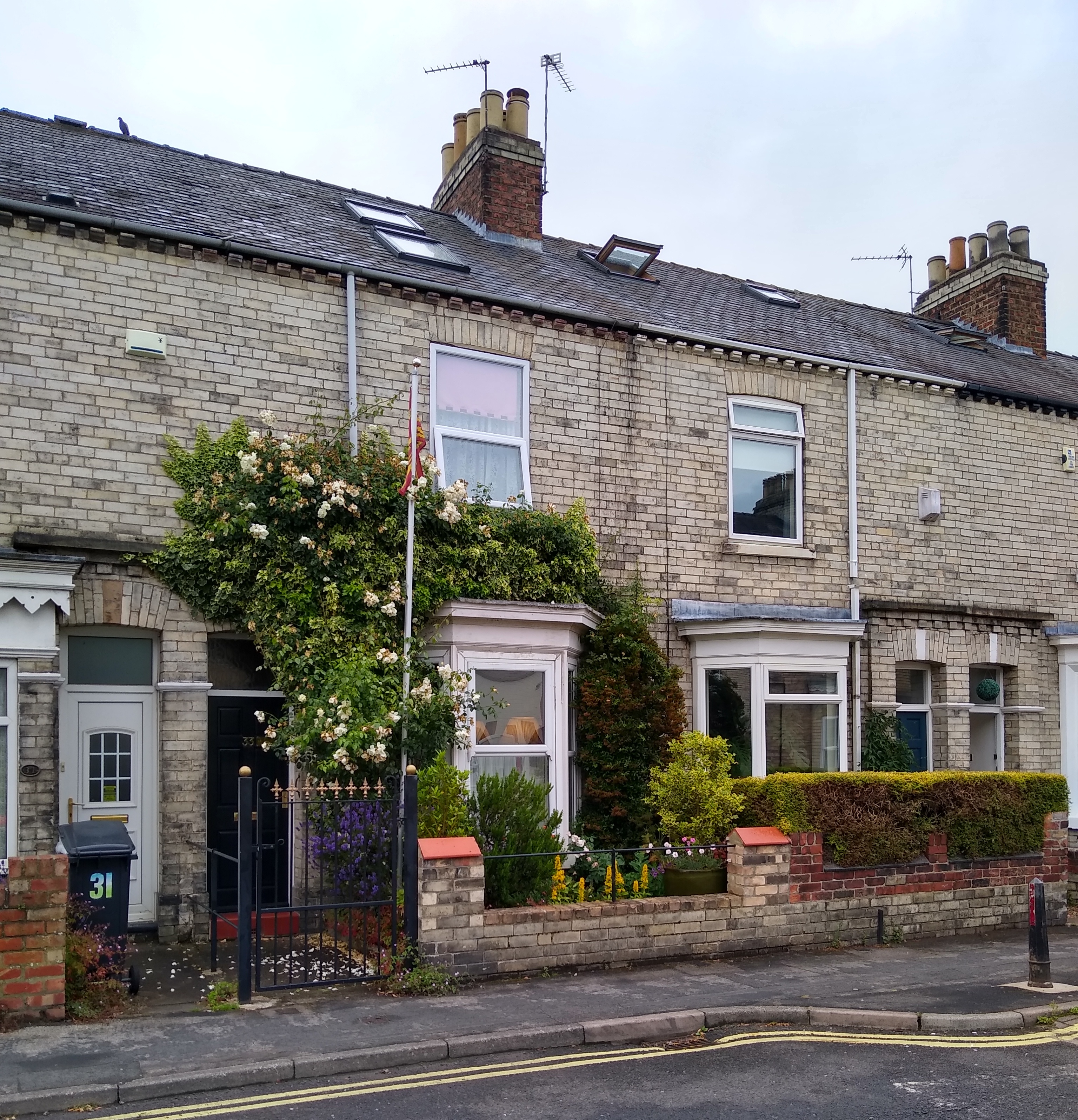
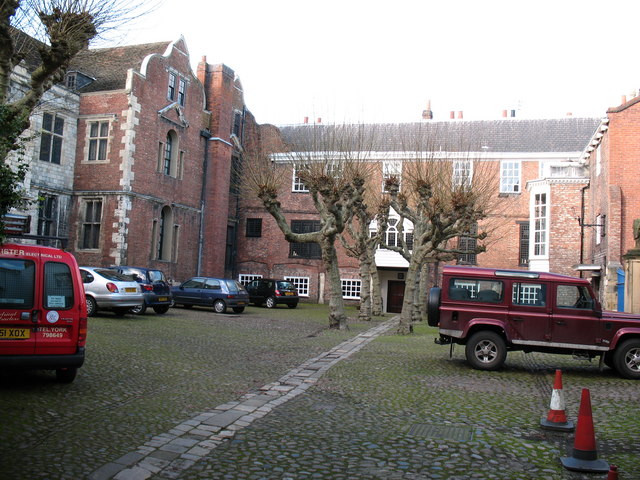
The Groves, located in Yorkshire, is a picturesque and idyllic neighborhood nestled along the River Ouse in the historic city of York. This residential area is known for its charming Georgian and Victorian architecture, tree-lined streets, and stunning views of the river.

The Groves is a highly sought-after residential area due to its prime location within walking distance of York's city center. Residents enjoy easy access to a wide array of amenities, including shops, restaurants, bars, and cultural attractions. The neighborhood's proximity to the river also offers opportunities for leisurely walks, cycling, and boating.

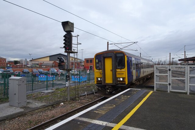
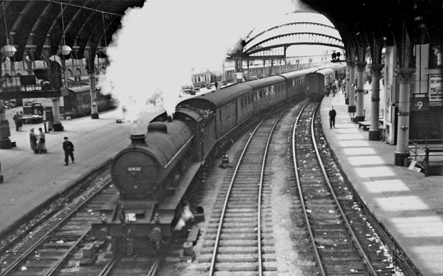
The area is renowned for its vibrant community spirit and friendly atmosphere. The Groves hosts a range of social events and activities throughout the year, fostering a strong sense of community among its residents. Additionally, the neighborhood benefits from excellent transport links, with several bus routes and a train station nearby, providing convenient connections to other parts of Yorkshire and beyond.

The Groves is also home to a number of highly regarded schools, making it an appealing choice for families. The neighborhood's proximity to the University of York also makes it a popular area for students and academics.

In summary, The Groves in Yorkshire is a charming and desirable residential area known for its beautiful architecture, riverside location, community spirit, and convenient access to amenities.

If you have any feedback on the listing, please let us know in the comments section below.
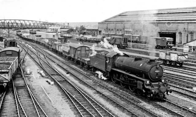
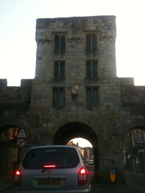
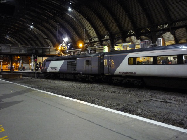
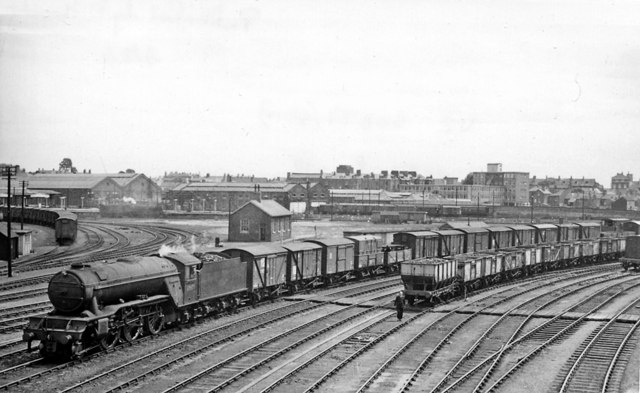
The Groves Images

Images are sourced within 2km of 53.966895/-1.0773483 or Grid Reference SE6052. Thanks to Geograph Open Source API. All images are credited.

River Ouse from Lendal Bridge Looking upstream towards Scarborough Bridge.
River Ouse from Lendal Bridge
Looking upstream towards Scarborough Bridge.
Train approaching Platform 11 The 0859 Leeds to York (2C26) service formed of 155341. The train was quite busy, arriving 10 minutes late. Class 155 units operate on the Harrogate Line from time to time, but are more regularly found operating York to Hull and Bridlington services.
Train approaching Platform 11
The 0859 Leeds to York (2C26) service formed of 155341. The train was quite busy, arriving 10 minutes late. Class 155 units operate on the Harrogate Line from time to time, but are more regularly found operating York to Hull and Bridlington services.
Ouse from Scarborough Bridge Looking downstream along the River Ouse from the rail and pedestrian/cycle bridge.
Ouse from Scarborough Bridge
Looking downstream along the River Ouse from the rail and pedestrian/cycle bridge.
Edible Garden in Museum Gardens Looking across part of the Edible Garden towards St. Olave's Church.
Edible Garden in Museum Gardens
Looking across part of the Edible Garden towards St. Olave's Church.
Flooded riverbank at Museum Gardens, York It's January 2024 and the River Ouse has burst its banks in York. Looking upstream from Lendal Bridge.
Flooded riverbank at Museum Gardens, York
It's January 2024 and the River Ouse has burst its banks in York. Looking upstream from Lendal Bridge.
North Street postern tower flooded, York It's January 2024 and the River Ouse has burst its banks in York.
North Street postern tower flooded, York
It's January 2024 and the River Ouse has burst its banks in York.
Wellington Row flooded, York It's January 2024 and the River Ouse has burst its banks in York.
Wellington Row flooded, York
It's January 2024 and the River Ouse has burst its banks in York.
York Station, with Down Special for Scarborough View southward, towards Doncaster and the South on the ECML and to Sheffield, Leeds etc.; ex-North Eastern major centre. The Whit-Monday Excursion train - probably from Leeds - is running non-stop on the Through line, headed by LNE B16/1 4-6-0 No. 61432. (Note the litter).
York Station, with Down Special for Scarborough
View southward, towards Doncaster and the South on the ECML and to Sheffield, Leeds etc.; ex-North Eastern major centre. The Whit-Monday Excursion train - probably from Leeds - is running non-stop on the Through line, headed by LNE B16/1 4-6-0 No. 61432. (Note the litter).
Up freight train on the York Goods Lines at York Yard South View northward, towards Skelton Junction and the North; ex-North Eastern ECML (York avoiding lines). The scene is taken from the footbridge off Wilton Street and gives an impression of the extent of the great Yards, which stretched for a mile ahead, the Goods Lines joining the lines through York Station at York Yard North. On the right is York Wagon Works and a 350hp 0-6-0 Diesel shunter can be seen at work; the great Carriage Works were off to the left. The Up Class F freight is headed by LNE B1 4-6-0 No. 61353.
Up freight train on the York Goods Lines at York Yard South
View northward, towards Skelton Junction and the North; ex-North Eastern ECML (York avoiding lines). The scene is taken from the footbridge off Wilton Street and gives an impression of the extent of the great Yards, which stretched for a mile ahead, the Goods Lines joining the lines through York Station at York Yard North. On the right is York Wagon Works and a 350hp 0-6-0 Diesel shunter can be seen at work; the great Carriage Works were off to the left. The Up Class F freight is headed by LNE B1 4-6-0 No. 61353.
Micklegate Bar, towards Blossom Street Taken whilst sat in the pretty much permanent traffic queue waiting to get through the lights at the junction
Micklegate Bar, towards Blossom Street
Taken whilst sat in the pretty much permanent traffic queue waiting to get through the lights at the junction
Train at platform 3 from 5 Looking across the main through platforms at York station.
Train at platform 3 from 5
Looking across the main through platforms at York station.
Downfreight on the Goods lines approaching York Yard South View SE from footpath off Wilton Street, towards York Station - off to the left of Branches Yard, the South Locomotive Sheds in the centre and Holgate and the main lines south to the right. This is a Class D semi-fitted freight, headed by Gresley V2 No. 60877.
Downfreight on the Goods lines approaching York Yard South
View SE from footpath off Wilton Street, towards York Station - off to the left of Branches Yard, the South Locomotive Sheds in the centre and Holgate and the main lines south to the right. This is a Class D semi-fitted freight, headed by Gresley V2 No. 60877.
A named Gresley V2 2-6-2 in York Locomotive Yard View northward, from Leeman Road as it passed beside the ex-North Eastern York (North) Locomotive Yard, where is situated nowadays the National Railway Museum. Few of the V2s were given names, so No. 60964 'The Durham Light Infantry' was an exception - here looking splendidly clean.
A named Gresley V2 2-6-2 in York Locomotive Yard
View northward, from Leeman Road as it passed beside the ex-North Eastern York (North) Locomotive Yard, where is situated nowadays the National Railway Museum. Few of the V2s were given names, so No. 60964 'The Durham Light Infantry' was an exception - here looking splendidly clean.
Weeping Willows by the River Ouse The River Ouse is formed by the junction of the River Ure and River Swale. The river flows south through York to its junction with the River Trent, where it becomes the Humber. Total length of the river is 52 miles (100 miles for the combined Ouse/Ure). The Ouse's  tributaries (which includes the Derwent, Aire, Don, Wharfe, Rother, Nidd, Swale, Ure, and Foss) drains a large upland area of Northern England, including much of the Yorkshire Dales and North York Moors.
Wikipedia: <span class="nowrap"><a title="http://en.wikipedia.org/wiki/River_Ouse,_Yorkshire" rel="nofollow ugc noopener" href="http://en.wikipedia.org/wiki/River_Ouse,_Yorkshire">Link</a><img style="margin-left:2px;" alt="External link" title="External link - shift click to open in new window" src="https://s1.geograph.org.uk/img/external.png" width="10" height="10"/></span>
Weeping Willows by the River Ouse
The River Ouse is formed by the junction of the River Ure and River Swale. The river flows south through York to its junction with the River Trent, where it becomes the Humber. Total length of the river is 52 miles (100 miles for the combined Ouse/Ure). The Ouse's tributaries (which includes the Derwent, Aire, Don, Wharfe, Rother, Nidd, Swale, Ure, and Foss) drains a large upland area of Northern England, including much of the Yorkshire Dales and North York Moors. Wikipedia: LinkExternal link
River Ouse upstream of Scarborough Bridge The River Ouse is formed by the junction of the River Ure and River Swale. The river flows south through York to its junction with the River Trent, where it becomes the Humber. Total length of the river is 52 miles (100 miles for the combined Ouse/Ure). The Ouse's  tributaries (which includes the Derwent, Aire, Don, Wharfe, Rother, Nidd, Swale, Ure, and Foss) drains a large upland area of Northern England, including much of the Yorkshire Dales and North York Moors.
Wikipedia: <span class="nowrap"><a title="http://en.wikipedia.org/wiki/River_Ouse,_Yorkshire" rel="nofollow ugc noopener" href="http://en.wikipedia.org/wiki/River_Ouse,_Yorkshire">Link</a><img style="margin-left:2px;" alt="External link" title="External link - shift click to open in new window" src="https://s1.geograph.org.uk/img/external.png" width="10" height="10"/></span>
River Ouse upstream of Scarborough Bridge
The River Ouse is formed by the junction of the River Ure and River Swale. The river flows south through York to its junction with the River Trent, where it becomes the Humber. Total length of the river is 52 miles (100 miles for the combined Ouse/Ure). The Ouse's tributaries (which includes the Derwent, Aire, Don, Wharfe, Rother, Nidd, Swale, Ure, and Foss) drains a large upland area of Northern England, including much of the Yorkshire Dales and North York Moors. Wikipedia: LinkExternal link
The northern end of York Station York Station is a major station and junction on the East Coast Main Line. The original station opened in 1839, but the present building opened in 1877 (it has been remodelled since). Lines branch off the ECML for Scarborough and Leeds.
Grade II* listed. <span class="nowrap"><a title="http://www.britishlistedbuildings.co.uk/en-464767-railway-station-" rel="nofollow ugc noopener" href="http://www.britishlistedbuildings.co.uk/en-464767-railway-station-">Link</a><img style="margin-left:2px;" alt="External link" title="External link - shift click to open in new window" src="https://s1.geograph.org.uk/img/external.png" width="10" height="10"/></span> 
Website: <span class="nowrap"><a title="http://www.nationalrail.co.uk/stations/YRK.html" rel="nofollow ugc noopener" href="http://www.nationalrail.co.uk/stations/YRK.html">Link</a><img style="margin-left:2px;" alt="External link" title="External link - shift click to open in new window" src="https://s1.geograph.org.uk/img/external.png" width="10" height="10"/></span> 
Wikipedia: <span class="nowrap"><a title="http://en.wikipedia.org/wiki/York_railway_station" rel="nofollow ugc noopener" href="http://en.wikipedia.org/wiki/York_railway_station">Link</a><img style="margin-left:2px;" alt="External link" title="External link - shift click to open in new window" src="https://s1.geograph.org.uk/img/external.png" width="10" height="10"/></span>
The northern end of York Station
York Station is a major station and junction on the East Coast Main Line. The original station opened in 1839, but the present building opened in 1877 (it has been remodelled since). Lines branch off the ECML for Scarborough and Leeds. Grade II* listed. LinkExternal link Website: LinkExternal link Wikipedia: LinkExternal link
York Station - waiting room York Station is a major station and junction on the East Coast Main Line. The original station opened in 1839, but the present building opened in 1877 (it has been remodelled since). Lines branch off the ECML for Scarborough and Leeds.
Grade II* listed. <span class="nowrap"><a title="http://www.britishlistedbuildings.co.uk/en-464767-railway-station-" rel="nofollow ugc noopener" href="http://www.britishlistedbuildings.co.uk/en-464767-railway-station-">Link</a><img style="margin-left:2px;" alt="External link" title="External link - shift click to open in new window" src="https://s1.geograph.org.uk/img/external.png" width="10" height="10"/></span> 
Website: <span class="nowrap"><a title="http://www.nationalrail.co.uk/stations/YRK.html" rel="nofollow ugc noopener" href="http://www.nationalrail.co.uk/stations/YRK.html">Link</a><img style="margin-left:2px;" alt="External link" title="External link - shift click to open in new window" src="https://s1.geograph.org.uk/img/external.png" width="10" height="10"/></span> 
Wikipedia: <span class="nowrap"><a title="http://en.wikipedia.org/wiki/York_railway_station" rel="nofollow ugc noopener" href="http://en.wikipedia.org/wiki/York_railway_station">Link</a><img style="margin-left:2px;" alt="External link" title="External link - shift click to open in new window" src="https://s1.geograph.org.uk/img/external.png" width="10" height="10"/></span>
York Station - waiting room
York Station is a major station and junction on the East Coast Main Line. The original station opened in 1839, but the present building opened in 1877 (it has been remodelled since). Lines branch off the ECML for Scarborough and Leeds. Grade II* listed. LinkExternal link Website: LinkExternal link Wikipedia: LinkExternal link
The southern end of York Station York Station is a major station and junction on the East Coast Main Line. The original station opened in 1839, but the present building opened in 1877 (it has been remodelled since). Lines branch off the ECML for Scarborough and Leeds.
Grade II* listed. <span class="nowrap"><a title="http://www.britishlistedbuildings.co.uk/en-464767-railway-station-" rel="nofollow ugc noopener" href="http://www.britishlistedbuildings.co.uk/en-464767-railway-station-">Link</a><img style="margin-left:2px;" alt="External link" title="External link - shift click to open in new window" src="https://s1.geograph.org.uk/img/external.png" width="10" height="10"/></span> 
Website: <span class="nowrap"><a title="http://www.nationalrail.co.uk/stations/YRK.html" rel="nofollow ugc noopener" href="http://www.nationalrail.co.uk/stations/YRK.html">Link</a><img style="margin-left:2px;" alt="External link" title="External link - shift click to open in new window" src="https://s1.geograph.org.uk/img/external.png" width="10" height="10"/></span> 
Wikipedia: <span class="nowrap"><a title="http://en.wikipedia.org/wiki/York_railway_station" rel="nofollow ugc noopener" href="http://en.wikipedia.org/wiki/York_railway_station">Link</a><img style="margin-left:2px;" alt="External link" title="External link - shift click to open in new window" src="https://s1.geograph.org.uk/img/external.png" width="10" height="10"/></span>
The southern end of York Station
York Station is a major station and junction on the East Coast Main Line. The original station opened in 1839, but the present building opened in 1877 (it has been remodelled since). Lines branch off the ECML for Scarborough and Leeds. Grade II* listed. LinkExternal link Website: LinkExternal link Wikipedia: LinkExternal link
Show me another place!

The Groves is located at Grid Ref: SE6052 (Lat: 53.966895, Lng: -1.0773483)

Division: North Riding

Unitary Authority: York

Police Authority: North Yorkshire

What 3 Words

///power.index.luck. Near York, North Yorkshire

Related Wikis

St Annes Monastic House

St Annes Monastic House is an Orthodox monastic house in North Yorkshire, England. The house is from modern times, being founded in 1995 and is located...

The Groves

The Groves is a district of York, England, covering the area just north of the city centre between Huntington Road and Haxby Road. The district is near...

York St John University

York St John University (originally established as York Diocesan College), often abbreviated to YSJ, is a public university located on a large urban campus...

Monkgate

Monkgate is a street in York, North Yorkshire, running north-east from the city centre. == History == The street roughly follows the line of a Roman road...

Middleton House, York

Middleton House is a grade II* listed building on Monkgate, immediately east of the city centre of York in England. The house was built in about 1700....

Clarence Street

Clarence Street is a former rugby stadium in York, England. From 1885 until 1989 it was the home of York F.C. (later York R.L.F.C.) before being sold and...

York County Hospital

York County Hospital (1740–1977) was a hospital in York, England. The building, which is grade II listed, has been converted for residential use. ��2...

Grays Court, York

Grays Court is a Grade I listed house in York, England. The house is within the city walls near York Minster. Dating back in part to 1080 and commissioned...

Nearby Amenities

Located within 500m of 53.966895,-1.0773483
Turning Circle
Lat/Long: 53.9709759/-1.0762377
Check Date: 2021-05-29
Traffic Calming: table
Lat/Long: 53.9677138/-1.0767377
Noexit: yes
Lat/Long: 53.9707134/-1.0789559
Noexit: yes
Lat/Long: 53.9702011/-1.0793613
Traffic Calming: table
Lat/Long: 53.967686/-1.0752055
Check Date: 2022-12-11
Traffic Calming: table
Lat/Long: 53.9692851/-1.077139
Noexit: yes
Lat/Long: 53.9700044/-1.0761915
Barrier: block
Bicycle: yes
Bollard Type: planter
Foot: yes
Motor Vehicle: no
Lat/Long: 53.9685002/-1.0753064
Check Date: 2022-10-23
Traffic Calming: table
Lat/Long: 53.9662131/-1.0783003
Turning Circle
Lat/Long: 53.9666356/-1.0697666
Turning Circle
Lat/Long: 53.96583/-1.0722092
Traffic Calming: table
Lat/Long: 53.9676564/-1.0800923
Noexit: motor_vehicle
Lat/Long: 53.9654822/-1.0782921
Noexit: motor_vehicle
Lat/Long: 53.9654155/-1.0781766
Traffic Calming: table
Lat/Long: 53.9653529/-1.0763086
Recycling
Recycling Books: yes
Recycling Cans: yes
Recycling Clothes: yes
Recycling Glass Bottles: yes
Recycling Newspaper: yes
Recycling Paper: yes
Recycling Plastic Bottles: yes
Recycling Type: container
Lat/Long: 53.9639065/-1.0788981
DoubleTree by Hilton York
Addr City: York
Addr Country: GB
Addr Postcode: YO31 7JA
Addr Street: St. Maurice's Road
Brand: DoubleTree
Brand Wikidata: Q2504643
Contact Facebook: https://www.facebook.com/DoubleTreebyHiltonYork
Contact Instagram: https://www.instagram.com/doubletreebyhiltonyork/
Contact Twitter: https://twitter.com/DTbyHiltonYork
Email: lbayk_res@hilton.com
Fax: +44-1904-629195
Fhrs Id: 245418
Internet Access: wlan
Internet Access Fee: no
Official Name: DoubleTree by Hilton
Operator: Hilton Hotels
Phone: +44 1904 638086
Rooms: 143
Smoking: no
Source Addr: FHRS Open Data
Stars: 4
Tourism: hotel
Website: https://www.hilton.com/en/hotels/lbaykdi-doubletree-york/
Wheelchair: yes
Lat/Long: 53.9628524/-1.0775982
Pub
Black Horse
Addr City: York
Addr Housenumber: 29
Addr Postcode: YO31 7PB
Addr Street: Monkgate
Beer Garden: yes
Fhrs Id: 244798
Floor Material: rough_wood
Food: at least pies
Note: Music on Saturdays
Old Name: Tap and Spile
Operator: Enterprise Inns
Parking: yes
Real Ale: 4 or so beers
Source Addr: FHRS Open Data
Wheelchair: no
Wheelchair Description: Steps at both front and back entrances
Lat/Long: 53.9637558/-1.0768418
Brigadier Gerard
Addr City: York
Addr Housenumber: 84
Addr Postcode: YO31 7PF
Addr Street: Monkgate
Disused Amenity: pub
Note: The usual Sam's sign in the window says "management couple required"
Operator: Samuel Smiths
Outdoor Seating: yes
Parking: yes
Lat/Long: 53.9645521/-1.074505
Diamonds Inn
Addr City: York
Addr Housenumber: 39
Addr Postcode: YO31 7PB
Addr Street: Monkgate
Brand: OYO
Brand Wikidata: Q24906315
Old Name: The Cavalier Hotel
Tourism: hotel
Lat/Long: 53.9640967/-1.0762061
Turning Circle
Lat/Long: 53.9633173/-1.0819125
Traffic Signals
Traffic Signals Direction: forward
Lat/Long: 53.9682069/-1.0815403
Post Box
Collection Times: Mo-Fr 16:45; Sa 09:30
Post Box Design: type_a
Post Box Type: pillar
Postal Code: YO31 7PA
Ref: YO31 127
Royal Cypher: EIIR
Royal Cypher Wikidata: Q33102113
Lat/Long: 53.9645051/-1.0752155
Telephone
Booth: KX100
Check Date: 2021-09-05
Covered: booth
Operator: BT
Operator Wikidata: Q593786
Phone: +44 1904 622063
Lat/Long: 53.9681589/-1.0811651
Barrier: bump_gate
Bicycle: yes
Foot: yes
Maxheight: 2
Motorcar: yes
Motorcycle: yes
Note: spacebar
Lat/Long: 53.9658723/-1.0834368
Telephone
Booth: KX100
Check Date: 2021-08-17
Covered: booth
Phone: +44 1904 628031
Lat/Long: 53.9657479/-1.0833147
Check Date: 2023-06-21
Removed Amenity: telephone
Lat/Long: 53.964801/-1.0834252
Richard III Museum
Addr City: York
Addr Postcode: YO1 7LQ
Addr Street: Goodramgate
Alt Name: Richard III Experience
Tourism: museum
Website: https://richardiiiexperience.com/
Wheelchair: no
Wikidata: Q7326656
Wikipedia: en:Richard III Experience at Monk Bar
Lat/Long: 53.9627535/-1.0785433
Telephone
Booth: KX100
Check Date: 2024-04-10
Covered: booth
Operator: BT
Operator Wikidata: Q593786
Phone: +44 1904 624150
Sms: yes
Lat/Long: 53.9651898/-1.0739335
Crossing
Crossing: zebra
Tactile Paving: yes
Lat/Long: 53.9628099/-1.0747835
Post Box
Collection Times: Mo-Fr 09:00, Sa 07:00
Post Box Type: lamp
Postal Code: YO31 8NP
Ref: YO31 520
Royal Cypher: EIIR
Royal Cypher Wikidata: Q33102113
Lat/Long: 53.9687536/-1.0772707
Post Box
Post Box Type: lamp
Postal Code: YO31 7PW
Ref: YO31 73
Royal Cypher: EIIR
Royal Cypher Wikidata: Q33102113
Lat/Long: 53.9660863/-1.078127
Post Box
Check Date: 2021-08-03
Collection Times: Mo-Fr 09:00; Sa 07:00
Post Box Design: type_a
Post Box Type: pillar
Postal Code: YO31 7EW
Ref: YO31 115
Royal Cypher: EIIR
Royal Cypher Wikidata: Q33102113
Lat/Long: 53.9674314/-1.0817389
Bus Stop
Gillygate
Bench: no
Bin: yes
Bus: yes
Departures Board: realtime
Lit: yes
Naptan AtcoCode: 32900182
Naptan Bearing: NE
Public Transport: platform
Shelter: no
Tactile Paving: no
Website: http://deps.at/?stop=32900182
Lat/Long: 53.9647479/-1.083473
Tourism: picnic_site
Lat/Long: 53.9660814/-1.0833441
Check Date: 2021-08-17
Information: map
Tourism: information
Lat/Long: 53.9657715/-1.0833522
Pub
Keystones
Addr City: York
Addr Housenumber: 4
Addr Postcode: YO31 7PE
Addr Street: Monkgate
Fhrs Id: 245781
Floor Material: rough_wood
Food: yes
Operator: Stonegate
Operator Wikidata: Q7619176
Outdoor Seating: yes
Real Ale: Doom Bar + 2
Source Addr: FHRS Open Data
Website: https://www.crafted-social.co.uk/keystones-york
Wheelchair: yes
Wheelchair Description: Flat entrance, flat throughout
Lat/Long: 53.9628764/-1.0782014
Crossing
Lat/Long: 53.9686515/-1.0833539
Noexit: yes
Lat/Long: 53.9660839/-1.0699192
Crossing
Button Operated: yes
Crossing: traffic_signals
Crossing Island: no
Crossing Ref: puffin
Tactile Paving: yes
Traffic Signals Sound: no
Traffic Signals Vibration: yes
Lat/Long: 53.9649318/-1.0832063
Place Of Worship
York City Church
Addr City: York
Addr Postcode: YO31 7EA
Addr Street: Gillygate
Note: was salvation army citadel
Old Name: Salvation Army Citadel
Religion: christian
Website: https://yorkcitychurch.org.uk/
Lat/Long: 53.9649142/-1.0835525
Entrance: yes
Lat/Long: 53.9635358/-1.0779998
Accident and Emergency
Emergency Ward Entrance
Emergency: emergency_ward_entrance
Entrance: yes
Fixme: During building work, access is via gate 2 to the north, but where is the actual A and E entrance?
Lat/Long: 53.9693367/-1.0835645
Barrier: bollard
Bicycle: no
Bollard: fixed
Foot: yes
Horse: no
Motor Vehicle: no
Lat/Long: 53.9651026/-1.0825312
Barrier: bollard
Bollard: removable
Lat/Long: 53.9648371/-1.0814458
Bicycle Parking
Bicycle Parking: stands
Capacity: 12
Check Date: 2023-08-09
Covered: no
Lat/Long: 53.9630321/-1.075093
Pub
The Punch Bowl
Addr City: York
Addr Housenumber: 134
Addr Postcode: YO31 7ND
Addr Street: Lowther Street
Ele: 14
Floor Material: carpet
Indoor Seating: yes
Note: 2 beer pumps turned around. Maybe you'd be lucky on a weekend.
Operator: Stonegate
Operator Wikidata: Q7619176
Outdoor Seating: yes
Real Ale: no
Website: https://www.craftunionpubs.com/punch-bowl-york
Wheelchair: yes
Wheelchair Description: ramp at entrance, then flat
Lat/Long: 53.9679506/-1.0808727
Castle Howard Ox
Addr City: York
Addr Housenumber: 3
Addr Postcode: YO31 7QA
Addr Street: Townend Street
Check Date: 2021-11-23
Disused Amenity: pub
Source: View from Clarence Street
Lat/Long: 53.9675088/-1.0811402
Barrier: cycle_barrier
Cycle Barrier: chicane
Cycle Barrier Installation: fixed
Ele: 14
Lat/Long: 53.9702966/-1.0778547
Ele: 12
Lat/Long: 53.9703131/-1.0767987
Barrier: bollard
Ele: 13
Lat/Long: 53.970513/-1.0767037
Ele: 13.8245850
Lat/Long: 53.9706494/-1.0756028
Bench
Backrest: yes
Source: survey
Lat/Long: 53.9646312/-1.0820219
Bench
Backrest: yes
Source: survey
Lat/Long: 53.9646339/-1.0821138
Cafe
Grays Court Historic Tea Room
Addr City: York
Addr Postcode: YO1 7JH
Addr Street: Chapter House Street
Fhrs Id: 245528
Source Addr: FHRS Open Data
Lat/Long: 53.9632192/-1.0805027
Fairer World
Addr City: York
Addr Housenumber: 84
Addr Postcode: YO31 7EQ
Addr Street: Gillygate
Description: Fairtrade foods, clothes, gifts
Phone: +44 1904 65516
Shop: convenience
Lat/Long: 53.9648972/-1.0830845
Bench
Artist Name: George Cutts
Artwork Type: sculpture
Backrest: no
Description: From memory a bit of blue pipework artwork that serves as a bench
Ele: 26
Material: steel
Note: Part of a series of 10 sculptures placed along the Foss Islands Cycle Route called Big Blue Pipe commissioned by Sustrans in the 1980s
Start Date: 1980s
Tourism: artwork
Lat/Long: 53.9698962/-1.072
Bench
Backrest: yes
Ele: 20.0
Lat/Long: 53.9660162/-1.0729776
Note: There's no crossing here
Lat/Long: 53.9654591/-1.0718965
Crossing
Button Operated: yes
Crossing: traffic_signals
Crossing Island: no
Crossing Ref: puffin
Tactile Paving: yes
Traffic Signals Sound: no
Traffic Signals Vibration: yes
Lat/Long: 53.9681339/-1.0812208
Mini Roundabout
Lat/Long: 53.9704517/-1.0820106
Turning Circle
Lat/Long: 53.9645147/-1.0826768
Bench
Artist Name: George Cutts
Artwork Type: sculpture
Backrest: no
Description: From memory a bit of blue pipework artwork that serves as a bench
Material: steel
Note: Part of a series of 10 sculptures placed along the Foss Islands Cycle Route called Big Blue Pipe commissioned by Sustrans in the 1980s
Start Date: 1980s
Tourism: artwork
Lat/Long: 53.9692159/-1.0711725
Crossing
Button Operated: yes
Crossing: traffic_signals
Crossing Island: no
Crossing Ref: puffin
Tactile Paving: yes
Lat/Long: 53.9629612/-1.0780335
Crossing
Button Operated: yes
Crossing: traffic_signals
Crossing Island: no
Crossing Ref: toucan
Tactile Paving: yes
Traffic Signals: signal
Traffic Signals Sound: yes
Traffic Signals Vibration: yes
Lat/Long: 53.969933/-1.0818574
Crossing
Button Operated: yes
Crossing: traffic_signals
Crossing Island: no
Crossing Ref: puffin
Pedestrian Island: yes
Tactile Paving: yes
Traffic Signals Sound: no
Traffic Signals Vibration: yes
Lat/Long: 53.9630626/-1.0783036
Crossing
Bicycle: yes
Crossing: unmarked
Crossing Island: no
Tactile Paving: yes
Lat/Long: 53.9646558/-1.0740004
Give Way
Direction: forward
Lat/Long: 53.9637029/-1.0728963
Crossing
Bicycle: yes
Crossing: unmarked
Crossing Island: no
Tactile Paving: yes
Lat/Long: 53.9647139/-1.0738919
Restaurant
Viceroy of India
Addr City: York
Addr Housenumber: 26
Addr Postcode: YO31 7PF
Addr Street: Monkgate
Cuisine: indian
Fhrs Id: 245292
Source Addr: FHRS Open Data
Lat/Long: 53.9632957/-1.0773007
Crossing
Crossing: unmarked
Crossing Island: yes
Tactile Paving: yes
Lat/Long: 53.9631417/-1.0779451
Crossing
Crossing: unmarked
Crossing Island: yes
Tactile Paving: yes
Lat/Long: 53.9687085/-1.0800171
Bus Stop
Ramsay Close
Bench: no
Bin: no
Bus: yes
Departures Board: timetable
Lit: yes
Public Transport: platform
Shelter: no
Tactile Paving: no
Website: http://deps.at/?32900986
Lat/Long: 53.9705867/-1.0735178
Crossing
Button Operated: yes
Crossing: traffic_signals
Crossing Island: no
Crossing Ref: pelican
Tactile Paving: yes
Traffic Signals Sound: no
Traffic Signals Vibration: yes
Lat/Long: 53.9681073/-1.0813933
Crossing
Button Operated: yes
Crossing: traffic_signals
Crossing Island: no
Crossing Ref: puffin
Tactile Paving: yes
Traffic Signals Sound: no
Traffic Signals Vibration: yes
Lat/Long: 53.9679664/-1.0814391
Bicycle Parking
Bicycle Parking: stands
Capacity: 6
Covered: no
Lat/Long: 53.9663032/-1.0826939
Barrier: bollard
Lat/Long: 53.9643182/-1.0803272
Bus Stop
Walpole Street
Bench: yes
Bin: yes
Bus: yes
Bus Display Name: Walpole Street
Bus Speech Output Name: Walpole Street
Departures Board: realtime;timetable
Departures Board Speech Output: yes
Lit: yes
Naptan AtcoCode: 3290YYA00183
Naptan NaptanCode: 32900183
Public Transport: platform
Shelter: yes
Tactile Paving: no
Toilets Wheelchair: no
Website: http://deps.at/?32900183
Wheelchair: yes
Lat/Long: 53.9702322/-1.0780685
Bus Stop
The Groves Clarence Gardens
Bench: yes
Bin: yes
Bus: yes
Bus Speech Output Name: Clarence Gardens
Departures Board: realtime;timetable
Lit: yes
Naptan AtcoCode: 3290YYA00084
Naptan NaptanCode: 32900084
Public Transport: platform
Shelter: no
Tactile Paving: yes
Website: http://deps.at/?32900084
Wheelchair: yes
Lat/Long: 53.9697005/-1.0787471
Crossing
Crossing: unmarked
Crossing Island: no
Kerb: lowered
Tactile Paving: yes
Lat/Long: 53.9652029/-1.0740498
Crossing
Crossing: unmarked
Crossing Island: no
Kerb: lowered
Tactile Paving: yes
Lat/Long: 53.9652227/-1.0741621
Bicycle Parking
Access: private
Bicycle Parking: lockers
Capacity: 15
Covered: yes
Lat/Long: 53.9691701/-1.0837198
Crossing
Button Operated: yes
Crossing: traffic_signals
Crossing Island: no
Crossing Ref: puffin
Tactile Paving: yes
Traffic Signals Sound: no
Traffic Signals Vibration: yes
Lat/Long: 53.9652813/-1.0831173
Bus Stop
York St John University
Bench: yes
Bin: no
Bus: yes
Bus Display Name: York St John University
Bus Speech Output Name: Clarence Street
Departures Board: realtime
Lit: yes
Naptan AtcoCode: 32900081
Public Transport: platform
Shelter: yes
Tactile Paving: no
Website: http://deps.at/?32900081
Wheelchair: yes
Lat/Long: 53.9670704/-1.0821642
Bus Stop
York St John University
Bench: yes
Bin: yes
Bus: yes
Bus Display Name: York St John University
Bus Speech Output Name: Clarence Street
Departures Board: realtime
Lit: yes
Naptan AtcoCode: 32900080
Public Transport: platform
Shelter: yes
Tactile Paving: yes
Website: http://deps.at/?32900080
Wheelchair: yes
Lat/Long: 53.967199/-1.0822071
Crossing
Button Operated: yes
Crossing: traffic_signals
Crossing Island: no
Crossing Ref: puffin
Tactile Paving: yes
Traffic Signals Sound: no
Traffic Signals Vibration: yes
Lat/Long: 53.9651023/-1.0829145
Oleria Patisserie
Addr City: York
Addr Housenumber: 78-80
Addr Postcode: YO31 7EQ
Addr Street: Gillygate
Old Name: Bakes & Co
Old Name 2: Tarts & Titbits
Shop: deli
Website: https://www.facebook.com/oleriapatisserie
Lat/Long: 53.9648262/-1.0831355
Bus Stop
The Gillygate
Bench: no
Bin: no
Bus: yes
Bus Display Name: Gillygate
Bus Speech Output Name: Gillygate
Departures Board: realtime
Lit: yes
Naptan AtcoCode: 32900181
Naptan Bearing: SW
Public Transport: platform
Shelter: no
Tactile Paving: no
Website: http://deps.at/?32900181
Lat/Long: 53.9643814/-1.0836581
Traffic Signals
Crossing: no
Traffic Signals Bicycle: continuous_green
Traffic Signals Direction: backward
Lat/Long: 53.9625471/-1.0786527
Post Box
Collection Times: Mo-Fr 11:30; Sa 17:45
Note: this is a private postal collection box
Post Box Mounting: wall
Post Box Type: lamp
Ref Signed: no
Royal Cypher: no
Lat/Long: 53.965244/-1.0809334
Spar
Addr City: York
Addr Housenumber: 133
Addr Postcode: YO31 7NB
Addr Street: Lowther Street
Addr Suburb: The Groves
Brand: Spar
Brand Wikidata: Q610492
Brand Wikipedia: en:Spar (retailer)
Shop: convenience
Lat/Long: 53.9673046/-1.0792036
The Reindeer - Londis
Addr City: York
Addr Housenumber: 107
Addr Postcode: YO31 7PS
Addr Street: Townend Street
Addr Suburb: The Groves
Shop: convenience
Wheelchair: yes
Lat/Long: 53.9661778/-1.0785752
Check Date: 2021-08-21
Traffic Calming: chicane
Lat/Long: 53.9667028/-1.0766869
Crossing
Button Operated: yes
Crossing: traffic_signals
Crossing Island: no
Crossing Ref: puffin
Tactile Paving: yes
Traffic Signals Sound: no
Traffic Signals Vibration: yes
Lat/Long: 53.9678949/-1.0812926
Bicycle Parking
Bicycle Parking: stands
Capacity: 4
Covered: no
Lat/Long: 53.9647931/-1.0834774
Crossing
Lat/Long: 53.9693628/-1.0829029
Pharmacy
Monkbar Pharmacy
Addr City: York
Addr Housenumber: 3
Addr Postcode: YO1 7LJ
Addr Street: Goodramgate
Dispensing: yes
Fhrs Id: 801837
Healthcare: pharmacy
Source Addr: FHRS Open Data
Website: https://www.monkbarpharmacy.co.uk/
Lat/Long: 53.9625907/-1.0785142
Entrance: yes
Lat/Long: 53.962717/-1.0786348
Bicycle Parking
Access: private
Bicycle Parking: lockers
Capacity: 2
Covered: yes
Lat/Long: 53.9692334/-1.0833769
Crossing
Crossing: zebra
Tactile Paving: yes
Lat/Long: 53.9700617/-1.0824838
Crossing
Crossing: unmarked
Crossing Island: yes
Tactile Paving: yes
Lat/Long: 53.967548/-1.0815244
Entrance: yes
Wheelchair: yes
Lat/Long: 53.9629229/-1.0748414
Crossing
Crossing: zebra
Tactile Paving: yes
Lat/Long: 53.9629095/-1.0749618
Bicycle Parking
Bicycle Parking: stands
Capacity: 18
Covered: no
Lat/Long: 53.9658167/-1.0815314
Man Made: campanile
Lat/Long: 53.9655401/-1.0800696
Bicycle Parking
Access: customers
Bicycle Parking: stands
Capacity: 10
Covered: yes
Lat/Long: 53.9662382/-1.0818569
Bicycle Parking
Bicycle Parking: stands
Capacity: 14
Covered: yes
Lat/Long: 53.9658368/-1.0813201
Bench
Backrest: yes
Lat/Long: 53.9658711/-1.0805826
Bicycle Parking
Bicycle Parking: stands
Capacity: 38
Covered: no
Lat/Long: 53.9655019/-1.0809333
Bicycle Parking
Bicycle Parking: stands
Capacity: 30
Covered: no
Lat/Long: 53.9658415/-1.0818432
Bicycle Parking
Bicycle Parking: stands
Capacity: 40
Covered: yes
Lat/Long: 53.9658845/-1.0821047
Bench
Backrest: yes
Lat/Long: 53.9659386/-1.0809098
Bench
Backrest: yes
Lat/Long: 53.9659307/-1.0807355
Bicycle Parking
Bicycle Parking: stands
Capacity: 60
Covered: no
Lat/Long: 53.9653887/-1.0800629
Bench
Backrest: no
Check Date: 2021-08-27
Lat/Long: 53.9652557/-1.0828818
Bench
Backrest: no
Check Date: 2021-08-27
Lat/Long: 53.9652794/-1.0828685
Bicycle Parking
Bicycle Parking: stands
Capacity: 30
Covered: no
Lat/Long: 53.9657216/-1.0819545
Bench
Backrest: yes
Material: metal
Seats: 4
Survey Date: 2024-04-10
Lat/Long: 53.9656402/-1.0735998
Bench
Backrest: yes
Material: metal
Seats: 4
Survey Date: 2024-04-10
Lat/Long: 53.9657167/-1.0735434
Noexit: yes
Lat/Long: 53.9651775/-1.0735247
Bicycle Parking
Bicycle Parking: stands
Capacity: 6
Covered: no
Lat/Long: 53.9662528/-1.0786248
Bicycle Parking
Bicycle Parking: stands
Capacity: 20
Covered: no
Lat/Long: 53.9658377/-1.0819991
Bicycle Parking
Bicycle Parking: stands
Capacity: 10
Covered: no
Lat/Long: 53.965739/-1.0816032
Bicycle Parking
Bicycle Parking: stands
Capacity: 8
Covered: no
Lat/Long: 53.9656326/-1.0836003
Barrier: bollard
Lat/Long: 53.9653714/-1.081817
Crossing
Crossing: unmarked
Kerb: lowered
Tactile Paving: yes
Lat/Long: 53.9650544/-1.0736919
Crossing
Crossing: unmarked
Kerb: lowered
Tactile Paving: yes
Lat/Long: 53.9649975/-1.0736472
Crossing
Crossing: unmarked
Crossing Island: no
Tactile Paving: no
Lat/Long: 53.9647119/-1.0747552
Bicycle Parking
Bicycle Parking: stands
Capacity: 10
Check Date: 2023-08-09
Covered: no
Lat/Long: 53.9630323/-1.0749973
Bicycle Parking
Bicycle Parking: stands
Capacity: 12
Check Date Capacity: 2023-10-27
Covered: no
Lat/Long: 53.9630264/-1.0740552
Bicycle Parking
Bicycle Parking: stands
Capacity: 14
Check Date: 2023-08-09
Covered: no
Lat/Long: 53.9631771/-1.0752414
Entrance: yes
Wheelchair: yes
Lat/Long: 53.9628953/-1.0746383
Bicycle Parking
Bicycle Parking: stands
Capacity: 10
Covered: no
Note: estimated capacity
Lat/Long: 53.965/-1.0796737
Bicycle Parking
Bicycle Parking: stands
Capacity: 10
Covered: no
Note: estimated capacity
Lat/Long: 53.9648868/-1.0791742
Bicycle Parking
Bicycle Parking: stands
Capacity: 8
Covered: no
Lat/Long: 53.9650158/-1.0809585
Bicycle Parking
Bicycle Parking: stands
Capacity: 10
Covered: no
Note: estimated capacity
Lat/Long: 53.9650406/-1.0797468
Bicycle Parking
Bicycle Parking: stands
Capacity: 12
Covered: no
Lat/Long: 53.9649736/-1.0807734
Bicycle Parking
Bicycle Parking: stands
Capacity: 14
Covered: no
Note: cycle parking for surgery users
Source: survey
Lat/Long: 53.9638963/-1.0767221
Noexit: yes
Lat/Long: 53.9641645/-1.0765233
Monk Bar Model Shop
Addr City: York
Addr Housenumber: 2
Addr Postcode: YO1 7LQ
Addr Street: Goodramgate
Shop: toys
Website: https://www.monkbarmodelshop.co.uk/
Lat/Long: 53.9627684/-1.078675
Escooter Rental
Monkgate
Brand Wikidata: Q63386916
Operator: TIER
Operator Type: private
Operator Wikidata: Q63386916
Source: Employee at TIER
Lat/Long: 53.9642987/-1.0756558
Crossing
Crossing: unmarked
Crossing Island: yes
Tactile Paving: yes
Lat/Long: 53.9667163/-1.0825427
Addr City: York
Addr Housenumber: 66
Addr Postcode: YO31 7EW
Addr Street: Clarence Street
Check Date: 2022-01-02
Old Name: Boots
Shop: vacant
Wheelchair: limited
Lat/Long: 53.9672736/-1.08179
Noexit: yes
Lat/Long: 53.9708262/-1.0775949
Cycleway: asl
Direction: forward
Lat/Long: 53.9649027/-1.083228
Cycleway: asl
Direction: backward
Lat/Long: 53.9650963/-1.0828793
Cycleway: asl
Direction: backward
Lat/Long: 53.96531/-1.0831268
Cycleway: asl
Direction: backward
Lat/Long: 53.9629314/-1.0782862
Cycleway: asl
Direction: forward
Lat/Long: 53.9629313/-1.0779799
Cycleway: asl
Direction: backward
Lat/Long: 53.9631563/-1.0779118
Noexit: yes
Lat/Long: 53.9691591/-1.0736212
Noexit: yes
Lat/Long: 53.9650018/-1.0778832
Bicycle Parking
Bicycle Parking: stands
Capacity: 12
Covered: no
Note: cycle parking for surgery staff
Source: survey
Lat/Long: 53.9644035/-1.0772958
Noexit: yes
Lat/Long: 53.9666931/-1.0723419
Noexit: yes
Lat/Long: 53.9706494/-1.0809607
Bus Stop
Grove Terrace Lane
Bench: no
Bin: no
Bus: yes
Departures Board: timetable
Lit: yes
Naptan AtcoCode: 3290YYA00988
Naptan NaptanCode: 32900988
Public Transport: platform
Shelter: no
Tactile Paving: no
Website: http://deps.at/?32900988
Lat/Long: 53.9684577/-1.0726739
Crossing
Crossing: unmarked
Tactile Paving: yes
Traffic Calming: table
Lat/Long: 53.9665227/-1.0760402
Check Date: 2021-08-27
Traffic Calming: chicane
Lat/Long: 53.9678542/-1.0808285
Traffic Calming: chicane
Lat/Long: 53.967374/-1.0790519
Entrance: yes
Lat/Long: 53.9672435/-1.0750785
Crossing
Crossing: unmarked
Crossing Island: no
Tactile Paving: yes
Lat/Long: 53.969354/-1.0731034
Noexit: yes
Lat/Long: 53.9654214/-1.0756044
Traffic Calming: hump
Lat/Long: 53.965528/-1.0748585
Traffic Calming: hump
Lat/Long: 53.9700545/-1.0804078
Check Date: 2021-08-21
Traffic Calming: hump
Lat/Long: 53.9711504/-1.0784816
Traffic Calming: hump
Lat/Long: 53.970577/-1.0805426
Traffic Calming: hump
Lat/Long: 53.9712023/-1.0794011
Check Date: 2021-06-14
Traffic Calming: hump
Lat/Long: 53.9695179/-1.0777293
Traffic Calming: hump
Lat/Long: 53.9681976/-1.0791752
Crossing
Traffic Calming: table
Lat/Long: 53.9646805/-1.0752166
Check Date: 2021-05-31
Traffic Calming: choker
Lat/Long: 53.967151/-1.0740982
Check Date: 2022-12-11
Traffic Calming: hump
Lat/Long: 53.9688204/-1.0759022
Check Date: 2022-01-17
Traffic Calming: choker
Lat/Long: 53.9670525/-1.0803123
Traffic Calming: hump
Lat/Long: 53.9665182/-1.0806587
Check Date: 2021-05-25
Traffic Calming: hump
Lat/Long: 53.968992/-1.0780031
Crossing
Crossing: unmarked
Crossing Island: no
Tactile Paving: yes
Traffic Calming: table
Lat/Long: 53.9656788/-1.077074
Check Date: 2021-05-25
Traffic Calming: hump
Lat/Long: 53.9685659/-1.0786772
Crossing
Traffic Calming: table
Lat/Long: 53.9673507/-1.074742
Check Date: 2022-10-11
Traffic Calming: hump
Lat/Long: 53.9683724/-1.0774667
Crossing
Crossing: unmarked
Tactile Paving: yes
Traffic Calming: table
Lat/Long: 53.9662659/-1.0751529
Check Date: 2021-05-25
Traffic Calming: hump
Lat/Long: 53.9676641/-1.0780072
Check Date: 2022-01-11
Traffic Calming: choker
Lat/Long: 53.9670256/-1.0736382
Check Date: 2021-06-04
Traffic Calming: hump
Lat/Long: 53.9682644/-1.0747846
Noexit: yes
Lat/Long: 53.9666099/-1.0724546
Crossing
Crossing: zebra
Crossing Island: no
Tactile Paving: yes
Lat/Long: 53.969494/-1.078938
Bicycle Parking
Bicycle Parking: stands
Capacity: 10
Covered: no
Lat/Long: 53.967298/-1.0750417
Crossing
Button Operated: yes
Crossing: traffic_signals
Crossing Island: yes
Crossing Ref: pelican
Tactile Paving: yes
Lat/Long: 53.9653075/-1.0720338
Telephone
Booth: KX100
Check Date: 2021-09-16
Covered: booth
Operator: BT
Operator Wikidata: Q593786
Phone: +44 1904 636623
Lat/Long: 53.9628883/-1.0780469
Parking Entrance
Lat/Long: 53.9698977/-1.0824604
Parking Entrance
Lat/Long: 53.9692853/-1.082836
Check Date: 2021-05-25
Traffic Calming: hump
Lat/Long: 53.9682293/-1.0776879
Check Date: 2021-05-29
Traffic Calming: hump
Lat/Long: 53.968349/-1.0762032
Check Date: 2022-06-24
Traffic Calming: table
Lat/Long: 53.9658934/-1.0809763
Crossing
Button Operated: yes
Crossing: traffic_signals
Crossing Island: no
Crossing Ref: pelican
Tactile Paving: yes
Traffic Signals Sound: no
Traffic Signals Vibration: yes
Lat/Long: 53.9637591/-1.07649
Theatre
Upstage Centre Youth Theatre
Addr City: York
Addr Housenumber: 41
Addr Postcode: YO31 7PB
Addr Street: Monkgate
Website: http://www.upstagecentre.org.uk/
Lat/Long: 53.9643671/-1.0762896
Library
Sycamore House Reading Café
Addr City: York
Addr Housenumber: 30
Addr Postcode: YO31 7EW
Addr Street: Clarence Street
Internet Access: wlan
Internet Access Fee: no
Lat/Long: 53.966292/-1.0825182
Atm
Check Date: 2023-10-27
Note: is inside sainsburys shop
Operator: Sainsbury's Bank
Lat/Long: 53.9629621/-1.0746779
Toilets
Check Date: 2023-10-27
Fee: no
Lat/Long: 53.9631192/-1.0749445
Baltic Polski Sklep
Addr City: York
Addr Housename: 6 Mansfield House
Addr Postcode: YO31 7NB
Addr Street: Lowther Street
Addr Suburb: The Groves
Note: sells Polish food and drink
Shop: convenience
Lat/Long: 53.9674028/-1.0795725
Bench
Backrest: yes
Lat/Long: 53.9667844/-1.0773673
Board Type: notice
Information: board
Note: community notice board
Tourism: information
Lat/Long: 53.9668523/-1.0773525
Kerb: raised
Lat/Long: 53.9667235/-1.0776222
Bicycle Parking
14
Bicycle Parking: stands
Capacity: 10
Covered: no
Lat/Long: 53.9683083/-1.0839864
Recycling
Check Date: 2021-05-25
Recycling Cans: yes
Recycling Clothes: yes
Recycling Glass: yes
Recycling Glass Bottles: yes
Recycling Magazines: yes
Recycling Newspaper: yes
Recycling Paper: yes
Recycling Plastic Bottles: yes
Recycling Type: container
Lat/Long: 53.9670698/-1.08338
Barrier: lift_gate
Bicycle: yes
Foot: yes
Motorcar: yes
Lat/Long: 53.9664574/-1.0830608
Life Ring
Emergency: life_ring
Lat/Long: 53.9654419/-1.0736161
Life Ring
Check Date: 2021-09-16
Emergency: life_ring
Lat/Long: 53.9656727/-1.0736063
Cafe
Kawa Cafe
Addr City: York
Addr Housenumber: 74
Addr Postcode: YO31 7EW
Addr Street: Clarence Street
Cuisine: coffee_shop
Old Name: The Pantry; Taste;The Corner Cafe
Lat/Long: 53.9674665/-1.0816093
Crossing
Crossing: unmarked
Tactile Paving: yes
Traffic Calming: table
Lat/Long: 53.9661719/-1.0826214
Giant
Addr City: York
Addr Postcode: YO31 7HB
Addr Street: Lord Mayors Walk
Branch: Store York
Brand: Giant
Brand Wikidata: Q703557
Service Bicycle Repair: yes
Shop: bicycle
Lat/Long: 53.9631743/-1.0788055
Entrance: yes
Lat/Long: 53.963982/-1.0766786
K Town
Addr City: York
Addr Housenumber: 36A
Addr Postcode: YO31 7EW
Addr Street: Clarence Street
Alt Name: Holy Moly Box
Check Date: 2022-01-02
Cuisine: korean
Disused Amenity: fast_food
Lat/Long: 53.9666358/-1.0823875
Restaurant
Coconut Lagoon
Addr City: York
Addr Housenumber: 56
Addr Postcode: YO31 7EW
Addr Street: Clarence Street
Cuisine: indian
Indoor Seating: yes
Outdoor Seating: no
Wheelchair: no
Lat/Long: 53.9670322/-1.0820162
Diamond Mini-market
Addr City: York
Addr Housenumber: 72
Addr Postcode: YO31 7EW
Addr Street: Clarence Street
Shop: convenience
Wheelchair: no
Lat/Long: 53.9674051/-1.0816667
Fast Food
Sun Lee Chop Suey House
Addr City: York
Addr Housenumber: 54
Addr Postcode: YO31 7EW
Addr Street: Clarence Street
Cuisine: chinese
Wheelchair: no
Lat/Long: 53.9669822/-1.0820604
Restaurant
Sunrise
Addr City: York
Addr Housenumber: 79
Addr Postcode: YO31 7EA
Addr Street: Gillygate
Cuisine: chinese
Fhrs Id: 245434
Toilets Wheelchair: no
Wheelchair: limited
Lat/Long: 53.9652652/-1.0832594
Parcel Locker
Brand: InPost
Brand Wikidata: Q3182097
Operator: InPost
Parcel Mail In: yes
Parcel Pickup: yes
Lat/Long: 53.9660916/-1.0785771
Telephone
Booth: KX100
Covered: booth
Operator: BT
Operator Wikidata: Q593786
Phone: +44 1904 624093
Sms: yes
Lat/Long: 53.9662155/-1.0781527
Cut
Addr City: York
Addr Housenumber: 64
Addr Postcode: YO31 7EQ
Addr Street: Gillygate
Email: hello@cuthairsalonyork.co.uk
Opening Hours: 09:00-19:00
Phone: +44 1904 675333
Shop: hairdresser
Website: http://cuthairsalonyork.co.uk
Lat/Long: 53.9645057/-1.0833899
Cooper's Barbers
Shop: hairdresser
Lat/Long: 53.9646942/-1.0750452
Liv York
Addr City: York
Addr Street: Monkgate
Note: specialist cycle shop for women
Old Name: The Miniature Scene
Shop: bicycle
Lat/Long: 53.9631757/-1.0775662
Cookhouse Design
Addr City: York
Addr Housenumber: 59
Addr Postcode: YO31 7PB
Addr Street: Monkgate
Shop: kitchen
Lat/Long: 53.964587/-1.0752035
Bagnalls
Craft: decorator
Lat/Long: 53.9663515/-1.0730433
Bus Stop
Monk Bridge
Bench: no
Bin: yes
Bus: yes
Lit: yes
Public Transport: platform
Shelter: no
Tactile Paving: yes
Website: http://deps.at/?32900189
Lat/Long: 53.9652776/-1.0730042
Crossing
Button Operated: yes
Crossing: traffic_signals
Tactile Paving: yes
Lat/Long: 53.9654015/-1.0721691
Bus Stop
Eboracum Way
Bus: yes
Departures Board: timetable
Lit: yes
Public Transport: platform
Website: http://deps.at/?32900191
Lat/Long: 53.9655255/-1.0712664
Studio
Jam Factory
Addr City: York
Addr Housenumber: 106
Addr Postcode: YO31 7NH
Addr Street: Eldon Street
Website: http://www.jamfactorystudios.co.uk/
Lat/Long: 53.9687426/-1.0766057
Fast Food
Groves Pizza
Addr City: York
Addr Housenumber: 25
Addr Postcode: YO31 8NN
Addr Street: Walpole Street
Addr Suburb: The Groves
Cuisine: pizza
Delivery: yes
Phone: +44 1904 635000
Takeaway: yes
Lat/Long: 53.9699446/-1.0769635
Fast Food
Goodfillers
Addr City: York
Addr Housenumber: 72
Addr Postcode: YO31 8JU
Addr Street: Haxby Road
Cuisine: sandwich
Lat/Long: 53.9699337/-1.0781084
Gold Mine
Addr City: York
Addr Housenumber: 74
Addr Postcode: YO31 8JU
Addr Street: Haxby Road
Shop: convenience
Lat/Long: 53.9700835/-1.0780118
Traffic Calming: hump
Lat/Long: 53.9699885/-1.0772929
Entrance: yes
Ref: MRI Centre
Lat/Long: 53.9689465/-1.0834166
The Groves
Place: neighbourhood
Wikidata: Q7738396
Wikipedia: en:The Groves
Lat/Long: 53.9670939/-1.0766395
Bicycle Parking
Bicycle Parking: stands
Capacity: 12
Covered: yes
Lat/Long: 53.964036/-1.0717734
Bicycle Parking
Bicycle Parking: stands
Capacity: 8
Covered: no
Lat/Long: 53.9645851/-1.0717493
Entrance: yes
Lat/Long: 53.9645392/-1.0718397
Fast Food
Roberto
Addr City: York
Addr Housenumber: 3a
Addr Postcode: YO1 7LJ
Addr Street: Goodramgate
Cuisine: ice_cream
Fhrs Id: 244898
Source Addr: FHRS Open Data
Lat/Long: 53.9625462/-1.07854
RSPCA
Addr City: York
Addr Housenumber: 5B
Addr Postcode: YO1 7LJ
Addr Street: Goodramgate
Brand: RSPCA
Brand Wikidata: Q584819
Brand Wikipedia: en:Royal Society for the Prevention of Cruelty to Animals
Opening Hours: Mo-Su 11:00-15:00
Operator: RSPCA York, Harrogate & District Branch
Phone: +44 1904 466140
Shop: charity
Website: https://www.rspca-yorkhome.org.uk
Lat/Long: 53.9624688/-1.078599
Cleggs
Addr City: York
Addr Postcode: YO1 7LQ
Addr Street: Goodramgate
Shop: gift
Lat/Long: 53.9626693/-1.0787251
Restaurant
Little Italy
Addr City: York
Addr Housenumber: 12
Addr Postcode: YO1 7LQ
Addr Street: Goodramgate
Cuisine: italian
Fhrs Id: 245766
Source Addr: FHRS Open Data
Lat/Long: 53.9625446/-1.078827
Heritage Collection Travel
Addr City: York
Addr Housenumber: 8
Addr Postcode: YO1 7LQ
Addr Street: Goodramgate
Old Name: Chylde's Play
Shop: travel_agency
Lat/Long: 53.9626314/-1.0787519
Bus Stop
Trinity Methodist Church
Bench: no
Bin: no
Bus: yes
Departures Board: timetable
Lit: yes
Public Transport: platform
Shelter: no
Tactile Paving: no
Website: http://deps.at/?32900214
Lat/Long: 53.9640485/-1.0760787
Bus Stop
Bench: no
Bin: no
Bus: yes
Lit: yes
Name Signed: no
Public Transport: platform
Shelter: no
Tactile Paving: no
Website: http://deps.at/?32900213
Lat/Long: 53.9634046/-1.0774914
Ivy & May Hair Design
Addr City: York
Addr Housenumber: 108b
Addr Street: Haxby Road
Shop: hairdresser
Source: https://www.openstreetmap.org/note/2381485 and survey
Wheelchair: no
Lat/Long: 53.9709974/-1.0777649
Fast Food
Monkey King
Addr City: York
Addr Housename: 8 Mansfield House
Addr Postcode: YO31 7NB
Addr Street: Lowther Street
Cuisine: chinese
Delivery: yes
Drive Through: no
Takeaway: yes
Website: https://take-a-way.co.uk/menu/2331/Monkey%20King%20-%20York/
Lat/Long: 53.9673491/-1.0793896
Post Box
Post Box Type: wall
Postal Code: YO31 8RL
Ref: YO31 89
Royal Cypher: EIIR
Royal Cypher Wikidata: Q33102113
Lat/Long: 53.9670888/-1.0726288
Restaurant
Monkey and Dog
Addr City: York
Addr Housenumber: 85A
Addr Postcode: YO31 7EL
Addr Street: Clarence Street
Cuisine: thai
Indoor Seating: yes
Old Name: Cafe Amsterdam
Outdoor Seating: no
Payment Cash: only
Source Payment Cash: Sign on door
Lat/Long: 53.9676695/-1.0818148
Social Club
York Clarence Club
Addr City: York
Addr Housenumber: 87-93
Addr Postcode: YO31 7EL
Addr Street: Clarence Street
Leisure: social_club
Lat/Long: 53.967794/-1.0817021
Traffic Calming: hump
Lat/Long: 53.9679367/-1.0810778
Crossing
Button Operated: yes
Crossing: traffic_signals
Crossing Island: no
Crossing Ref: puffin
Tactile Paving: yes
Traffic Signals Sound: no
Traffic Signals Vibration: yes
Lat/Long: 53.968048/-1.0811242
Fast Food
The Sea Catcher
Addr City: York
Addr Housenumber: 1b
Addr Postcode: YO31 7EL
Addr Street: Clarence Street
Cuisine: fish_and_chips
Fhrs Id: 246027
Lat/Long: 53.9654887/-1.0833361
Gillygate Shoe Repairs
Addr City: York
Addr Housenumber: 72
Addr Postcode: YO31 7EQ
Addr Street: Gillygate
Shop: shoe_repair
Lat/Long: 53.9647187/-1.083202
Fast Food
St John
Addr City: York
Addr Housenumber: 1a
Addr Postcode: YO31 7EL
Addr Street: Clarence Street
Cuisine: pizza
Fhrs Id: 244964
Lat/Long: 53.9654225/-1.0832985
Cafe
Alys Bakery
Addr City: York
Addr Housenumber: 81
Addr Postcode: YO31 7EA
Addr Street: Gillygate
Cuisine: coffee_shop
Old Name: Coffea
Old Name 1: Waffle On
Lat/Long: 53.9653152/-1.0832637
Cafe
Osbornes
Addr City: York
Addr Housenumber: 68
Addr Postcode: YO31 7EQ
Addr Street: Gillygate
Cuisine: coffee_shop
Old Name: The Cafe 68 Gillygate
Vegan: friendly
Lat/Long: 53.9645799/-1.0833122
Cafe
Rae & Webb
Addr City: York
Addr Housenumber: 74
Addr Postcode: YO31 7EQ
Addr Street: Gillygate
Cuisine: coffee_shop
Old Name: Perky Peacock
Lat/Long: 53.9647581/-1.0831725
Addr City: York
Addr Housenumber: 18
Addr Postcode: YO31 7HA
Addr Street: Lord Mayors Walk
Disused Amenity: cafe
Old Name: True Story
Old Name 2: Me & Mrs Fisher
Lat/Long: 53.9635007/-1.0789992
Vending Machine
Check Date: 2021-08-17
Vending: maps
Lat/Long: 53.9657854/-1.0834114
Barrier: cycle_barrier
Lat/Long: 53.9695817/-1.0795765
Restaurant
Jaipur Spice
Addr City: York
Addr Postcode: YO31 8JS
Addr Street: Haxby Road
Contact Facebook: https://www.facebook.com/JaipurSpice1998
Cuisine: indian
Toilets: yes
Toilets Wheelchair: yes
Website: https://www.jaipur-spice.co.uk/
Wheelchair: yes
Lat/Long: 53.9699952/-1.0797633
Restaurant
Yorkshire Bar and Grill
Addr City: York
Addr Postcode: YO31 7JA
Addr Street: St. Maurice's Road
Note: is part of DoubleTree by Hilton York
Old Name: Cloisters
Lat/Long: 53.9630767/-1.0778012
City Guest House
Addr City: York
Addr Housenumber: 68
Addr Postcode: YO31 7PF
Addr Street: Monkgate
Fhrs Id: 245596
Source Addr: FHRS Open Data
Tourism: guest_house
Lat/Long: 53.9643447/-1.0749817
Addr City: York
Addr Housenumber: 2
Addr Postcode: YO31 7PE
Addr Street: Monkgate
Old Name: Meadowcroft Drycleaners
Shop: vacant
Lat/Long: 53.9627648/-1.0782968
Mary Shortle
Addr City: York
Addr Postcode: YO31 7HB
Addr Street: Lord Mayors Walk
Shop: toys
Lat/Long: 53.9631056/-1.0786482
Chris Wood Hair Studio
Addr City: York
Addr Housenumber: 10
Addr Postcode: YO1 7LQ
Addr Street: Goodramgate
Old Name: Maynews
Shop: hairdresser
Lat/Long: 53.9625896/-1.0787904
Cafe
Costa
Addr City: York
Addr Housename: Fountains Learning Centre
Addr Postcode: YO31 7EX
Addr Street: Clarence Street
Brand: Costa
Brand Wikidata: Q608845
Cuisine: coffee_shop
Operator: Costa
Takeaway: yes
Lat/Long: 53.9660075/-1.0825781
Barrier: bollard
Lat/Long: 53.9684165/-1.0754449
Turning Circle
Lat/Long: 53.9697249/-1.0749683
Barrier: cycle_barrier
Lat/Long: 53.9698169/-1.0799265
Turning Circle
Lat/Long: 53.9712/-1.0764148
Traffic Calming: table
Lat/Long: 53.9692961/-1.0745573
Barrier: cycle_barrier
Bicycle: yes
Note: easy to get bike through, harder to get tricycle or bike with two wheeled trailer
Lat/Long: 53.9692187/-1.0757439
Telephone
Booth: KX100
Covered: booth
Phone: +44 1904 635308
Lat/Long: 53.9691982/-1.0753291
Entrance: yes
Lat/Long: 53.969979/-1.0752222
Monkgate Guest House
Addr City: York
Addr Housenumber: 65
Addr Postcode: YO31 7PA
Addr Street: Monkgate
Fhrs Id: 245730
Tourism: guest_house
Lat/Long: 53.964774/-1.0748521
Dentist
North Yorkshire Dental Care
Addr City: York
Addr Housenumber: 31-33
Addr Postcode: YO31 7PB
Addr Street: Monkgate
Healthcare: dentist
Lat/Long: 53.9644616/-1.077368
Doctors
YSJ Student Health Centre
Addr City: York
Addr Housename: Block G
Addr Postcode: YO31 7EX
Addr Street: Lord Mayors Walk
Healthcare: doctor
Operator: York Medical Group
Phone: +44 1904 724775
Website: https://www.yorkstudenthealthcentre.co.uk/
Lat/Long: 53.9651592/-1.0800703
Traffic Calming: bump
Lat/Long: 53.9675265/-1.0842231
The Village Shop
Addr City: York
Addr Postcode: YO1 7LJ
Addr Street: Goodramgate
Diet Vegan: yes
Old Name: Monkbar Barbers
Shop: yes
Lat/Long: 53.9626363/-1.0784389
Defibrillator
Check Date: 2023-08-20
Emergency: defibrillator
Indoor: no
Lit: yes
Location: outside Door 84 community centre
Note: to left of entrance of Door 84
Ref: AF133
Lat/Long: 53.9672804/-1.077693
Entrance: yes
Lat/Long: 53.9672722/-1.0776611
Crossing
Crossing: zebra
Lat/Long: 53.9701293/-1.0825512
Blades of Gold
Addr City: York
Addr Housenumber: 77a
Addr Postcode: YO31 7EA
Addr Street: Gillygate
Barber: turkish
Disused Shop: sign
Hairdresser: barber
Old Name: SVL
Shop: hairdresser
Lat/Long: 53.96518/-1.0832849
Crew
Shop: hairdresser
Lat/Long: 53.9645301/-1.0837369
Addr City: York
Addr Housenumber: 75
Addr Postcode: YO31 7EA
Addr Street: Gillygate
Disused Office: trades_union
Office: vacant
Old Name: GMB
Lat/Long: 53.964968/-1.0833285
Chirality Ink
Shop: tattoo
Lat/Long: 53.9653592/-1.0832822
Foss Bank
Addr City: York
Addr Housenumber: 16
Addr Postcode: YO31 8RB
Addr Street: Huntington Road
Tourism: guest_house
Lat/Long: 53.9664211/-1.0734895
Palm Court
Addr City: York
Addr Housenumber: 17
Addr Postcode: YO31 8RB
Addr Street: Huntington Road
Tourism: guest_house
Lat/Long: 53.9664684/-1.073468
Addr City: York
Addr Housenumber: 34
Addr Postcode: YO31 7EW
Addr Street: Clarence Street
Check Date: 2022-10-11
Old Name: Holistic Touch
Shop: vacant
Lat/Long: 53.966584/-1.082436
USA Nails
Shop: beauty
Lat/Long: 53.9646259/-1.0832756
Ollyfaith Ventures Ltd
Cuisine: african
Email: info@ollyfaith.co.uk
Note: Sign on shop front suggests a bit more than food
Old Name: The Adult Shop
Phone: 07564508819
Shop: food
Lat/Long: 53.9646772/-1.0832341
Collinson's Properties
Shop: estate_agent
Lat/Long: 53.966943/-1.072693
Milly's Beauty Bar
Shop: beauty
Lat/Long: 53.9670833/-1.0726206
Bowen House
Addr City: York
Addr Housenumber: 4
Addr Postcode: YO31 8RF
Addr Street: Gladstone Street
Tourism: guest_house
Lat/Long: 53.967735/-1.0722477
Note: Seems to be now short term apartments?
Old Name: Bulmers
Lat/Long: 53.9629793/-1.078433
Incity Motorcycles
Shop: motorcycle
Lat/Long: 53.9676176/-1.0812352
Addr City: York
Addr Housenumber: 62
Addr Postcode: YO31 7EQ
Addr Street: Gillygate
Old Name: David Long
Shop: vacant
Lat/Long: 53.9644162/-1.083491
Ross Charles
Shop: hairdresser
Lat/Long: 53.9648612/-1.0831045
Zentist
Shop: new_age
Lat/Long: 53.964795/-1.0831474
The Lounge
Shop: hairdresser
Lat/Long: 53.9649527/-1.0830052
Adam Bennett
Old Name: Beck
Shop: estate_agent
Lat/Long: 53.9643282/-1.0835968
Fastframe
Shop: framing
Lat/Long: 53.9643736/-1.0835393
Clinic
Breast Imaging
Healthcare: clinic
Level: 1
Lat/Long: 53.9700445/-1.0826872
Magnolia Centre
Healthcare: yes
Level: 0
Phone: +44 1904 725 591
Lat/Long: 53.9695456/-1.0831269
Bicycle Parking
Bicycle Parking: stands
Capacity: 40
Covered: no
Lat/Long: 53.9700411/-1.0821991
Bicycle Parking
Bicycle Parking: stands
Capacity: 22
Covered: no
Lat/Long: 53.9699496/-1.0823814
Bus Stop
York Hospital
Bench: yes
Bin: no
Bus: yes
Lit: yes
Public Transport: platform
Shelter: yes
Tactile Paving: yes
Website: http://deps.at/?32900083
Lat/Long: 53.9695741/-1.0818531
Man Made: elevator
Lat/Long: 53.9695962/-1.0831272
Flicks
Shop: hairdresser
Lat/Long: 53.9671913/-1.0818671
Dara tatoo & piercing
Old Name: Yorvik Carpet & Floorings
Opening Hours: Tu-Sa 10:30-17:30
Shop: cosmetics
Lat/Long: 53.9669251/-1.0821165
M B Smith
Craft: upholstery
Lat/Long: 53.9670933/-1.0819589
Betty Brown
Shop: wigs
Lat/Long: 53.9671449/-1.0819105
J G Fielder
Shop: funeral_directors
Lat/Long: 53.9668643/-1.0821734
Fast Food
Pizza California Plus
Addr City: York
Addr Housenumber: 64
Addr Postcode: YO31 7EW
Addr Street: Clarence Street
Cuisine: pizza
Indoor Seating: no
Outdoor Seating: no
Takeaway: only
Wheelchair: no
Wheelchair Description: Steps at entrance
Lat/Long: 53.9672321/-1.0818288
Printer
Press Green
Shop: printing
Lat/Long: 53.9635592/-1.0790973
Jobcentre Plus
Addr City: York
Addr Postcode: YO31 7JZ
Addr Street: Monkgate
Brand: Jobcentre Plus
Brand Wikidata: Q6206793
Brand Wikipedia: en:Jobcentre Plus
Government: social_welfare
Office: employment_agency
Operator: Department of Work and Pensions
Lat/Long: 53.9635088/-1.0778152
Barrier: bollard
Bollard: fixed
Lat/Long: 53.9657603/-1.0830245
Ammas Oven
Addr City: York
Addr Housename: 7 Mansfield House
Addr Postcode: YO31 7NB
Addr Street: Lowther Street
Addr Suburb: The Groves
Shop: convenience
Lat/Long: 53.9673729/-1.079481
LSE Tool Hire
Shop: tool_hire
Lat/Long: 53.9675607/-1.0812808
Co-op Food
Addr City: York
Addr Postcode: YO31 7ES
Addr Street: Clarence Street
Brand: Co-op Food
Brand Wikidata: Q3277439
Brand Wikipedia: en:Co-op Food
Operator: The Co-operative Group
Operator Wikidata: Q117202
Shop: supermarket
Website: https://www.coop.co.uk/store-finder/YO31-7WS/clarence-street
Wheelchair: yes
Lat/Long: 53.9680955/-1.0816617
Restaurant
York Tandoori
Addr City: York
Addr Housename: 1 Mansfield House
Addr Postcode: YO31 7NB
Addr Street: Lowther Street
Addr Suburb: The Groves
Cuisine: indian
Lat/Long: 53.9675118/-1.0799719
Bicycle Parking
Bicycle Parking: stands
Capacity: 6
Covered: no
Lat/Long: 53.9680957/-1.0815286
Entrance: shop
Lat/Long: 53.9680734/-1.0815635
Fast Food
Sizzlers
Addr City: York
Addr Housename: 2 Mansfield House
Addr Postcode: YO31 7NB
Addr Street: Lowther Street
Addr Suburb: The Groves
Cuisine: italian
Lat/Long: 53.967485/-1.0798753
Disused Highway: bus_stop
Note: Has "not in use" sign on it.
Physically Present: yes
Shelter: no
Lat/Long: 53.9676003/-1.0797396
Atm
Check Date: 2021-05-25
Fee: no
Indoor: yes
Note: is inside co-op
Lat/Long: 53.9681078/-1.0815942
Building: ruins
Lat/Long: 53.9682453/-1.0811687
Entrance: main
Lat/Long: 53.9628649/-1.0772319
Mittel Hair
Shop: hairdresser
Lat/Long: 53.9633373/-1.0771715
National Federation of Fishermans Organisations
Office: ngo
Lat/Long: 53.9633688/-1.07708
Mittel Sports Injury Clinic
Healthcare: physiotherapist
Source: survey
Lat/Long: 53.9633178/-1.0771414
Tourism: artwork
Lat/Long: 53.9702847/-1.0723683
Barrier: bollard
Bollard: fixed
Lat/Long: 53.9655702/-1.0833639
Note: access only for north east bound motorised vehicles
Traffic Calming: choker
Lat/Long: 53.9642426/-1.0795355
Man Made: surveillance
Surveillance Type: camera
Lat/Long: 53.9630786/-1.0755918
Man Made: surveillance
Surveillance Type: camera
Lat/Long: 53.9629028/-1.0758368
Life Ring
Emergency: life_ring
Lat/Long: 53.96887/-1.0728221
Bicycle Parking
Bicycle Parking: lockers
Capacity: 3
Covered: yes
Lat/Long: 53.9662449/-1.0825344
Entrance: yes
Lat/Long: 53.9660897/-1.0820062
Bicycle Parking
Bicycle Parking: stands
Capacity: 10
Covered: yes
Lat/Long: 53.9662575/-1.082576
Stop
Direction: backward
Stop: minor
Lat/Long: 53.9647422/-1.0716208
Park View
Addr City: York
Addr Housenumber: 22
Addr Postcode: YO31 8JX
Addr Street: Haxby Road
Tourism: guest_house
Lat/Long: 53.9685674/-1.0799066
Mowbray House
Addr City: York
Addr Housenumber: 34
Addr Postcode: YO31 8JX
Addr Street: Haxby Road
Tourism: guest_house
Lat/Long: 53.9687836/-1.079582
Newton House
Addr City: York
Addr Housenumber: 22
Addr Postcode: YO31 8NP
Addr Street: Neville Street
Tourism: guest_house
Lat/Long: 53.9693989/-1.0787076
Bicycle Parking
Bicycle Parking: stands
Capacity: 8
Covered: no
Lat/Long: 53.9628572/-1.0780686
Bicycle Parking
Lord Mayors Walk
Bicycle Parking: stands
Capacity: 8
Covered: no
Lat/Long: 53.9634033/-1.0787799
Bicycle Parking
Access: customers
Bicycle Parking: stands
Capacity: 4
Covered: no
Source: survey
Lat/Long: 53.964222/-1.076086
Information: map
Map: cycle
Tourism: information
Lat/Long: 53.9633962/-1.0788168
Information: map
Tourism: information
Lat/Long: 53.9640423/-1.0790502
Defibrillator
Emergency: defibrillator
Indoor: yes
Location: in York St John Security office
Opening Hours: 24/7
Lat/Long: 53.965202/-1.0806825
J Rymer
Shop: funeral_directors
Source: survey
Lat/Long: 53.9655939/-1.0764942
River Foss
Board Type: nature
Check Date: 2024-04-10
Information: board
Tourism: information
Lat/Long: 53.9656029/-1.0735802
Addr City: York
Addr Housenumber: 6
Addr Street: Chapter House Street
Lat/Long: 53.9630183/-1.0802158
Addr City: York
Addr Housenumber: 20
Addr Postcode: YO1 7JG
Addr Street: Ogleforth
Lat/Long: 53.9629324/-1.0801416
Addr City: York
Addr Housenumber: 1A
Addr Postcode: YO1 7JG
Addr Street: Ogleforth
Lat/Long: 53.9628382/-1.0795792
Addr City: York
Addr Housenumber: 21
Addr Postcode: YO1 7JG
Addr Street: Ogleforth
Lat/Long: 53.9628825/-1.0798715
Addr City: York
Addr Housenumber: 19
Addr Postcode: YO1 7JG
Addr Street: Ogleforth
Lat/Long: 53.9628525/-1.0798096
Addr City: York
Addr Housenumber: 17
Addr Postcode: YO1 7JG
Addr Street: Ogleforth
Lat/Long: 53.9628225/-1.0797455
Recycling
Recycling Clothes: yes
Recycling Type: container
Lat/Long: 53.9661336/-1.0785286
Bicycle Parking
Bicycle Parking: stands
Capacity: 4
Covered: no
Lat/Long: 53.9674001/-1.0793645
Bicycle Parking
Bicycle Parking: stands
Capacity: 4
Covered: no
Lat/Long: 53.9675231/-1.0797963
Bench
Backrest: yes
Lat/Long: 53.9674332/-1.0794798
Vending Machine
Vending: parking
Lat/Long: 53.9669346/-1.0734014
Noexit: yes
Lat/Long: 53.9665274/-1.0745198
Barrier: bollard
Lat/Long: 53.9659023/-1.0769755
Vending Machine
Vending: parking_tickets
Lat/Long: 53.9656802/-1.0770198
Waste Basket
Lat/Long: 53.966275/-1.0783099
Life Ring
Emergency: life_ring
Lat/Long: 53.9660365/-1.0729482
Barrier: bollard
Bicycle: yes
Bollard: fixed
Colour: grey
Foot: yes
Material: concrete
Motor Vehicle: no
Lat/Long: 53.9654508/-1.0782378
Noexit: motor_vehicle
Lat/Long: 53.9660739/-1.0779735
Noexit: motor_vehicle
Lat/Long: 53.9660394/-1.0778924
Barrier: bollard
Bicycle: yes
Bollard: removable
Bollard Type: planter
Colour: black
Foot: yes
Material: metal
Motor Vehicle: no
Lat/Long: 53.9660536/-1.0779256
Barrier: bollard
Bicycle: yes
Bollard: removable
Bollard Type: planter
Colour: black
Foot: yes
Material: metal
Motor Vehicle: no
Lat/Long: 53.9683884/-1.0763241
Barrier: bollard
Bicycle: yes
Bollard: fixed
Bollard Type: planter
Foot: yes
Motor Vehicle: no
Lat/Long: 53.9653382/-1.0779243
Noexit: motor_vehicle
Lat/Long: 53.9653751/-1.0778731
Entrance: yes
Lat/Long: 53.9699592/-1.0796966
Vending Machine
Vending: parking_tickets
Lat/Long: 53.9661372/-1.0780292
Bench: no
Bin: no
Disused Highway: bus_stop
Lit: yes
Naptan AtcoCode: 3290YYA00991
Naptan NaptanCode: 32900991
Note: Clearly no buses stop here since Groves LTN happened.
Shelter: no
Tactile Paving: no
Lat/Long: 53.9660572/-1.0780529
Ralph and Sydney
Disused Shop: hairdresser
Note: To Let sign in window
Lat/Long: 53.968423/-1.0801958
Your Barbers
Addr City: York
Addr Housenumber: 7
Addr Postcode: YO31 7HB
Addr Street: Lord Mayors Walk
Old Name: Gerard Hobson Printmaker
Shop: hairdresser
Lat/Long: 53.9630286/-1.0785042
Motorcycle Parking
Capacity: 10
Lat/Long: 53.9658884/-1.0812706
Traffic Signals
Crossing: no
Lat/Long: 53.9652665/-1.0721348
Crossing
Button Operated: yes
Crossing: traffic_signals
Crossing Island: yes
Crossing Ref: pelican
Tactile Paving: yes
Lat/Long: 53.9652826/-1.0721886
Car Sharing
Enterprise Car Club
Brand: Enterprise Car Club
Brand Wikidata: Q5123055
Brand Wikipedia: en:Enterprise Car Club
Lat/Long: 53.9675623/-1.0750854
Car Sharing
Enterprise Car Club
Brand: Enterprise Car Club
Brand Wikidata: Q5123055
Brand Wikipedia: en:Enterprise Car Club
Operator: Enterprise Car Club
Operator Wikidata: Q5123055
Lat/Long: 53.9656942/-1.0837778
Cycleway: asl
Direction: forward
Lat/Long: 53.9681531/-1.0812784
Cycleway: asl
Direction: forward
Lat/Long: 53.9681217/-1.0813971
Cycleway: asl
Direction: forward
Lat/Long: 53.9679331/-1.0814497
Traffic Signals
Traffic Signals: signal
Traffic Signals Direction: forward
Lat/Long: 53.9681174/-1.0810447
Traffic Signals
Traffic Signals: signal
Traffic Signals Direction: backward
Lat/Long: 53.9653555/-1.0831385
Traffic Signals
Traffic Signals: signal
Traffic Signals Direction: forward
Lat/Long: 53.9648547/-1.0832654
Traffic Signals
Traffic Signals: signal
Traffic Signals Direction: backward
Lat/Long: 53.9650845/-1.0827893
Traffic Signals
Traffic Signals: signal
Traffic Signals Direction: forward
Lat/Long: 53.9650914/-1.0833347
Charging Station
EVolt
Capacity: 2
Socket Type2: 2
Lat/Long: 53.9660526/-1.0838769
Bicycle Parking
13
Bicycle Parking: shed
Lat/Long: 53.9685766/-1.0838203
Barrier: cycle_barrier
Lat/Long: 53.9665821/-1.0745311
Barrier: cycle_barrier
Cycle Barrier: chicane
Cycle Barrier Installation: fixed
Lat/Long: 53.9650998/-1.0768109
Barrier: cycle_barrier
Cycle Barrier: chicane
Cycle Barrier Installation: fixed
Lat/Long: 53.9653086/-1.0763966
Escooter Rental
Holgate
Brand Wikidata: Q63386916
Operator: TIER
Operator Type: private
Operator Wikidata: Q63386916
Source: Employee at TIER
Lat/Long: 53.9653825/-1.0807843
Advertising: board
Lat/Long: 53.9658955/-1.0789616
Barrier: bollard
Bicycle: yes
Bollard: removable
Colour: black
Foot: yes
Material: metal
Motor Vehicle: no
Lat/Long: 53.9669159/-1.0773754
Artwork Type: sculpture
Tourism: artwork
Lat/Long: 53.9658026/-1.0793431
Bench
Lat/Long: 53.9653995/-1.0797012
Escooter Rental
City Residence
Brand Wikidata: Q63386916
Operator: TIER
Operator Type: private
Operator Wikidata: Q63386916
Source: Employee at TIER
Lat/Long: 53.9703539/-1.0774516
Access: private
Booth: K6
Man Made: telephone_box
Lat/Long: 53.9629572/-1.0774699
Bus Stop
Grove Terrace Lane
Bench: no
Bin: no
Bus: yes
Departures Board: timetable
Lit: yes
Public Transport: platform
Shelter: no
Tactile Paving: no
Website: http://deps.at/?32900987
Lat/Long: 53.9687174/-1.0729494
Crossing
Crossing: unmarked
Crossing Island: no
Lat/Long: 53.9644651/-1.0736499
Crossing
Crossing: unmarked
Crossing Island: no
Tactile Paving: no
Lat/Long: 53.9644965/-1.0737253
Traffic Signals
Crossing: no
Traffic Signals Direction: backward
Lat/Long: 53.9629013/-1.0783238
Crossing
Button Operated: yes
Crossing: traffic_signals
Crossing Island: no
Crossing Ref: puffin
Tactile Paving: yes
Traffic Signals Sound: no
Traffic Signals Vibration: yes
Lat/Long: 53.9631305/-1.0782943
Cycleway: asl
Direction: forward
Lat/Long: 53.9631459/-1.0783379
Traffic Signals
Crossing: no
Traffic Signals Direction: forward
Lat/Long: 53.9631649/-1.0784063
Traffic Signals
Crossing: no
Traffic Signals Direction: backward
Lat/Long: 53.963181/-1.0778551
Traffic Signals
Crossing: no
Traffic Signals Direction: forward
Lat/Long: 53.9629076/-1.0779295
Traffic Signals
Crossing: no
Traffic Signals Direction: backward
Lat/Long: 53.9637854/-1.0764382
Traffic Signals
Crossing: no
Traffic Signals Direction: forward
Lat/Long: 53.9637321/-1.0765401
Cycleway: asl
Lat/Long: 53.9652765/-1.0720072
Cycleway: asl
Direction: forward
Lat/Long: 53.9653909/-1.0722184
Traffic Signals
Crossing: no
Traffic Signals Direction: forward
Lat/Long: 53.9653763/-1.0722828
Crossing
Crossing: unmarked
Crossing Island: no
Tactile Paving: yes
Lat/Long: 53.9655258/-1.0719813
Cycleway: asl
Direction: backward
Lat/Long: 53.9654848/-1.0717712
Traffic Signals
Crossing: no
Traffic Signals Direction: backward
Lat/Long: 53.965501/-1.0716994
Traffic Signals
Crossing: no
Traffic Signals Direction: backward
Lat/Long: 53.9655509/-1.0720011
Crossing
Button Operated: yes
Crossing: traffic_signals
Tactile Paving: yes
Lat/Long: 53.965302/-1.0719046
Traffic Signals
Crossing: no
Lat/Long: 53.9652339/-1.0719696
Crossing
Crossing: unmarked
Crossing Island: no
Tactile Paving: no
Lat/Long: 53.9646545/-1.0746836
Give Way
Direction: forward
Lat/Long: 53.9682428/-1.0815466
Cycleway: asl
Direction: forward
Lat/Long: 53.9680779/-1.0810932
Cycleway: asl
Direction: backward
Lat/Long: 53.9678669/-1.0813259
Traffic Signals
Crossing: no
Traffic Signals Direction: backward
Lat/Long: 53.9678271/-1.0813735
Traffic Signals
Crossing: no
Traffic Signals Direction: forward
Lat/Long: 53.9699763/-1.081867
Traffic Signals
Crossing: no
Traffic Signals Direction: backward
Lat/Long: 53.9698848/-1.0818462
Traffic Signals
Crossing: no
Traffic Signals Direction: forward
Lat/Long: 53.968231/-1.0813708
Traffic Signals
Crossing: no
Traffic Signals Direction: forward
Lat/Long: 53.9682231/-1.0814251
Traffic Signals
Traffic Signals Direction: forward
Lat/Long: 53.9678799/-1.081464
Traffic Signals
Traffic Signals: signal
Traffic Signals Direction: backward
Lat/Long: 53.9626658/-1.0785069
Crossing
Crossing: unmarked
Crossing Island: no
Tactile Paving: yes
Lat/Long: 53.9646735/-1.0714366
Crossing
Crossing: unmarked
Crossing Island: no
Tactile Paving: yes
Lat/Long: 53.9646528/-1.0715131
Bench
Lat/Long: 53.9693338/-1.0799647
Bench
Lat/Long: 53.9692762/-1.0798835
Bench
Lat/Long: 53.9693701/-1.0796602
Bench
Lat/Long: 53.9692991/-1.0803589
Bench
Lat/Long: 53.9692352/-1.080477
Bench
Lat/Long: 53.9691137/-1.0808216
Bench
Lat/Long: 53.9689418/-1.0807734
Bench
Lat/Long: 53.9687193/-1.0807103
Bench
Lat/Long: 53.9686925/-1.0806996
Bench
Lat/Long: 53.9686459/-1.0806875
Crossing
Crossing: unmarked
Crossing Island: no
Tactile Paving: yes
Lat/Long: 53.9650651/-1.0832671
Crossing
Crossing: zebra
Lat/Long: 53.9628775/-1.0744797
Crossing
Crossing: marked
Lat/Long: 53.9629042/-1.0743717
Barrier: cycle_barrier
Cycle Barrier: chicane
Lat/Long: 53.9671805/-1.0803912
Give Way
Direction: forward
Lat/Long: 53.9625891/-1.0752792
Give Way
Direction: forward
Lat/Long: 53.962687/-1.0754272
Give Way
Direction: backward
Lat/Long: 53.9633335/-1.0736165
Give Way
Direction: forward
Lat/Long: 53.9631368/-1.0740552
Give Way
Direction: forward
Lat/Long: 53.9632377/-1.0734855
Give Way
Direction: forward
Lat/Long: 53.9631435/-1.0736798
Give Way
Direction: backward
Lat/Long: 53.9632482/-1.0739009
Give Way
Direction: backward
Lat/Long: 53.963407/-1.0734504
Give Way
Direction: forward
Lat/Long: 53.9633202/-1.0732797
Give Way
Direction: forward
Lat/Long: 53.9634234/-1.0731125
Give Way
Direction: forward
Lat/Long: 53.9635562/-1.0729811
Give Way
Direction: backward
Lat/Long: 53.963626/-1.0731386
Give Way
Direction: backward
Lat/Long: 53.963511/-1.0732995
Give Way
Direction: backward
Lat/Long: 53.9627702/-1.0747103
Give Way
Direction: backward
Lat/Long: 53.9628938/-1.0743509
Escooter Rental
Lowther Street
Brand Wikidata: Q63386916
Operator: TIER
Operator Type: private
Operator Wikidata: Q63386916
Source: Employee at TIER
Lat/Long: 53.9672785/-1.0789479
Medowcroft Drycleaners
Addr City: York
Addr Postcode: YO31 7HB
Addr Street: Lord Mayors Walk
Shop: laundry
Lat/Long: 53.9630568/-1.0785851
Stop
Direction: backward
Stop: minor
Lat/Long: 53.9646561/-1.0718218
Bicycle Parking
Capacity: 6
Lat/Long: 53.9693693/-1.0800491
Direction: both
Surface: asphalt
Traffic Calming: bump
Lat/Long: 53.9652812/-1.0791383
Stop
Direction: forward
Stop: minor
Lat/Long: 53.9672205/-1.0834346
Bicycle Parking
Bicycle Parking: stands
Capacity: 6
Covered: no
Lat/Long: 53.9691107/-1.0807545
Natural: shrub
Lat/Long: 53.9664459/-1.070757
Natural: shrub
Lat/Long: 53.9664772/-1.0706333
Natural: shrub
Lat/Long: 53.9664699/-1.0706976
Natural: shrub
Lat/Long: 53.9664766/-1.0706676
Natural: shrub
Lat/Long: 53.9664593/-1.0707265
Crossing
Crossing: marked
Crossing Island: yes
Lat/Long: 53.9656935/-1.0708654
Colour: green
Man Made: street_cabinet
Material: metal
Street Cabinet: telecom
Utility: telecom
Lat/Long: 53.9660064/-1.0702032
Man Made: surveillance
Surveillance Type: camera
Lat/Long: 53.9627445/-1.075928
Camera Type: panning
Man Made: surveillance
Source: survey
Surveillance: outdoor
Surveillance Type: camera
Lat/Long: 53.9638677/-1.078847
Life Ring
Emergency: life_ring
Lat/Long: 53.9643024/-1.0726964
Life Ring
Emergency: life_ring
Lat/Long: 53.9638435/-1.0724474
Life Ring
Emergency: life_ring
Lat/Long: 53.9637112/-1.072126
Life Ring
Emergency: life_ring
Lat/Long: 53.9672923/-1.070885
Escooter Rental
Monk Bar Car Park
Brand Wikidata: Q63386916
Operator: TIER
Operator Type: private
Operator Wikidata: Q63386916
Source: Employee at TIER
Lat/Long: 53.9640656/-1.079019
Escooter Rental
De Gray Court
Brand Wikidata: Q63386916
Operator: TIER
Operator Type: private
Operator Wikidata: Q63386916
Source: Employee at TIER
Lat/Long: 53.9655151/-1.082164
Escooter Rental
Music Block
Brand Wikidata: Q63386916
Operator: TIER
Operator Type: private
Operator Wikidata: Q63386916
Source: Employee at TIER
Lat/Long: 53.9650307/-1.080835
Bicycle Parking
Bicycle Parking: stands
Capacity: 8
Covered: yes
Fee: no
Lat/Long: 53.9634733/-1.0735961
Turning Circle
Lat/Long: 53.9680037/-1.0706421
Cafe
Chocolate & Co
Addr City: York
Addr Housenumber: 4
Addr Postcode: YO31 7NB
Addr Street: Lowther Street
Lat/Long: 53.9674458/-1.0797213
Bus Stop
York Hospital
Lit: yes
Website: http://deps.at/?32900082
Lat/Long: 53.969847/-1.081763
Bus Stop
Ramsey Close
Departures Board: timetable
Website: http://deps.at/?32900196
Lat/Long: 53.9702346/-1.073321
Bus Stop
Lowther Street
Bench: no
Bin: no
Departures Board: timetable
Lit: yes
Shelter: no
Tactile Paving: no
Website: http://deps.at/?32900198
Lat/Long: 53.965593/-1.0739187
Bus Stop
Lowther Street
Bench: no
Bin: no
Departures Board: timetable
Lit: yes
Shelter: no
Tactile Paving: no
Website: http://deps.at/?32900197
Lat/Long: 53.96569/-1.0736773
Bus Stop
Lord Mayors Walk Coash Stop
Departures Board: no
Website: http://deps.at/?32900116
Lat/Long: 53.9634643/-1.0792844
Bench
Backrest: yes
Material: metal
Seats: 4
Survey Date: 2024-04-10
Lat/Long: 53.9656242/-1.0736104
The data included in this document is from www.openstreetmap.org. The data is made available under ODbL.

Have you been to The Groves?

Leave your review of The Groves below (or comments, questions and feedback).