Stocksmoor

Settlement in Yorkshire

England

Stocksmoor

Cliffe House, Shepley Photographed during the 2021 artinthehouse event.
Cliffe House, Shepley Credit: Dave Pickersgill

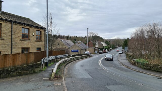
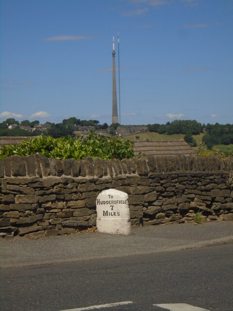
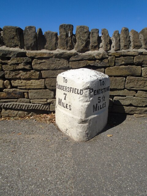
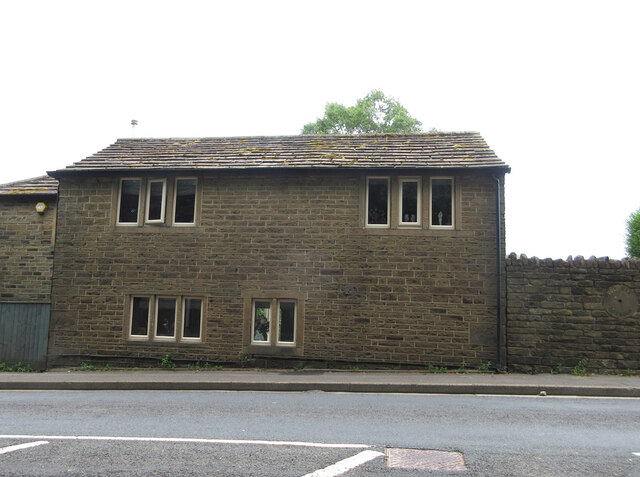
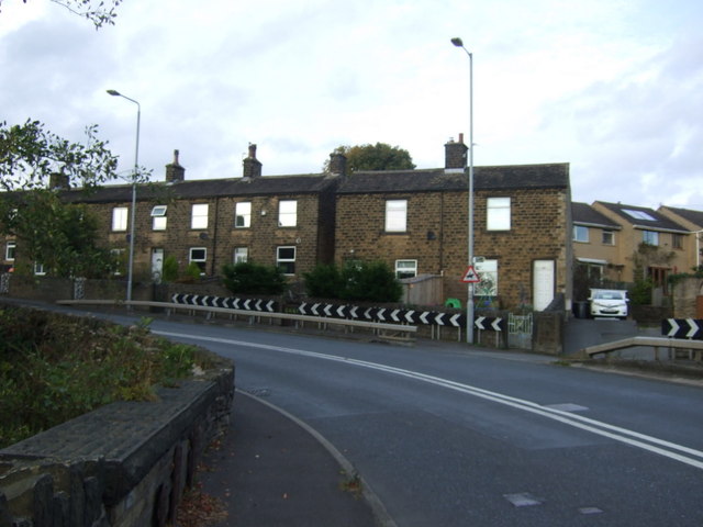
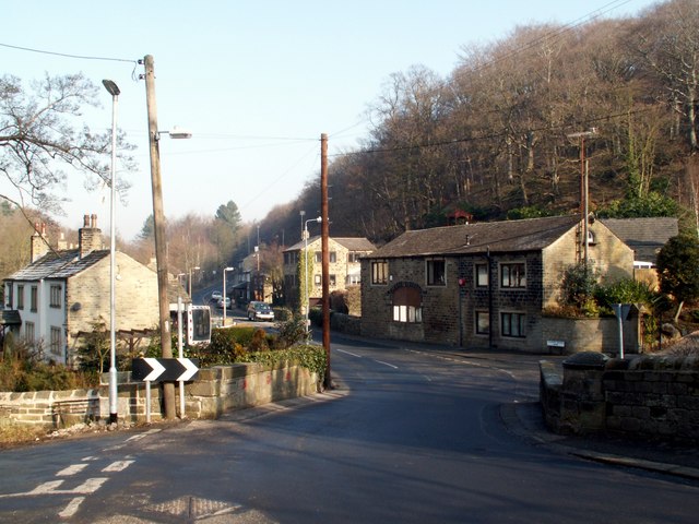
Stocksmoor is a small village located in the metropolitan borough of Kirklees, West Yorkshire, England. It is situated approximately 9 miles south of Huddersfield and lies within the picturesque Holme Valley.

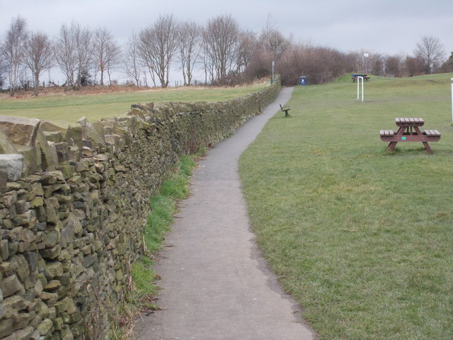
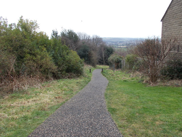
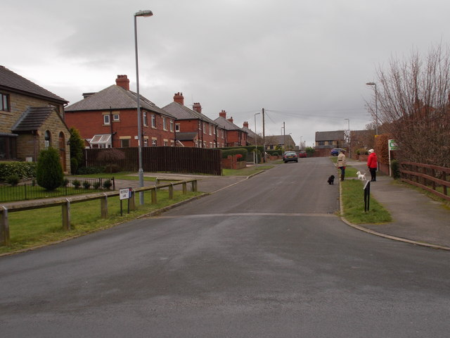
This rural village is characterized by its charming countryside setting, surrounded by rolling hills, farmlands, and woodland areas. The village is home to a close-knit community that prides itself on its strong sense of community spirit and friendly atmosphere.

Stocksmoor offers a range of amenities and facilities to cater to its residents' needs. These include a village hall, a local pub, and a small convenience store for daily essentials. The nearby town of Huddersfield provides residents with a wider range of services and recreational opportunities.

The village boasts excellent transportation links, making it an attractive location for commuters. Stocksmoor railway station provides regular services to Huddersfield, Sheffield, and Leeds, allowing for easy access to major employment hubs in the region.

Nature enthusiasts and outdoor lovers are drawn to Stocksmoor due to its proximity to stunning natural landscapes. The village is surrounded by beautiful walking trails, such as the Pennine Way and the Kirklees Way, offering opportunities for leisurely strolls and more challenging hikes.

Overall, Stocksmoor is a peaceful and scenic village that offers a high quality of life. It appeals to those seeking a tranquil rural retreat while still providing convenient access to nearby towns and cities.

If you have any feedback on the listing, please let us know in the comments section below.
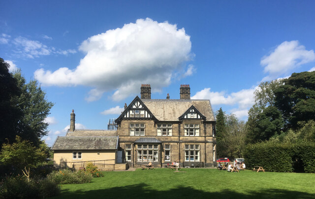
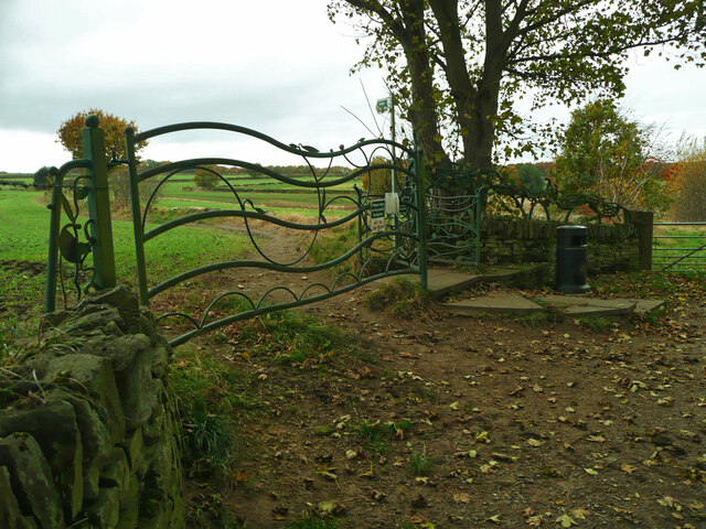
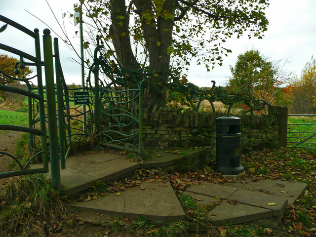
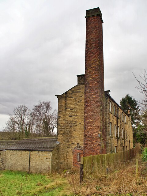
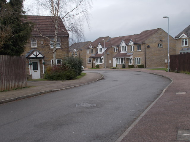
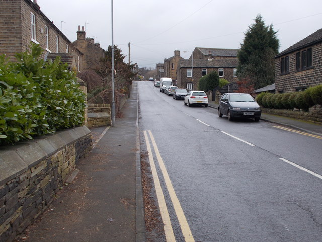
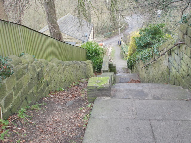
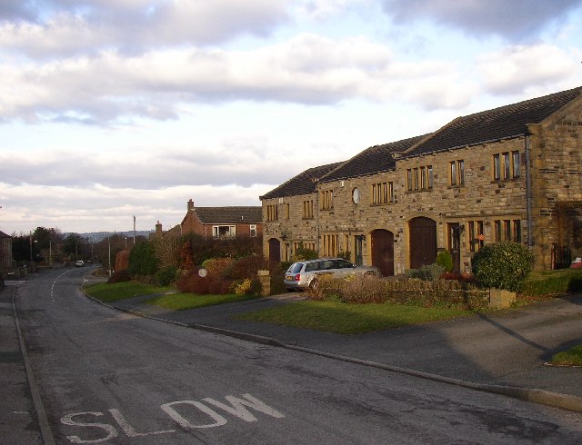
Stocksmoor Images

Images are sourced within 2km of 53.593057/-1.7253848 or Grid Reference SE1810. Thanks to Geograph Open Source API. All images are credited.

Cliffe House, Shepley Photographed during the 2021 artinthehouse event.
Cliffe House, Shepley
Photographed during the 2021 artinthehouse event.
Millennium Gate, Jenkyn Lane, Shepley See <span class="nowrap"><a title="https://www.shepleyvillage.org/village-association-news-august-2014/" rel="nofollow ugc noopener" href="https://www.shepleyvillage.org/village-association-news-august-2014/">Link</a><img style="margin-left:2px;" alt="External link" title="External link - shift click to open in new window" src="https://s1.geograph.org.uk/img/external.png" width="10" height="10"/></span> for a better photograph.
Millennium Gate, Jenkyn Lane, Shepley
See LinkExternal link for a better photograph.
Part of the Millennium Gate, Jenkyn Lane, Shepley This is a revisit to the first geograph for the square: <a href="https://www.geograph.org.uk/photo/81818">SE1809 : Ornate Gateway on the Kirklees Way</a> taken in June 2005. I litter bin has been provided and the foot gate now has a sign asking people to keep to the public footpath.
Part of the Millennium Gate, Jenkyn Lane, Shepley
This is a revisit to the first geograph for the square: SE1809 : Ornate Gateway on the Kirklees Way taken in June 2005. I litter bin has been provided and the foot gate now has a sign asking people to keep to the public footpath.
Old industrial building and chimney Off Abbey Road in Shepley. The building now appears to be in residential use.
Old industrial building and chimney
Off Abbey Road in Shepley. The building now appears to be in residential use.
Abbey Road, Shelley
Abbey Road, Shelley
Old milestone A view across the A629 in Shepley.   The milestone has been painted recently.   But in the distance the two masts of Emley Moor Transmitter.  The shorter one was a replacement for the original which collapsed from the weight of snow in 1963.   Now that needs repairs and alterations so the thinner structure has been set up beside it.
Old milestone
A view across the A629 in Shepley. The milestone has been painted recently. But in the distance the two masts of Emley Moor Transmitter. The shorter one was a replacement for the original which collapsed from the weight of snow in 1963. Now that needs repairs and alterations so the thinner structure has been set up beside it.
Old milestone A close-up of the milestone on Abbey Road in Shepley, the A629.   It may have been defaced at some time, 1940?, but the legend has been recut and the stone is well-maintained.   Grade II listed 1135384.
Old milestone
A close-up of the milestone on Abbey Road in Shepley, the A629. It may have been defaced at some time, 1940?, but the legend has been recut and the stone is well-maintained. Grade II listed 1135384.
Toll Bar Cottage, Shepley Former Toll House on the Eastern side of Lane Head Road (A629). Known as Bar House 1859.  
It served the Huddersfield & Penistone Turnpike Trust in the 18ᵗʰ & 19ᵗʰ C.

Milestone Society National ID: YW.SHE
Toll Bar Cottage, Shepley
Former Toll House on the Eastern side of Lane Head Road (A629). Known as Bar House 1859. It served the Huddersfield & Penistone Turnpike Trust in the 18ᵗʰ & 19ᵗʰ C. Milestone Society National ID: YW.SHE
Entering Shelley Heading north east on the A629.
Entering Shelley
Heading north east on the A629.
A629, Shelley Heading north east towards Huddersfield.
A629, Shelley
Heading north east towards Huddersfield.
Houses on Penistone Road (A629), Shelley
Footpath - Westerley Lane
Cricket Ground - Westerley Lane
Footpath - Westerley Lane
Westerley Lane - viewed from Hawthorne Way
Hawthorne Way - viewed from Westerley Lane
Far Bank - Penistone Road
Footpath & Steps - Penistone Road
Show me another place!

Stocksmoor is located at Grid Ref: SE1810 (Lat: 53.593057, Lng: -1.7253848)

Division: West Riding

Unitary Authority: Kirklees

Police Authority: West Yorkshire

What 3 Words

///laser.unsecured.business. Near Shepley, West Yorkshire

Related Wikis

Stocksmoor railway station

Stocksmoor railway station serves the village of Stocksmoor near Huddersfield in West Yorkshire, England. The station is 6.25 miles (10 km) from Huddersfield...

Stocksmoor

Stocksmoor is a hamlet, near Huddersfield, West Yorkshire, England. It is situated between the villages of Shepley and Brockholes. The total population...

Thunder Bridge

Thunder Bridge or Thunderbridge is a hamlet and bridge in the civil parish of Kirkburton, in the Kirklees district, in the county of West Yorkshire, England...

Shepley railway station

Shepley railway station serves the villages of Shepley and Shelley in West Yorkshire, England. It lies on the Penistone Line operated by Northern. Opened...

Nearby Amenities

Located within 500m of 53.593057,-1.7253848
Stocksmoor
Place: village
Lat/Long: 53.5949058/-1.7229969
Bus Stop
Stocks Moor Road
Bus: yes
Local Ref: 45018750
Naptan AtcoCode: 450018750
Naptan Bearing: E
Naptan CommonName: Stocks Moor Road
Naptan Crossing: Nr-Opp Crangle Fields
Naptan Indicator: Stop 45018750
Naptan PlusbusZoneRef: LEEDS
Naptan ShortCommonName: Cross Lane
Naptan Street: Stocks Moor Road
Naptan Verified: no
Public Transport: platform
Source: naptan_import
Lat/Long: 53.5946614/-1.7288043
Bus Stop
Stocksmoor Rail Station
Bus: yes
Local Ref: 45018751
Naptan AtcoCode: 450018751
Naptan Bearing: SW
Naptan CommonName: Stocksmoor Rail Station
Naptan Crossing: Nr-Opp Derwin Avenue
Naptan Indicator: Stop 45018751
Naptan Landmark: Clothiers Arms PH
Naptan PlusbusZoneRef: LEEDS
Naptan ShortCommonName: Stocksmoor Rail Stn
Naptan Street: Station Road
Naptan Verified: no
Public Transport: platform
Shelter: no
Source: naptan_import
Lat/Long: 53.5946878/-1.7235352
Bus Stop
Cross Lane Fulstone Road
Bus: yes
Local Ref: 45018752
Naptan AtcoCode: 450018752
Naptan Bearing: W
Naptan CommonName: Cross Lane Fulstone Road
Naptan Crossing: Fulstone Road
Naptan Indicator: Stop 45018752
Naptan PlusbusZoneRef: LEEDS
Naptan ShortCommonName: Fulstone Road
Naptan Street: Cross Lane
Naptan Verified: no
Public Transport: platform
Source: naptan_import
Lat/Long: 53.5931085/-1.7257774
Bus Stop
Cross Lane Stocks Moor Road
Bus: yes
Local Ref: 45018753
Naptan AtcoCode: 450018753
Naptan Bearing: NW
Naptan CommonName: Cross Lane Stocks Moor Road
Naptan Crossing: Stocks Moor Road
Naptan Indicator: Stop 45018753
Naptan PlusbusZoneRef: LEEDS
Naptan ShortCommonName: Stocks Moor Road
Naptan Street: Cross Lane
Naptan Verified: no
Public Transport: platform
Source: naptan_import
Lat/Long: 53.5941968/-1.730016
Barrier: stile
Step Count: 1
Stile: stepover
Lat/Long: 53.5928347/-1.7262899
Bench
Backrest: yes
Colour: black
Material: metal
Seats: 4
Source: survey
Lat/Long: 53.5955093/-1.7233585
Post Box
Collection Plate Date: 2017-09-19
Collection Times: Mo-Fr 16:30; Sa 10:30
Operator: Royal Mail
Post Box Type: wall
Ref: HD4 343
Royal Cypher: GR
Royal Cypher Wikidata: Q33102273
Source: survey
Lat/Long: 53.5943139/-1.7300975
Waste Basket
Source: survey
Lat/Long: 53.5952408/-1.7250683
Bench
Material: wood
Seats: 3
Source: survey
Lat/Long: 53.5952479/-1.725003
Pub
Clothiers Arms
Lat/Long: 53.5946062/-1.7229465
Railway: switch
Lat/Long: 53.5956187/-1.7283278
Stocksmoor
Naptan AtcoCode: 9100STKSMR
Network: National Rail
Network Website: https://www.nationalrail.co.uk/stations/ssm/
Network Wikidata: Q26334
Operator: Northern Rail
Operator Website: https://www.northernrailway.co.uk/stations/stocksmoor
Operator Wikidata: Q85789775
Public Transport: station
Railway: station
Ref Crs: SSM
Source: NPE
Wikidata: Q2109920
Wikipedia: en:Stocksmoor railway station
Lat/Long: 53.5941495/-1.7232658
Vending Machine
Operator: Northern
Vending: public_transport_tickets
Lat/Long: 53.5941801/-1.7231584
Parking
Lat/Long: 53.5943131/-1.7230134
Parking
Lat/Long: 53.5947064/-1.7225438
Railway: crossing
Lat/Long: 53.5926139/-1.7181431
Railway: crossing
Lat/Long: 53.5925807/-1.7181801
Bench
Lat/Long: 53.5942734/-1.723448
Bench
Backrest: yes
Lat/Long: 53.5902588/-1.7234107
Barrier: kissing_gate
Lat/Long: 53.5940999/-1.7314986
Barrier: stile
Step Count: 3
Stile: stepover
Lat/Long: 53.5921747/-1.7291524
Barrier: stile
Step Count: 1
Stile: stepover
Lat/Long: 53.5919941/-1.7312011
Barrier: stile
Stile: stepover
Lat/Long: 53.5920171/-1.7311443
Barrier: stile
Step Count: 1
Stile: stepover
Lat/Long: 53.5927257/-1.7273266
Barrier: stile
Stile: squeezer
Lat/Long: 53.5919294/-1.7321029
Defibrillator
Access: yes
Check Date: 2023-03-09
Defibrillator Location: On outside wall of Stocksmoor Village Hall
Emergency: defibrillator
Indoor: no
Opening Hours: 24/7
Lat/Long: 53.5946209/-1.7239843
Traffic Calming: table
Lat/Long: 53.5935467/-1.7277677
The data included in this document is from www.openstreetmap.org. The data is made available under ODbL.

Have you been to Stocksmoor?

Leave your review of Stocksmoor below (or comments, questions and feedback).