Stirches

Settlement in Roxburghshire

Scotland

Stirches

River Teviot, Hawick Hawick High School on the left.
River Teviot, Hawick Credit: Richard Webb

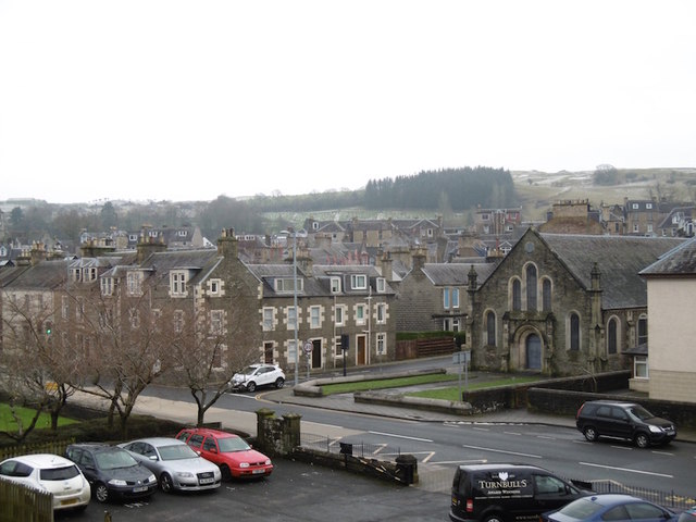
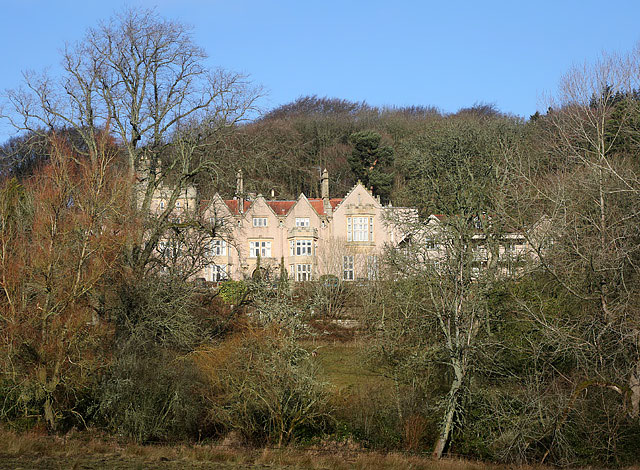
Stirches is a small village located in the county of Roxburghshire, in the Scottish Borders region of Scotland. Situated approximately 2 miles north of the town of Hawick, Stirches is nestled in a picturesque and rural setting, surrounded by rolling hills and beautiful countryside.

The village has a population of around 500 residents, who enjoy a peaceful and close-knit community atmosphere. Stirches is known for its charming and traditional architecture, with many houses and buildings dating back several centuries. The village is predominantly residential, with a mix of detached and semi-detached houses, as well as a few small businesses.

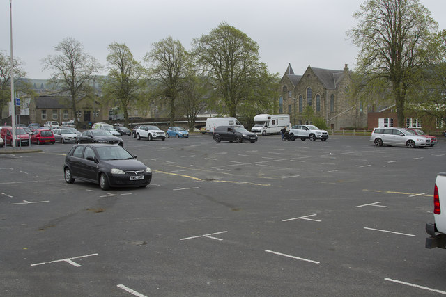
Stirches benefits from its proximity to Hawick, which offers a wider range of amenities and services, including shops, supermarkets, schools, and healthcare facilities. Residents of Stirches can easily access these amenities while still enjoying the tranquility of village life.

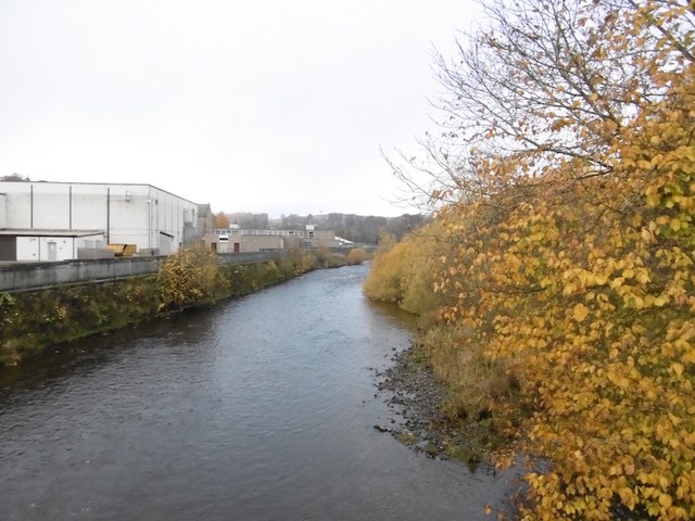
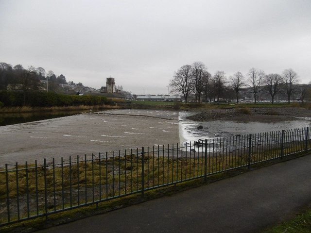
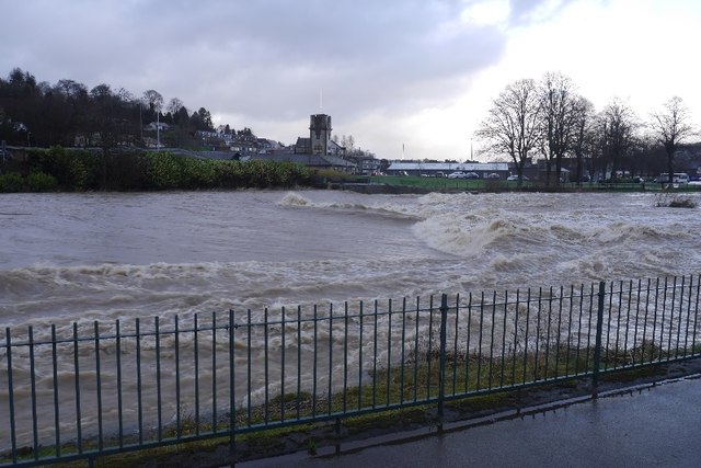
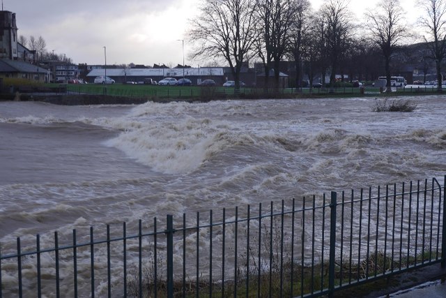
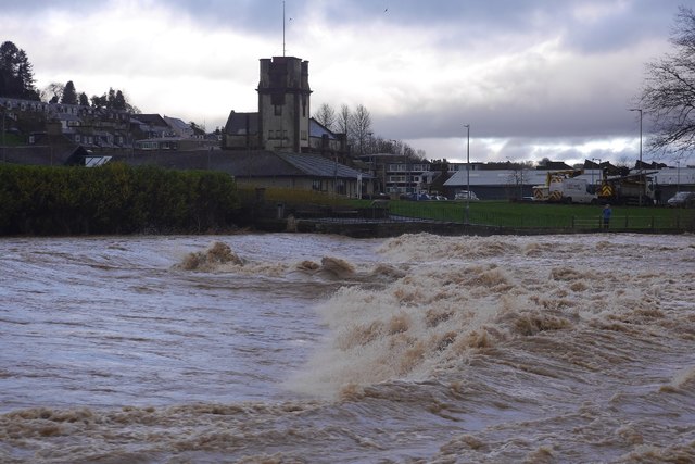
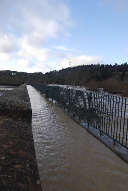
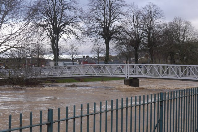
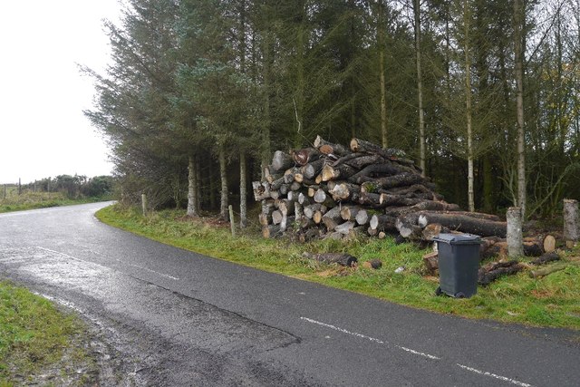
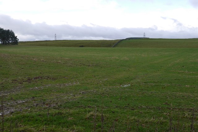
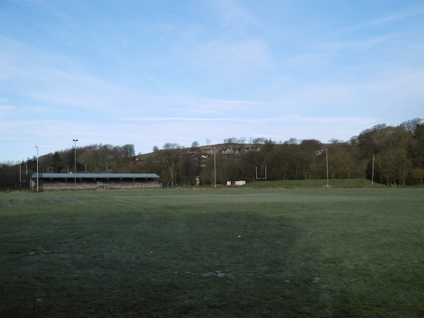
The surrounding area is renowned for its natural beauty, making it a popular destination for outdoor enthusiasts. There are several walking and cycling trails nearby, allowing residents to explore the stunning countryside and take in the breathtaking views. The River Teviot flows close to Stirches, providing opportunities for fishing and other water-based activities.

Overall, Stirches offers a peaceful and idyllic setting for those seeking a quiet and rural lifestyle, while still being within easy reach of essential amenities and the natural beauty of the Scottish Borders.

If you have any feedback on the listing, please let us know in the comments section below.

Stirches Images

Images are sourced within 2km of 55.434736/-2.7931773 or Grid Reference NT4915. Thanks to Geograph Open Source API. All images are credited.

River Teviot, Hawick Hawick High School on the left.
River Teviot, Hawick
Hawick High School on the left.
Common Haugh, Hawick The car park was empty as it was closed for line work.
Common Haugh, Hawick
The car park was empty as it was closed for line work.
Lawson Bridge, Hawick A little upstream of its predecessor, it is often used by Hawick High School pupils to get their buses on The Haugh.
Lawson Bridge, Hawick
A little upstream of its predecessor, it is often used by Hawick High School pupils to get their buses on The Haugh.
Cauld, Hawick The River Teviot in a relatively benign mood. Note the big shingle bank beneath the cauld.
Cauld, Hawick
The River Teviot in a relatively benign mood. Note the big shingle bank beneath the cauld.
Cauld, Hawick The weir upstream of the town during a spate. All footbridges were closed at the time.
Cauld, Hawick
The weir upstream of the town during a spate. All footbridges were closed at the time.
Teviot in spate After some hours of heavy rain.
Teviot in spate
After some hours of heavy rain.
Cauld, Hawick The Teviot shortly after it flooded the Common Haugh.
Cauld, Hawick
The Teviot shortly after it flooded the Common Haugh.
Flooded path, Hawick A wall gives some protection to Hawick High School as the Teviot rises to the edge of major flooding.
Flooded path, Hawick
A wall gives some protection to Hawick High School as the Teviot rises to the edge of major flooding.
Lawson Bridge, Hawick The river level is dropping after a rapid rise during heavy rain. The Common Haugh had flooded.
Lawson Bridge, Hawick
The river level is dropping after a rapid rise during heavy rain. The Common Haugh had flooded.
Logs near Priestrig Log stacks beside a minor road near Hawick.
Logs near Priestrig
Log stacks beside a minor road near Hawick.
Pasture near Stouslie North of Hawick.
Pasture near Stouslie
North of Hawick.
Common Haugh, Hawick The school bus for Newcastleton before a fraught journey home.
Common Haugh, Hawick
The school bus for Newcastleton before a fraught journey home.
Buccleuch Road, Hawick
Cauld, Hawick There is a big pile of shingle, deposited by recent spates.
Cauld, Hawick
There is a big pile of shingle, deposited by recent spates.
Cricket pitch, Hawick The square is being prepared for the forthcoming season. Looks strange on a frosty morning.
Cricket pitch, Hawick
The square is being prepared for the forthcoming season. Looks strange on a frosty morning.
St Andrew’s Care Home, Hawick This former convent at Stirches has a commanding position overlooking the town of Hawick in the Scottish Borders.
St Andrew’s Care Home, Hawick
This former convent at Stirches has a commanding position overlooking the town of Hawick in the Scottish Borders.
Haugh Car Park This is an unusual car park in a town, in that there was no charge. There is also, according to the signs, a market held here one day a week.
Haugh Car Park
This is an unusual car park in a town, in that there was no charge. There is also, according to the signs, a market held here one day a week.
The bandstand Wilton Park The bandstand was renovated in 2015. This seems to be just the start of what is obviously a long term plan to upgrade Wilton Park as there is a new cafe being built and much other work being done to the paths and playground. A vast amount of money must be being spent on it for the benefit of the people of Hawick.
The bandstand Wilton Park
The bandstand was renovated in 2015. This seems to be just the start of what is obviously a long term plan to upgrade Wilton Park as there is a new cafe being built and much other work being done to the paths and playground. A vast amount of money must be being spent on it for the benefit of the people of Hawick.
Show me another place!

Stirches is located at Grid Ref: NT4915 (Lat: 55.434736, Lng: -2.7931773)

Unitary Authority: The Scottish Borders

Police Authority: The Lothians and Scottish Borders

What 3 Words

///alleyway.arch.terminal. Near Hawick, Scottish Borders

Nearby Locations

Stirches Heip Hill

Related Wikis

Stirches

Stirches is an area of Hawick in the Scottish Borders, mostly consisting of ex-council housing built in 1973. It is often considered to be one of the more...

Hawick railway station

Hawick railway station served the town of Hawick, Scottish Borders, Scotland from 1849 to 1969 on the Waverley Route. == History == The first station opened...

Hawick Library

Hawick Library is housed in the building built in 1904 in Hawick and it was one of the many libraries funded by Andrew Carnegie. The library is a Category...
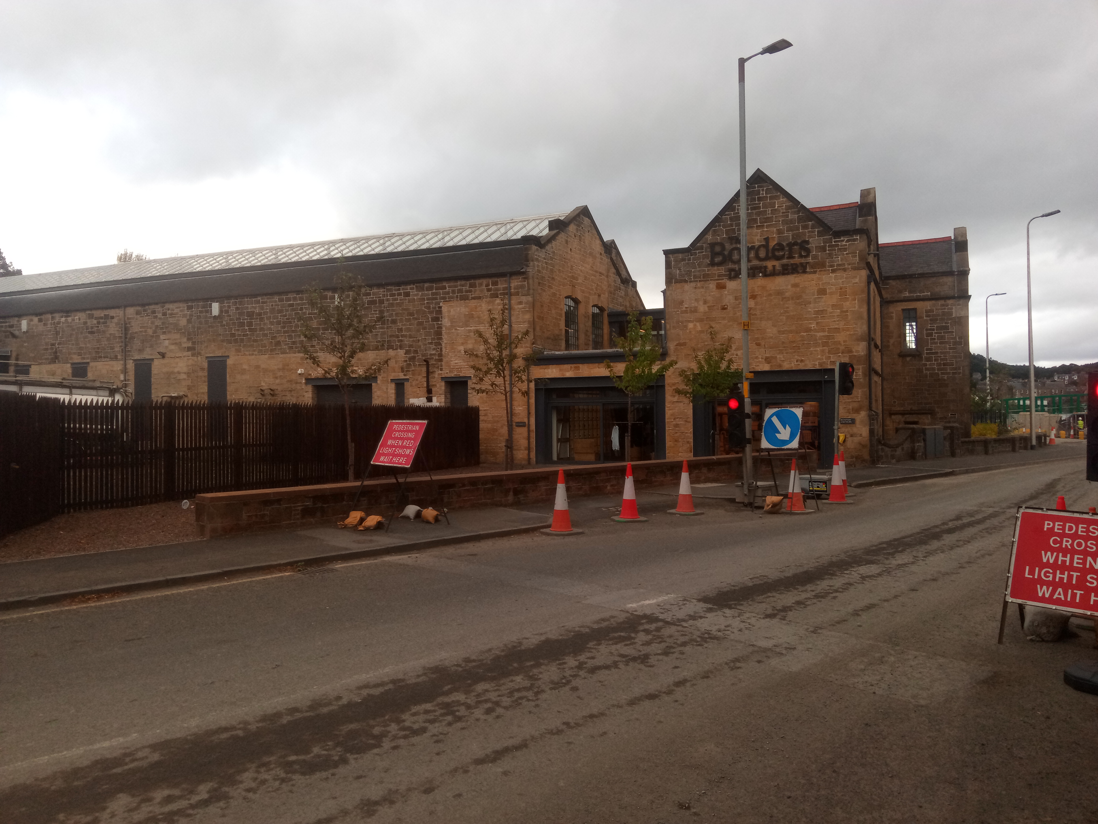
Borders distillery

The Borders distillery, is a malt whisky, gin and vodka production facility in the Scottish Borders town of Hawick. The distillery produces malt whisky...

Nearby Amenities

Located within 500m of 55.434736,-2.7931773
Bus Stop
Stirches
Bench: no
Bus: yes
Lit: yes
Naptan AtcoCode: 6900857
Naptan Bearing: S
Naptan CommonName: Stirches
Naptan Indicator: Maxton Court
Naptan Landmark: Maxton Court
Naptan NaptanCode: 72725942
Naptan Street: Stirches Road
Naptan Verified: no
Public Transport: platform
Shelter: no
Source: naptan_import
Tactile Paving: yes
Lat/Long: 55.4325655/-2.7922201
Bus Stop
Silverbuthall Road
Naptan AtcoCode: 6900858
Naptan Bearing: N
Naptan CommonName: Silverbuthall Road
Naptan Indicator: o/s 49/51
Naptan Landmark: Silverbuthall Road
Naptan NaptanCode: 72725947
Naptan Street: Silverbuthall Road
Naptan Verified: no
Source: naptan_import
Lat/Long: 55.4316383/-2.7896888
Bus Stop
Silverbuthall Road
Bus: yes
Naptan AtcoCode: 6900859
Naptan Bearing: S
Naptan BusStopType: CUS
Naptan CommonName: Silverbuthall Road
Naptan Indicator: o/s 22
Naptan Landmark: Silverbuthall Road
Naptan NaptanCode: 72725948
Naptan Street: Silverbuthall Road
Naptan Verified: no
Public Transport: platform
Shelter: no
Source: naptan_import
Lat/Long: 55.4315589/-2.789466
Bus Stop
Silverbuthall Road
Bus: yes
Naptan AtcoCode: 6900860
Naptan Bearing: N
Naptan CommonName: Silverbuthall Road
Naptan Indicator: nr Atkinson Road
Naptan Landmark: Atkinson Road
Naptan NaptanCode: 72726295
Naptan Street: Silverbuthall Road
Naptan Verified: no
Public Transport: platform
Source: naptan_import
Lat/Long: 55.4330979/-2.7863043
Bus Stop
Silverbuthall Road
Bus: yes
Naptan AtcoCode: 6900861
Naptan Bearing: S
Naptan BusStopType: CUS
Naptan CommonName: Silverbuthall Road
Naptan Indicator: nr Churchill Road
Naptan Landmark: Atkinson Road
Naptan NaptanCode: 72725975
Naptan Street: Silverbuthall Road
Naptan Verified: no
Public Transport: platform
Shelter: no
Source: naptan_import
Lat/Long: 55.4329912/-2.7861283
Bus Stop
Hazelwood Road
Bench: yes
Bus: yes
Lit: yes
Naptan AtcoCode: 6900871
Naptan Bearing: E
Naptan CommonName: Hazelwood Road
Naptan Indicator: nr Raeson Park
Naptan Landmark: Raeson Park
Naptan NaptanCode: 72726526
Naptan Street: Hazelwood Road
Naptan Verified: no
Public Transport: platform
Shelter: yes
Source: naptan_import
Tactile Paving: yes
Lat/Long: 55.4323727/-2.7914735
Bus Stop
Roxburghe Drive
Bus: yes
Naptan AtcoCode: 6900872
Naptan Bearing: E
Naptan CommonName: Roxburghe Drive
Naptan Indicator: Alemoor Court
Naptan Landmark: Telephone Box
Naptan NaptanCode: 72726427
Naptan Street: Roxburghe Drive
Naptan Verified: no
Public Transport: platform
Shelter: yes
Source: naptan_import
Lat/Long: 55.4340618/-2.7887257
Bus Stop
Roxburghe Drive
Bus: yes
Naptan AtcoCode: 6900873
Naptan Bearing: E
Naptan CommonName: Roxburghe Drive
Naptan Indicator: Crailing Court
Naptan Landmark: Bowden Drive
Naptan NaptanCode: 72726458
Naptan Street: Roxburghe Drive
Naptan Verified: no
Public Transport: platform
Shelter: no
Source: naptan_import
Lat/Long: 55.4352006/-2.7863145
Bus Stop
Guthrie Drive
Bus: yes
Naptan AtcoCode: 6900874
Naptan Bearing: N
Naptan CommonName: Guthrie Drive
Naptan Indicator: Hugh McLeod Place
Naptan Landmark: Hugh McLeod Place
Naptan NaptanCode: 72726527
Naptan Street: Guthrie Drive
Naptan Verified: no
Public Transport: platform
Shelter: yes
Source: naptan_import
Lat/Long: 55.4362165/-2.7876307
Bus Stop
Guthrie Drive
Bus: yes
Naptan AtcoCode: 6900875
Naptan Bearing: W
Naptan CommonName: Guthrie Drive
Naptan Indicator: Lanton Place
Naptan Landmark: Lanton Place
Naptan NaptanCode: 72726535
Naptan Street: Guthrie Drive
Naptan Verified: no
Public Transport: platform
Shelter: yes
Source: naptan_import
Lat/Long: 55.4359675/-2.7914031
Bus Stop
Guthrie Drive
Bus: yes
Naptan AtcoCode: 6900876
Naptan Bearing: W
Naptan CommonName: Guthrie Drive
Naptan Indicator: Deloraine Court
Naptan Landmark: Deloraine Court
Naptan NaptanCode: 72726536
Naptan Street: Guthrie Drive
Naptan Verified: no
Public Transport: platform
Shelter: yes
Source: naptan_import
Lat/Long: 55.4344632/-2.7933644
Bus Stop
Branxholme Road
Naptan AtcoCode: 6900882
Naptan Bearing: N
Naptan CommonName: Branxholme Road
Naptan Indicator: opp No 1
Naptan Landmark: Branxholme Road
Naptan NaptanCode: 72726492
Naptan Street: Branxholme Road
Naptan Verified: no
Source: naptan_import
Lat/Long: 55.4306262/-2.7900111
Recycling
Lat/Long: 55.4350669/-2.7921445
Noexit: yes
Lat/Long: 55.4331293/-2.7885807
Noexit: yes
Lat/Long: 55.4347272/-2.7861364
Noexit: yes
Lat/Long: 55.4343499/-2.788883
Noexit: yes
Lat/Long: 55.4347278/-2.7880687
Noexit: yes
Lat/Long: 55.4356768/-2.7864582
Noexit: yes
Lat/Long: 55.4351022/-2.7875899
Noexit: yes
Lat/Long: 55.4365564/-2.7892652
Noexit: yes
Lat/Long: 55.4362246/-2.7901919
Noexit: yes
Lat/Long: 55.4358708/-2.7899492
Noexit: yes
Lat/Long: 55.4356738/-2.7875714
Noexit: yes
Lat/Long: 55.4341087/-2.7928603
Noexit: yes
Lat/Long: 55.433852/-2.7937728
Noexit: yes
Lat/Long: 55.4328978/-2.7919418
Stirches
Place: suburb
Wikidata: Q7617535
Wikipedia: en:Stirches
Lat/Long: 55.4343912/-2.7912189
Stirches House
Place: hamlet
Lat/Long: 55.4373354/-2.7957274
Telephone
Booth: K6
Covered: booth
Source: survey
Lat/Long: 55.4327589/-2.7868504
Post Box
Post Box Type: lamp
Royal Cypher: scottish_crown
Source: survey
Lat/Long: 55.4327698/-2.7868572
Power: pole
Lat/Long: 55.438311/-2.7889718
Power: pole
Lat/Long: 55.4377925/-2.7896398
Power: pole
Lat/Long: 55.4373246/-2.7902427
Power: pole
Lat/Long: 55.4384421/-2.7891884
Power: pole
Lat/Long: 55.4379637/-2.7897889
Power: pole
Lat/Long: 55.4374278/-2.7904616
Power: pole
Lat/Long: 55.4383541/-2.7896798
Power: pole
Lat/Long: 55.437076/-2.7913266
Power: pole
Lat/Long: 55.4364937/-2.7920586
Power: pole
Lat/Long: 55.4357212/-2.7930207
Power: pole
Lat/Long: 55.4351176/-2.7937867
Power: pole
Lat/Long: 55.4346565/-2.7943388
Power: pole
Lat/Long: 55.4340736/-2.7950603
Material: wood
Power: pole
Lat/Long: 55.4339382/-2.7959883
Power: pole
Lat/Long: 55.4338089/-2.7969244
Power: pole
Lat/Long: 55.433643/-2.7981421
Power: pole
Lat/Long: 55.4334878/-2.7992311
Power: pole
Lat/Long: 55.4333462/-2.8002705
Post Box
Operator: Royal Mail
Operator Wikidata: Q638098
Lat/Long: 55.4340269/-2.7887647
Noexit: yes
Lat/Long: 55.4346799/-2.7909954
Noexit: yes
Lat/Long: 55.4351867/-2.791542
Give Way
Direction: forward
Lat/Long: 55.431969/-2.787107
Generator Method: photovoltaic
Generator Output Electricity: yes
Generator Source: solar
Generator Type: solar_photovoltaic_panel
Power: generator
Lat/Long: 55.4321897/-2.787137
Generator Method: photovoltaic
Generator Output Electricity: yes
Generator Source: solar
Generator Type: solar_photovoltaic_panel
Power: generator
Lat/Long: 55.433904/-2.7927589
Generator Method: photovoltaic
Generator Output Electricity: yes
Generator Source: solar
Generator Type: solar_photovoltaic_panel
Power: generator
Lat/Long: 55.4329635/-2.7934228
Generator Method: photovoltaic
Generator Output Electricity: yes
Generator Source: solar
Generator Type: solar_photovoltaic_panel
Power: generator
Lat/Long: 55.4332127/-2.7946224
Generator Method: photovoltaic
Generator Output Electricity: yes
Generator Source: solar
Generator Type: solar_photovoltaic_panel
Power: generator
Lat/Long: 55.4344168/-2.7881791
Generator Method: photovoltaic
Generator Output Electricity: yes
Generator Source: solar
Generator Type: solar_photovoltaic_panel
Power: generator
Lat/Long: 55.4315391/-2.7893485
Generator Method: photovoltaic
Generator Output Electricity: yes
Generator Source: solar
Generator Type: solar_photovoltaic_panel
Power: generator
Lat/Long: 55.4308055/-2.7894786
Power: pole
Lat/Long: 55.4374008/-2.7993611
Power: pole
Lat/Long: 55.4370441/-2.7993738
Power: pole
Lat/Long: 55.4366918/-2.7993789
Power: pole
Lat/Long: 55.4375619/-2.7907005
The data included in this document is from www.openstreetmap.org. The data is made available under ODbL.

Have you been to Stirches?

Leave your review of Stirches below (or comments, questions and feedback).