Staines-upon-Thames

Settlement in Middlesex Spelthorne

England

Staines-upon-Thames

Staines Reservoir A view along the causeway of the Staines Reservoirs in Surrey looking west with the twin water towers visible at the end. The north and south basins are on either side of the causeway.
Staines Reservoir Credit: John P Reeves

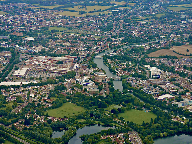
Staines-upon-Thames, located in the county of Middlesex, England, is a historic market town situated on the banks of the River Thames. With a population of around 20,000 residents, it is known for its charming character and picturesque surroundings.

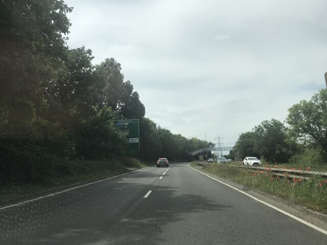
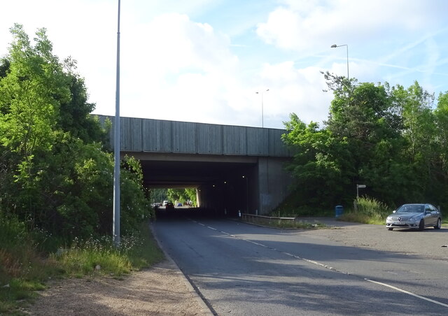
The town traces its origins back to the Roman occupation of Britain, when it was established as a settlement known as Ad Pontes. Staines played a significant role throughout history, serving as a crossing point over the River Thames and an important stop on the London to Windsor route. Today, it remains a vital transportation hub, with excellent road and rail links connecting it to London and other nearby towns.

Staines-upon-Thames boasts a mix of modern and traditional architecture, showcasing its rich heritage. The town center offers a range of shops, restaurants, and pubs, catering to both locals and visitors. The Two Rivers shopping center is a popular destination, providing a wide variety of retail options.

Nature enthusiasts can explore the tranquil beauty of the nearby Staines Moor, a designated nature reserve, or take a stroll along the Thames Path, appreciating the scenic river views. The town also hosts several parks and green spaces, including Laleham Park and Staines Park, providing recreational areas for families and locals to enjoy.

Historical landmarks are dotted throughout Staines-upon-Thames, such as the Staines Bridge, a Grade II listed structure, and the Staines Town Hall, an impressive Victorian building. For those interested in the town's past, the Spelthorne Museum offers a glimpse into the local history and culture.

Overall, Staines-upon-Thames, Middlesex, is a charming town with a rich heritage, scenic landscapes, and a warm community atmosphere, making it an attractive place to live or visit.

If you have any feedback on the listing, please let us know in the comments section below.

Staines-upon-Thames Images

Images are sourced within 2km of 51.433814/-0.51183822 or Grid Reference TQ0371. Thanks to Geograph Open Source API. All images are credited.

Staines Reservoir A view along the causeway of the Staines Reservoirs in Surrey looking west with the twin water towers visible at the end. The north and south basins are on either side of the causeway.
Staines Reservoir
A view along the causeway of the Staines Reservoirs in Surrey looking west with the twin water towers visible at the end. The north and south basins are on either side of the causeway.
On the A308
On the A308
Approaching the A30/M25 junction
Houses on Wraysbury Road
A30 / M25 Motorway bridge over Wraysbury Road (B376)
Lammas Recreation Ground, Staines
Outdoor exercise area, Lammas Recreation Ground, Staines
Houses on Greenpark, Staines
Vicarage Road, Staines
The London Stone, Staines On Church Street.
See <a href="https://www.geograph.org.uk/photo/7298114">TQ0371 : Sign for the London Stone, Staines</a> for sign.
The London Stone, Staines
On Church Street. See TQ0371 : Sign for the London Stone, Staines for sign.
Sign for the London Stone, Staines See <a href="https://www.geograph.org.uk/photo/7298113">TQ0371 : The London Stone, Staines</a> for context.
Sign for the London Stone, Staines
Church Street, Staines
The Thames Lodge, Staines
Railway bridge over the B376, Staines
St Peter's Church Staines
Houses on Laleham Road, Staines
Laleham Road (B376), Staines
Houses on Laleham Road, Staines
Show me another place!

Staines-upon-Thames is located at Grid Ref: TQ0371 (Lat: 51.433814, Lng: -0.51183822)

Administrative County: Surrey

District: Spelthorne

Police Authority: Surrey

What 3 Words

///prices.relay.indoor. Near Staines, Surrey

Related Wikis

Staines-upon-Thames

Staines-upon-Thames is a market town in northwest Surrey, England, around 17 miles (28 kilometres) west of central London. It is in the Borough of Spelthorne...

Wraysbury River

The Wraysbury River is an anabranch of the River Colne to the west of London. == Course == The river leaves the Colne at West Drayton and runs under the...

Staines Town Hall

Staines Town Hall is a municipal building in the Market Square, Staines-upon-Thames, Surrey, England. The town hall, which briefly served as the headquarters...

Staines High Street railway station

Staines High Street railway station was a railway station that formerly served the town of Staines (now Staines-upon-Thames), on the Windsor & Eton line...

Nearby Amenities

Located within 500m of 51.433814,-0.51183822
Staines-upon-Thames
Old Name: Staines
Place: town
Source Name: local knowledge
Wikidata: Q285323
Wikipedia: en:Staines-upon-Thames
Lat/Long: 51.434012/-0.511044
Crossing
Crossing: traffic_signals
Crossing Ref: pelican
Kerb: lowered
Lat/Long: 51.4360995/-0.5125364
Created By: YahooApplet 1.0
Lat/Long: 51.4359323/-0.5106768
Crossing
Bicycle: yes
Crossing: unmarked
Crossing Island: yes
Lat/Long: 51.4350399/-0.508444
Cinema
Vue
Addr City: Staines-upon-Thames
Addr County: Surrey
Addr Postcode: TW18 4BL
Addr Street: Mustard Mill Road
Brand: Vue
Brand Wikidata: Q2535134
Brand Wikipedia: en:Vue Cinemas
Fhrs Id: 277987
Source Addr: FHRS Open Data
Lat/Long: 51.4342658/-0.5136433
Bus Station
Elmsleigh Bus Station
Bus: yes
Naptan AtcoCode: 400G4402126A
Public Transport: station
Lat/Long: 51.4325278/-0.5092379
Pub
The Cock Inn
Lat/Long: 51.4350634/-0.5155384
Bicycle Parking
Created By: Potlatch 0.9c
Lat/Long: 51.4352147/-0.5111478
Bicycle Parking
Bicycle Parking: stands
Capacity: 12
Covered: yes
Lat/Long: 51.4359798/-0.5126069
Bicycle Parking
Created By: Potlatch 0.9c
Lat/Long: 51.4342141/-0.5104268
Bicycle Parking
Created By: Potlatch 0.9c
Lat/Long: 51.4336912/-0.5122082
Pub
London Stone
Addr City: Staines-upon-Thames
Addr Housenumber: 14
Addr Postcode: TW18 4EP
Addr Street: Church Street
Brewery: yes;various
Check Date: 2018-02-05
Fhrs Id: 1090433
Outdoor Seating: yes
Lat/Long: 51.4339805/-0.5143542
Bicycle Parking
Created By: Potlatch 0.9c
Lat/Long: 51.4338142/-0.5130665
Fast Food
itsu
Addr City: Staines-upon-Thames
Addr Housename: Itsu
Addr Postcode: TW18 4BL
Addr Street: Mustard Mill Road
Addr Unit: T5
Brand: itsu
Brand Wikidata: Q6094914
Cuisine: asian
Fhrs Id: 277871
Source Addr: FHRS Open Data
Takeaway: yes
Lat/Long: 51.4345259/-0.5125163
Post Office
Staines Post Office
Addr City: Staines-upon-Thames
Addr Housenumber: 49-51
Addr Postcode: TW18 4QR
Addr Street: High Street
Brand: Post Office
Brand Wikidata: Q1783168
Opening Hours: Mo-Fr 09:00-17:30; Sa 09:00-12:30
Operator: WHSmith
Operator Wikidata: Q1548712
Ref Pol Id: 93974
Website: https://www.postoffice.co.uk/branch-finder/1570250/staines
Lat/Long: 51.4337226/-0.511928
Bicycle Parking
Created By: Potlatch 0.9c
Lat/Long: 51.432408/-0.5099251
Bicycle Parking
Lat/Long: 51.4320401/-0.5107547
Library
Lat/Long: 51.4321637/-0.5110881
Bicycle Parking
Created By: Potlatch 0.9c
Lat/Long: 51.4333677/-0.5142499
Historic: memorial
Memorial: war_memorial
Lat/Long: 51.4333326/-0.5141111
Telephone
Booth: K6
Covered: booth
Listed Status: Grade II
Operator: BT
Lat/Long: 51.4330765/-0.5140391
Crossing
Crossing: traffic_signals
Crossing Ref: pelican
Kerb: lowered
Sloped Curb: yes
Lat/Long: 51.4338831/-0.515695
Crossing
Crossing: traffic_signals
Crossing Ref: pelican
Kerb: lowered
Sloped Curb: yes
Lat/Long: 51.4337173/-0.5147211
Crossing
Crossing: traffic_signals
Crossing Ref: pelican
Kerb: lowered
Sloped Curb: yes
Tactile Paving: yes
Wheelchair: yes
Lat/Long: 51.4334677/-0.5126702
Disused Shop: yes
Lat/Long: 51.4329931/-0.5142051
Traffic Signals
Source: bing
Traffic Signals Direction: forward
Lat/Long: 51.4335776/-0.5129459
Bicycle Parking
Created By: Potlatch 0.9c
Lat/Long: 51.4346047/-0.5138504
Place Of Worship
Staines Methodist
Denomination: methodist
Religion: christian
Lat/Long: 51.4326587/-0.5130142
Place Of Worship
Staines Baptist
Denomination: baptist
Religion: christian
Lat/Long: 51.4354262/-0.5146208
Bus Stop
Bowes Road
Naptan AtcoCode: 40004401130A
Naptan Bearing: NW
Naptan CommonName: Bowes Road
Naptan Indicator: adj
Naptan Landmark: Bowes Road
Naptan NaptanCode: suratpap
Naptan Street: Chertsey Lane
Naptan Verified: no
Public Transport: platform
Shelter: yes
Source: naptan_import
Lat/Long: 51.4296277/-0.514285
Bus Stop
Pinetrees Business Park
Naptan AtcoCode: 40004401131A
Naptan Bearing: NW
Naptan CommonName: Pinetrees Business Park
Naptan Indicator: Opp
Naptan Landmark: Pinetrees Business Park
Naptan NaptanCode: suratpaw
Naptan Street: Chertsey Lane
Naptan Verified: no
Public Transport: platform
Shelter: yes
Source: naptan_import
Tactile Paving: no
Lat/Long: 51.4316021/-0.5176394
Bus Stop
Pinetrees Business Park
Bench: yes
Naptan AtcoCode: 40004401131B
Naptan Bearing: SE
Naptan BusStopType: CUS
Naptan CommonName: Pinetrees Business Park
Naptan Indicator: adj
Naptan Landmark: Pinetrees Business Park
Naptan NaptanCode: suratpda
Naptan Street: Chertsey Lane
Naptan Verified: no
Public Transport: platform
Shelter: yes
Source: naptan_import
Tactile Paving: no
Lat/Long: 51.4318116/-0.5176602
Bus Stop
Kingston Road
Bus: yes
Local Ref: L
Naptan AtcoCode: 40004402022A
Naptan Bearing: SW
Naptan CommonName: Kingston Road
Naptan Indicator: Stop L
Naptan Landmark: Kingston Road
Naptan NaptanCode: surdawmg
Naptan Street: London Road
Naptan Verified: no
Public Transport: platform
Source: naptan_import
Lat/Long: 51.4354566/-0.5051182
Bus Stop
Staines Police Station
Bus: yes
Local Ref: M
Naptan AtcoCode: 40004402124A
Naptan Bearing: SE
Naptan CommonName: London Road
Naptan Indicator: Stop M
Naptan Landmark: Police Station
Naptan NaptanCode: surdpwmw
Naptan Street: Kingston Road
Naptan Verified: no
Public Transport: platform
Ref: 57536
Source: naptan_import
Lat/Long: 51.4346799/-0.5049797
Bus Stop
Staines Police Station
Bus: yes
Local Ref: U
Naptan AtcoCode: 40004402124C
Naptan Bearing: NW
Naptan CommonName: London Road
Naptan Indicator: Stop U
Naptan Landmark: London Road
Naptan NaptanCode: surdpwtj
Naptan Street: Kingston Road
Naptan Verified: no
Public Transport: platform
Ref: 75164
Source: naptan_import
Lat/Long: 51.4348899/-0.5055739
Bus Stop
High Street
Bus: yes
Local Ref: J
Naptan AtcoCode: 40004402125A
Naptan Bearing: E
Naptan CommonName: Post Office
Naptan Indicator: Stop J
Naptan Landmark: Railway Bridge
Naptan NaptanCode: surdtadg
Naptan Street: High Street
Naptan Verified: no
Public Transport: platform
Ref: 58815
Source: naptan_import
Lat/Long: 51.4351399/-0.5077608
Bus Stop
Elmsleigh Bus Station
Alt Name: Staines Bus Station
Bus: yes
Local Ref: 1
Naptan AltCommonName: Staines Bus Station
Naptan AltStreet: Not Specified
Naptan AtcoCode: 40004402126A
Naptan CommonName: Elmsleigh Bus Station
Naptan Indicator: Stop 1
Naptan Landmark: Bus Station
Naptan NaptanCode: surdtadw
Naptan Street: South Street
Naptan Verified: no
Public Transport: platform
Ref: 98266
Source: naptan_import
Lat/Long: 51.4328808/-0.508829
Bus Stop
Elmsleigh Bus Station
Alt Name: Staines Bus Station
Bus: yes
Local Ref: 2
Naptan AltCommonName: Staines Bus Station
Naptan AltStreet: Not Specified
Naptan AtcoCode: 40004402126B
Naptan CommonName: Elmsleigh Bus Station
Naptan Indicator: Stop 2
Naptan Landmark: Bus Station
Naptan NaptanCode: surdtaga
Naptan Street: South Street
Naptan Verified: no
Public Transport: platform
Ref: 98267
Source: naptan_import
Lat/Long: 51.4328317/-0.509141
Bus Stop
Elmsleigh Bus Station
Alt Name: Staines Bus Station
Bus: yes
Local Ref: 3
Naptan AltCommonName: Staines Bus Station
Naptan AltStreet: Not Specified
Naptan AtcoCode: 40004402126C
Naptan CommonName: Elmsleigh Bus Station
Naptan Indicator: Stop 3
Naptan Landmark: Bus Station
Naptan NaptanCode: surdtagd
Naptan Street: South Street
Naptan Verified: no
Public Transport: platform
Ref: 98268
Source: naptan_import
Lat/Long: 51.4327197/-0.5094302
Bus Stop
Elmsleigh Bus Station
Alt Name: Staines Bus Station
Bus: yes
Local Ref: 4
Naptan AltCommonName: Staines Bus Station
Naptan AltStreet: Not Specified
Naptan AtcoCode: 40004402126D
Naptan CommonName: Elmsleigh Bus Station
Naptan Indicator: Stop 4
Naptan Landmark: Bus Station
Naptan NaptanCode: surdtagj
Naptan Street: South Street
Naptan Verified: no
Public Transport: platform
Ref: 98269
Source: naptan_import
Lat/Long: 51.432633/-0.5096005
Bus Stop
Elmsleigh Bus Station
Alt Name: Staines Bus Station
Bus: yes
Local Ref: 6
Naptan AltCommonName: Staines Bus Station
Naptan AltStreet: Not Specified
Naptan AtcoCode: 40004402126E
Naptan CommonName: Elmsleigh Bus Station
Naptan Indicator: Stop 6
Naptan Landmark: Bus Station
Naptan NaptanCode: surdtagm
Naptan Street: South Street
Naptan Verified: no
Public Transport: platform
Ref: surdtagm
Source: naptan_import
Lat/Long: 51.4326526/-0.5092752
Bus Stop
Elmsleigh Bus Station
Alt Name: Staines Bus Station
Bus: yes
Local Ref: 7
Naptan AltCommonName: Staines Bus Station
Naptan AltStreet: Not Specified
Naptan AtcoCode: 40004402126F
Naptan CommonName: Elmsleigh Bus Station
Naptan Indicator: Stop 7
Naptan Landmark: Bus Station
Naptan NaptanCode: surdtagp
Naptan Street: South Street
Naptan Verified: no
Public Transport: platform
Source: naptan_import
Lat/Long: 51.4325939/-0.5093826
Bus Stop
Elmsleigh Bus Station
Alt Name: Staines Bus Station
Bus: yes
Local Ref: 8
Naptan AltCommonName: Staines Bus Station
Naptan AltStreet: Not Specified
Naptan AtcoCode: 40004402126G
Naptan CommonName: Elmsleigh Bus Station
Naptan Indicator: Stop 8
Naptan Landmark: Bus Station
Naptan NaptanCode: surdtapw
Naptan Street: South Street
Naptan Verified: no
Public Transport: platform
Source: naptan_import
Lat/Long: 51.4325826/-0.5091744
Bus Stop
Elmsleigh Bus Station
Alt Name: Staines Bus Station
Bus: yes
Local Ref: 9
Naptan AltCommonName: Staines Bus Station
Naptan AltStreet: Not Specified
Naptan AtcoCode: 40004402126H
Naptan CommonName: Elmsleigh Bus Station
Naptan Indicator: Stop 9
Naptan Landmark: Bus Station
Naptan NaptanCode: surdtata
Naptan Street: South Street
Naptan Verified: no
Public Transport: platform
Source: naptan_import
Lat/Long: 51.432469/-0.5093345
Bus Stop
Elmsleigh Bus Station
Alt Name: Staines Bus Station
Bus: yes
Local Ref: 10
Naptan AltCommonName: Staines Bus Station
Naptan AltStreet: Not Specified
Naptan AtcoCode: 40004402126I
Naptan CommonName: Elmsleigh Bus Station
Naptan Indicator: Stop 10
Naptan Landmark: Bus Station
Naptan NaptanCode: surdtatd
Naptan Street: South Street
Naptan Verified: no
Public Transport: platform
Source: naptan_import
Lat/Long: 51.4324822/-0.5095534
Bus Stop
Elmsleigh Bus Station
Alt Name: Staines Bus Station
Bus: yes
Local Ref: 5
Naptan AltCommonName: Staines Bus Station
Naptan AltStreet: Not Specified
Naptan AtcoCode: 40004402126J
Naptan CommonName: Elmsleigh Bus Station
Naptan Indicator: Stop 5
Naptan Landmark: Bus Station
Naptan NaptanCode: surgwadg
Naptan Street: South Street
Naptan Verified: no
Public Transport: platform
Ref: 98270
Source: naptan_import
Lat/Long: 51.4322457/-0.5096546
Bus Stop
Staines Bridge
Local Ref: C
Naptan AtcoCode: 40004402129A
Naptan Bearing: E
Naptan CommonName: Staines Bridge
Naptan Indicator: Stop C
Naptan Landmark: Bridge Street
Naptan NaptanCode: surdtdad
Naptan Street: Clarence Street
Naptan Verified: no
Public Transport: platform
Source: naptan_import
Lat/Long: 51.4338935/-0.5154156
Bus Stop
Staines Bridge
Local Ref: Z
Naptan AtcoCode: 40004402129B
Naptan Bearing: W
Naptan CommonName: Staines Bridge
Naptan Indicator: Stop Z
Naptan Landmark: Clarence Street
Naptan NaptanCode: surdtdjd
Naptan Street: Clarence Street
Naptan Verified: no
Public Transport: platform
Source: naptan_import
Lat/Long: 51.4334463/-0.5133592
Bus Stop
Bridge Street
Local Ref: B
Naptan AtcoCode: 40004402130B
Naptan Bearing: S
Naptan CommonName: Bridge Street
Naptan Indicator: Stop B
Naptan Landmark: Bridge Street
Naptan NaptanCode: surdtdjg
Naptan Street: Bridge Street
Naptan Verified: no
Public Transport: platform
Source: naptan_import
Lat/Long: 51.4343982/-0.5156606
Bus Stop
Thames Street
Local Ref: H
Naptan AtcoCode: 40004402208A
Naptan Bearing: S
Naptan CommonName: Thames Street
Naptan Indicator: Stop H
Naptan Landmark: Thames Street
Naptan NaptanCode: surdwpdm
Naptan Street: Thames Street
Naptan Verified: no
Public Transport: platform
Source: naptan_import
Lat/Long: 51.4330456/-0.5121337
Bus Stop
South Street
Bus: yes
Local Ref: K
Naptan AtcoCode: 40004402209A
Naptan Bearing: S
Naptan CommonName: Ripley Way
Naptan Indicator: Set Down
Naptan Landmark: Ripley Way
Naptan NaptanCode: surdwpdp
Naptan Street: South Street
Naptan Verified: no
Public Transport: platform
Ref: 59514
Source: naptan_import
Lat/Long: 51.4345151/-0.5087085
Traffic Signals
Source: Surrey Air Survey
Traffic Signals Direction: backward
Lat/Long: 51.4354526/-0.5149147
Crossing
Crossing: traffic_signals
Crossing Island: yes
Crossing Ref: pelican
Kerb: lowered
Sloped Curb: yes
Lat/Long: 51.4352785/-0.5151862
Bicycle Parking
Bicycle Parking: stands
Capacity: 16
Covered: no
Lat/Long: 51.4335075/-0.5140817
Bicycle Parking
Bicycle Parking: stands
Capacity: 4
Covered: no
Lat/Long: 51.4352078/-0.5078803
Barrier: bollard
Lat/Long: 51.435486/-0.5141574
Restaurant
Ghurka Oven
Lat/Long: 51.4350831/-0.5055263
Traffic Signals
Source: Surrey Air Survey
Traffic Signals Direction: forward
Lat/Long: 51.4356468/-0.5152306
Crossing
Bicycle: yes
Crossing: traffic_signals
Crossing Ref: toucan
Kerb: lowered
Lat/Long: 51.4332505/-0.5082388
Crossing
Bicycle: yes
Crossing: traffic_signals
Crossing Ref: toucan
Kerb: lowered
Lat/Long: 51.4332514/-0.5083551
Crossing
Bicycle: yes
Crossing: traffic_signals
Crossing Ref: toucan
Kerb: lowered
Lat/Long: 51.4314593/-0.5109152
Traffic Signals
Source: Surrey Air Survey
Traffic Signals Direction: forward
Lat/Long: 51.4346772/-0.5090959
Crossing
Bicycle: yes
Crossing: traffic_signals
Crossing Ref: toucan
Kerb: lowered
Lat/Long: 51.431679/-0.5107224
Traffic Signals
Source: Surrey Air Survey
Traffic Signals Direction: forward
Lat/Long: 51.4329465/-0.508301
Traffic Signals
Source: Surrey Air Survey
Traffic Signals Direction: forward
Lat/Long: 51.4315367/-0.510702
Crossing
Crossing: traffic_signals
Crossing Ref: pelican
Kerb: lowered
Lat/Long: 51.431744/-0.5112118
Crossing
Bicycle: yes
Crossing: traffic_signals
Crossing Ref: toucan
Kerb: lowered
Lat/Long: 51.4314862/-0.5107607
Traffic Signals
Source: Surrey Air Survey
Traffic Signals Direction: forward
Lat/Long: 51.4314107/-0.5109802
Crossing
Crossing: uncontrolled
Crossing Island: yes
Crossing Ref: zebra
Kerb: lowered
Tactile Paving: yes
Lat/Long: 51.4328409/-0.5185481
Traffic Signals
Source: bing
Traffic Signals Direction: forward
Lat/Long: 51.4337936/-0.5156055
Traffic Signals
Source: bing
Traffic Signals Direction: forward
Lat/Long: 51.4338207/-0.5161959
Crossing
Crossing: uncontrolled
Crossing Island: yes
Kerb: lowered
Lat/Long: 51.4309126/-0.5161308
Crossing
Crossing: uncontrolled
Crossing Island: yes
Kerb: lowered
Lat/Long: 51.4313213/-0.5171187
Traffic Signals
Source: Surrey Air Survey
Traffic Signals Direction: backward
Lat/Long: 51.4319827/-0.517913
Crossing
Crossing: uncontrolled
Crossing Island: yes
Crossing Ref: zebra
Kerb: lowered
Tactile Paving: yes
Lat/Long: 51.432745/-0.5187352
Crossing
Bicycle: yes
Crossing: unmarked
Kerb: lowered
Lat/Long: 51.4305133/-0.5150937
Turning Circle
Lat/Long: 51.4306246/-0.5127165
Crossing
Crossing: unmarked
Kerb: lowered
Sloped Curb: yes
Lat/Long: 51.4323362/-0.5120273
Crossing
Crossing: uncontrolled
Crossing Ref: zebra
Lat/Long: 51.4326482/-0.5091502
Crossing
Crossing: uncontrolled
Crossing Ref: zebra
Lat/Long: 51.4327277/-0.5092815
Give Way
Source: DigitalGlobe-Standard
Lat/Long: 51.430859/-0.5158615
Crossing
Bicycle: yes
Crossing: uncontrolled
Crossing Island: yes
Kerb: lowered
Lat/Long: 51.430901/-0.5158158
Give Way
Source: DigitalGlobe-Standard
Lat/Long: 51.4309998/-0.5156834
Crossing
Crossing: unmarked
Kerb: lowered
Sloped Curb: yes
Lat/Long: 51.4310164/-0.5155587
Crossing
Crossing Island: yes
Kerb: lowered
Sloped Curb: yes
Lat/Long: 51.4310534/-0.5167529
Give Way
Source: DigitalGlobe-Standard
Lat/Long: 51.4322362/-0.5158581
Crossing
Bicycle: yes
Crossing: unmarked
Kerb: lowered
Lat/Long: 51.4326521/-0.5175475
Crossing
Bicycle: yes
Crossing: uncontrolled
Kerb: lowered
Sloped Curb: yes
Traffic Calming: table
Lat/Long: 51.4327604/-0.5174193
Crossing
Crossing Island: yes
Kerb: lowered
Sloped Curb: yes
Lat/Long: 51.4360479/-0.5155029
Crossing
Lat/Long: 51.4366049/-0.50996
Crossing
Crossing: uncontrolled
Crossing Island: no
Lat/Long: 51.4342277/-0.5120735
Mini Roundabout
Direction: clockwise
Lat/Long: 51.4347829/-0.5124155
Crossing
Bicycle: dismount
Crossing Island: yes
Kerb: lowered
Sloped Curb: yes
Source Bicycle: sign
Lat/Long: 51.435339/-0.5134714
Barrier: lift_gate
Lat/Long: 51.4360225/-0.5137684
Staines West Station
Abandoned Railway: station
Railway: site
Lat/Long: 51.4363061/-0.5152818
Police
Lat/Long: 51.4341714/-0.5053948
Railway: switch
Lat/Long: 51.437572/-0.5125278
Railway: switch
Lat/Long: 51.4378791/-0.5130377
Turning Circle
Lat/Long: 51.4316139/-0.5167072
Restaurant
Nando's
Addr Housename: Nandos
Addr Postcode: TW18 4BL
Addr Street: Mustard Mill Road
Addr Unit: S8
Brand: Nando's
Brand Wikidata: Q3472954
Brand Wikipedia: en:Nando's
Cuisine: chicken;portuguese
Fhrs Id: 277872
Source Addr: FHRS Open Data
Website: https://www.nandos.co.uk/restaurants/staines
Lat/Long: 51.4344663/-0.5127733
Staines High Street Junction
Historic Railway: junction
Railway: site
Lat/Long: 51.4347511/-0.5085152
West Thames Junction
Historic Railway: junction
Railway: site
Lat/Long: 51.4316223/-0.5091823
Restaurant
I Terroni
Addr City: Staines
Addr Housenumber: 133-135
Addr Postcode: TW18 4PD
Addr Street: High Street
Cuisine: italian;neapolitan
Smoking: no
Website: https://iterroni.co.uk/
Lat/Long: 51.4349482/-0.5082685
Devstars
Addr City: Staines-upon-Thames
Addr Housenumber: 40
Addr Postcode: TW18 4EP
Addr Street: Church Street
Ele: 3
Office: it
Opening Hours: 8:30 - 17:30
Phone: +44 1784 458493
Lat/Long: 51.4347508/-0.5151864
Mezo
Addr Housenumber: 5C
Phone: +44 1784 465736
Shop: hairdresser
Lat/Long: 51.4333922/-0.5129415
Jerico
Shop: hairdresser
Lat/Long: 51.4335212/-0.5146241
Games Workshop
Brand: Games Workshop
Brand Wikidata: Q587270
Brand Wikipedia: en:Games Workshop
Shop: games
Lat/Long: 51.4335119/-0.5145525
Oasis
Brand: Oasis
Brand Wikidata: Q64532852
Shop: clothes
Lat/Long: 51.4334933/-0.5144125
Post Box
Operator: Royal Mail
Post Box Type: pillar
Ref: TW18 506D
Royal Cypher: GR
Royal Cypher Wikidata: Q33102273
Lat/Long: 51.4301909/-0.5099069
Telephone
Booth: ST6
Operator: BT
Lat/Long: 51.4331202/-0.5122293
Telephone
Booth: K6
Covered: booth
Listed Status: Grade II
Operator: BT
Lat/Long: 51.4330964/-0.5142543
Post Box
Operator: Royal Mail
Post Box Apertures: 2
Post Box Design: type_c
Post Box Type: pillar
Ref: TW18 508;TW18 5081
Royal Cypher: EIIR
Royal Cypher Wikidata: Q33102113
Lat/Long: 51.4334246/-0.5125756
Post Box
Operator: Royal Mail
Post Box Type: pillar
Ref: TW18 501D
Royal Cypher: EIIR
Royal Cypher Wikidata: Q33102113
Lat/Long: 51.4334857/-0.5142388
Post Box
Operator: Royal Mail
Post Box Type: meter
Ref: TW18 535
Royal Cypher: EIIR
Royal Cypher Wikidata: Q33102113
Lat/Long: 51.4335308/-0.5125775
Telephone
Booth: KX100
Covered: booth
Operator: BT
Lat/Long: 51.4335804/-0.512446
Telephone
Booth: KX100
Covered: booth
Operator: BT
Lat/Long: 51.4335752/-0.5124717
Bicycle Parking
Lat/Long: 51.4335875/-0.5125309
Bicycle Parking
Lat/Long: 51.433642/-0.5126983
Telephone
Operator: BT
Lat/Long: 51.4341988/-0.5106593
Telephone
Operator: BT
Lat/Long: 51.4342002/-0.5106352
Post Box
Collection Plate: CP1
Collection Times: Mo-Fr 16:45; Sa 11:45
Operator: Royal Mail
Post Box Type: pillar
Ref: TW18 534
Royal Cypher: EIIR
Royal Cypher Wikidata: Q33102113
Lat/Long: 51.435039/-0.5112551
Post Box
Collection Plate: CP1
Collection Times: Mo-Fr 16:30; Sa 11:45
Operator: Royal Mail
Post Box Apertures: 2
Post Box Type: pillar
Ref: TW18 545;TW18 5451
Royal Cypher: EIIR
Royal Cypher Wikidata: Q33102113
Lat/Long: 51.435149/-0.5076616
Power: transformer
Lat/Long: 51.4362791/-0.5118623
Carpetright
Brand: Carpetright
Brand Wikidata: Q5045782
Brand Wikipedia: en:Carpetright
Shop: carpet
Website: https://www.carpetright.co.uk/store/staines
Lat/Long: 51.4367276/-0.5139419
Furniture Village
Brand: Furniture Village
Brand Wikidata: Q5509685
Brand Wikipedia: en:Furniture Village
Contact Website: https://www.furniturevillage.co.uk/stores/staines.html
Shop: furniture
Lat/Long: 51.437063/-0.5136012
Disused Shop: electronics
Old Name: Currys
Lat/Long: 51.4365264/-0.5141123
TK Maxx
Brand: TK Maxx
Brand Wikidata: Q23823668
Brand Wikipedia: en:TK Maxx
Shop: department_store
Lat/Long: 51.4373648/-0.5129228
Next
Brand: Next
Brand Wikidata: Q246655
Brand Wikipedia: en:Next plc
Shop: clothes
Lat/Long: 51.4372176/-0.5132515
The Missing Geek
Shop: toys
Lat/Long: 51.4338651/-0.5140956
Restaurant
Zizzi
Addr City: Staines-upon-Thames
Addr Housenumber: 2
Addr Postcode: TW18 4BJ
Addr Street: Tillys Lane
Brand: Zizzi
Brand Wikidata: Q8072944
Brand Wikipedia: en:Zizzi
Cuisine: italian
Fhrs Id: 1003785
Source Addr: FHRS Open Data
Website: https://www.zizzi.co.uk/italian/restaurants/staines
Lat/Long: 51.4343209/-0.5123423
Restaurant
Prezzo
Addr City: Staines-upon-Thames
Addr Postcode: TW18 4BL
Addr Street: Mustard Mill Road
Addr Unit: T7a
Brand: Prezzo
Brand Wikidata: Q7242489
Brand Wikipedia: en:Prezzo (restaurant)
Cuisine: italian
Fhrs Id: 831348
Source Addr: FHRS Open Data
Lat/Long: 51.4346376/-0.5121627
Restaurant
Kung Fu
Addr City: Staines-upon-Thames
Addr Housename: Unit 35
Addr Housenumber: Two Rivers
Addr Postcode: TW18 4WB
Addr Street: Mustard Mill Road
Check Date: 2021-03-11
Contact Facebook: https://www.facebook.com/Kungfustaines
Cuisine: oriental;buffet
Opening Hours: Mo-Su 12:00-15:30,17:30-22:30
Opening Hours Covid19: closed
Phone: +44 1784 442988
Lat/Long: 51.4344574/-0.5120592
Cafe
The Village Cafe
Lat/Long: 51.435067/-0.515215
Singh Hub
Shop: mobile_phone
Lat/Long: 51.4350681/-0.5069416
Bobby's Food & Wine
Addr City: Staines
Addr Housenumber: 163
Addr Street: High Street
Shop: convenience
Lat/Long: 51.4350915/-0.5066146
Robert Tracey
Shop: tailor
Lat/Long: 51.4349596/-0.5081861
Romans
Brand: Romans
Brand Wikidata: Q113562519
Office: estate_agent
Lat/Long: 51.435064/-0.5059942
Fast Food
5 Star Curry & Gril
Cuisine: pakistani
Lat/Long: 51.4352648/-0.5067011
Express Dry Cleaners
Addr Housenumber: 171
Shop: dry_cleaning
Lat/Long: 51.4351182/-0.5062355
Frost Partnership
Addr Housenumber: 146
Office: estate_agent
Website: https://frostweb.co.uk/
Lat/Long: 51.435252/-0.5068302
Lewis
Shop: furniture
Lat/Long: 51.4349995/-0.5079165
Restaurant
Yori
Cuisine: korean
Lat/Long: 51.43503/-0.5074756
Hearing & Mobility
Addr City: Staines
Addr Housenumber: 11-17a
Addr Postcode: TW18 4QX
Addr Street: Kingston Road
Opening Hours: Mo-Sa 09:00-17:00
Shop: hearing_aids
Lat/Long: 51.4350224/-0.5054787
Doctors
Majestik Aesthetics
Healthcare: doctor
Healthcare Speciality: plastic_surgery
Website: https://majestikaesthetics.co.uk/
Lat/Long: 51.4350175/-0.5076561
Style Avenue
Shop: beauty
Lat/Long: 51.435023/-0.5075568
Restaurant
Pizza Hut
Addr City: Staines-upon-Thames
Addr Housenumber: 152 - 154
Addr Postcode: TW18 4AH
Addr Street: High Street
Brand: Pizza Hut
Brand Wikidata: Q191615
Brand Wikipedia: en:Pizza Hut
Cuisine: pizza
Fhrs Id: 1013302
Opening Hours: Su-Th 12:00-23:00; Fr-Sa 12:00-00:00
Source Addr: FHRS Open Data
Lat/Long: 51.4352726/-0.5066167
Vitamin Shop
Shop: nutrition_supplements
Website: https://regents.co.uk/
Lat/Long: 51.4350851/-0.5067044
Nawa Barber
Shop: hairdresser
Lat/Long: 51.4349899/-0.5080523
Shop: vacant
Lat/Long: 51.4350738/-0.5068645
The Best Connection
Office: employment_agency
Phone: +44 1784 450555
Lat/Long: 51.4350176/-0.5058982
Restaurant
Gwalmandi
Addr City: Staines-upon-Thames
Addr Housenumber: 159
Addr Postcode: TW18 4PA
Addr Street: High Street
Cuisine: pakistani
Fhrs Id: 715698
Source Addr: FHRS Open Data
Lat/Long: 51.4350798/-0.5067801
Stirling Ackroyd
Brand: Stirling Ackroyd
Brand Wikidata: Q81062228
Office: estate_agent
Lat/Long: 51.4352344/-0.5070375
Restaurant
Staines Food Court
Cuisine: chinese
Lat/Long: 51.4350417/-0.5073153
Restaurant
Bombay Naka
Addr City: Staines-upon-Thames
Addr Housenumber: 151
Addr Postcode: TW18 4PA
Addr Street: High Street
Cuisine: indian
Fhrs Id: 277881
Phone: +44 1784 850296
Source Addr: FHRS Open Data
Website: https://bombaynaka.co.uk/
Lat/Long: 51.4350547/-0.5071621
Cafe
Coffee Genius
Lat/Long: 51.4351238/-0.5061561
Crossing
Bicycle: yes
Crossing Island: yes
Kerb: lowered
Lat/Long: 51.4318375/-0.5097403
Traffic Signals
Source: Surrey Air Survey
Traffic Signals Direction: forward
Lat/Long: 51.4320308/-0.50966
Crossing
Crossing: uncontrolled
Crossing Ref: zebra
Lat/Long: 51.4325741/-0.5090223
Crossing
Bicycle: yes
Crossing: traffic_signals
Crossing Ref: toucan
Kerb: lowered
Lat/Long: 51.4328477/-0.5082587
Traffic Signals
Source: Surrey Air Survey
Traffic Signals Direction: forward
Lat/Long: 51.4328603/-0.5081524
Crossing
Bicycle: yes
Crossing: uncontrolled
Crossing Ref: zebra
Kerb: lowered
Lat/Long: 51.4332869/-0.5074454
Crossing
Bicycle: yes
Crossing: traffic_signals
Crossing Ref: toucan
Kerb: lowered
Lat/Long: 51.4347221/-0.5091306
Crossing
Bicycle: yes
Crossing: traffic_signals
Crossing Ref: toucan
Kerb: lowered
Lat/Long: 51.434801/-0.5090098
Crossing
Crossing: unmarked
Kerb: lowered
Sloped Curb: yes
Lat/Long: 51.4364495/-0.5121298
Crossing
Crossing: unmarked
Kerb: lowered
Sloped Curb: yes
Lat/Long: 51.4364883/-0.5115062
Crossing
Crossing: traffic_signals
Crossing Ref: pelican
Kerb: lowered
Sloped Curb: yes
Lat/Long: 51.4336347/-0.5146738
Crossing
Crossing: traffic_signals
Crossing Ref: pelican
Kerb: lowered
Sloped Curb: yes
Lat/Long: 51.4337983/-0.5156552
Traffic Signals
Source: Surrey Air Survey
Traffic Signals Direction: forward
Lat/Long: 51.4338916/-0.515768
Crossing
Crossing: unmarked
Kerb: lowered
Sloped Curb: yes
Lat/Long: 51.4349852/-0.5152522
Crossing
Bicycle: yes
Crossing: unmarked
Kerb: lowered
Sloped Curb: yes
Lat/Long: 51.435286/-0.509864
Crossing
Bicycle: yes
Crossing: unmarked
Kerb: lowered
Sloped Curb: yes
Lat/Long: 51.4353219/-0.5099165
Crossing
Crossing: traffic_signals
Crossing Ref: pelican
Kerb: lowered
Sloped Curb: yes
Lat/Long: 51.4355609/-0.5151766
Crossing
Bicycle: yes
Crossing Island: yes
Kerb: lowered
Sloped Curb: yes
Lat/Long: 51.4355411/-0.5103698
Optical Center
Addr City: Staines-upon-Thames
Addr Housenumber: Unit S10 Two Rivers Retail Park
Addr Postcode: TW18 4BL
Addr Street: Mustard Mill Road
Brand: Optical Center
Brand Wikidata: Q3354448
Opening Hours: Mo-Sa 09:30-18:00; Su 11:00-17:00
Operator: Optical Center
Phone: +44 1784 279150
Shop: optician
Website: https://optician.optical-center.co.uk/884-optical-center-staines-two-rivers
Lat/Long: 51.4348023/-0.5115103
Crossing
Crossing: uncontrolled
Crossing Island: no
Crossing Ref: zebra
Kerb: lowered
Lat/Long: 51.4355804/-0.5136814
Crossing
Crossing Island: yes
Kerb: lowered
Lat/Long: 51.4361337/-0.5109675
Crossing
Bicycle: yes
Crossing: uncontrolled
Crossing Ref: zebra
Kerb: lowered
Lat/Long: 51.4332638/-0.5075568
Crossing
Crossing: uncontrolled
Crossing Island: no
Crossing Ref: zebra
Kerb: lowered
Lat/Long: 51.4356705/-0.5136596
Crossing
Crossing Island: yes
Kerb: lowered
Sloped Curb: yes
Lat/Long: 51.436365/-0.5156486
Roll Out The Line
Artist Name: David Annand
Artwork Type: sculpture
Date: March 2004
Tourism: artwork
Lat/Long: 51.4338298/-0.511994
A-Plan
Office: insurance
Lat/Long: 51.4333583/-0.512902
Restaurant
Moc
Cuisine: vietnamese
Lat/Long: 51.435113/-0.5063099
Canaan Books
Phone: +44 1784 457194
Shop: books
Lat/Long: 51.4349449/-0.5084968
Cutting Image
Phone: +44 1784 449005
Shop: hairdresser
Lat/Long: 51.4351182/-0.5060921
Headmasters
Shop: hairdresser
Lat/Long: 51.4334031/-0.5131228
Lotus Nail Salon
Shop: beauty
Lat/Long: 51.4351071/-0.506393
Fast Food
Mondo
Cuisine: grill
Phone: +44 773 857 2680
Lat/Long: 51.4350102/-0.5077646
School Uniforms Direct
Addr City: Staines
Addr Housenumber: 23
Addr Postcode: TW18 4QY
Addr Street: High Street
Shop: clothes
Website: https://www.schooluniformdirect.co.uk
Lat/Long: 51.4334028/-0.5132309
Source 4
Phone: +44 1784 490044
Lat/Long: 51.4334033/-0.513038
Pharmacy
Sunset
Healthcare: pharmacy
Lat/Long: 51.4350987/-0.5065118
Tracey's Florist
Shop: florist
Website: traceysflorist.com
Lat/Long: 51.4349396/-0.5086103
Shop: yes
Lat/Long: 51.4331732/-0.5126864
Shop: yes
Lat/Long: 51.4334024/-0.5133439
Staines Supermarket
Shop: convenience
Lat/Long: 51.4350583/-0.5070866
Restaurant
TGI Friday's
Addr Housename: TGI Fridays Ltd
Addr Postcode: TW18 4BL
Addr Street: Mustard Mill Road
Addr Unit: S6a
Brand: TGI Friday's
Brand Wikidata: Q1524184
Brand Wikipedia: en:TGI Fridays
Cuisine: american
Fhrs Id: 831350
Source Addr: FHRS Open Data
Lat/Long: 51.4343143/-0.5133931
Continuum
Artist Name: David Backhouse
Artwork Type: statue
Tourism: artwork
Lat/Long: 51.4350167/-0.5110968
Traffic Signals
Source: Surrey Air Survey
Traffic Signals Direction: forward
Lat/Long: 51.4320464/-0.5179804
Crossing
Crossing: traffic_signals
Crossing Ref: pelican
Kerb: lowered
Lat/Long: 51.432006/-0.5179376
Crossing
Bicycle: yes
Crossing Island: yes
Kerb: lowered
Lat/Long: 51.4328663/-0.5174805
Crossing
Crossing: traffic_signals
Crossing Ref: pelican
Kerb: lowered
Sloped Curb: yes
Lat/Long: 51.4340483/-0.5159221
Traffic Signals
Source: Mapbox
Traffic Signals Direction: forward
Lat/Long: 51.4340847/-0.5159055
Crossing
Crossing: traffic_signals
Crossing Ref: pelican
Kerb: lowered
Sloped Curb: yes
Lat/Long: 51.4340374/-0.5160204
Crossing
Crossing: unmarked
Kerb: lowered
Sloped Curb: yes
Lat/Long: 51.4343825/-0.5158514
Traffic Signals
Source: Surrey Air Survey
Traffic Signals Direction: forward
Lat/Long: 51.4352507/-0.5152162
Crossing
Crossing: traffic_signals
Crossing Ref: pelican
Kerb: lowered
Sloped Curb: yes
Lat/Long: 51.4354522/-0.5149815
Barrier: bollard
Lat/Long: 51.4336388/-0.515197
Crossing
Crossing: unmarked
Kerb: lowered
Sloped Curb: yes
Lat/Long: 51.4335314/-0.5142423
Tactile Paving: no
Lat/Long: 51.4334871/-0.5126172
Traffic Signals
Source: bing
Traffic Signals Direction: forward
Lat/Long: 51.4333194/-0.5126703
Traffic Signals
Source: Surrey Air Survey
Traffic Signals Direction: forward
Lat/Long: 51.4337268/-0.5147751
Crossing
Crossing: traffic_signals
Crossing Ref: pelican
Kerb: lowered
Sloped Curb: yes
Tactile Paving: yes
Wheelchair: yes
Lat/Long: 51.4333438/-0.5126998
Tactile Paving: no
Lat/Long: 51.4333635/-0.5126529
Tactile Paving: no
Lat/Long: 51.4334556/-0.5127046
Traffic Signals
Source: Surrey Air Survey
Traffic Signals Direction: forward
Lat/Long: 51.4336248/-0.5146156
Crossing
Crossing: unmarked
Kerb: lowered
Sloped Curb: yes
Lat/Long: 51.4336368/-0.5135957
Crossing
Crossing: unmarked
Crossing Island: yes
Kerb: lowered
Sloped Curb: yes
Lat/Long: 51.4356156/-0.5141467
Traffic Signals
Source: Surrey Air Survey
Traffic Signals Direction: backward
Lat/Long: 51.436126/-0.5124952
Traffic Signals
Source: Surrey Air Survey
Traffic Signals Direction: forward
Lat/Long: 51.4360681/-0.5125817
Crossing
Bicycle: dismount
Crossing Island: yes
Kerb: lowered
Sloped Curb: yes
Source Bicycle: sign
Lat/Long: 51.4353313/-0.5131306
Crossing
Bicycle: dismount
Crossing Island: yes
Kerb: lowered
Sloped Curb: yes
Source Bicycle: sign
Lat/Long: 51.4353774/-0.5130297
Barrier: bollard
Lat/Long: 51.4354366/-0.5143016
Crossing
Bicycle: dismount
Crossing Island: yes
Kerb: lowered
Sloped Curb: yes
Source Bicycle: sign
Lat/Long: 51.4353571/-0.5135108
Crossing
Crossing: unmarked
Kerb: lowered
Sloped Curb: yes
Lat/Long: 51.4361454/-0.5111126
Crossing
Crossing: traffic_signals
Crossing Ref: pelican
Kerb: lowered
Lat/Long: 51.4349963/-0.5092436
Traffic Signals
Source: Surrey Air Survey
Traffic Signals Direction: forward
Lat/Long: 51.4327732/-0.5082093
Traffic Signals
Source: Surrey Air Survey
Traffic Signals Direction: forward
Lat/Long: 51.4350066/-0.5092769
Crossing
Bicycle: yes
Crossing: traffic_signals
Crossing Ref: toucan
Kerb: lowered
Lat/Long: 51.4315492/-0.5108306
Traffic Signals
Source: Surrey Air Survey
Traffic Signals Direction: forward
Lat/Long: 51.4349562/-0.5088897
Traffic Signals
Source: Surrey Air Survey
Traffic Signals Direction: forward
Lat/Long: 51.4317705/-0.5110853
Traffic Signals
Source: Surrey Air Survey
Traffic Signals Direction: forward
Lat/Long: 51.4317074/-0.5111826
Crossing
Crossing: traffic_signals
Crossing Ref: pelican
Kerb: lowered
Lat/Long: 51.4317428/-0.5110627
Crossing
Crossing: traffic_signals
Crossing Ref: pelican
Kerb: lowered
Lat/Long: 51.4349336/-0.5092656
Crossing
Bicycle: yes
Crossing: traffic_signals
Crossing Ref: toucan
Kerb: lowered
Lat/Long: 51.4314411/-0.511001
Crossing
Bicycle: yes
Crossing: traffic_signals
Crossing Ref: toucan
Kerb: lowered
Lat/Long: 51.4327565/-0.5082683
Traffic Signals
Source: Surrey Air Survey
Traffic Signals Direction: forward
Lat/Long: 51.4330262/-0.5083969
Traffic Signals
Source: Surrey Air Survey
Traffic Signals Direction: forward
Lat/Long: 51.4332853/-0.5082438
Traffic Signals
Source: Surrey Air Survey
Traffic Signals Direction: forward
Lat/Long: 51.4321082/-0.5092373
Crossing
Bicycle: yes
Crossing Island: yes
Kerb: lowered
Lat/Long: 51.431878/-0.5096081
Crossing
Bicycle: yes
Crossing: uncontrolled
Crossing Ref: zebra
Kerb: lowered
Lat/Long: 51.4335086/-0.5071364
Traffic Signals
Source: Surrey Air Survey
Traffic Signals Direction: forward
Lat/Long: 51.4347818/-0.5093628
Traffic Signals
Source: Surrey Air Survey
Traffic Signals Direction: forward
Lat/Long: 51.433244/-0.5080813
Crossing
Bicycle: yes
Crossing: traffic_signals
Crossing Ref: toucan
Kerb: lowered
Lat/Long: 51.4331478/-0.5081486
Crossing
Bicycle: yes
Crossing: traffic_signals
Crossing Ref: toucan
Kerb: lowered
Lat/Long: 51.4332119/-0.5080716
Barrier: bollard
Lat/Long: 51.4319009/-0.5114681
Crossing
Crossing: traffic_signals
Crossing Ref: pelican
Kerb: lowered
Sloped Curb: yes
Lat/Long: 51.4324817/-0.5119558
Crossing
Crossing: traffic_signals
Crossing Ref: pelican
Kerb: lowered
Sloped Curb: yes
Lat/Long: 51.432535/-0.5119986
Crossing
Crossing: traffic_signals
Crossing Ref: pelican
Kerb: lowered
Sloped Curb: yes
Lat/Long: 51.4326819/-0.5118816
Crossing
Crossing: traffic_signals
Crossing Ref: pelican
Kerb: lowered
Sloped Curb: yes
Lat/Long: 51.4326397/-0.5119855
Crossing
Crossing: traffic_signals
Crossing Ref: pelican
Kerb: lowered
Sloped Curb: yes
Lat/Long: 51.4323706/-0.5116144
Traffic Signals
Source: Surrey Air Survey
Traffic Signals Direction: forward
Lat/Long: 51.4323038/-0.511691
Crossing
Crossing: traffic_signals
Crossing Ref: pelican
Kerb: lowered
Sloped Curb: yes
Lat/Long: 51.4325075/-0.511563
Barrier: bollard
Lat/Long: 51.4322115/-0.5113248
Traffic Signals
Source: Surrey Air Survey
Traffic Signals Direction: forward
Lat/Long: 51.4325206/-0.5115258
Crossing
Crossing: traffic_signals
Crossing Ref: pelican
Kerb: lowered
Sloped Curb: yes
Lat/Long: 51.4326286/-0.5116782
Traffic Signals
Source: Surrey Air Survey
Traffic Signals Direction: forward
Lat/Long: 51.43272/-0.5119168
Crossing
Crossing: traffic_signals
Crossing Ref: pelican
Kerb: lowered
Sloped Curb: yes
Lat/Long: 51.4323332/-0.5117181
Traffic Signals
Source: Surrey Air Survey
Traffic Signals Direction: forward
Lat/Long: 51.4325137/-0.5120357
Crossing
Bicycle: yes
Crossing: unmarked
Kerb: lowered
Lat/Long: 51.4317827/-0.5113372
Entrance: main
Lat/Long: 51.4328138/-0.5093106
Toilets
Fixme: check position
Lat/Long: 51.4333457/-0.5095405
Entrance: main
Lat/Long: 51.4342183/-0.5105138
Crossing
Crossing: unmarked
Crossing Island: yes
Kerb: lowered
Tactile Paving: yes
Lat/Long: 51.4306858/-0.5155657
TUI
Brand: TUI
Brand Wikidata: Q7795876
Brand Wikipedia: en:TUI UK
Shop: travel_agency
Lat/Long: 51.4347424/-0.5117915
Bull Statue
Tourism: artwork
Lat/Long: 51.4353193/-0.5060229
Traffic Signals
Source: Surrey Air Survey
Traffic Signals Direction: forward
Lat/Long: 51.4352313/-0.5061594
Traffic Signals
Source: Surrey Air Survey
Traffic Signals Direction: forward
Lat/Long: 51.4351211/-0.5058354
Traffic Signals
Source: Surrey Air Survey
Traffic Signals Direction: backward
Lat/Long: 51.4353043/-0.505812
Traffic Signals
Source: Surrey Air Survey
Traffic Signals Direction: forward
Lat/Long: 51.4351175/-0.5072974
Traffic Signals
Source: Surrey Air Survey
Traffic Signals Direction: backward
Lat/Long: 51.4351244/-0.5071958
Crossing
Crossing: traffic_signals
Crossing Ref: pelican
Kerb: lowered
Source: Surrey Air Survey
Lat/Long: 51.4351448/-0.505875
Crossing
Crossing: traffic_signals
Crossing Ref: pelican
Kerb: lowered
Source: Surrey Air Survey
Lat/Long: 51.4351211/-0.5072441
Crossing
Crossing: traffic_signals
Crossing Ref: pelican
Kerb: lowered
Source: Surrey Air Survey
Lat/Long: 51.4352863/-0.5058713
Crossing
Crossing: traffic_signals
Crossing Ref: pelican
Kerb: lowered
Source: Surrey Air Survey
Lat/Long: 51.4352377/-0.5060981
Bench
Source: GPS survey
Lat/Long: 51.4340159/-0.5190074
Bench
Source: GPS survey
Lat/Long: 51.4339658/-0.5188787
Bench
Source: GPS survey
Lat/Long: 51.4338922/-0.5187285
Bench
Source: GPS survey
Lat/Long: 51.433817/-0.5186024
Bench
Source: GPS survey
Lat/Long: 51.4337434/-0.5184791
Bench
Source: GPS survey
Lat/Long: 51.4336815/-0.5183771
Historic: memorial
Memorial: obelisk
Source: GPS survey
Lat/Long: 51.432552/-0.5140963
Pub
Slug & Lettuce
Addr Postcode: TW18 4BU
Addr Street: Clarence Street
Addr Unit: 3, 4
Brand: Slug & Lettuce
Brand Wikidata: Q7542224
Fhrs Id: 277869
Indoor Seating: yes
Operator: Stonegate
Operator Wikidata: Q7619176
Outdoor Seating: yes
Source Addr: FHRS Open Data
Website: https://www.slugandlettuce.co.uk/staines
Lat/Long: 51.4332352/-0.5155537
Bicycle Parking
Bicycle Parking: stands
Capacity: 12
Covered: no
Lat/Long: 51.4347254/-0.5093578
Samsung
Office: company
Lat/Long: 51.4320696/-0.5102298
Give Way
Source: DigitalGlobe-Standard
Lat/Long: 51.4309625/-0.5156122
Barrier: kerb
Lat/Long: 51.4307369/-0.5154947
Barrier: kerb
Lat/Long: 51.4310913/-0.5158309
Brewers Decorator Centre
Brand: Brewers
Brand Wikidata: Q121435210
Shop: trade
Website: https://www.brewers.co.uk/stores/staines/stn
Lat/Long: 51.431356/-0.5063597
Addr Housename: The Coach House
Lat/Long: 51.4305792/-0.5078005
Coal tax post
Historic: boundary_stone
Inscription: 24 & 25 VICT CAP 42
Material: iron
Note: Coal tax boundary marker 85
Lat/Long: 51.4329593/-0.5175635
Coal tax post
Historic: boundary_stone
Inscription: ACT 24 & 25 VICT CAP 42
Material: iron
Note: Coal tax boundary marker 86
Lat/Long: 51.4327956/-0.5174299
Coal tax obelisk
Historic: boundary_stone
Inscription: 14 & 15 VICT CAP 146
Material: iron
Note: Coal tax boundary marker 87
Lat/Long: 51.43089/-0.5105921
Post Box
Lat/Long: 51.4324857/-0.5168774
Addr Housenumber: 22
Addr Street: Farmer's Road
Lat/Long: 51.4321589/-0.5171829
Addr Housenumber: 17
Addr Street: Farmer's Road
Lat/Long: 51.431965/-0.5172619
Addr Housenumber: 11
Addr Street: Farmer's Road
Lat/Long: 51.4318688/-0.5169965
Addr Housenumber: 5
Addr Street: Farmer's Road
Lat/Long: 51.4321261/-0.5168287
Mooring: post
Lat/Long: 51.4324316/-0.5139471
Mooring: post
Lat/Long: 51.4324422/-0.5139813
Mooring: post
Lat/Long: 51.4321498/-0.5147401
Mooring: post
Lat/Long: 51.4319259/-0.5142288
Addr Housenumber: 25
Addr Postcode: TW18 3JA
Addr Street: The Hythe
Lat/Long: 51.4321119/-0.515723
Addr Housenumber: 20
Addr Postcode: TW18 3JA
Addr Street: The Hythe
Lat/Long: 51.4320535/-0.5154609
Pub
The Swan Hotel
Addr City: Staines-upon-Thames
Addr Postcode: TW18 3JB
Addr Street: The Hythe
Brewery: Fuller's Griffin Brewery
Email: swanhotel.staines@fullers.co.uk
Fhrs Id: 315338
Opening Hours: Mo-Th 07:30-23:00; Fr 07:30-00:00; Sa 08:30-00:00; Su 12:00-22:30
Operator: Fuller's
Phone: +44 1784 452 494
Source Addr: FHRS Open Data
Website: https://www.swanstaines.co.uk/
Lat/Long: 51.4324517/-0.5161157
Addr Housenumber: 10
Addr Postcode: TW18 3JF
Addr Street: The Hythe
Lat/Long: 51.4325829/-0.5165436
Addr Housenumber: 2
Addr Postcode: TW18 3JF
Addr Street: The Hythe
Lat/Long: 51.4326538/-0.5169326
Addr Housenumber: 3c
Addr Street: Chertsey Lane
Lat/Long: 51.4311961/-0.5155538
Addr Housenumber: 3d
Addr Street: Chertsey Lane
Lat/Long: 51.4311882/-0.5155892
Addr Housenumber: 3b
Addr Street: Chertsey Lane
Lat/Long: 51.431249/-0.5156241
Addr Housenumber: 3a
Addr Street: Chertsey Lane
Lat/Long: 51.4312569/-0.5155887
Addr Housenumber: 11
Addr Street: The Fernery
Lat/Long: 51.431633/-0.5150959
Addr Housenumber: 9
Addr Street: The Fernery
Lat/Long: 51.4315833/-0.5151468
Addr Housenumber: 7
Addr Street: The Fernery
Lat/Long: 51.4315079/-0.5152241
Addr Housenumber: 5
Addr Street: The Fernery
Lat/Long: 51.4314518/-0.5152815
Addr Housenumber: 3
Addr Street: The Fernery
Lat/Long: 51.4314303/-0.5154643
Addr Housenumber: 1
Addr Street: The Fernery
Lat/Long: 51.4313766/-0.5155192
Addr Housenumber: 12
Addr Street: The Fernery
Lat/Long: 51.4316502/-0.515139
Addr Housenumber: 10
Addr Street: The Fernery
Lat/Long: 51.4316005/-0.5151899
Addr Housenumber: 8
Addr Street: The Fernery
Lat/Long: 51.431525/-0.5152672
Addr Housenumber: 6
Addr Street: The Fernery
Lat/Long: 51.431469/-0.5153247
Addr Housenumber: 4
Addr Street: The Fernery
Lat/Long: 51.4314475/-0.5155075
Addr Housenumber: 2
Addr Street: The Fernery
Lat/Long: 51.4313939/-0.5155624
Addr Housenumber: 5
Addr Street: Boleyn Close
Lat/Long: 51.4314925/-0.5167472
Addr Housenumber: 2
Addr Street: Boleyn Close
Lat/Long: 51.4313606/-0.5162198
Staines East Junction
Railway: junction
Lat/Long: 51.4327929/-0.5049004
The River Guardian
Artist Name: Simon Buchanan
Artwork Type: sculpture
Material: stone
Tourism: artwork
Lat/Long: 51.4329616/-0.5153432
Origami swans
Artist Name: Tom Brown
Artwork Type: sculpture
Tourism: artwork
Year: 2002
Lat/Long: 51.4324914/-0.5138582
Spelthorne coat of arms mosaic
Artist Name: Gary Drostle
Artwork Type: mosaic
Tourism: artwork
Lat/Long: 51.4342743/-0.5105092
Co-op Food
Addr City: Staines-upon-Thames
Addr Housenumber: 126
Addr Postcode: TW18 4EY
Addr Street: High Street
Brand: Co-op Food
Brand Wikidata: Q3277439
Brand Wikipedia: en:Co-op Food
Fhrs Id: 1298916
Shop: supermarket
Source Addr: FHRS Open Data
Lat/Long: 51.4352148/-0.5079281
Bus Stop
Two Rivers
Public Transport: platform
Lat/Long: 51.4363853/-0.5122258
Crossing
Lat/Long: 51.4369606/-0.5103196
Crossing
Lat/Long: 51.4374268/-0.5109338
Crossing
Lat/Long: 51.4378668/-0.5115459
Crossing
Lat/Long: 51.4371734/-0.5083018
Crossing
Lat/Long: 51.4367054/-0.5090653
Barrier: lift_gate
Lat/Long: 51.4360007/-0.5138673
Barrier: bollard
Motor Vehicle: no
Lat/Long: 51.4350572/-0.5087802
Crossing
Crossing: uncontrolled
Tactile Paving: yes
Lat/Long: 51.4352251/-0.5071454
Tactile Paving: yes
Lat/Long: 51.4349973/-0.5084391
Tactile Paving: yes
Lat/Long: 51.4350824/-0.5084489
Pub
Last Hop
Indoor Seating: yes
Microbrewery: yes
Outdoor Seating: no
Website: https://lasthop.co.uk/
Lat/Long: 51.4335413/-0.5161893
Restaurant
Roshni's
Cuisine: indian
Indoor Seating: yes
Outdoor Seating: no
Website: https://roshnis.co.uk/
Lat/Long: 51.4336383/-0.5160608
Barrier: lift_gate
Motor Vehicle: private
Lat/Long: 51.4342057/-0.5121531
Barrier: lift_gate
Motor Vehicle: private
Lat/Long: 51.4342481/-0.5119951
Crossing
Crossing: uncontrolled
Crossing Island: no
Lat/Long: 51.4343067/-0.5139242
Pub
Thames Side Brewery
Website: https://thamessidebrewery.co.uk/
Lat/Long: 51.4356619/-0.5145354
Longden
Organic: yes
Origin: asian
Shop: supermarket
Lat/Long: 51.4348004/-0.5096576
Thai Nails & Beauty
Shop: beauty
Lat/Long: 51.4350662/-0.5070025
Tony's Food & Wine
Shop: convenience
Lat/Long: 51.435052/-0.5072122
Gregory Brown
Office: estate_agent
Phone: +44 1784 451458
Website: https://www.gregory-brown.co.uk/
Lat/Long: 51.4349655/-0.5081179
Contract Options
Office: employment_agency
Lat/Long: 51.4351316/-0.5086181
Tactile Paving: no
Lat/Long: 51.4333275/-0.5127416
Bench
Backrest: yes
Lat/Long: 51.430651/-0.5105761
Bench
Backrest: yes
Lat/Long: 51.4305801/-0.5105137
Bench
Backrest: yes
Lat/Long: 51.4303738/-0.5103716
Bench
Backrest: yes
Lat/Long: 51.4305076/-0.5104735
Bench
Backrest: yes
Lat/Long: 51.4302853/-0.5102924
Game
Addr City: Staines
Addr Housenumber: 105-111
Addr Postcode: TW18 4PJ
Addr Street: High Street
Brand: Game
Brand Wikidata: Q5519813
Opening Hours: Mo-Fr 09:30-19:00; Sa 09:00-18:30; Su 11:00-17:00
Shop: video_games
Website: https://storefinder.game.co.uk/game/stores/2420/Staines
Lat/Long: 51.4344537/-0.5095697
Explore Learning
Office: educational_institution
Lat/Long: 51.4342582/-0.5121919
Fast Food
Five Guys
Brand: Five Guys
Brand Wikidata: Q1131810
Cuisine: burger
Official Name: Five Guys Burgers and Fries
Takeaway: yes
Lat/Long: 51.4347026/-0.5119459
The data included in this document is from www.openstreetmap.org. The data is made available under ODbL.

Have you been to Staines-upon-Thames?

Leave your review of Staines-upon-Thames below (or comments, questions and feedback).