St Martin's

Settlement in Kent Canterbury

England

St Martin's

Canterbury Cathedral The cathedral entrance, right in the city centre taken from the southwest. The cathedral's central 'Bell Harry Tower' (250' high) is on the right, dating from c.1500AD.
Canterbury Cathedral Credit: Pam Brophy

St Martin's is a small village located in the county of Kent, England. It is situated on the eastern coast of the country, overlooking the English Channel. With a population of around 1,000 residents, it is a close-knit community that thrives on its rural charm and picturesque surroundings.

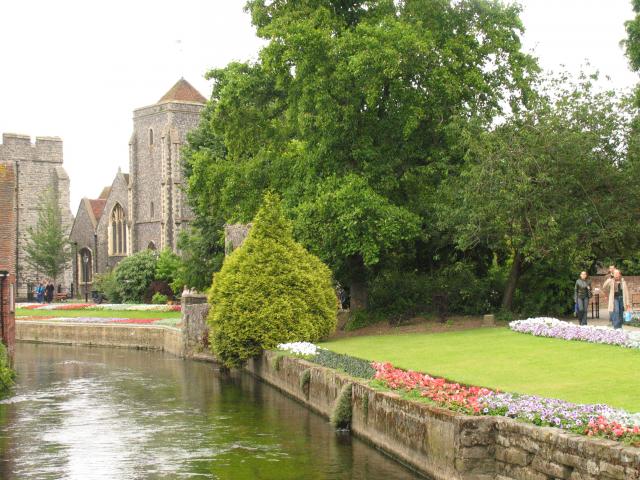
The village of St Martin's is known for its stunning landscape, characterized by rolling hills, lush green fields, and a rugged coastline. It offers breathtaking views, particularly from its elevated position, making it a popular destination for nature enthusiasts and hikers. In addition, the village is surrounded by several nature reserves and protected areas, providing ample opportunities for outdoor activities such as birdwatching and wildlife spotting.

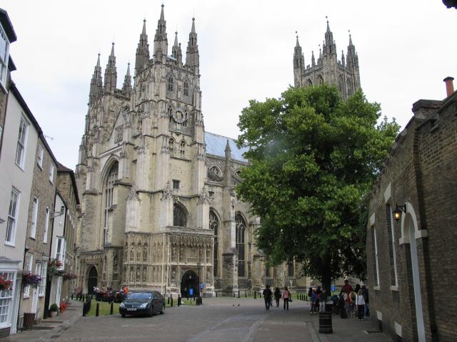
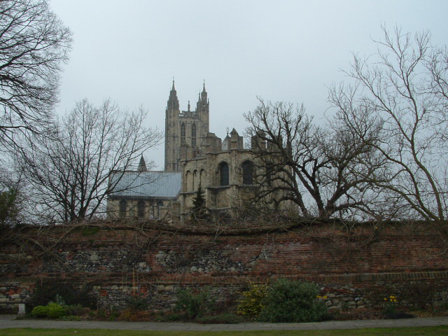
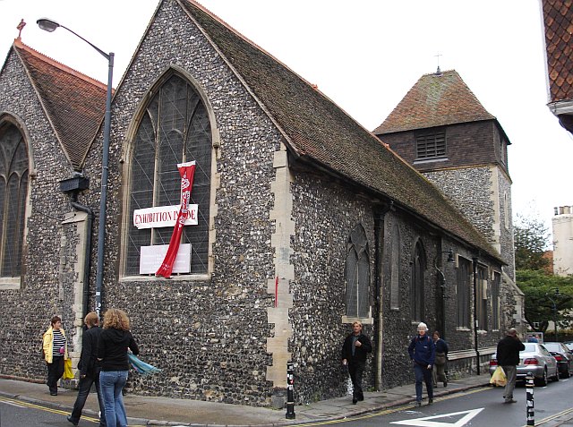
St Martin's is also home to a historic church dating back to the 12th century. The St Martin's Church, a Grade I listed building, is considered a significant architectural gem in the area and attracts visitors interested in history and religious heritage.

Despite its relatively small size, the village has a strong sense of community and offers essential amenities to its residents. It has a local pub, a primary school, and a few shops catering to everyday needs. For more extensive facilities, the nearby town of Dover is easily accessible, providing a range of services and amenities.

Overall, St Martin's in Kent is a tranquil and idyllic village that offers a rural escape with its natural beauty, historic landmarks, and a tight-knit community.

If you have any feedback on the listing, please let us know in the comments section below.
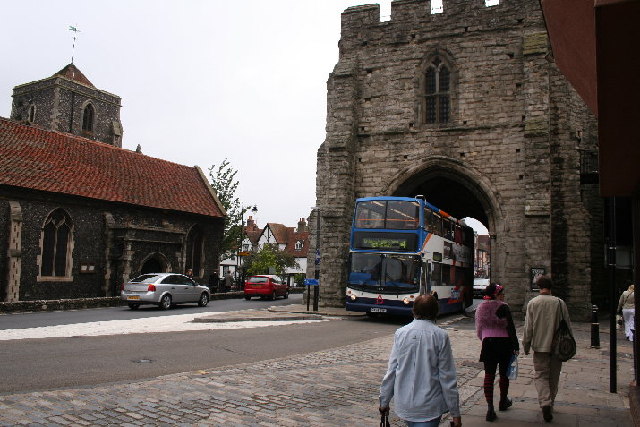
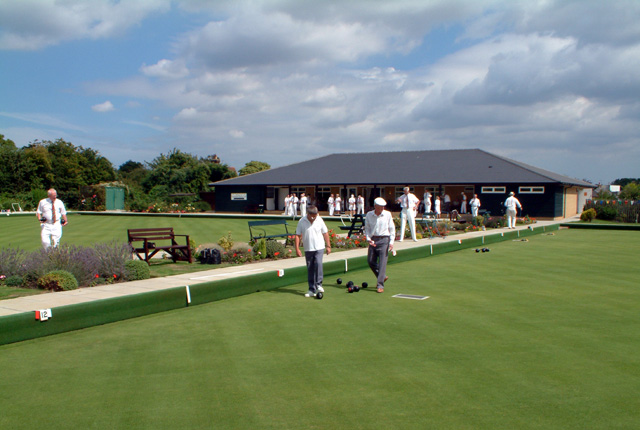
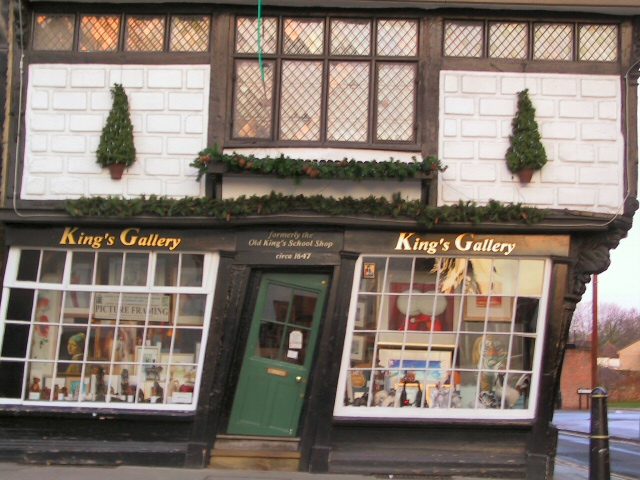
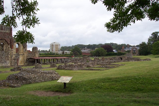
St Martin's Images

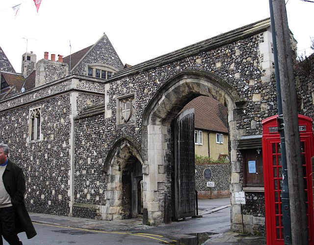
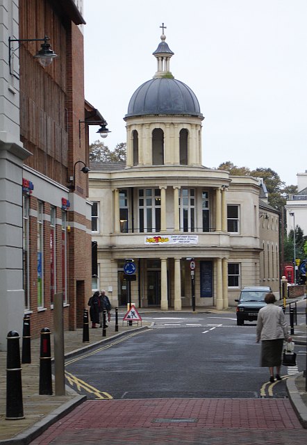
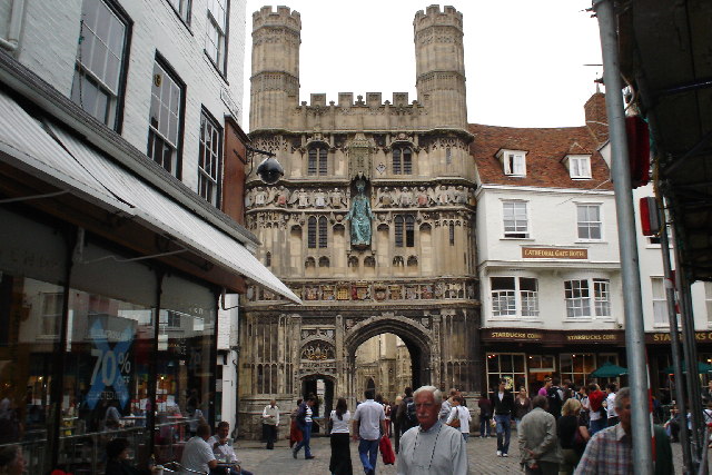
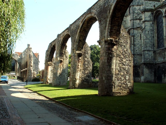
Images are sourced within 2km of 51.278674/1.0957243 or Grid Reference TR1657. Thanks to Geograph Open Source API. All images are credited.

Canterbury Cathedral The cathedral entrance, right in the city centre taken from the southwest. The cathedral's central 'Bell Harry Tower' (250' high) is on the right, dating from c.1500AD.
Canterbury Cathedral
The cathedral entrance, right in the city centre taken from the southwest. The cathedral's central 'Bell Harry Tower' (250' high) is on the right, dating from c.1500AD.
City Gate seen beyond the Church, from the River: Canterbury Situated in the southern part of the grid square.
City Gate seen beyond the Church, from the River: Canterbury
Situated in the southern part of the grid square.
Approach to Canterbury Cathedral 11.00 am, Palm Sunday 2005. Photograph taken from gardens just inside city walls.
Approach to Canterbury Cathedral
11.00 am, Palm Sunday 2005. Photograph taken from gardens just inside city walls.
Canterbury A section of one of the channels of the Great Stour that flows through the centre of the town next to this 1500 building, now an Italian Restaurant. This scene is situated more or less in the centre of the square. This was taken looking more or less north east.
Canterbury
A section of one of the channels of the Great Stour that flows through the centre of the town next to this 1500 building, now an Italian Restaurant. This scene is situated more or less in the centre of the square. This was taken looking more or less north east.
West Gate, Canterbury
Canterbury Bowling Club The club was founded in the reign of Queen Victoria. This is the club's new site, in South Canterbury Road. It boasts two well-kept greens.
Canterbury Bowling Club
The club was founded in the reign of Queen Victoria. This is the club's new site, in South Canterbury Road. It boasts two well-kept greens.
Tipsy One over the eight? No, this door has been cut to accommodate the settlement of this quaint old building over the centuries.
Tipsy
One over the eight? No, this door has been cut to accommodate the settlement of this quaint old building over the centuries.
St Augustine's Abbey, Canterbury, Kent The remains of St Augustine's Abbey in Canterbury. It was founded by St Augustine in about 598AD to mark the success of his mission to restore Christianity to England. Many of the Kings of Kent and early Archbishops of Canterbury are buried there. After the Dissolution of the Monasteries Henry VIII converted part of it to a royal palace (left end of picture). The site is now owned by English Heritage.
St Augustine's Abbey, Canterbury, Kent
The remains of St Augustine's Abbey in Canterbury. It was founded by St Augustine in about 598AD to mark the success of his mission to restore Christianity to England. Many of the Kings of Kent and early Archbishops of Canterbury are buried there. After the Dissolution of the Monasteries Henry VIII converted part of it to a royal palace (left end of picture). The site is now owned by English Heritage.
Canterbury Cathedral Sunset Sunset over Canterbury Cathedral
Canterbury Cathedral Sunset
Sunset over Canterbury Cathedral
St Alphege Lane At its junction with Palace Street. The former church is now used as a local heritage centre.
St Alphege Lane
At its junction with Palace Street. The former church is now used as a local heritage centre.
The Sun Hotel, Sun Street, Canterbury The plaque on the wall reads "Sun Hotel formerly known as The Little Inn made famous by Chas. Dickens in his travels thro' Kent Built 1503" It has been a jeweller's shop for many years. Sun Street runs around the south east side of the Cathedral precinct from the Butter Market into Palace Street.
The Sun Hotel, Sun Street, Canterbury
The plaque on the wall reads "Sun Hotel formerly known as The Little Inn made famous by Chas. Dickens in his travels thro' Kent Built 1503" It has been a jeweller's shop for many years. Sun Street runs around the south east side of the Cathedral precinct from the Butter Market into Palace Street.
St Peter's Church, Canterbury In St Peter's Lane from its junction with St Peter's Street. The pub on the left is the Cricketers.
St Peter's Church, Canterbury
In St Peter's Lane from its junction with St Peter's Street. The pub on the left is the Cricketers.
The Beaney Institute Standing in the High Street, opposite the County Hotel, this extravagantly ornate Victorian building was built at the behest of Dr Beaney, the son of a local labourer who made good, became a doctor of medicine, sailed to Australia and became very rich. The building houses the central library and the Royal museum and art gallery.
The Beaney Institute
Standing in the High Street, opposite the County Hotel, this extravagantly ornate Victorian building was built at the behest of Dr Beaney, the son of a local labourer who made good, became a doctor of medicine, sailed to Australia and became very rich. The building houses the central library and the Royal museum and art gallery.
The Mint Yard Gate, Kings School, Canterbury Housed in several buildings around the west and north of the cathedral precinct, this is the main entrance to the school, one of the oldest in the country.
The Mint Yard Gate, Kings School, Canterbury
Housed in several buildings around the west and north of the cathedral precinct, this is the main entrance to the school, one of the oldest in the country.
St Andrew's URC church, Canterbury Seen from Rose Lane looking SW. This is a recently built church and forms part of the Whitefriars redevelopment. It stands at the junction of Rose Lane and Marlowe Avenue with Watling Street.
St Andrew's URC church, Canterbury
Seen from Rose Lane looking SW. This is a recently built church and forms part of the Whitefriars redevelopment. It stands at the junction of Rose Lane and Marlowe Avenue with Watling Street.
Cathedral Gate, Canterbury
Tenterden Drive, Canterbury
Infirmary Chapel ruins, Canterbury, Kent These ruined 12th century arches are all that's left of the Infirmary Chapel, part of the monastery that became Canterbury cathedral.
Infirmary Chapel ruins, Canterbury, Kent
These ruined 12th century arches are all that's left of the Infirmary Chapel, part of the monastery that became Canterbury cathedral.
Show me another place!

St Martin's is located at Grid Ref: TR1657 (Lat: 51.278674, Lng: 1.0957243)

Administrative County: Kent

District: Canterbury

Police Authority: Kent

What 3 Words

///ducks.soaks.privately. Near Canterbury, Kent

Nearby Locations

St Martin's

Related Wikis

St Martin's Mill, Canterbury

St Martin's Mill is a Grade II listed, house converted tower mill in Canterbury, Kent, England. == History == St Martin's Mill was built in 1817 by John...

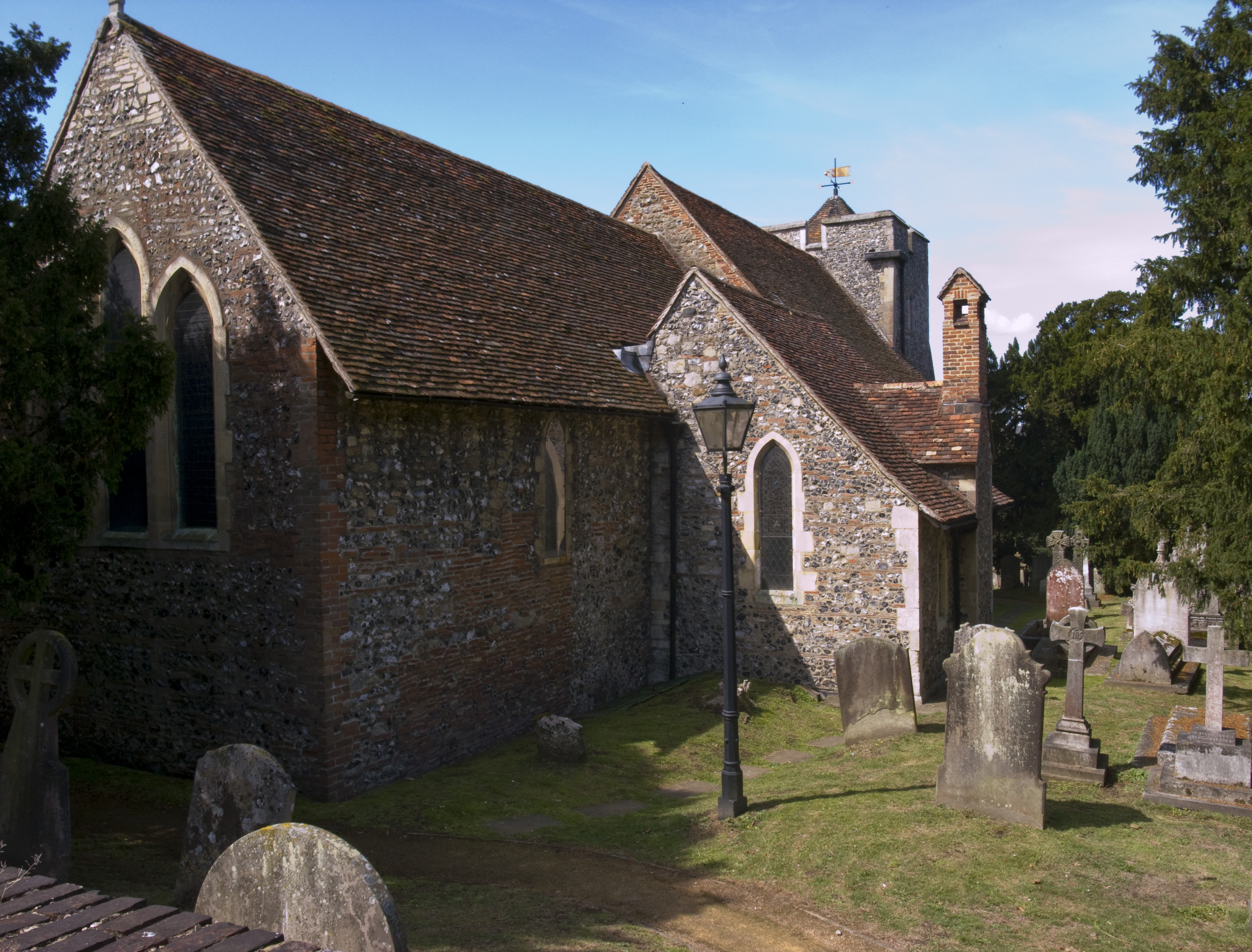
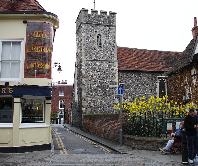
St Martin's Church, Canterbury

The Church of St Martin is an ancient Church of England parish church in Canterbury, England, situated slightly beyond the city centre. It is recognised...

St Augustine's Conduit House

St Augustine's Conduit House is an archaeological site in Canterbury, Kent, England, a medieval conduit house built to serve St Augustine's Abbey a short...

HM Prison Canterbury

HMP Canterbury is a former prison in Canterbury, Kent, England. The prison was operated by Her Majesty's Prison Service. The former prison site was bought...

Nearby Amenities

Located within 500m of 51.278674,1.0957243
Crossing
Crossing: traffic_signals
Crossing Island: no
Crossing Ref: toucan
Tactile Paving: yes
Lat/Long: 51.277361/1.0890158
Traffic Calming: cushion
Lat/Long: 51.2769085/1.0938957
Traffic Calming: cushion
Lat/Long: 51.2764175/1.0942211
Traffic Calming: cushion
Lat/Long: 51.2754878/1.0966942
Traffic Calming: cushion
Lat/Long: 51.2749768/1.0979518
Mini Roundabout
Direction: clockwise
Traffic Calming: table
Lat/Long: 51.274699/1.0984824
Post Box
Note: The previous edit says that this postbox is a pillar but as at Thursday 22.06.2023 this postbox is a lamp.
Operator: Royal Mail
Operator Wikidata: Q638098
Post Box Mounting: pier
Post Box Type: lamp
Postal Code: CT1
Ref: CT1 17
Royal Cypher: EIIR
Source: survey
Survey Date: 2023-06-22
Lat/Long: 51.275699/1.1006035
Barrier: bollard
Lat/Long: 51.2755091/1.0930735
Turning Circle
Lat/Long: 51.2814935/1.0914407
Turning Circle
Lat/Long: 51.2817799/1.0905846
St. Martin's
Place: suburb
Lat/Long: 51.2781407/1.0948644
Turning Circle
Lat/Long: 51.2772534/1.1001428
Post Office
St Martins Hill Post Office
Addr Country: GB
Addr County: Kent
Addr Housenumber: 31
Addr Postcode: CT1 1PU
Addr Street: St. Martin's Hill
Brand: Post Office
Brand Wikidata: Q1783168
Fhrs Id: 1102522
Operator: Post Office Ltd
Ref Pol Id: 1138
Source Addr: FHRS Open Data
Website: https://www.postoffice.co.uk/branch-finder/095909x/st-martins-hill
Lat/Long: 51.2779123/1.0984554
Post Box
Operator: Royal Mail
Operator Wikidata: Q638098
Post Box Type: pillar
Postal Code: CT1
Ref: CT1 230
Source: survey
Lat/Long: 51.2778646/1.0984963
Crossing
Crossing: traffic_signals
Crossing Island: no
Crossing Ref: pelican
Tactile Paving: yes
Lat/Long: 51.2778579/1.0988917
Bus Stop
Windmill Road
Bench: no
Bin: no
Naptan AtcoCode: 2400A049970A
Naptan Bearing: E
Naptan CommonName: Windmill Road
Naptan Indicator: opp
Naptan Landmark: Windmill Road
Naptan NaptanCode: kntgaptj
Naptan PlusbusZoneRef: CNTBE
Naptan Street: St Martin's Hill
Naptan Verified: no
Public Transport: platform
Ref: kntgaptj
Shelter: no
Source: naptan_import
Source Date: 2015-10-14T11:16:00
Tactile Paving: no
Lat/Long: 51.2779311/1.0993886
Barrier: cycle_barrier
Lat/Long: 51.2771844/1.0929308
Traffic Calming: hump
Lat/Long: 51.2795968/1.1014046
Bus Stop
Law Courts
Bench: yes
Bin: no
Bus: yes
Lit: no
Naptan AtcoCode: 2400A039950A
Naptan Bearing: NW
Naptan CommonName: Law Courts
Naptan Indicator: o/s
Naptan Landmark: Law Courts
Naptan NaptanCode: kntdptgp
Naptan PlusbusZoneRef: CNTBE
Naptan Street: Chaucer Road
Naptan Verified: no
Public Transport: platform
Shelter: yes
Source: naptan_import
Tactile Paving: no
Lat/Long: 51.2824614/1.0939532
Bus Stop
Windmill Road
Bench: yes
Bin: yes
Naptan AtcoCode: 2400A049960A
Naptan Bearing: W
Naptan CommonName: Windmill Road
Naptan Indicator: adj
Naptan Landmark: Windmill Road
Naptan NaptanCode: kntgaptg
Naptan PlusbusZoneRef: CNTBE
Naptan Street: St Martin's Hill
Naptan Verified: no
Public Transport: platform
Ref: kntgaptg
Shelter: yes
Source: naptan_import
Source Date: 2018-04-03T11:12:00
Tactile Paving: no
Lat/Long: 51.2778224/1.0995004
Bus Stop
Barton Court School
Alt Name: St Martins Church
Bench: no
Bin: no
Naptan AltCommonName: St Martins Church
Naptan AtcoCode: 2400A049980A
Naptan Bearing: E
Naptan CommonName: Barton Court School
Naptan Indicator: opp
Naptan Landmark: Barton Court Grammar School
Naptan NaptanCode: kntgaptm
Naptan PlusbusZoneRef: CNTBE
Naptan Street: Longport
Naptan Verified: no
Public Transport: platform
Ref: kntgaptm
Shelter: no
Source: naptan_import
Source Date: 2015-10-14T11:14:00
Lat/Long: 51.2775325/1.0920192
Bus Stop
Barton Court School
Alt Name: St Martins Church
Bench: no
Bin: no
Naptan AltCommonName: St Martins Church
Naptan AtcoCode: 2400A050000A
Naptan Bearing: W
Naptan CommonName: Barton Court School
Naptan Indicator: adj
Naptan Landmark: Barton Court Grammar School
Naptan NaptanCode: kntgaptw
Naptan PlusbusZoneRef: CNTBE
Naptan Street: Longport
Naptan Verified: no
Public Transport: platform
Ref: kntgaptw
Shelter: no
Source: naptan_import
Source Date: 2018-03-29T11:37:00
Lat/Long: 51.2774303/1.0911232
Barrier: bollard
Foot: yes
Lat/Long: 51.2807558/1.0952911
Barrier: bollard
Bicycle: no
Foot: yes
Lat/Long: 51.2813604/1.0961079
Barrier: block
Lat/Long: 51.2812063/1.1006443
Traffic Calming: hump
Lat/Long: 51.2783392/1.0978601
Traffic Calming: hump
Lat/Long: 51.2787062/1.0975945
Traffic Calming: hump
Lat/Long: 51.2786833/1.0961958
Crossing
Bicycle: yes
Crossing: traffic_signals
Crossing Island: no
Crossing Ref: toucan
Foot: yes
Tactile Paving: yes
Lat/Long: 51.2775149/1.0903906
Traffic Calming: choker
Lat/Long: 51.2746485/1.0988475
Barrier: stile
Lat/Long: 51.2823996/1.096937
Traffic Calming: cushion
Lat/Long: 51.2743056/1.0959429
Traffic Calming: cushion
Lat/Long: 51.2743484/1.0939919
Entrance: yes
Lat/Long: 51.2799357/1.0904578
Entrance: yes
Lat/Long: 51.2801602/1.0899235
Traffic Calming: cushion
Lat/Long: 51.2759355/1.0954498
Conduit House
Designation: English Heritage site
Historic: monument
Source: http://gothisplace.com/View/English/Conduit%20House%20Canterbury,%20UK
Lat/Long: 51.2806644/1.0950089
Barrier: cycle_barrier
Lat/Long: 51.2777991/1.0959264
Barrier: cycle_barrier
Bicycle: yes
Foot: yes
Source: survey
Lat/Long: 51.277762/1.0987289
Communication Mobile Phone: yes
Man Made: mast
Lat/Long: 51.2822356/1.0965429
Communication Mobile Phone: yes
Man Made: mast
Lat/Long: 51.2825161/1.096621
Barrier: arch
Lat/Long: 51.2758205/1.0959642
Place Of Worship
Laud Worship Rooms
Religion: muslim
Lat/Long: 51.2792236/1.0900097
Place Of Worship
CCCU Chapel
Lat/Long: 51.2794215/1.0899976
Entrance: yes
Lat/Long: 51.2762094/1.1008122
Barrier: bollard
Lat/Long: 51.2751266/1.0940013
Barrier: bollard
Lat/Long: 51.2755311/1.0929615
Barrier: cycle_barrier
Lat/Long: 51.2790634/1.0936038
Generator Method: photovoltaic
Generator Source: solar
Generator Type: solar_photovoltaic_panel
Location: roof
Power: generator
Lat/Long: 51.2799527/1.0948107
Generator Method: photovoltaic
Generator Source: solar
Generator Type: solar_photovoltaic_panel
Location: roof
Power: generator
Lat/Long: 51.2803453/1.0943869
Generator Method: photovoltaic
Generator Orientation: 173
Generator Source: solar
Generator Type: solar_photovoltaic_panel
Location: roof
Power: generator
Lat/Long: 51.2776423/1.0978925
Generator Method: photovoltaic
Generator Output Electricity: yes
Generator Solar Modules: 20
Generator Source: solar
Generator Type: solar_photovoltaic_panel
Location: roof
Power: generator
Lat/Long: 51.2741959/1.0950199
Generator Output Electricity: yes
Generator Source: solar
Generator Type: solar_photovoltaic_panel
Location: roof
Power: generator
Lat/Long: 51.2792044/1.0940596
Generator Output Electricity: yes
Generator Source: solar
Generator Type: solar_photovoltaic_panel
Location: roof
Power: generator
Lat/Long: 51.2791759/1.094116
Generator Output Electricity: yes
Generator Solar Modules: 6
Generator Source: solar
Generator Type: solar_photovoltaic_panel
Location: roof
Power: generator
Lat/Long: 51.2796289/1.0944942
Generator Output Electricity: yes
Generator Solar Modules: 6
Generator Source: solar
Generator Type: solar_photovoltaic_panel
Location: roof
Power: generator
Lat/Long: 51.2796507/1.0945505
Generator Method: photovoltaic
Generator Output Electricity: yes
Generator Solar Modules: 8
Generator Source: solar
Generator Type: solar_photovoltaic_panel
Location: roof
Power: generator
Lat/Long: 51.2820093/1.0917342
Generator Method: photovoltaic
Generator Output Electricity: yes
Generator Solar Modules: 8
Generator Source: solar
Generator Type: solar_photovoltaic_panel
Location: roof
Power: generator
Lat/Long: 51.2819833/1.0917097
Generator Output Electricity: yes
Generator Solar Modules: 8
Generator Source: solar
Generator Type: solar_photovoltaic_panel
Location: roof
Power: generator
Lat/Long: 51.2816027/1.0912018
Generator Output Electricity: yes
Generator Solar Modules: 8
Generator Source: solar
Generator Type: solar_photovoltaic_panel
Location: roof
Power: generator
Lat/Long: 51.281586/1.0912554
Generator Method: photovoltaic
Generator Output Electricity: yes
Generator Source: solar
Generator Type: solar_photovoltaic_panel
Location: roof
Power: generator
Lat/Long: 51.2811699/1.0961873
Generator Method: photovoltaic
Generator Solar Modules: 14
Generator Source: solar
Generator Type: solar_photovoltaic_panel
Location: roof
Power: generator
Lat/Long: 51.2804208/1.0939698
Generator Method: photovoltaic
Generator Solar Modules: 8
Generator Source: solar
Generator Type: solar_photovoltaic_panel
Location: roof
Power: generator
Lat/Long: 51.2804879/1.0945183
Generator Method: photovoltaic
Generator Solar Modules: 8
Generator Source: solar
Generator Type: solar_photovoltaic_panel
Location: roof
Power: generator
Lat/Long: 51.280451/1.0945572
Bab's Hill
Natural: peak
Lat/Long: 51.2768258/1.0979457
Life Ring
Emergency: life_ring
Lat/Long: 51.281374/1.0968246
Bench
Backrest: yes
Lat/Long: 51.2813051/1.0969162
Waste Basket
Lat/Long: 51.281293/1.0969286
Legacy Park Viewpoint
Tourism: viewpoint
Lat/Long: 51.2814055/1.0986407
Bench: yes
Leisure: picnic_table
Lit: no
Lat/Long: 51.2812963/1.0978567
Bench: yes
Leisure: picnic_table
Lit: no
Lat/Long: 51.2813243/1.0977935
Bench: yes
Leisure: picnic_table
Lit: no
Lat/Long: 51.2812819/1.0977928
Bench
Backrest: yes
Lat/Long: 51.2814198/1.0986538
Bench
Backrest: yes
Lat/Long: 51.2813938/1.0986558
Bench
Backrest: yes
Lat/Long: 51.2810632/1.098467
Bench
Backrest: yes
Lat/Long: 51.2811224/1.0984688
Traffic Calming: hump
Lat/Long: 51.2814692/1.1002388
Traffic Calming: hump
Lat/Long: 51.2819154/1.0976707
Bench
Backrest: yes
Lat/Long: 51.2799237/1.0988789
Bench
Backrest: yes
Lat/Long: 51.2799055/1.0989098
Bicycle Parking
Bicycle Parking: stands
Capacity: 10
Colour: silver
Covered: no
Cyclestreets Id: 195077
Lat/Long: 51.2797908/1.099074
Bench: yes
Leisure: picnic_table
Lit: no
Lat/Long: 51.2814115/1.0977631
Waste Basket
Waste: dog_excrement
Lat/Long: 51.281745/1.0983423
Barrier: bollard
Lat/Long: 51.281769/1.0983295
Howe Park Trust
Board Type: history
Information: board
Tourism: information
Lat/Long: 51.2817529/1.0982895
Crossing
Crossing: unmarked
Crossing Island: no
Tactile Paving: no
Lat/Long: 51.2798494/1.1002707
Bicycle Parking
Lat/Long: 51.2782782/1.1025891
Entrance: main
Lat/Long: 51.2821637/1.0943368
Bicycle Parking
Bicycle Parking: stands
Capacity: 5
Covered: no
Survey Date: 2023-03-20
Lat/Long: 51.2820825/1.0942112
Barrier: bollard
Lat/Long: 51.2821462/1.0940341
Access: no
Barrier: lift_gate
Locked: yes
Lat/Long: 51.2822862/1.0941437
Bench
Backrest: yes
Material: wood
Seats: 6
Survey Date: 2023-03-21
Lat/Long: 51.2817659/1.0942106
Grit Bin
Material: plastic
Survey Date: 2023-03-21
Lat/Long: 51.2816113/1.0942248
Bench
Backrest: yes
Material: wood
Seats: 4
Lat/Long: 51.2818445/1.0945157
Bench
Backrest: yes
Material: wood
Seats: 6
Lat/Long: 51.2818067/1.0945961
Bench
Backrest: yes
Material: wood
Seats: 6
Lat/Long: 51.2817084/1.0945505
Street Lamp
Survey Date: 2023-03-22
Lat/Long: 51.2820018/1.0941663
Street Lamp
Survey Date: 2023-03-22
Lat/Long: 51.281684/1.0941037
Addr City: Canterbury
Addr Postcode: CT1 1PU
Addr Street: St. Martin's Hill
Brand: Premier
Brand Wikidata: Q7240340
Note: £1 minimum spend for card payments.
Opening Hours: Mo -Sa 06:30-21:00; Su 08:00-18:00
Operator: Premier
Payment Cash: yes
Payment Credit Cards: yes
Phone: +44 1227 464673
Shop: convenience
Website: https://www.premier-stores.co.uk/our-stores/st-martins-hill
Lat/Long: 51.2780102/1.0985098
Atm
Currency GBP: yes
Fee: no
Opening Hours: 24/7
Operator: Post Office
Source: survey
Lat/Long: 51.2779912/1.098441
Waste Basket
Waste: trash
Lat/Long: 51.2758941/1.0960657
The end of the abbey
Board Type: history
Information: board
Ref: 12
Tourism: information
Lat/Long: 51.2777455/1.0887448
The data included in this document is from www.openstreetmap.org. The data is made available under ODbL.

Have you been to St Martin's?

Leave your review of St Martin's below (or comments, questions and feedback).