St Dunstan's

Settlement in Kent Canterbury

England

St Dunstan's

Great Stour Canterbury Viewed from the Williamson Tannery Weighbridge.
Great Stour Canterbury Credit: pam fray

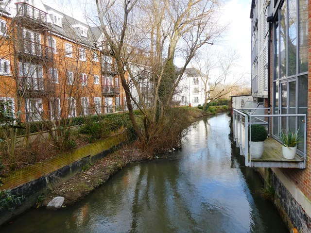
St Dunstan's is a small village located in the county of Kent, in southeastern England. Situated just two miles east of the historic city of Canterbury, it is nestled in the picturesque countryside of the Stour Valley. The village is named after St Dunstan, the Archbishop of Canterbury from 959 to 988, who was highly influential during the Anglo-Saxon period.

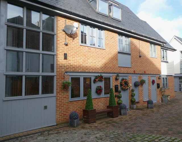
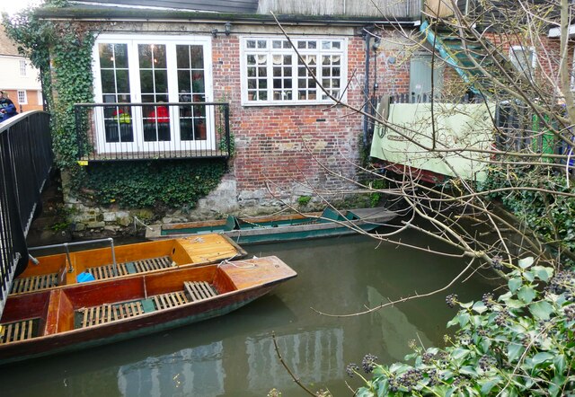
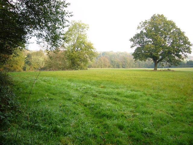
The village is known for its idyllic setting, with charming cottages, lush green fields, and a tranquil atmosphere. St Dunstan's is famous for its ancient parish church, St Dunstan's Church, which dates back to the 12th century. This beautiful place of worship features stunning medieval architecture, including a Norman doorway and a striking tower.

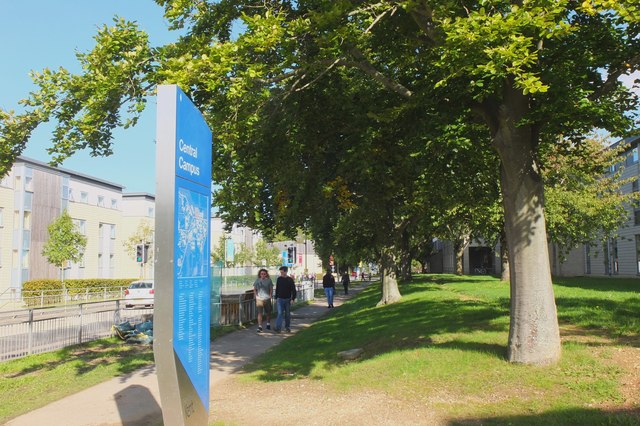
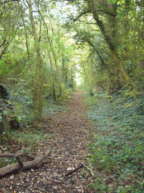
In addition to its rich history, St Dunstan's offers a range of amenities for its residents and visitors. The village has a local pub, The Dove Inn, which serves traditional English cuisine and provides a cozy atmosphere for socializing. There are also several walking trails in the surrounding countryside, offering breathtaking views of the Kent Downs Area of Outstanding Natural Beauty.

St Dunstan's is conveniently located near Canterbury, which provides easy access to a wider range of amenities, including shops, restaurants, and cultural attractions. Canterbury Cathedral, a UNESCO World Heritage site, is a must-visit for tourists and locals alike.

Overall, St Dunstan's is a charming village that seamlessly blends history, natural beauty, and modern convenience, making it an appealing destination for those seeking a peaceful and picturesque retreat.

If you have any feedback on the listing, please let us know in the comments section below.
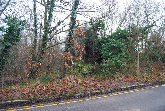
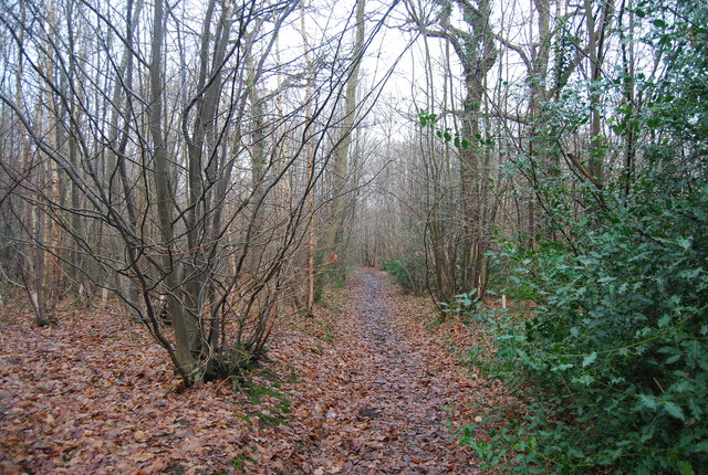
St Dunstan's Images

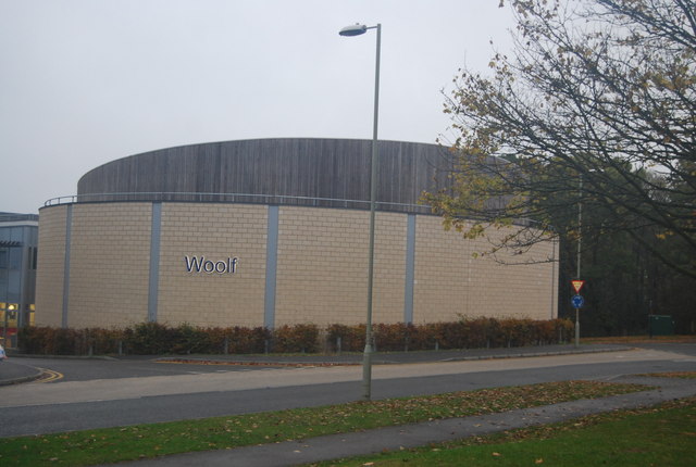
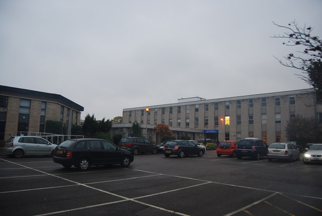
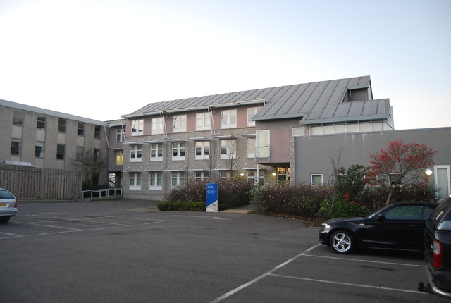
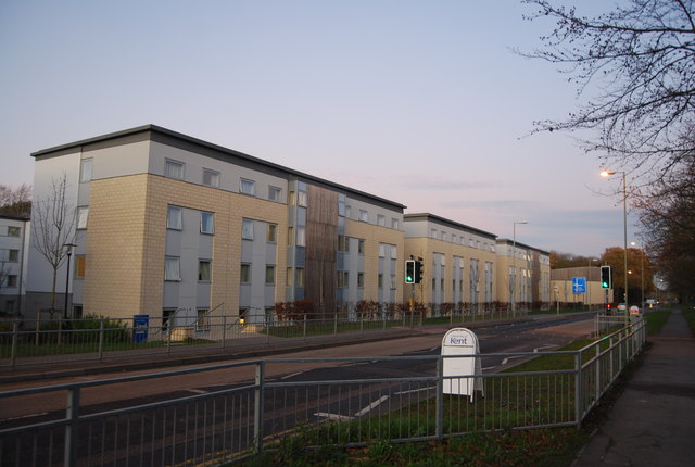
Images are sourced within 2km of 51.2834/1.0689487 or Grid Reference TR1458. Thanks to Geograph Open Source API. All images are credited.

Great Stour Canterbury Viewed from the Williamson Tannery Weighbridge.
Great Stour Canterbury
Viewed from the Williamson Tannery Weighbridge.
Clearwater Mews Canterbury A small, modern development of houses and apartments near the Williamson Tannery Weighbridge and Tannery Square, off Stour Street.
Clearwater Mews Canterbury
A small, modern development of houses and apartments near the Williamson Tannery Weighbridge and Tannery Square, off Stour Street.
Punts on the Great Stour, Canterbury By the Williamson Tannery Weighbridge, Tannery Square.
Punts on the Great Stour, Canterbury
By the Williamson Tannery Weighbridge, Tannery Square.
University of Kent at Canterbury A road on the northern side of the campus site.
University of Kent at Canterbury
A road on the northern side of the campus site.
Woolf Building, University of Kent Founded in 1965, the University of Kent is a campus university. The main Canterbury campus covers 300 acres and is just over two miles from the city centre. There are also sites at Medway and Tonbridge.
Website: <span class="nowrap"><a title="http://www.kent.ac.uk/" rel="nofollow ugc noopener" href="http://www.kent.ac.uk/">Link</a><img style="margin-left:2px;" alt="External link" title="External link - shift click to open in new window" src="https://s1.geograph.org.uk/img/external.png" width="10" height="10"/></span>
Woolf Building, University of Kent
Founded in 1965, the University of Kent is a campus university. The main Canterbury campus covers 300 acres and is just over two miles from the city centre. There are also sites at Medway and Tonbridge. Website: LinkExternal link
Mathematics Department, University of Kent Founded in 1965, the University of Kent is a campus university. The main Canterbury campus covers 300 acres and is just over two miles from the city centre. There are also sites at Medway and Tonbridge.
Website: <span class="nowrap"><a title="http://www.kent.ac.uk/" rel="nofollow ugc noopener" href="http://www.kent.ac.uk/">Link</a><img style="margin-left:2px;" alt="External link" title="External link - shift click to open in new window" src="https://s1.geograph.org.uk/img/external.png" width="10" height="10"/></span>
Mathematics Department, University of Kent
Founded in 1965, the University of Kent is a campus university. The main Canterbury campus covers 300 acres and is just over two miles from the city centre. There are also sites at Medway and Tonbridge. Website: LinkExternal link
Cornwallis Building, University of Kent Part of Darwin College.
Cornwallis Building, University of Kent
Part of Darwin College.
University of Kent Founded in 1965, the University of Kent is a campus university. The main Canterbury campus covers 300 acres and is just over two miles from the city centre. There are also sites at Medway and Tonbridge.
Website: <span class="nowrap"><a title="http://www.kent.ac.uk/" rel="nofollow ugc noopener" href="http://www.kent.ac.uk/">Link</a><img style="margin-left:2px;" alt="External link" title="External link - shift click to open in new window" src="https://s1.geograph.org.uk/img/external.png" width="10" height="10"/></span>
University of Kent
Founded in 1965, the University of Kent is a campus university. The main Canterbury campus covers 300 acres and is just over two miles from the city centre. There are also sites at Medway and Tonbridge. Website: LinkExternal link
Darwin College Founded in 1965, the University of Kent is a campus university. The main Canterbury campus covers 300 acres and is just over two miles from the city centre. There are also sites at Medway and Tonbridge.
Website: <span class="nowrap"><a title="http://www.kent.ac.uk/" rel="nofollow ugc noopener" href="http://www.kent.ac.uk/">Link</a><img style="margin-left:2px;" alt="External link" title="External link - shift click to open in new window" src="https://s1.geograph.org.uk/img/external.png" width="10" height="10"/></span>
Darwin College
Founded in 1965, the University of Kent is a campus university. The main Canterbury campus covers 300 acres and is just over two miles from the city centre. There are also sites at Medway and Tonbridge. Website: LinkExternal link
Woolf College Founded in 1965, the University of Kent is a campus university. The main Canterbury campus covers 300 acres and is just over two miles from the city centre. There are also sites at Medway and Tonbridge.
Website: <span class="nowrap"><a title="http://www.kent.ac.uk/" rel="nofollow ugc noopener" href="http://www.kent.ac.uk/">Link</a><img style="margin-left:2px;" alt="External link" title="External link - shift click to open in new window" src="https://s1.geograph.org.uk/img/external.png" width="10" height="10"/></span>
Woolf College
Founded in 1965, the University of Kent is a campus university. The main Canterbury campus covers 300 acres and is just over two miles from the city centre. There are also sites at Medway and Tonbridge. Website: LinkExternal link
Darwin College Founded in 1965, the University of Kent is a campus university. The main Canterbury campus covers 300 acres and is just over two miles from the city centre. There are also sites at Medway and Tonbridge.
Website: <span class="nowrap"><a title="http://www.kent.ac.uk/" rel="nofollow ugc noopener" href="http://www.kent.ac.uk/">Link</a><img style="margin-left:2px;" alt="External link" title="External link - shift click to open in new window" src="https://s1.geograph.org.uk/img/external.png" width="10" height="10"/></span>
Darwin College
Founded in 1965, the University of Kent is a campus university. The main Canterbury campus covers 300 acres and is just over two miles from the city centre. There are also sites at Medway and Tonbridge. Website: LinkExternal link
Part of the Blean Walk This section involves walking through a couple of fields of quite long grass.
Part of the Blean Walk
This section involves walking through a couple of fields of quite long grass.
Old Crab and Winkle line Dismantled Canterbury to Whitstable railway line, with north entrance to tunnel behind.
Old Crab and Winkle line
Dismantled Canterbury to Whitstable railway line, with north entrance to tunnel behind.
Field looking towards Tyler Hill Taken behind University of Kent old Park and Ride car park, some surviving green land that goes to Tyler Hill behind the distant trees.
Field looking towards Tyler Hill
Taken behind University of Kent old Park and Ride car park, some surviving green land that goes to Tyler Hill behind the distant trees.
Department of Mathematics, University of Kent Founded in 1965, the University of Kent is a campus university. The main Canterbury campus covers 300 acres and is just over two miles from the city centre. There are also sites at Medway and Tonbridge.
Website: <span class="nowrap"><a title="http://www.kent.ac.uk/" rel="nofollow ugc noopener" href="http://www.kent.ac.uk/">Link</a><img style="margin-left:2px;" alt="External link" title="External link - shift click to open in new window" src="https://s1.geograph.org.uk/img/external.png" width="10" height="10"/></span>
Department of Mathematics, University of Kent
Founded in 1965, the University of Kent is a campus university. The main Canterbury campus covers 300 acres and is just over two miles from the city centre. There are also sites at Medway and Tonbridge. Website: LinkExternal link
Woolf Building, University of Kent Founded in 1965, the University of Kent is a campus university. The main Canterbury campus covers 300 acres and is just over two miles from the city centre. There are also sites at Medway and Tonbridge.
Website: <span class="nowrap"><a title="http://www.kent.ac.uk/" rel="nofollow ugc noopener" href="http://www.kent.ac.uk/">Link</a><img style="margin-left:2px;" alt="External link" title="External link - shift click to open in new window" src="https://s1.geograph.org.uk/img/external.png" width="10" height="10"/></span>
Woolf Building, University of Kent
Founded in 1965, the University of Kent is a campus university. The main Canterbury campus covers 300 acres and is just over two miles from the city centre. There are also sites at Medway and Tonbridge. Website: LinkExternal link
Footpath leading off Park Wood Rd, University of Kent
Footpath through Brotherhood Wood The ancient woodland management technique of coppicing is evident in this woodland.
Footpath through Brotherhood Wood
The ancient woodland management technique of coppicing is evident in this woodland.
Show me another place!

St Dunstan's is located at Grid Ref: TR1458 (Lat: 51.2834, Lng: 1.0689487)

Administrative County: Kent

District: Canterbury

Police Authority: Kent

What 3 Words

///elite.pure.rested. Near Canterbury, Kent

Related Wikis

St. Dunstan's, Canterbury

St. Dunstan's is an Anglican church in Canterbury, Kent, at the junction of London Road and Whitstable Road. It is dedicated to St. Dunstan (909-988) and...

Thomas Byrne (VC)

Thomas Byrne, VC (December 1866 Dublin – 15 March 1944) was an Irish British Army soldier. He was the recipient of the Victoria Cross (VC), the highest...

Canterbury West railway station

Canterbury West railway station is a Grade II listed railway station, and the busier of the two stations in Canterbury in Kent, England. The station as...

Canterbury city walls

Canterbury city walls are a sequence of defensive walls built around the city of Canterbury in Kent, England. The first city walls were built by the Romans...

Canterbury Guildhall

Canterbury Guildhall, formerly the Church of the Holy Cross, is a municipal building in St Peter's Place in Canterbury, Kent, England. The structure, which...

Westgate, Canterbury

The Westgate is a medieval gatehouse in Canterbury, Kent, England. This 60-foot (18 m) high western gate of the city wall is the largest surviving city...

Kent Museum of Freemasonry

The Kent Museum of Freemasonry, is a museum in St Peters Place, Canterbury, Kent with a rare collection of masonic exhibits of national and international...

Canterbury North Lane railway station

North Lane railway station was the original station of the Canterbury and Whitstable Railway in Canterbury, Kent, United Kingdom. It opened in 1830, closed...

Nearby Amenities

Located within 500m of 51.2834,1.0689487
Crossing
Button Operated: yes
Crossing: traffic_signals
Crossing Island: no
Crossing Ref: pelican
Kerb: lowered
Tactile Paving: yes
Traffic Signals Sound: yes
Traffic Signals Vibration: no
Lat/Long: 51.281928/1.0757128
Mini Roundabout
Westgate Roundabout
Direction: clockwise
Lat/Long: 51.2816639/1.0755051
Parking Entrance
Maxheight: 2.2
Maxweight: 2.5
Lat/Long: 51.2834081/1.0751663
Crossing
Crossing: uncontrolled
Tactile Paving: yes
Lat/Long: 51.2840175/1.0756826
Barrier: bollard
Bollard: fixed
Fixme: maxwidth is an estimate. Go out and measure it.
Maxwidth: 3
Lat/Long: 51.2808746/1.0709194
Barrier: bollard
Bollard: fixed
Fixme: maxwidth is an estimate. Go out an measure it.
Maxwidth: 3
Lat/Long: 51.2806891/1.0712909
Mini Roundabout
St. Dunstan's
Direction: clockwise
Lat/Long: 51.2839496/1.0708451
Barrier: cycle_barrier
Cycle Barrier: double
Cycle Barrier Installation: fixed
Lat/Long: 51.2811994/1.0638918
St. Dunstan's Level Crossing
Crossing Barrier: double_half
Railway: level_crossing
Lat/Long: 51.2826472/1.0734117
Crossing
Check Date Crossing: 2021-09-16
Crossing: traffic_signals
Crossing Ref: toucan
Lat/Long: 51.2818326/1.0637117
Traffic Calming: table
Lat/Long: 51.280996/1.0632319
Supreme Bake
Addr City: Canterbury
Addr Country: GB
Addr County: Kent
Addr Housenumber: 29
Addr Postcode: CT2 8BZ
Addr Street: St. Dunstan's Street
Fhrs Id: 1103043
Old Name: Three Cooks
Shop: bakery
Wikidata: Q26534644
Lat/Long: 51.2830882/1.0727189
Post Box
Collection Times: Mo-Fr 17:30, Sa 13:15
Post Box Apertures: 2
Postal Code: CT2
Ref: CT2 7711;CT2 7722
Royal Cypher: EIIR
Royal Cypher Wikidata: Q33102113
Lat/Long: 51.2828013/1.0743598
Bus Stop
Naptan AtcoCode: 2400A071070A
Naptan NaptanCode: kntgdmaw
Lat/Long: 51.2836895/1.0621394
Telephone
Booth: K6
Check Date: 2024-04-26
Covered: booth
Listed Status: Grade II
Payment Coins: yes
Payment Credit Cards: yes
Payment Debit Cards: yes
Phone: +44 1227 768729
Lat/Long: 51.2836907/1.0712453
Crossing
Crossing: uncontrolled
Crossing Island: no
Crossing Ref: zebra
Kerb: lowered
Tactile Paving: yes
Lat/Long: 51.2822103/1.0743135
Crossing
Crossing: uncontrolled
Crossing Island: yes
Crossing Ref: zebra
Kerb: lowered
Tactile Paving: yes
Lat/Long: 51.2839171/1.0706313
Crossing
Crossing: uncontrolled
Crossing Island: no
Crossing Ref: zebra
Kerb: lowered
Tactile Paving: yes
Lat/Long: 51.2836839/1.0713432
Pub
The West Gate Inn
Addr City: Canterbury
Addr Country: GB
Addr County: Kent
Addr Housenumber: 1-3
Addr Postcode: CT2 7EB
Addr Street: North Lane
Brand: Wetherspoon
Brand Wikidata: Q6109362
Brand Wikipedia: en:Wetherspoons
Contact Website: https://www.jdwetherspoon.com/pubs/all-pubs/england/kent/the-west-gate-inn-canterbury
Fhrs Id: 1102560
Internet Access: wlan
Internet Access Fee: no
Opening Hours: Mo-Th 08:00-00:00;Fr 08:00-00:00;Sa 00:00-01:00,08:00-00:00;Su 00:00-01:00,08:00-00:00
Payment Cash: yes
Payment Credit Cards: yes
Payment Debit Cards: yes
Phone: +44 1227 464329
Smoking: no
Smoking Outside: yes
Source Addr: FHRS Open Data;website
Wheelchair: limited
Lat/Long: 51.2820079/1.0756173
Post Box
Postal Code: CT2
Ref: CT2 54
Source: survey
Lat/Long: 51.2850236/1.0747334
Post Box
Collection Times: Mo-Fr 09:00; Sa 07:00
Post Box Type: wall
Postal Code: CT2
Ref: CT2 47
Royal Cypher: EIIR
Royal Cypher Wikidata: Q33102113
Source: survey
Lat/Long: 51.2831538/1.0680368
Post Box
Brand: Royal Mail
Brand Wikidata: Q638098
Check Date: 2021-09-16
Mapillary: 796885281027743
Operator: Royal Mail
Operator Wikidata: Q638098
Post Box Type: pillar
Postal Code: CT2
Ref: CT2 62
Royal Cypher: EIIR
Royal Cypher Wikidata: Q33102113
Survey Date: 2021-07-17
Lat/Long: 51.2853058/1.0689384
Barrier: lift_gate
Lat/Long: 51.2827102/1.0732799
Crossing
Crossing: unmarked
Crossing Island: no
Kerb: lowered
Tactile Paving: yes
Lat/Long: 51.2802364/1.0730066
Bench
Backrest: yes
Lat/Long: 51.2805769/1.0735433
Waste Basket
Lat/Long: 51.2804733/1.073438
Bench
Backrest: yes
Lat/Long: 51.2804356/1.0734023
Bench
Lat/Long: 51.2803519/1.0733075
Toilets
Lat/Long: 51.2844271/1.0640564
Crossing
Crossing: uncontrolled
Crossing Island: no
Crossing Ref: zebra
Lat/Long: 51.2845972/1.0709912
Bus Stop
St Dunstans Church
Bench: yes
Bin: yes
Lit: yes
Naptan AtcoCode: 2400A048140A
Naptan Bearing: NW
Naptan BusStopType: CUS
Naptan CommonName: St Dunstans Church
Naptan Indicator: adj
Naptan Landmark: St Dunstans Church
Naptan NaptanCode: kntgagaj
Naptan PlusbusZoneRef: CNTBE
Naptan Street: St. Dunstans Street
Naptan Verified: no
Public Transport: platform
Ref: KNTGAGAJ
Shelter: yes
Source: naptan_import
Tactile Paving: no
Lat/Long: 51.2837643/1.0710935
Crossing
Crossing: traffic_signals
Crossing Island: no
Crossing Ref: pelican
Lat/Long: 51.2827539/1.0668394
Bus Stop
Hanscomb House
Naptan AtcoCode: 2400100621
Naptan Bearing: NE
Naptan CommonName: Hanscomb House
Naptan Indicator: adj
Naptan Landmark: Pine Tree Avenue
Naptan NaptanCode: kntgtgtj
Naptan Street: Forty Acres Road
Naptan Verified: no
Shelter: no
Source: naptan_import
Lat/Long: 51.2849274/1.0712592
Bus Stop
Queens Avenue
Bench: no
Bin: no
Flag: yes
Lit: yes
Naptan AtcoCode: 240096711
Naptan Bearing: E
Naptan CommonName: Queens Avenue
Naptan Indicator: adj
Naptan Landmark: Victoria Memorial Recreation Ground
Naptan NaptanCode: kntgmajp
Naptan PlusbusZoneRef: CNTBE
Naptan Street: Rheims Way
Naptan Verified: no
Public Transport: platform
Ref: kntgmajp
Shelter: no
Source: naptan_import
Source Date: 2018-04-03T10:20:00
Tactile Paving: no
Lat/Long: 51.2810596/1.0677721
Bus Stop
Queens Avenue
Naptan AtcoCode: 240096713
Naptan Bearing: W
Naptan CommonName: Queens Avenue
Naptan Indicator: opp
Naptan Landmark: Victoria Memorial Recreation Ground
Naptan NaptanCode: kntgmajm
Naptan PlusbusZoneRef: CNTBE
Naptan Street: Rheims Way
Naptan Verified: no
Public Transport: platform
Ref: kntgmajm
Shelter: no
Source: naptan_import
Source Date: 2018-04-03T10:23:00
Lat/Long: 51.2808497/1.0674878
Bus Stop
Temple Road
Bench: no
Bin: no
Naptan AtcoCode: 2400A040380A
Naptan Bearing: SW
Naptan CommonName: Temple Road
Naptan Indicator: opp
Naptan Landmark: Temple Road
Naptan NaptanCode: kntdpwdt
Naptan PlusbusZoneRef: CNTBE
Naptan Street: London Road
Naptan Verified: no
Public Transport: platform
Ref: kntdpwdt
Shelter: no
Source: naptan_import
Source Date: 2018-04-03T10:58:00
Lat/Long: 51.282599/1.0664793
Bus Stop
Westgate Towers
Bench: no
Bin: no
Check Date Shelter: 2021-04-08
Lit: yes
Naptan AtcoCode: 2400A048110A
Naptan Bearing: NW
Naptan CommonName: Westgate Towers
Naptan Indicator: NW-bound
Naptan Landmark: Westgate Towers
Naptan NaptanCode: kntgadwt
Naptan PlusbusZoneRef: CNTBE
Naptan Street: St Dunstans Street
Naptan Verified: no
Shelter: no
Source: naptan_import
Tactile Paving: no
Lat/Long: 51.28183/1.074965
Bus Stop
Westgate Towers
Bench: no
Bin: no
Check Date Shelter: 2021-04-08
Lit: no
Naptan AtcoCode: 2400A048120A
Naptan Bearing: SE
Naptan CommonName: Westgate Towers
Naptan Indicator: SE-bound
Naptan Landmark: Westgate Towers
Naptan NaptanCode: kntgagad
Naptan PlusbusZoneRef: CNTBE
Naptan Street: St Dunstans Street
Naptan Verified: no
Shelter: no
Source: naptan_import
Tactile Paving: no
Lat/Long: 51.2820205/1.0748269
Bus Stop
St Dunstans Church
Bench: no
Bin: yes
Check Date Shelter: 2021-07-16
Lit: yes
Naptan AtcoCode: 2400A048130A
Naptan Bearing: SE
Naptan CommonName: St Dunstans Church
Naptan Indicator: opp
Naptan Landmark: St Dunstans Church
Naptan NaptanCode: kntgagag
Naptan PlusbusZoneRef: CNTBE
Naptan Street: St Dunstans Street
Naptan Verified: no
Shelter: no
Source: naptan_import
Tactile Paving: yes
Lat/Long: 51.2835723/1.0716283
Bus Stop
Westgate Court Avenue
Bench: yes
Bin: no
Flag: yes
Lit: yes
Naptan AtcoCode: 2400A048150A
Naptan Bearing: SE
Naptan CommonName: Westgate Court Avenue
Naptan Indicator: opp
Naptan Landmark: Westgate Court Avenue
Naptan NaptanCode: kntgagam
Naptan PlusbusZoneRef: CNTBE
Naptan ShortCommonName: Westgate Court Ave
Naptan Street: Whitstable Road
Naptan Verified: no
Public Transport: platform
Ref: kntgagam
Shelter: no
Short Name: Westgate Court Ave
Source: naptan_import
Source Date: 2014-07-04T15:00:00
Tactile Paving: no
Lat/Long: 51.2861768/1.0677426
Bus Stop
Westgate Court Avenue
Bench: yes
Naptan AtcoCode: 2400A048160A
Naptan Bearing: NW
Naptan CommonName: Westgate Court Avenue
Naptan Indicator: adj
Naptan Landmark: Westgate Court Avenue
Naptan NaptanCode: kntgagap
Naptan PlusbusZoneRef: CNTBE
Naptan ShortCommonName: Westgate Court Ave
Naptan Street: Whitstable Road
Naptan Verified: no
Public Transport: platform
Ref: kntgagap
Shelter: yes
Short Name: Westgate Court Ave
Source: naptan_import
Source Date: 2018-04-03T11:02:00
Tactile Paving: yes
Lat/Long: 51.2864365/1.0671961
Bus Stop
Temple Road
Bench: yes
Bin: yes
Lit: no
Naptan AtcoCode: 2400A049990A
Naptan Bearing: NE
Naptan CommonName: Temple Road
Naptan Indicator: adj
Naptan Landmark: London Road
Naptan NaptanCode: kntgaptp
Naptan PlusbusZoneRef: CNTBE
Naptan Street: London Road
Naptan Verified: no
Public Transport: platform
Ref: kntgaptp
Shelter: yes
Source: naptan_import
Source Date: 2018-04-03T10:56:00
Tactile Paving: no
Lat/Long: 51.2823886/1.065396
Bus Stop
Nursery Walk
Check Date Shelter: 2024-04-03
Naptan AtcoCode: 2400A050240A
Naptan Bearing: NE
Naptan CommonName: Nursery Walk
Naptan Indicator: adj
Naptan Landmark: Nursery Walk
Naptan NaptanCode: kntgatgj
Naptan PlusbusZoneRef: CNTBE
Naptan Street: Forty Acres Road
Naptan Verified: no
Shelter: no
Source: naptan_import
Lat/Long: 51.286401/1.0728655
Bus Stop
Nursery Walk
Naptan AtcoCode: 2400A050250A
Naptan Bearing: SW
Naptan CommonName: Nursery Walk
Naptan Indicator: opp
Naptan Landmark: Nursery Walk
Naptan NaptanCode: kntgatgm
Naptan PlusbusZoneRef: CNTBE
Naptan Street: Forty Acres Road
Naptan Verified: no
Shelter: no
Source: naptan_import
Lat/Long: 51.2860588/1.0725931
Bus Stop
Canterbury West Railway Station
Bench: yes
Bin: yes
Flag: no
Lit: yes
Naptan AtcoCode: 2400A062680R
Naptan Bearing: N
Naptan BusStopType: CUS
Naptan CommonName: Canterbury West Railway Station
Naptan Indicator: o/s
Naptan Landmark: O/S Stn Entrance
Naptan NaptanCode: kntgdawt
Naptan PlusbusZoneRef: CNTBE
Naptan Street: Station Road
Naptan Verified: no
Public Transport: platform
Shelter: yes
Source: naptan_import
Tactile Paving: yes
Lat/Long: 51.2840784/1.0756396
Taxi
Canterbury West Rail Station
Capacity: 6
Naptan AtcoCode: 2400A062690R
Naptan CommonName: Canterbury West Rail Station
Naptan Indicator: taxi rank
Naptan Landmark: Railway Station
Naptan PlusbusZoneRef: CNTBE
Naptan Street: Station Road West
Naptan Verified: no
Source: naptan_import
Source Date: 2013-07-26T15:20:00
Lat/Long: 51.2839825/1.0755735
Taxi
Falstaff Hotel
Capacity: 4
Naptan AtcoCode: 2400A062700R
Naptan CommonName: Falstaff Hotel
Naptan Indicator: taxi rank
Naptan Landmark: Falstaff Hotel
Naptan PlusbusZoneRef: CNTBE
Naptan Street: St Dunstan's Street
Naptan Verified: no
Source: naptan_import
Source Date: 2014-01-31T12:09:00
Lat/Long: 51.2819433/1.0749677
Pub
The Bishop's Finger
Addr City: Canterbury
Addr Country: GB
Addr County: Kent
Addr Housenumber: 13
Addr Postcode: CT2 8AF
Addr Street: St. Dunstan's Street
Brewery: Shepherd Neame
Contact Facebook: https://www.facebook.com/bishopsfingercanterbury
Contact Phone: +44 1227 768915
Fhrs Id: 1103328
Opening Hours: Su-Th 12:00-00:00; Fr 12:00-01:00; Sa 11:00-01:00
Source Addr: fhrs
Website: https://www.bishopsfingercanterbury.co.uk/
Lat/Long: 51.2820234/1.074921
Falstaff Hotel
Addr City: Canterbury
Addr Country: GB
Addr County: Kent
Addr Housenumber: 8-12
Addr Postcode: CT2 8AF
Addr Street: St. Dunstan's Street
Bar: yes
Contact Phone: +44 1227 462138
Fhrs Id: 1102882
Internet Access: wlan
Survey Date: 2021-07-23
Tourism: hotel
Website: https://www.thefalstaffincanterbury.com/
Wheelchair: yes
Wikidata: Q26551374
Lat/Long: 51.2819949/1.0749909
Bicycle Parking
Access: destination
Bicycle Parking: front_wheel
Capacity: 2
Covered: no
Source: survey
Lat/Long: 51.2828499/1.0665653
Bicycle Parking
Bicycle Parking: stands
Capacity: 36
Covered: no
Cyclestreets Id: 26730
Lat/Long: 51.2844472/1.0757338
Bicycle Parking
Bicycle Parking: stands
Capacity: 3
Covered: no
Cyclestreets Id: 27031
Lat/Long: 51.2809163/1.0634028
Bench
Lat/Long: 51.282752/1.073293
Waste Basket
Lat/Long: 51.282752/1.073309
Waste Basket
Lat/Long: 51.2831366/1.072183
Bicycle Parking
Bicycle Parking: stands
Capacity: 48
Check Date: 2023-06-13
Covered: no
Cyclestreets Id: 27074
Lat/Long: 51.2844236/1.0757928
Bicycle Parking
Bicycle Parking: stands
Capacity: 30
Check Date: 2023-06-13
Covered: yes
Cyclestreets Id: 27074
Lat/Long: 51.2844174/1.075808
Traffic Calming: cushion
Lat/Long: 51.2862806/1.0728491
Traffic Calming: cushion
Lat/Long: 51.2852018/1.0716526
Barrier: cycle_barrier
Lat/Long: 51.2817431/1.0625358
Railway: switch
Lat/Long: 51.2837872/1.0745302
Railway: buffer_stop
Lat/Long: 51.2830629/1.07369
Bicycle Parking
Bicycle Parking: stands
Capacity: 10
Check Date: 2023-06-13
Covered: no
Cyclestreets Id: 36474
Lat/Long: 51.2818371/1.0751691
Entrance: main
Lat/Long: 51.2832679/1.0690522
Entrance: main
Lat/Long: 51.2833398/1.0689465
Barrier: cycle_barrier
Cycle Barrier: double
Cycle Barrier Installation: fixed
Lat/Long: 51.2815901/1.064025
Cafe
Refectory Kitchen
Addr City: Canterbury
Addr Country: GB
Addr County: Kent
Addr Housenumber: 16
Addr Postcode: CT2 8AF
Addr Street: St. Dunstan's Street
Fhrs Id: 1102529
Opening Hours: Mo-Fr 08:00-17:00; Su 09:00-16:00
Twitter: refectorykitch
Website: https://refectorykitchen.wordpress.com/
Lat/Long: 51.2821284/1.0746926
Sainsbury's Local
Addr City: Canterbury
Addr Country: GB
Addr County: Kent
Addr Housenumber: 21-24
Addr Postcode: CT2 8BH
Addr Street: St. Dunstan's Street
Brand: Sainsbury's Local
Brand Wikidata: Q13218434
Brand Wikipedia: en:Sainsbury's Local
Check Date Opening Hours: 2023-06-19
Fhrs Id: 1102767
Opening Hours: Mo-Su 07:00-23:00
Shop: convenience
Source Addr Postcode: FHRS Open Data
Website: https://stores.sainsburys.co.uk/4436/canterbury-st-dunstans-street-local
Wheelchair: yes
Lat/Long: 51.2825028/1.0740056
Atm
Cash In: no
Check Date: 2024-04-26
Fee: no
Operator: Sainsbury's bank
Lat/Long: 51.2824452/1.0739924
Mini Roundabout
St Dunstans Roundabout
Direction: clockwise
Lat/Long: 51.2823127/1.0741085
Elevator
Lat/Long: 51.2840007/1.0748475
Elevator
Lat/Long: 51.2838755/1.0751165
Crossing
Crossing: uncontrolled
Crossing Island: no
Crossing Ref: zebra
Kerb: lowered
Tactile Paving: yes
Lat/Long: 51.2826362/1.0744252
Street Lamp
Lat/Long: 51.2814986/1.0628194
Crossing
Crossing: uncontrolled
Crossing Island: no
Crossing Ref: zebra
Kerb: lowered
Tactile Paving: yes
Lat/Long: 51.2843741/1.0703349
Railway: buffer_stop
Lat/Long: 51.2830995/1.0736079
Railway: switch
Lat/Long: 51.2833294/1.0741413
Railway: switch
Lat/Long: 51.2840738/1.0747778
St. Dunstan's Level Crossing
Crossing Barrier: double_half
Railway: level_crossing
Lat/Long: 51.2826747/1.0733539
Entrance: main
Lat/Long: 51.2837433/1.0697801
Entrance: main
Lat/Long: 51.2837743/1.0699073
Entrance: main
Lat/Long: 51.2831872/1.068104
Entrance: main
Lat/Long: 51.283218/1.0682015
Entrance: main
Lat/Long: 51.283229/1.0682361
Entrance: main
Lat/Long: 51.2832569/1.0683256
Entrance: yes
Lat/Long: 51.283271/1.068365
Entrance: yes
Lat/Long: 51.2832937/1.0684234
Entrance: main
Lat/Long: 51.2833135/1.0684754
Entrance: main
Lat/Long: 51.283318/1.0684938
Entrance: main
Lat/Long: 51.2833372/1.0685729
Entrance: yes
Lat/Long: 51.2833405/1.0685867
Entrance: main
Lat/Long: 51.2833443/1.0686025
Entrance: main
Lat/Long: 51.2833574/1.0686547
Entrance: main
Lat/Long: 51.2833729/1.0687103
Entrance: main
Lat/Long: 51.2833866/1.0687593
Entrance: main
Lat/Long: 51.2833974/1.0688112
Entrance: main
Lat/Long: 51.2834203/1.0688798
Entrance: main
Lat/Long: 51.2834333/1.0689333
Entrance: main
Lat/Long: 51.2834528/1.0689723
Entrance: main
Lat/Long: 51.2834741/1.0690297
Entrance: main
Lat/Long: 51.2834787/1.069042
Entrance: main
Lat/Long: 51.2835011/1.0691025
Entrance: main
Lat/Long: 51.2836329/1.0692603
Entrance: yes
Lat/Long: 51.2836357/1.0691866
Entrance: main
Lat/Long: 51.2836531/1.069455
Entrance: main
Lat/Long: 51.2836719/1.0693633
Entrance: yes
Lat/Long: 51.2836795/1.0693846
Entrance: main
Lat/Long: 51.2836796/1.0695455
Entrance: main
Lat/Long: 51.2837158/1.0696748
Entrance: main
Lat/Long: 51.2837362/1.0697519
Entrance: main
Lat/Long: 51.2837884/1.0699701
Entrance: main
Lat/Long: 51.2837953/1.069998
Entrance: main
Lat/Long: 51.2838103/1.0700511
Entrance: main
Lat/Long: 51.2838471/1.0701698
Entrance: main
Lat/Long: 51.2838559/1.0701945
Entrance: main
Lat/Long: 51.2839123/1.0703477
Entrance: main
Lat/Long: 51.2839537/1.0704773
Entrance: main
Lat/Long: 51.2840106/1.0706157
Entrance: main
Lat/Long: 51.2840918/1.0706267
Noexit: yes
Lat/Long: 51.2841201/1.0684573
Noexit: yes
Lat/Long: 51.2842365/1.068491
Entrance: main
Lat/Long: 51.2813734/1.0689552
Entrance: main
Lat/Long: 51.281382/1.0686842
Entrance: main
Lat/Long: 51.2814547/1.0687004
Entrance: main
Lat/Long: 51.2814567/1.0689765
Entrance: main
Lat/Long: 51.2814941/1.0687115
Entrance: main
Lat/Long: 51.2814963/1.0690031
Entrance: main
Lat/Long: 51.2815854/1.0687338
Entrance: main
Lat/Long: 51.2815924/1.0690295
Entrance: main
Lat/Long: 51.2816695/1.0690381
Entrance: main
Lat/Long: 51.2817377/1.0685297
Entrance: main
Lat/Long: 51.2817413/1.0689274
Entrance: main
Lat/Long: 51.2817933/1.0688457
Entrance: main
Lat/Long: 51.2817977/1.0684371
Entrance: main
Lat/Long: 51.2818575/1.0687481
Entrance: main
Lat/Long: 51.2818745/1.0683301
Entrance: main
Lat/Long: 51.2819121/1.0686667
Entrance: main
Lat/Long: 51.2819328/1.0682371
Entrance: main
Lat/Long: 51.281968/1.0685822
Entrance: main
Lat/Long: 51.2820075/1.0681244
Entrance: main
Lat/Long: 51.2820673/1.0680332
Entrance: main
Lat/Long: 51.2821369/1.0683249
Entrance: main
Lat/Long: 51.282163/1.067599
Entrance: main
Lat/Long: 51.2821829/1.0682489
Entrance: main
Lat/Long: 51.2821941/1.0677118
Entrance: main
Lat/Long: 51.2822929/1.0680491
Entrance: main
Lat/Long: 51.2823415/1.0679705
Entrance: main
Lat/Long: 51.2823673/1.0674051
Entrance: main
Lat/Long: 51.2823995/1.0675275
Entrance: main
Lat/Long: 51.2824019/1.0679068
Entrance: main
Lat/Long: 51.2824198/1.0675938
Entrance: main
Lat/Long: 51.2824381/1.067851
Entrance: main
Lat/Long: 51.2824542/1.0677148
Entrance: main
Lat/Long: 51.2813774/1.0682988
Entrance: main
Lat/Long: 51.2813886/1.0681572
Entrance: main
Lat/Long: 51.2813948/1.0680856
Entrance: main
Lat/Long: 51.2814078/1.0679454
Entrance: main
Lat/Long: 51.2814123/1.067884
Entrance: main
Lat/Long: 51.281425/1.0677317
Entrance: main
Lat/Long: 51.2815218/1.0673553
Entrance: main
Lat/Long: 51.2816035/1.067379
Entrance: main
Lat/Long: 51.2816468/1.067383
Entrance: main
Lat/Long: 51.2817319/1.0674082
Entrance: main
Lat/Long: 51.2817755/1.0674187
Entrance: main
Lat/Long: 51.2818649/1.0674445
Entrance: main
Lat/Long: 51.2819696/1.0674378
Entrance: main
Lat/Long: 51.2815175/1.0668984
Entrance: main
Lat/Long: 51.2815286/1.0667849
Entrance: main
Lat/Long: 51.2816247/1.0660712
Entrance: main
Lat/Long: 51.2816276/1.0665143
Entrance: main
Lat/Long: 51.2816628/1.0660802
Entrance: main
Lat/Long: 51.2816638/1.0665235
Entrance: main
Lat/Long: 51.2817759/1.0661055
Entrance: main
Lat/Long: 51.2817793/1.0665513
Entrance: main
Lat/Long: 51.2818132/1.0661142
Entrance: main
Lat/Long: 51.2818163/1.0665601
Entrance: main
Lat/Long: 51.2818369/1.0662637
Entrance: main
Lat/Long: 51.2818415/1.0662112
Entrance: main
Lat/Long: 51.2818809/1.0665046
Entrance: main
Lat/Long: 51.2818865/1.0664382
Entrance: main
Lat/Long: 51.2817165/1.0671531
Entrance: main
Lat/Long: 51.2818077/1.0671715
Entrance: main
Lat/Long: 51.2818683/1.0671862
Entrance: main
Lat/Long: 51.2819516/1.0672044
Entrance: main
Lat/Long: 51.2820453/1.0672292
Entrance: main
Lat/Long: 51.2821239/1.0672476
Entrance: main
Lat/Long: 51.2822447/1.0672075
Entrance: main
Lat/Long: 51.2823217/1.0671518
Entrance: main
Lat/Long: 51.2823619/1.0671237
Entrance: main
Lat/Long: 51.2824417/1.0670648
Entrance: main
Lat/Long: 51.2816135/1.0658698
Entrance: main
Lat/Long: 51.2816266/1.0657339
Entrance: main
Lat/Long: 51.2816326/1.0656714
Entrance: main
Lat/Long: 51.2816462/1.0655231
Entrance: main
Lat/Long: 51.2816614/1.0653602
Entrance: main
Lat/Long: 51.2817861/1.0651529
Entrance: main
Lat/Long: 51.2818997/1.0650704
Entrance: yes
Lat/Long: 51.2822986/1.0659068
Entrance: yes
Lat/Long: 51.2823423/1.066052
Entrance: main
Lat/Long: 51.2824503/1.0664088
Entrance: main
Lat/Long: 51.2822116/1.0656066
Entrance: main
Lat/Long: 51.2824834/1.0665192
Entrance: main
Lat/Long: 51.2831617/1.0677542
Entrance: main
Lat/Long: 51.2824989/1.0654958
Entrance: main
Lat/Long: 51.2825573/1.0657554
Entrance: main
Lat/Long: 51.2818461/1.0627894
Entrance: yes
Lat/Long: 51.2820192/1.0626902
Entrance: main
Lat/Long: 51.2829047/1.0655833
Entrance: main
Lat/Long: 51.2830954/1.065376
Entrance: main
Lat/Long: 51.2831187/1.0653579
Entrance: main
Lat/Long: 51.2833164/1.065206
Entrance: main
Lat/Long: 51.283339/1.065189
Entrance: yes
Lat/Long: 51.2837284/1.0654524
Entrance: yes
Lat/Long: 51.2837799/1.0656333
Entrance: main
Lat/Long: 51.284256/1.0704374
Entrance: main
Lat/Long: 51.2842741/1.0704112
Entrance: main
Lat/Long: 51.2843239/1.0703394
Entrance: main
Lat/Long: 51.2843273/1.0703069
Entrance: main
Lat/Long: 51.2843679/1.0702471
Entrance: main
Note: Entrance to 17
Lat/Long: 51.2844019/1.0701795
Entrance: main
Note: Entrance to 19
Lat/Long: 51.2844048/1.0701748
Entrance: main
Lat/Long: 51.2844301/1.0701368
Entrance: main
Lat/Long: 51.2844671/1.0700813
Entrance: main
Lat/Long: 51.2844929/1.0700424
Entrance: main
Lat/Long: 51.2845027/1.0700277
Entrance: main
Lat/Long: 51.2845396/1.0699722
Entrance: main
Lat/Long: 51.2845965/1.069856
Entrance: main
Lat/Long: 51.2846041/1.0698445
Entrance: main
Lat/Long: 51.2846586/1.0697622
Entrance: main
Lat/Long: 51.2846662/1.0697508
Entrance: main
Lat/Long: 51.2846987/1.0696888
Entrance: main
Lat/Long: 51.2847297/1.0696417
Entrance: main
Lat/Long: 51.2847613/1.0695935
Entrance: main
Lat/Long: 51.2847924/1.0695395
Entrance: main
Lat/Long: 51.2848248/1.0694866
Entrance: main
Lat/Long: 51.2848567/1.0694346
Entrance: main
Lat/Long: 51.2848841/1.06939
Entrance: main
Lat/Long: 51.2849453/1.0692181
Entrance: main
Lat/Long: 51.2850079/1.0691013
Entrance: main
Lat/Long: 51.2850676/1.0690094
Entrance: main
Lat/Long: 51.2851238/1.0689271
Entrance: main
Lat/Long: 51.2851431/1.0687209
Entrance: yes
Lat/Long: 51.2851628/1.0688393
Entrance: yes
Lat/Long: 51.2812195/1.0704781
Addr Door: 10
Entrance: yes
Lat/Long: 51.2812719/1.0704287
Entrance: yes
Lat/Long: 51.2813315/1.0704292
Entrance: yes
Lat/Long: 51.2813945/1.0704396
Entrance: yes
Lat/Long: 51.2814791/1.0704506
Entrance: yes
Lat/Long: 51.2812361/1.0706863
Entrance: main
Lat/Long: 51.2818271/1.0705224
Entrance: main
Lat/Long: 51.2818362/1.0706821
Entrance: main
Lat/Long: 51.2818647/1.0705766
Entrance: main
Lat/Long: 51.2819142/1.0708036
Entrance: main
Lat/Long: 51.2819609/1.0707574
Entrance: main
Lat/Long: 51.2820078/1.070824
Entrance: main
Lat/Long: 51.282018/1.0708385
Entrance: main
Lat/Long: 51.2820734/1.0709172
Entrance: main
Lat/Long: 51.2820899/1.0709205
Entrance: main
Lat/Long: 51.2821213/1.070966
Entrance: main
Lat/Long: 51.2821534/1.0710127
Entrance: main
Lat/Long: 51.2821847/1.0710581
Entrance: main
Lat/Long: 51.2822165/1.0711036
Entrance: yes
Lat/Long: 51.282273/1.0711832
Entrance: yes
Lat/Long: 51.2822826/1.0711977
Entrance: yes
Lat/Long: 51.2823027/1.0712277
Entrance: main
Lat/Long: 51.2823245/1.0712603
Entrance: main
Lat/Long: 51.282346/1.0712925
Entrance: main
Lat/Long: 51.2823521/1.0713022
Entrance: main
Lat/Long: 51.2824067/1.0713838
Entrance: main
Lat/Long: 51.2824179/1.0714006
Entrance: main
Lat/Long: 51.2824711/1.0714801
Entrance: main
Lat/Long: 51.2824801/1.0714942
Entrance: main
Lat/Long: 51.2825081/1.071537
Entrance: yes
Lat/Long: 51.2825377/1.0715827
Entrance: main
Lat/Long: 51.2825647/1.0716234
Entrance: main
Lat/Long: 51.2826016/1.0716793
Entrance: main
Lat/Long: 51.282756/1.0718905
Entrance: main
Lat/Long: 51.2827909/1.071943
Entrance: main
Lat/Long: 51.2830839/1.072349
Entrance: main
Lat/Long: 51.2821464/1.0707735
Entrance: main
Lat/Long: 51.2821813/1.0707254
Entrance: main
Lat/Long: 51.282195/1.0709064
Entrance: main
Lat/Long: 51.2822226/1.070657
Entrance: main
Lat/Long: 51.2822439/1.0709822
Entrance: main
Lat/Long: 51.2822565/1.0706228
Entrance: main
Lat/Long: 51.2822679/1.0710195
Entrance: main
Lat/Long: 51.2822891/1.07057
Entrance: main
Lat/Long: 51.2822918/1.0710565
Entrance: main
Lat/Long: 51.2823152/1.0710928
Entrance: main
Lat/Long: 51.2823189/1.0705209
Entrance: main
Lat/Long: 51.2823405/1.071132
Entrance: main
Lat/Long: 51.2823413/1.0706655
Entrance: main
Lat/Long: 51.2823487/1.0704738
Entrance: main
Lat/Long: 51.2823679/1.0711677
Entrance: main
Lat/Long: 51.2823696/1.0706232
Entrance: main
Lat/Long: 51.2823745/1.070435
Entrance: main
Lat/Long: 51.2823787/1.0711838
Entrance: main
Lat/Long: 51.2823914/1.0704095
Entrance: yes
Lat/Long: 51.2824064/1.0703866
Entrance: main
Lat/Long: 51.2824217/1.0705439
Entrance: main
Lat/Long: 51.2824219/1.0703625
Entrance: main
Lat/Long: 51.2824228/1.0712502
Entrance: main
Lat/Long: 51.2824559/1.0712999
Entrance: main
Lat/Long: 51.2824726/1.070458
Entrance: main
Lat/Long: 51.282479/1.0713346
Entrance: main
Lat/Long: 51.2825035/1.0713714
Entrance: main
Lat/Long: 51.2825399/1.0714215
Entrance: main
Lat/Long: 51.282566/1.0714602
Entrance: main
Lat/Long: 51.2825896/1.0714936
Entrance: main
Lat/Long: 51.2826128/1.071527
Entrance: main
Lat/Long: 51.2826363/1.0715593
Entrance: main
Lat/Long: 51.2826937/1.0715717
Entrance: main
Lat/Long: 51.2825836/1.0702863
Entrance: main
Lat/Long: 51.2825924/1.070379
Entrance: main
Lat/Long: 51.2826157/1.0704156
Entrance: main
Lat/Long: 51.2826382/1.0704504
Entrance: main
Lat/Long: 51.2826621/1.0704885
Entrance: yes
Lat/Long: 51.2826824/1.0705235
Entrance: main
Lat/Long: 51.282705/1.0705588
Entrance: main
Lat/Long: 51.2827273/1.0705938
Entrance: main
Lat/Long: 51.2827507/1.0706303
Entrance: main
Lat/Long: 51.2827749/1.070668
Entrance: main
Lat/Long: 51.2827801/1.0706762
Entrance: main
Lat/Long: 51.2828229/1.0707432
Entrance: main
Lat/Long: 51.282847/1.0707808
Entrance: main
Lat/Long: 51.2828537/1.0707913
Entrance: main
Lat/Long: 51.2828927/1.0708523
Entrance: main
Lat/Long: 51.2829149/1.070887
Entrance: main
Lat/Long: 51.2829212/1.0708968
Entrance: main
Lat/Long: 51.2829571/1.0709529
Entrance: main
Lat/Long: 51.2829641/1.0709638
Entrance: main
Lat/Long: 51.2829993/1.0710194
Entrance: main
Lat/Long: 51.2830058/1.0710298
Entrance: main
Lat/Long: 51.2830285/1.0710648
Entrance: main
Lat/Long: 51.2830643/1.0711039
Entrance: main
Lat/Long: 51.2831002/1.0711599
Entrance: main
Lat/Long: 51.2831098/1.0711748
Entrance: main
Lat/Long: 51.2831424/1.0712258
Entrance: main
Lat/Long: 51.2831513/1.0712396
Entrance: main
Lat/Long: 51.2831864/1.0712945
Entrance: main
Lat/Long: 51.2825404/1.0704896
Entrance: main
Lat/Long: 51.2825921/1.0705725
Entrance: main
Lat/Long: 51.2825992/1.0705845
Entrance: main
Lat/Long: 51.2826427/1.0706531
Entrance: yes
Lat/Long: 51.2826464/1.0706588
Entrance: main
Lat/Long: 51.2826512/1.0706665
Entrance: main
Lat/Long: 51.2826927/1.0707319
Entrance: main
Lat/Long: 51.2827176/1.070771
Entrance: main
Lat/Long: 51.2827408/1.0708077
Entrance: main
Lat/Long: 51.2827632/1.070843
Entrance: main
Lat/Long: 51.2827985/1.0709001
Entrance: garage
Lat/Long: 51.2828222/1.0709226
Entrance: yes
Lat/Long: 51.2828398/1.0709484
Entrance: main
Lat/Long: 51.2828502/1.0709637
Entrance: main
Lat/Long: 51.2829173/1.071062
Entrance: main
Lat/Long: 51.282813/1.0713507
Entrance: main
Lat/Long: 51.2828342/1.0713138
Entrance: main
Lat/Long: 51.2828421/1.0713002
Entrance: main
Lat/Long: 51.2828814/1.0712327
Entrance: main
Lat/Long: 51.2828892/1.0712192
Entrance: main
Lat/Long: 51.2828033/1.0716895
Entrance: garage
Lat/Long: 51.2828269/1.0715199
Entrance: main
Lat/Long: 51.2828598/1.0714611
Entrance: main
Lat/Long: 51.2828671/1.071448
Entrance: main
Lat/Long: 51.2829089/1.0713751
Entrance: main
Lat/Long: 51.2829165/1.0713614
Entrance: main
Lat/Long: 51.2829537/1.0712946
Entrance: main
Lat/Long: 51.2829622/1.0712793
Entrance: main
Lat/Long: 51.2830038/1.0712066
Entrance: main
Lat/Long: 51.2830372/1.0711476
Entrance: main
Lat/Long: 51.2827595/1.0702726
Entrance: main
Lat/Long: 51.2827829/1.0702354
Entrance: main
Lat/Long: 51.2827877/1.070199
Entrance: main
Lat/Long: 51.2828214/1.0701732
Entrance: main
Lat/Long: 51.2828917/1.0703264
Entrance: main
Lat/Long: 51.2830151/1.0705107
Entrance: main
Lat/Long: 51.2831774/1.0704626
Entrance: main
Lat/Long: 51.2826344/1.0700354
Entrance: main
Lat/Long: 51.2827575/1.0698461
Entrance: main
Lat/Long: 51.2827546/1.0696618
Entrance: main
Lat/Long: 51.2828919/1.070051
Entrance: main
Lat/Long: 51.2829203/1.070017
Entrance: main
Lat/Long: 51.2829279/1.0700052
Entrance: main
Lat/Long: 51.2829386/1.0695266
Entrance: main
Lat/Long: 51.2829594/1.0699565
Entrance: main
Lat/Long: 51.2829951/1.0694808
Entrance: main
Lat/Long: 51.2829974/1.0698975
Entrance: main
Lat/Long: 51.2830173/1.0694466
Entrance: main
Lat/Long: 51.2830203/1.0698615
Entrance: main
Lat/Long: 51.2830287/1.0698484
Entrance: main
Lat/Long: 51.2830375/1.0694155
Entrance: yes
Lat/Long: 51.283051/1.0698135
Entrance: main
Lat/Long: 51.2830559/1.0698058
Entrance: main
Lat/Long: 51.2830844/1.0693407
Entrance: main
Lat/Long: 51.2830951/1.0697439
Entrance: garage
Lat/Long: 51.2831145/1.0692923
Entrance: garage
Lat/Long: 51.2831163/1.0694818
Entrance: main
Lat/Long: 51.2831237/1.069699
Entrance: garage
Lat/Long: 51.2831358/1.0692581
Entrance: main
Lat/Long: 51.283145/1.0694417
Entrance: main
Lat/Long: 51.2831472/1.0696621
Entrance: main
Lat/Long: 51.2831741/1.0696199
Entrance: main
Lat/Long: 51.2833817/1.069182
Entrance: main
Lat/Long: 51.2834079/1.0692576
Entrance: main
Lat/Long: 51.2834337/1.069332
Entrance: main
Lat/Long: 51.2834601/1.0694082
Entrance: main
Lat/Long: 51.283487/1.0694862
Entrance: main
Lat/Long: 51.283514/1.0695648
Entrance: main
Lat/Long: 51.2836033/1.0697807
Entrance: main
Lat/Long: 51.2824503/1.0703184
Entrance: main
Lat/Long: 51.2824842/1.0702661
Entrance: yes
Lat/Long: 51.2825017/1.0702387
Entrance: main
Lat/Long: 51.282517/1.0702148
Entrance: main
Lat/Long: 51.2819361/1.0704666
Entrance: main
Lat/Long: 51.2819789/1.0704028
Entrance: main
Lat/Long: 51.2820274/1.0703248
Entrance: main
Lat/Long: 51.2820398/1.0703051
Entrance: main
Lat/Long: 51.2820913/1.070223
Entrance: main
Lat/Long: 51.2821018/1.0702064
Entrance: main
Lat/Long: 51.2821526/1.0701254
Entrance: main
Lat/Long: 51.282162/1.0701105
Entrance: main
Lat/Long: 51.2822096/1.0700347
Entrance: main
Lat/Long: 51.2822501/1.0699702
Entrance: main
Lat/Long: 51.2822706/1.0699376
Entrance: main
Lat/Long: 51.2822957/1.0698975
Entrance: main
Lat/Long: 51.2823285/1.0698454
Entrance: main
Lat/Long: 51.2823706/1.069762
Entrance: main
Lat/Long: 51.2824277/1.0697266
Entrance: main
Lat/Long: 51.2825957/1.0697078
Entrance: main
Lat/Long: 51.2826491/1.0696582
Entrance: main
Lat/Long: 51.2841875/1.0676774
Entrance: main
Lat/Long: 51.2841945/1.0678131
Entrance: main
Lat/Long: 51.2842073/1.0676494
Entrance: main
Lat/Long: 51.2842128/1.0677874
Entrance: main
Lat/Long: 51.2842255/1.0676236
Entrance: main
Lat/Long: 51.2842313/1.0677614
Entrance: main
Lat/Long: 51.2842444/1.0675968
Entrance: main
Lat/Long: 51.2842503/1.0677347
Entrance: main
Lat/Long: 51.2842628/1.0675707
Entrance: main
Lat/Long: 51.2842689/1.0677087
Entrance: main
Lat/Long: 51.284282/1.0675436
Entrance: main
Lat/Long: 51.2842877/1.0676824
Entrance: main
Lat/Long: 51.2843077/1.0676543
Entrance: main
Lat/Long: 51.2843264/1.0676279
Entrance: main
Lat/Long: 51.28442/1.0677149
Entrance: main
Lat/Long: 51.2844846/1.067958
Entrance: main
Lat/Long: 51.2845029/1.0679894
Entrance: main
Lat/Long: 51.2845507/1.067948
Entrance: main
Lat/Long: 51.2845796/1.0681261
Entrance: main
Lat/Long: 51.2845985/1.0681585
Entrance: main
Lat/Long: 51.2846148/1.0680657
Entrance: main
Lat/Long: 51.2846432/1.0681111
Entrance: main
Lat/Long: 51.2846723/1.0682933
Entrance: main
Lat/Long: 51.2846906/1.0683248
Entrance: main
Lat/Long: 51.2847076/1.0682284
Entrance: main
Lat/Long: 51.2847321/1.0674956
Entrance: main
Lat/Long: 51.284743/1.0673969
Entrance: main
Lat/Long: 51.2847432/1.0682698
Entrance: main
Lat/Long: 51.2847598/1.0674262
Entrance: main
Lat/Long: 51.2847694/1.0684493
Entrance: main
Lat/Long: 51.2847885/1.0684822
Entrance: main
Lat/Long: 51.284792/1.0676109
Entrance: main
Lat/Long: 51.2848023/1.0676876
Entrance: main
Lat/Long: 51.2848086/1.0683857
Entrance: main
Lat/Long: 51.2848358/1.0675668
Entrance: main
Lat/Long: 51.2848364/1.0684346
Entrance: main
Lat/Long: 51.2848539/1.0675979
Entrance: main
Lat/Long: 51.2848665/1.0677999
Entrance: main
Lat/Long: 51.2848695/1.06862
Entrance: main
Lat/Long: 51.2848954/1.0678528
Entrance: main
Lat/Long: 51.2849012/1.0685511
Entrance: main
Lat/Long: 51.2849163/1.0677488
Entrance: main
Lat/Long: 51.2849336/1.0677799
Entrance: main
Lat/Long: 51.2849596/1.0679651
Entrance: main
Lat/Long: 51.2850035/1.0679934
Entrance: main
Lat/Long: 51.2850208/1.0678938
Entrance: main
Lat/Long: 51.2850383/1.0679247
Entrance: main
Lat/Long: 51.2850677/1.0681056
Entrance: main
Lat/Long: 51.2851198/1.068055
Entrance: main
Lat/Long: 51.2851364/1.0680841
Entrance: main
Lat/Long: 51.2852143/1.0683069
Entrance: main
Lat/Long: 51.2852327/1.0683409
Entrance: main
Lat/Long: 51.2853339/1.0685525
Entrance: main
Lat/Long: 51.2853647/1.0683165
Entrance: main
Lat/Long: 51.2854017/1.0684515
Entrance: main
Lat/Long: 51.2854533/1.0683059
Entrance: main
Lat/Long: 51.2854933/1.06812
Entrance: main
Lat/Long: 51.2855577/1.0680354
Entrance: main
Lat/Long: 51.2855801/1.067941
Entrance: main
Lat/Long: 51.2856544/1.0678389
Entrance: main
Lat/Long: 51.2856788/1.0677773
Entrance: main
Lat/Long: 51.285752/1.0676294
Entrance: main
Lat/Long: 51.2849946/1.0665771
Entrance: main
Lat/Long: 51.2850487/1.0666797
Entrance: main
Lat/Long: 51.2850986/1.0667292
Entrance: main
Lat/Long: 51.2851535/1.0668382
Entrance: main
Lat/Long: 51.2851899/1.0668938
Entrance: main
Lat/Long: 51.2852471/1.0670066
Entrance: main
Lat/Long: 51.2852877/1.0670677
Entrance: main
Lat/Long: 51.285342/1.0671754
Entrance: main
Lat/Long: 51.2854069/1.0672131
Entrance: main
Lat/Long: 51.285464/1.067325
Entrance: main
Lat/Long: 51.2846169/1.0666861
Entrance: main
Lat/Long: 51.2846536/1.0666379
Entrance: main
Lat/Long: 51.2846882/1.0665923
Entrance: main
Lat/Long: 51.284716/1.066532
Entrance: main
Lat/Long: 51.2847444/1.0664791
Entrance: main
Lat/Long: 51.2847803/1.0664318
Entrance: main
Lat/Long: 51.2848157/1.0663852
Entrance: main
Lat/Long: 51.2848522/1.0663373
Entrance: main
Lat/Long: 51.2844849/1.0653712
Entrance: main
Lat/Long: 51.2845427/1.065481
Entrance: main
Lat/Long: 51.2846014/1.0655925
Entrance: main
Lat/Long: 51.2846587/1.0657014
Entrance: main
Lat/Long: 51.2838406/1.0644799
Entrance: main
Lat/Long: 51.2838805/1.064451
Entrance: main
Lat/Long: 51.2839346/1.0644696
Entrance: main
Lat/Long: 51.2839781/1.0644379
Entrance: main
Lat/Long: 51.2841444/1.0643707
Entrance: main
Lat/Long: 51.2841879/1.064339
Entrance: main
Lat/Long: 51.2842239/1.0643127
Entrance: main
Lat/Long: 51.2842678/1.0642807
Entrance: main
Lat/Long: 51.2834653/1.0646586
Entrance: main
Lat/Long: 51.2834711/1.0645822
Entrance: main
Lat/Long: 51.2834857/1.0647274
Entrance: main
Lat/Long: 51.2835147/1.0645496
Entrance: main
Lat/Long: 51.2835192/1.0647832
Entrance: main
Lat/Long: 51.2835396/1.064852
Entrance: main
Lat/Long: 51.2835779/1.0649022
Entrance: main
Lat/Long: 51.2835835/1.0645564
Entrance: main
Lat/Long: 51.2835984/1.064971
Entrance: main
Lat/Long: 51.2836185/1.0650387
Entrance: main
Lat/Long: 51.2836212/1.0645276
Entrance: main
Lat/Long: 51.2832739/1.0639142
Entrance: main
Lat/Long: 51.2832856/1.0639915
Entrance: main
Lat/Long: 51.2833051/1.0640581
Entrance: main
Lat/Long: 51.2833175/1.0638816
Entrance: main
Lat/Long: 51.2833244/1.0641243
Entrance: main
Lat/Long: 51.2833394/1.064188
Entrance: main
Lat/Long: 51.2833503/1.064266
Entrance: main
Lat/Long: 51.2833683/1.0638762
Entrance: main
Lat/Long: 51.2833701/1.0643337
Entrance: main
Lat/Long: 51.2834208/1.063852
Entrance: main
Lat/Long: 51.2827507/1.0620601
Entrance: main
Lat/Long: 51.2827704/1.0621276
Entrance: main
Lat/Long: 51.2827763/1.0622056
Entrance: main
Lat/Long: 51.282809/1.0622603
Entrance: main
Lat/Long: 51.2828402/1.062301
Entrance: main
Lat/Long: 51.2828818/1.0622705
Entrance: main
Lat/Long: 51.2829244/1.0622392
Entrance: main
Lat/Long: 51.2829366/1.0633691
Entrance: main
Lat/Long: 51.2829383/1.0627585
Entrance: main
Lat/Long: 51.2829596/1.0628314
Entrance: main
Lat/Long: 51.2829663/1.0622085
Entrance: main
Lat/Long: 51.2829796/1.0628999
Entrance: main
Lat/Long: 51.2829941/1.0633494
Entrance: main
Lat/Long: 51.2829991/1.0629668
Entrance: main
Lat/Long: 51.2830198/1.0633074
Entrance: main
Lat/Long: 51.2830728/1.0633146
Entrance: main
Lat/Long: 51.2831144/1.0632837
Entrance: main
Lat/Long: 51.2831186/1.0635147
Entrance: main
Lat/Long: 51.283138/1.0635813
Entrance: main
Lat/Long: 51.2831573/1.0636475
Entrance: main
Lat/Long: 51.2831674/1.0632904
Entrance: main
Lat/Long: 51.283209/1.0632596
Entrance: yes
Lat/Long: 51.2831311/1.0620852
Entrance: yes
Lat/Long: 51.2831714/1.0618917
Entrance: yes
Lat/Long: 51.2832011/1.0623017
Entrance: yes
Lat/Long: 51.2832155/1.0620253
Entrance: yes
Lat/Long: 51.2832726/1.0622424
Entrance: yes
Lat/Long: 51.2833141/1.0617679
Entrance: yes
Lat/Long: 51.2834376/1.0621817
Entrance: yes
Lat/Long: 51.2834511/1.0619531
Entrance: yes
Lat/Long: 51.2834703/1.0623014
Entrance: yes
Lat/Long: 51.2835057/1.0621158
Entrance: yes
Lat/Long: 51.2835339/1.061892
Entrance: yes
Lat/Long: 51.283582/1.0620785
Entrance: main
Lat/Long: 51.2834696/1.0627465
Entrance: main
Lat/Long: 51.283489/1.0628121
Entrance: main
Lat/Long: 51.2835085/1.0628783
Waste Basket
Lat/Long: 51.283521/1.063611
Entrance: main
Lat/Long: 51.2835285/1.062946
Entrance: main
Lat/Long: 51.2836042/1.0638793
Entrance: main
Lat/Long: 51.2836124/1.0629181
Entrance: main
Lat/Long: 51.2836236/1.0639449
Entrance: main
Lat/Long: 51.2836423/1.0640081
Entrance: main
Lat/Long: 51.2836506/1.0628902
Entrance: main
Lat/Long: 51.2836611/1.0640717
Entrance: main
Lat/Long: 51.2836874/1.0628632
Entrance: main
Lat/Long: 51.2837188/1.0641309
Entrance: main
Lat/Long: 51.2837216/1.0627959
Entrance: main
Lat/Long: 51.2837382/1.0641965
Entrance: main
Lat/Long: 51.2837569/1.0642598
Entrance: main
Lat/Long: 51.283762/1.0627663
Entrance: main
Lat/Long: 51.2837757/1.0643234
Entrance: main
Lat/Long: 51.2838048/1.062735
Entrance: main
Lat/Long: 51.2838868/1.0631038
Entrance: main
Lat/Long: 51.2838913/1.0629852
Entrance: main
Lat/Long: 51.2839058/1.0631681
Entrance: main
Lat/Long: 51.283946/1.0632172
Entrance: main
Lat/Long: 51.2839652/1.0632822
Entrance: main
Lat/Long: 51.2839738/1.0636928
Entrance: main
Lat/Long: 51.2839788/1.0638221
Entrance: main
Lat/Long: 51.2839843/1.0633465
Entrance: main
Lat/Long: 51.2839978/1.0638864
Entrance: main
Lat/Long: 51.2840141/1.063663
Entrance: main
Lat/Long: 51.2840394/1.063935
Entrance: main
Lat/Long: 51.284055/1.0636327
Entrance: main
Lat/Long: 51.2840584/1.0639992
Entrance: main
Lat/Long: 51.2840775/1.0640639
Man Made: monitoring_station
Monitoring Air Quality: continuous
Lat/Long: 51.283739/1.0710809
Crossing
Crossing Island: no
Crossing Markings: no
Crossing Signals: no
Tactile Paving: no
Lat/Long: 51.2859765/1.0677396
Entrance: main
Lat/Long: 51.285728/1.0667704
Entrance: main
Lat/Long: 51.2857978/1.0668044
Entrance: main
Lat/Long: 51.2859882/1.067037
Entrance: main
Lat/Long: 51.2851315/1.0658176
Entrance: main
Lat/Long: 51.2851498/1.0657894
Entrance: main
Lat/Long: 51.2851681/1.0657613
Entrance: main
Lat/Long: 51.2851931/1.0657341
Entrance: main
Lat/Long: 51.2852129/1.0657035
Entrance: main
Lat/Long: 51.285246/1.0656559
Entrance: main
Lat/Long: 51.2853095/1.0655615
Entrance: main
Lat/Long: 51.2853625/1.0660995
Entrance: main
Lat/Long: 51.2853714/1.065488
Entrance: main
Lat/Long: 51.28538/1.066035
Entrance: main
Lat/Long: 51.2854026/1.0654176
Entrance: main
Lat/Long: 51.2854392/1.0659474
Entrance: main
Lat/Long: 51.2854539/1.0659259
Entrance: main
Lat/Long: 51.2855136/1.0658376
Entrance: main
Lat/Long: 51.2855547/1.0658046
Entrance: main
Lat/Long: 51.2856139/1.0657169
Entrance: main
Lat/Long: 51.2856285/1.0656955
Entrance: main
Lat/Long: 51.2856882/1.0656071
Entrance: main
Lat/Long: 51.2857068/1.0655733
Entrance: main
Lat/Long: 51.2857662/1.0654858
Entrance: main
Lat/Long: 51.2857758/1.065456
Entrance: main
Lat/Long: 51.2858356/1.0653679
Entrance: main
Lat/Long: 51.2858678/1.0653557
Entrance: main
Lat/Long: 51.2859225/1.0652594
Entrance: main
Lat/Long: 51.2859368/1.0652384
Entrance: main
Lat/Long: 51.2859966/1.0651502
Entrance: main
Lat/Long: 51.2855794/1.0663797
Entrance: main
Lat/Long: 51.2856095/1.0663595
Entrance: main
Lat/Long: 51.2856711/1.0662684
Entrance: main
Lat/Long: 51.2856819/1.0662524
Entrance: main
Lat/Long: 51.2857457/1.066158
Entrance: main
Lat/Long: 51.2857577/1.0661146
Entrance: main
Lat/Long: 51.2858193/1.0660235
Entrance: main
Lat/Long: 51.2858301/1.0660075
Entrance: main
Lat/Long: 51.2858888/1.0659055
Entrance: main
Lat/Long: 51.2859192/1.0658992
Entrance: main
Lat/Long: 51.2859809/1.065808
Entrance: main
Lat/Long: 51.2859917/1.0657921
Entrance: main
Lat/Long: 51.2860555/1.0656977
Entrance: main
Lat/Long: 51.2860658/1.0656618
Entrance: main
Lat/Long: 51.2861274/1.0655707
Entrance: main
Lat/Long: 51.2861381/1.0655547
Entrance: main
Lat/Long: 51.2861643/1.0653335
Entrance: main
Lat/Long: 51.286202/1.0654603
Entrance: main
Lat/Long: 51.2859343/1.0646012
Entrance: main
Lat/Long: 51.2859489/1.0646241
Entrance: main
Lat/Long: 51.2859865/1.0646834
Entrance: main
Lat/Long: 51.2860454/1.064776
Entrance: main
Lat/Long: 51.2860689/1.0648
Entrance: main
Lat/Long: 51.2860818/1.0652099
Entrance: main
Lat/Long: 51.2861278/1.0648925
Entrance: main
Lat/Long: 51.2861393/1.0649107
Entrance: main
Lat/Long: 51.2861983/1.0650031
Entrance: main
Lat/Long: 51.2863081/1.0651994
Entrance: main
Lat/Long: 51.2863471/1.0652602
Entrance: main
Lat/Long: 51.2864059/1.0653522
Entrance: main
Lat/Long: 51.2864409/1.0653512
Entrance: main
Lat/Long: 51.2864924/1.0654666
Entrance: main
Lat/Long: 51.2865019/1.0654813
Entrance: main
Lat/Long: 51.2865636/1.065577
Entrance: garage
Lat/Long: 51.2866237/1.0656667
Entrance: main
Lat/Long: 51.2866435/1.0656988
Entrance: main
Lat/Long: 51.2861847/1.0643032
Entrance: main
Lat/Long: 51.2862444/1.0643992
Entrance: main
Lat/Long: 51.2862561/1.0644178
Entrance: main
Lat/Long: 51.286286/1.0645011
Entrance: main
Lat/Long: 51.2863143/1.064511
Entrance: main
Lat/Long: 51.2863459/1.0645969
Entrance: main
Lat/Long: 51.2863575/1.0646155
Entrance: main
Lat/Long: 51.2864157/1.0647087
Entrance: main
Lat/Long: 51.2864434/1.0647269
Entrance: main
Lat/Long: 51.2865032/1.0648227
Entrance: main
Lat/Long: 51.2865149/1.0648413
Entrance: main
Lat/Long: 51.2865731/1.0649345
Entrance: main
Lat/Long: 51.2865858/1.0649764
Entrance: main
Lat/Long: 51.2866456/1.0650722
Entrance: main
Lat/Long: 51.2866573/1.0650907
Entrance: main
Lat/Long: 51.2867155/1.0651839
Entrance: main
Lat/Long: 51.2867405/1.0651948
Entrance: main
Lat/Long: 51.2867834/1.0652387
Entrance: main
Lat/Long: 51.2867855/1.065362
Entrance: main
Lat/Long: 51.2867927/1.0657876
Entrance: main
Lat/Long: 51.2868134/1.0658203
Entrance: main
Lat/Long: 51.2861647/1.067023
Entrance: main
Lat/Long: 51.2862362/1.0669072
Entrance: main
Lat/Long: 51.2863033/1.0668975
Entrance: main
Lat/Long: 51.2863626/1.0667884
Entrance: main
Lat/Long: 51.2864313/1.0667844
Entrance: main
Lat/Long: 51.2864906/1.0666752
Entrance: main
Lat/Long: 51.2865427/1.0666504
Entrance: main
Lat/Long: 51.2866113/1.0665368
Entrance: main
Lat/Long: 51.2866784/1.0664803
Entrance: main
Lat/Long: 51.2867462/1.0663673
Entrance: main
Lat/Long: 51.2867806/1.0663165
Entrance: main
Lat/Long: 51.2868467/1.0662069
Entrance: main
Lat/Long: 51.2868801/1.0661552
Entrance: main
Lat/Long: 51.2869493/1.0660401
Entrance: main
Lat/Long: 51.2870384/1.065755
Entrance: main
Lat/Long: 51.2871111/1.0656194
Entrance: main
Lat/Long: 51.2871785/1.0654343
Entrance: garage
Lat/Long: 51.2871983/1.0653959
Entrance: garage
Lat/Long: 51.2872021/1.0653155
Entrance: main
Lat/Long: 51.2872481/1.0652606
Entrance: main
Lat/Long: 51.2858789/1.0630493
Entrance: main
Lat/Long: 51.2858968/1.0631951
Entrance: main
Lat/Long: 51.2859933/1.0632559
Entrance: main
Lat/Long: 51.2860876/1.0632597
Entrance: main
Lat/Long: 51.2861197/1.0632293
Entrance: main
Lat/Long: 51.28573/1.0628044
Barrier: cycle_barrier
Lat/Long: 51.2860857/1.0640677
Entrance: main
Lat/Long: 51.2852852/1.0655892
Entrance: main
Lat/Long: 51.2855175/1.0652551
Entrance: main
Lat/Long: 51.2855336/1.0652293
Restaurant
A La Turka
Addr City: Canterbury
Addr Housenumber: 15
Addr Postcode: CT2 8AF
Addr Street: St. Dunstan's Street
Cuisine: turkish
Fhrs Id: 1103147
Opening Hours: Mo-Su 11:30-23:00
Phone: +44 1227 639102
Source Addr: Leaflet
Source Addr Postcode: http://data.companieshouse.gov.uk/doc/company/09049706
Source Opening Hours: website
Source Phone: Leaflet
Source Website: Leaflet
Website: https://ala-turka.co.uk/
Lat/Long: 51.2821133/1.0747355
Bicycle Parking
Bicycle Parking: stands
Capacity: 4
Covered: no
Cyclestreets Id: 47380
Lat/Long: 51.2828277/1.074346
Street Lamp
Lat/Long: 51.2809086/1.0632628
Street Lamp
Lat/Long: 51.2810656/1.0631836
Communication Microwave: no
Communication Mobile Phone: yes
Man Made: mast
Operator: O2
Tower Type: communication
Lat/Long: 51.2809537/1.0649642
Bicycle Rental
Brompton Dock
Lat/Long: 51.284234/1.0757272
Man Made: monitoring_station
Monitoring Traffic: induction_loop
Vehicle: yes
Lat/Long: 51.2807133/1.068426
Man Made: monitoring_station
Monitoring Traffic: induction_loop
Vehicle: yes
Lat/Long: 51.2808131/1.0684907
Man Made: monitoring_station
Monitoring Traffic: induction_loop
Vehicle: yes
Lat/Long: 51.2834183/1.0718245
Entrance: main
Lat/Long: 51.285657/1.0712612
Communication Microwave: no
Communication Mobile Phone: yes
Man Made: mast
Tower Type: communication
Lat/Long: 51.2839129/1.0752828
Man Made: street_cabinet
Lat/Long: 51.2831776/1.0683676
Bus Stop
St Dunstan's Church
Bench: no
Bin: no
Flag: yes
Lit: yes
Shelter: no
Tactile Paving: no
Lat/Long: 51.2838335/1.0704972
Entrance: main
Lat/Long: 51.2841477/1.0754023
Canterbury West
Local Ref: 2
Public Transport: stop_position
Railway: stop
Train: yes
Lat/Long: 51.2841886/1.0753812
Canterbury West
Naptan AtcoCode: 9100CNTBW
Network: National Rail
Network Website: https://www.nationalrail.co.uk/stations/cbw/
Network Wikidata: Q26334
Operator: Southeastern
Operator Website: https://www.southeasternrailway.co.uk/travel-information/more-travel-help/station-information/stations/canterbury-west
Operator Wikidata: Q1696490
Platforms: 2
Public Transport: station
Railway: station
Ref Crs: CBW
Train: yes
Wheelchair: yes
Wikidata: Q671106
Wikipedia: en:Canterbury West railway station
Lat/Long: 51.2842245/1.0753092
Canterbury West
Local Ref: 2
Public Transport: stop_position
Railway: stop
Train: yes
Lat/Long: 51.2842782/1.0752498
Entrance: main
Naptan AtcoCode: 2400CNTBW0
Naptan CommonName: Canterbury West Rail Station
Naptan Indicator: entrance
Naptan Landmark: Canterbury West Station
Naptan Street: Station Road
Ref: 2400CNTBW0
Source: naptan_import
Source Date: 2013-11-28T15:28:00
Lat/Long: 51.2840744/1.0755597
Barrier: lift_gate
Lat/Long: 51.2826288/1.0734529
Feathers
Addr City: Canterbury
Addr Postcode: CT2 8AF
Addr Street: St. Dunstan's Street
Shop: frame
Source Addr Postcode: code-point_open
Lat/Long: 51.2820775/1.0748105
Entrance: main
Lat/Long: 51.2829257/1.0726759
Entrance: main
Lat/Long: 51.2829002/1.0727226
Entrance: main
Lat/Long: 51.28287/1.0727779
Entrance: yes
Lat/Long: 51.2828573/1.0728011
Entrance: main
Lat/Long: 51.2828495/1.0728154
Entrance: main
Lat/Long: 51.2828236/1.0728577
Entrance: yes
Lat/Long: 51.2828154/1.0728729
Entrance: main
Lat/Long: 51.2828064/1.0728897
Entrance: main
Lat/Long: 51.2827626/1.0729809
Entrance: yes
Lat/Long: 51.282755/1.0729994
Entrance: main
Lat/Long: 51.282697/1.0731294
Entrance: main
Lat/Long: 51.2826669/1.0731988
Entrance: main
Lat/Long: 51.2827082/1.073104
Entrance: main
Lat/Long: 51.2827408/1.0730312
Generator Method: photovoltaic
Generator Orientation: 280
Generator Solar Modules: 6
Generator Source: solar
Generator Type: solar_photovoltaic_panel
Location: roof
Power: generator
Lat/Long: 51.2815847/1.0674052
Generator Method: photovoltaic
Generator Orientation: 156
Generator Output Electricity: yes
Generator Solar Modules: 10
Generator Source: solar
Generator Type: solar_photovoltaic_panel
Location: roof
Power: generator
Lat/Long: 51.281981/1.065065
Generator Method: photovoltaic
Generator Output Electricity: yes
Generator Source: solar
Generator Type: solar_photovoltaic_panel
Location: roof
Power: generator
Lat/Long: 51.2827184/1.0621601
Generator Method: photovoltaic
Generator Output Electricity: yes
Generator Solar Modules: 9
Generator Source: solar
Generator Type: solar_photovoltaic_panel
Location: roof
Power: generator
Lat/Long: 51.2811531/1.0727468
Generator Method: photovoltaic
Generator Orientation: 211
Generator Output Electricity: yes
Generator Solar Modules: 16
Generator Source: solar
Generator Type: solar_photovoltaic_panel
Location: roof
Power: generator
Lat/Long: 51.2843767/1.073471
Generator Method: photovoltaic
Generator Orientation: 41
Generator Output Electricity: yes
Generator Solar Modules: 8
Generator Source: solar
Generator Type: solar_photovoltaic_panel
Location: roof
Power: generator
Lat/Long: 51.2805911/1.0697964
Generator Method: photovoltaic
Generator Orientation: 188
Generator Solar Modules: 24
Generator Source: solar
Generator Type: solar_photovoltaic_panel
Location: roof
Power: generator
Start Date: 2019
Lat/Long: 51.2814324/1.0678585
Alpha 9 Software
Addr City: Canterbury
Addr Country: GB
Addr County: Kent
Addr Housenumber: 28A
Addr Postcode: CT2 8BZ
Addr Street: St. Dunstan's Street
Office: software
Phone: +44 1227 620810
Website: https://www.alpha9software.com/
Lat/Long: 51.2829071/1.0730593
Mail Boxes Etc.
Addr City: Canterbury
Addr Country: GB
Addr County: Kent
Addr Housenumber: 30
Addr Postcode: CT2 8HG
Addr Street: St. Dunstan's Street
Brand Wikidata: Q1139182
Opening Hours: Mo-Fr 09:00-17:30; Sa-Su,PH off
Phone: +44 1227 464161
Shop: copyshop
Website: https://www.mbe.co.uk/canterbury
Lat/Long: 51.2831278/1.0726161
Charging Station
Authentication App: yes
Authentication Membership Card: yes
Fee: 0.30
Motorcar: yes
Note: Fee is per kWh
Operator: EV Dot
Ref: ALF-00000284
Lat/Long: 51.2816159/1.0703254
Generator Method: photovoltaic
Generator Orientation: 229
Generator Source: solar
Generator Type: solar_photovoltaic_panel
Location: roof
Power: generator
Start Date: 2019
Lat/Long: 51.2830875/1.0706051
Generator Method: photovoltaic
Generator Orientation: 141
Generator Solar Modules: 14
Generator Source: solar
Generator Type: solar_photovoltaic_panel
Location: roof
Power: generator
Lat/Long: 51.2846435/1.0659877
Generator Method: photovoltaic
Generator Output Electricity: yes
Generator Solar Modules: 20
Generator Source: solar
Generator Type: solar_photovoltaic_panel
Location: roof
Power: generator
Lat/Long: 51.2811841/1.0732765
Generator Method: photovoltaic
Generator Orientation: 155
Generator Solar Modules: 16
Generator Source: solar
Generator Type: solar_photovoltaic_panel
Location: roof
Power: generator
Lat/Long: 51.2835111/1.0620649
Generator Method: photovoltaic
Generator Orientation: 245
Generator Solar Modules: 8
Generator Source: solar
Generator Type: solar_photovoltaic_panel
Location: roof
Power: generator
Lat/Long: 51.2835991/1.0644454
Generator Method: photovoltaic
Generator Orientation: 155
Generator Solar Modules: 6
Generator Source: solar
Generator Type: solar_photovoltaic_panel
Location: roof
Power: generator
Lat/Long: 51.2832083/1.0652004
Generator Method: photovoltaic
Generator Orientation: 245
Generator Solar Modules: 10
Generator Source: solar
Generator Type: solar_photovoltaic_panel
Location: roof
Power: generator
Lat/Long: 51.2832821/1.0651414
Generator Method: photovoltaic
Generator Orientation: 245
Generator Solar Modules: 12
Generator Source: solar
Generator Type: solar_photovoltaic_panel
Location: roof
Power: generator
Lat/Long: 51.2829138/1.0654834
Generator Method: photovoltaic
Generator Orientation: 224
Generator Output Electricity: yes
Generator Solar Modules: 10
Generator Source: solar
Generator Type: solar_photovoltaic_panel
Location: roof
Power: generator
Lat/Long: 51.287497/1.0684647
Generator Method: photovoltaic
Generator Orientation: 224
Generator Output Electricity: yes
Generator Solar Modules: 10
Generator Source: solar
Generator Type: solar_photovoltaic_panel
Location: roof
Power: generator
Lat/Long: 51.2868671/1.067947
Generator Method: photovoltaic
Generator Orientation: 224
Generator Output Electricity: yes
Generator Solar Modules: 8
Generator Source: solar
Generator Type: solar_photovoltaic_panel
Location: roof
Power: generator
Lat/Long: 51.2863051/1.0667521
Generator Method: photovoltaic
Generator Orientation: 135
Generator Output Electricity: yes
Generator Solar Modules: 7
Generator Source: solar
Generator Type: solar_photovoltaic_panel
Location: roof
Power: generator
Lat/Long: 51.2868746/1.0670431
Dream Doors
Addr City: Canterbury
Addr Country: GB
Addr County: Kent
Addr Housenumber: 28
Addr Postcode: CT2 8BZ
Addr Street: St. Dunstan's Street
Opening Hours: Mo-Fr 09:00-17:00;Sa 10:00-16:00;Su off;PH off
Phone: +44 1227 457062
Shop: kitchen
Website: https://www.dreamdoors.co.uk/
Lat/Long: 51.2828664/1.0731473
Cafe
Pumpkin
Addr City: Canterbury
Addr Country: GB
Addr County: Kent
Addr Postcode: CT2 8AN
Addr Street: Station Road West
Brand: Pumpkin
Brand Wikidata: Q27825961
Cuisine: coffee_shop
Fhrs Id: 1102503
Takeaway: yes
Lat/Long: 51.2841921/1.0755153
Generator Method: photovoltaic
Generator Orientation: 211
Generator Output Electricity: yes
Generator Solar Modules: 20
Generator Source: solar
Generator Type: solar_photovoltaic_panel
Power: generator
Lat/Long: 51.2844891/1.0733517
Generator Method: photovoltaic
Generator Orientation: 211
Generator Output Electricity: yes
Generator Solar Modules: 16
Generator Source: solar
Generator Type: solar_photovoltaic_panel
Power: generator
Lat/Long: 51.2845332/1.0736172
Generator Method: photovoltaic
Generator Orientation: 211
Generator Output Electricity: yes
Generator Solar Modules: 12
Generator Source: solar
Generator Type: solar_photovoltaic_panel
Location: roof
Power: generator
Lat/Long: 51.2844388/1.0731237
World War I Memorial
Historic: memorial
Memorial: war_memorial
Lat/Long: 51.2852652/1.0628259
Generator Method: photovoltaic
Generator Output Electricity: yes
Generator Solar Modules: 8
Generator Source: solar
Generator Type: solar_photovoltaic_panel
Location: roof
Power: generator
Lat/Long: 51.2806213/1.0721011
Generator Method: photovoltaic
Generator Output Electricity: yes
Generator Solar Modules: 8
Generator Source: solar
Generator Type: solar_photovoltaic_panel
Location: roof
Power: generator
Lat/Long: 51.280701/1.0720836
Generator Method: photovoltaic
Generator Output Electricity: yes
Generator Source: solar
Generator Type: solar_photovoltaic_panel
Location: roof
Power: generator
Lat/Long: 51.2808742/1.0704683
Barrier: bollard
Bicycle: yes
Bollard: fixed
Foot: yes
Horse: yes
Motor Vehicle: no
Lat/Long: 51.2822153/1.0744791
Note: No Entry Except Cycles
Traffic Sign: GB:616
Lat/Long: 51.2822241/1.0744333
Parking Entrance
Maxheight: 2.2
Maxweight: 2.5
Lat/Long: 51.282972/1.0741528
Barrier: lift_gate
Lat/Long: 51.2827932/1.0744353
Generator Method: photovoltaic
Generator Output Electricity: yes
Generator Source: solar
Generator Type: solar_photovoltaic_panel
Location: roof
Power: generator
Lat/Long: 51.2871195/1.0665643
Toilets
Fee: no
Wheelchair: yes
Lat/Long: 51.2840779/1.0753275
Bench
Backrest: yes
Lat/Long: 51.2809105/1.0739165
Direction: 50
Tourism: viewpoint
Lat/Long: 51.2811671/1.0749831
Railway: crossing
Lat/Long: 51.2835073/1.0745535
Railway: crossing
Lat/Long: 51.2835781/1.0744252
Waste Basket
Material: plastic
Survey Date: 2023-06-10
Lat/Long: 51.2817756/1.0637318
Grit Bin
Access: yes
Material: plastic
Survey Date: 2023-06-10
Lat/Long: 51.2817591/1.06374
Spain Brothers & Co
Office: accountant
Lat/Long: 51.2818046/1.0747375
Bench
Lat/Long: 51.2810701/1.0750641
Bicycle Parking
Bicycle Parking: stands
Covered: no
Lat/Long: 51.2835619/1.0751237
River boat tours
Tourism: attraction
Lat/Long: 51.2815168/1.0754444
Roman Road
Description: Series of stones across the path mark the course of the Roman road of Watling Street, which crossed the River Stour here. The actual Roman road is buried a metre under the ground level.
Historic: memorial
Memorial: plaque
Lat/Long: 51.2795365/1.0725303
Pier of bridge
Historic: yes
Lat/Long: 51.2812619/1.0749598
Bicycle Parking
Bicycle Parking: stands
Capacity: 4
Colour: black
Covered: no
Lat/Long: 51.2825947/1.066046
Bicycle Parking
Access: yes
Bicycle Parking: stands
Capacity: 10
Covered: no
Fee: no
Survey Date: 2023-08-21
Lat/Long: 51.2839277/1.0754625
Bench
Backrest: yes
Material: metal
Seats: 6
Survey Date: 2023-08-21
Lat/Long: 51.283966/1.0755109
Waste Basket
Material: plastic
Survey Date: 2023-10-03
Waste: trash
Lat/Long: 51.2841974/1.076026
Defibrillator
Access: yes
Defibrillator Location: Front outside wall of Canterbury West station. Yellow box.
Emergency: defibrillator
Indoor: no
Level: 0
Opening Hours: 24/7
Ref GB The Circuit: 9547E986-7331-4A62-9D1D-AF2D0106F22C
Lat/Long: 51.2839936/1.0754578
The data included in this document is from www.openstreetmap.org. The data is made available under ODbL.

Have you been to St Dunstan's?

Leave your review of St Dunstan's below (or comments, questions and feedback).