St Catherines

Settlement in Lincolnshire Lincoln

England

St Catherines

Bridleway to Bracebridge Heath
Bridleway to Bracebridge Heath Credit: Jonathan Thacker

St Catherines is a small village located in the county of Lincolnshire, England. Situated approximately 10 miles northeast of the city of Lincoln, it falls within the district of East Lindsey. With a population of around 500 residents, it is considered a close-knit community with a strong sense of local pride.

The village is nestled in the picturesque Lincolnshire Wolds, an Area of Outstanding Natural Beauty, which attracts visitors with its rolling hills and charming landscapes. St Catherines is surrounded by lush green fields and offers breathtaking views of the countryside.

Despite its small size, the village boasts a few amenities to cater to the needs of its residents. There is a local pub, The Stag's Head, which serves as a social hub for the community. Additionally, there is a village hall that hosts various events and activities throughout the year, fostering a sense of community spirit.

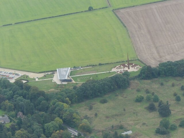
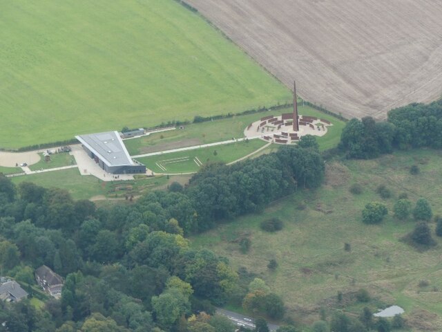
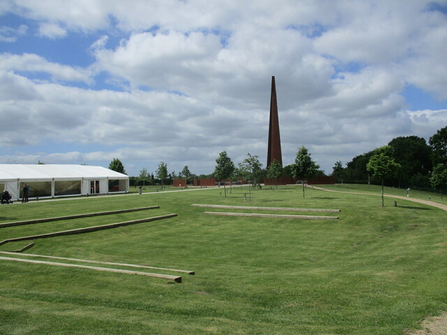
St Catherines is known for its historical significance, with St Catherine's Church being a prominent landmark. The church, dating back to the 12th century, showcases stunning architecture and is a testament to the village's rich heritage.

The village also benefits from its proximity to the city of Lincoln, which offers a wider range of amenities, including shopping centers, restaurants, and entertainment options. The area is well-connected, with good transport links to nearby towns and cities.

Overall, St Catherines is a quaint and peaceful village, offering a tranquil lifestyle in a beautiful countryside setting.

If you have any feedback on the listing, please let us know in the comments section below.

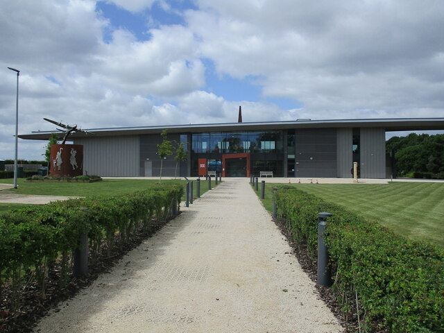
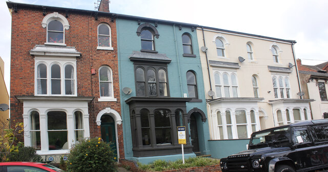
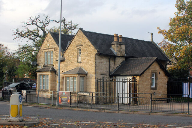
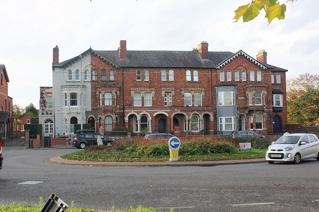
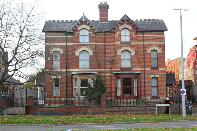
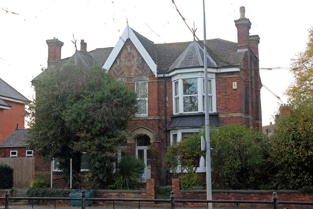
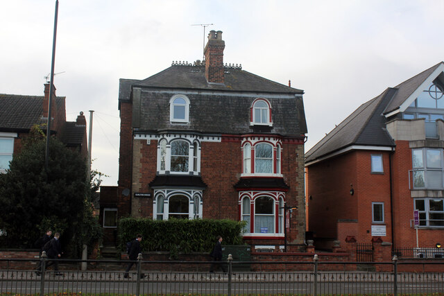
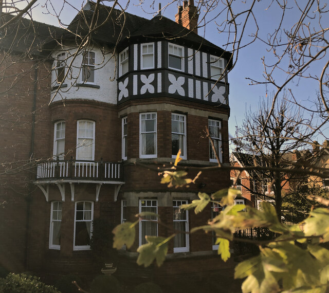
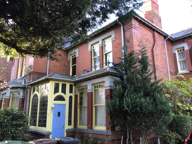
St Catherines Images

Images are sourced within 2km of 53.214819/-0.54632546 or Grid Reference SK9769. Thanks to Geograph Open Source API. All images are credited.

Bridleway to Bracebridge Heath
International Bomber Command Centre: aerial 2021 (1) See <span class="nowrap"><a title="https://internationalbcc.co.uk/" rel="nofollow ugc noopener" href="https://internationalbcc.co.uk/">Link</a><img style="margin-left:2px;" alt="External link" title="External link - shift click to open in new window" src="https://s1.geograph.org.uk/img/external.png" width="10" height="10"/></span>.
International Bomber Command Centre: aerial 2021 (1)
See LinkExternal link.
International Bomber Command Centre: aerial 2021 (2) See <span class="nowrap"><a title="https://internationalbcc.co.uk/" rel="nofollow ugc noopener" href="https://internationalbcc.co.uk/">Link</a><img style="margin-left:2px;" alt="External link" title="External link - shift click to open in new window" src="https://s1.geograph.org.uk/img/external.png" width="10" height="10"/></span>.
International Bomber Command Centre: aerial 2021 (2)
See LinkExternal link.
Lodge, Newark Road, Lincoln A picturesque affair complete with polychrome brick, timber framing, decorative tilework, and fretted bargeboards. Built 1883 for Bracebridge Hall, possibly by Albert Vicars who did the house (which is much less spirited). Grade II listed.
Lodge, Newark Road, Lincoln
A picturesque affair complete with polychrome brick, timber framing, decorative tilework, and fretted bargeboards. Built 1883 for Bracebridge Hall, possibly by Albert Vicars who did the house (which is much less spirited). Grade II listed.
St Botolph's Buildings, 466 High Street, Lincoln 466-468, shops with living accommodation built by John Fullalove for John Sheppard some time in or before 1877. Whites 1872 directory has a No.423 next to St Botolph’s Church with Mrs Rebecca Thorpe, shopkeeper also appearing at 423 in 1868. Prior to this in 1856 William Thorpe is listed at 423. Certainly by 1894 it was numbered 466. The advertising sign (Warwicks & Richardsons Ltd, Northgate, Newark on Trent) painted on the front wall of 466 suggests it may have been a public house but a list of Warwicks’ pubs has no entry for here. In Northgate Brewery from 1871 Warwicks were acquired by John Smith's Tadcaster Brewery Co. Ltd, in 1962. No.466 was possibly an off licence, numbered 423 with William or Rebecca Thorpe then? Occupants of 466 include; 1894-1905 William Atkinson, pork butchers; 1909 George Codd, pork butcher; 1913 Thomas Pearson, cycle dealer; 1919 John T Pearson, greengrocer; 1965 Empty. Tony Edens was established in 1977 but I don’t know how long they have been here; the limited company was only established in 2005.
St Botolph's Buildings, 466 High Street, Lincoln
466-468, shops with living accommodation built by John Fullalove for John Sheppard some time in or before 1877. Whites 1872 directory has a No.423 next to St Botolph’s Church with Mrs Rebecca Thorpe, shopkeeper also appearing at 423 in 1868. Prior to this in 1856 William Thorpe is listed at 423. Certainly by 1894 it was numbered 466. The advertising sign (Warwicks & Richardsons Ltd, Northgate, Newark on Trent) painted on the front wall of 466 suggests it may have been a public house but a list of Warwicks’ pubs has no entry for here. In Northgate Brewery from 1871 Warwicks were acquired by John Smith's Tadcaster Brewery Co. Ltd, in 1962. No.466 was possibly an off licence, numbered 423 with William or Rebecca Thorpe then? Occupants of 466 include; 1894-1905 William Atkinson, pork butchers; 1909 George Codd, pork butcher; 1913 Thomas Pearson, cycle dealer; 1919 John T Pearson, greengrocer; 1965 Empty. Tony Edens was established in 1977 but I don’t know how long they have been here; the limited company was only established in 2005.
International Bomber Command Memorial Erected on 2015. The site was opened to the public in 2018. Designed by Stephen Palmer of Place Architecture.
International Bomber Command Memorial
Erected on 2015. The site was opened to the public in 2018. Designed by Stephen Palmer of Place Architecture.
International Bomber Command Centre Designed by Stephen Palmer of Place Architecture.
International Bomber Command Centre
Designed by Stephen Palmer of Place Architecture.
52-55 South Park, Lincoln A row of 4 houses previously known as 4 to 1 South Park Villas. (I can find only two planning applications for 4 houses in South Park, both 1872 in date). Planning for no.55 was approved for owner/architect Barker & Son in April 1948 for 'conversion', possibly to flats? Planning for no.52 was approved for owners Lindum Estates, architect C Warren-Neil in August 1951 for 'conversion'. Nos. 54 and 55 differ from the other two in having only one access door, presumably a passage. They now comprise 7 flats, 6 1-bed and 1 3-bed in the basement. 2021 particulars described them as "looking a little ‘tired’ and would benefit from a scheme of refurbishment".
52-55 South Park, Lincoln
A row of 4 houses previously known as 4 to 1 South Park Villas. (I can find only two planning applications for 4 houses in South Park, both 1872 in date). Planning for no.55 was approved for owner/architect Barker & Son in April 1948 for 'conversion', possibly to flats? Planning for no.52 was approved for owners Lindum Estates, architect C Warren-Neil in August 1951 for 'conversion'. Nos. 54 and 55 differ from the other two in having only one access door, presumably a passage. They now comprise 7 flats, 6 1-bed and 1 3-bed in the basement. 2021 particulars described them as "looking a little ‘tired’ and would benefit from a scheme of refurbishment".
The Old Police House, South Park, Lincoln Built between 1868 and 1877 replacing the South Common Toll Gate House. It was a Police Station until at least 1965 and since 1974 it has been a private residence. (City Fire and Police Station in Church Lane closed in 1967 but continued as a store until around the time Nettleham headquarters were officially opened in November 1981).
The Old Police House, South Park, Lincoln
Built between 1868 and 1877 replacing the South Common Toll Gate House. It was a Police Station until at least 1965 and since 1974 it has been a private residence. (City Fire and Police Station in Church Lane closed in 1967 but continued as a store until around the time Nettleham headquarters were officially opened in November 1981).
1-11 (odd) St Catherines, Lincoln Three attached houses built by D Taylor, architects Drury and Mortimer to planning approved May 1878. The three, from High Street, were named 'Lonan House', 'Claremont House’ and 'Scarboro' Villa'. By 1897 they had become five, 'Abbey Gate', 'Beaufort House', 'Claremont House', 'Scarboro' Villa' and 'Matlock House'. By 1913 they had become six, 'Abbey Gate', 'Radcliffe House', 'Claremont House', 'Parkdale', 'Scarboro' Villa' and 'Matlock House'.
1-11 (odd) St Catherines, Lincoln
Three attached houses built by D Taylor, architects Drury and Mortimer to planning approved May 1878. The three, from High Street, were named 'Lonan House', 'Claremont House’ and 'Scarboro' Villa'. By 1897 they had become five, 'Abbey Gate', 'Beaufort House', 'Claremont House', 'Scarboro' Villa' and 'Matlock House'. By 1913 they had become six, 'Abbey Gate', 'Radcliffe House', 'Claremont House', 'Parkdale', 'Scarboro' Villa' and 'Matlock House'.
13-15 St Catherines, Lincoln Pair of semi-detached houses called Clarence Villas built for Mr Beard by Barnes and Wright, architects Bellamy and Hardy. Planning was approved in March 1876. A kitchen extension was added to 13 in 1887 that was called Russendale by 1913. Outbuildings were added to 15 in 1924 then called Oakfield Lodge. 13 was no.2 and 15 no.1 Clarence Villas well into the 20th century.
13-15 St Catherines, Lincoln
Pair of semi-detached houses called Clarence Villas built for Mr Beard by Barnes and Wright, architects Bellamy and Hardy. Planning was approved in March 1876. A kitchen extension was added to 13 in 1887 that was called Russendale by 1913. Outbuildings were added to 15 in 1924 then called Oakfield Lodge. 13 was no.2 and 15 no.1 Clarence Villas well into the 20th century.
17-19 St Catherines, Lincoln Now (2022) The Old Surgery Studios 1-7 19 St Catherines. A pair of semi-detached houses for William Beard to planning granted in July 1874, architects Bellamy & Hardy. Additions to rear in 1902, 1992 and 2001. Previously South Park Surgery the planning for change of Use from Doctors' Surgery to a 7-bedroom house in multiple occupation was granted in July 2017. 17 was no.2 and 19 no.1 Osbourne Villas well into the 20th century.
17-19 St Catherines, Lincoln
Now (2022) The Old Surgery Studios 1-7 19 St Catherines. A pair of semi-detached houses for William Beard to planning granted in July 1874, architects Bellamy & Hardy. Additions to rear in 1902, 1992 and 2001. Previously South Park Surgery the planning for change of Use from Doctors' Surgery to a 7-bedroom house in multiple occupation was granted in July 2017. 17 was no.2 and 19 no.1 Osbourne Villas well into the 20th century.
27-29 St Catherines, Lincoln A pair of semi-detached houses built by J K Sharpe, planning approved December 1875. No. 29 was ' Carlton House'. In 2005 no. 27 'Creston Villa' was converted to Creston Villa Guest House that was no.8 in the 'Best B and Bs and Inns' in the world issued by 'tripadvisor' in January 2011.
27-29 St Catherines, Lincoln
A pair of semi-detached houses built by J K Sharpe, planning approved December 1875. No. 29 was ' Carlton House'. In 2005 no. 27 'Creston Villa' was converted to Creston Villa Guest House that was no.8 in the 'Best B and Bs and Inns' in the world issued by 'tripadvisor' in January 2011.
Ferncliffe House, 2 St Catherines, Lincoln Not the best picture but it is difficult to photograph. House built for Alderman Thomas Wallis, architect W Mortimer and Son to planning approved in July 1896. Wallis made additions in 1907 and a dispensing room by builder W Challands in 1911. Presumably from about 1911, the house is occupied by Major Osmand Harry Chapman MD RAMC surgeon until at least 1919. In 1913 Ruddock's directory calls it Fernville. Planning was granted in October 2015 for 54m of 1.95m high wrought iron railings and gate to front elevation.
Ferncliffe House, 2 St Catherines, Lincoln
Not the best picture but it is difficult to photograph. House built for Alderman Thomas Wallis, architect W Mortimer and Son to planning approved in July 1896. Wallis made additions in 1907 and a dispensing room by builder W Challands in 1911. Presumably from about 1911, the house is occupied by Major Osmand Harry Chapman MD RAMC surgeon until at least 1919. In 1913 Ruddock's directory calls it Fernville. Planning was granted in October 2015 for 54m of 1.95m high wrought iron railings and gate to front elevation.
5 Cross O'Cliff Hill, Lincoln It seems to have been built between 1897 and 1913 and called 'Hill Rise'. It is not shown on the 1905 OS map. There are two potential candidates in the planning files, one 1905 and one 1908. It appears to have some substantial outbuildings to the rear. Unusually it has retained the original iron railings on the roadside, most having been removed for the metal in WWII.
5 Cross O'Cliff Hill, Lincoln
It seems to have been built between 1897 and 1913 and called 'Hill Rise'. It is not shown on the 1905 OS map. There are two potential candidates in the planning files, one 1905 and one 1908. It appears to have some substantial outbuildings to the rear. Unusually it has retained the original iron railings on the roadside, most having been removed for the metal in WWII.
Ashleigh, 9 Cross O'Cliff Hill, Lincoln House built for John Lodge (MD Wagon & Engine Co.) architect W Mortimer and Son to planning granted in April 1897. Garage and greenhouse added in 1912. Apparently called Ashleigh from new. In October 2013 planning was granted for conversion to 4 flats. In the grounds to the rear is an annex to be converted to two flats. Prior to this the property had been a training facility for some time, owned by Lincolnshire County Council. Access to 6 parking spaces at the rear had been accessed through a private driveway within the ownership of no. 11.
Ashleigh, 9 Cross O'Cliff Hill, Lincoln
House built for John Lodge (MD Wagon & Engine Co.) architect W Mortimer and Son to planning granted in April 1897. Garage and greenhouse added in 1912. Apparently called Ashleigh from new. In October 2013 planning was granted for conversion to 4 flats. In the grounds to the rear is an annex to be converted to two flats. Prior to this the property had been a training facility for some time, owned by Lincolnshire County Council. Access to 6 parking spaces at the rear had been accessed through a private driveway within the ownership of no. 11.
29-31 Cross O'Cliff Hill, Lincoln Pair of semi-detached houses shown on the 1905 OS map but not the 1886 OS map. Note that the properties are not symmetrical, no.29 occupying only the section with the gable end to the road, 31 having the centre section. Directories I have list them in 1913 but not 1897, suggesting a build date between 1898 and 1904. 1913 they are called 'The Croft' (29, apparently empty) and 'Brentwood' (31). By 1919, now occupied, no. 29 is 'Strathmore' and is shown in 1965 Kelly’s as two flats. 31 has subsequently been converted to at least 5 flats.
29-31 Cross O'Cliff Hill, Lincoln
Pair of semi-detached houses shown on the 1905 OS map but not the 1886 OS map. Note that the properties are not symmetrical, no.29 occupying only the section with the gable end to the road, 31 having the centre section. Directories I have list them in 1913 but not 1897, suggesting a build date between 1898 and 1904. 1913 they are called 'The Croft' (29, apparently empty) and 'Brentwood' (31). By 1919, now occupied, no. 29 is 'Strathmore' and is shown in 1965 Kelly’s as two flats. 31 has subsequently been converted to at least 5 flats.
Brickworks Chimney, Cross O'Cliff Hill, Lincoln Close to the Orchard Walk houses, for some reason this is the only remaining structure from William Bartholomew Best's Cross O'Cliffe Brick & Tile Works. Kelly's Directory of 1872 is the earliest mention with the 1868 directory carrying no reference to the works. However there is a note in the press 1856 about the intended use of the land and the online heritage information and management system for the City claims it to be built in 1857 by R Toynbee. This may be a confusion with “Ward’s Brickyard” that is described in a Great Northern Railway 1863 schedule and plan as further north, roughly in the area of the LSST school. Cross O'Cliffe Brick & Tile Works was known from 1889 as Lincoln Brick Company who probably modernised the works. It closed in 1901 and by 1907 most buildings were ruinous and only the chimney and two buildings remained (both post 1887, known in 1965 as Old Brickyard Cottage and Fieldhouse, demolished by 2004). There is evidence that buildings on the site were previously agricultural, probably for pigs and post-dating the brickworks; it seems the area was used by butcher Zachariah T Priestley for slaughtering work c.1914. In 1992 the building remains were made safe and the 45ft 6in (13.8m) chimney was reduced in height by 17 feet (5m), refurbished and repaired.
Brickworks Chimney, Cross O'Cliff Hill, Lincoln
Close to the Orchard Walk houses, for some reason this is the only remaining structure from William Bartholomew Best's Cross O'Cliffe Brick & Tile Works. Kelly's Directory of 1872 is the earliest mention with the 1868 directory carrying no reference to the works. However there is a note in the press 1856 about the intended use of the land and the online heritage information and management system for the City claims it to be built in 1857 by R Toynbee. This may be a confusion with “Ward’s Brickyard” that is described in a Great Northern Railway 1863 schedule and plan as further north, roughly in the area of the LSST school. Cross O'Cliffe Brick & Tile Works was known from 1889 as Lincoln Brick Company who probably modernised the works. It closed in 1901 and by 1907 most buildings were ruinous and only the chimney and two buildings remained (both post 1887, known in 1965 as Old Brickyard Cottage and Fieldhouse, demolished by 2004). There is evidence that buildings on the site were previously agricultural, probably for pigs and post-dating the brickworks; it seems the area was used by butcher Zachariah T Priestley for slaughtering work c.1914. In 1992 the building remains were made safe and the 45ft 6in (13.8m) chimney was reduced in height by 17 feet (5m), refurbished and repaired.
Show me another place!

St Catherines is located at Grid Ref: SK9769 (Lat: 53.214819, Lng: -0.54632546)

Division: Parts of Kesteven

Administrative County: Lincolnshire

District: Lincoln

Police Authority: Lincolnshire

What 3 Words

///books.danger.twin. Near Lincoln, Lincolnshire

Nearby Locations

South Common St Catherines

Related Wikis

St Catherine's, Lincoln

St Catherine's is an area of Lincoln, Lincolnshire, England, at the southern end of the High Street, and centred on a roundabout at its junction with the...

St Katherine's Church, Lincoln

St Katherine's Church, Lincoln also known as "Southside" and "St Katherines Cathedral Church" is a Grade II-listed church in Lincoln, Lincolnshire, England...

The Old Deanery, Lincoln

The Old Deanery, Lincoln was the official residence of the Dean of Lincoln. It was a spacious building set around a courtyard. The Deanery is thought to...

Hospital of the Holy Innocents

The Hospital of the Holy Innocents, or the Melandry was a Leper Hospital on South Park common in Lincoln, England. It was founded in the late 11th or...

Church of St. Basil and St. Paisios, Lincoln

The Church of St. Basil and St. Paisios, Lincoln also known as the Greek Orthodox Church of St. Basil and St. Paisios in Lincoln is an active Greek Orthodox...

St. Catherine's Priory, Lincoln

St. Katherine's Priory also known as The Priory of Saint Katherine without Lincoln was a Gilbertine priory of Canons Regular on the Fosse Way just outside...

Sincil Bank

Sincil Bank Stadium, known for sponsorship reasons as LNER Stadium, is a football stadium in Lincoln, England which has been the home of Lincoln City since...

Boultham

Boultham is a suburb of Lincoln in Lincolnshire, England. The population of the City of Lincoln ward at the 2011 census was 7,465.The ecclesiastical parish...

Nearby Amenities

Located within 500m of 53.214819,-0.54632546
001
Source: GPS waypoint
Upload Tag: ojw_lincoln
Lat/Long: 53.2119076/-0.5466338
107
Created By: xybot
Source: GPS waypoint
Upload Tag: ojw_lincoln
Lat/Long: 53.218835/-0.545078
110
Created By: almien_upload
Source: GPS waypoint
Upload Tag: ojw_lincoln
Lat/Long: 53.215638/-0.5460288
112
Source: GPS waypoint
Upload Tag: ojw_lincoln
Lat/Long: 53.2161345/-0.5402029
119
Source: GPS waypoint
Upload Tag: ojw_lincoln
Lat/Long: 53.2152485/-0.5433566
120
Created By: almien_upload
Source: GPS waypoint
Upload Tag: ojw_lincoln
Lat/Long: 53.2144595/-0.5487492
122
Source: GPS waypoint
Upload Tag: ojw_lincoln
Lat/Long: 53.2135265/-0.5492229
123
Source: GPS waypoint
Upload Tag: ojw_lincoln
Lat/Long: 53.2138711/-0.5494289
140
Created By: xybot
Source: GPS waypoint
Upload Tag: ojw_lincoln
Lat/Long: 53.214153/-0.550935
141
Created By: almien_upload
Source: GPS waypoint
Upload Tag: ojw_lincoln
Lat/Long: 53.2153451/-0.5507329
143
Source: GPS waypoint
Upload Tag: ojw_lincoln
Lat/Long: 53.2187957/-0.5452119
167
Source: GPS waypoint
Upload Tag: ojw_lincoln
Lat/Long: 53.2188834/-0.5431919
169
Source: GPS waypoint
Upload Tag: ojw_lincoln
Lat/Long: 53.2174109/-0.5433775
170
Source: GPS waypoint
Upload Tag: ojw_lincoln
Lat/Long: 53.2167532/-0.5451726
171
Source: GPS waypoint
Upload Tag: ojw_lincoln
Lat/Long: 53.2159559/-0.5437671
Pub
Shakespeare
Addr City: Lincoln
Addr Country: GB
Addr Housenumber: 40
Addr Postcode: LN5 8AS
Addr Street: High Street
Fhrs Id: 330170
Source Addr: FHRS Open Data
Lat/Long: 53.2175551/-0.5457211
112
Created By: almien_upload
Source: GPS waypoint
Upload Tag: ojw_lincoln
Lat/Long: 53.2160789/-0.5408564
Crossing
Crossing: yes
Crossing Ref: pelican
Lat/Long: 53.2153367/-0.5434765
Barrier: cycle_barrier
Source: survey
Lat/Long: 53.2166601/-0.5448867
Barrier: cycle_barrier
Lat/Long: 53.2165581/-0.5437972
Shakespeare Street Garage
Shop: car_repair
Source: approx
Lat/Long: 53.2179274/-0.5447308
Barrier: bollard
Source: survey
Lat/Long: 53.2143118/-0.5496398
Crossing
Crossing: yes
Crossing Ref: pelican
Lat/Long: 53.2150283/-0.5462424
Barrier: bollard
Bicycle: no
Foot: yes
Source: survey
Wheelchair: no
Lat/Long: 53.2159858/-0.5488715
Barrier: bollard
Lat/Long: 53.218509/-0.5425017
Pub
Golden Eagle
Addr City: Lincoln
Addr Housename: Golden Eagle
Addr Housenumber: 21
Addr Postcode: LN5 8BD
Addr Street: High Street
Email: goldeneagle@castlerockbrewery.co.uk
Fhrs Id: 329950
Phone: +44 152 252 1058
Source Addr: FHRS Open Data
Website: https://www.castlerockbrewery.co.uk/pubs/golden-eagle/
Lat/Long: 53.2164605/-0.5459852
Bus Stop
Queens Park School
Naptan AtcoCode: 2700LCMS1328
Naptan Bearing: NE
Naptan CommonName: Queens Park School
Naptan Indicator: opp
Naptan Landmark: Queens Park School
Naptan NaptanCode: linajpgp
Naptan PlusbusZoneRef: LINCLNC
Naptan Street: South Park Avenue
Naptan Verified: no
Source: naptan_import
Lat/Long: 53.2151124/-0.5444573
Bus Stop
South Common
Naptan AtcoCode: 2700LLCO3409
Naptan Bearing: S
Naptan CommonName: South Common
Naptan Indicator: adj
Naptan Landmark: South Common
Naptan NaptanCode: lindagtm
Naptan PlusbusZoneRef: LINCLNC
Naptan Street: St Catherines
Naptan Verified: no
Public Transport: platform
Shelter: yes
Source: naptan_import
Lat/Long: 53.2131343/-0.5466371
Bus Stop
High Street
Naptan AtcoCode: 2700LLDS2745
Naptan Bearing: E
Naptan CommonName: High Street
Naptan Indicator: Eastbound
Naptan Landmark: High Street
Naptan NaptanCode: linatmtg
Naptan PlusbusZoneRef: LINCLNC
Naptan Street: Dixon Street
Naptan Verified: no
Shelter: no
Source: naptan_import
Lat/Long: 53.2189481/-0.5464241
Bus Stop
High Street
Naptan AtcoCode: 2700LLDS2746
Naptan Bearing: W
Naptan CommonName: High Street
Naptan Indicator: Westbound
Naptan Landmark: High Street
Naptan NaptanCode: linatmtj
Naptan PlusbusZoneRef: LINCLNC
Naptan Street: Dixon Street
Naptan Verified: no
Shelter: no
Source: naptan_import
Lat/Long: 53.2188808/-0.5468009
Bus Stop
Robey Street
Naptan AtcoCode: 2700LLHS2544
Naptan Bearing: S
Naptan CommonName: Robey Street
Naptan Indicator: opp
Naptan Landmark: Robey Street
Naptan NaptanCode: linatdwj
Naptan PlusbusZoneRef: LINCLNC
Naptan Street: High Street
Naptan Verified: no
Public Transport: platform
Shelter: yes
Source: naptan_import
Lat/Long: 53.2181157/-0.5452541
Bus Stop
Robey Street
Naptan AtcoCode: 2700LLHS2545
Naptan Bearing: N
Naptan CommonName: Robey Street
Naptan Indicator: adj
Naptan Landmark: Robey Street
Naptan NaptanCode: linatdwm
Naptan PlusbusZoneRef: LINCLNC
Naptan Street: High Street
Naptan Verified: no
Shelter: yes
Source: naptan_import
Lat/Long: 53.2177157/-0.5456271
Bus Stop
Tealby Street
Naptan AtcoCode: 2700LLHS2547
Naptan Bearing: N
Naptan CommonName: Tealby Street
Naptan Indicator: adj
Naptan Landmark: Tealby Street
Naptan NaptanCode: linatdwt
Naptan PlusbusZoneRef: LINCLNC
Naptan Street: High Street
Naptan Verified: no
Shelter: no
Source: naptan_import
Lat/Long: 53.2156724/-0.5461456
Bus Stop
Tealby Street
Naptan AtcoCode: 2700LLHS2548
Naptan Bearing: S
Naptan CommonName: Tealby Street
Naptan Indicator: opp
Naptan Landmark: Tealby Street
Naptan NaptanCode: linatgad
Naptan PlusbusZoneRef: LINCLNC
Naptan Street: High Street
Naptan Verified: no
Public Transport: platform
Shelter: yes
Source: naptan_import
Lat/Long: 53.2154994/-0.5459718
Bus Stop
Queens Park School
Naptan AtcoCode: 2700LLNI2351
Naptan Bearing: SW
Naptan CommonName: Queens Park School
Naptan Indicator: o/s
Naptan Landmark: Queens Park School
Naptan NaptanCode: linaptwp
Naptan PlusbusZoneRef: LINCLNC
Naptan Street: South Park Avenue
Naptan Verified: no
Source: naptan_import
Lat/Long: 53.2149851/-0.5443418
Bus Stop
Football Ground
Naptan AtcoCode: 2700LLSB3029
Naptan Bearing: S
Naptan CommonName: Football Ground
Naptan Landmark: Football Ground
Naptan NaptanCode: linawgjm
Naptan PlusbusZoneRef: LINCLNC
Naptan Street: Sincil Bank
Naptan Verified: no
Source: naptan_import
Lat/Long: 53.2177452/-0.5421513
Bus Stop
Hamilton Road
Naptan AtcoCode: 2700LLSC0105
Naptan Bearing: S
Naptan CommonName: Hamilton Road
Naptan Indicator: opp
Naptan Landmark: Hamilton Road
Naptan NaptanCode: linadatm
Naptan PlusbusZoneRef: LINCLNC
Naptan Street: St Catherines
Naptan Verified: no
Source: naptan_import
Lat/Long: 53.212008/-0.5471683
Bus Stop
Hamilton Road
Naptan AtcoCode: 2700LLSC1408
Naptan Bearing: N
Naptan CommonName: Hamilton Road
Naptan Indicator: adj
Naptan Landmark: Hamilton Road
Naptan NaptanCode: linajtmt
Naptan PlusbusZoneRef: LINCLNC
Naptan Street: St Catherines
Naptan Verified: no
Source: naptan_import
Lat/Long: 53.2121807/-0.5473271
Bus Stop
South Common
Naptan AtcoCode: 2700LLSC1409
Naptan Bearing: N
Naptan CommonName: South Common
Naptan Indicator: opp
Naptan Landmark: South Common
Naptan NaptanCode: linajtmw
Naptan PlusbusZoneRef: LINCLNC
Naptan Street: St Catherines
Naptan Verified: no
Shelter: yes
Source: naptan_import
Lat/Long: 53.2135149/-0.5468926
Barrier: bollard
Source: survey
Lat/Long: 53.2142949/-0.5495991
Barrier: bollard
Source: survey
Lat/Long: 53.2144495/-0.548801
Restaurant
Passage to India
Cuisine: indian
Lat/Long: 53.218365/-0.5451179
Disused Amenity: toilets
Lat/Long: 53.2136449/-0.5462886
Tourism: picnic_site
Lat/Long: 53.212507/-0.5433971
Traffic Signals
Button Operated: yes
Crossing: traffic_signals
Crossing Ref: pelican
Traffic Signals Sound: yes
Lat/Long: 53.2186046/-0.545261
Traffic Signals
Crossing: traffic_signals
Crossing Ref: pelican
Lat/Long: 53.218809/-0.5453961
Traffic Signals
Lat/Long: 53.2188262/-0.5452052
Traffic Calming: island
Lat/Long: 53.2192058/-0.5451265
Crossing
Crossing: yes
Crossing Ref: pelican
Source: survey
Lat/Long: 53.2168549/-0.5456778
Traffic Calming: island
Lat/Long: 53.2175103/-0.5455202
Post Box
Post Box Type: pillar
Ref: LN5 83
Royal Cypher: EIIR
Royal Cypher Wikidata: Q33102113
Lat/Long: 53.2112658/-0.5480394
Waste Basket
Source: survey
Lat/Long: 53.2121576/-0.5472943
Waste Basket
Source: survey
Lat/Long: 53.2126951/-0.5471583
Waste Basket
Source: survey
Lat/Long: 53.2144297/-0.5464327
Post Box
Ref: LN5 10
Source: survey
Lat/Long: 53.2150533/-0.5463409
Waste Basket
Source: survey
Lat/Long: 53.2153651/-0.5462376
Waste Basket
Source: survey
Lat/Long: 53.2156308/-0.546143
Waste Basket
Source: survey
Lat/Long: 53.2159233/-0.5460418
Telephone
Booth: KX100
Covered: booth
Lat/Long: 53.2166334/-0.5458814
Bench
Source: survey
Lat/Long: 53.2169236/-0.5458146
Waste Basket
Source: survey
Lat/Long: 53.2169255/-0.5457572
Telephone
Booth: KX100
Covered: booth
Source: survey
Lat/Long: 53.2175207/-0.5456465
Bicycle Parking
Bicycle Parking: stands
Capacity: 8
Covered: no
Source: survey
Lat/Long: 53.2175682/-0.5456357
Waste Basket
Source: survey
Lat/Long: 53.2176118/-0.5456257
Post Box
Post Box Type: wall
Ref: LN5 9
Source: survey
Lat/Long: 53.2180317/-0.5455394
Bench
Source: survey
Lat/Long: 53.2142472/-0.5461101
Bench
Source: survey
Lat/Long: 53.214349/-0.5458071
Bench
Source: survey
Lat/Long: 53.2143851/-0.5457623
Bench
Source: survey
Lat/Long: 53.214444/-0.5457131
Barrier: kissing_gate
Lat/Long: 53.2141049/-0.5431226
Bench
Source: survey
Lat/Long: 53.2153063/-0.5432943
Barrier: cycle_barrier
Lat/Long: 53.2165327/-0.5435291
Waste Basket
Source: survey
Lat/Long: 53.217356/-0.5426469
Barrier: bollard
Lat/Long: 53.2169671/-0.545162
Barrier: bollard
Lat/Long: 53.2169908/-0.5454892
Waste Basket
Source: survey
Lat/Long: 53.2155252/-0.5459476
Barrier: stile
Lat/Long: 53.2160966/-0.5396377
Traffic Signals
Lat/Long: 53.2126333/-0.5467936
Traffic Signals
Lat/Long: 53.2128972/-0.5468925
Traffic Signals
Lat/Long: 53.2125422/-0.5467999
Crossing
Button Operated: yes
Crossing: traffic_signals
Kerb: lowered
Tactile Paving: yes
Traffic Signals Sound: yes
Lat/Long: 53.2125439/-0.5469121
Crossing
Button Operated: yes
Crossing: traffic_signals
Kerb: lowered
Tactile Paving: yes
Traffic Signals Sound: yes
Lat/Long: 53.2126442/-0.5469808
Crossing
Button Operated: yes
Crossing: traffic_signals
Kerb: lowered
Tactile Paving: yes
Traffic Signals Sound: yes
Lat/Long: 53.2126593/-0.5470958
Crossing
Button Operated: yes
Crossing: traffic_signals
Kerb: lowered
Tactile Paving: yes
Traffic Signals Sound: yes
Lat/Long: 53.2126977/-0.546865
Crossing
Button Operated: yes
Crossing: traffic_signals
Kerb: lowered
Tactile Paving: yes
Traffic Signals Sound: yes
Lat/Long: 53.2128102/-0.5466867
St Catherines
Place: neighbourhood
Source: Bing
Wikidata: Q7587461
Lat/Long: 53.2125931/-0.550512
Tealby Street Food Store
Addr City: Lincoln
Addr Housenumber: 14-16
Addr Postcode: LN5 8BS
Addr Street: High Street
Opening Hours: 07:00-22:00
Shop: newsagent
Source: http://lincolnshire.coop/divisions/food-stores/stores/tealby-street-food-store.aspx
Lat/Long: 53.2153699/-0.5463219
Crossing
Button Operated: yes
Crossing: traffic_signals
Crossing Ref: pelican
Traffic Signals Sound: yes
Lat/Long: 53.2184812/-0.5452298
Because it's Beautiful
Addr City: Lincoln
Addr Housenumber: 451
Addr Street: High Street
Shop: furniture
Lat/Long: 53.217515/-0.5453263
Belvoir Lettings Agency
Addr City: Lincoln
Addr Housenumber: 450
Addr Postcode: LN5 8HZ
Addr Street: High Street
Source: survey
Lat/Long: 53.2176684/-0.5453049
Premier
Addr City: Lincoln
Addr Housenumber: 448
Addr Postcode: LN5 8HZ
Addr Street: High Street
Brand: Premier
Brand Wikidata: Q7240340
Shop: convenience
Website: https://www.premier-stores.co.uk/our-stores/high-street-premier
Lat/Long: 53.2177521/-0.5452797
Restaurant
Castlegate
Addr City: Lincoln
Addr Housenumber: 445-446
Addr Postcode: LN5 8HZ
Addr Street: High Street
Cuisine: indian
Website: http://www.castlegaterestaurant.net
Lat/Long: 53.2178695/-0.5452544
Fast Food
Peri Peri Grill
Addr City: Lincoln
Addr Housenumber: 147
Addr Postcode: LN5 8HZ
Addr Street: High Street
Outdoor Seating: no
Takeaway: only
Lat/Long: 53.2178265/-0.5452661
Traffic Calming: island
Lat/Long: 53.2147254/-0.5462783
Generator Method: photovoltaic
Generator Output Electricity: yes
Generator Source: solar
Generator Type: solar_photovoltaic_panel
Location: roof
Power: generator
Source: imagery
Lat/Long: 53.2134586/-0.5513124
Generator Method: photovoltaic
Generator Output Electricity: yes
Generator Source: solar
Generator Type: solar_photovoltaic_panel
Location: roof
Power: generator
Source: imagery
Lat/Long: 53.213671/-0.551235
Generator Method: photovoltaic
Generator Output Electricity: yes
Generator Source: solar
Generator Type: solar_photovoltaic_panel
Location: roof
Power: generator
Source: imagery
Lat/Long: 53.2137317/-0.5514911
Generator Method: photovoltaic
Generator Output Electricity: yes
Generator Source: solar
Generator Type: solar_photovoltaic_panel
Location: roof
Power: generator
Source: imagery
Lat/Long: 53.2168899/-0.5510688
Generator Method: photovoltaic
Generator Output Electricity: yes
Generator Source: solar
Generator Type: solar_photovoltaic_panel
Location: roof
Power: generator
Source: imagery
Lat/Long: 53.21724/-0.5509964
Generator Method: photovoltaic
Generator Output Electricity: yes
Generator Source: solar
Generator Type: solar_photovoltaic_panel
Location: roof
Power: generator
Source: imagery
Lat/Long: 53.2173958/-0.5503205
Generator Method: photovoltaic
Generator Output Electricity: yes
Generator Source: solar
Generator Type: solar_photovoltaic_panel
Location: roof
Power: generator
Source: imagery
Lat/Long: 53.2171966/-0.5509454
Generator Method: photovoltaic
Generator Output Electricity: yes
Generator Source: solar
Generator Type: solar_photovoltaic_panel
Location: roof
Power: generator
Source: Bing imagery
Lat/Long: 53.2155119/-0.5537365
Generator Method: photovoltaic
Generator Output Electricity: yes
Generator Source: solar
Generator Type: solar_photovoltaic_panel
Location: roof
Power: generator
Source: Bing imagery
Lat/Long: 53.2155777/-0.5536493
Generator Method: photovoltaic
Generator Output Electricity: yes
Generator Source: solar
Generator Type: solar_photovoltaic_panel
Location: roof
Power: generator
Source: Bing imagery
Lat/Long: 53.215716/-0.5464436
Generator Method: photovoltaic
Generator Output Electricity: yes
Generator Source: solar
Generator Type: solar_photovoltaic_panel
Location: roof
Power: generator
Source: Bing imagery
Lat/Long: 53.2156767/-0.5462746
Traffic Signals
Lat/Long: 53.2128523/-0.5466932
Traffic Signals
Lat/Long: 53.2126154/-0.5471103
Camera Mount: pole
Camera Type: panning
Man Made: surveillance
Surveillance: public
Surveillance Type: camera
Surveillance Zone: town
Lat/Long: 53.2191911/-0.545143
Camera Mount: pole
Camera Type: dome
Man Made: surveillance
Surveillance: public
Surveillance Type: camera
Surveillance Zone: town
Lat/Long: 53.2144091/-0.54648
Generator Method: photovoltaic
Generator Output Electricity: yes
Generator Source: solar
Generator Type: solar_photovoltaic_panel
Location: roof
Power: generator
Lat/Long: 53.2185083/-0.5443409
Generator Method: photovoltaic
Generator Output Electricity: yes
Generator Source: solar
Generator Type: solar_photovoltaic_panel
Location: roof
Power: generator
Lat/Long: 53.2184778/-0.5434504
Generator Method: photovoltaic
Generator Output Electricity: yes
Generator Source: solar
Generator Type: solar_photovoltaic_panel
Location: roof
Power: generator
Lat/Long: 53.2189387/-0.546197
Generator Method: photovoltaic
Generator Output Electricity: yes
Generator Source: solar
Generator Type: solar_photovoltaic_panel
Location: roof
Power: generator
Lat/Long: 53.2190093/-0.5470312
Generator Method: photovoltaic
Generator Output Electricity: yes
Generator Source: solar
Generator Type: solar_photovoltaic_panel
Location: roof
Power: generator
Lat/Long: 53.218501/-0.5466717
Generator Method: photovoltaic
Generator Output Electricity: yes
Generator Source: solar
Generator Type: solar_photovoltaic_panel
Location: roof
Power: generator
Lat/Long: 53.2188704/-0.548037
Generator Method: photovoltaic
Generator Output Electricity: yes
Generator Source: solar
Generator Type: solar_photovoltaic_panel
Location: roof
Power: generator
Lat/Long: 53.2185428/-0.5485292
Generator Method: photovoltaic
Generator Output Electricity: yes
Generator Source: solar
Generator Type: solar_photovoltaic_panel
Location: roof
Power: generator
Lat/Long: 53.2155925/-0.5536951
The data included in this document is from www.openstreetmap.org. The data is made available under ODbL.

Have you been to St Catherines?

Leave your review of St Catherines below (or comments, questions and feedback).