South Corriegills

Settlement in Buteshire

Scotland

South Corriegills

Holy Island View From near the trig point above Clauchlands is a fine view across to Holy Island.
Dead Bracken conspicuous in the foreground.
Holy Island View Credit: Adam Ward

South Corriegills is a small and picturesque village located in the county of Buteshire, Scotland. Situated on the western coast of the island, it is surrounded by stunning natural beauty and offers a tranquil escape from the bustling urban centers.

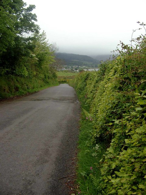
The village is characterized by its charming cottages and traditional stone buildings, which give it a timeless and idyllic feel. The local community is close-knit, friendly, and welcoming to visitors. The village is also home to a number of amenities, including a post office, a small grocery store, and a cozy pub, providing residents with essential services and a sense of community.

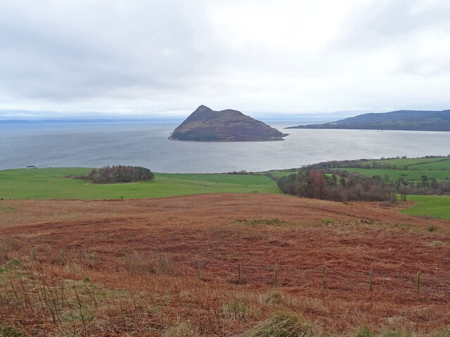
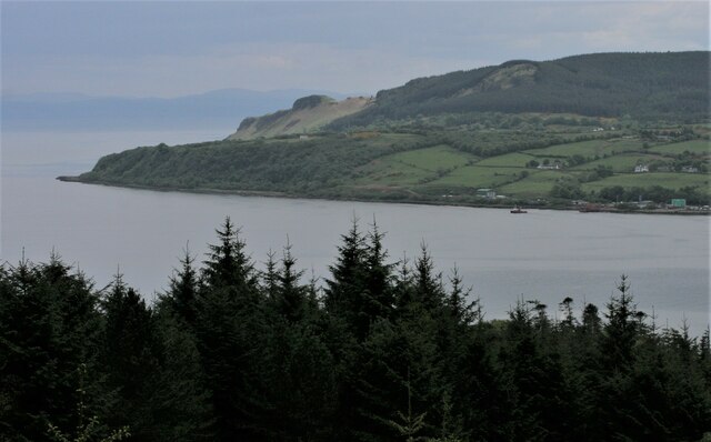
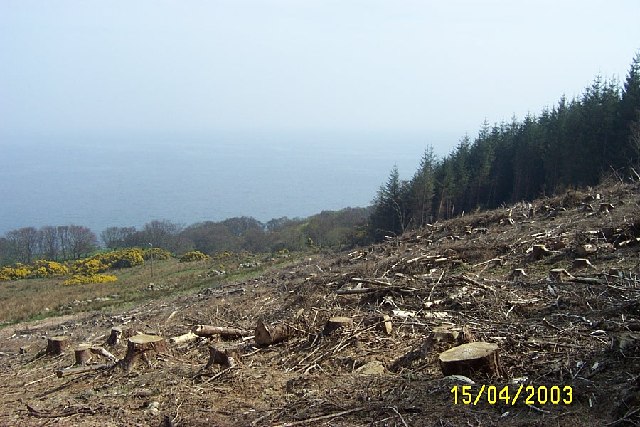
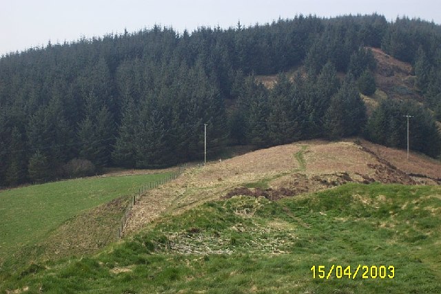
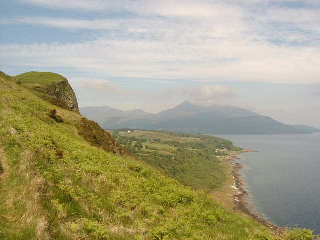
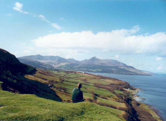
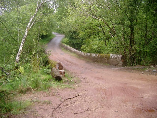
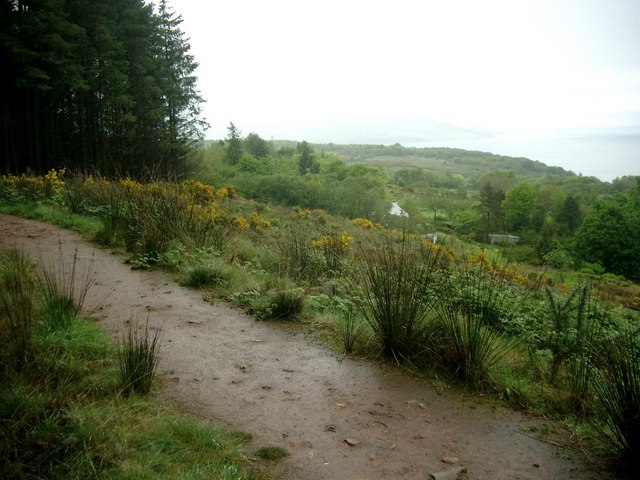
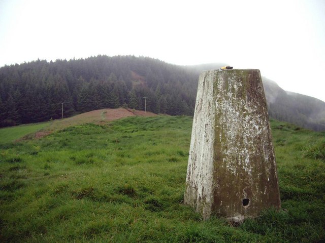
South Corriegills is blessed with breathtaking scenery, with the rugged coastline and rolling hills providing a backdrop that is both dramatic and serene. The area is rich in wildlife, making it a haven for nature enthusiasts and birdwatchers. The nearby Corriegills Forest offers walking and hiking trails, allowing visitors to explore the area's natural beauty.

For history enthusiasts, the village boasts a rich heritage. The ruins of a medieval castle can be found on the outskirts, serving as a reminder of the area's past. Additionally, there are several historic sites and landmarks scattered throughout the village and its surroundings, providing a glimpse into South Corriegills' fascinating history.

Overall, South Corriegills is a hidden gem in Buteshire, offering a peaceful and picturesque environment for residents and visitors alike. Whether you are seeking a quiet retreat or an opportunity to immerse yourself in nature, this village provides a perfect escape.

If you have any feedback on the listing, please let us know in the comments section below.

South Corriegills Images

Images are sourced within 2km of 55.563777/-5.1088611 or Grid Reference NS0434. Thanks to Geograph Open Source API. All images are credited.

Holy Island View From near the trig point above Clauchlands is a fine view across to Holy Island.
Dead Bracken conspicuous in the foreground.
Holy Island View
From near the trig point above Clauchlands is a fine view across to Holy Island. Dead Bracken conspicuous in the foreground.
Dun Fionn, Clauchland Hills The bare hill just left of centre is Dun Fionn, a hillfort at the eastern end of the Clauchland Hills. It is a Scheduled Monument <span class="nowrap"><a title="http://portal.historicenvironment.scot/designation/SM4710" rel="nofollow ugc noopener" href="http://portal.historicenvironment.scot/designation/SM4710">Link</a><img style="margin-left:2px;" alt="External link" title="External link - shift click to open in new window" src="https://s1.geograph.org.uk/img/external.png" width="10" height="10"/></span>. See Canmore <span class="nowrap"><a title="https://canmore.org.uk/site/40197/arran-clauchlands-dun-fionn" rel="nofollow ugc noopener" href="https://canmore.org.uk/site/40197/arran-clauchlands-dun-fionn">Link</a><img style="margin-left:2px;" alt="External link" title="External link - shift click to open in new window" src="https://s1.geograph.org.uk/img/external.png" width="10" height="10"/></span> for more information.

On the left is Corriegills Point.

Camera location is on the slopes above Brodick Castle.
Dun Fionn, Clauchland Hills
The bare hill just left of centre is Dun Fionn, a hillfort at the eastern end of the Clauchland Hills. It is a Scheduled Monument LinkExternal link. See Canmore LinkExternal link for more information. On the left is Corriegills Point. Camera location is on the slopes above Brodick Castle.
Resting cows A herd of very contented-looking young cows on fertile grazing by Kerr's Port.
Resting cows
A herd of very contented-looking young cows on fertile grazing by Kerr's Port.
Clearfelled timber, Isle of Arran Near to corriegills outside Brodick 40 year old plantation being felled.
Clearfelled timber, Isle of Arran
Near to corriegills outside Brodick 40 year old plantation being felled.
Brodick Pier with Caledonian MacBrayne Ferry
View west from Dun Fionn near Lamlash, Arran Iron age fort on hill between Brodick and Lamlash
View west from Dun Fionn near Lamlash, Arran
Iron age fort on hill between Brodick and Lamlash
Clauchlands, Arran This view is of the edge of the cliffs alongside Clauchlands Farm. We started our walk from Lamlash Bay, heading for Brodick.  This photo shows Corriegills Point in the near distance and Goat Fell beyond.
Clauchlands, Arran
This view is of the edge of the cliffs alongside Clauchlands Farm. We started our walk from Lamlash Bay, heading for Brodick. This photo shows Corriegills Point in the near distance and Goat Fell beyond.
Clauchlands Farmland, Lamlash, Arran This photo was taken from the road to Clauchlands Farm and shows Lamlash Bay, Holy Island and Kings Cross in the distance (please see supplemental photo for picture of the photographer's assistant!)
Clauchlands Farmland, Lamlash, Arran
This photo was taken from the road to Clauchlands Farm and shows Lamlash Bay, Holy Island and Kings Cross in the distance (please see supplemental photo for picture of the photographer's assistant!)
Clauchlands Farmland, Lamlash, Arran Sorry, I have a thing about cows!
Clauchlands Farmland, Lamlash, Arran
Sorry, I have a thing about cows!
Arran east coast near Clauchland Looking north along the east coast of Arran between the villages of Lamlash and Brodick. Goat Fell can be seen in the distance.
Arran east coast near Clauchland
Looking north along the east coast of Arran between the villages of Lamlash and Brodick. Goat Fell can be seen in the distance.
The Corriegills Road Looking towards Brodick
The Corriegills Road
Looking towards Brodick
The Corriegills Bridge Looking  NW
The Corriegills Bridge
Looking NW
The path to Clauchlands Point On a rainy day.  Brodick Bay can just be seen in the distance.
The path to Clauchlands Point
On a rainy day. Brodick Bay can just be seen in the distance.
The trig on Dun Fionn Looking NW on a wet day.  Dun Fionn is an Iron-Age fort (and a pretty good defensive position!).
The trig on Dun Fionn
Looking NW on a wet day. Dun Fionn is an Iron-Age fort (and a pretty good defensive position!).
Where the path divides At this point, a faint path continues along the base of the cliff, while the main path to Dun Fionn and Brodick climbs steeply away from the coast.  Corriegills Point then (very faintly) Merkland Point in the distance.
Where the path divides
At this point, a faint path continues along the base of the cliff, while the main path to Dun Fionn and Brodick climbs steeply away from the coast. Corriegills Point then (very faintly) Merkland Point in the distance.
Boulders on the Clauchlands shore Clauchlands Point and Hamilton Isle in the distance.
Boulders on the Clauchlands shore
Clauchlands Point and Hamilton Isle in the distance.
Clauchlands shore and Holy Island Early morning mist on Holy Island as seen from the car park at Clauchlands. A pair of eider ducks are just off shore.
Clauchlands shore and Holy Island
Early morning mist on Holy Island as seen from the car park at Clauchlands. A pair of eider ducks are just off shore.
Field above Brodick Bay Goatfell can be seen across the bay.
Field above Brodick Bay
Goatfell can be seen across the bay.
Show me another place!

South Corriegills is located at Grid Ref: NS0434 (Lat: 55.563777, Lng: -5.1088611)

Unitary Authority: North Ayrshire

Police Authority: Ayrshire

What 3 Words

///eternally.reviews.driving. Near Brodick, North Ayrshire

Nearby Locations

South Corriegills

Related Wikis

Strathwhillan

Strathwhillan (Scottish Gaelic: Srath Chuilinn) is a tiny community on the Isle of Arran in the Firth of Clyde, Scotland. It is really a suburb of the...

Arran War Memorial Hospital

The Arran War Memorial Hospital is a healthcare facility located in Lamlash on the Isle of Arran, Scotland. It has seventeen staffed beds for in-patient...

Brodick

Brodick ( BROD-ik, Scottish Gaelic: Tràigh a' Chaisteil ("Castle Beach") or Breadhaig) is the main village on the Isle of Arran, in the Firth of Clyde...

Lamlash

Lamlash (Scottish Gaelic: An t-Eilean Àrd) is a village on the Isle of Arran, in the Firth of Clyde, Scotland. It lies three miles (five kilometres) south...

Home Farm, Brodick

Home Farm was the estate farm for Brodick Castle. It now houses a series of tourist enterprises including a cheese shop and Arran Aromatics. This was the...

Cladach

Note: Cladach is a general Scottish Gaelic word for "beach" or "shore" and occurs in many Scottish placenames Cladach (Scottish Gaelic: An Cladach) is...

Arran Hydro-Electric Schemes

There are several hydro-electric schemes on the Isle of Arran, an island in the Firth of Clyde, Scotland. Most of them were installed during the early...

Holy Island, Firth of Clyde

The Holy Island or Holy Isle (Scottish Gaelic: Eilean MoLaise) is an island in the Firth of Clyde, off the west coast of central Scotland, inside Lamlash...

Nearby Amenities

Located within 500m of 55.563777,-5.1088611
Dunfion Bagpipes
Man Made: works
Product: Bagpipes
Lat/Long: 55.5622742/-5.1062279
Dun Dubh
Ele: 225
Natural: peak
Lat/Long: 55.5611733/-5.1119923
Material: wood
Power: pole
Lat/Long: 55.5658617/-5.1151433
Material: wood
Power: pole
Lat/Long: 55.5649844/-5.1112163
Material: wood
Power: pole
Lat/Long: 55.5652194/-5.1121813
Material: wood
Power: pole
Lat/Long: 55.565381/-5.1127789
Material: wood
Power: pole
Lat/Long: 55.5656728/-5.1138553
Material: wood
Power: pole
Lat/Long: 55.5647388/-5.1102587
Power: pole
Lat/Long: 55.5645604/-5.1095832
Power: pole
Lat/Long: 55.56434/-5.1087703
Power: pole
Lat/Long: 55.5638741/-5.1078647
Power: pole
Lat/Long: 55.5633829/-5.1069627
Power: pole
Lat/Long: 55.5630765/-5.1063948
Power: pole
Lat/Long: 55.5627154/-5.1057045
Power: pole
Lat/Long: 55.5622054/-5.1048508
Power: pole
Lat/Long: 55.5617289/-5.104049
Power: pole
Lat/Long: 55.5612356/-5.1032399
Power: pole
Lat/Long: 55.5654028/-5.1098175
Power: pole
Lat/Long: 55.5666143/-5.1090396
Power: pole
Lat/Long: 55.5670975/-5.1088196
Power: pole
Lat/Long: 55.5676591/-5.108506
Power: pole
Lat/Long: 55.5681062/-5.1078669
The data included in this document is from www.openstreetmap.org. The data is made available under ODbL.

Have you been to South Corriegills?

Leave your review of South Corriegills below (or comments, questions and feedback).