Matson

Settlement in Gloucestershire Gloucester

England

Matson

Trigpoint, Robinswood Hill, Gloucestershire This is the trigpoint at the top of Robinswood Hill, Gloucester and Cheltenham are visible in the distance. The beacon was used during the Golden Jubilee.
Trigpoint, Robinswood Hill, Gloucestershire Credit: Bob G

Matson is a suburban area located in the county of Gloucestershire in England. Situated about three miles west of the city of Gloucester, Matson is a residential district that forms a part of the wider Matson and Robinswood ward. The area is primarily comprised of housing estates, with a mix of privately-owned houses and council properties.

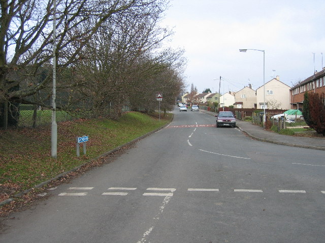
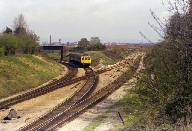
Matson is well-connected to Gloucester and other nearby towns via a network of roads and public transportation. The area benefits from good transport links, including regular bus services that provide easy access to Gloucester city center and surrounding areas. The M5 motorway is also easily accessible, allowing for convenient travel to other parts of the country.

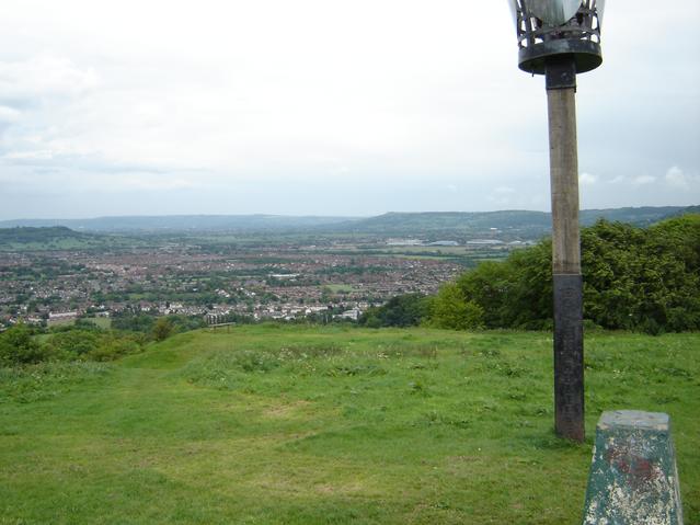
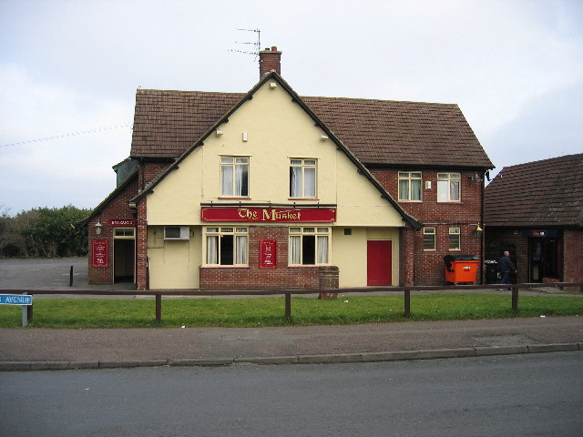
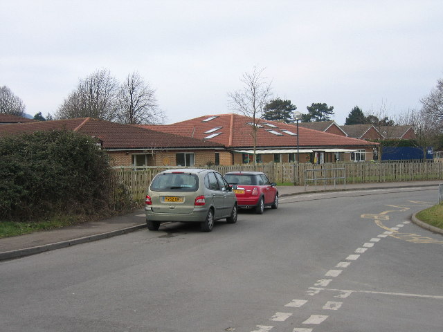
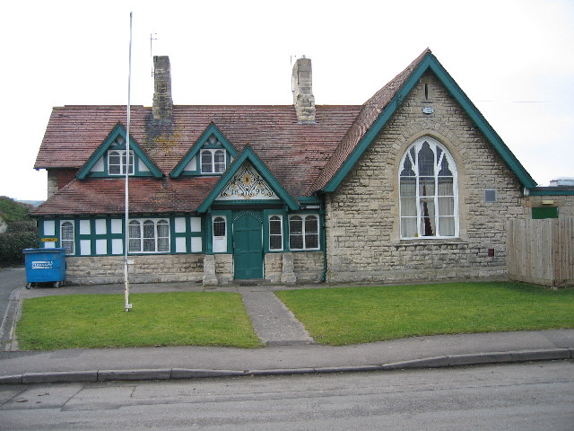
The community in Matson is diverse, with a mix of families, professionals, and retirees residing in the area. The district is home to several amenities, including a local primary school, shops, a community center, and a pub. Additionally, the nearby Robinswood Hill Country Park offers residents the opportunity to enjoy outdoor activities and beautiful natural surroundings.

Matson has a strong sense of community, with various local groups and organizations providing support and opportunities for residents to engage in social activities. The area is known for its friendly atmosphere and close-knit community spirit.

Overall, Matson, Gloucestershire is a residential area that offers a convenient location, good transport links, and a welcoming community for its residents.

If you have any feedback on the listing, please let us know in the comments section below.
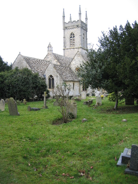
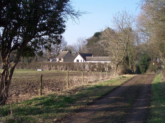
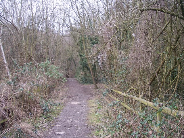
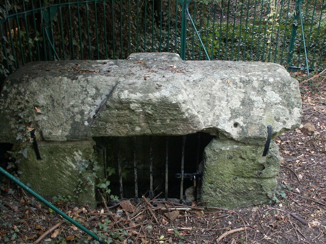
Matson Images

Images are sourced within 2km of 51.836788/-2.215787 or Grid Reference SO8515. Thanks to Geograph Open Source API. All images are credited.

Trigpoint, Robinswood Hill, Gloucestershire This is the trigpoint at the top of Robinswood Hill, Gloucester and Cheltenham are visible in the distance. The beacon was used during the Golden Jubilee.
Trigpoint, Robinswood Hill, Gloucestershire
This is the trigpoint at the top of Robinswood Hill, Gloucester and Cheltenham are visible in the distance. The beacon was used during the Golden Jubilee.
St Barnabas's Church, Gloucester By the roundabout at the junction of Stroud Road and Cole Avenue.
St Barnabas's Church, Gloucester
By the roundabout at the junction of Stroud Road and Cole Avenue.
Tredworth Cemetery, Gloucester The chapel in this large cemetery near the old Gloucester bypass.
Tredworth Cemetery, Gloucester
The chapel in this large cemetery near the old Gloucester bypass.
Sneedham's Green Sneedham's Green is common land with sheep grazing. These sheep have no fences or animal grids to enclose them. Apparently the flock has learned where it is allowed to go.
Sneedham's Green
Sneedham's Green is common land with sheep grazing. These sheep have no fences or animal grids to enclose them. Apparently the flock has learned where it is allowed to go.
The Turmut Hoer Abbeymead A turmut hoer hoes turnips!
The Turmut Hoer Abbeymead
A turmut hoer hoes turnips!
Abbeymead Primary School
Curlew Road Gloucester The houses in this part of town all face onto the wrong road, the address being the vehicle access at the back, very confusing for visitors and deliverymen.
Curlew Road Gloucester
The houses in this part of town all face onto the wrong road, the address being the vehicle access at the back, very confusing for visitors and deliverymen.
The Musket Matson
The Musket Matson
Primary  School Upton St Leonards
Primary School Upton St Leonards
Bowden Hall Hotel Upton St Leonards Once a country house
Bowden Hall Hotel Upton St Leonards
Once a country house
Matson Lane Looking North A large housing estate to the right and a country park to the left
Matson Lane Looking North
A large housing estate to the right and a country park to the left
The Village Institute Upton St Leonards
Parish Church Upton St Leonards
Old Road from Manor Farm to Bondend Looking north along the lane.
Old Road from Manor Farm to Bondend
Looking north along the lane.
Footpath up Robins Wood Hill Looking north east up the hill.
Footpath up Robins Wood Hill
Looking north east up the hill.
Robins Wood Hill Spring Cross The spring provided water to the city of Gloucester for more than 400 years. in the reign of Edward 3rd, it became the subject of a dispute between the Grey Friars and St Peters Abbey, concerning the quantity of water the former was to receive, which was settled by the King in 1350.
Robins Wood Hill Spring Cross
The spring provided water to the city of Gloucester for more than 400 years. in the reign of Edward 3rd, it became the subject of a dispute between the Grey Friars and St Peters Abbey, concerning the quantity of water the former was to receive, which was settled by the King in 1350.
Tuffley Junction A DMU from Gloucester Eastgate approaches Tuffley Junction on the former Midland Railway line.  This line was plagued with level crossings and was eventually closed and lifted in the 1970s when all traffic was diverted into Gloucester Central.  The line on the right, today's main line, is the former Great Western Main line from Gloucester South Junction.  The course of line can be seen on the OS maps by examining the fence lines behind the buildings on Stroud Road.
Tuffley Junction
A DMU from Gloucester Eastgate approaches Tuffley Junction on the former Midland Railway line. This line was plagued with level crossings and was eventually closed and lifted in the 1970s when all traffic was diverted into Gloucester Central. The line on the right, today's main line, is the former Great Western Main line from Gloucester South Junction. The course of line can be seen on the OS maps by examining the fence lines behind the buildings on Stroud Road.
Gloucester Crematorium
Show me another place!

Matson is located at Grid Ref: SO8515 (Lat: 51.836788, Lng: -2.215787)

Administrative County: Gloucestershire

District: Gloucester

Police Authority: Gloucestershire

What 3 Words

///handed.gave.oval. Near Barnwood, Gloucestershire

Nearby Locations

Matson

Related Wikis

Matson, Gloucester

Matson is a suburb of Gloucester, in the county of Gloucestershire, England. In 1931 the parish had a population of 40. == History == Unlike neighbouring...

Gloucester Academy

Gloucester Academy, was formed as a merger of Bishop's College, a mixed CofE school and Central Technology College, a boys school, starting life on the...
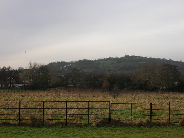
Robinswood Hill

Robinswood Hill (grid reference SO840150) is a hill and country park to the south of the city centre of Gloucester, close to the Stroud Road (A4173). It...

Gloucestershire Wildlife Trust

The Gloucestershire Wildlife Trust is the Gloucestershire local partner in a conservation network of 46 Wildlife Trusts. The Wildlife Trusts are local...

Nearby Amenities

Located within 500m of 51.836788,-2.215787
Traffic Signals
Lat/Long: 51.8357974/-2.2110233
Matson
Is In: Gloucester, Gloucestershire, England, UK
Place: suburb
Lat/Long: 51.8350068/-2.2146264
Noexit: yes
Lat/Long: 51.8341667/-2.2104683
Post Box
Brand: Royal Mail
Brand Wikidata: Q638098
Collection Times: Mo-Fr 17:45
Mapillary: 873020599945605
Operator: Royal Mail
Operator Wikidata: Q638098
Post Box Type: pillar
Ref: GL4 109
Source: survey
Survey Date: 2020-08-08
Lat/Long: 51.8351867/-2.2141568
Telephone
Booth: KX300
Covered: booth
Created By: Potlatch 0.9c
Mapillary: 202496674898273
Survey Date: 2020-08-08
Lat/Long: 51.8342583/-2.2145957
Pharmacy
Matson Pharmacy
Dispensing: yes
Lat/Long: 51.8346289/-2.2140736
Post Office
Matson Post Office
Addr City: Gloucester
Addr Country: GB
Addr Housenumber: 75
Addr Postcode: GL4 6LL
Addr Street: Matson Avenue
Addr Village: Matson
Opening Hours: Mo-Sa 06:30-19:00; Su 07:30-13:00
Operator: Martin's
Ref Pol Id: 7241
Lat/Long: 51.8351539/-2.2140032
Matson RFC
Description: Matson Rugby Football Club
Sport: rugby
Lat/Long: 51.8334439/-2.2171837
Ele: 44.8269043
Waterway: confluence
Lat/Long: 51.8362888/-2.2111608
Note: Drain enters stream here
Lat/Long: 51.837435/-2.2114311
Ele: 43.8654785
Note: Drain enters stream
Lat/Long: 51.8384639/-2.2116628
Addr City: Gloucester
Addr Housenumber: 8a,8b
Addr Street: Garnalls Road
Ele: 42.9041748
Lat/Long: 51.8390545/-2.2134906
Addr City: Gloucester
Addr Housenumber: 6a,6b
Addr Street: Garnalls Road
Ele: 43.3847656
Lat/Long: 51.8391659/-2.2135593
Addr City: Gloucester
Addr Housenumber: 4a,4b
Addr Street: Garnalls Road
Ele: 43.3847656
Lat/Long: 51.8392561/-2.2135936
Addr City: Gloucester
Addr Housenumber: 2a,2b
Addr Street: Garnalls Road
Ele: 43.8654785
Lat/Long: 51.8393727/-2.2136537
Ele: 42.1832275
Note: Two drains enter stream on opposite banks at this point
Lat/Long: 51.839079/-2.2120062
Ele: 42.4235840
Note: A drain enters the stream here
Lat/Long: 51.8391957/-2.2120062
Ele: 36.6557617
Note: A drain enters the stream here
Lat/Long: 51.8397154/-2.2125898
Ele: 38.8186035
Note: A drain enters the stream here
Lat/Long: 51.8401715/-2.2130533
Bus Stop
Bus: yes
Note: No reference
Public Transport: platform
Source: survey
Lat/Long: 51.8354764/-2.2107277
Note: Parish boundary marker
Lat/Long: 51.8379888/-2.2224476
Cherry Tree Court
Addr Housenumber: 1-6
Lat/Long: 51.8398661/-2.2177784
Bench
Lat/Long: 51.8408366/-2.2175381
Parking
Lat/Long: 51.8396434/-2.2195894
Parking
Lat/Long: 51.8395638/-2.2200787
Public Building
Katherine Wheel Club
Source: survey
Lat/Long: 51.8403275/-2.2184994
Cherry Tree Court
Addr Housenumber: 7-12
Lat/Long: 51.8396487/-2.2179672
Taylor House
Lat/Long: 51.8397972/-2.2187397
Barrier: bollard
Lat/Long: 51.8394379/-2.2179832
Barrier: entrance
Lat/Long: 51.8391873/-2.2207739
Bus Stop
Garnalls Road
Bus: yes
Naptan AtcoCode: 1600GL3699
Naptan Bearing: S
Naptan CommonName: Garnalls Rd
Naptan Indicator: Opp
Naptan NaptanCode: glodgmjd
Naptan PlusbusZoneRef: GLOSTER
Naptan Street: Painswick Rd
Naptan Verified: no
Public Transport: platform
Source: naptan_import
Lat/Long: 51.8372252/-2.2120195
Bus Stop
Garnalls Road
Bus: yes
Naptan AtcoCode: 1600GL3700
Naptan Bearing: N
Naptan CommonName: Garnalls Rd
Naptan NaptanCode: glodgmga
Naptan PlusbusZoneRef: GLOSTER
Naptan Street: Painswick Rd
Naptan Verified: no
Public Transport: platform
Source: naptan_import
Lat/Long: 51.8375842/-2.212355
Bus Stop
Prinknash Road
Bus: yes
Naptan AtcoCode: 1600GL3703
Naptan Bearing: S
Naptan CommonName: Prinknash Rd
Naptan Indicator: Opp
Naptan NaptanCode: glodgmag
Naptan PlusbusZoneRef: GLOSTER
Naptan Street: Painswick Rd
Naptan Verified: no
Public Transport: platform
Source: naptan_import
Lat/Long: 51.8396955/-2.2132649
Bus Stop
Prinknash Road
Bus: yes
Naptan AtcoCode: 1600GL3704
Naptan Bearing: N
Naptan CommonName: Prinknash Rd
Naptan NaptanCode: glodgjwd
Naptan PlusbusZoneRef: GLOSTER
Naptan Street: Painswick Rd
Naptan Verified: no
Public Transport: platform
Source: naptan_import
Lat/Long: 51.8397041/-2.2134972
Bus Stop
The Old Police Station
Bus: yes
Naptan AtcoCode: 1600GLB145
Naptan Bearing: S
Naptan CommonName: Police Station
Naptan Indicator: Opp
Naptan NaptanCode: glodgjgj
Naptan PlusbusZoneRef: GLOSTER
Naptan Street: Matson Ave
Naptan Verified: no
Note: Looks great to me, I've changed name to Old Police Station as the station has been a residential property for about 15 years... will survey soon
Public Transport: platform
Source: naptan_import
Lat/Long: 51.8392731/-2.2156052
Bus Stop
The Old Police Station
Bus: yes
Naptan AtcoCode: 1600GLB146
Naptan Bearing: N
Naptan CommonName: Police Station
Naptan NaptanCode: glodgjgd
Naptan PlusbusZoneRef: GLOSTER
Naptan Street: Matson Ave
Naptan Verified: no
Note: Looks great to me, I've changed name to Old Police Station as the station has been a residential property for about 15 years... will survey soon
Public Transport: platform
Source: naptan_import
Lat/Long: 51.8391193/-2.2157168
Bus Stop
Robinswood Junior School
Bus: yes
Naptan AtcoCode: 1600GLB147
Naptan Bearing: S
Naptan CommonName: Robinswood Junior School
Naptan NaptanCode: glodgjmt
Naptan PlusbusZoneRef: GLOSTER
Naptan Street: Matson Ave
Naptan Verified: yes
Note: Verified against existing OSM bus stop, copied over existing bus stop tags and deleted the OSM version of this stop. Used OSM name as this is the one used on stop.
Operator: Stagecoach
Public Transport: platform
Source: naptan_import
Lat/Long: 51.8373374/-2.2144637
Bus Stop
Robinswood Junior School
Loc Name: Winsley Road
Naptan AtcoCode: 1600GLB148
Naptan Bearing: N
Naptan CommonName: Robinswood Junior School
Naptan NaptanCode: glodgjmd
Naptan PlusbusZoneRef: GLOSTER
Naptan Street: Matson Ave
Naptan Verified: yes
Note: I have copied over tags from the old OSM version of this stop which has now been deleted. The name used on the OSM version of this stop is different than used in NaPTAN and I have added this to this node in a name:local tag
Operator: Stagecoach
Shelter: yes
Source: naptan_import
Lat/Long: 51.837788/-2.2148421
Bus Stop
Shops
Bus: yes
Loc Name: Matson Shops
Naptan AtcoCode: 1600GLB149
Naptan Bearing: S
Naptan CommonName: Matson Shops
Naptan NaptanCode: glodgjpt
Naptan PlusbusZoneRef: GLOSTER
Naptan Street: Matson Ave
Naptan Verified: yes
Note: Verified against existing OSM bus stop, copied over existing bus stop tags and deleted the OSM version of this stop
Operator: Stagecoach
Public Transport: platform
Shelter: yes
Source: naptan_import
Lat/Long: 51.8348873/-2.2142393
Bus Stop
Shops
Bus: yes
Naptan AtcoCode: 1600GLB150
Naptan Bearing: N
Naptan CommonName: Matson Shops
Naptan Indicator: Opp
Naptan NaptanCode: glodgjgw
Naptan PlusbusZoneRef: GLOSTER
Naptan Street: Matson Ave
Naptan Verified: no
Note: Verified against existing OSM bus stop, copied over existing bus stop tags and deleted the OSM version of this stop
Operator: Stagecoach
Public Transport: platform
Shelter: yes
Source: naptan_import
Lat/Long: 51.8348977/-2.2149873
Bus Stop
Winnycroft Lane
Naptan AtcoCode: 1600GLB151
Naptan Bearing: SW
Naptan CommonName: Winnycroft Ln
Naptan NaptanCode: glodgjgp
Naptan PlusbusZoneRef: GLOSTER
Naptan Street: Matson Ave
Naptan Verified: yes
Source: naptan_import
Lat/Long: 51.8326012/-2.2161546
Bus Stop
Winnycroft Lane
Naptan AtcoCode: 1600GLB152
Naptan Bearing: NE
Naptan CommonName: Winnycroft Ln
Naptan NaptanCode: glodgjdt
Naptan PlusbusZoneRef: GLOSTER
Naptan Street: Matson Ave
Naptan Verified: yes
Source: naptan_import
Lat/Long: 51.8327178/-2.2160945
Bus Stop
Painswick Road school stop
Bus: yes
Departures Board: no
Naptan AtcoCode: 1600GLB437
Naptan Bearing: SW
Naptan CommonName: Painswick Rd
Naptan NaptanCode: glodgpag
Naptan PlusbusZoneRef: GLOSTER
Naptan ShortCommonName: Probably School Bus Only
Naptan Street: Wheatway
Naptan Verified: no
Public Transport: platform
Shelter: no
Source: naptan_import
Lat/Long: 51.8361147/-2.210095
Bus Stop
Painswick Rd school stop
Bus: yes
Departures Board: no
Naptan AtcoCode: 1600GLB438
Naptan Bearing: NE
Naptan CommonName: Painswick Rd
Naptan NaptanCode: glodgpaw
Naptan PlusbusZoneRef: GLOSTER
Naptan ShortCommonName: Probably School Bus Only
Naptan Street: Wheatway
Naptan Verified: no
Public Transport: platform
Shelter: no
Source: naptan_import
Lat/Long: 51.8362589/-2.2100363
Bus Stop
Wheatway
Bus: yes
Naptan AtcoCode: 1600GLB441
Naptan Bearing: S
Naptan CommonName: Wheatway
Naptan NaptanCode: glodgmwd
Naptan PlusbusZoneRef: GLOSTER
Naptan Street: Painswick Road
Naptan Verified: no
Public Transport: platform
Source: naptan_import
Lat/Long: 51.8352676/-2.2106316
Bus Stop
Wheatway
Naptan AtcoCode: 1600GLB442
Naptan Bearing: N
Naptan CommonName: Wheatway
Naptan Indicator: Opp
Naptan NaptanCode: glodgmtp
Naptan PlusbusZoneRef: GLOSTER
Naptan Street: Painswick Rd
Naptan Verified: no
Source: naptan_import
Lat/Long: 51.8353032/-2.2108204
Historic: bus_stop
Note: NaPTAN data replaced this.
Operator: Stagecoach
Lat/Long: 51.8328133/-2.2155709
Matson Avenue
Power: substation
Ref: 5234
Source: survey
Lat/Long: 51.838875/-2.2157597
Post Box
Brand: Royal Mail
Brand Wikidata: Q638098
Fixme: resurvey
Note: No faceplate at time of survey, will resurvey. Replaces nearby postbox which was placed from memory and not accurately positioned.
Operator: Royal Mail
Operator Wikidata: Q638098
Post Box Mounting: pier
Post Box Type: lamp
Lat/Long: 51.8381222/-2.2149977
Barrier: cycle_barrier
Lat/Long: 51.8391293/-2.2161507
Fixme: This telephone box appears to be missing on Street Level Imagery. Please confirm if it has been removed or is in a different location.
Mapillary: 135142658650304
Phone: +44 1452 525100
Removed Amenity: telephone
Source: survey
Survey Date: 2020-08-08
Lat/Long: 51.8399468/-2.2157174
Atm
Note: position_approx
Source: local knowledge
Lat/Long: 51.8351072/-2.214077
Barrier: bollard
Source: Bing
Lat/Long: 51.8367951/-2.2142458
Barrier: bollard
Source: Bing
Lat/Long: 51.8357033/-2.2143156
Fixme: This telephone box appears to be missing on Street Level Imagery. Please confirm if it has been removed or is in a different location.
Mapillary: 1491975881143499
Removed Amenity: telephone
Source: Bing
Survey Date: 2020-08-08
Lat/Long: 51.8355562/-2.2143263
Barrier: bollard
Source: Bing
Lat/Long: 51.8357149/-2.2143344
Barrier: bollard
Source: Bing
Lat/Long: 51.8408324/-2.2171529
Barrier: bollard
Source: Bing
Lat/Long: 51.8408415/-2.2171724
Barrier: bollard
Source: Bing
Lat/Long: 51.8408154/-2.2171167
Barrier: bollard
Source: Bing
Lat/Long: 51.8408506/-2.2171912
Barrier: bollard
Source: Bing
Lat/Long: 51.8408593/-2.2172106
Barrier: bollard
Source: Bing
Lat/Long: 51.840868/-2.2172274
Barrier: bollard
Source: Bing
Lat/Long: 51.8408249/-2.2171342
Street Lamp
Source: Bing
Lat/Long: 51.8379668/-2.2225837
Source: Bing
Traffic Calming: hump
Lat/Long: 51.8382448/-2.2224455
Street Lamp
Source: Bing
Lat/Long: 51.836963/-2.2217603
Street Lamp
Source: Bing
Lat/Long: 51.8385175/-2.2224074
Street Lamp
Source: Bing
Lat/Long: 51.8382652/-2.222518
Power: pole
Source: Bing
Lat/Long: 51.8397825/-2.2138114
Street Lamp
Source: Bing
Lat/Long: 51.839787/-2.2136706
Street Lamp
Source: Bing
Lat/Long: 51.8353781/-2.2108792
Street Lamp
Source: Bing
Lat/Long: 51.8357714/-2.2111515
Street Lamp
Source: Bing
Lat/Long: 51.8351768/-2.2105573
Street Lamp
Source: Bing
Lat/Long: 51.8352729/-2.2110784
Street Lamp
Source: Bing
Lat/Long: 51.835623/-2.2108122
Street Lamp
Source: Bing
Lat/Long: 51.8335693/-2.210839
Street Lamp
Source: Bing
Lat/Long: 51.833748/-2.2112083
Street Lamp
Source: Bing
Lat/Long: 51.8344756/-2.2112639
Street Lamp
Source: Bing
Lat/Long: 51.8340194/-2.2112773
Street Lamp
Source: Bing
Lat/Long: 51.8350275/-2.2113678
Street Lamp
Source: Bing
Lat/Long: 51.8353593/-2.2113864
Street Lamp
Source: Bing
Lat/Long: 51.8347622/-2.2111417
Street Lamp
Source: Bing
Lat/Long: 51.8342343/-2.2111296
Barrier: bollard
Source: Bing
Lat/Long: 51.8350028/-2.2122654
Barrier: bollard
Source: Bing
Lat/Long: 51.8350459/-2.212319
Barrier: bollard
Source: Bing
Lat/Long: 51.835038/-2.2123069
Barrier: bollard
Source: Bing
Lat/Long: 51.8350964/-2.2124055
Barrier: bollard
Source: Bing
Lat/Long: 51.8350206/-2.2122855
Barrier: bollard
Source: Bing
Lat/Long: 51.8350678/-2.2123539
Barrier: bollard
Source: Bing
Lat/Long: 51.8350757/-2.2123673
Street Lamp
Source: Bing
Lat/Long: 51.8352502/-2.2126697
Barrier: bollard
Source: Bing
Lat/Long: 51.8348445/-2.2121735
Barrier: bollard
Source: Bing
Lat/Long: 51.8349315/-2.2122084
Barrier: bollard
Source: Bing
Lat/Long: 51.834987/-2.2122493
Barrier: bollard
Source: Bing
Lat/Long: 51.8350885/-2.2123914
Barrier: bollard
Source: Bing
Lat/Long: 51.834796/-2.2121701
Barrier: bollard
Source: Bing
Lat/Long: 51.8348876/-2.2121836
Barrier: bollard
Source: Bing
Lat/Long: 51.8348238/-2.2121715
Power: pole
Source: Bing
Lat/Long: 51.8344898/-2.2122225
Street Lamp
Source: Bing
Lat/Long: 51.8348793/-2.2120535
Barrier: bollard
Source: Bing
Lat/Long: 51.8349075/-2.2121943
Barrier: bollard
Source: Bing
Lat/Long: 51.8351035/-2.2124189
Barrier: bollard
Source: Bing
Lat/Long: 51.8349671/-2.2122305
Barrier: bollard
Source: Bing
Lat/Long: 51.8350277/-2.2122955
Barrier: bollard
Source: Bing
Lat/Long: 51.8349224/-2.212201
Barrier: bollard
Source: Bing
Lat/Long: 51.8348333/-2.2121722
Barrier: bollard
Source: Bing
Lat/Long: 51.8349576/-2.2122238
Barrier: bollard
Source: Bing
Lat/Long: 51.8351217/-2.2124565
Street Lamp
Source: Bing
Lat/Long: 51.8351002/-2.2121272
Barrier: bollard
Source: Bing
Lat/Long: 51.8351184/-2.2124451
Barrier: bollard
Source: Bing
Lat/Long: 51.8348967/-2.2121876
Barrier: bollard
Source: Bing
Lat/Long: 51.8348143/-2.2121701
Barrier: bollard
Source: Bing
Lat/Long: 51.8348549/-2.2121755
Barrier: bollard
Source: Bing
Lat/Long: 51.8350123/-2.2122748
Barrier: bollard
Source: Bing
Lat/Long: 51.8348669/-2.2121789
Barrier: bollard
Source: Bing
Lat/Long: 51.8350608/-2.2123411
Street Lamp
Source: Bing
Lat/Long: 51.8353944/-2.212549
Barrier: bollard
Source: Bing
Lat/Long: 51.8347844/-2.2121715
Barrier: bollard
Source: Bing
Lat/Long: 51.8350533/-2.2123297
Barrier: bollard
Source: Bing
Lat/Long: 51.8351113/-2.2124317
Street Lamp
Source: Bing
Lat/Long: 51.8346025/-2.2121802
Barrier: bollard
Source: Bing
Lat/Long: 51.8349414/-2.2122124
Street Lamp
Source: Bing
Lat/Long: 51.835207/-2.2124095
Barrier: bollard
Source: Bing
Lat/Long: 51.8348777/-2.2121802
Barrier: bollard
Source: Bing
Lat/Long: 51.8349941/-2.212256
Barrier: bollard
Source: Bing
Lat/Long: 51.8348051/-2.2121688
Barrier: bollard
Source: Bing
Lat/Long: 51.8349485/-2.2122171
Barrier: bollard
Source: Bing
Lat/Long: 51.8350823/-2.2123807
Barrier: bollard
Source: Bing
Lat/Long: 51.8349763/-2.2122392
Street Lamp
Source: Bing
Lat/Long: 51.8343726/-2.2120334
Street Lamp
Source: Bing
Lat/Long: 51.834977/-2.2129113
Street Lamp
Source: Bing
Lat/Long: 51.8350396/-2.2126209
Street Lamp
Source: Bing
Lat/Long: 51.8351755/-2.213026
Street Lamp
Source: Bing
Lat/Long: 51.8367658/-2.2117234
Street Lamp
Source: Bing
Lat/Long: 51.8364327/-2.2116442
Street Lamp
Source: Bing
Lat/Long: 51.8361588/-2.211437
Street Lamp
Source: Bing
Lat/Long: 51.8363614/-2.21079
Power: pole
Source: Bing
Lat/Long: 51.8366896/-2.211655
Street Lamp
Source: Bing
Lat/Long: 51.8366004/-2.210729
Barrier: bollard
Source: Bing
Lat/Long: 51.8379458/-2.2137933
Barrier: bollard
Source: Bing
Lat/Long: 51.8379416/-2.2138147
Street Lamp
Source: Bing
Lat/Long: 51.8380601/-2.2137772
Barrier: bollard
Source: Bing
Lat/Long: 51.8379495/-2.2137752
Barrier: bollard
Source: Bing
Lat/Long: 51.8379586/-2.2137343
Power: pole
Source: Bing
Lat/Long: 51.8379495/-2.2137504
Barrier: bollard
Source: Bing
Lat/Long: 51.8379793/-2.2139576
Barrier: bollard
Source: Bing
Lat/Long: 51.837971/-2.2139864
Street Lamp
Source: Bing
Lat/Long: 51.8378269/-2.2137329
Barrier: bollard
Source: Bing
Lat/Long: 51.8380481/-2.2138858
Barrier: bollard
Source: Bing
Lat/Long: 51.8380079/-2.213908
Addr Housenumber: 35, 35a
Lat/Long: 51.8380614/-2.2136444
Barrier: bollard
Source: Bing
Lat/Long: 51.8379918/-2.2139281
Barrier: bollard
Lat/Long: 51.8380862/-2.2138905
Barrier: bollard
Source: Bing
Lat/Long: 51.8380253/-2.2138939
Street Lamp
Source: Bing
Lat/Long: 51.8370645/-2.2133661
Street Lamp
Source: Bing
Lat/Long: 51.837248/-2.2131214
Street Lamp
Source: Bing
Lat/Long: 51.8373123/-2.213454
Power: pole
Source: Bing
Lat/Long: 51.8375182/-2.2135197
Street Lamp
Source: Bing
Lat/Long: 51.83757/-2.2135941
Barrier: bollard
Source: Bing
Lat/Long: 51.8371308/-2.2133407
Barrier: bollard
Source: Bing
Lat/Long: 51.8372054/-2.2132495
Barrier: bollard
Source: Bing
Lat/Long: 51.8371921/-2.2132783
Barrier: bollard
Source: Bing
Lat/Long: 51.8370848/-2.2133514
Barrier: bollard
Source: Bing
Lat/Long: 51.8371623/-2.2133179
Barrier: bollard
Source: Bing
Lat/Long: 51.8371043/-2.2133481
Barrier: bollard
Source: Bing
Lat/Long: 51.8371747/-2.2133025
Barrier: bollard
Source: Bing
Lat/Long: 51.8370595/-2.2133446
Barrier: bollard
Source: Bing
Lat/Long: 51.8372137/-2.213226
Street Lamp
Source: Bing
Lat/Long: 51.837331/-2.2126717
Street Lamp
Source: Bing
Lat/Long: 51.8375299/-2.2126254
Addr Housenumber: 2
Addr Street: The Oaks
Source: survey
Lat/Long: 51.8350323/-2.2199393
Addr Housenumber: 10
Addr Street: The Oaks
Source: survey
Lat/Long: 51.8348293/-2.2196765
Addr Housenumber: 8
Addr Street: The Oaks
Source: survey
Lat/Long: 51.8348872/-2.2197194
Addr Housenumber: 6
Addr Street: The Oaks
Source: survey
Lat/Long: 51.83498/-2.2197724
Addr Housenumber: 4
Addr Street: The Oaks
Source: survey
Lat/Long: 51.8350368/-2.2198435
Fee: no
Lat/Long: 51.8338421/-2.2173302
Cafe
Together in Matson
Lat/Long: 51.8338672/-2.2164187
Crossing
Crossing: marked
Lat/Long: 51.8375795/-2.2146609
Barrier: kissing_gate
Foot: yes
Source: survey;gps
Lat/Long: 51.8335178/-2.211455
Barrier: stile
Foot: yes
Source: survey;gps
Lat/Long: 51.8331175/-2.2118326
Waste Basket
Operator: Gloucester City Council
Source: survey;gps
Waste: trash;dog_excrement
Lat/Long: 51.839123/-2.2103133
Barrier: cycle_barrier
Foot: yes
Source: survey;gps
Lat/Long: 51.8403225/-2.2125906
Waste Basket
Operator: Gloucester City Council
Source: survey
Waste: dog_excrement
Lat/Long: 51.8349062/-2.2144872
Fast Food
Jade Garden
Fixme: Check if this is still here
Survey Date: 2020-08-08
Lat/Long: 51.8345552/-2.2140898
Jane's Pantry
Fixme: Check if this is still here
Shop: grocery
Survey Date: 2020-08-08
Lat/Long: 51.8347068/-2.2140589
Spinners
Fixme: Check if this is still here
Shop: laundry
Survey Date: 2020-08-08
Lat/Long: 51.8347524/-2.2140522
Disused Amenity: cafe
Fixme: Check if this is still here
Old Name: Matson Gateway
Survey Date: 2020-08-08
Lat/Long: 51.8348237/-2.2140509
Matson Mini Market
Brand: Premier
Brand Wikidata: Q7240340
Shop: convenience
Survey Date: 2020-08-08
Website: https://www.premier-stores.co.uk/our-stores/matson-mini-market
Lat/Long: 51.8349944/-2.2140348
The Matson Store
Fixme: Check if this is still here
Shop: general
Survey Date: 2020-08-08
Lat/Long: 51.8352828/-2.2139959
Glam
Fixme: Check if this is still here
Shop: hairdresser
Survey Date: 2020-08-08
Lat/Long: 51.835209/-2.2139986
Martin's
Brand: Martin's
Brand Wikidata: Q116779207
Shop: newsagent
Website: https://my.morrisons.com/storefinder/65905/martins-matson-75-matson-avenue
Lat/Long: 51.8350914/-2.2140187
Traffic Calming: hump
Lat/Long: 51.8386331/-2.215289
The data included in this document is from www.openstreetmap.org. The data is made available under ODbL.

Have you been to Matson?

Leave your review of Matson below (or comments, questions and feedback).