Matlock Bank

Settlement in Derbyshire Derbyshire Dales

England

Matlock Bank

Sandy Lane heading to Sandy Lane Farm
Sandy Lane heading to Sandy Lane Farm Credit: Neil Theasby

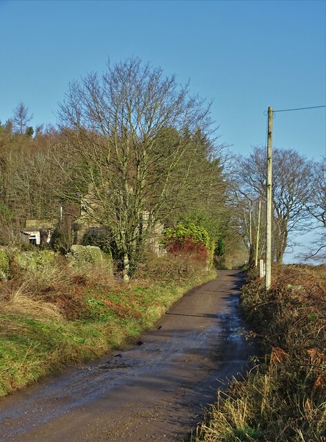
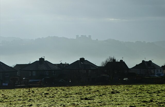
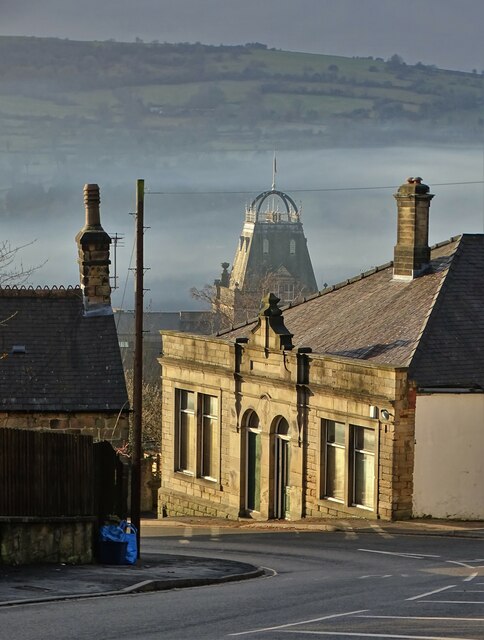
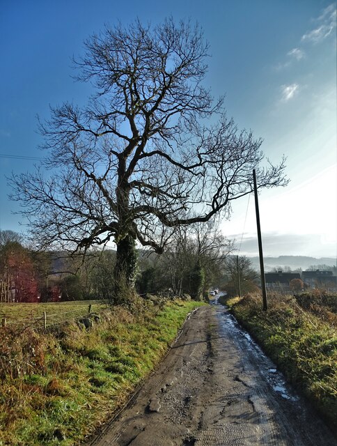
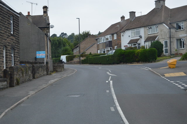
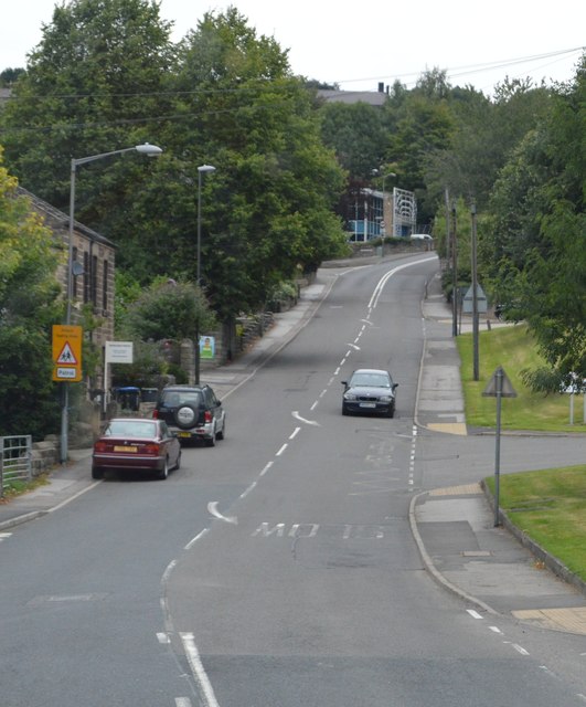
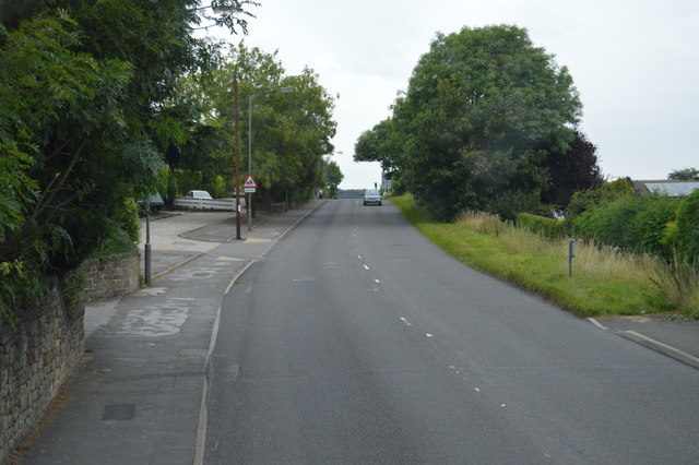
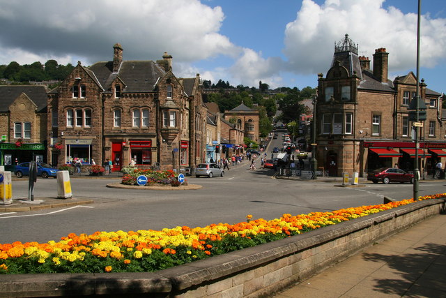
Matlock Bank is a residential area located in the town of Matlock, Derbyshire, in the United Kingdom. Situated on a steep hillside, it offers stunning panoramic views of the surrounding countryside and the River Derwent. Matlock Bank is known for its charming Victorian and Edwardian houses, which add to the area's character and appeal.

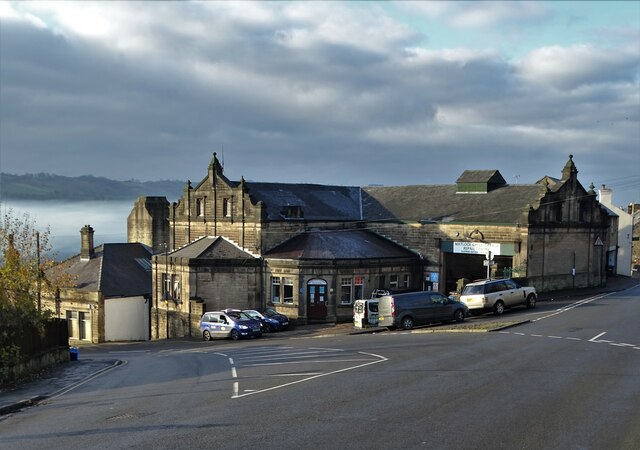
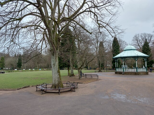
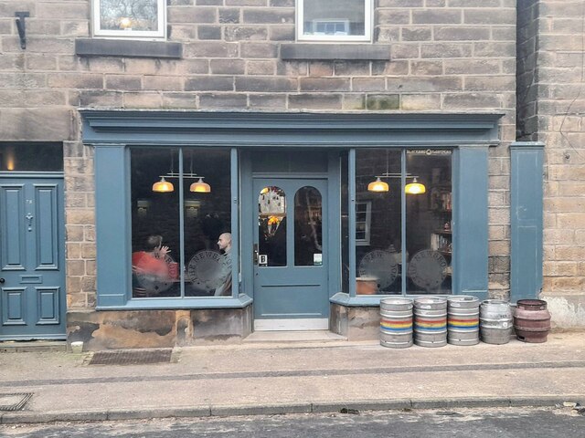
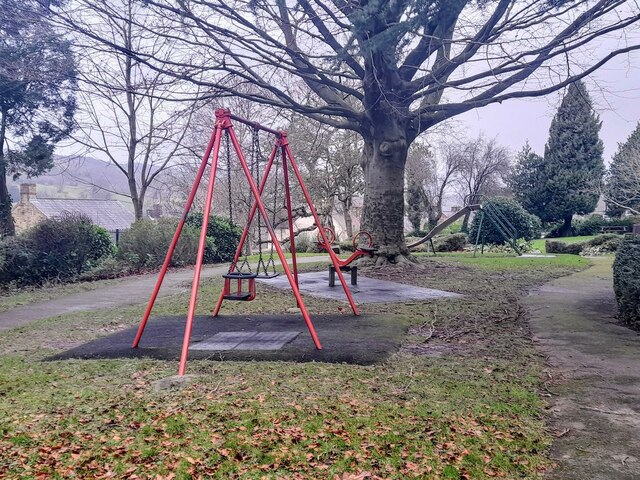
The area is well-served by local amenities, including shops, restaurants, and pubs, making it a desirable place to live. Matlock Bank also benefits from being within close proximity to Matlock town center, which provides residents with access to a wider range of facilities and services.

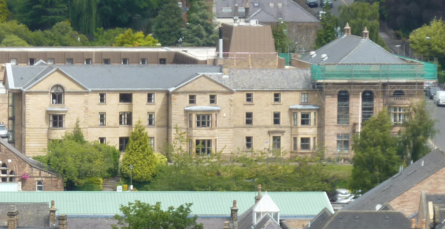
One of the notable landmarks in Matlock Bank is Riber Castle, a Grade II listed building that dominates the skyline. Built in the mid-19th century, it now serves as luxury apartments and offers a unique living experience.

Nature enthusiasts will appreciate the nearby High Tor, a limestone cliff that provides breathtaking views of the surrounding countryside and is a popular spot for rock climbing and hiking. Matlock Bank is also close to the Peak District National Park, offering residents ample opportunities for outdoor activities, including walking, cycling, and exploring the picturesque landscapes.

The area benefits from excellent transport links, with regular bus services connecting it to Matlock town center and surrounding areas. Matlock Bank also has its own train station, providing convenient access to other towns and cities in the region.

Overall, Matlock Bank offers a picturesque and vibrant residential area with a range of amenities, stunning views, and easy access to both urban and natural attractions.

If you have any feedback on the listing, please let us know in the comments section below.
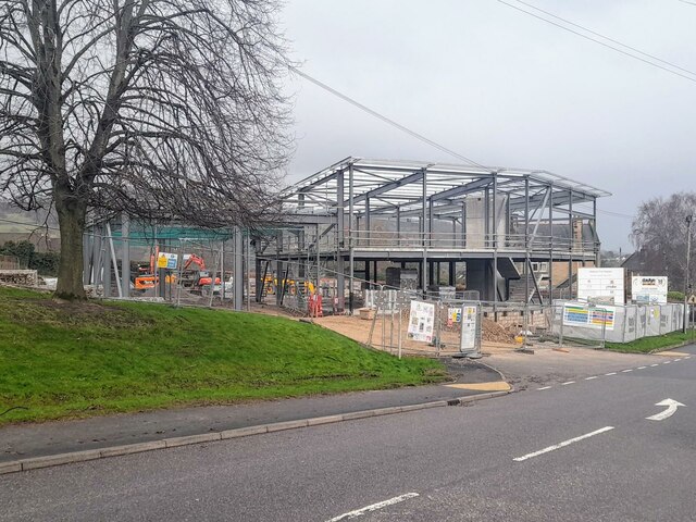
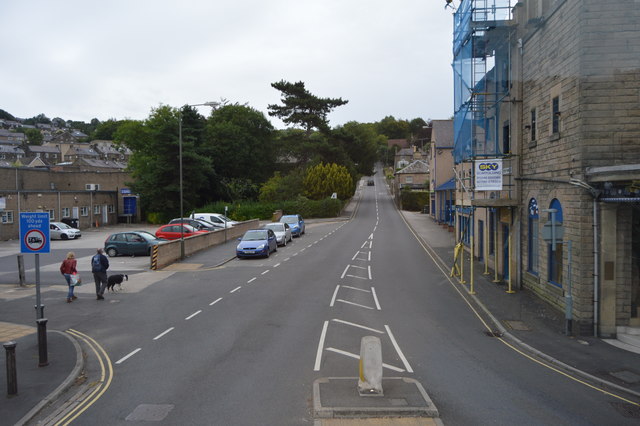
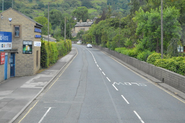
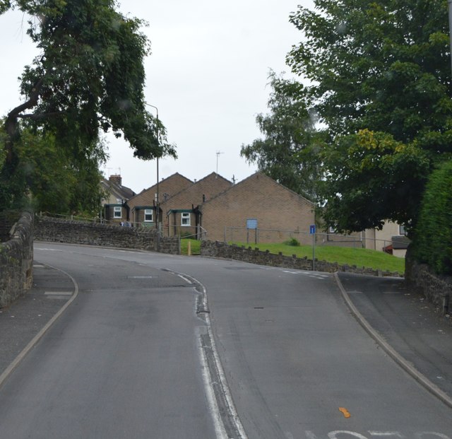
Matlock Bank Images

Images are sourced within 2km of 53.13989/-1.551494 or Grid Reference SK3060. Thanks to Geograph Open Source API. All images are credited.

Sandy Lane heading to Sandy Lane Farm
View to Riber Castle Over the rooftops of Gritstone Road. Riber Castle can be seen through misty air as a high pressure weather system settles over England.
View to Riber Castle
Over the rooftops of Gritstone Road. Riber Castle can be seen through misty air as a high pressure weather system settles over England.
View to the tower of Smedley's Hydro Seen from Wellington Street. Smedley's Hydro was a hydropathic facility developed in the second half of the nineteenth century. In the 1950's the old building was taken over by Derbyshire County Council, becoming the organisations administrative hub. The mist in the valley was related to a high pressure weather system settling over the north of England. The illuminated building on the corner was part of the old Matlock tram depot.
View to the tower of Smedley's Hydro
Seen from Wellington Street. Smedley's Hydro was a hydropathic facility developed in the second half of the nineteenth century. In the 1950's the old building was taken over by Derbyshire County Council, becoming the organisations administrative hub. The mist in the valley was related to a high pressure weather system settling over the north of England. The illuminated building on the corner was part of the old Matlock tram depot.
Former tram depot on Matlock Bank
Sandy Lane heading to Chesterfield Road The surface of this lane is dreadful. Speaking from personal experience, it is inadvisable to drive low-slung saloon cars along it.
Sandy Lane heading to Chesterfield Road
The surface of this lane is dreadful. Speaking from personal experience, it is inadvisable to drive low-slung saloon cars along it.
Hall Leys Park, Matlock
The Newsroom micropub A micropub in an old newsagents shop.
The Newsroom micropub
A micropub in an old newsagents shop.
Children's play area in Sparrow Park
New fire station under construction The 1950s fire station, pictured in <a href="https://www.geograph.org.uk/photo/2024536">SK3060 : Matlock fire station</a>, has been demolished, to be replaced by something more modern.
New fire station under construction
The 1950s fire station, pictured in SK3060 : Matlock fire station, has been demolished, to be replaced by something more modern.
Steep Turnpike
Steep Turnpike
A615 The A615 runs 8 miles from Matlock to Alfreton.
<span class="nowrap"><a title="http://www.sabre-roads.org.uk/wiki/index.php?title=A615" rel="nofollow ugc noopener" href="http://www.sabre-roads.org.uk/wiki/index.php?title=A615">Link</a><img style="margin-left:2px;" alt="External link" title="External link - shift click to open in new window" src="https://s1.geograph.org.uk/img/external.png" width="10" height="10"/></span>
A615
The A615 runs 8 miles from Matlock to Alfreton. LinkExternal link
A632 The A632 is a non-primary A-road connecting the Peak District with the Dukeries. It runs 22 miles from Matlock to Cuckney, via Chesterfield.
<span class="nowrap"><a title="http://www.sabre-roads.org.uk/wiki/index.php?title=A632" rel="nofollow ugc noopener" href="http://www.sabre-roads.org.uk/wiki/index.php?title=A632">Link</a><img style="margin-left:2px;" alt="External link" title="External link - shift click to open in new window" src="https://s1.geograph.org.uk/img/external.png" width="10" height="10"/></span>
A632
The A632 is a non-primary A-road connecting the Peak District with the Dukeries. It runs 22 miles from Matlock to Cuckney, via Chesterfield. LinkExternal link
A632, Lime Tree Rd The A632 is a non-primary A-road connecting the Peak District with the Dukeries. It runs 22 miles from Matlock to Cuckney, via Chesterfield.
<span class="nowrap"><a title="http://www.sabre-roads.org.uk/wiki/index.php?title=A632" rel="nofollow ugc noopener" href="http://www.sabre-roads.org.uk/wiki/index.php?title=A632">Link</a><img style="margin-left:2px;" alt="External link" title="External link - shift click to open in new window" src="https://s1.geograph.org.uk/img/external.png" width="10" height="10"/></span>
A632, Lime Tree Rd
The A632 is a non-primary A-road connecting the Peak District with the Dukeries. It runs 22 miles from Matlock to Cuckney, via Chesterfield. LinkExternal link
A632 The A632 is a non-primary A-road connecting the Peak District with the Dukeries. It runs 22 miles from Matlock to Cuckney, via Chesterfield.
<span class="nowrap"><a title="http://www.sabre-roads.org.uk/wiki/index.php?title=A632" rel="nofollow ugc noopener" href="http://www.sabre-roads.org.uk/wiki/index.php?title=A632">Link</a><img style="margin-left:2px;" alt="External link" title="External link - shift click to open in new window" src="https://s1.geograph.org.uk/img/external.png" width="10" height="10"/></span>
A632
The A632 is a non-primary A-road connecting the Peak District with the Dukeries. It runs 22 miles from Matlock to Cuckney, via Chesterfield. LinkExternal link
Building by the A632
Chesterfield Rd The A632 is a non-primary A-road connecting the Peak District with the Dukeries. It runs 22 miles from Matlock to Cuckney, via Chesterfield.
<span class="nowrap"><a title="http://www.sabre-roads.org.uk/wiki/index.php?title=A632" rel="nofollow ugc noopener" href="http://www.sabre-roads.org.uk/wiki/index.php?title=A632">Link</a><img style="margin-left:2px;" alt="External link" title="External link - shift click to open in new window" src="https://s1.geograph.org.uk/img/external.png" width="10" height="10"/></span>
Chesterfield Rd
The A632 is a non-primary A-road connecting the Peak District with the Dukeries. It runs 22 miles from Matlock to Cuckney, via Chesterfield. LinkExternal link
Duke of Wellington
Duke of Wellington
Chesterfield Rd The A632 is a non-primary A-road connecting the Peak District with the Dukeries. It runs 22 miles from Matlock to Cuckney, via Chesterfield.
<span class="nowrap"><a title="http://www.sabre-roads.org.uk/wiki/index.php?title=A632" rel="nofollow ugc noopener" href="http://www.sabre-roads.org.uk/wiki/index.php?title=A632">Link</a><img style="margin-left:2px;" alt="External link" title="External link - shift click to open in new window" src="https://s1.geograph.org.uk/img/external.png" width="10" height="10"/></span>
Chesterfield Rd
The A632 is a non-primary A-road connecting the Peak District with the Dukeries. It runs 22 miles from Matlock to Cuckney, via Chesterfield. LinkExternal link
Show me another place!

Matlock Bank is located at Grid Ref: SK3060 (Lat: 53.13989, Lng: -1.551494)

Administrative County: Derbyshire

District: Derbyshire Dales

Police Authority: Derbyshire

What 3 Words

///still.permanent.torch. Near Matlock, Derbyshire

Nearby Locations

Matlock Bank

Related Wikis

Matlock Cable Tramway

Matlock Cable Tramway was a cable tramway that served the town of Matlock, Derbyshire, UK between 28 March 1893 and 30 September 1927. == History == The...

Matlock, Derbyshire

Matlock is the county town of Derbyshire, England. It is in the south-eastern part of the Peak District, with the National Park directly to the west....

Matlock Urban District

Matlock was an Urban District in Derbyshire, England from 1894 to 1974. It was created under the Local Government Act 1894. The district was abolished...

Matlock Town Hall

Matlock Town Hall is a municipal building in Bank Road, Matlock, Derbyshire, England. The building is now used as the offices of Derbyshire Dales District...

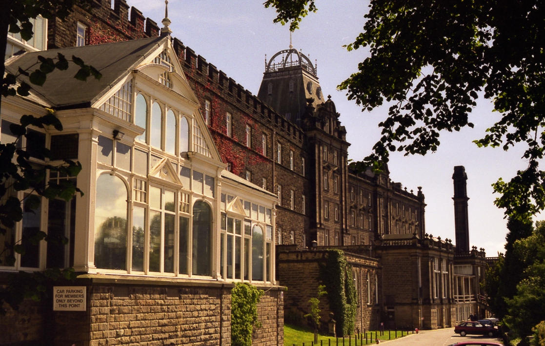
County Hall, Matlock

The County Hall is a municipal building in Matlock, Derbyshire, England. The building, which was originally a hydropathic establishment but is now the...

Matlock Town F.C.

Matlock Town Football Club is a football club based in Matlock, Derbyshire, England. Nicknamed 'the Gladiators', they are currently members of the Northern...

Matlock Bridge

Matlock Bridge also known as Derwent Bridge, is a stone bridge spanning the River Derwent in Matlock town centre, Derbyshire, England. The bridge dates...

All Saints' Church, Matlock Bank

All Saints’ Church, Matlock Bank is a Grade II listed parish church in the Church of England in Matlock, Derbyshire. == History == A mission room and school...

Nearby Amenities

Located within 500m of 53.13989,-1.551494
Traffic Signals
Note: no right turn to railway station
Lat/Long: 53.1376356/-1.5566637
Rapids: 2
Waterway: rapids
Lat/Long: 53.1377704/-1.5561716
Matlock
Is In: Derbyshire, England, UK
Place: town
Wikidata: Q1337703
Wikipedia: en:Matlock, Derbyshire
Lat/Long: 53.1374514/-1.5544694
Telephone
Booth: KX100
Covered: booth
Mapillary: 3054373528136995
Survey Date: 2021-07-17
Lat/Long: 53.1388068/-1.5546541
Post Box
Brand: Royal Mail
Brand Wikidata: Q638098
Mapillary: 582232473018101
Operator: Royal Mail
Operator Wikidata: Q638098
Post Box Mounting: stone_wall
Post Box Type: wall
Ref: DE4 906
Survey Date: 2021-07-17
Lat/Long: 53.1441232/-1.5494429
Bench
Lat/Long: 53.1441077/-1.5493485
Post Box
Collection Times: Mo-Fr 18:30; Sa 12:00
Operator: Royal Mail
Operator Wikidata: Q638098
Post Box Apertures: 2
Post Box Type: pillar
Ref: DE4 1350
Royal Cypher: EIIR
Royal Cypher Wikidata: Q33102113
Lat/Long: 53.1388288/-1.5545303
Barrier: height_restrictor
Maxheight: no_sign
Lat/Long: 53.1364337/-1.5547882
Toilets
Fee: no
Toilets Wheelchair: yes
Wheelchair: yes
Lat/Long: 53.1381967/-1.5581703
Cromwell Hotel
Tourism: hotel
Lat/Long: 53.1363734/-1.5552168
Addr City: Matlock
Addr Postcode: DE4 3AT
Addr Street: Crown Square
Disused Amenity: pub
Old Fhrs Id: 258773
Old Name: The Crown
Old Operator: J D Wetherspoon
Real Ale: yes
Toilets: yes
Toilets Wheelchair: yes
Wheelchair: yes
Lat/Long: 53.1389312/-1.5559254
Post Box
Brand: Royal Mail
Brand Wikidata: Q638098
Collection Times: Mo-Fr 09:00; Sa 07:00
Mapillary: 1851114425277066
Operator: Royal Mail
Operator Wikidata: Q638098
Post Box Type: pillar
Ref: DE4 910
Royal Cypher: EIIR
Survey Date: 2021-07-17
Lat/Long: 53.137656/-1.5567505
Post Box
Brand: Royal Mail
Brand Wikidata: Q638098
Mapillary: 1001974003920542
Operator: Royal Mail
Operator Wikidata: Q638098
Post Box Mounting: stone_wall
Post Box Type: wall
Ref: DE4 914
Survey Date: 2021-07-17
Lat/Long: 53.1403262/-1.5468237
Brand: Royal Mail
Brand Wikidata: Q638098
Disused Amenity: post_box
Operator: Royal Mail
Operator Wikidata: Q638098
Post Box Mounting: stone_wall
Post Box Type: wall
Ref: DE4 940
Lat/Long: 53.1374462/-1.5471777
Post Box
Operator: Royal Mail
Operator Wikidata: Q638098
Ref: DE4 944
Lat/Long: 53.1417605/-1.557591
Post Box
Operator: Royal Mail
Operator Wikidata: Q638098
Ref: DE4 911
Lat/Long: 53.1420261/-1.5505609
Bar
Monk Bar
Addr City: Matlock
Addr County: Derbyshire
Addr Housenumber: 79
Addr Postcode: DE4 3LT
Addr Street: Dale Road
Fhrs Id: 1626321
Floor Material: rough_wood
Outdoor Seating: yes
Real Ale: no
Lat/Long: 53.1361491/-1.5552957
Fast Food
Star Pizza
Addr City: Matlock
Addr County: Derbyshire
Addr Housenumber: 57
Addr Postcode: DE4 3LT
Addr Street: Dale Road
Cuisine: pizza
Fhrs Id: 1626760
Old Name: Turkish Delight
Takeaway: yes
Website: https://starpizzamatlock.co.uk/
Lat/Long: 53.1368179/-1.5556941
Fast Food
Pizza Connection
Addr City: Matlock
Addr County: Derbyshire
Addr Housenumber: 38
Addr Postcode: DE4 3LT
Addr Street: Dale Road
Fhrs Id: 1626137
Wheelchair: yes
Lat/Long: 53.1368448/-1.5561496
Fast Food
Pizza Point
Addr City: Matlock
Addr County: Derbyshire
Addr Housename: Crown Square
Addr Housenumber: 28-30
Addr Postcode: DE4 3AT
Addr Street: Crown Square
Fhrs Id: 1626371
Lat/Long: 53.1385483/-1.5560478
Addr City: Matlock
Addr Street: Snitterton Road
Disused Amenity: bank
Old Name: RBS
Source: survey
Lat/Long: 53.1376868/-1.5574274
Marketplace
Derbyshire Dales Markets
Addr City: Matlock
Addr Postcode: DE4 3AT
Addr Street: Crown Square
Source: survey
Lat/Long: 53.1393823/-1.5566313
Cafe
Matlock Cafe
Addr City: Matlock
Addr County: Derbyshire
Addr Housenumber: 9
Addr Postcode: DE4 3AU
Addr Street: Bakewell Road
Fhrs Id: 1699021
Lat/Long: 53.1389351/-1.55683
Crossing
Crossing: traffic_signals
Crossing Island: no
Crossing Ref: pelican
Source: survey
Tactile Paving: yes
Lat/Long: 53.1378014/-1.5567351
Peak Rail Shop
Addr City: Matlock
Addr Housename: Matlock Railway Station
Addr Postcode: DE4 3NA
Addr Street: Station Yard
Note: Railway book shop
Old Fhrs Id: 1035173
Shop: books
Website: https://www.peakrail.co.uk/
Lat/Long: 53.1380316/-1.5582553
Wilsons
Shop: butcher
Source: survey
Lat/Long: 53.1383205/-1.55592
Ele: 89
Lat/Long: 53.1384889/-1.5570475
Restaurant
Maazi Indian
Addr City: Matlock
Addr County: Derbyshire
Addr Housenumber: 25
Addr Postcode: DE4 3AR
Addr Street: Causeway Lane
Cuisine: indian
Fhrs Id: 1626237
Source: http://take-a-way.co.uk/browse-restaurants/City-Matlock/
Source Cuisine: Tricibus on roof
Website: https://take-a-way.co.uk/menu/526/maazi-matlock/
Wheelchair: no
Lat/Long: 53.1379235/-1.5529817
Mini Roundabout
Direction: clockwise
Source: local_knowledge;Bing
Lat/Long: 53.1379949/-1.553371
Bench
Ele: 161
Lat/Long: 53.143627/-1.5523044
Bench
Lat/Long: 53.1434669/-1.5505456
Bench
Lat/Long: 53.1379659/-1.5484692
Ele: 134
Information: board
Tourism: information
Lat/Long: 53.1380864/-1.5477899
Ginger Butcher
Addr City: Matlock
Addr Housenumber: 2
Addr Postcode: DE4 3AQ
Addr Street: Bank Road
Fhrs Id: 1669446
Old Name: Hambridges
Shop: butcher
Wheelchair: yes
Lat/Long: 53.1384667/-1.5549627
Ele: 114
Lat/Long: 53.1380509/-1.5496568
Bench
Lat/Long: 53.1371977/-1.5492718
Barrier: stile
Stile: squeezer
Lat/Long: 53.1380924/-1.5495448
Information: board
Tourism: information
Lat/Long: 53.1375163/-1.5494161
Barrier: stile
Stile: squeezer
Lat/Long: 53.1388345/-1.5492596
Bench
Lat/Long: 53.1378735/-1.5494429
Atm
Fee: no
Operator: Post Office
Lat/Long: 53.1388288/-1.5544318
Cedar House B&B
Source: GPS
Tourism: guest_house
Lat/Long: 53.1362342/-1.5544505
Railway: buffer_stop
Lat/Long: 53.1366296/-1.5539228
Bar
MoCa Cafe Bar
Addr City: Matlock
Addr Housenumber: 77
Addr Postcode: DE4 3LT
Addr Street: Dale Road
Description Floor: rough wood
Food: yes
Note: very pub-like, could also be cafe given the name and the food
Old Name: The Olde English
Real Ale: Half a dozen or so varying beers;most local
Source: survey
Lat/Long: 53.1364736/-1.5554233
Historic: memorial
Source: survey
Wheelchair: yes
Lat/Long: 53.1379261/-1.5555906
Cafe
Black Cat Café
Addr City: Matlock
Addr Housenumber: 2
Addr Postcode: DE4 3LT
Addr Street: Dale Road
Internet Access: yes
Internet Access Fee: no
Website: http://www.blackcatmatlock.co.uk
Lat/Long: 53.1372158/-1.5569026
Atm
Brand: Cashzone
Brand Wikidata: Q110738461
Currency GBP: yes
Drive Through: no
Fee: no
Indoor: no
Network: Allpoint
Network Wikidata: Q4733264
Operator: Cashzone
Lat/Long: 53.1382405/-1.55357
Rutland Court
Building: residential
Old Name: Oldham Villas
Lat/Long: 53.1430188/-1.5497106
Barrier: height_restrictor
Maxheight: 2.1
Lat/Long: 53.1391686/-1.5552115
DECEPTION Escape Rooms
Addr City: Matlock
Addr Housenumber: 23
Addr Postcode: DE4 3AS
Addr Street: Firs Parade
Building Use: leisure
Contact Website: https://www.deceptionescaperooms.com
Leisure: escape_game
Lat/Long: 53.1390207/-1.5526606
Leisure: playground
Lat/Long: 53.1412365/-1.5481129
Toilets
Changing Table: yes
Fee: yes
Toilets Wheelchair: yes
Wheelchair: yes
Lat/Long: 53.1380273/-1.5538573
Bar
Conservative Club
Lat/Long: 53.137169/-1.5567196
Disused Amenity: pub
Old Name: The Railway
Lat/Long: 53.1388618/-1.5567293
Barrier: height_restrictor
Maxheight: 2.1
Lat/Long: 53.1396588/-1.5564697
Crossing
Button Operated: yes
Crossing: traffic_signals
Crossing Island: no
Crossing Ref: pelican
Tactile Paving: yes
Traffic Signals Sound: yes
Traffic Signals Vibration: yes
Lat/Long: 53.1386622/-1.5560011
Crossing
Button Operated: yes
Crossing: traffic_signals
Crossing Island: no
Crossing Ref: pelican
Tactile Paving: yes
Traffic Signals Sound: yes
Traffic Signals Vibration: yes
Lat/Long: 53.1382458/-1.5548285
Crossing
Button Operated: yes
Crossing: traffic_signals
Crossing Island: no
Crossing Ref: pelican
Tactile Paving: yes
Traffic Signals Sound: yes
Traffic Signals Vibration: yes
Lat/Long: 53.1385701/-1.555142
Pharmacy
Manor
Healthcare: pharmacy
Shop: chemist
Lat/Long: 53.1386767/-1.5531109
Pharmacy
Boots
Addr City: Matlock
Addr County: Derbyshire
Addr Housenumber: 21
Addr Postcode: DE4 3AR
Addr Street: Causeway Lane
Brand: Boots
Brand Wikidata: Q6123139
Brand Wikipedia: en:Boots (company)
Fhrs Id: 1699026
Healthcare: pharmacy
Website: https://www.boots.com/stores/119-matlock-causeway-lane-de4-3ar
Wheelchair: yes
Lat/Long: 53.1384077/-1.5542351
Cafe
Zinc Home & Gift
Addr City: Matlock
Addr County: Derbyshire
Addr Housenumber: 8
Addr Postcode: DE4 3AQ
Addr Street: Bank Road
Fhrs Id: 1626614
Old Name: Shawes
Shop: gift
Lat/Long: 53.1386603/-1.5547206
Pharmacy
Manor
Healthcare: pharmacy
Shop: chemist
Lat/Long: 53.1387166/-1.5546347
Fast Food
The Blue Pig Deli
Addr City: Matlock
Addr Housenumber: 87-89
Addr Postcode: DE4 3FQ
Addr Street: Smedley Street East
Fhrs Id: 1626429
Old Name: Blueberry Food Company
Lat/Long: 53.142006/-1.5507498
Addr City: Matlock
Addr Housenumber: 79
Addr Postcode: DE4 3FQ
Addr Street: Smedley Street East
Disused Amenity: fast_food
Old Fhrs Id: 258139
Old Name: The Greedy Pig
Lat/Long: 53.1419398/-1.5505453
Matlock Green Recovery
Shop: car_repair
Lat/Long: 53.143989/-1.5497478
Fast Food
Wellington Fish Bar
Addr City: Matlock
Addr Housenumber: 26
Addr Postcode: DE4 3GS
Addr Street: Wellington Street
Fhrs Id: 1626749
Lat/Long: 53.1440453/-1.5500697
Cafe
Designate
Addr City: Matlock
Addr County: Derbyshire
Addr Housenumber: 72
Addr Postcode: DE4 3FQ
Addr Street: Smedley Street East
Fhrs Id: 1626481
Old Amenity: pub
Old Name: The Gate
Lat/Long: 53.1421485/-1.5504828
Pub
The Farmacy
Addr City: Matlock
Addr County: Derbyshire
Addr Housenumber: 76
Addr Postcode: DE4 3JJ
Addr Street: Smedley Street
Brewery: various
Contact Facebook: https://www.facebook.com/thefarmacymatlock/
Fhrs Id: 1627077
Old Fhrs Id: 683540
Opening Hours: Mo,Tu off; We,Th 16:00-22:00; Fr,Sa 12:00-23:00; Su 15:00-22:00
Opening Hours Covid19: closes at 10pm
Operator: AAA Aldwark Artisan Ales
Real Ale: 5 or 6 I think
Lat/Long: 53.1423677/-1.5507574
Baytree Studio
Shop: jewelry
Lat/Long: 53.1434245/-1.5557327
Zepnat
Shop: bicycle
Lat/Long: 53.143307/-1.5549897
McKenzies
Shop: car_repair
Lat/Long: 53.1419211/-1.5496381
Bella Figura
Shop: clothes
Lat/Long: 53.1430745/-1.5524245
Fast Food
Kelly's
Lat/Long: 53.1430827/-1.5523284
Matlock Laundry
Shop: laundry
Lat/Long: 53.1384248/-1.553305
Addr City: Matlock
Addr Postcode: DE4 3AS
Addr Street: Firs Parade
Old Name: M&Co
Shop: vacant
Lat/Long: 53.1388512/-1.5525352
Wards Shoe Shop
Shop: clothes
Lat/Long: 53.1386204/-1.5535491
Patience
Shop: clothes
Lat/Long: 53.1380274/-1.5529456
Pharmacy
Superdrug
Brand: Superdrug
Brand Wikidata: Q7643261
Brand Wikipedia: en:Superdrug
Contact Website: https://www.superdrug.com/store/matlock
Healthcare: pharmacy
Wheelchair: yes
Lat/Long: 53.138383/-1.5540828
Fast Food
Mrs Tiggy Winkles
Addr City: Matlock
Addr Housenumber: 7
Addr Postcode: DE4 3AR
Addr Street: Causeway Lane
Cuisine: sandwich
Fhrs Id: 1626485
Toilets Wheelchair: no
Wheelchair: limited
Lat/Long: 53.1383391/-1.5548723
Fast Food
Matlock Fish Bar
Addr City: Matlock
Addr County: Derbyshire
Addr Housenumber: 17-19
Addr Postcode: DE4 3AR
Addr Street: Causeway Lane
Fhrs Id: 1626376
Lat/Long: 53.138348/-1.5543901
Lady Fair
Shop: clothes
Lat/Long: 53.1388966/-1.5521352
Cafe
Costa
Addr City: Matlock
Addr County: Derbyshire
Addr Housename: Crown Buildings
Addr Postcode: DE4 3AR
Addr Street: Crown Square
Brand: Costa
Brand Wikidata: Q608845
Brand Wikipedia: en:Costa Coffee
Cuisine: coffee_shop
Fhrs Id: 1626583
Takeaway: yes
Toilets Wheelchair: no
Wheelchair: no
Lat/Long: 53.1383624/-1.5551641
China & Crystal
Shop: gift
Lat/Long: 53.1386739/-1.5533782
Farmers
Shop: electrical
Lat/Long: 53.1376344/-1.5527811
Bank
Nationwide
Atm: yes
Branch: Building Society
Brand: Nationwide
Brand Wikidata: Q846735
Brand Wikipedia: en:Nationwide Building Society
Contact Website: https://locations.nationwidebranches.co.uk/matlock/2-causeway-lane
Toilets Wheelchair: no
Wheelchair: yes
Lat/Long: 53.1381646/-1.5551131
Scizzors
Shop: hairdresser
Lat/Long: 53.1390138/-1.5517844
Bank
Lloyds Bank
Addr Country: GB
Atm: yes
Brand: Lloyds Bank
Brand Wikidata: Q1152847
Brand Wikipedia: en:Lloyds Bank
Contact Website: https://branches.lloydsbank.com/matlock/11-causeway-lane
Lat/Long: 53.1383349/-1.5547297
Selecta Tyre
Shop: car_repair
Lat/Long: 53.1386908/-1.5515617
Young's
Shop: florist
Lat/Long: 53.1381686/-1.5559939
Restaurant
Viva-Italian
Addr City: Matlock
Addr County: Derbyshire
Addr Housenumber: 27-29
Addr Postcode: DE4 3LT
Addr Street: Dale Road
Cuisine: italian
Fhrs Id: 1626377
Website: https://www.vivarestaurant.net/
Lat/Long: 53.1371246/-1.5559106
Restaurant
Stones
Addr City: Matlock
Addr County: Derbyshire
Addr Housenumber: 1C
Addr Postcode: DE4 3LT
Addr Street: Dale Road
Fhrs Id: 1627005
Lat/Long: 53.1376402/-1.5563058
Pub
Twenty Ten
Addr City: Matlock
Addr County: Derbyshire
Addr Housenumber: 16
Addr Postcode: DE4 3LT
Addr Street: Dale Road
Description Floor: Rough wood
Email: elfuturo0@gmail.com
Fhrs Id: 1626227
Opening Hours: We-Th 12:00-22:30; Fr-Sa 12:00-00:30; Su 12:00-20:00
Phone: +44 7482 575592
Real Ale: 2 from Amber Ales
Website: https://www.facebook.com/TwentyTenMatlock
Lat/Long: 53.1371499/-1.5564704
Restaurant
Thailand No1
Addr City: Matlock
Addr Housenumber: 45
Addr Postcode: DE4 3LT
Addr Street: Dale Road
Brand Website: https://thailandnumber1.co.uk/
Cuisine: thai
Fhrs Id: 1626293
Takeaway: yes
Lat/Long: 53.1368602/-1.5557961
Stanley Fearn
Shop: bicycle
Lat/Long: 53.1393709/-1.5578453
Cafe
Cool River
Addr City: Matlock
Addr Place: Parkside
Addr Postcode: DE4 3SX
Addr Street: Olde Englishe Road
Addr Unit: 12
Fhrs Id: 1626502
Website: https://coolrivercafe.co.uk/
Lat/Long: 53.1364939/-1.5548816
Fast Food
Cantonese Wok
Addr City: Matlock
Addr County: Derbyshire
Addr Floor: 0
Addr Housenumber: 83
Addr Postcode: DE4 3LU
Addr Street: Dale Road
Cuisine: chinese
Fhrs Id: 1626294
Takeaway: yes
Lat/Long: 53.1360937/-1.5553524
Carol Tunney
Shop: antiques
Lat/Long: 53.1364424/-1.5558397
Fast Food
Derbyshire Larder
Lat/Long: 53.1368913/-1.5562072
Restaurant
Momtaz
Lat/Long: 53.1387109/-1.5556316
Fast Food
Greggs
Addr City: Matlock
Addr County: Derbyshire
Addr Housename: Crown Square
Addr Housenumber: 9
Addr Postcode: DE4 3AT
Addr Street: Crown Square
Brand: Greggs
Brand Wikidata: Q3403981
Brand Wikipedia: en:Greggs
Contact Website: https://www.greggs.co.uk/shop-finder?shop-code=2242
Cuisine: sandwich;bakery
Fhrs Id: 1626473
Takeaway: yes
Toilets Wheelchair: no
Wheelchair: yes
Lat/Long: 53.1387165/-1.5557698
Holland & Barrett
Addr City: Matlock
Addr County: Derbyshire
Addr Housename: Crown Square
Addr Housenumber: 11
Addr Postcode: DE4 3AT
Addr Street: Crown Square
Brand: Holland & Barrett
Brand Wikidata: Q5880870
Brand Wikipedia: en:Holland & Barrett
Fhrs Id: 1626291
Shop: health_food
Toilets Wheelchair: no
Wheelchair: yes
Lat/Long: 53.1387873/-1.5558771
Zhivago
Shop: jewelry
Lat/Long: 53.1386976/-1.5531898
Addr City: Matlock
Addr Housenumber: 6
Addr Postcode: DE4 3AT
Addr Street: Crown Square
Disused Amenity: cafe
Old Fhrs Id: 1061866
Old Name: JJ's
Lat/Long: 53.1382221/-1.5559445
Cut Above
Shop: hairdresser
Lat/Long: 53.1384112/-1.5532155
us - retro
Shop: gift
Lat/Long: 53.138671/-1.556236
Gents Barbers
Shop: hairdresser
Toilets Wheelchair: no
Wheelchair: limited
Lat/Long: 53.1384882/-1.5559839
Disused Amenity: bank
Old Name: The Nottingham
Lat/Long: 53.1387937/-1.5550917
Cafe
Cafe in the Park
Addr City: Matlock
Addr Postcode: DE4 3AR
Addr Street: Causeway Lane
Fhrs Id: 1626427
Wheelchair: yes
Lat/Long: 53.1372363/-1.5529023
Bench
Backrest: yes
Lat/Long: 53.1363701/-1.5545948
Childcare
Busy Bees
Addr City: Matlock
Addr Postcode: DE4 3DQ
Addr Street: Chesterfield Road
Branch: Nursery
Brand: Busy Bees
Brand Wikidata: Q28134563
Fhrs Id: 1626850
Old Name: Tree Tops
Lat/Long: 53.1399083/-1.5481712
Birds
Addr City: Matlock
Addr County: Derbyshire
Addr Housenumber: 15
Addr Postcode: DE4 3AR
Addr Street: Causeway Lane
Brand: Birds
Brand Wikidata: Q63001935
Brand Wikipedia: en:Birds Bakery
Fhrs Id: 1626178
Official Name: Birds Bakery
Shop: bakery
Lat/Long: 53.1383333/-1.5545206
Fleur
Shop: florist
Lat/Long: 53.1373966/-1.5571297
PG Auto Spares
Shop: car_repair
Lat/Long: 53.139817/-1.5573331
Library
Lat/Long: 53.1384993/-1.5520011
Fast Food
New China
Addr City: Matlock
Addr County: Derbyshire
Addr Housenumber: 6
Addr Postcode: DE4 3AS
Addr Street: Firs Parade
Fhrs Id: 1626166
Lat/Long: 53.1383437/-1.5534623
High Peak (Dry)
Shop: laundry
Lat/Long: 53.1387717/-1.552891
Cafe
Geisha
Addr City: Matlock
Addr Housenumber: 24
Addr Postcode: DE4 3AS
Addr Street: Firs Parade
Old Fhrs Id: 1137364
Shop: clothes
Lat/Long: 53.1384756/-1.5527354
The Compleat Knit
Shop: doityourself
Lat/Long: 53.1385041/-1.5528246
Townhall
Matlock Town Hall
Wheelchair: limited
Lat/Long: 53.1394374/-1.554276
Fabrik
Shop: hairdresser
Lat/Long: 53.1367432/-1.5556921
Bar
Edgefold Club
Addr City: Matlock
Addr County: Derbyshire
Addr Postcode: DE4 3NJ
Addr Street: Edgefold Road
Fhrs Id: 1626296
Lat/Long: 53.1401951/-1.5554505
Bridal Studio
Shop: clothes
Lat/Long: 53.14106/-1.5516926
bedazzled
Shop: beauty
Lat/Long: 53.1411235/-1.551647
French Wine People
Shop: alcohol
Lat/Long: 53.1373678/-1.5576097
Cafe
Kefi
Addr City: Matlock
Addr County: Derbyshire
Addr Housenumber: 3
Addr Postcode: DE4 3LZ
Addr Street: Snitterton Road
Contact Instagram: https://www.instagram.com/kefimatlock
Diet Vegetarian: yes
Fhrs Id: 1626903
Old Fhrs Id: 504701
Old Name: Greenway
Lat/Long: 53.1374691/-1.5573951
Bus Stop
Smedley Street East
Bus: yes
Naptan AtcoCode: 1000DMCR2368
Naptan NaptanCode: dbsatpwa
Public Transport: platform
Lat/Long: 53.1409153/-1.5458024
Crossing
Crossing: traffic_signals
Crossing Ref: pelican
Lat/Long: 53.1377106/-1.5565257
Elliot Carpets
Shop: carpet
Lat/Long: 53.136758/-1.5560439
Magpie
Clothes: vintage
Shop: clothes
Lat/Long: 53.1370731/-1.5564184
The Sheisha Shack
Shop: e-cigarette
Lat/Long: 53.137121/-1.5563868
Dales & Peaks
Addr City: Matlock
Addr Housenumber: 2
Addr Street: Dale Road
Brand Website: https://www.dalesandpeaks.co.uk/
Office: estate_agent
Lat/Long: 53.137458/-1.5567279
Fatboys
Shop: variety_store
Lat/Long: 53.1372038/-1.5564945
Spinderella
Shop: laundry
Lat/Long: 53.1368047/-1.5561002
Cornerstone Christian Bookshop
Shop: books
Lat/Long: 53.1374017/-1.5566581
Kick Off
Shop: yes
Lat/Long: 53.1372585/-1.5565484
JAG
Shop: vacant
Lat/Long: 53.1370552/-1.5563385
Poundland
Addr City: Matlock
Addr County: Derbyshire
Addr Housenumber: 7-11
Addr Postcode: DE4 3AQ
Addr Street: Bank Road
Brand: Poundland
Brand Wikidata: Q1434528
Fhrs Id: 1663831
Old Name: Wilko
Shop: variety_store
Toilets Wheelchair: no
Wheelchair: yes
Lat/Long: 53.1389224/-1.5549522
Cafe
Mad Hatter
Addr City: Matlock
Addr County: Derbyshire
Addr Housename: Crown Square
Addr Housenumber: 34
Addr Postcode: DE4 3AT
Addr Street: Crown Square
Fhrs Id: 1626577
Old Name: Little Gem
Lat/Long: 53.1386296/-1.55615
Crown Computing
Shop: computer
Toilets Wheelchair: no
Wheelchair: limited
Lat/Long: 53.1385234/-1.5560167
Gaynors
Shop: hairdresser
Lat/Long: 53.1383557/-1.5560098
C. W. Sellors
Shop: jewelry
Lat/Long: 53.1382712/-1.5559197
In the Flow
Shop: stationery
Lat/Long: 53.1385995/-1.5554069
Thompson
Shop: travel_agency
Toilets Wheelchair: no
Wheelchair: yes
Lat/Long: 53.1386547/-1.5552812
British Red Cross
Brand: British Red Cross
Brand Wikidata: Q4970966
Brand Wikipedia: en:British Red Cross
Shop: charity
Lat/Long: 53.1387089/-1.555228
Age UK
Brand: Age UK
Brand Wikidata: Q4691850
Brand Wikipedia: en:Age UK
Shop: charity
Lat/Long: 53.1384836/-1.554849
Thrift
Shop: second_hand
Lat/Long: 53.1383485/-1.5533228
British Heart Foundation
Brand: British Heart Foundation
Brand Wikidata: Q4970039
Brand Wikipedia: en:British Heart Foundation
Shop: charity
Website: https://www.bhf.org.uk/what-we-do/find-bhf-near-you/matlock-bhf-shop
Lat/Long: 53.1384876/-1.5531559
Mind
Brand: Mind
Brand Wikidata: Q3314763
Brand Wikipedia: en:Mind (charity)
Shop: charity
Lat/Long: 53.1384112/-1.5530385
Rainbows
Shop: charity
Lat/Long: 53.1387443/-1.5527729
Co-operative funeralcare
Shop: funeral_directors
Lat/Long: 53.1387121/-1.5529526
Sue Ryder
Branch: Care
Brand: Sue Ryder
Brand Wikidata: Q7634271
Brand Wikipedia: en:Sue Ryder (charity)
Shop: charity
Lat/Long: 53.1387401/-1.5530438
Original Factory Shop
Shop: variety_store
Lat/Long: 53.1385582/-1.5524775
Kick off Sports
Shop: sports
Toilets Wheelchair: no
Wheelchair: limited
Lat/Long: 53.1384402/-1.5528883
City Electrical Factors
Shop: electrical
Lat/Long: 53.1384804/-1.5529956
Saxon Mee
Shop: estate_agent
Lat/Long: 53.1377679/-1.5529099
Leon's
Shop: hairdresser
Lat/Long: 53.1415328/-1.5511747
Coleman Bradshaw
Office: solicitors
Lat/Long: 53.1415939/-1.5510705
Bench
Lat/Long: 53.138144/-1.5544401
Bench
Lat/Long: 53.1382051/-1.55466
Bench
Lat/Long: 53.1380372/-1.5554817
Bench
Lat/Long: 53.1379836/-1.5556687
Bench
Lat/Long: 53.1379641/-1.5551298
Jack's
Shop: hairdresser
Lat/Long: 53.1434254/-1.5539787
Tinkers Sandwich Bar & Deli
Addr City: Matlock
Addr County: Derbyshire
Addr Housenumber: 94
Addr Postcode: DE4 3JJ
Addr Street: Smedley Street
Fhrs Id: 1626391
Shop: deli
Lat/Long: 53.143123/-1.5525042
Doctors
Jonathan Poston Osteopath
Healthcare: doctor
Lat/Long: 53.1431051/-1.5525982
Unison
Office: association
Lat/Long: 53.1428176/-1.551535
Vapeorinn Uk
Shop: yes
Lat/Long: 53.1419576/-1.5506608
Pub
The Newsroom
Brewery: various;Krombacher
Description: Draught and Keg, beers, ciders and lagers. Bottled wine and spirits. Matlock and Dales CAMRA pub of the year 2020.
Min Age: Children typically allowed until 9pm
Opening Hours: Mo 18:00-23:00; Tu-Su 12:00-23:00
Opening Hours Covid19: Closes 10pm
Lat/Long: 53.1419004/-1.5504713
Mat-Locks
Shop: hairdresser
Lat/Long: 53.1418222/-1.5503115
Yoga
Shop: yes
Lat/Long: 53.1416134/-1.5497971
Tan
Shop: yes
Lat/Long: 53.1438231/-1.5482024
Specsavers
Brand: Specsavers
Brand Wikidata: Q2000610
Brand Wikipedia: en:Specsavers
Contact Website: https://www.specsavers.co.uk/stores/matlock
Shop: optician
Lat/Long: 53.1386799/-1.5554633
Lighthouse
Shop: charity
Lat/Long: 53.13865/-1.556466
Nose n Tail
Shop: pet
Lat/Long: 53.138738/-1.5564647
Ladbrokes
Brand: Ladbrokes
Brand Wikidata: Q1799875
Brand Wikipedia: en:Ladbrokes Coral
Shop: bookmaker
Lat/Long: 53.1383914/-1.5550192
Thomas Cook
Disused Brand: Thomas Cook
Disused Brand Wikidata: Q2141800
Disused Brand Wikipedia: en:Thomas Cook Group
Disused Shop: travel_agency
Lat/Long: 53.1383756/-1.5548045
Vision Express
Brand: Vision Express
Brand Wikidata: Q7936150
Brand Wikipedia: en:Vision Express
Shop: optician
Lat/Long: 53.1383947/-1.5546106
Beautique
Shop: beauty
Lat/Long: 53.1424301/-1.5508746
Conservative Campaign Centre
Office: political_party
Lat/Long: 53.1425126/-1.5504
Clinic
NHS Healthcare
No
Emergency: no
Healthcare: clinic
Operator: NHS
Operator Wikidata: Q918396
Lat/Long: 53.1379908/-1.552804
Matlock Design and Print
Shop: copyshop
Lat/Long: 53.1380291/-1.5526521
College
Adult Community Education Centre
Lat/Long: 53.1381026/-1.5524691
Allenhill Spaw
Natural: spring
Lat/Long: 53.1403207/-1.5587408
Unpolished Perfection
Shop: antiques
Lat/Long: 53.1367213/-1.5556419
Little Shabby Hen
Shop: antiques
Lat/Long: 53.1365282/-1.5554756
Matlock Kitchen and Bathroom Centre
Shop: bathroom_furnishing
Lat/Long: 53.1366875/-1.5555588
Riverside Vintage
Shop: antiques
Lat/Long: 53.1363355/-1.5554079
Midday Sun
Shop: tattoo
Lat/Long: 53.1374208/-1.5568629
Silvarious
Shop: jewelry
Lat/Long: 53.1383819/-1.5559041
The Boutique
Shop: clothes
Lat/Long: 53.1384171/-1.5559352
Fidler Taylor
Office: estate_agent
Lat/Long: 53.1384451/-1.5560129
Sally Botham
Office: estate_agent
Lat/Long: 53.1402673/-1.5531845
Citizens Advice Bureau
Office: ngo
Lat/Long: 53.1396461/-1.5542161
Bench
Backrest: yes
Source: survey;gps
Lat/Long: 53.136977/-1.5534875
Bench
Backrest: yes
Source: survey;gps
Lat/Long: 53.1369781/-1.5530981
Bench
Backrest: yes
Source: survey;gps
Lat/Long: 53.1369963/-1.5530981
Bench
Backrest: yes
Source: survey;gps
Lat/Long: 53.1370014/-1.5534875
Bench
Backrest: yes
Source: survey;gps
Lat/Long: 53.1370198/-1.5534875
Bench
Backrest: yes
Source: survey;gps
Lat/Long: 53.1370271/-1.5531085
Bench
Backrest: yes
Source: survey;gps
Lat/Long: 53.1371236/-1.553243
Bench
Backrest: yes
Source: survey;gps
Lat/Long: 53.1371255/-1.5532703
Bench
Backrest: yes
Source: survey;gps
Lat/Long: 53.1371279/-1.5533055
The Beauty Lounge
Shop: beauty
Lat/Long: 53.1408481/-1.5519407
Bicycle Parking
Lat/Long: 53.1385549/-1.5577355
Pub
The Remarkable Hare
Addr City: Matlock
Addr County: Derbyshire
Addr Housenumber: 77
Addr Postcode: DE4 3LT
Addr Street: Dale Road
Addr Unit: Unit B
Description Floor: Rough wood
Fhrs Id: 1626858
Food: yes
Internet Access: wlan
Real Ale: 8 beers (presumably vary)
Website: https://www.remarkablehare.co.uk/
Lat/Long: 53.1364061/-1.5554185
Cafe
Mrs Marddles Tea Room
Addr City: Matlock
Addr Housename: Corner Retail Unit C
Addr Housenumber: 77
Addr Postcode: DE4 3LT
Addr Street: Dale Road
Note: Appears to be part of Riverside Vintage
Old Fhrs Id: 1031698
Lat/Long: 53.1363488/-1.555352
Defibrillator
Defibrillator Location: On outside wall of M&S Foodhall, facing Bakewell Road, near Car Park
Emergency: defibrillator
Lat/Long: 53.139111/-1.5566939
Cafe
The Snug
Opening Hours: Mo-Sa 10:00-17:00; Su 11:00-16:00
Website: https://www.bow-boutique.co.uk/the-snug.html
Lat/Long: 53.1381569/-1.5548353
The Nail Hut
Shop: beauty
Lat/Long: 53.1417996/-1.5502503
Waste Basket
Lat/Long: 53.1380005/-1.5556681
Bench
Lat/Long: 53.1379626/-1.555681
Bench
Lat/Long: 53.1380266/-1.5556117
Bench
Lat/Long: 53.1380065/-1.5556442
Yaz Taxi Matlock
Addr City: Matlock
Addr Country: GB
Addr County: Derbyshire Dales
Addr Postcode: DE4 3AQ
Addr Street: Bank road
Fixme: Yaz Taxi is a public hire taxi company located in Matlock,Darly Dale,Wirksworth,Bakewell,and cross Derbyshire Dales.
Opening Hours: 24/7
Payment Cash: yes
Phone: +44 1629 690091
Website: https://www.yaztaxi.co.uk/
Lat/Long: 53.1401404/-1.5530882
Snakebite Ink
Shop: tattoo
Lat/Long: 53.1386688/-1.5565717
Taxi
Maz Taxis
Addr City: Matlock
Addr County: Derbyshire Dales
Addr Housenumber: 86
Addr Postcode: DE4 3GL
Addr Street: Bank Road
Opening Hours: 24/7
Payment Cash: yes
Phone: +44 7598 161151
Website: https://maztaxis.co.uk
Lat/Long: 53.1411895/-1.5515357
Barrier: yes
Lat/Long: 53.143104/-1.5498486
Bus Stop
Smedley Street East
Bus: yes
Naptan AtcoCode: 1000DMCR2369
Naptan NaptanCode: dbsatpwd
Public Transport: platform
Lat/Long: 53.1408265/-1.5458106
Smedley Street East
Bus: yes
Public Transport: stop_position
Lat/Long: 53.1408871/-1.5457627
Smedley Street East
Bus: yes
Public Transport: stop_position
Lat/Long: 53.1408486/-1.5458386
Bus Stop
Lynholmes Road
Bus: yes
Naptan AtcoCode: 1000DMLT2364
Naptan NaptanCode: dbsdtdtm
Public Transport: platform
Lat/Long: 53.1380401/-1.547649
Bus Stop
Lynholmes Road
Bus: yes
Naptan AtcoCode: 1000DMLT2508
Naptan NaptanCode: dbsdtdtp
Public Transport: platform
Lat/Long: 53.1377361/-1.5472038
Lynholmes Road
Bus: yes
Public Transport: stop_position
Lat/Long: 53.1377368/-1.547238
Lynholmes Road
Bus: yes
Public Transport: stop_position
Lat/Long: 53.138067/-1.547602
Bus Stop
Causeway Lane
Bus: yes
Naptan AtcoCode: 1000DMCLP173
Naptan NaptanCode: dbsatpmw
Public Transport: platform
Shelter: no
Lat/Long: 53.1376099/-1.5531443
Bus Stop
Causeway Lane
Bench: yes
Bin: no
Bus: yes
Naptan AtcoCode: 1000DMCL1773
Naptan NaptanCode: dbsatpmt
Public Transport: platform
Shelter: yes
Lat/Long: 53.1382154/-1.5540784
Bus Stop
Imperial Road
Bus: yes
Naptan AtcoCode: 1000DMIR2338
Naptan NaptanCode: dbsatwgw
Public Transport: platform
Lat/Long: 53.1392602/-1.5553306
Bus Stop
Bakewell Road (Stand B)
Bus: yes
Local Ref: B
Naptan AtcoCode: 100051737
Naptan NaptanCode: dbsjamwg
Public Transport: platform
Lat/Long: 53.139113/-1.5568163
Bus Stop
Bakewell Road (Stand A)
Bus: yes
Local Ref: A
Naptan AtcoCode: 100051730
Naptan NaptanCode: dbsjamwd
Public Transport: platform
Lat/Long: 53.1389094/-1.5565763
Bus Stop
Bakewell Road (Stand C)
Bus: yes
Local Ref: C
Naptan AtcoCode: 100051738
Naptan NaptanCode: dbsjamwj
Public Transport: platform
Lat/Long: 53.1393475/-1.5570284
Bus Stop
Bakewell Road (Stand D)
Bus: yes
Local Ref: D
Naptan AtcoCode: 100051739
Naptan NaptanCode: dbsjamwm
Public Transport: platform
Lat/Long: 53.1394103/-1.5569449
Generator Method: photovoltaic
Generator Output Electricity: yes
Generator Source: solar
Generator Type: solar_photovoltaic_panel
Location: roof
Power: generator
Lat/Long: 53.1438306/-1.5485732
Generator Method: photovoltaic
Generator Output Electricity: yes
Generator Source: solar
Generator Type: solar_photovoltaic_panel
Location: roof
Power: generator
Lat/Long: 53.1438274/-1.5485061
Generator Method: photovoltaic
Generator Output Electricity: yes
Generator Source: solar
Generator Type: solar_photovoltaic_panel
Location: roof
Power: generator
Lat/Long: 53.1429796/-1.5486094
Generator Method: photovoltaic
Generator Output Electricity: yes
Generator Source: solar
Generator Type: solar_photovoltaic_panel
Location: roof
Power: generator
Lat/Long: 53.1429772/-1.5485799
Generator Method: photovoltaic
Generator Output Electricity: yes
Generator Source: solar
Generator Type: solar_photovoltaic_panel
Location: roof
Power: generator
Lat/Long: 53.1433387/-1.5559117
Generator Method: photovoltaic
Generator Output Electricity: yes
Generator Source: solar
Generator Type: solar_photovoltaic_panel
Location: roof
Power: generator
Lat/Long: 53.1412422/-1.5585953
Generator Method: photovoltaic
Generator Output Electricity: yes
Generator Source: solar
Generator Type: solar_photovoltaic_panel
Location: roof
Power: generator
Lat/Long: 53.1410909/-1.5579542
Generator Method: photovoltaic
Generator Output Electricity: yes
Generator Source: solar
Generator Type: solar_photovoltaic_panel
Location: roof
Power: generator
Lat/Long: 53.140642/-1.5588447
Generator Method: photovoltaic
Generator Output Electricity: yes
Generator Source: solar
Generator Type: solar_photovoltaic_panel
Location: roof
Power: generator
Lat/Long: 53.1404377/-1.5581205
Generator Method: photovoltaic
Generator Output Electricity: yes
Generator Source: solar
Generator Type: solar_photovoltaic_panel
Location: roof
Power: generator
Lat/Long: 53.1440753/-1.5512755
Generator Method: photovoltaic
Generator Output Electricity: yes
Generator Source: solar
Generator Type: solar_photovoltaic_panel
Location: roof
Power: generator
Lat/Long: 53.142806/-1.5472173
Generator Method: photovoltaic
Generator Output Electricity: yes
Generator Source: solar
Generator Type: solar_photovoltaic_panel
Location: roof
Power: generator
Lat/Long: 53.1420611/-1.5475821
Generator Method: photovoltaic
Generator Output Electricity: yes
Generator Source: solar
Generator Type: solar_photovoltaic_panel
Location: roof
Power: generator
Lat/Long: 53.1373452/-1.5462169
Generator Method: photovoltaic
Generator Output Electricity: yes
Generator Source: solar
Generator Type: solar_photovoltaic_panel
Location: roof
Power: generator
Lat/Long: 53.1361607/-1.5482088
Generator Method: photovoltaic
Generator Output Electricity: yes
Generator Source: solar
Generator Type: solar_photovoltaic_panel
Location: roof
Power: generator
Lat/Long: 53.13618/-1.5482947
Generator Method: photovoltaic
Generator Output Electricity: yes
Generator Source: solar
Generator Type: solar_photovoltaic_panel
Location: roof
Power: generator
Lat/Long: 53.1385577/-1.5473049
Generator Method: photovoltaic
Generator Output Electricity: yes
Generator Source: solar
Generator Type: solar_photovoltaic_panel
Location: roof
Power: generator
Lat/Long: 53.1409112/-1.552491
Generator Method: photovoltaic
Generator Output Electricity: yes
Generator Source: solar
Generator Type: solar_photovoltaic_panel
Location: roof
Power: generator
Lat/Long: 53.1407744/-1.5533949
Generator Method: photovoltaic
Generator Output Electricity: yes
Generator Source: solar
Generator Type: solar_photovoltaic_panel
Location: roof
Power: generator
Lat/Long: 53.1408146/-1.5546233
Generator Method: photovoltaic
Generator Output Electricity: yes
Generator Source: solar
Generator Type: solar_photovoltaic_panel
Location: roof
Power: generator
Lat/Long: 53.140813/-1.5547038
Generator Method: photovoltaic
Generator Output Electricity: yes
Generator Source: solar
Generator Type: solar_photovoltaic_panel
Location: roof
Power: generator
Lat/Long: 53.1408452/-1.5549372
Generator Method: photovoltaic
Generator Output Electricity: yes
Generator Source: solar
Generator Type: solar_photovoltaic_panel
Location: roof
Power: generator
Lat/Long: 53.14085/-1.5550525
Generator Method: photovoltaic
Generator Output Electricity: yes
Generator Source: solar
Generator Type: solar_photovoltaic_panel
Location: roof
Power: generator
Lat/Long: 53.1410544/-1.5541674
Generator Method: photovoltaic
Generator Output Electricity: yes
Generator Source: solar
Generator Type: solar_photovoltaic_panel
Location: roof
Power: generator
Lat/Long: 53.1411831/-1.554972
Generator Method: photovoltaic
Generator Output Electricity: yes
Generator Source: solar
Generator Type: solar_photovoltaic_panel
Location: roof
Power: generator
Lat/Long: 53.1409626/-1.55612
Generator Method: photovoltaic
Generator Output Electricity: yes
Generator Source: solar
Generator Type: solar_photovoltaic_panel
Location: roof
Power: generator
Lat/Long: 53.1409546/-1.5562166
Power: transformer
Lat/Long: 53.1388202/-1.5507828
Power: transformer
Lat/Long: 53.13892/-1.5508157
Generator Method: photovoltaic
Generator Output Electricity: yes
Generator Source: solar
Generator Type: solar_photovoltaic_panel
Location: roof
Power: generator
Lat/Long: 53.1411379/-1.554776
Bus Stop
Town Hall
Bench: no
Bin: yes
Bus: yes
Naptan AtcoCode: 1000DMBR2089
Naptan NaptanCode: dbsdtmgp
Public Transport: platform
Shelter: yes
Lat/Long: 53.1392092/-1.554375
Bus Stop
Old English
Bench: no
Bin: no
Bus: yes
Lit: yes
Public Transport: platform
Shelter: no
Tactile Paving: no
Lat/Long: 53.1365772/-1.5558442
Bus Stop
Old English
Bus: yes
Departures Board: timetable
Naptan AtcoCode: 1000DMDR2444
Naptan NaptanCode: dbsdtatw
Public Transport: platform
Shelter: no
Lat/Long: 53.1364432/-1.555641
Bus Stop
Matlock Interchange (Stand 4)
Bus: yes
Local Ref: 4
Public Transport: platform
Lat/Long: 53.1382613/-1.5580355
Bus Stop
Matlock Interchange (Stand 3)
Bus: yes
Local Ref: 3
Public Transport: platform
Lat/Long: 53.1382961/-1.55811
Bus Stop
Matlock Interchange (Stand 2)
Bus: yes
Local Ref: 2
Public Transport: platform
Lat/Long: 53.1383256/-1.5581556
Bus Stop
Matlock Interchange (Stand 1)
Bus: yes
Local Ref: 1
Public Transport: platform
Lat/Long: 53.1383628/-1.5581686
Fast Food
Domino's
Addr City: Matlock
Addr Country: GB
Addr County: Derbyshire
Addr Housenumber: 29
Addr Postcode: DE4 3AR
Addr Street: Causeway Lane
Brand: Domino's
Brand Wikidata: Q839466
Brand Wikipedia: en:Domino's Pizza
Contact Website: https://www.dominos.co.uk/pizza-near-me/matlock/29-causeway-lane
Cuisine: pizza
Fhrs Id: 1626678
Takeaway: yes
Lat/Long: 53.1376775/-1.5528422
Crossing: uncontrolled
Crossing Barrier: no
Railway: level_crossing
Lat/Long: 53.1355074/-1.5522578
Bicycle Parking
Bicycle Parking: stands
Capacity: 12
Lat/Long: 53.1393926/-1.5557617
Entrance: main
Wheelchair: yes
Lat/Long: 53.1382109/-1.5535544
Bench
Backrest: yes
Lat/Long: 53.136125/-1.5529387
Camera Mount: street_lamp
Camera Type: dome
Man Made: surveillance
Surveillance: public
Surveillance Type: camera
Surveillance Zone: entrance
Lat/Long: 53.1384357/-1.5575375
Crossing
Button Operated: yes
Crossing: traffic_signals
Crossing Island: no
Tactile Paving: yes
Traffic Signals Sound: yes
Traffic Signals Vibration: yes
Lat/Long: 53.1370475/-1.5561835
Clock
Display: analog
Faces: 4
Support: roof
Lat/Long: 53.137848/-1.555214
Bicycle Parking
Access: yes
Bicycle Parking: stands
Capacity: 16
Covered: no
Indoor: no
Lit: no
Lat/Long: 53.1381133/-1.5539615
Bicycle Parking
Bicycle Parking: stands
Capacity: 2
Covered: yes
Lat/Long: 53.1379935/-1.5539092
Information: terminal
Tourism: information
Lat/Long: 53.1379797/-1.5571664
Bicycle Parking
Access: public
Capacity: 10
Covered: no
Lat/Long: 53.1396267/-1.5540029
Post Box
Post Box Type: wall
Royal Cypher: GR
Royal Cypher Wikidata: Q33102273
Lat/Long: 53.1419307/-1.5510237
Drinking Water
Access: public
Bottle: yes
Covered: yes
Fee: no
Indoor: no
Lat/Long: 53.1354504/-1.5516831
Defibrillator
Access: yes
Defibrillator Location: On outside wall of building on Bank Road, near The Blue Pig Deli near junction with Smedley Street
Emergency: defibrillator
Indoor: no
Mapillary: 389105432691508
Ref GB The Circuit: 71B755DD-E82A-4166-981B-6011F249B552
Survey Date: 2021-07-17
Lat/Long: 53.1419578/-1.5509796
Defibrillator
Access: yes
Defibrillator Location: Outside Saint Joseph church
Emergency: defibrillator
Indoor: no
Ref GB The Circuit: E22AFC67-6520-4FE0-9A31-ADC200E1F639
Lat/Long: 53.1398982/-1.5531925
Vending Machine
Vending: parking_tickets
Lat/Long: 53.139068/-1.5550429
Mobile Lab
Shop: mobile_phone
Lat/Long: 53.1383383/-1.5547927
Waste Basket
Lat/Long: 53.1381332/-1.5540183
Waste Basket
Lat/Long: 53.1374936/-1.5532096
Matlock - Rock and River
Board Type: history
Information: board
Tourism: information
Lat/Long: 53.1363491/-1.5547988
Bicycle Parking
Bicycle Parking: stands
Capacity: 2
Covered: no
Lat/Long: 53.1380135/-1.5578875
Crossing
Crossing: unmarked
Crossing Markings: no
Lat/Long: 53.1384284/-1.5574433
Crossing
Crossing: unmarked
Crossing Markings: no
Lat/Long: 53.1384802/-1.5575141
Waste Basket
Lat/Long: 53.1368192/-1.5486722
Generator Method: photovoltaic
Generator Output Electricity: yes
Generator Source: solar
Generator Type: solar_photovoltaic_panel
Location: roof
Power: generator
Lat/Long: 53.1354603/-1.5506751
Post Office
Lime Tree Road Post Office
Addr City: Matlock
Addr Postcode: DE4 3EJ
Addr Street: Lime Tree Road
Brand: Post Office
Brand Wikidata: Q1783168
Contact Phone: 2019-05-12
Operator: One Stop
Operator Wikidata: Q65954217
Ref Pol Id: 167629
Lat/Long: 53.1366753/-1.5468514
The Identity Store
Addr City: Matlock
Addr Postcode: DE4 3LY
Addr Street: Dale Road
Opening Hours: Sa 10:00-14:00
Shop: leatherworking
Website: https://identityleathercraft.com/
Lat/Long: 53.1370381/-1.5567547
Bench
Source: survey;gps
Lat/Long: 53.1378842/-1.5558093
The data included in this document is from www.openstreetmap.org. The data is made available under ODbL.

Have you been to Matlock Bank?

Leave your review of Matlock Bank below (or comments, questions and feedback).