Sandyhills

Settlement in Kirkcudbrightshire

Scotland

Sandyhills

Shell lag Empty cockle shells have been winnowed out of the fine sand by the tidal flow and left in this impressive strew on the surface. The place abounds in lessons for the geological interpretation of ancient fossil and sediment deposits.
Shell lag Credit: Jonathan Wilkins

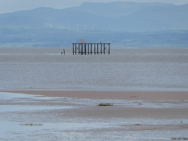
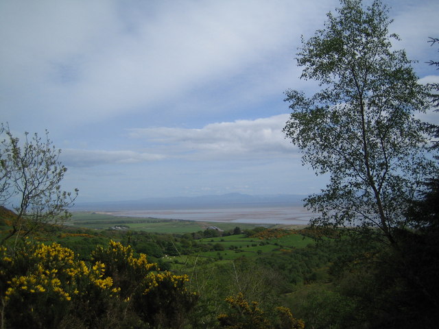
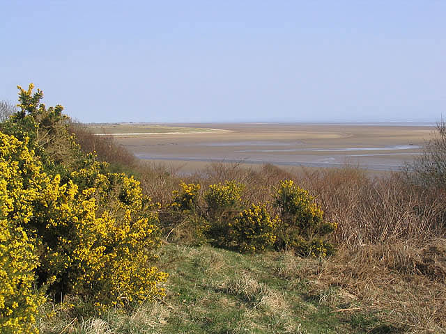
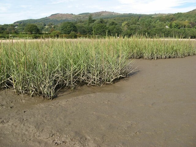
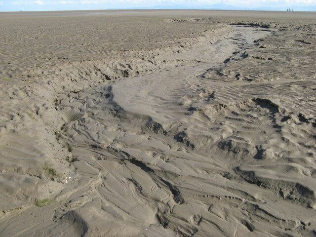
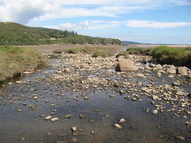
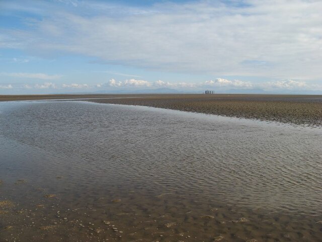
Sandyhills is a small village located in the historic county of Kirkcudbrightshire, Scotland. Situated on the Solway Firth coastline, it is known for its stunning natural beauty and tranquil atmosphere. The village is situated approximately 4 miles south of Dalbeattie and 20 miles southwest of Dumfries.

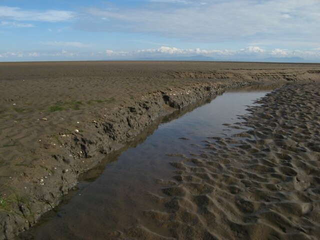
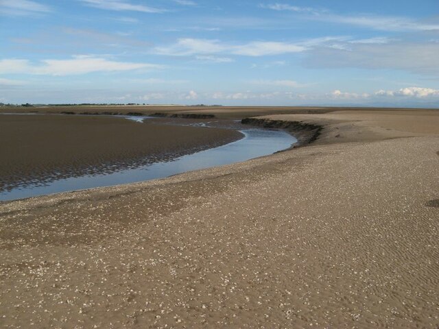
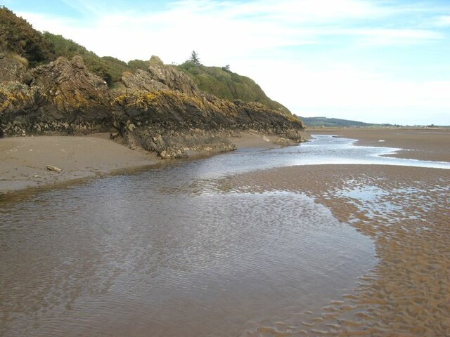
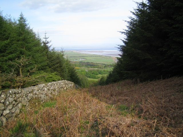
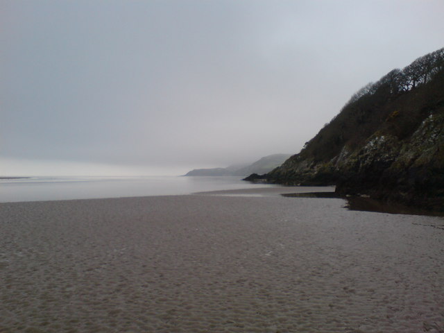
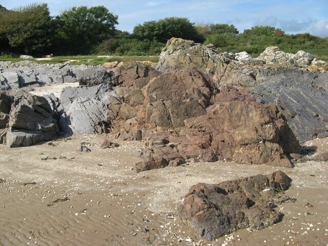
Sandyhills is surrounded by picturesque countryside, with rolling hills and lush green fields as far as the eye can see. It is popular amongst nature enthusiasts and outdoor adventurers, offering a variety of activities such as hiking, birdwatching, and horse riding. The nearby Dalbeattie Forest provides ample opportunities for walking and mountain biking.

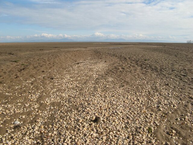
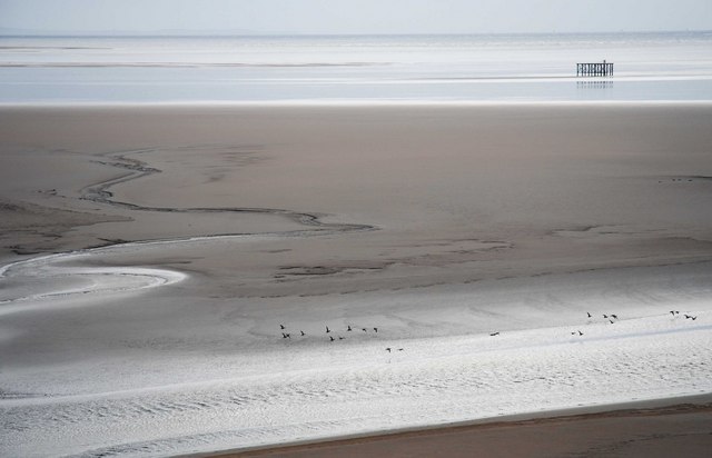
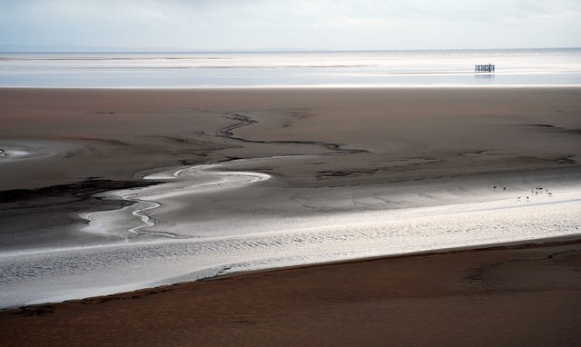
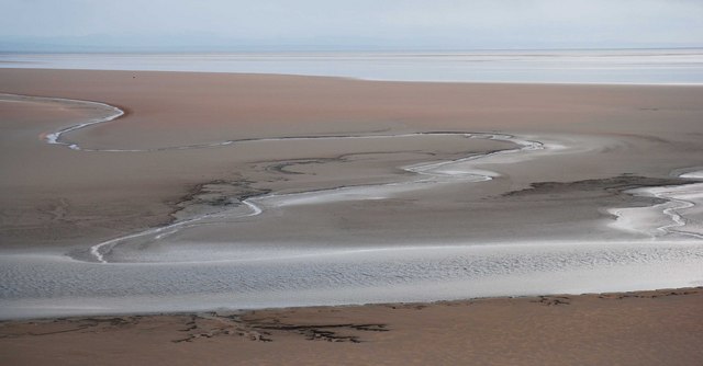
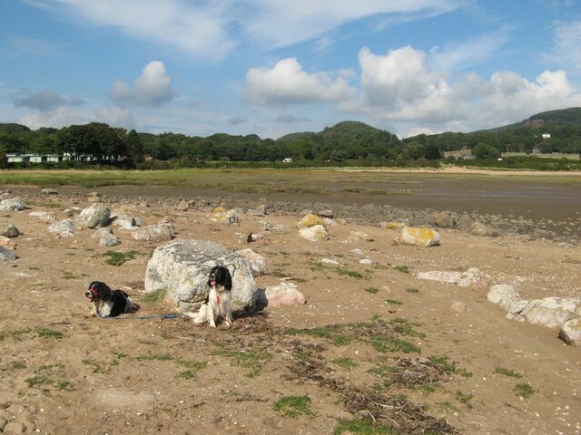
The village itself is small and charming, with a close-knit community. It boasts a handful of amenities including a local pub, a convenience store, and a caravan park which attracts tourists during the summer months. The sandy beach in Sandyhills is a major attraction, with its golden sand and clear blue waters providing a perfect spot for sunbathing, picnicking, and swimming.

Historically, Sandyhills has been a popular holiday destination, with many visitors flocking to the village during the summer season. The area has a rich history, with evidence of prehistoric settlements and ancient burial sites in the vicinity. The village has also been linked to the smuggling trade in the past, with tales of hidden caves and secret passages.

Overall, Sandyhills is a tranquil and picturesque village, offering a peaceful escape for those looking to immerse themselves in nature and enjoy the beauty of the Scottish countryside.

If you have any feedback on the listing, please let us know in the comments section below.

Sandyhills Images

Images are sourced within 2km of 54.882541/-3.7352348 or Grid Reference NX8855. Thanks to Geograph Open Source API. All images are credited.

Shell lag Empty cockle shells have been winnowed out of the fine sand by the tidal flow and left in this impressive strew on the surface. The place abounds in lessons for the geological interpretation of ancient fossil and sediment deposits.
Shell lag
Empty cockle shells have been winnowed out of the fine sand by the tidal flow and left in this impressive strew on the surface. The place abounds in lessons for the geological interpretation of ancient fossil and sediment deposits.
Erosion features The extent of re-working by tidal currents is a surprise. Here a channel can be seen eating its way through layered, muddy sand with cockle shell layers.
Erosion features
The extent of re-working by tidal currents is a surprise. Here a channel can be seen eating its way through layered, muddy sand with cockle shell layers.
Tidal river channel Part of the meandering course of Southwick Water as it makes its way across the sand at low tide.
Tidal river channel
Part of the meandering course of Southwick Water as it makes its way across the sand at low tide.
Rocks by Southwick Water The principal outfall of Southwick Water hugs the steep coastal rocks to form a channel which is intermittently quite deep for the unwary.
Rocks by Southwick Water
The principal outfall of Southwick Water hugs the steep coastal rocks to form a channel which is intermittently quite deep for the unwary.
Bombing range target Well out on Mersehead Sands.
'During World War 2 the airfield at Dumfries trained bomb aimers and air gunners, preparing them for their future role in Bomber Command. There were a few bombing ranges in the area which generally consisted of a wooden target situated away from towns and villages.' 
<span class="nowrap"><a title="https://www.solwaymilitarytrail.co.uk/trail-attractions/sandyhills-bombing-range/" rel="nofollow ugc noopener" href="https://www.solwaymilitarytrail.co.uk/trail-attractions/sandyhills-bombing-range/">Link</a><img style="margin-left:2px;" alt="External link" title="External link - shift click to open in new window" src="https://s1.geograph.org.uk/img/external.png" width="10" height="10"/></span>
Walter Baxter risked life and limb for a closer look <a title="https://www.geograph.org.uk/photo/2988812" href="https://www.geograph.org.uk/photo/2988812">Link</a>
Bombing range target
Well out on Mersehead Sands. 'During World War 2 the airfield at Dumfries trained bomb aimers and air gunners, preparing them for their future role in Bomber Command. There were a few bombing ranges in the area which generally consisted of a wooden target situated away from towns and villages.' LinkExternal link Walter Baxter risked life and limb for a closer look Link
View towards Mersehead Sands, Solway Firth The picture of Mersehead Sands was taken whilst ascending Bainloch Hill.
View towards Mersehead Sands, Solway Firth
The picture of Mersehead Sands was taken whilst ascending Bainloch Hill.
View down the firebreak to the Solway Firth
The Solway Firth Southwick Water at low tide with the Mersehead Sands beyond in the Solway Firth.
The Solway Firth
Southwick Water at low tide with the Mersehead Sands beyond in the Solway Firth.
Looking over the Solway Sands
Solway Sands
Solway Sands
Looking over the Solway Firth Sands
The Solway Coast The Solway coast looking towards Sandyhills Bay.
The Solway Coast
The Solway coast looking towards Sandyhills Bay.
Reed bed Not the most popular part of this wonderful bay, by virtue of the sticky, muddy substrate which is sufficiently rarely covered by the tide to support a significant bed of reeds which are just coming into flower.
Reed bed
Not the most popular part of this wonderful bay, by virtue of the sticky, muddy substrate which is sufficiently rarely covered by the tide to support a significant bed of reeds which are just coming into flower.
Dry channel Water drains off the sands rapidly as the tide falls, causing deep channels to form. The channel, now dried-out completely, shows a wonderful collection of intricate bedforms indicative of flowing water and sediment transport. A sedimentologist's dream?
Dry channel
Water drains off the sands rapidly as the tide falls, causing deep channels to form. The channel, now dried-out completely, shows a wonderful collection of intricate bedforms indicative of flowing water and sediment transport. A sedimentologist's dream?
Barnhourie Burn outlet The wide, shallow outlet of the burn at low tide.
Barnhourie Burn outlet
The wide, shallow outlet of the burn at low tide.
Outflow channel Water flowing out from the Barnhourie burn on the vast inter-tidal plain. The topography is much more complex than the map suggests!
Outflow channel
Water flowing out from the Barnhourie burn on the vast inter-tidal plain. The topography is much more complex than the map suggests!
Erratic boulder shore The strip above the normal tide level is strewn with very pleasing, rounded glacial erratic boulders. Their concentration at the two extremities of the shore at Sandyhills Bay is surprising.
Erratic boulder shore
The strip above the normal tide level is strewn with very pleasing, rounded glacial erratic boulders. Their concentration at the two extremities of the shore at Sandyhills Bay is surprising.
Red granite vein Grey rocks which are sedimentary in origin are intruded here by a wide vein of reddened granite. The contrast is very pleasing.
Red granite vein
Grey rocks which are sedimentary in origin are intruded here by a wide vein of reddened granite. The contrast is very pleasing.
Show me another place!

Sandyhills is located at Grid Ref: NX8855 (Lat: 54.882541, Lng: -3.7352348)

Unitary Authority: Dumfries and Galloway

Police Authority: Dumfries and Galloway

What 3 Words

///aviators.screaming.unhappily. Near Dalbeattie, Dumfries & Galloway

Related Wikis

Colvend and Southwick

Colvend and Southwick is a community council area and civil parish within the Stewartry area of Dumfries and Galloway, Scotland. It is also part of the...

Rough Island, Scotland

"Rough Island" is also used as a translation of "Garbh Eilean", a common Scottish name for islandsRough Island is a 20-acre (8 ha) uninhabited tidal island...

Rockcliffe, Dumfries and Galloway

Rockcliffe is a small, coastal village in Kirkcudbrightshire, Dumfries and Galloway in Scotland, with a view of Rough Island, Hestan Island, the Solway...

Kippford

Kippford (/ˈkɪpfəd/; otherwise Scaur) is a small village along the Solway coast, in the historic county of Kirkcudbrightshire in Dumfries and Galloway...

Rough Firth

Rough Firth is an inlet on the northern coast of the Solway Firth in the Stewartry area of Dumfries and Galloway, Scotland. The firth lies between Almorness...

Palnackie

Palnackie is a village in the parish of Buittle in the historical county of Kirkcudbrightshire in Dumfries and Galloway, Scotland. It has a population...

Hestan Island

Hestan Island is a small coastal island at the southern foot of the River Urr estuary in the Solway Firth, in the historical county of Kirkcudbrightshire...

Dalbeattie

Dalbeattie (, Scots: Dawbeattie, Scottish Gaelic: Dail Bheithe meaning 'haugh of the birch' or Dail bhàite 'drowned (i.e. liable to flood) haugh') is a...

Nearby Amenities

Located within 500m of 54.882541,-3.7352348
Bus Stop
Village
Naptan AtcoCode: 680000031111
Naptan Bearing: SW
Naptan CommonName: Village
Naptan Indicator: Car Park
Naptan Landmark: Beach
Naptan NaptanCode: 34238293
Naptan Notes: none
Naptan Street: A710
Naptan Verified: no
Shelter: yes
Source: naptan_import
Lat/Long: 54.880054/-3.7310868
Bus Stop
Village
Naptan AtcoCode: 680000031222
Naptan Bearing: NE
Naptan BusStopType: CUS
Naptan CommonName: Village
Naptan Indicator: opp Car Park
Naptan Landmark: Beach
Naptan NaptanCode: 34238294
Naptan Notes: none
Naptan Street: A710
Naptan Verified: no
Source: naptan_import
Lat/Long: 54.880127/-3.7313298
Sandyhills
Place: village
Lat/Long: 54.8808438/-3.7306608
Barend
Place: hamlet
Lat/Long: 54.8833983/-3.7356961
Barrier: lift_gate
Lat/Long: 54.8794749/-3.7308752
Post Box
Brand: Royal Mail
Brand Wikidata: Q638098
Collection Times: Mo-Fr 15:30; Sa 11:00
Operator: Royal Mail
Operator Wikidata: Q638098
Post Box Type: lamp
Ref: DG5 44
Royal Cypher: scottish_crown
Source: survey
Lat/Long: 54.8800861/-3.7311419
Telephone
Booth: K6
Covered: booth
Operator: BT
Operator Wikidata: Q593786
Phone: +44 1387 780200
Source: survey
Lat/Long: 54.8800895/-3.7308535
Toilets
Access: yes
Female: yes
Male: yes
Toilets Disposal: flush
Lat/Long: 54.8799398/-3.7306309
Access: customers
Leisure: swimming_pool
Location: indoor
Lat/Long: 54.8842707/-3.736952
Pub
The Beagle Country Pub
Lat/Long: 54.8841567/-3.7366759
Power: pole
Lat/Long: 54.8826332/-3.7285733
Power: pole
Lat/Long: 54.8825454/-3.7299331
Power: pole
Lat/Long: 54.8824782/-3.7310723
Power: pole
Lat/Long: 54.8824099/-3.7321861
Power: pole
Lat/Long: 54.8823342/-3.7333465
Power: pole
Lat/Long: 54.8820511/-3.7274998
Power: pole
Lat/Long: 54.885673/-3.7340678
Power: pole
Lat/Long: 54.8849763/-3.7335205
Power: pole
Lat/Long: 54.8839134/-3.732708
Power: pole
Lat/Long: 54.8830054/-3.7330835
Power: pole
Lat/Long: 54.8816777/-3.7338366
Power: pole
Lat/Long: 54.880993/-3.7342906
Power: pole
Lat/Long: 54.8804841/-3.7344221
Power: pole
Lat/Long: 54.8799935/-3.7345642
Power: pole
Lat/Long: 54.8791855/-3.7347488
Power: pole
Lat/Long: 54.8782421/-3.7351837
Power: pole
Lat/Long: 54.8804292/-3.7330007
Power: pole
Lat/Long: 54.880395/-3.7322497
Access: yes
Door: hinged
Entrance: shop
Lat/Long: 54.8801107/-3.7304168
The data included in this document is from www.openstreetmap.org. The data is made available under ODbL.

Have you been to Sandyhills?

Leave your review of Sandyhills below (or comments, questions and feedback).