Routster

Settlement in Yorkshire Craven

England

Routster

Eldroth, Garnet Brow According to the OS benchmark database there is a gatepost in this location with a cutmark on a face. 5 metres from the entrance there is a fallen gatepost. 3 sides of the post were checked but no benchmark was found.
Eldroth, Garnet Brow Credit: Mel Towler

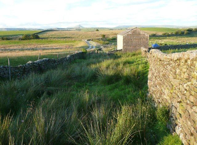
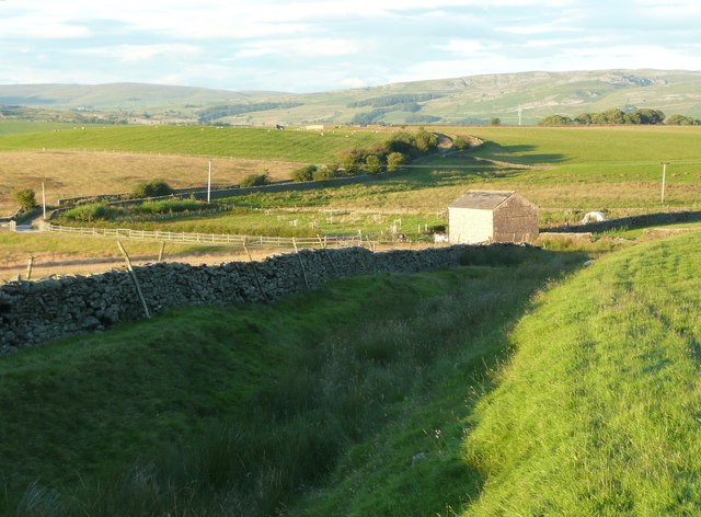
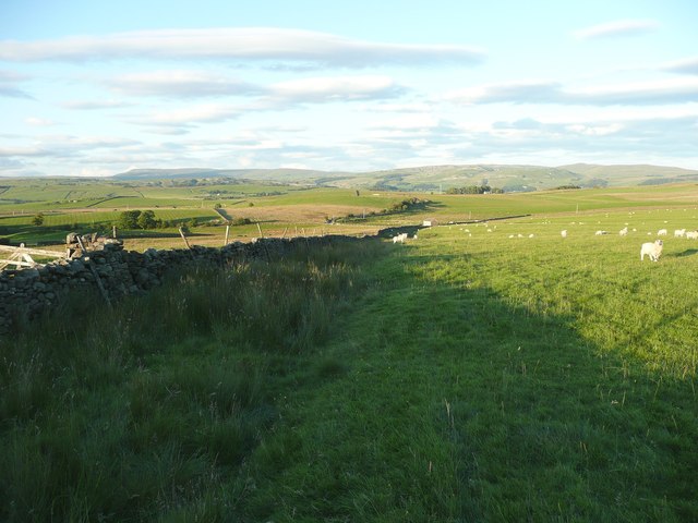
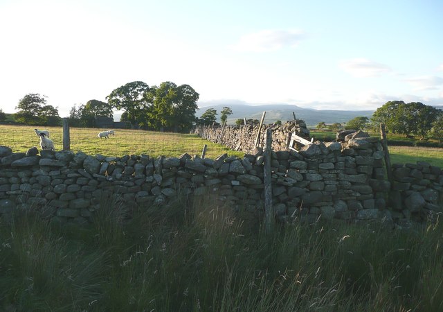
Routster is a small village nestled in the scenic countryside of Yorkshire, England. Situated on the eastern edge of the county, it is surrounded by rolling hills and lush green fields, offering residents and visitors a tranquil and picturesque setting.

With a population of around 500 people, Routster maintains a close-knit community atmosphere. The village is characterized by charming stone cottages, some of which date back several centuries, adding to its historic appeal. The local church, St. Mary's, stands proudly in the heart of the village, showcasing stunning architecture and serving as a focal point for religious and community events.

Despite its modest size, Routster boasts a range of amenities to cater to its residents' needs. The village is home to a primary school, providing education for local children, and a village hall that hosts various social gatherings and activities. Additionally, a cozy pub offers a friendly atmosphere for locals to catch up over a pint or enjoy a traditional British meal.

Surrounded by beautiful countryside, Routster is an ideal location for outdoor enthusiasts. The village provides easy access to numerous walking and cycling routes, allowing visitors to explore the breathtaking landscapes that Yorkshire is renowned for. The nearby River Swale also offers opportunities for fishing and boating.

Overall, Routster offers a peaceful and idyllic lifestyle, with its picturesque surroundings, strong sense of community, and access to the stunning Yorkshire countryside. It is a hidden gem for those seeking a tranquil retreat away from the hustle and bustle of city life.

If you have any feedback on the listing, please let us know in the comments section below.
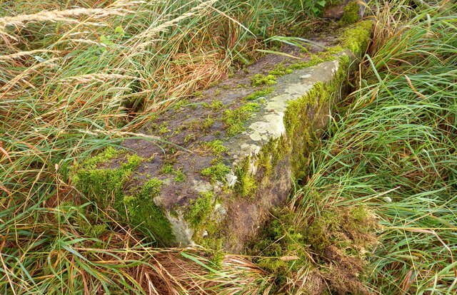
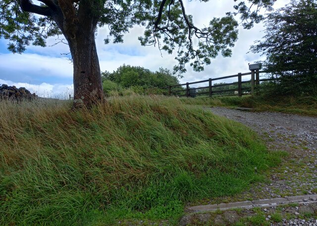
Routster Images

Images are sourced within 2km of 54.06403/-2.3546741 or Grid Reference SD7663. Thanks to Geograph Open Source API. All images are credited.

Eldroth, Garnet Brow According to the OS benchmark database there is a gatepost in this location with a cutmark on a face. 5 metres from the entrance there is a fallen gatepost. 3 sides of the post were checked but no benchmark was found.
Eldroth, Garnet Brow
According to the OS benchmark database there is a gatepost in this location with a cutmark on a face. 5 metres from the entrance there is a fallen gatepost. 3 sides of the post were checked but no benchmark was found.
Eldroth, Garnet Brow According to the OS benchmark database there is a gatepost on the right of this entrance with a cutmark on a face. 5 metres from the entrance, to the left of the tree, there is a fallen gatepost. 3 sides of the post were checked but no benchmark was found.
Eldroth, Garnet Brow
According to the OS benchmark database there is a gatepost on the right of this entrance with a cutmark on a face. 5 metres from the entrance, to the left of the tree, there is a fallen gatepost. 3 sides of the post were checked but no benchmark was found.
Eldroth, farm track The benchmark is cut into the drystone wall on the north side of the track.
Eldroth, farm track
The benchmark is cut into the drystone wall on the north side of the track.
Eldroth, farm track There is a benchmark cut into the drystone wall on the north side of the track.
Eldroth, farm track
There is a benchmark cut into the drystone wall on the north side of the track.
Stile on a footpath near Farther Rome, Giggleswick This is a long field path from Farther Rome to Lower Wham.
Stile on a footpath near Farther Rome, Giggleswick
This is a long field path from Farther Rome to Lower Wham.
Small footbridge in a little valley, Giggleswick A stone slab spans the narrow stream channel.
Small footbridge in a little valley, Giggleswick
A stone slab spans the narrow stream channel.
Lane to Lawkland Green
Structure near Blaithwaite Possibly a small covered reservoir.
Structure near Blaithwaite
Possibly a small covered reservoir.
Boundary stones Of the standard pattern in this area, with separate stones for each parish, here Lawkland and Giggleswick, with a distinctive shape.
Boundary stones
Of the standard pattern in this area, with separate stones for each parish, here Lawkland and Giggleswick, with a distinctive shape.
Parish boundary at a bend in the road The boundary stones, for Lawkland and Giggleswick, are against the wall amongst the plants on the left. See <a href="https://www.geograph.org.uk/photo/3079019">SD7864 : Boundary stones</a> for a close view.
Parish boundary at a bend in the road
The boundary stones, for Lawkland and Giggleswick, are against the wall amongst the plants on the left. See SD7864 : Boundary stones for a close view.
Parsons Close A grouping of house, small plantation to give shelter, and a telecommunications mast.
Parsons Close
A grouping of house, small plantation to give shelter, and a telecommunications mast.
View from Cross Lane
Green Lane The bottom end of the lane, where there is a barn. The lane is green, and also wet.
Green Lane
The bottom end of the lane, where there is a barn. The lane is green, and also wet.
Green Lane Named and shown as a walled lane on the 1850 OS map. Fortunately one can now walk along the rim on dry grass.
Green Lane
Named and shown as a walled lane on the 1850 OS map. Fortunately one can now walk along the rim on dry grass.
Higher Wham, Giggleswick
Brown House Barn from Green Lane
Green Lane Formerly an enclosed track, now evidently little-used, to judge by the obstruction at the top of this field where three gates are tied together and have to be climbed – not easy with a horse!
Green Lane
Formerly an enclosed track, now evidently little-used, to judge by the obstruction at the top of this field where three gates are tied together and have to be climbed – not easy with a horse!
Blocked footpath off Green Lane The OS map shows a public footpath from Green lane, from which this photograph was taken, to Routster, going along the left side of the sunlit wall.
Blocked footpath off Green Lane
The OS map shows a public footpath from Green lane, from which this photograph was taken, to Routster, going along the left side of the sunlit wall.
Show me another place!

Routster is located at Grid Ref: SD7663 (Lat: 54.06403, Lng: -2.3546741)

Division: West Riding

Administrative County: North Yorkshire

District: Craven

Police Authority: North Yorkshire

What 3 Words

///hiring.dollar.kingdom. Near Settle, North Yorkshire

Nearby Locations

Routster

Related Wikis

Eldroth

Eldroth is a village in North Yorkshire, England. It is in the civil parish of Lawkland, part of the former Craven District, some 3.25 miles (5.23 km)...

Lawkland

Lawkland is a civil parish in North Yorkshire, England, near the A65 and 4 miles (6.4 km) west of Settle. It lies within the Forest of Bowland Area of...

Giggleswick railway station

Giggleswick is a railway station on the Bentham Line, which runs between Leeds and Morecambe via Skipton. The station, situated 41+1⁄4 miles (66 km) north...
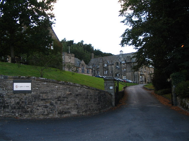
Giggleswick School

Giggleswick School is a public school (English private boarding and day school) in Giggleswick, near Settle, North Yorkshire, England. == Early school... ==

Nearby Amenities

Located within 500m of 54.06403,-2.3546741
Power: pole
Lat/Long: 54.0650061/-2.347352
Power: pole
Lat/Long: 54.066825/-2.3494277
Power: pole
Lat/Long: 54.0668339/-2.3508365
Power: pole
Lat/Long: 54.0670128/-2.3521308
Power: pole
Source: Bing
Lat/Long: 54.0671412/-2.3531691
Power: pole
Lat/Long: 54.0673534/-2.3547149
Power: pole
Lat/Long: 54.0675222/-2.3560281
Power: pole
Lat/Long: 54.0677117/-2.357594
Power: pole
Source: Bing
Lat/Long: 54.0676933/-2.3532446
Power: pole
Source: Bing
Lat/Long: 54.0681576/-2.3533483
Power: pole
Source: Bing
Lat/Long: 54.0648566/-2.3549605
Power: pole
Source: Bing
Lat/Long: 54.0650225/-2.3544624
Power: pole
Source: Bing
Lat/Long: 54.0651854/-2.3540163
Power: pole
Source: Bing
Lat/Long: 54.06598/-2.3536583
Power: pole
Source: Bing
Lat/Long: 54.0667518/-2.3533185
Power: pole
Source: Bing
Lat/Long: 54.0664641/-2.3523458
Power: pole
Source: Bing
Lat/Long: 54.0661795/-2.3513627
Power: pole
Source: Bing
Lat/Long: 54.0659481/-2.3505404
The data included in this document is from www.openstreetmap.org. The data is made available under ODbL.

Have you been to Routster?

Leave your review of Routster below (or comments, questions and feedback).