Roserrow

Settlement in Cornwall

England

Roserrow

Bluebells and gorse above Downhedge Cove The western side of this area of headland is seen from a distance in <a href="https://www.geograph.org.uk/photo/2389106">SW9480 : Bluebells above Downhedge Cove</a>. The bluebells are sprinkled with red campion. A view from the coast path.
Bluebells and gorse above Downhedge Cove Credit: Derek Harper

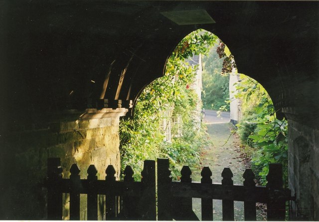
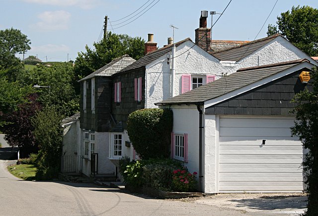
Roserrow is a charming village located in the county of Cornwall, England. Situated near the popular coastal town of Polzeath, it offers a tranquil and picturesque setting for residents and visitors alike. The village is nestled amidst rolling green hills and enjoys stunning views of the nearby coastline.

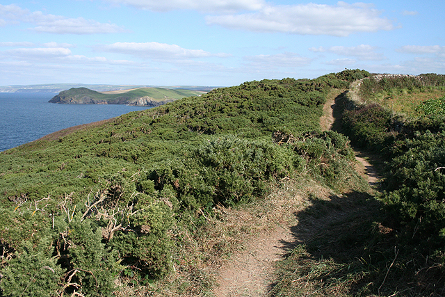
Roserrow is known for its natural beauty and is a favorite destination for those seeking a peaceful retreat. The area is home to a variety of wildlife, including rare bird species, making it a haven for nature enthusiasts. The village is surrounded by well-maintained walking trails, providing ample opportunity for outdoor exploration and leisurely strolls.

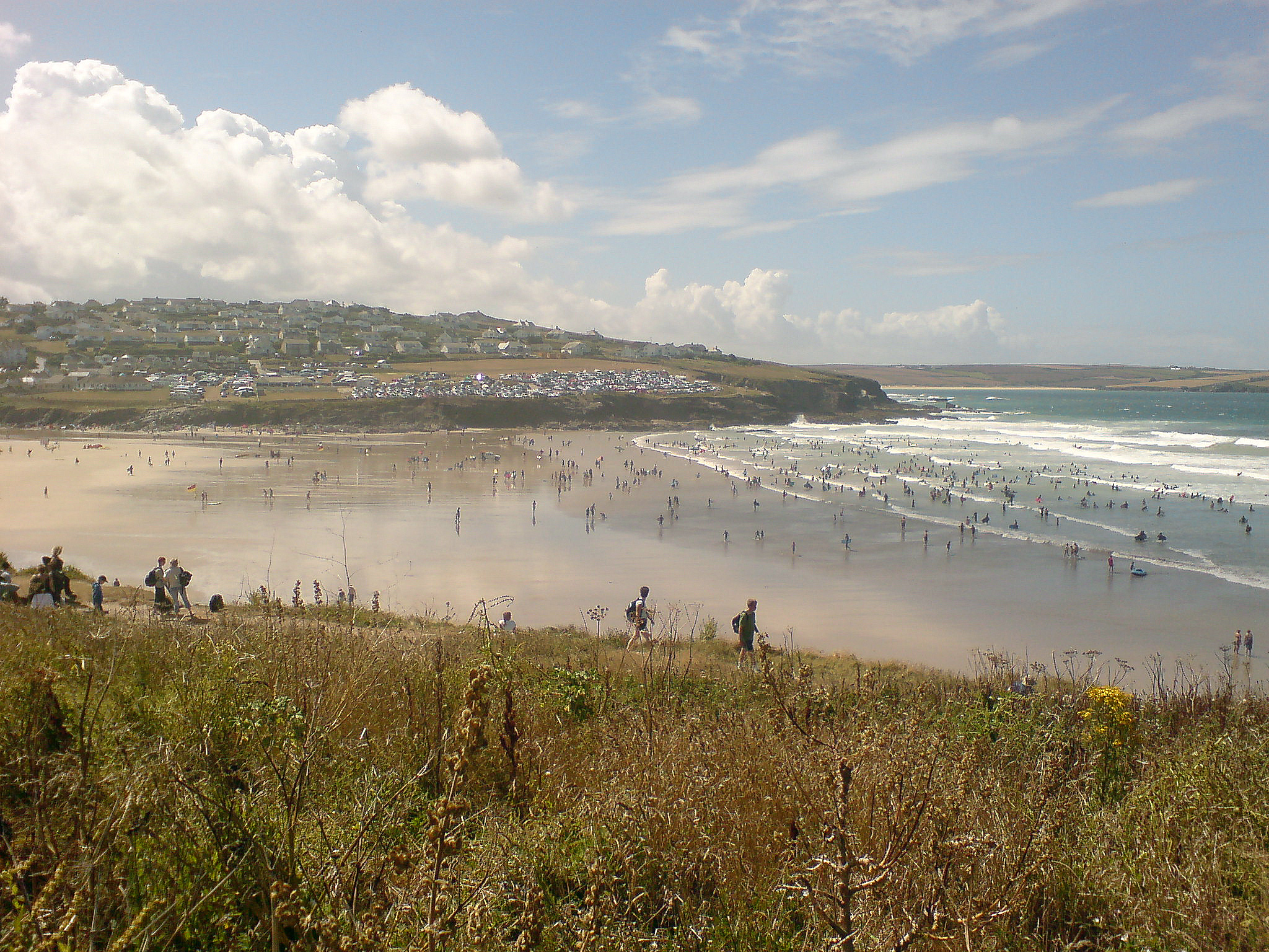
The nearby Polzeath Beach is a major attraction for beach lovers and surf enthusiasts. With its golden sands and clear blue waters, the beach offers excellent conditions for water sports such as surfing, paddleboarding, and swimming. Roserrow's close proximity to this popular beach makes it an ideal base for those looking to enjoy seaside activities.

The village itself boasts a range of amenities to cater to residents and visitors. It features a selection of local shops, cafes, and restaurants, offering a variety of dining options. For golf enthusiasts, Roserrow is home to a well-regarded golf course, providing a challenging and scenic experience for players of all levels.

Overall, Roserrow is a serene and idyllic village in Cornwall that offers a perfect blend of natural beauty, outdoor activities, and amenities. Whether seeking relaxation or adventure, this charming village has something to offer everyone.

If you have any feedback on the listing, please let us know in the comments section below.

Roserrow Images

Images are sourced within 2km of 50.566836/-4.896645 or Grid Reference SW9478. Thanks to Geograph Open Source API. All images are credited.

Bluebells and gorse above Downhedge Cove The western side of this area of headland is seen from a distance in <a href="https://www.geograph.org.uk/photo/2389106">SW9480 : Bluebells above Downhedge Cove</a>. The bluebells are sprinkled with red campion. A view from the coast path.
Bluebells and gorse above Downhedge Cove
The western side of this area of headland is seen from a distance in SW9480 : Bluebells above Downhedge Cove. The bluebells are sprinkled with red campion. A view from the coast path.
Bluebells above Downhedge Cove Another view of the flowers shown in <a href="https://www.geograph.org.uk/photo/2389365">SW9480 : Bluebells and gorse above Downhedge Cove</a>. This area seems to have been cleared recently, as satellite images shows gorse extending beyond the line of the fence on the right.
Bluebells above Downhedge Cove
Another view of the flowers shown in SW9480 : Bluebells and gorse above Downhedge Cove. This area seems to have been cleared recently, as satellite images shows gorse extending beyond the line of the fence on the right.
Bluebells above Downhedge Cove The South West Coast Path follows footpath 546/31/4 through a clifftop field of bluebells scattered with red campion. <a href="https://www.geograph.org.uk/photo/2389406">SW9480 : Bluebells above Downhedge Cove</a> is of the same field, almost certainly cleared of gorse in the last few years.
Bluebells above Downhedge Cove
The South West Coast Path follows footpath 546/31/4 through a clifftop field of bluebells scattered with red campion. SW9480 : Bluebells above Downhedge Cove is of the same field, almost certainly cleared of gorse in the last few years.
Bluebells above Downhedge Cove Another view across the clifftop field shown in <a href="https://www.geograph.org.uk/photo/2389459">SW9480 : Bluebells above Downhedge Cove</a> and <a href="https://www.geograph.org.uk/photo/2389406">SW9480 : Bluebells above Downhedge Cove</a>.
Bluebells above Downhedge Cove
Another view across the clifftop field shown in SW9480 : Bluebells above Downhedge Cove and SW9480 : Bluebells above Downhedge Cove.
Bluebells on the coast path The South West Coast Path follows footpath 546/31/4, with Com Head the next headland. Jutting out further away are The Rumps.
Bluebells on the coast path
The South West Coast Path follows footpath 546/31/4, with Com Head the next headland. Jutting out further away are The Rumps.
Coast Path above Carnweather Point The South West Coast Path follows footpath 546/31/4 along the top of the coastal slope. Jutting out to sea on the left is Kellan Head.
Coast Path above Carnweather Point
The South West Coast Path follows footpath 546/31/4 along the top of the coastal slope. Jutting out to sea on the left is Kellan Head.
Downhedge Cove View from the South West Coast Path
Downhedge Cove
View from the South West Coast Path
Carnweather Point Looking back over the western part of Port Quin Bay from the South West Coast Path.
Carnweather Point
Looking back over the western part of Port Quin Bay from the South West Coast Path.
Downhedge Cove Low tide in Downhedge Cove. A spring has gradually eroded this cove which is only really seafree at low tide. There is no access to it from the footpath above
Downhedge Cove
Low tide in Downhedge Cove. A spring has gradually eroded this cove which is only really seafree at low tide. There is no access to it from the footpath above
St Minver Highlands: Port Quin Bay Headlands, from left to right – Kellan Head, Doyden Point and Trevan Point. Seen from near Carnweather Point. Doyden house, now owned by the National Trust, stands above Trevan Point. It was built in the late 19th century by a governor of Wandsworth Prison, London
St Minver Highlands: Port Quin Bay
Headlands, from left to right – Kellan Head, Doyden Point and Trevan Point. Seen from near Carnweather Point. Doyden house, now owned by the National Trust, stands above Trevan Point. It was built in the late 19th century by a governor of Wandsworth Prison, London
St Minver Highlands: by Carnweather Point Port Quin Bay. Looking towards Com Head and The Rumps on the South West Coast Path. The island is known as The Mouls
St Minver Highlands: by Carnweather Point
Port Quin Bay. Looking towards Com Head and The Rumps on the South West Coast Path. The island is known as The Mouls
St Minver Highlands: near Carnweather Point With Kellan Head in the distance, left, marking the entrance to Port Quin
St Minver Highlands: near Carnweather Point
With Kellan Head in the distance, left, marking the entrance to Port Quin
St Minver Highlands: on the South West Coast Path By Port Quin Bay with Trevan Point in view
St Minver Highlands: on the South West Coast Path
By Port Quin Bay with Trevan Point in view
Port Quin Bay viewed from near Carnweather Point View across Port Quin Bay from near Carnweather Point, across the bay from left to right is Kellan Head, Doyden Point and Trevan Point.
Port Quin Bay viewed from near Carnweather Point
View across Port Quin Bay from near Carnweather Point, across the bay from left to right is Kellan Head, Doyden Point and Trevan Point.
The Coastal Slope Looking Towards Carnweather Point In the distance is the promontory of The Rumps and the island called The Mouls in <a href="https://www.geograph.org.uk/gridref/SW9381">SW9381</a>.
The Coastal Slope Looking Towards Carnweather Point
In the distance is the promontory of The Rumps and the island called The Mouls in SW9381.
St Miniver church gateway Dappled sunlight through the parish church gateway.
St Miniver church gateway
Dappled sunlight through the parish church gateway.
Barns, Pentireglaze The barns can be seen from the opposite direction left of centre in <a href="https://www.geograph.org.uk/photo/721718">SW9479 : Pentireglaze</a>. The modern house on the ridge is Bellapaise.
Barns, Pentireglaze
The barns can be seen from the opposite direction left of centre in SW9479 : Pentireglaze. The modern house on the ridge is Bellapaise.
Lane at Pentireglaze Similar to <a href="https://www.geograph.org.uk/photo/2388980">SW9479 : Barns, Pentireglaze</a>, with the lane to Polzeath crossing the valley that leads down to the sea at Pentireglaze Haven. Alexanders in the foreground.
Lane at Pentireglaze
Similar to SW9479 : Barns, Pentireglaze, with the lane to Polzeath crossing the valley that leads down to the sea at Pentireglaze Haven. Alexanders in the foreground.
Show me another place!

Roserrow is located at Grid Ref: SW9478 (Lat: 50.566836, Lng: -4.896645)

Unitary Authority: Cornwall

Police Authority: Devon and Cornwall

What 3 Words

///handover.privately.gratuity. Near Polzeath, Cornwall

Nearby Locations

Roserrow

Related Wikis

Tredrizzick

Tredrizzick (Cornish: Treredenek) is a small village in Cornwall, England, United Kingdom, at grid reference SW 955 769. It is on the road linking the...
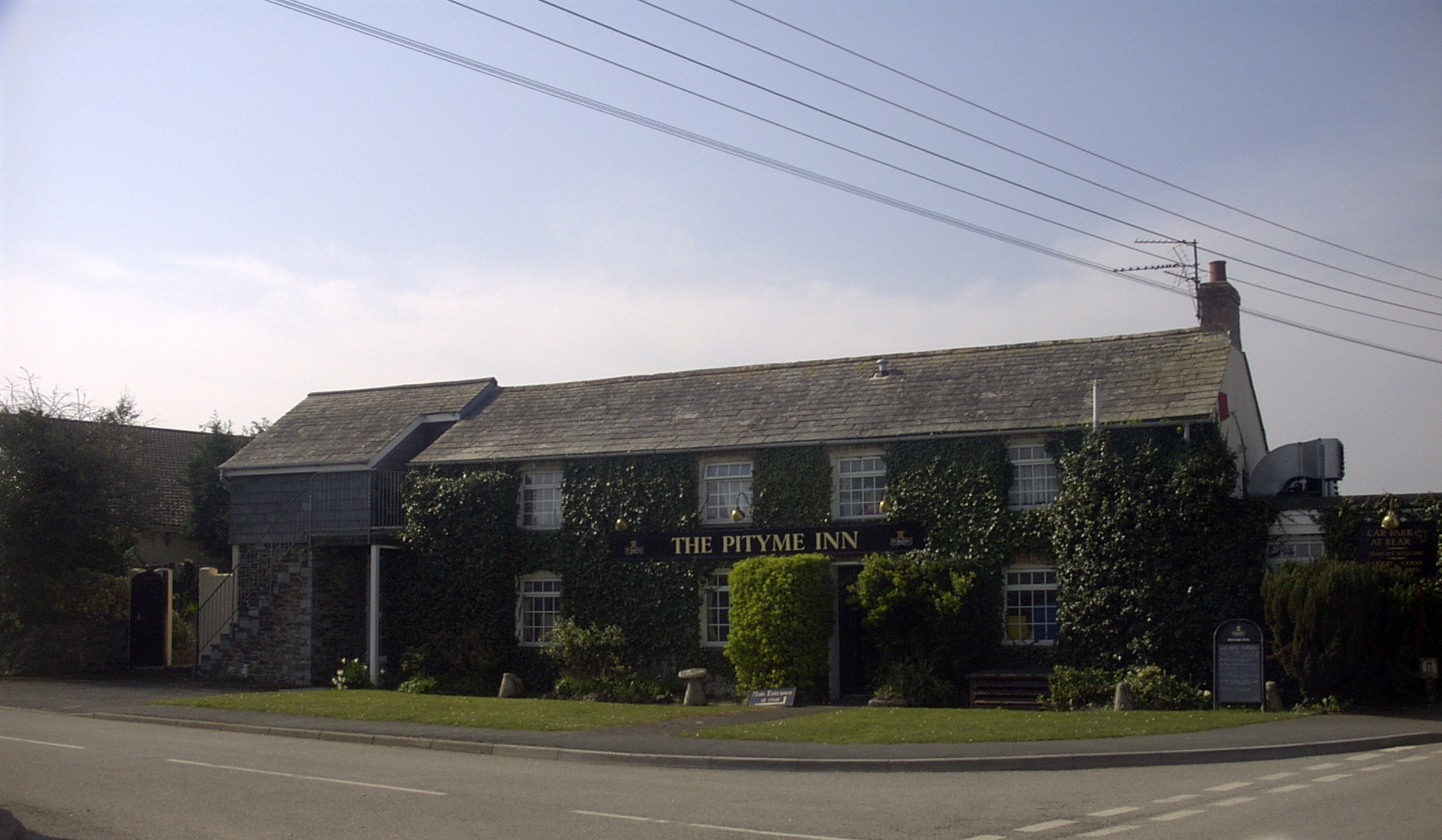
Pityme

Pityme () is a small village at grid reference SW 952 767 in north Cornwall, England, United Kingdom. Pityme is at the junction of the road from Wadebridge...

Polzeath

Polzeath (;Standard Written Form: Polsegh, meaning dry creek) is a small seaside resort village in the civil parish of St Minver in Cornwall, England,...

Trebetherick

Trebetherick (Cornish: Trebedrek) is a village on the north coast of Cornwall. It is situated on the east side of the River Camel estuary approximately...

Nearby Amenities

Located within 500m of 50.566836,-4.896645
Roserrow
Place: hamlet
Lat/Long: 50.5661275/-4.896013
The Point at Polzeath
Addr City: Polzeath / St Minver
Addr Postcode: PL27 6QT
Alt Name: Point Golf Course
Building: yes
Int Name: Polzeath Golf Course
Leisure: sports_centre
Website: https://www.thepointatpolzeath.co.uk/
Lat/Long: 50.5647088/-4.9017141
Restaurant
Point at Polzeath Restaurant
Addr City: Polzeath
Addr Housename: The Point
Addr Postcode: PL27 6QT
Source: visit
Website: https://www.thepointatpolzeath.co.uk/
Lat/Long: 50.5640284/-4.9017517
The data included in this document is from www.openstreetmap.org. The data is made available under ODbL.

Have you been to Roserrow?

Leave your review of Roserrow below (or comments, questions and feedback).