Roan of Craigoch

Settlement in Ayrshire

Scotland

Roan of Craigoch

Autumn in Tradunnock Wood Autumn colours were showing well in Tradunnock Wood on this November visit. The wood was planted during the 18th century as part of the agricultural improvements. For a springtime view see <a href="https://www.geograph.org.uk/photo/6459539">NS3005 : In Tradunnock beechwood</a>
Autumn in Tradunnock Wood Credit: Mary and Angus Hogg

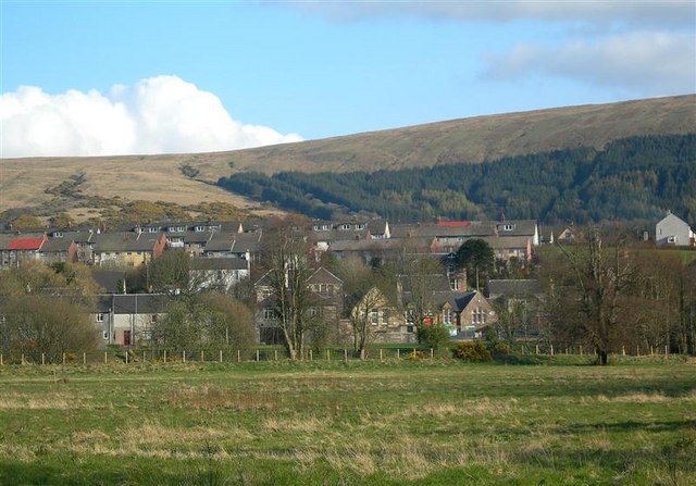
Roan of Craigoch is a small hamlet located in the picturesque county of Ayrshire, Scotland. Situated in the southwestern part of the country, it is nestled amidst rolling hills and lush greenery, providing a serene and tranquil atmosphere.

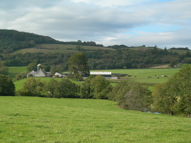
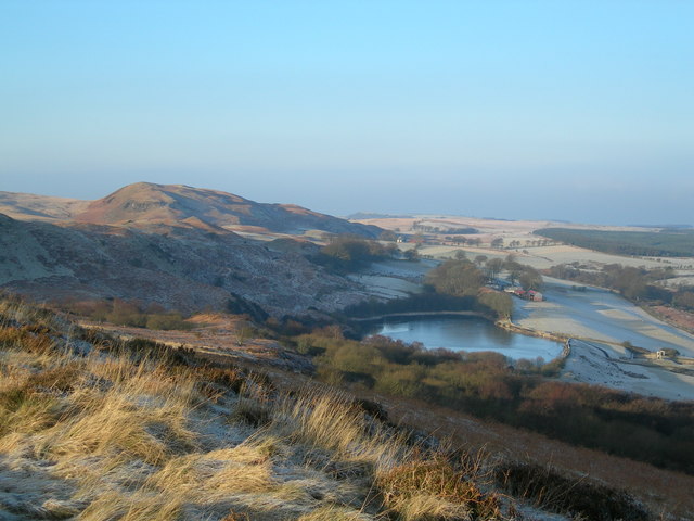
The hamlet derives its name from the prominent Roan Hill that overlooks the area, offering panoramic views of the surrounding countryside. Roan of Craigoch is surrounded by farmland, which contributes to its rural charm and agricultural character.

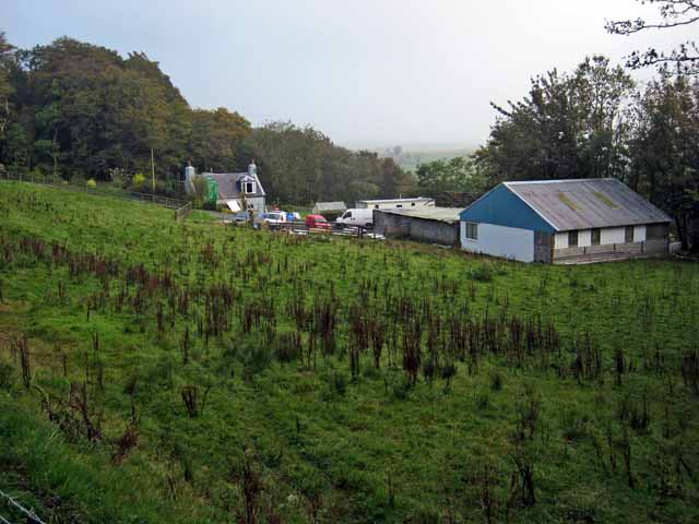
With a population of around 200 residents, Roan of Craigoch boasts a close-knit community that values its traditions and heritage. The hamlet is known for its friendly locals who warmly welcome visitors and take pride in their beautiful corner of Ayrshire.

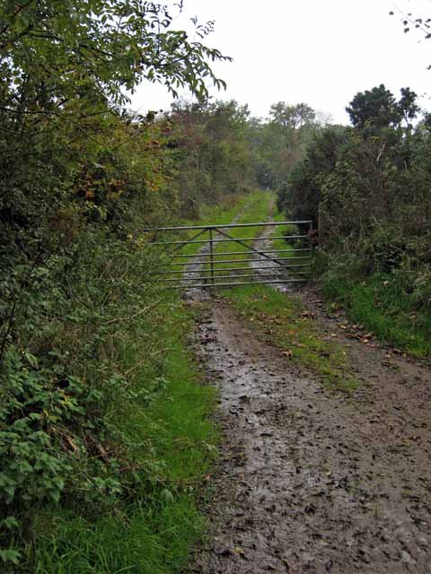
Despite its small size, Roan of Craigoch is well-connected to the nearby towns and cities. The main road passing through the hamlet provides easy access for transportation, making it convenient for both residents and visitors to explore the wider region.

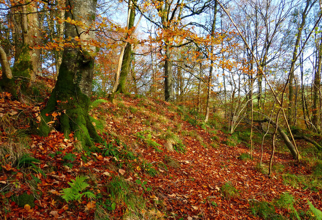
Nature lovers are drawn to Roan of Craigoch for its abundance of outdoor activities. The surrounding countryside offers opportunities for hiking, cycling, and fishing, allowing visitors to immerse themselves in the breathtaking landscapes.

Overall, Roan of Craigoch is a charming and idyllic hamlet that showcases the natural beauty and warmth of Ayrshire. Its tranquil setting, strong community spirit, and access to the outdoors make it a delightful destination for those seeking a peaceful retreat in the heart of Scotland.

If you have any feedback on the listing, please let us know in the comments section below.

Roan of Craigoch Images

Images are sourced within 2km of 55.303973/-4.6844717 or Grid Reference NS2904. Thanks to Geograph Open Source API. All images are credited.

Autumn in Tradunnock Wood Autumn colours were showing well in Tradunnock Wood on this November visit. The wood was planted during the 18th century as part of the agricultural improvements. For a springtime view see <a href="https://www.geograph.org.uk/photo/6459539">NS3005 : In Tradunnock beechwood</a>
Autumn in Tradunnock Wood
Autumn colours were showing well in Tradunnock Wood on this November visit. The wood was planted during the 18th century as part of the agricultural improvements. For a springtime view see NS3005 : In Tradunnock beechwood
Barcully sky The promise of a fine winter sunset didn’t live up to expectation with the colours fading shortly after this shot was taken.
Barcully sky
The promise of a fine winter sunset didn’t live up to expectation with the colours fading shortly after this shot was taken.
Carsloe Farm Carsloe Farm and the Water of Girvan, with Craigfin Hill in the background
Carsloe Farm
Carsloe Farm and the Water of Girvan, with Craigfin Hill in the background
Girvan valley Looking from the B741 Girvan to Maybole road towards Kilkerran House.
Girvan valley
Looking from the B741 Girvan to Maybole road towards Kilkerran House.
Grass runway on the Kilkerran estate Beside the Water of Girvan
Grass runway on the Kilkerran estate
Beside the Water of Girvan
Black Glen
Black Glen
Farm road to Craigfin Off the High Road from Maybole to Dailly
Farm road to Craigfin
Off the High Road from Maybole to Dailly
Lodge and entrance to Kilkerran Estate Some fine specimen trees in the park.
Lodge and entrance to Kilkerran Estate
Some fine specimen trees in the park.
Lodge to Kilkerran Castle One of three or four entrances to the Castle grounds. This is the northernmost, close to Ruglen.
Lodge to Kilkerran Castle
One of three or four entrances to the Castle grounds. This is the northernmost, close to Ruglen.
Ladyburn
Ladyburn
Hamilton Bridge Looking down the Water of Girvan towards Hamilton Bridge, on a fine March afternoon. This bridge was built in 1825 by Sir James Fergusson of Kilkerran who named it after his friend Sir Hew Hamilton of Bargany.
Hamilton Bridge
Looking down the Water of Girvan towards Hamilton Bridge, on a fine March afternoon. This bridge was built in 1825 by Sir James Fergusson of Kilkerran who named it after his friend Sir Hew Hamilton of Bargany.
Water of Girvan Viewed from the fishermen's track on the north bank on a March afternoon.  The Girvan is a salmon-fishing river, with several pools on this stretch.
Water of Girvan
Viewed from the fishermen's track on the north bank on a March afternoon. The Girvan is a salmon-fishing river, with several pools on this stretch.
Water of Girvan The open part of the River Girvan, before it enters the narrow wooded section on its way to Hamilton Bridge.
Water of Girvan
The open part of the River Girvan, before it enters the narrow wooded section on its way to Hamilton Bridge.
Reflections The Water of Girvan below the Hamilton Bridge, on a fine March afternoon.
Reflections
The Water of Girvan below the Hamilton Bridge, on a fine March afternoon.
Footbridge Across The River Girvan Viewed on a cool October morning, just as the mist was lifting from the valley floor.
Footbridge Across The River Girvan
Viewed on a cool October morning, just as the mist was lifting from the valley floor.
River Girvan Viewed on a fine October morning, after a cold and frosty night.
River Girvan
Viewed on a fine October morning, after a cold and frosty night.
Drumgirnan Bridge Built across the River Girvan in 1799, Drumgirnan Bridge features upcurved parapets, a vermiculated arch, quatrefoils and monarch's heads. (Source: "Discovering Ayrshire", by John Strawhorn & Ken Andrew).
Drumgirnan Bridge
Built across the River Girvan in 1799, Drumgirnan Bridge features upcurved parapets, a vermiculated arch, quatrefoils and monarch's heads. (Source: "Discovering Ayrshire", by John Strawhorn & Ken Andrew).
Drumgirnan Bridge Detail The bridge, built in 1799, features the heads of sad-faced and happy monarchs.  The arches are "vermiculated", ie: they look like they have worm holes.
Drumgirnan Bridge Detail
The bridge, built in 1799, features the heads of sad-faced and happy monarchs. The arches are "vermiculated", ie: they look like they have worm holes.
Show me another place!

Roan of Craigoch is located at Grid Ref: NS2904 (Lat: 55.303973, Lng: -4.6844717)

Unitary Authority: South Ayrshire

Police Authority: Ayrshire

What 3 Words

///directive.chuckle.gates. Near Maybole, South Ayrshire

Nearby Locations

Roan of Craigoch Ruglen

Related Wikis

Kilkerran railway station

Kilkerran railway station served an area of rural Ayrshire, Scotland from 1860 to 1965 on the Maybole and Girvan Railway. == History == The station opened...

Kilkerran House

Kilkerran House is an 18th-century private house near Maybole, Ayrshire, Scotland. It is a category A listed building set within grounds included in the...

Lochspouts

Lochspouts Loch (NS 2885 0586) or Lochspouts was situated in a hollow, surrounded by hilly ground on three sides and bounded by a narrow trap dyke to the...

South Ayrshire

South Ayrshire (Scots: Sooth Ayrshire; Scottish Gaelic: Siorrachd Àir a Deas, pronounced [ˈʃirˠəxk aːɾʲ ə ˈtʲes̪]) is one of thirty-two council areas of...

Crosshill railway station (Ayr)

Crosshill railway station served the village of Crosshill, South Ayrshire, Scotland, from 1860 to 1862 on the Maybole and Girvan Railway. == History... ==

Dalquharran Castle

Dalquharran Castle is a category A listed building in South Ayrshire, Scotland, designed by Robert Adam and completed around 1790. The first recorded lord...

Crosshill, South Ayrshire

Crosshill is a small village in South Ayrshire, Scotland.Crosshill has a primary school. == References ==

Dailly

Dailly (Scottish Gaelic: Dail Mhaol Chiarain) is a village in South Ayrshire, Scotland. It is located on the Water of Girvan, five miles (eight kilometres...

Nearby Amenities

Located within 500m of 55.303973,-4.6844717
Kilkerran
Historic Railway: station
Railway: site
Lat/Long: 55.3036546/-4.6844052
Railway: level_crossing
Lat/Long: 55.30382/-4.6841421
Power: pole
Lat/Long: 55.3057991/-4.6773269
Power: pole
Lat/Long: 55.3059899/-4.6781225
Power: pole
Lat/Long: 55.3053758/-4.6788143
Power: pole
Lat/Long: 55.3047805/-4.6795461
Power: pole
Lat/Long: 55.304118/-4.6803771
Power: pole
Lat/Long: 55.3035388/-4.6810925
Power: pole
Lat/Long: 55.3028857/-4.6818857
Power: pole
Lat/Long: 55.3023562/-4.6825278
Power: pole
Lat/Long: 55.3018966/-4.6830897
Power: pole
Lat/Long: 55.3020807/-4.6843174
Power: pole
Lat/Long: 55.3022245/-4.6852404
Power: pole
Lat/Long: 55.3023535/-4.6860526
Power: pole
Lat/Long: 55.3025874/-4.686546
Power: pole
Lat/Long: 55.3030443/-4.6866239
Power: pole
Lat/Long: 55.3035885/-4.6867065
Power: pole
Lat/Long: 55.3039406/-4.6865837
Power: pole
Lat/Long: 55.3042685/-4.686461
Power: pole
Lat/Long: 55.3038277/-4.6801198
Power: pole
Lat/Long: 55.3035435/-4.6798459
Power: pole
Lat/Long: 55.3034904/-4.6873605
Power: pole
Lat/Long: 55.3033843/-4.6879908
Power: pole
Lat/Long: 55.3000836/-4.6823201
Power: pole
Lat/Long: 55.3007731/-4.6826176
Power: pole
Lat/Long: 55.3013846/-4.6828702
The data included in this document is from www.openstreetmap.org. The data is made available under ODbL.

Have you been to Roan of Craigoch?

Leave your review of Roan of Craigoch below (or comments, questions and feedback).