Riverside of Blairs

Settlement in Kincardineshire

Scotland

Riverside of Blairs

Driveway to Auchlunies
Driveway to Auchlunies Credit: Alan Reid

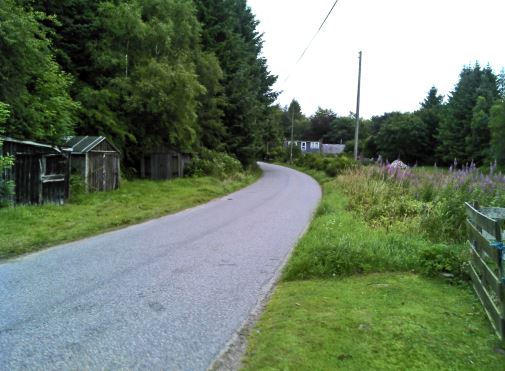
Riverside of Blairs is a charming village located in the picturesque region of Kincardineshire, Scotland. Situated on the banks of the River Dee, this idyllic hamlet offers a tranquil retreat for residents and visitors alike.

The village is known for its stunning natural beauty, with the river flowing gently through the heart of the community, surrounded by lush greenery and rolling hills. The Riverside of Blairs offers a peaceful and serene environment, making it an ideal destination for those seeking respite from the hustle and bustle of city life.

Despite its small size, Riverside of Blairs boasts a close-knit and welcoming community. The locals are known for their friendly nature and warm hospitality, making visitors feel right at home. The village offers a range of amenities, including a local pub, a small convenience store, and a post office, ensuring that residents have their everyday needs catered to.

Outdoor enthusiasts will be delighted by the abundance of recreational activities available in and around Riverside of Blairs. The river offers excellent fishing opportunities, attracting anglers from far and wide. The surrounding countryside is perfect for hiking, cycling, and exploring, with numerous trails and paths meandering through the stunning landscape.

For history enthusiasts, the nearby Blairs Museum is a must-visit attraction. Housed in the historic Blairs College, the museum showcases a fascinating collection of religious artifacts and provides insight into the area's rich cultural heritage.

Overall, Riverside of Blairs is a hidden gem in Kincardineshire, offering a picturesque retreat with its natural beauty, friendly community, and range of recreational activities.

If you have any feedback on the listing, please let us know in the comments section below.

Riverside of Blairs Images

Images are sourced within 2km of 57.101683/-2.1951996 or Grid Reference NJ8801. Thanks to Geograph Open Source API. All images are credited.

Driveway to Auchlunies
Craigingles Wood The southern fringe of Craigingles Wood viewed from the south-east.
Craigingles Wood
The southern fringe of Craigingles Wood viewed from the south-east.
Minor road, Hill of Blairs Very much a wooded corner of Kincardineshire. The woodland is long established and varied.
Minor road, Hill of Blairs
Very much a wooded corner of Kincardineshire. The woodland is long established and varied.
Looking toward the road junction Photographer is standing on the roadway edge near Sunnyside Croft.
Looking toward the road junction
Photographer is standing on the roadway edge near Sunnyside Croft.
Looking southwest from Sunnyside Croft Photographer is standing near the edge of the minor road.
Looking southwest from Sunnyside Croft
Photographer is standing near the edge of the minor road.
Craigend road scene Photographer is standing on the road verge
Craigend road scene
Photographer is standing on the road verge
Gated access to Craigingles Wood From minor road north of Craigend.
Gated access to Craigingles Wood
From minor road north of Craigend.
Access to Auchlunies House From the road junction north of The Briggs.
Access to Auchlunies House
From the road junction north of The Briggs.
Approaching Bogleuchars Croft On minor road from Burnhead.
Approaching Bogleuchars Croft
On minor road from Burnhead.
Road near to Westerton Looking southward.
Road near to Westerton
Looking southward.
St Devenick's Bieldside
A93, Bieldside
A93, Bieldside
A93, Bieldside
A93, Bieldside
Cult's Kirk Sanctuary
OS Cut Mark - Bieldside, Bieldside Inn <span class="nowrap"><a title="https://www.bench-marks.org.uk/bm84439" rel="nofollow ugc noopener" href="https://www.bench-marks.org.uk/bm84439">Link</a><img style="margin-left:2px;" alt="External link" title="External link - shift click to open in new window" src="https://s1.geograph.org.uk/img/external.png" width="10" height="10"/></span>
OS Cut Mark - Bieldside, Bieldside Inn
Location of OS Cut Mark - Bieldside, Bieldside Inn
Murtle Den Crescent, Milltimber, Aberdeen Murtle Den Crescent leads into Oldfold Park, a recently-built housing development in Milltimber, on the outskirts of Aberdeen.
Murtle Den Crescent, Milltimber, Aberdeen
Murtle Den Crescent leads into Oldfold Park, a recently-built housing development in Milltimber, on the outskirts of Aberdeen.
St Mary's Chapel The massive, cathedral-like St Mary's Chapel is part of the former Blairs College Roman Catholic seminary. The college complex, incorporating several phases of building and a very large site, closed in the 1980s but the chapel remains open for regular services and for visitors. A small museum and tea room is open throughout the year, and displays some of the College's Catholic art collection, including medieval vestments and the memorial portrait of Mary, Queen of Scots. The college and chapel are built in the former estate lands of John Menzies of Pitfodels who donated the estate to the Catholic Church. The site is in open countryside, close to the banks of the River Dee and set amongst former park land with avenues of trees and straight-edged fields. 

St Mary's Chapel was built as part of a new range for the college, using generous funding by Major Lennon of Liverpool. The chapel is built onto the U-plan range of New College, built from 1898. The chapel itself, to the east of the college, was started in 1899 with Robert Curran as architect.
St Mary's Chapel
The massive, cathedral-like St Mary's Chapel is part of the former Blairs College Roman Catholic seminary. The college complex, incorporating several phases of building and a very large site, closed in the 1980s but the chapel remains open for regular services and for visitors. A small museum and tea room is open throughout the year, and displays some of the College's Catholic art collection, including medieval vestments and the memorial portrait of Mary, Queen of Scots. The college and chapel are built in the former estate lands of John Menzies of Pitfodels who donated the estate to the Catholic Church. The site is in open countryside, close to the banks of the River Dee and set amongst former park land with avenues of trees and straight-edged fields. St Mary's Chapel was built as part of a new range for the college, using generous funding by Major Lennon of Liverpool. The chapel is built onto the U-plan range of New College, built from 1898. The chapel itself, to the east of the college, was started in 1899 with Robert Curran as architect.
Show me another place!

Riverside of Blairs is located at Grid Ref: NJ8801 (Lat: 57.101683, Lng: -2.1951996)

Unitary Authority: Aberdeenshire

Police Authority: North East

What 3 Words

///delay.foal.kinds. Near Cults, Aberdeen

Nearby Locations

Riverside of Blairs

Related Wikis

Blairs College

St Mary's College, Blairs (commonly known as Blairs College), situated near Aberdeen in Scotland, was from 1829 to 1986 a junior seminary for boys and...

Bieldside railway station

Bieldside railway station served the Bieldside area within the parish of Peterculter from 1897 to 1937 on the Deeside Railway that ran from Aberdeen (Joint...

Bieldside

Bieldside is a suburb to the west of Aberdeen City Centre, Scotland. Together with the neighbouring suburb of Cults, it is the wealthiest area in Scotland...

Murtle railway station

Murtle railway station, later Murtle Halt railway station served Murtle and Beaconhill Houses and estates, the Mill of Murtle, Milton of Murtle, the local...

West Cults railway station

West Cults railway station served the small suburban village of West Cults area within the parish of Peterculter from 1894 to 1937 on the Deeside Railway...

Deeside Way

The Deeside Way is a 41-mile (66 km) rail trail that follows, in part, the bed of the former Deeside Railway in Aberdeenshire. Forming part of the National...

Cults Academy

Cults Academy is an Aberdeen City Council secondary school in Cults, Aberdeen, Scotland. It was the recipient of The Sunday Times Scottish State Secondary...

Lower Deeside

Lower Deeside is a region along the River Dee in Aberdeenshire and Aberdeen in Scotland. The boundaries of this area are subject to interpretation, since...

Nearby Amenities

Located within 500m of 57.101683,-2.1951996
Power: tower
Lat/Long: 57.1006784/-2.1890037
Power: tower
Lat/Long: 57.1047691/-2.1976297
Power: tower
Lat/Long: 57.1021356/-2.1920396
Power: tower
Lat/Long: 57.103529/-2.194983
Riverside of Blairs
Place: hamlet
Lat/Long: 57.1021917/-2.1950707
Blairs Museum
Addr City: Aberdeen
Addr Housename: Blairs Museum
Addr Postcode: AB12 5YQ
Addr Street: South Deeside Road
Contact Phone: +44 1224 863767
Contact Website: https://www.blairsmuseum.com/visit/blairs-museum/
Fee: yes
Museum: history
Toilets: yes
Toilets Wheelchair: yes
Tourism: museum
Wheelchair: yes
Wikidata: Q4924227
Wikipedia: en:Blairs College
Lat/Long: 57.0988697/-2.1946631
Post Box
Collection Times: Mo-Fr 09:00; Sa 07:00
Operator: Royal Mail
Post Box Type: lamp
Ref: AB12 701
Lat/Long: 57.101402/-2.200321
Power: pole
Lat/Long: 57.098282/-2.1930949
Power: pole
Lat/Long: 57.0982079/-2.1921885
Power: pole
Lat/Long: 57.0981441/-2.1912871
Power: pole
Lat/Long: 57.0980769/-2.1903806
Power: pole
Lat/Long: 57.1042533/-2.1902619
Power: pole
Lat/Long: 57.1038035/-2.1899286
Power: pole
Lat/Long: 57.1034236/-2.189661
Power: pole
Lat/Long: 57.1028792/-2.1893024
Power: pole
Lat/Long: 57.1025377/-2.1900574
Bus Stop
Riverside of Blairs
Bus: yes
Naptan AtcoCode: 630040732
Naptan Bearing: W
Naptan CommonName: Riverside of Blairs
Naptan Indicator: opp
Naptan NaptanCode: 23632537
Naptan Street: B9077
Naptan Verified: no
Public Transport: platform
Source: naptan;bing;naptan_compare_tool
Lat/Long: 57.1014233/-2.2000751
Bus Stop
Riverside of Blairs
Bus: yes
Naptan AtcoCode: 630040733
Naptan Bearing: E
Naptan CommonName: Riverside of Blairs
Naptan Indicator: at
Naptan NaptanCode: 23632538
Naptan Street: B9077
Naptan Verified: no
Public Transport: platform
Source: naptan;bing;naptan_compare_tool
Lat/Long: 57.1016461/-2.1981629
The data included in this document is from www.openstreetmap.org. The data is made available under ODbL.

Have you been to Riverside of Blairs?

Leave your review of Riverside of Blairs below (or comments, questions and feedback).