Racton

Settlement in Sussex Chichester

England

Racton

King's Cottage, Racton: early September 2021 Also see <span class="nowrap"><a title="http://www.pastfinders.com/sussexhistory/charles_ii.htm" rel="nofollow ugc noopener" href="http://www.pastfinders.com/sussexhistory/charles_ii.htm">Link</a><img style="margin-left:2px;" alt="External link" title="External link - shift click to open in new window" src="https://s1.geograph.org.uk/img/external.png" width="10" height="10"/></span>
King's Cottage, Racton: early September 2021 Credit: Basher Eyre

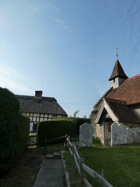
Racton is a small village located in the county of Sussex, England. Situated near the South Downs National Park, it is nestled amidst picturesque countryside, providing residents and visitors with stunning views and a tranquil atmosphere. The village is part of the district of Chichester and lies approximately 10 miles northwest of the city of Chichester itself.

Racton has a long and rich history, dating back to the Roman era when a settlement existed in the area. The village is known for its historic buildings, including the Grade II listed Racton Monument, a 100-foot tall obelisk erected in 1826 to commemorate the Duke of Wellington's victory at the Battle of Waterloo.

With a population of around 200 people, Racton is a close-knit community where residents enjoy a peaceful rural lifestyle. The village is primarily residential, consisting of a mix of traditional cottages and more modern houses.

While Racton does not have its own amenities such as shops or schools, it benefits from its proximity to nearby towns and villages that offer a range of facilities. The village is well-connected by road, with the A27 passing nearby, providing easy access to Chichester and other towns in the region.

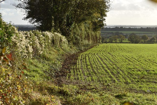
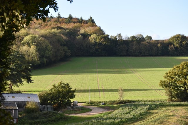
Racton is a haven for nature lovers and outdoor enthusiasts, as it is surrounded by beautiful countryside and walking trails. The South Downs Way, a popular long-distance footpath, passes close to the village, attracting hikers and nature enthusiasts from far and wide.

Overall, Racton offers a peaceful and idyllic setting for those looking to escape the hustle and bustle of city life and enjoy the natural beauty of the Sussex countryside.

If you have any feedback on the listing, please let us know in the comments section below.
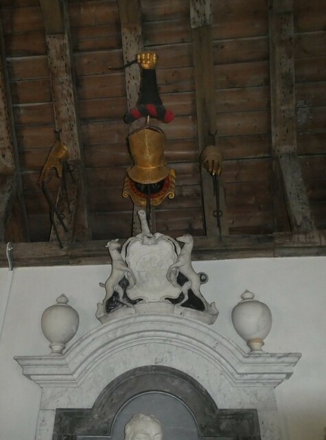
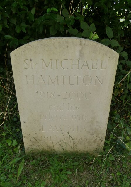
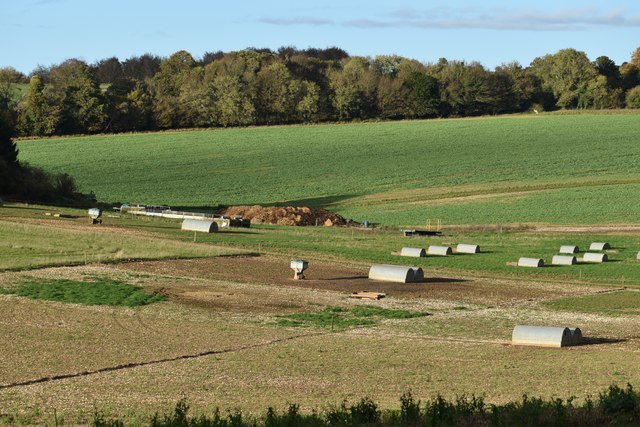
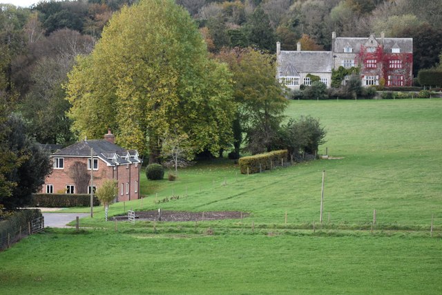
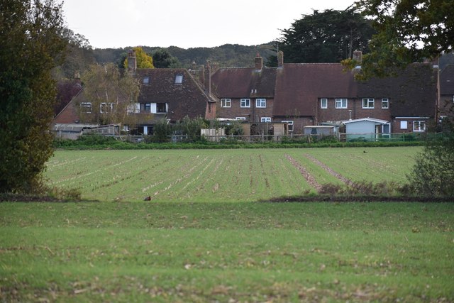
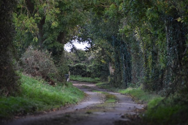
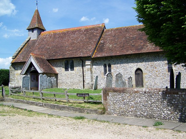
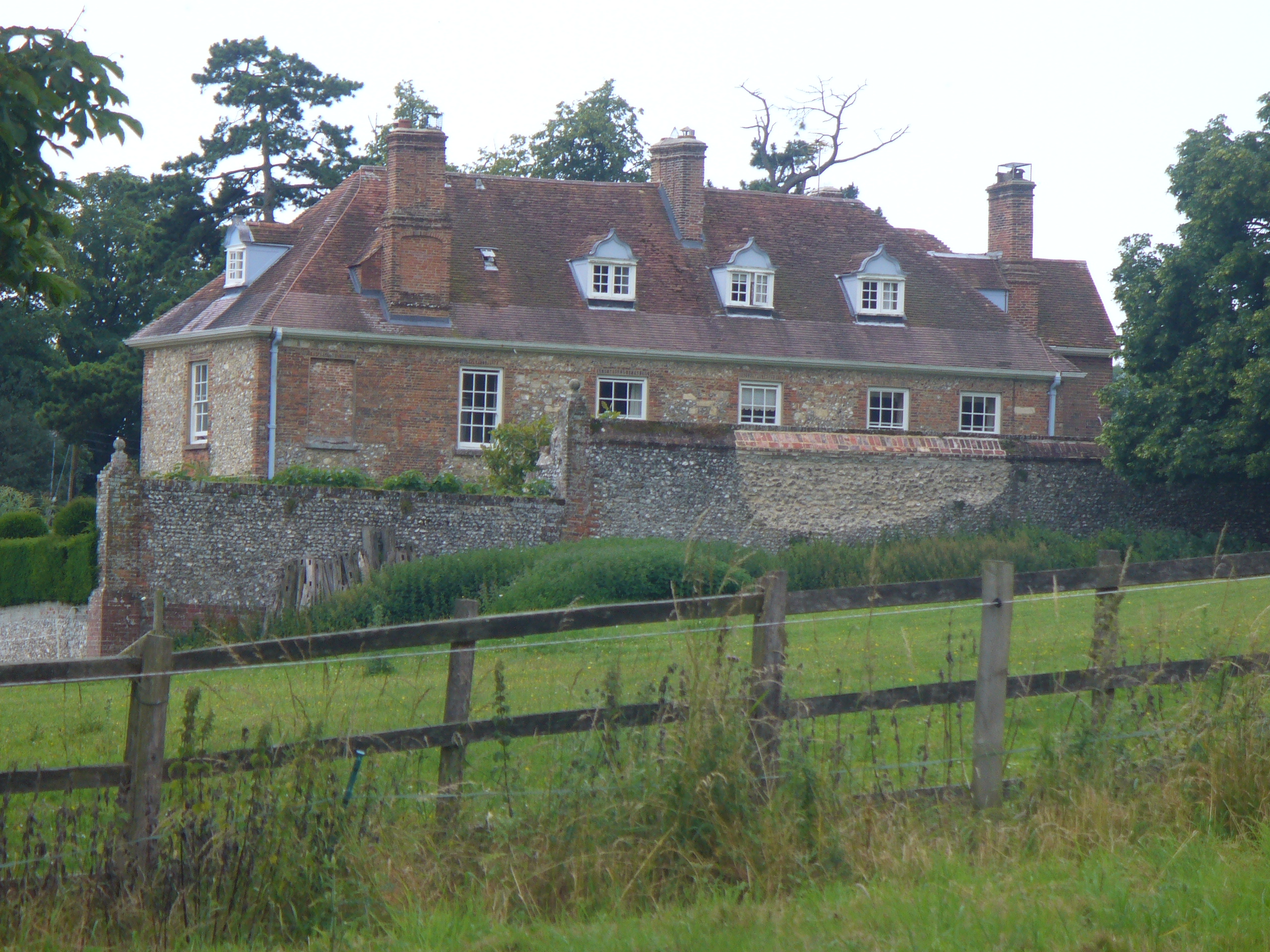
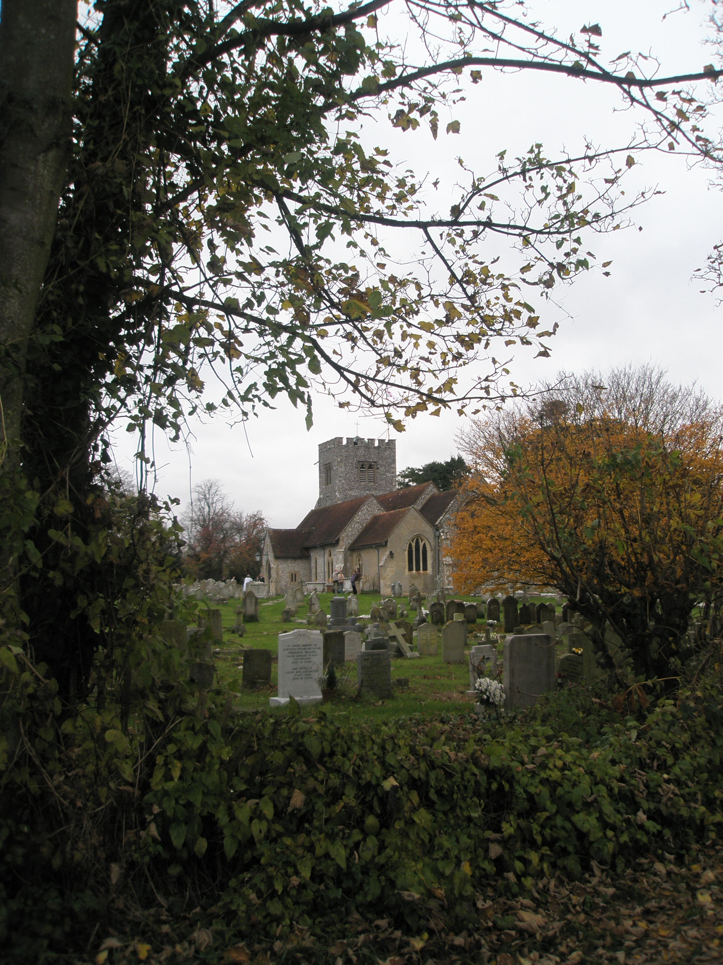
Racton Images

Images are sourced within 2km of 50.87855/-0.88958907 or Grid Reference SU7809. Thanks to Geograph Open Source API. All images are credited.

King's Cottage, Racton: early September 2021 Also see <span class="nowrap"><a title="http://www.pastfinders.com/sussexhistory/charles_ii.htm" rel="nofollow ugc noopener" href="http://www.pastfinders.com/sussexhistory/charles_ii.htm">Link</a><img style="margin-left:2px;" alt="External link" title="External link - shift click to open in new window" src="https://s1.geograph.org.uk/img/external.png" width="10" height="10"/></span>
King's Cottage, Racton: early September 2021
Also see LinkExternal link
Ledger slab: Elizabeth Gounter A ledger slab is an inscribed stone slab laid into the floor of a church to commemorate or mark the place of the burial of a wealthy deceased person. The term derives  from the Old English liċġan, meaning to lie down. They may be made of  Tournai marble, Sussex Marble, Nottingham alabaster or Swithland Slate.
Ledger slab: Elizabeth Gounter
A ledger slab is an inscribed stone slab laid into the floor of a church to commemorate or mark the place of the burial of a wealthy deceased person. The term derives from the Old English liċġan, meaning to lie down. They may be made of Tournai marble, Sussex Marble, Nottingham alabaster or Swithland Slate.
Racton Church: memorial to an admiral For more information see <span class="nowrap"><a title="https://en.wikipedia.org/wiki/Robert_Hornby" rel="nofollow ugc noopener" href="https://en.wikipedia.org/wiki/Robert_Hornby">Link</a><img style="margin-left:2px;" alt="External link" title="External link - shift click to open in new window" src="https://s1.geograph.org.uk/img/external.png" width="10" height="10"/></span>
Racton Church: memorial to an admiral
For more information see LinkExternal link
Racton Church: flowers by the altar
Racton Church: a wife's memorial for her husband His wife Ethel was the daughter of Admiral of the Fleet Geoffrey Hornby <span class="nowrap"><a title="https://en.wikipedia.org/wiki/Geoffrey_Hornby" rel="nofollow ugc noopener" href="https://en.wikipedia.org/wiki/Geoffrey_Hornby">Link</a><img style="margin-left:2px;" alt="External link" title="External link - shift click to open in new window" src="https://s1.geograph.org.uk/img/external.png" width="10" height="10"/></span> and the sibling of Admiral Robert Hornby <span class="nowrap"><a title="https://en.wikipedia.org/wiki/Robert_Hornby" rel="nofollow ugc noopener" href="https://en.wikipedia.org/wiki/Robert_Hornby">Link</a><img style="margin-left:2px;" alt="External link" title="External link - shift click to open in new window" src="https://s1.geograph.org.uk/img/external.png" width="10" height="10"/></span> and Brigadier-General Edmund Hornby VC <span class="nowrap"><a title="https://en.wikipedia.org/wiki/Robert_Hornby" rel="nofollow ugc noopener" href="https://en.wikipedia.org/wiki/Robert_Hornby">Link</a><img style="margin-left:2px;" alt="External link" title="External link - shift click to open in new window" src="https://s1.geograph.org.uk/img/external.png" width="10" height="10"/></span>
Racton Church: a wife's memorial for her husband
His wife Ethel was the daughter of Admiral of the Fleet Geoffrey Hornby LinkExternal link and the sibling of Admiral Robert Hornby LinkExternal link and Brigadier-General Edmund Hornby VC LinkExternal link
Racton Church: memorial to a former rector Frederick Henry Arnold, LL.D (19 October 1830 - 4 May 1906) was born in Sussex and educated at Trinity College, Dublin. He was ordained in 1860. After a curacy at Barlavington he was the incumbent of Appledram from 1861 to 1865 when he was appointed Rector of Racton with Lordington.
Racton Church: memorial to a former rector
Frederick Henry Arnold, LL.D (19 October 1830 - 4 May 1906) was born in Sussex and educated at Trinity College, Dublin. He was ordained in 1860. After a curacy at Barlavington he was the incumbent of Appledram from 1861 to 1865 when he was appointed Rector of Racton with Lordington.
Racton Church: floor memorial I also found this <span class="nowrap"><a title="https://ancestors.familysearch.org/en/KZFM-FLQ/colonel-george-gounter-of-racton-1620" rel="nofollow ugc noopener" href="https://ancestors.familysearch.org/en/KZFM-FLQ/colonel-george-gounter-of-racton-1620">Link</a><img style="margin-left:2px;" alt="External link" title="External link - shift click to open in new window" src="https://s1.geograph.org.uk/img/external.png" width="10" height="10"/></span>
Racton Church: floor memorial
I also found this LinkExternal link
Racton Church: incumbency board
Racton Church: always look up These knightly symbols are quite a rarity
Racton Church: always look up
These knightly symbols are quite a rarity
Racton Church: a politician's gravestone For more about Sir Michael Hamilton see <span class="nowrap"><a title="https://en.wikipedia.org/wiki/Michael_Hamilton_(politician)" rel="nofollow ugc noopener" href="https://en.wikipedia.org/wiki/Michael_Hamilton_(politician)">Link</a><img style="margin-left:2px;" alt="External link" title="External link - shift click to open in new window" src="https://s1.geograph.org.uk/img/external.png" width="10" height="10"/></span>
Racton Church: a politician's gravestone
For more about Sir Michael Hamilton see LinkExternal link
Field edge in late sunlight above Funtington The distant water is Chichester Harbour, with the sea on the horizon.
Field edge in late sunlight above Funtington
The distant water is Chichester Harbour, with the sea on the horizon.
Farmland at Asdean Park
Farmland with pigsties at Asdean Park
Asdean House and Farm
Haresfoot Close, Funtington, seen across fields
Private drive to Funtington Down House
Bridleway 503_2 heading north Towards Park Gate Cottages.
Bridleway 503_2 heading north
Towards Park Gate Cottages.
Footpath 538 across a harvested field
Show me another place!

Racton is located at Grid Ref: SU7809 (Lat: 50.87855, Lng: -0.88958907)

Administrative County: West Sussex

District: Chichester

Police Authority: Sussex

What 3 Words

///scribbled.encoding.sparrows. Near Emsworth, Hampshire

Related Wikis

Racton

Racton is a hamlet in the Chichester district of West Sussex, England. It lies on the B2147 road 2.1 miles (3.4 km) northeast of Emsworth and within the...

Lordington House

Lordington House is a manor house near Walderton in West Sussex. It is a Grade II* listed building. == History == Lordington House was built around 1500...

Racton Monument

Racton Monument (known locally as Racton Ruin) is a folly on a hill in Racton, West Sussex, England with views over Chichester Harbour and to the Isle...

Walderton

Walderton is a hamlet in the Chichester district of West Sussex, England. It lies on the B2146 road 4 miles (6.4 km) northeast of Emsworth. It is in the...

Woodmancote, Chichester District

Woodmancote is a village in the Chichester district of West Sussex, England. It lies just off the B2147 road 2 miles (3.2 km) northeast of Emsworth. It...

Bourne (electoral division)

Bourne is an electoral division of West Sussex in the United Kingdom, and returns one member to sit on West Sussex County Council. The former County Councillor...

Funtington

Funtington is a village and civil parish in the Chichester district of West Sussex, England. It lies on the B2146 Road 4.5 miles (7.2 km) west of Chichester...

Stansted Park

Stansted Park (including Stansted House) is an Edwardian country house in the parish of Stoughton, West Sussex, England. It is near the city of Chichester...

Nearby Amenities

Located within 500m of 50.87855,-0.88958907
Post Box
Collection Times: Mo-Fr 09:00; Sa 07:00
Operator: Royal Mail
Post Box Type: lamp
Ref: PO18 125
Royal Cypher: EIIR
Royal Cypher Wikidata: Q33102113
Source: survey
Lat/Long: 50.8784328/-0.8900119
Bus Stop
Bus: yes
Naptan AtcoCode: 4400CH0479
Naptan Bearing: S
Naptan BusStopType: CUS
Naptan CommonName: Church
Naptan Indicator: opp. Monument Lane
Naptan Landmark: Monument Lane
Naptan NaptanCode: wsxajgaw
Naptan Street: B2147
Naptan Verified: no
Public Transport: platform
Source: naptan_import
Lat/Long: 50.8783475/-0.8899891
Bus Stop
Lordington House
Bus: yes
Naptan AtcoCode: 4400CH0480
Naptan Bearing: NE
Naptan BusStopType: CUS
Naptan CommonName: Lordington House
Naptan Indicator: adj Lordington Park
Naptan Landmark: Newbarn Lane
Naptan NaptanCode: wsxajgda
Naptan Street: B2146
Naptan Verified: no
Public Transport: platform
Source: naptan_import
Lat/Long: 50.882345/-0.8877849
Bus Stop
Lordington House
Bus: yes
Naptan AtcoCode: 4400CH0481
Naptan Bearing: SW
Naptan BusStopType: CUS
Naptan CommonName: Lordington House
Naptan Indicator: opp. Lordington Park
Naptan Landmark: Newbarn Lane
Naptan NaptanCode: wsxajgdg
Naptan Street: B2176
Naptan Verified: no
Public Transport: platform
Source: naptan_import
Lat/Long: 50.882307/-0.8875726
Racton
Place: hamlet
Wikidata: Q7279861
Lat/Long: 50.8771098/-0.8917999
Bus Stop
Bus: yes
Naptan AtcoCode: 4400CH0478
Naptan Bearing: N
Naptan BusStopType: CUS
Naptan CommonName: Church
Naptan Indicator: adj. Monument Lane
Naptan Landmark: Monument Lane
Naptan NaptanCode: wsxajgat
Naptan Street: B2147
Naptan Verified: no
Public Transport: platform
Source: naptan_import
Lat/Long: 50.8784422/-0.8900108
Barrier: stile
Material: wood
Source: survey
Lat/Long: 50.8801948/-0.8883841
Barrier: kissing_gate
Material: steel
Source: survey
Lat/Long: 50.8818793/-0.8890896
Barrier: stile
Source: survey
Lat/Long: 50.8829414/-0.8889499
Post Box
Post Box Type: lamp
Ref: PO18 124
Royal Cypher: EIIR
Royal Cypher Wikidata: Q33102113
Lat/Long: 50.882245/-0.8877952
Defibrillator
Defibrillator Location: wall
Emergency: defibrillator
Indoor: no
Lat/Long: 50.8782365/-0.8904612
Lordington
Place: hamlet
Lat/Long: 50.8822405/-0.8912753
Waterway: weir
Lat/Long: 50.8820024/-0.8890774
The data included in this document is from www.openstreetmap.org. The data is made available under ODbL.

Have you been to Racton?

Leave your review of Racton below (or comments, questions and feedback).