Porth Swtan

Settlement in Anglesey

Wales

Porth Swtan

Rockfall at Porth Swtan A considerable chunk of the cliff at the back of Porth Swtan (Church Bay) beach has collapsed.
Rockfall at Porth Swtan Credit: Mike Parker

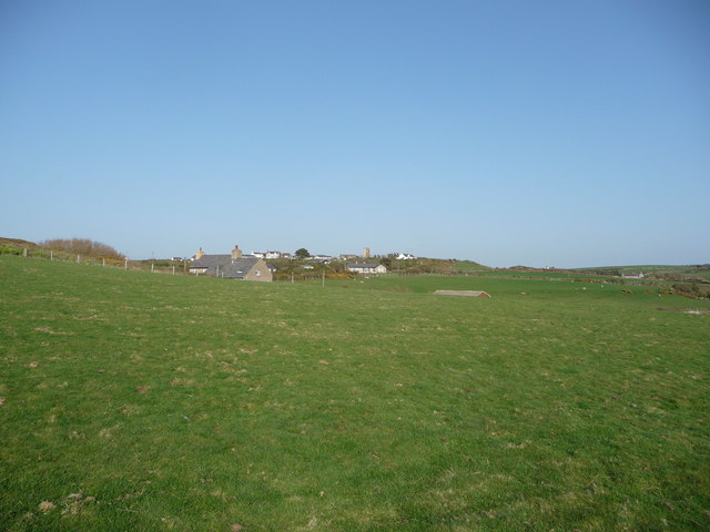
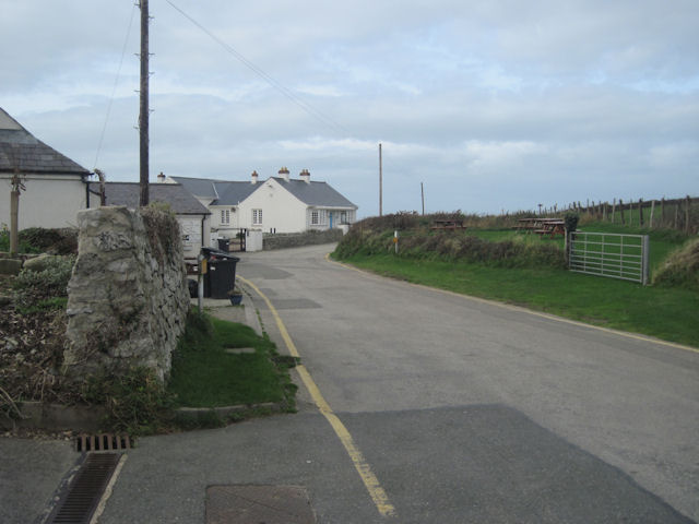
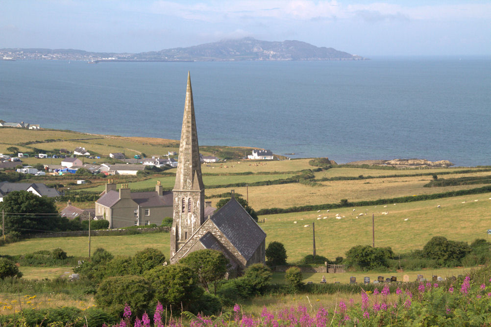
Porth Swtan, also known as Church Bay, is a picturesque coastal village located on the western coast of the Isle of Anglesey in Wales. It is situated approximately 12 miles west of Holyhead, the largest town on the island. The village derives its name from the small church, St. Rhwydrys, which stands on the cliffs overlooking the bay.

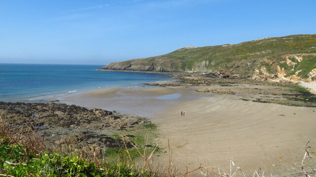
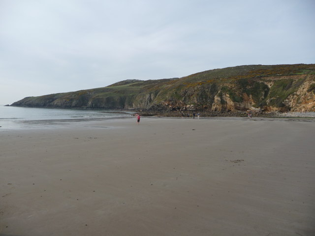
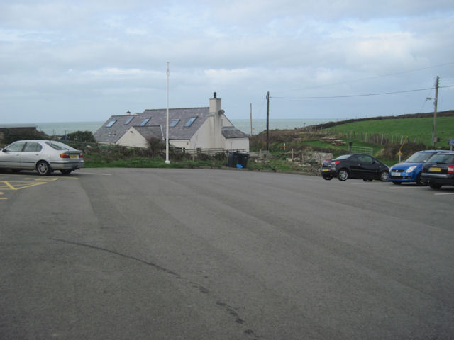
Porth Swtan is renowned for its stunning natural beauty and unspoiled surroundings. The bay itself boasts a sandy beach, ideal for families and sunbathers, and offers breathtaking views of the Irish Sea. The area is also popular among water sports enthusiasts, with opportunities for surfing, kayaking, and paddleboarding.

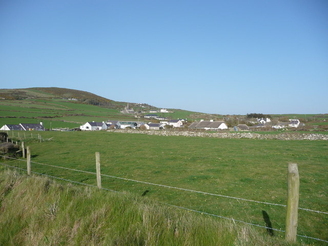
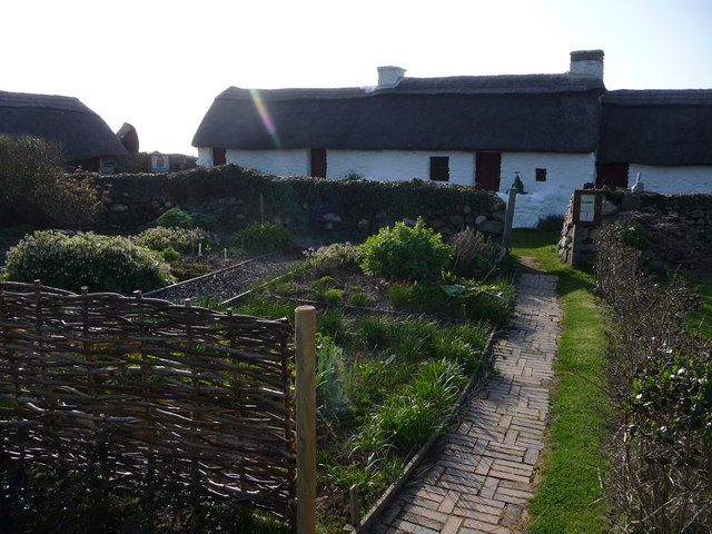
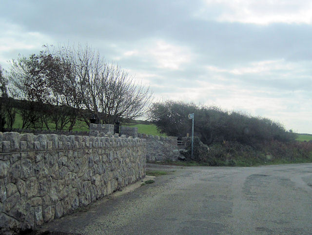
The village is home to a small community, and its charm lies in its tranquility and simplicity. There are a handful of cottages, a few bed and breakfast establishments, and a couple of cafes and restaurants serving delicious local cuisine. Visitors can enjoy a leisurely stroll along the coastal path, taking in the fresh sea air and observing the diverse wildlife that inhabits the area.

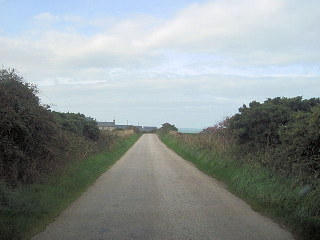
Porth Swtan is surrounded by lush green fields and rolling hills, making it an ideal base for exploring the beautiful countryside of Anglesey. Just a short drive away, visitors can discover ancient archaeological sites, such as the Neolithic burial chamber at Barclodiad y Gawres, or visit nearby attractions like the South Stack Lighthouse and RSPB Reserve.

In summary, Porth Swtan is a charming coastal village that offers visitors a chance to experience the natural beauty and tranquility of Anglesey. With its stunning beach, picturesque surroundings, and proximity to other attractions, this hidden gem on the Welsh coast is a must-visit destination for nature lovers and those seeking a peaceful escape.

If you have any feedback on the listing, please let us know in the comments section below.
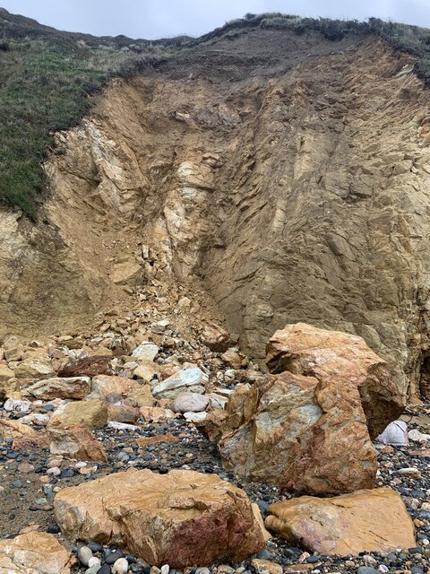
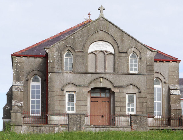
Porth Swtan Images

Images are sourced within 2km of 53.370185/-4.5517939 or Grid Reference SH3088. Thanks to Geograph Open Source API. All images are credited.

Rockfall at Porth Swtan A considerable chunk of the cliff at the back of Porth Swtan (Church Bay) beach has collapsed.
Rockfall at Porth Swtan
A considerable chunk of the cliff at the back of Porth Swtan (Church Bay) beach has collapsed.
Wavecrest Café, Porth Swtan Closed now for the season.
Wavecrest Café, Porth Swtan
Closed now for the season.
Church Bay near Rhydwyn, Anglesey
The sands of Church Bay / Porth Swtan, Anglesey Porth Swtan or Church Bay is a gem of a sandy cove with  a large-ish expanse of flat firm sand at low tide.
The sands of Church Bay / Porth Swtan, Anglesey
Porth Swtan or Church Bay is a gem of a sandy cove with a large-ish expanse of flat firm sand at low tide.
Campsite above Church Bay / Porth Swtan Porth Swtan gets its name from the thatched whitewashed building seen here adjacent to this campsite, a rare survivor and the last thatched building on Anglesey, called Swtan. The campsite is ideally located next to coastal paths and a short walk from the sandy bay.
Campsite above Church Bay / Porth Swtan
Porth Swtan gets its name from the thatched whitewashed building seen here adjacent to this campsite, a rare survivor and the last thatched building on Anglesey, called Swtan. The campsite is ideally located next to coastal paths and a short walk from the sandy bay.
Barbed wire fence beside the coastal path The coastal path here borders fields adjacent to the Swtan, the last surviving thatched dwelling on Anglesey, a tyddyn or smallholding lived in until the 1960's, when its old roof beams collapsed and since when it has been restored as a museum.
Barbed wire fence beside the coastal path
The coastal path here borders fields adjacent to the Swtan, the last surviving thatched dwelling on Anglesey, a tyddyn or smallholding lived in until the 1960's, when its old roof beams collapsed and since when it has been restored as a museum.
Ruined windmill inland of the coastal path The tower of this old windmill stands out inland of the path.
Ruined windmill inland of the coastal path
The tower of this old windmill stands out inland of the path.
The last thatched cottage on Anglesey at Porth Swtan This building now serves as a folk museum, recreating the tyddyn or smallholding plot held by a family here before its dereliction in the 1960's.
The last thatched cottage on Anglesey at Porth Swtan
This building now serves as a folk museum, recreating the tyddyn or smallholding plot held by a family here before its dereliction in the 1960's.
The frontage of Swtan thatched tyddyn at Church Bay The main building is whitewashed and restored along with this outbuilding and the vegetable garden.
The frontage of Swtan thatched tyddyn at Church Bay
The main building is whitewashed and restored along with this outbuilding and the vegetable garden.
Recreated vegetable garden at Swtan This thatched cottage and its immediate plot recreates life for the past residents, with a sheltered plot here for basic staple foods such as spuds, beans and other veg. It is maintained by local Women's Institute volunteers I believe.
Recreated vegetable garden at Swtan
This thatched cottage and its immediate plot recreates life for the past residents, with a sheltered plot here for basic staple foods such as spuds, beans and other veg. It is maintained by local Women's Institute volunteers I believe.
Long straight road to Cilmaenan
Car Park at Church Bay
Lane down to shore at Church Bay From Car Park
Lane down to shore at Church Bay
From Car Park
Road past Parcnewydd Start of footpath can be seen. Between Grugmor and Borthwen
Road past Parcnewydd
Start of footpath can be seen. Between Grugmor and Borthwen
Carreglwyd Folly This dilapidated folly was a viewing platform with steps leading up. The views across to Holyhead are now obscured by trees
Carreglwyd Folly
This dilapidated folly was a viewing platform with steps leading up. The views across to Holyhead are now obscured by trees
Carreglwyd Seat This Folly had a round roof and seating and was used by Lady Reade to "take Tea" in the grounds of Carreglwyd House
Carreglwyd Seat
This Folly had a round roof and seating and was used by Lady Reade to "take Tea" in the grounds of Carreglwyd House
Baptist Chapel, Rhydwyn
Country south-west of Mynydd y Garn
Show me another place!

Porth Swtan is located at Grid Ref: SH3088 (Lat: 53.370185, Lng: -4.5517939)

Unitary Authority: Isle of Anglesey

Police Authority: North Wales

What 3 Words

///tango.pirates.putts. Near Llanfaethlu, Isle of Anglesey

Nearby Locations

Porth Swtan

Related Wikis

Church Bay, Anglesey

Church Bay (Welsh: Porth Swtan) is a settlement on the north-west coast of Anglesey, Wales, United Kingdom, about a mile and a half north-west of the...

Clegir Mawr

Clegir Mawr is a Site of Special Scientific Interest (SSSI) in the community of Cylch-y-Garn in the north-west of the island of Anglesey, Wales. It is...

Rhydwyn

Rhydwyn (; Rhyd-Wyn) is a village in the community of Cylch-y-Garn, in the north west of Anglesey, Wales. Rhydwyn is named after a little stream that once...

Menai Bach, Rhydwyn

Menai Bach is a Grade II listed building in Rhydwyn, rural north west Anglesey, Wales. It is a C19 terraced house. A date stone offset to the left of the...

Nearby Amenities

Located within 500m of 53.370185,-4.5517939
Barrier: kissing_gate
Lat/Long: 53.3720284/-4.5561966
Barrier: kissing_gate
Lat/Long: 53.374135/-4.5546724
Barrier: kissing_gate
Lat/Long: 53.3696965/-4.5567019
Barrier: kissing_gate
Lat/Long: 53.3673526/-4.5570522
Barrier: kissing_gate
Lat/Long: 53.3669505/-4.5568521
Cafe
Wavecrest Cafe
Addr City: Church Bay
Addr Postcode: LL65 4ET
Opening Hours: Th-Su 10:30-17:00
Website: https://www.wavecrestcafe.co.uk/wavecrestcafe/Welcome.html
Lat/Long: 53.3716601/-4.5557318
Restaurant
The Lobster Pot
Lat/Long: 53.3718512/-4.5546705
Barrier: kissing_gate
Lat/Long: 53.3714901/-4.5561552
Toilets
Lat/Long: 53.3713697/-4.5549019
Gadlys Coastal Holiday Cottages
Addr Postcode: LL65 4ES
Cabins: yes
Caravans: yes
Phone: +44 7786 547361
Shower: yes
Tents: yes
Toilets: yes
Tourism: camp_site
Website: https://www.ukcampsite.co.uk/sites/details.asp?revid=7741
Lat/Long: 53.3719901/-4.5521893
Porth y Cychod
Natural: beach
Lat/Long: 53.3718993/-4.5572845
Porth y Santes
Natural: beach
Lat/Long: 53.3710063/-4.5575162
Porth y Pren
Natural: beach
Lat/Long: 53.3701559/-4.5577121
Porth Tyddyn-uchaf
Natural: beach
Lat/Long: 53.3689547/-4.5579616
Post Box
Post Box Type: lamp
Royal Cypher: EIIR
Lat/Long: 53.3710934/-4.5521071
Bench
Lat/Long: 53.3721166/-4.5564648
The data included in this document is from www.openstreetmap.org. The data is made available under ODbL.

Have you been to Porth Swtan?

Leave your review of Porth Swtan below (or comments, questions and feedback).