Paynes End

Settlement in Hertfordshire East Hertfordshire

England

Paynes End

River Quin at Stapleton Bridge Viewed looking downstream the river makes a right-angled turn to the right at the confluence with the two other streams in the distance.
River Quin at Stapleton Bridge Credit: Nigel Cox

Paynes End is a small village located in the county of Hertfordshire, England. Situated approximately 3 miles northeast of the town of Harpenden, it falls within the civil parish of Flamstead. The village is nestled amidst picturesque countryside, surrounded by rolling hills and farmland.

Historically, Paynes End was an agricultural community, with farming being the primary occupation of its residents. Today, the village retains its rural charm, with a scattering of traditional cottages and farmhouses dotting the landscape. The area is known for its tranquil atmosphere, offering a peaceful retreat from the hustle and bustle of nearby urban centers.

Although small in size, Paynes End benefits from its proximity to Harpenden, which provides access to a range of amenities including shops, restaurants, and schools. The village itself does not have many facilities, but it does boast a local pub, providing a gathering place for residents and visitors alike.

For those who enjoy outdoor activities, Paynes End is surrounded by beautiful countryside, offering opportunities for walking, cycling, and exploring nature. The village is also within close reach of the Chiltern Hills, an Area of Outstanding Natural Beauty, providing further options for outdoor enthusiasts.

Overall, Paynes End offers a peaceful and idyllic setting for those seeking a rural retreat, while still providing easy access to nearby amenities and recreational activities.

If you have any feedback on the listing, please let us know in the comments section below.
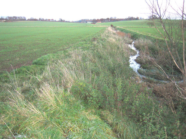
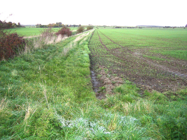
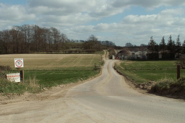
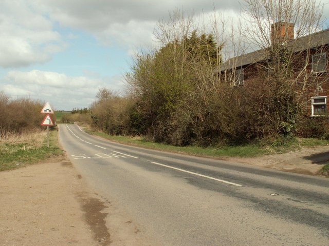
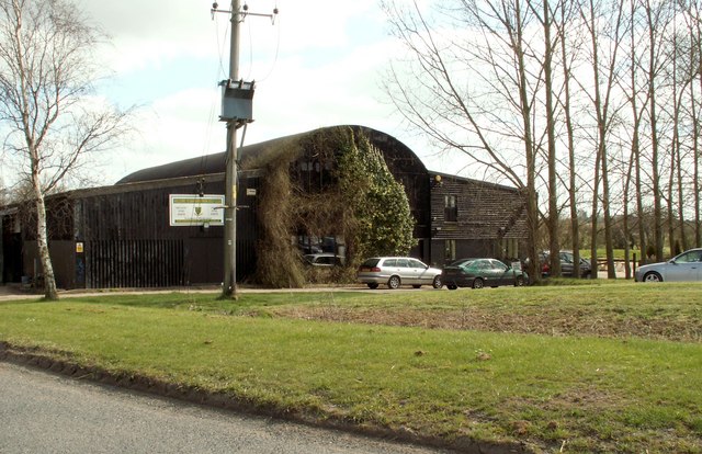
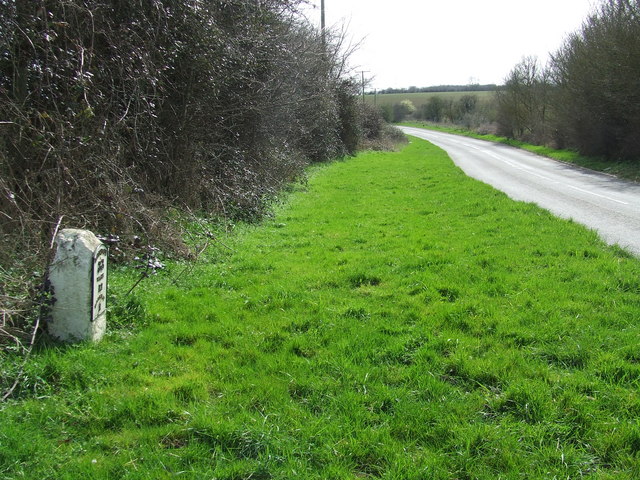
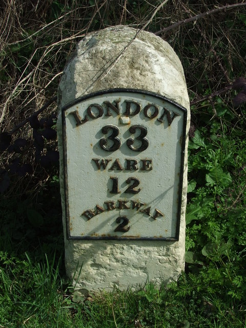
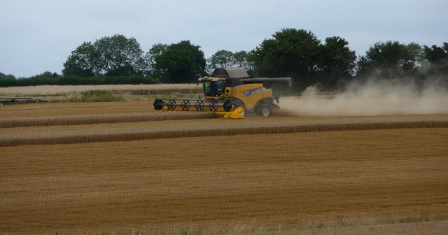
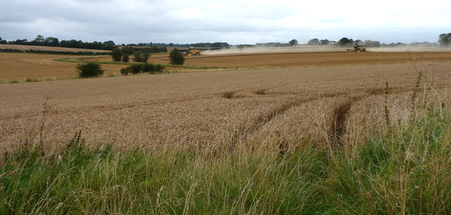
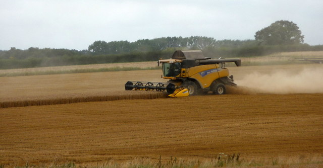
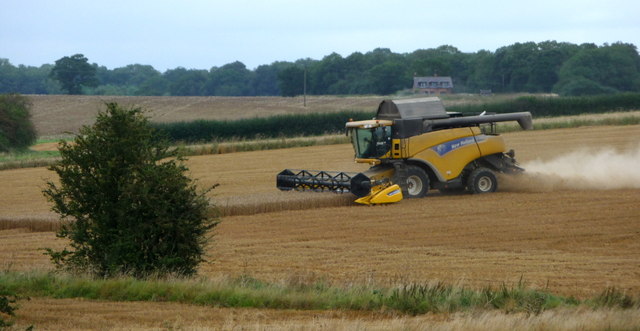
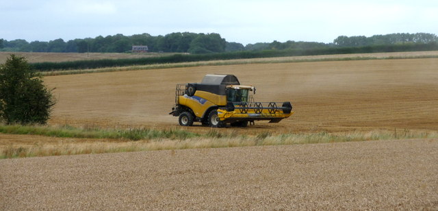
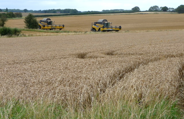
Paynes End Images

Images are sourced within 2km of 51.981221/0.042293028 or Grid Reference TL4033. Thanks to Geograph Open Source API. All images are credited.

River Quin at Stapleton Bridge Viewed looking downstream the river makes a right-angled turn to the right at the confluence with the two other streams in the distance.
River Quin at Stapleton Bridge
Viewed looking downstream the river makes a right-angled turn to the right at the confluence with the two other streams in the distance.
River Quin near Anstey The flat valley of the River Quin as it runs parallel to the B1368 road west of Anstey.
River Quin near Anstey
The flat valley of the River Quin as it runs parallel to the B1368 road west of Anstey.
Footpath and track, leading to a chalk pit
The B.1368 at Biggin Hill
The clubhouse at Barkway Park Golf Club
Old Milestone Old milestone on the B1368 near to Barkway, Hertfordshire. For close up view see <a title="https://www.geograph.org.uk/photo/1792639" href="https://www.geograph.org.uk/photo/1792639">Link</a> and for more info see <span class="nowrap"><a title="http://milestones.megalithia.com/sites/missing.php?site_status=offmap&site_ngr=TL385341&site_name=Barkway" rel="nofollow ugc noopener" href="http://milestones.megalithia.com/sites/missing.php?site_status=offmap&site_ngr=TL385341&site_name=Barkway">Link</a><img style="margin-left:2px;" alt="External link" title="External link - shift click to open in new window" src="https://s1.geograph.org.uk/img/external.png" width="10" height="10"/></span> do look at their home page.
Old Milestone
Old milestone on the B1368 near to Barkway, Hertfordshire. For close up view see Link and for more info see LinkExternal link do look at their home page.
Old Milestone Old milestone on the B1368 near to Barkway, Hertfordshire. For overall view see <a title="https://www.geograph.org.uk/photo/1792635" href="https://www.geograph.org.uk/photo/1792635">Link</a> and for more info see <span class="nowrap"><a title="http://milestones.megalithia.com/sites/missing.php?site_status=offmap&site_ngr=TL385341&site_name=Barkway" rel="nofollow ugc noopener" href="http://milestones.megalithia.com/sites/missing.php?site_status=offmap&site_ngr=TL385341&site_name=Barkway">Link</a><img style="margin-left:2px;" alt="External link" title="External link - shift click to open in new window" src="https://s1.geograph.org.uk/img/external.png" width="10" height="10"/></span>  do look at their home page.
Old Milestone
Old milestone on the B1368 near to Barkway, Hertfordshire. For overall view see Link and for more info see LinkExternal link do look at their home page.
Old Milestone Old milestone on the B1368 near to Anstey, Hertfordshire. For close up view see <a title="https://www.geograph.org.uk/photo/1792660" href="https://www.geograph.org.uk/photo/1792660">Link</a> and for more info see <span class="nowrap"><a title="http://milestones.megalithia.com/sites/tl389326.htm" rel="nofollow ugc noopener" href="http://milestones.megalithia.com/sites/tl389326.htm">Link</a><img style="margin-left:2px;" alt="External link" title="External link - shift click to open in new window" src="https://s1.geograph.org.uk/img/external.png" width="10" height="10"/></span> do look at their home page.
Old Milestone
Old milestone on the B1368 near to Anstey, Hertfordshire. For close up view see Link and for more info see LinkExternal link do look at their home page.
Old Milestone Old milestone on the B1368 near to Anstey, Hertfordshire. For overall view see <a title="https://www.geograph.org.uk/photo/1792654" href="https://www.geograph.org.uk/photo/1792654">Link</a> and for more info see <span class="nowrap"><a title="http://milestones.megalithia.com/sites/tl389326.htm" rel="nofollow ugc noopener" href="http://milestones.megalithia.com/sites/tl389326.htm">Link</a><img style="margin-left:2px;" alt="External link" title="External link - shift click to open in new window" src="https://s1.geograph.org.uk/img/external.png" width="10" height="10"/></span> do look at their home page.
Old Milestone
Old milestone on the B1368 near to Anstey, Hertfordshire. For overall view see Link and for more info see LinkExternal link do look at their home page.
Combine Harvester near Anstey, Hertfordshire
Combine Harvesters near Anstey, Hertfordshire
Combine Harvester near Anstey, Hertfordshire
Combine Harvesters near Anstey, Hertfordshire
Combine Harvester near Anstey, Hertfordshire
Combine Harvesters near Anstey, Hertfordshire
Show me another place!

Paynes End is located at Grid Ref: TL4033 (Lat: 51.981221, Lng: 0.042293028)

Administrative County: Hertfordshire

District: East Hertfordshire

Police Authority: Hertfordshire

What 3 Words

///general.small.confusion. Near Buntingford, Hertfordshire

Related Wikis

Anstey Castle

Anstey Castle was in the village of Anstey, Hertfordshire. It was a 12th-century stone motte and bailey fortress that, according to tradition, was founded...

Anstey, Hertfordshire

Anstey is a village and civil parish in the East Hertfordshire district of Hertfordshire, England, about 15 miles (24 km) northeast of Stevenage. According...

Nuthampstead

Nuthampstead is a small village and civil parish in North East Hertfordshire located a few miles south of the town of Royston. In the 2001 census the parish...

Barkway

Barkway is a long-established village and civil parish in the North Hertfordshire district of Hertfordshire, England, about five miles south-east of...

River Quin

The River Quin is a small watercourse which rises near Barkway in north east Hertfordshire, England. The river is fed by a number of sources including...

Brent Pelham Windmill

Brent Pelham Windmill is a Grade II listed smock mill at Brent Pelham, Hertfordshire, England which is derelict. == History == Brent Pelham Mill was built...

RAF Barkway

Royal Air Force Barkway or more simply RAF Barkway was one of the smallest Royal Air Force stations in the United Kingdom. It was a Communications Station...

Hare Street House

Hare Street House is a Grade II* listed building in the hamlet of Hare Street that lies between Buntingford and Great Hormead in the East Hertfordshire...

Nearby Amenities

Located within 500m of 51.981221,0.042293028
Blind Fiddler PH
Naptan AtcoCode: 210021302855
Naptan Bearing: N
Naptan BusStopType: CUS
Naptan CommonName: Blind Fiddler PH
Naptan Crossing: Moatside
Naptan Indicator: opp
Naptan Landmark: Moatside
Naptan NaptanCode: hrtdtpgp
Naptan ShortCommonName: NA
Naptan Street: Unknown
Naptan Verified: no
Public Transport: platform
Source: naptan_import
Lat/Long: 51.9784421/0.0460368
Blind Fiddler PH
Naptan AtcoCode: 210021310115
Naptan Bearing: S
Naptan BusStopType: CUS
Naptan CommonName: Blind Fiddler PH
Naptan Crossing: Castle Cottages
Naptan Indicator: o/s
Naptan Landmark: Castle Cottages
Naptan NaptanCode: hrtdpgaj
Naptan ShortCommonName: NA
Naptan Street: Unknown
Naptan Verified: no
Public Transport: platform
Source: naptan_import
Lat/Long: 51.9783068/0.0460597
Power: pole
Lat/Long: 51.9795161/0.0449806
Material: wood
Power: pole
Lat/Long: 51.9802464/0.0422984
Power: pole
Lat/Long: 51.9795128/0.0437763
Material: wood
Power: pole
Lat/Long: 51.9831076/0.0384521
Power: pole
Lat/Long: 51.9795112/0.0435617
Material: wood
Power: pole
Lat/Long: 51.9809716/0.0410297
Material: wood
Power: pole
Lat/Long: 51.9816555/0.0399193
Material: wood
Power: pole
Lat/Long: 51.9823725/0.0387766
Material: wood
Power: pole
Lat/Long: 51.9839782/0.038098
Barrier: kissing_gate
Foot: yes
Source: GPS
Lat/Long: 51.9777805/0.0423927
Barrier: kissing_gate
Foot: yes
Source: GPS
Lat/Long: 51.9791805/0.0419264
Bench
Backrest: yes
Lat/Long: 51.9770455/0.0446262
Bench
Backrest: yes
Lat/Long: 51.9794889/0.0462386
Power: pole
Source: Bing
Lat/Long: 51.9789148/0.0477085
The Knoll
Historic: water_well
Source: https://www.ribapix.com/Wellhead-and-shelter-with-postbox-The-Knoll-Anstey-Hertfordshire_RIBA42206
Lat/Long: 51.9795166/0.0462783
Telephone
Booth: K6
Covered: booth
Listed Status: Grade II
Phone: +44 1763 848434
Lat/Long: 51.9797227/0.0464943
Information: guidepost
Tourism: information
Lat/Long: 51.97955/0.0463003
Post Box
Post Box Type: lamp
Lat/Long: 51.9794592/0.0462323
Paynes End
Place: locality
Lat/Long: 51.9812987/0.042336
Cheapside
Place: locality
Lat/Long: 51.9803868/0.0473249
Power: pole
Lat/Long: 51.9793759/0.0465285
The data included in this document is from www.openstreetmap.org. The data is made available under ODbL.

Have you been to Paynes End?

Leave your review of Paynes End below (or comments, questions and feedback).