Parsley Hay

Settlement in Derbyshire Derbyshire Dales

England

Parsley Hay

Sunset above the railway cutting Looking over to the disused Railway cutting, with the setting sun in the west.
Sunset above the railway cutting Credit: Jay Pea

Parsley Hay is a small village located in the county of Derbyshire, England. Situated in the Peak District National Park, it is surrounded by picturesque landscapes and offers a tranquil retreat for nature lovers and outdoor enthusiasts alike. The village is nestled at an elevation of around 400 meters above sea level, providing stunning views of the surrounding rolling hills and moorlands.

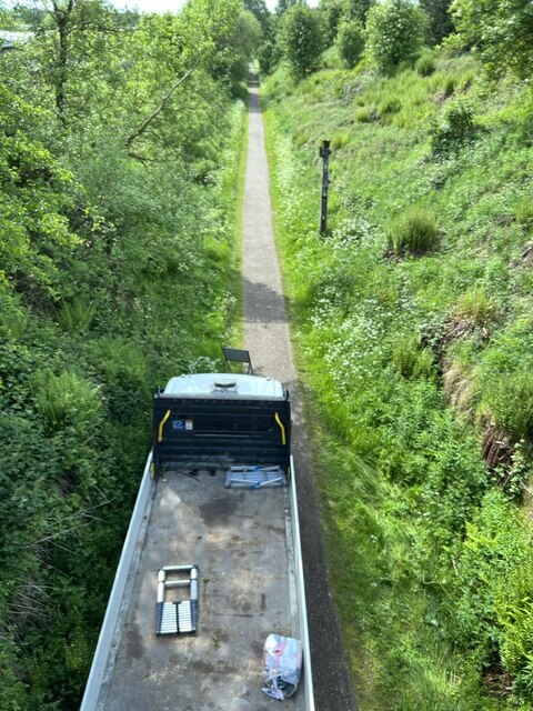
Parsley Hay is best known for its impressive position as a gateway to the Peak District. It serves as a significant transport hub, being the starting point for the High Peak Trail, a popular walking and cycling route that stretches for 17 miles. The trail follows the former Cromford and High Peak Railway, providing visitors with an opportunity to explore the area's industrial heritage while enjoying the scenic beauty.

Despite its small size, Parsley Hay boasts various amenities for visitors. The Parsley Hay Visitor Centre, operated by the Peak District National Park Authority, provides information and facilities for those embarking on outdoor adventures. The center offers parking, public toilets, picnic areas, and a small café serving refreshments.

The village is also a stop along the Tissington Trail, another well-known traffic-free path that attracts walkers, cyclists, and horse riders. This former railway line offers a different perspective of the surrounding countryside, passing through charming villages and offering access to stunning natural attractions such as Dovedale and Thorpe Cloud.

In summary, Parsley Hay, Derbyshire, is a charming village nestled in the heart of the Peak District National Park. It serves as a gateway to the area, offering access to popular trails and providing facilities for visitors to enjoy the beautiful landscapes and outdoor activities that the region has to offer.

If you have any feedback on the listing, please let us know in the comments section below.

Parsley Hay Images

Images are sourced within 2km of 53.169412/-1.7806007 or Grid Reference SK1463. Thanks to Geograph Open Source API. All images are credited.

Sunset above the railway cutting Looking over to the disused Railway cutting, with the setting sun in the west.
Sunset above the railway cutting
Looking over to the disused Railway cutting, with the setting sun in the west.
Tractor and trailer A tractor and trailer approaching the A515 at Parsley Hay. The steps provide access to the High Peak Trail.
Tractor and trailer
A tractor and trailer approaching the A515 at Parsley Hay. The steps provide access to the High Peak Trail.
The High Peak Trail A very cold and icy section of the trail just south east of the A515 road bridge.
The High Peak Trail
A very cold and icy section of the trail just south east of the A515 road bridge.
Former Lineside Hut Old plate layer's hut and adjacent fenced off wildlife areas on the Tissington Trail.
Former Lineside Hut
Old plate layer's hut and adjacent fenced off wildlife areas on the Tissington Trail.
Old cottage Looking from the over bridge in a south westerly direction to an old cottage and grassland. The Tissington trail is rather wet and slippery from recent snow and rain.
Old cottage
Looking from the over bridge in a south westerly direction to an old cottage and grassland. The Tissington trail is rather wet and slippery from recent snow and rain.
Old Railway cutting Old railway cutting, now used as the Tissington Trail.
Old Railway cutting
Old railway cutting, now used as the Tissington Trail.
Cutting and Trail One of the cuttings on the High Peak Trail.
Cutting and Trail
One of the cuttings on the High Peak Trail.
Disused Gate One of several disused access gates across the former railway. Other railway signage post can just be seen.
Disused Gate
One of several disused access gates across the former railway. Other railway signage post can just be seen.
Camping Pods Several camping pods in a field along the Tissington Trail. There are several pockets of cowslips just coming into flower.
Camping Pods
Several camping pods in a field along the Tissington Trail. There are several pockets of cowslips just coming into flower.
Cowslips A large pocket of cowslips alongside the trail.
Cowslips
A large pocket of cowslips alongside the trail.
Fern Fronds A  fern plant starting to sprout this year’s annual growth.
Fern Fronds
A fern plant starting to sprout this year’s annual growth.
Fern and Limestone Wall Another Fern growing next to the Limestone wall.
Fern and Limestone Wall
Another Fern growing next to the Limestone wall.
Parsley Hay Cutting The first of several cuttings along the Tissington Trail, again with cowslips, and a lone cyclist.
Parsley Hay Cutting
The first of several cuttings along the Tissington Trail, again with cowslips, and a lone cyclist.
Two Trails The northern end of the Tissington Trail where it joins the High Peak Trail. The white building is the former Telephone Exchange, now a holiday and events centre.
Two Trails
The northern end of the Tissington Trail where it joins the High Peak Trail. The white building is the former Telephone Exchange, now a holiday and events centre.
Contractors A specialist contractor surveying the over bridge on the High Peak Trail.
Contractors
A specialist contractor surveying the over bridge on the High Peak Trail.
Contractors 2 Another vehicle used to move scaffolding underneath the bridge to enable inspection. Not much room for pedestrians using the trail.
Contractors 2
Another vehicle used to move scaffolding underneath the bridge to enable inspection. Not much room for pedestrians using the trail.
Across the field A very nice arable crop of Barley, rather unusual at this height above sea level.
Across the field
A very nice arable crop of Barley, rather unusual at this height above sea level.
Iron fence post The post has been recycled from a section of narrow gauge rail, there were several different narrow gauge lines in the locality all used in the extraction of  sand for use in the nearby brick works.
Iron fence post
The post has been recycled from a section of narrow gauge rail, there were several different narrow gauge lines in the locality all used in the extraction of sand for use in the nearby brick works.
Show me another place!

Parsley Hay is located at Grid Ref: SK1463 (Lat: 53.169412, Lng: -1.7806007)

Administrative County: Derbyshire

District: Derbyshire Dales

Police Authority: Derbyshire

What 3 Words

///lift.sharper.fond. Near Newhaven, Derbyshire

Nearby Locations

Parsley Hay

Related Wikis

Parsley Hay railway station

Parsley Hay railway station served Parsley Hay, a hamlet within Hartington Middle Quarter civil parish, about 9.3 miles (15 km) south east of Buxton, Derbyshire...

Newhaven Tunnel

Newhaven Tunnel was a railway tunnel located on the Cromford and High Peak Railway near the village of Newhaven in Derbyshire. Mostly used for moving mineral...

Gib Hill

Gib Hill is a large burial mound in the Peak District, Derbyshire, England. It is thought to be a Neolithic oval barrow with an Early Bronze Age round...

Arbor Low

Arbor Low is a well-preserved Neolithic henge in the Derbyshire Peak District, England. It lies on a Carboniferous Limestone plateau known as the White...

Nearby Amenities

Located within 500m of 53.169412,-1.7806007
Bicycle Rental
Parsley Hay Cycle Hire
Lat/Long: 53.170794/-1.7827335
Toilets
Fee: no
Source: survey
Toilets Wheelchair: yes
Lat/Long: 53.1709784/-1.7828097
Cafe
Source: survey
Lat/Long: 53.17085/-1.7828036
Drinking Water
Source: survey
Lat/Long: 53.1708362/-1.7828413
Parsley Hay
Is In: Derbyshire, England, UK
Place: village
Lat/Long: 53.1696976/-1.7805862
Bicycle Parking
Capacity: 20
Lat/Long: 53.1706221/-1.7824441
Parsley Hay
Tourism: picnic_site
Lat/Long: 53.1705544/-1.7825965
Istrian kazun
Board Type: history
Information: board
Tourism: information
Lat/Long: 53.1715804/-1.7842883
Shelter
Istrian kazun
Shelter Type: weather_shelter
Lat/Long: 53.1716013/-1.7843205
Peak District Info
Information: office
Tourism: information
Lat/Long: 53.1707307/-1.782645
Power: pole
Lat/Long: 53.1671124/-1.7843878
Power: pole
Lat/Long: 53.1708683/-1.7870674
Power: pole
Lat/Long: 53.1706738/-1.7858416
Power: pole
Lat/Long: 53.1694406/-1.7821562
Power: pole
Lat/Long: 53.1693152/-1.7835885
Power: pole
Lat/Long: 53.1682668/-1.7849296
Power: pole
Lat/Long: 53.1691689/-1.7850101
Power: pole
Lat/Long: 53.1698522/-1.7850342
Power: pole
Lat/Long: 53.1705484/-1.7850798
Power: pole
Lat/Long: 53.1713217/-1.7851093
Power: pole
Lat/Long: 53.172153/-1.7851844
Telephone
Booth: K6
Covered: booth
Phone: +44 1298 84355
Lat/Long: 53.1692867/-1.7801149
Parsley Hay Junction
Railway: junction
Lat/Long: 53.1671247/-1.7809778
Parsley Hay
Historic Railway: station
Railway: site
Wikidata: Q7140002
Wikipedia: en:Parsley Hay railway station
Lat/Long: 53.1707826/-1.783019
Parsley Hay Station
Abandoned Railway: station
Railway: site
Lat/Long: 53.1693932/-1.7818721
Post Box
Post Box Type: lamp
Lat/Long: 53.1693334/-1.7803279
Bicycle Parking
Bicycle Parking: stands
Capacity: 24
Lat/Long: 53.1707236/-1.7828764
The data included in this document is from www.openstreetmap.org. The data is made available under ODbL.

Have you been to Parsley Hay?

Leave your review of Parsley Hay below (or comments, questions and feedback).