Park Corner

Settlement in Hertfordshire St. Albans

England

Park Corner

St Alban Way towards St Albans
St Alban Way towards St Albans Credit: Ian S

Park Corner is a small village located in Hertfordshire, England. Situated in the East Hertfordshire district, it is nestled in the picturesque countryside and is known for its tranquil and idyllic surroundings. The village is part of the civil parish of Furneux Pelham and has a population of around 200 residents.

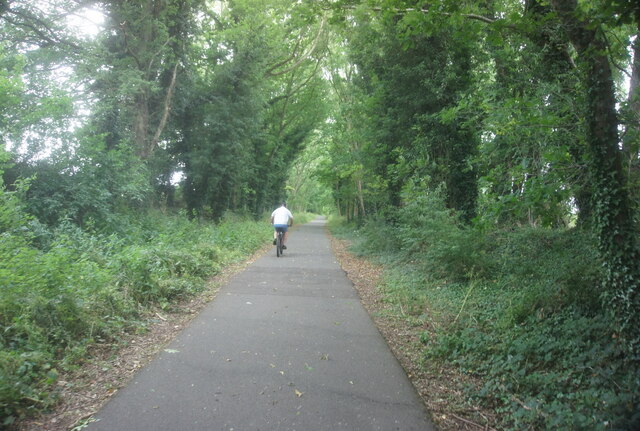
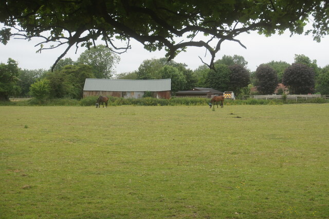
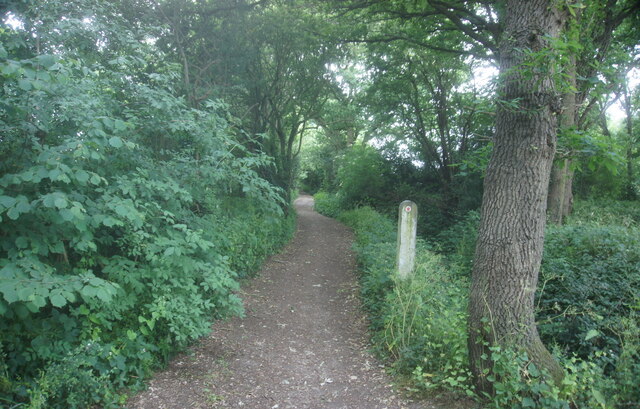
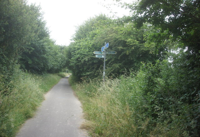
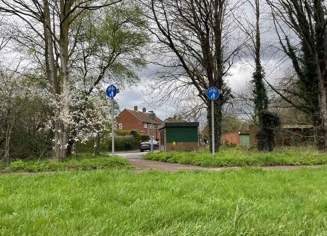
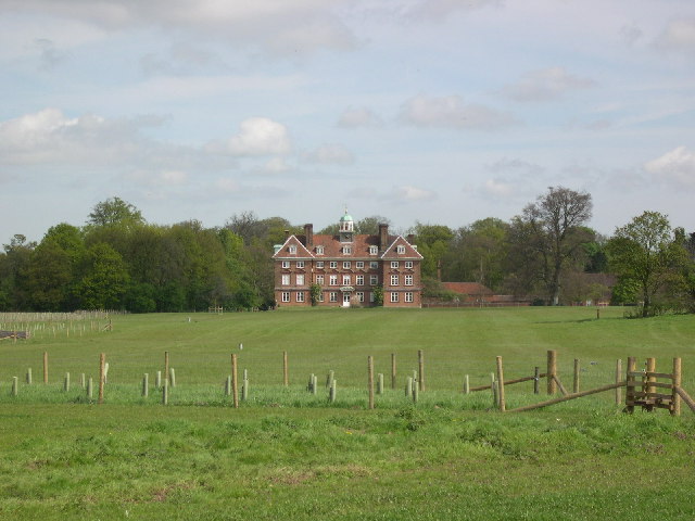
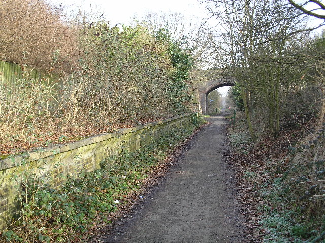
Park Corner is characterized by its charming rural setting, with rolling hills, lush green fields, and charming country lanes. The village is surrounded by a mix of farmland and woodlands, providing ample opportunities for outdoor activities such as walking, hiking, and cycling. The area is also renowned for its rich biodiversity, with an abundance of wildlife and bird species.

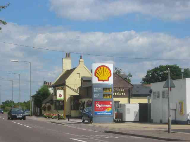
The village itself is small, with a few residential properties and a local pub, creating a close-knit community atmosphere. The nearest amenities and services are available in the nearby villages of Furneux Pelham and Clavering, where residents can find shops, schools, and other essential facilities.

Park Corner is conveniently located for those seeking a peaceful rural lifestyle, while still having access to larger towns and cities. The village is within easy reach of the market towns of Bishop's Stortford and Saffron Walden, which offer a wider range of amenities and transport links. The M11 motorway is also easily accessible, providing convenient connections to London and Cambridge.

Overall, Park Corner is a charming and tranquil village, offering a serene countryside escape while still being within reach of essential services and urban centers.

If you have any feedback on the listing, please let us know in the comments section below.
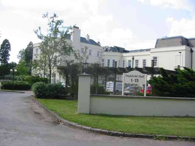
Park Corner Images

Images are sourced within 2km of 51.741211/-0.26494633 or Grid Reference TL1906. Thanks to Geograph Open Source API. All images are credited.

St Alban Way towards St Albans
Building at Nast Hyde Farm
Byway #51 from St Alban Way
National Cycle Network signpost On St Alban Way.
National Cycle Network signpost
On St Alban Way.
St Alban Way towards St Albans
Cycle path towards Sleapcross Gardens
Byway towards Ellenbrook
The Crooked Billet Pub Beer Garden A place where children play and adults drink seemingly in their separate spheres. A shot in black and white seemed to accentuate the separation of these two worlds.
The Crooked Billet Pub Beer Garden
A place where children play and adults drink seemingly in their separate spheres. A shot in black and white seemed to accentuate the separation of these two worlds.
Greenhouses A couple of the giant greenhouses at Smallford, between St Albans and Hatfield.
Greenhouses
A couple of the giant greenhouses at Smallford, between St Albans and Hatfield.
Tyttenhanger House This grade 1 listed building, now converted to offices, sits in Tyttenhanger Park, which occupied most of the square
Tyttenhanger House
This grade 1 listed building, now converted to offices, sits in Tyttenhanger Park, which occupied most of the square
Bowmans Lakes This is one of several lakes used for wash water by Lafarge Sand and Gravel. It is a haven for water birds and fishermen
Bowmans Lakes
This is one of several lakes used for wash water by Lafarge Sand and Gravel. It is a haven for water birds and fishermen
Highfield Hall at Tyttenhanger  St Albans The premises are now refurbished as upmarket apartments
Highfield Hall at Tyttenhanger St Albans
The premises are now refurbished as upmarket apartments
St Marks Church Colney Heath Wonder if the congregation stays at home and logs on to the sermons
St Marks Church Colney Heath
Wonder if the congregation stays at home and logs on to the sermons
River Colne at Colney Heath I often wonder which Colne came first in the naming 
stages
River Colne at Colney Heath
I often wonder which Colne came first in the naming stages
Pumping Station at Colney Heath This is a pumping station extracting water from one or more borehole.
Round the back of the site the North London Society of Model Engineers has a model railway system open on Summer Sunday afternoons.
Pumping Station at Colney Heath
This is a pumping station extracting water from one or more borehole. Round the back of the site the North London Society of Model Engineers has a model railway system open on Summer Sunday afternoons.
Three Horseshoes and the Garage at Smallford The pub shows up on the out of date map so I thought it worthwhile including as a record.
Three Horseshoes and the Garage at Smallford
The pub shows up on the out of date map so I thought it worthwhile including as a record.
BT testing ground for overhead installations. The facility appears almost to be forgotten. witness the next photo.
BT testing ground for overhead installations.
The facility appears almost to be forgotten. witness the next photo.
Nicholas Breakspear R.C. School near Smallford This is a senior school with an accent on sport.
Nicholas Breakspear R.C. School near Smallford
This is a senior school with an accent on sport.
Show me another place!

Park Corner is located at Grid Ref: TL1906 (Lat: 51.741211, Lng: -0.26494633)

Administrative County: Hertfordshire

District: St. Albans

Police Authority: Hertfordshire

What 3 Words

///ankle.parts.fields. Near Hatfield, Hertfordshire

Nearby Locations

Park Corner Colney Heath

Related Wikis

Colney Heath F.C.

Colney Heath Football Club is a semi-professional football club based in Colney Heath, Hertfordshire, England. Affiliated to the Hertfordshire County Football...

Colney Heath Local Nature Reserve

Colney Heath Local Nature Reserve is a 22.5 hectare Local Nature Reserve in Colney Heath in Hertfordshire. It is owned and managed by Colney Heath Parish...

Sleapshyde

Sleapshyde is a small village in Hertfordshire, United Kingdom. It is located between Hatfield and St Albans, to the south of Smallford and to the north...

Colney Heath

Colney Heath is a large village in Hertfordshire, England. The village became a civil parish in 1947 when the St. Peter Rural parish was split to form...

Colney Heath Mill

Colney Heath Mill is a Grade II listed smock mill at Colney Heath, Hertfordshire, England, which has been converted to residential accommodation. ��2...

Smallford railway station

Smallford railway station was a station on the former St Albans Branch Line in the UK. The station opened as Springfield in 1866, and was renamed in 1879...
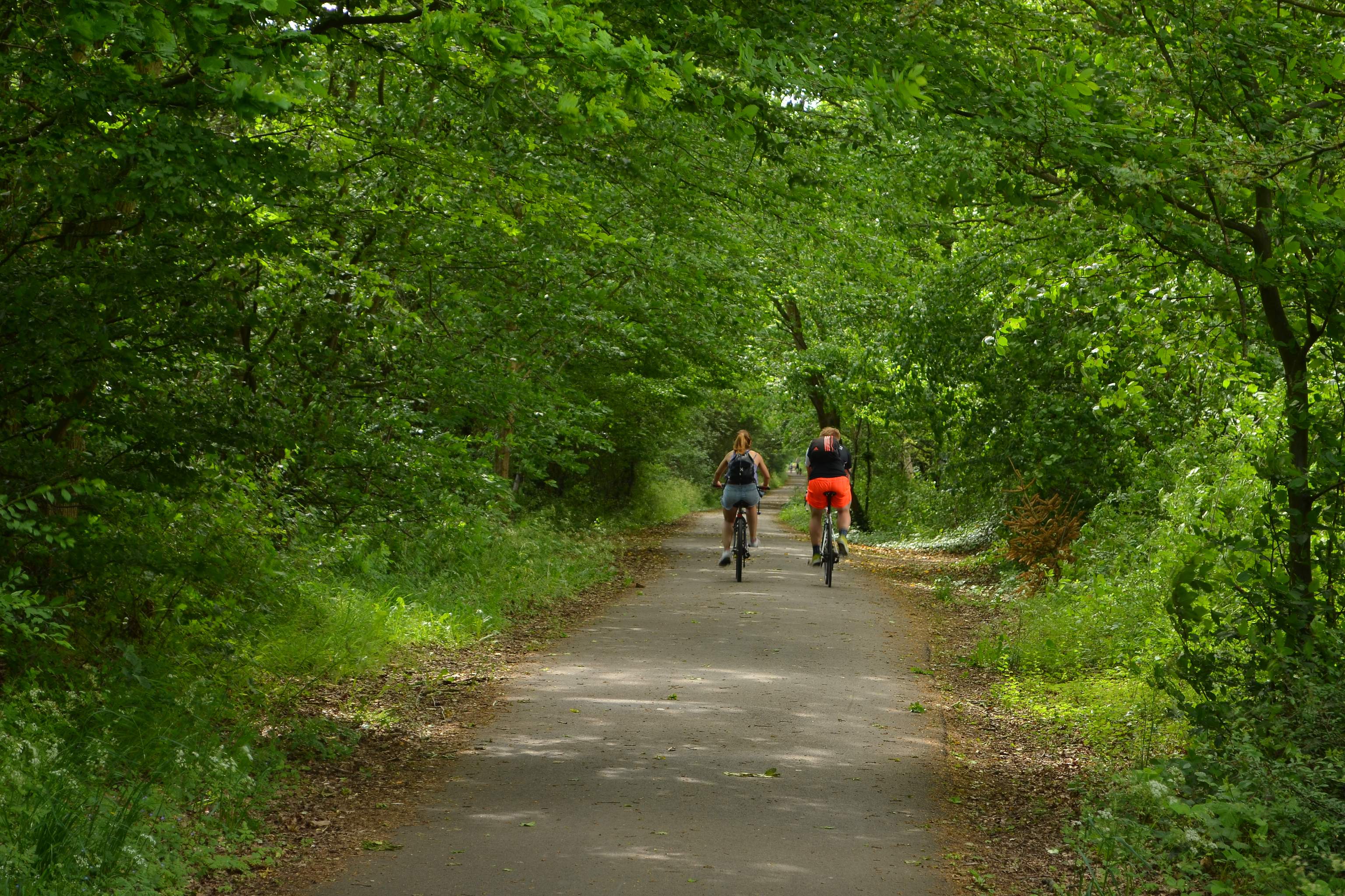
Alban Way

The Alban Way is a traffic free multi-user route along a former railway line in Hertfordshire, England, that has been constructed along the route of the...

Smallford

Smallford is a village in the City and District of St Albans, Hertfordshire, United Kingdom. It is sandwiched between Hatfield and St Albans. It was served...

Nearby Amenities

Located within 500m of 51.741211,-0.26494633
Traffic Signals
Traffic Signals: traffic_lights
Traffic Signals Direction: forward
Lat/Long: 51.7431174/-0.2675263
Crossing
Bicycle: yes
Crossing: unmarked
Crossing Island: yes
Crossing Markings: no
Kerb: lowered
Tactile Paving: yes
Lat/Long: 51.7424658/-0.2700376
Bus Stop
Sleapcross Gardens
Bench: no
Bin: no
Bus: yes
Lit: yes
Local Ref: NR
Naptan AtcoCode: 210021505920
Naptan Bearing: SW
Naptan CommonName: Sleapcross Gardens
Naptan Crossing: North Orbital Road
Naptan Indicator: nr
Naptan Landmark: North Orbital Road
Naptan NaptanCode: hrtawgmg
Naptan PlusbusZoneRef: HATFILD;STALBCY
Naptan ShortCommonName: NA
Naptan Street: Smallford Lane
Naptan Verified: no
Public Transport: platform
Shelter: no
Source: naptan_import
Tactile Paving: no
Lat/Long: 51.7446661/-0.2654499
Bus Stop
Wistlea Crescent
Bench: yes
Bin: yes
Bus: yes
Lit: yes
Naptan AtcoCode: 210021505940
Naptan Bearing: SE
Naptan CommonName: Wistlea Crescent
Naptan Crossing: opp Richardson Place
Naptan Indicator: adj
Naptan Landmark: opp Richardson Place
Naptan NaptanCode: hrtawgmj
Naptan PlusbusZoneRef: STALBCY
Naptan ShortCommonName: NA
Naptan Street: High Street
Naptan Verified: no
Public Transport: platform
Shelter: yes
Source: naptan_import
Tactile Paving: yes
Lat/Long: 51.7413104/-0.2651126
Bus Stop
Crooked Billet PH
Bench: no
Bin: no
Bus: yes
Lit: yes
Local Ref: NR
Naptan AtcoCode: 210021505960
Naptan Bearing: SE
Naptan CommonName: Crooked Billet PH
Naptan Crossing: Colney Heath JMI School
Naptan Indicator: nr
Naptan Landmark: Colney Heath JMI School
Naptan NaptanCode: hrtawgmp
Naptan PlusbusZoneRef: HATFILD;STALBCY
Naptan ShortCommonName: NA
Naptan Street: High Street
Naptan Verified: no
Public Transport: platform
Shelter: no
Source: naptan_import
Tactile Paving: no
Lat/Long: 51.7400561/-0.261397
Bus Stop
Crooked Billet PH
Bench: no
Bin: yes
Bus: yes
Lit: yes
Naptan AtcoCode: 210021506240
Naptan Bearing: NW
Naptan CommonName: Crooked Billet PH
Naptan Crossing: Village Hall
Naptan Indicator: opp
Naptan Landmark: Village Hall
Naptan NaptanCode: hrtawgdt
Naptan PlusbusZoneRef: HATFILD;STALBCY
Naptan ShortCommonName: NA
Naptan Street: High Street
Naptan Verified: no
Public Transport: platform
Shelter: no
Source: naptan_import
Tactile Paving: no
Lat/Long: 51.7396715/-0.2603255
Bus Stop
Wistlea Crescent
Bench: yes
Bin: yes
Bus: yes
Lit: yes
Naptan AtcoCode: 210021506260
Naptan Bearing: NW
Naptan CommonName: Wistlea Crescent
Naptan Crossing: Richardson Place
Naptan Indicator: opp
Naptan Landmark: Richardson Place
Naptan NaptanCode: hrtawgdw
Naptan PlusbusZoneRef: STALBCY
Naptan ShortCommonName: NA
Naptan Street: High Street
Naptan Verified: no
Public Transport: platform
Shelter: yes
Source: naptan_import
Tactile Paving: yes
Lat/Long: 51.74138/-0.2655822
Bus Stop
Sleapcross Gardens
Bench: no
Bin: no
Bus: yes
Lit: yes
Naptan AtcoCode: 210021506280
Naptan Bearing: NE
Naptan CommonName: Sleapcross Gardens
Naptan Crossing: North Orbital Road
Naptan Indicator: opp
Naptan Landmark: North Orbital Road
Naptan NaptanCode: hrtawgjg
Naptan PlusbusZoneRef: HATFILD;STALBCY
Naptan ShortCommonName: NA
Naptan Street: Smallford Lane
Naptan Verified: no
Public Transport: platform
Shelter: no
Source: naptan_import
Tactile Paving: no
Lat/Long: 51.7442937/-0.2658118
Crossing
Crossing: unmarked
Crossing Island: no
Tactile Paving: no
Lat/Long: 51.7401214/-0.2621494
Crossing
Crossing: unmarked
Lat/Long: 51.7415166/-0.2660399
Turning Circle
Lat/Long: 51.7410191/-0.2664023
Give Way
Lat/Long: 51.743962/-0.2656648
Give Way
Lat/Long: 51.7425167/-0.2698423
Crossing
Bicycle: yes
Crossing: unmarked
Crossing Island: yes
Crossing Markings: no
Kerb: lowered
Tactile Paving: yes
Lat/Long: 51.7425397/-0.2699518
Removed Amenity: telephone
Lat/Long: 51.7444338/-0.2654616
Crossing
Bicycle: yes
Crossing: unmarked
Crossing Island: yes
Crossing Markings: no
Kerb: lowered
Tactile Paving: yes
Lat/Long: 51.744033/-0.2657191
Crossing
Bicycle: yes
Crossing: unmarked
Crossing Island: yes
Crossing Markings: no
Kerb: lowered
Tactile Paving: yes
Lat/Long: 51.7440492/-0.2658432
Coal tax post
Historic: boundary_stone
Inscription: (none)
Material: iron
Note: Coal tax boundary marker 36
Lat/Long: 51.7392006/-0.2656122
Post Box
Brand: Royal Mail
Brand Wikidata: Q638098
Collection Times: Mo-Fr 09:00, Sa 07:00
Drive Through: no
Operator: Royal Mail
Operator Wikidata: Q638098
Post Box Type: pillar
Ref: AL4 156D
Royal Cypher: EIIR
Royal Cypher Wikidata: Q33102113
Lat/Long: 51.7402216/-0.2624001
Barrier: entrance
Lat/Long: 51.7395666/-0.259187
Crossing
Bicycle: yes
Button Operated: yes
Crossing: traffic_signals
Crossing Island: yes
Horse: yes
Tactile Paving: yes
Traffic Signals Sound: yes
Traffic Signals Vibration: yes
Lat/Long: 51.742966/-0.267473
Crossing
Bicycle: yes
Button Operated: yes
Crossing: traffic_signals
Crossing Island: no
Crossing Markings: no
Horse: yes
Kerb: lowered
Tactile Paving: yes
Lat/Long: 51.742868/-0.2674858
Traffic Signals
Traffic Signals: traffic_lights
Traffic Signals Direction: forward
Lat/Long: 51.7430597/-0.2672178
Traffic Signals
Traffic Signals: traffic_lights
Traffic Signals Direction: forward
Lat/Long: 51.7428879/-0.2673512
Traffic Signals
Traffic Signals: traffic_lights
Traffic Signals Direction: forward
Lat/Long: 51.7428306/-0.2674344
Access: no
Barrier: cycle_barrier
Bicycle: yes
Cycle Barrier: tilted
Foot: yes
Horse: yes
Lat/Long: 51.7375673/-0.2685492
Material: wood
Power: pole
Lat/Long: 51.7402558/-0.2668798
Power: pole
Lat/Long: 51.7378591/-0.2655011
Material: wood
Power: pole
Lat/Long: 51.7393182/-0.2662924
Material: wood
Power: pole
Lat/Long: 51.7420637/-0.2641641
Material: wood
Power: pole
Lat/Long: 51.7428235/-0.2636625
Material: wood
Power: pole
Lat/Long: 51.7435335/-0.2632213
Material: wood
Power: pole
Lat/Long: 51.744143/-0.2628189
Crossing
Crossing: unmarked
Lat/Long: 51.7418292/-0.2674625
Noexit: yes
Lat/Long: 51.7429273/-0.2627599
Crossing
Bicycle: yes
Button Operated: no
Crossing: traffic_signals
Crossing Island: no
Kerb: lowered
Tactile Paving: no
Lat/Long: 51.7429239/-0.2673458
Waste Basket
Waste: trash
Lat/Long: 51.7396662/-0.2602883
Grit Bin
Lat/Long: 51.7400441/-0.2621953
Waste Basket
Waste: trash
Lat/Long: 51.7400532/-0.2621417
Waste Basket
Waste: trash
Lat/Long: 51.7404103/-0.2625655
Direction: both
Traffic Calming: cushion
Lat/Long: 51.7404335/-0.2628004
Direction: both
Traffic Calming: cushion
Lat/Long: 51.7408637/-0.2639301
Waste Basket
Waste: trash
Lat/Long: 51.7413811/-0.2656259
Waste Basket
Waste: trash
Lat/Long: 51.7413263/-0.2651216
Bench
Backrest: yes
Lat/Long: 51.741602/-0.266389
Bench
Lat/Long: 51.742373/-0.268225
Bench
Backrest: yes
Lat/Long: 51.7390127/-0.2587732
Board Type: history
Check Date: 2023-08-26
Information: board
Tourism: information
Lat/Long: 51.7390515/-0.2656707
Waste Basket
Lat/Long: 51.739206/-0.2657556
Waste Basket
Lat/Long: 51.7390539/-0.2656323
Crossing
Crossing: unmarked
Crossing Island: yes
Crossing Markings: no
Kerb: flush
Tactile Paving: no
Lat/Long: 51.743511/-0.2664968
Crossing
Crossing: marked
Crossing Island: no
Crossing Markings: zebra
Tactile Paving: yes
Traffic Calming: table
Lat/Long: 51.7406376/-0.2633648
Direction: 235
Generator Method: photovoltaic
Generator Output Electricity: yes
Generator Solar Modules: 16
Generator Source: solar
Generator Type: solar_photovoltaic_panel
Location: roof
Power: generator
Lat/Long: 51.7406039/-0.2619422
Direction: 285
Generator Method: photovoltaic
Generator Output Electricity: yes
Generator Solar Modules: 9
Generator Source: solar
Generator Type: solar_photovoltaic_panel
Location: roof
Power: generator
Lat/Long: 51.7398152/-0.261988
Railway: turntable
Lat/Long: 51.7372161/-0.2678407
Crossing
Crossing: unmarked
Lat/Long: 51.7411793/-0.2649321
Crossing
Crossing: unmarked
Lat/Long: 51.7417208/-0.2667063
Crossing
Crossing: unmarked
Lat/Long: 51.7415818/-0.2662406
Give Way
Direction: backward
Lat/Long: 51.7419456/-0.2672832
Give Way
Direction: backward
Lat/Long: 51.7418581/-0.2671142
Give Way
Direction: forward
Lat/Long: 51.7418163/-0.2672347
Give Way
Direction: backward
Lat/Long: 51.7418401/-0.2673293
Turning Circle
Lat/Long: 51.740471/-0.2620244
Crossing
Crossing: unmarked
Crossing Island: no
Crossing Markings: no
Tactile Paving: no
Lat/Long: 51.7407232/-0.2634216
Crossing
Crossing: unmarked
Lat/Long: 51.7442139/-0.265622
Marker: aerial
Substance: oil
Utility: oil
Lat/Long: 51.7418725/-0.2709947
Marker: post
Substance: oil
Utility: oil
Lat/Long: 51.7418768/-0.2709808
Marker: aerial
Substance: oil
Utility: oil
Lat/Long: 51.7417673/-0.2705283
Marker: post
Substance: oil
Utility: oil
Lat/Long: 51.7417526/-0.2705198
Street Lamp
Lat/Long: 51.7419555/-0.2707307
Street Lamp
Lat/Long: 51.7416938/-0.2707262
Street Lamp
Lat/Long: 51.7417348/-0.2713011
Street Lamp
Lat/Long: 51.7414997/-0.271294
Marker: aerial
Substance: oil
Utility: oil
Lat/Long: 51.7391764/-0.2659024
Marker: post
Substance: oil
Utility: oil
Lat/Long: 51.7391742/-0.265898
Marker: post
Substance: oil
Utility: oil
Lat/Long: 51.7392121/-0.2658098
Crossing
Bicycle: yes
Button Operated: yes
Crossing: traffic_signals
Crossing Island: yes
Horse: yes
Tactile Paving: yes
Traffic Signals Sound: yes
Traffic Signals Vibration: yes
Lat/Long: 51.7431423/-0.2674635
Traffic Sign: GB:950
Lat/Long: 51.7430095/-0.2671574
Turning Circle
Lat/Long: 51.7410139/-0.2646094
Crossing
Crossing: unmarked
Lat/Long: 51.7417731/-0.2672681
Crossing
Crossing: unmarked
Lat/Long: 51.7409044/-0.2641289
Give Way
Lat/Long: 51.7422655/-0.2700213
Crossing
Crossing: unmarked
Crossing Island: yes
Crossing Markings: no
Kerb: flush
Tactile Paving: no
Lat/Long: 51.7434231/-0.2662534
Give Way
Lat/Long: 51.7438058/-0.2653402
Barrier: kerb
Kerb: regular
Lat/Long: 51.7400163/-0.2623832
The data included in this document is from www.openstreetmap.org. The data is made available under ODbL.

Have you been to Park Corner?

Leave your review of Park Corner below (or comments, questions and feedback).