Obridge

Settlement in Somerset Somerset West and Taunton

England

Obridge

Service Road behind the main street in Taunton This is the service road behind the main street in Taunton and it also provides access for delivery vehicles to the nearby Morrisons superstore.
Service Road behind the main street in Taunton Credit: Mike Crowe

Located in the county of Somerset, England, Obridge is a small suburban area situated on the outskirts of the historic town of Taunton. The name "Obridge" is derived from the Old English word "Oferbricge", meaning "over the bridge", which refers to its proximity to the River Tone.

Obridge is primarily a residential area, known for its peaceful and leafy surroundings. The housing in the area consists mainly of detached and semi-detached properties, with a mix of traditional and modern architectural styles. The community benefits from a range of local amenities, including convenience stores, a post office, and a primary school, making it an attractive location for families.

One of the prominent features of Obridge is the Obridge Viaduct, a historic landmark that spans the River Tone. Originally built in 1840 as part of the Bristol and Exeter Railway, the viaduct showcases impressive Victorian engineering and adds to the area's charm.

Residents of Obridge enjoy easy access to the town center of Taunton, which offers a wide range of shopping, dining, and entertainment options. The area is well-connected by road and public transport, with regular bus services and a nearby train station.

Surrounded by picturesque countryside, Obridge is also popular among nature enthusiasts and outdoor lovers. The nearby countryside offers opportunities for walking, cycling, and exploring the beautiful landscapes of Somerset.

Overall, Obridge offers a peaceful residential environment with convenient access to amenities and the nearby town of Taunton, making it an ideal place for those seeking a suburban lifestyle with easy access to both urban and rural attractions.

If you have any feedback on the listing, please let us know in the comments section below.
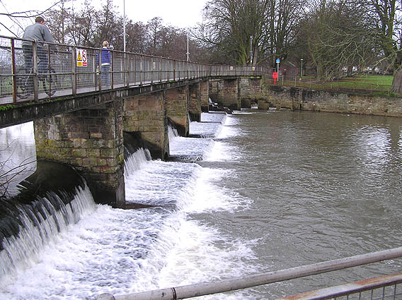
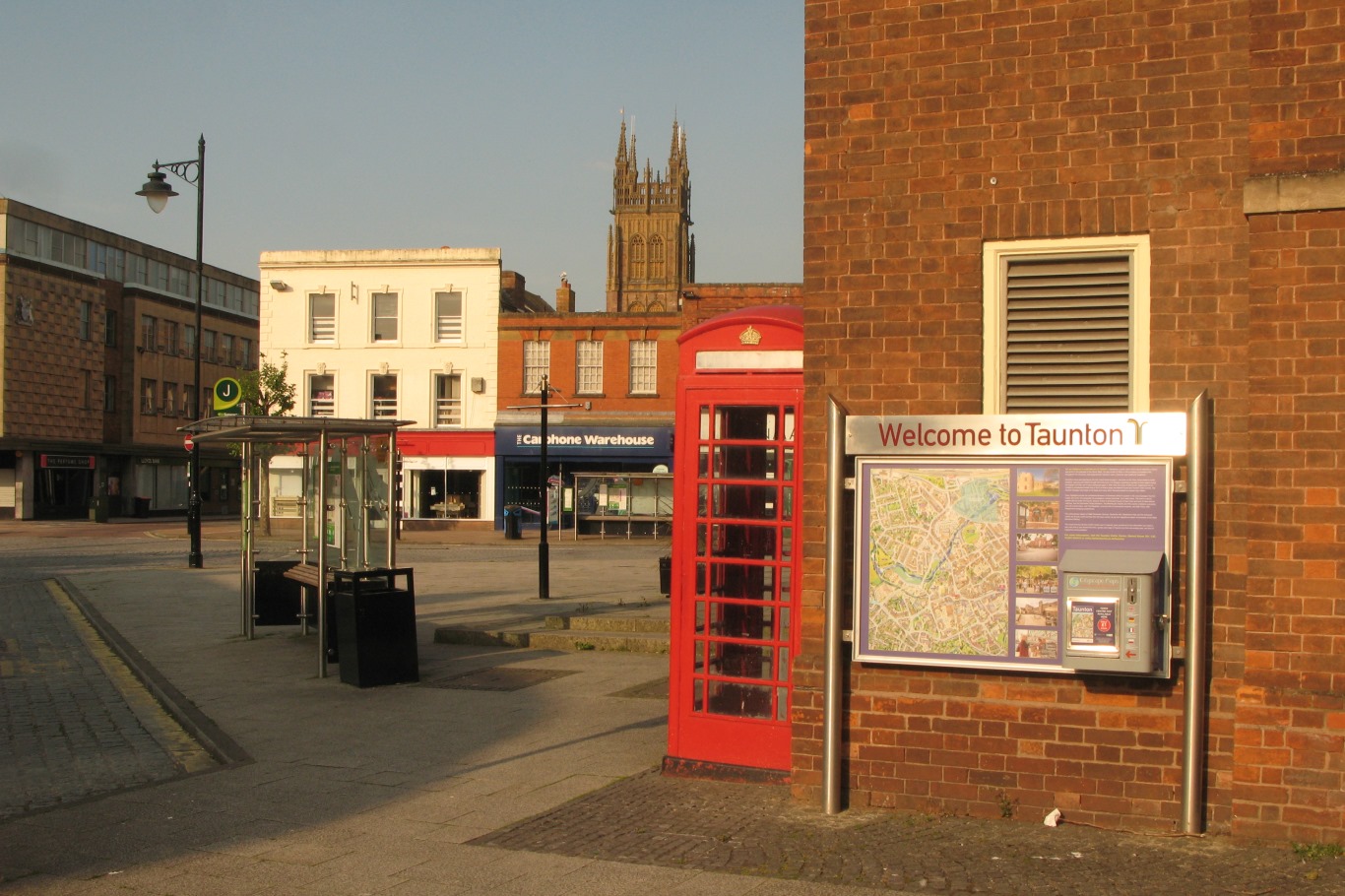
Obridge Images

Images are sourced within 2km of 51.0243/-3.0939961 or Grid Reference ST2325. Thanks to Geograph Open Source API. All images are credited.

Service Road behind the main street in Taunton This is the service road behind the main street in Taunton and it also provides access for delivery vehicles to the nearby Morrisons superstore.
Service Road behind the main street in Taunton
This is the service road behind the main street in Taunton and it also provides access for delivery vehicles to the nearby Morrisons superstore.
Swans on the River Tone The view point is the access bridge for the cattle market/auction site which is visible at centre right. Priory Bridge can be seen in the background.
Swans on the River Tone
The view point is the access bridge for the cattle market/auction site which is visible at centre right. Priory Bridge can be seen in the background.
Vivary Park, Taunton This elaborate fountain is in the centre of the park.  The fort-like building in the background is the barracks.
Vivary Park, Taunton
This elaborate fountain is in the centre of the park. The fort-like building in the background is the barracks.
Taunton Carnival Theatreland, the 2005 entry from Harlequins Carnival Club of Ilminster leaves the Priory Bridge Road assembly area during Taunton Carnival procession.
Taunton Carnival
Theatreland, the 2005 entry from Harlequins Carnival Club of Ilminster leaves the Priory Bridge Road assembly area during Taunton Carnival procession.
Taunton Carnival A view over Priory Bridge Road car park, in use as the assembly area for Taunton Carnival 2005. As the skies darken, last minute checks are being made on the floats and the majorettes are preparing to practise their routine.
Taunton Carnival
A view over Priory Bridge Road car park, in use as the assembly area for Taunton Carnival 2005. As the skies darken, last minute checks are being made on the floats and the majorettes are preparing to practise their routine.
Taunton Carnival As the moon rises, a police motor cyclist keeps an eye on some of the carnival floats preparing for the 2005 Taunton Carnival procession.
Taunton Carnival
As the moon rises, a police motor cyclist keeps an eye on some of the carnival floats preparing for the 2005 Taunton Carnival procession.
Taunton Carnival It's rush, rush, rush as start time approaches!  This is a view of some of the carnival floats in the Priory Bridge Road assembly area as they prepare for the 2005 Taunton Carnival procession.
Taunton Carnival
It's rush, rush, rush as start time approaches! This is a view of some of the carnival floats in the Priory Bridge Road assembly area as they prepare for the 2005 Taunton Carnival procession.
Taunton Carnival The 2005 entry form Phoenix Carnival club leaves the assembly area as it starts its journey along the Taunton Carnival procession route.
Taunton Carnival
The 2005 entry form Phoenix Carnival club leaves the assembly area as it starts its journey along the Taunton Carnival procession route.
Taunton Carnival Admiring crowds line the route as the 2005 entry form Gemini Carnival Club starts on its way along the Taunton Carnival procession.  This is a tableau float and the poses will be maintained for the duration of the procession, approximately two hours.
Taunton Carnival
Admiring crowds line the route as the 2005 entry form Gemini Carnival Club starts on its way along the Taunton Carnival procession. This is a tableau float and the poses will be maintained for the duration of the procession, approximately two hours.
Taunton School An independent boarding and day school for boys set in beautiful grounds close to the town centre.
Taunton School
An independent boarding and day school for boys set in beautiful grounds close to the town centre.
The County Ground, Taunton Somerset are playing Hampshire in a four day county fixture. The Ian Botham Stand opposite is named after one of Somerset's most illustrious former players.
The County Ground, Taunton
Somerset are playing Hampshire in a four day county fixture. The Ian Botham Stand opposite is named after one of Somerset's most illustrious former players.
The Creech Castle Hotel. Taunton A local landmark at the busy junction of the A38 and the A358.
The Creech Castle Hotel. Taunton
A local landmark at the busy junction of the A38 and the A358.
River Tone Looking down from the footbridge at the riverside path alongside the supermarket car park. A popular spot for feeding swans, ducks and gulls.
River Tone
Looking down from the footbridge at the riverside path alongside the supermarket car park. A popular spot for feeding swans, ducks and gulls.
St. Mary Magdalene, Taunton The parish church of St.Mary Magdalene, Taunton
St. Mary Magdalene, Taunton
The parish church of St.Mary Magdalene, Taunton
Christmas Lights, Taunton A view of the cross at the top of North Street, Taunton, with festive lights in the background.
Christmas Lights, Taunton
A view of the cross at the top of North Street, Taunton, with festive lights in the background.
St. James's church, Taunton
Tudor Inn, Taunton Dates back to the 1600's when Judge Jeffrys of "Bloody Assize" infamy, was believed to have stayed here.
Tudor Inn, Taunton
Dates back to the 1600's when Judge Jeffrys of "Bloody Assize" infamy, was believed to have stayed here.
French Weir, River Tone
Show me another place!

Obridge is located at Grid Ref: ST2325 (Lat: 51.0243, Lng: -3.0939961)

Administrative County: Somerset

District: Somerset West and Taunton

Police Authority: Avon and Somerset

What 3 Words

///such.navy.woods. Near Taunton, Somerset

Nearby Locations

Lyngford Firepool Obridge

Related Wikis

The St Augustine of Canterbury School, Taunton

The St Augustine of Canterbury School was a joint Church of England and Roman Catholic Voluntary Aided (VA) secondary school in Taunton, Somerset, England...

Taunton railway station

Taunton railway station is a junction station on the route from London to Penzance, 163 miles 12 chains (263 km) west of London Paddington station, measured...

Taunton metro rail

Taunton Metro Rail (TMR) was a light rail network proposed in 2009 to use a combination of existing rail infrastructure and the construction of new infrastructure...

Somerset Cricket Museum

Somerset Cricket Museum in Taunton, Somerset, England, is a small museum housing exhibits on the history of cricket with a particular emphasis on the history...

Somerset Military Museum

The Somerset Military Museum is part of the Museum of Somerset located in the 12th century great hall of Taunton Castle, in Taunton, Somerset. It is a...

Taunton

Taunton () is the county town of Somerset, England, with a 2011 population of 64,621. Its thousand-year history includes a 10th-century monastic foundation...

Sieges of Taunton

The sieges of Taunton were a series of three blockades during the First English Civil War. The town of Taunton, in Somerset, was considered to be of strategic...

Taunton Rural District

Taunton was a rural district in Somerset, England, from 1894 to 1974. It was created in 1894 under the Local Government Act 1894. In 1974 it was abolished...

Nearby Amenities

Located within 500m of 51.0243,-3.0939961
Operator: Network Rail
Railway: switch
Lat/Long: 51.0243678/-3.0883342
Barrier: bollard
Bicycle: yes
Foot: yes
Lat/Long: 51.02372/-3.0951928
Seamark Type: gate
Waterway: lock_gate
Lat/Long: 51.0220091/-3.0983555
Seamark Type: gate
Waterway: lock_gate
Lat/Long: 51.022119/-3.0981774
Turning Circle
Lat/Long: 51.0255916/-3.0926113
Turning Circle
Lat/Long: 51.0252534/-3.0935553
Traffic Calming: cushion
Lat/Long: 51.0268242/-3.0910524
Crossing
Bicycle: yes
Crossing Island: yes
Kerb: lowered
Tactile Paving: yes
Lat/Long: 51.0274138/-3.0919351
Crossing
Bicycle: dismount
Crossing: unmarked
Crossing Markings: no
Kerb: lowered
Tactile Paving: yes
Lat/Long: 51.0275308/-3.0903913
Crossing
Bicycle: dismount
Crossing: unmarked
Crossing Markings: no
Kerb: lowered
Tactile Paving: yes
Lat/Long: 51.0275497/-3.0902488
Crossing
Bicycle: yes
Crossing: traffic_signals
Crossing Ref: pelican
Lat/Long: 51.0267789/-3.0951687
Traffic Calming: table
Lat/Long: 51.0260805/-3.0901795
Barrier: block
Lat/Long: 51.0236078/-3.0933477
Atm
Opening Hours: 24/7
Wheelchair: yes
Lat/Long: 51.0249591/-3.0994052
Crossing
Bicycle: dismount
Crossing Island: yes
Kerb: lowered
Tactile Paving: yes
Lat/Long: 51.0279009/-3.0900336
Crossing
Bicycle: dismount
Crossing: unmarked
Crossing Markings: no
Kerb: lowered
Tactile Paving: yes
Lat/Long: 51.0278507/-3.0900059
Crossing
Bicycle: dismount
Crossing Island: yes
Kerb: lowered
Tactile Paving: yes
Lat/Long: 51.0279/-3.0899482
Crossing
Bicycle: dismount
Crossing: unmarked
Crossing Markings: no
Kerb: lowered
Tactile Paving: yes
Lat/Long: 51.0279438/-3.090057
Crossing
Bicycle: dismount
Crossing: unmarked
Crossing Markings: no
Kerb: lowered
Tactile Paving: yes
Lat/Long: 51.0278638/-3.0899392
Crossing
Bicycle: dismount
Crossing: unmarked
Crossing Markings: no
Kerb: lowered
Tactile Paving: yes
Lat/Long: 51.02794/-3.089965
Crossing
Bicycle: dismount
Crossing Island: yes
Kerb: lowered
Tactile Paving: yes
Lat/Long: 51.0267518/-3.0956684
Taunton East Junction
Historic Railway: junction
Railway: site
Lat/Long: 51.0231187/-3.0961906
Operator: Network Rail
Railway: switch
Lat/Long: 51.0231771/-3.0990027
Operator: Network Rail
Railway: switch
Lat/Long: 51.024658/-3.0871988
Crossing
Bicycle: dismount
Crossing: unmarked
Crossing Markings: no
Kerb: lowered
Tactile Paving: yes
Lat/Long: 51.020439/-3.0959846
Crossing
Bicycle: dismount
Crossing: unmarked
Crossing Markings: no
Kerb: lowered
Tactile Paving: yes
Lat/Long: 51.0208642/-3.0959758
Access: yes
Entrance: yes
Wheelchair: yes
Lat/Long: 51.0274146/-3.0911811
Noexit: yes
Lat/Long: 51.0253743/-3.0917288
Crossing
Crossing Island: yes
Lat/Long: 51.0253094/-3.0991506
Crossing
Crossing Island: yes
Lat/Long: 51.0257224/-3.0981463
Access: private
Addr Flats: 1;2;3;4;5;6;7;8;9;10;11;12;14;15;16;17;18;19;20;21;22;23;24;25;26;27;28;29;30;31;32;33;34;35;36;37;38;39;40;41;42;43;44;45;46;47;48;49;50;51;52;53;54;55
Entrance: main
Lat/Long: 51.0225343/-3.0940282
Access: private
Addr Flats: 56;57;58;59;60;61;62;63;64;65;66;67;68;69;70;71;72;73;74;75;76;77;78;79;80;81;82;83;84;85;86;87;88;89;90;91;92;93;94;95;96;97;98;99;100;101;102;103;104;105;106;107;108;109
Entrance: main
Lat/Long: 51.0227419/-3.0936038
Crossing
Bicycle: dismount
Crossing: unmarked
Crossing Markings: no
Kerb: lowered
Tactile Paving: yes
Lat/Long: 51.0277116/-3.0909527
Crossing
Bicycle: dismount
Crossing Island: yes
Kerb: lowered
Tactile Paving: yes
Lat/Long: 51.0277638/-3.0909805
Crossing
Bicycle: dismount
Crossing: unmarked
Crossing Markings: no
Kerb: lowered
Tactile Paving: yes
Lat/Long: 51.0278094/-3.0910029
Crossing
Bicycle: dismount
Crossing: unmarked
Crossing Markings: no
Kerb: lowered
Tactile Paving: yes
Lat/Long: 51.028171/-3.0905935
Crossing
Bicycle: dismount
Crossing Island: yes
Kerb: lowered
Tactile Paving: yes
Lat/Long: 51.0281763/-3.0905372
Crossing
Bicycle: dismount
Crossing: unmarked
Crossing Markings: no
Kerb: lowered
Tactile Paving: yes
Lat/Long: 51.0281802/-3.0904832
Obridge
Is In: Taunton
Place: suburb
Lat/Long: 51.0261888/-3.0935416
Firepool
Is In: Taunton, Somerset, England, United Kingdom
Place: suburb
Lat/Long: 51.0215244/-3.0977635
Post Box
Collection Times: Mo-Fr 17:00; Sa 11:45
Operator: Royal Mail
Operator Wikidata: Q638098
Post Box Type: pillar
Ref: TA2 320
Royal Cypher: GVIR
Royal Cypher Wikidata: Q33102169
Lat/Long: 51.0270101/-3.0937854
Operator: Network Rail
Railway: switch
Lat/Long: 51.024528/-3.0876166
Give Way
Lat/Long: 51.0250348/-3.1005659
Give Way
Lat/Long: 51.0250523/-3.1010401
Give Way
Lat/Long: 51.025909/-3.0976234
Give Way
Lat/Long: 51.0259571/-3.0977439
Post Box
Mapillary: 599838597655508
Operator: Royal Mail
Operator Wikidata: Q638098
Post Box Type: pillar
Ref: TA2 451
Survey Date: 2020-02-18
Lat/Long: 51.0253914/-3.0992051
Give Way
Direction: backward
Lat/Long: 51.0267057/-3.0956418
Give Way
Lat/Long: 51.0267597/-3.0981246
Give Way
Lat/Long: 51.028006/-3.0954313
Give Way
Lat/Long: 51.0281017/-3.09609
Give Way
Lat/Long: 51.0281915/-3.0966221
Give Way
Lat/Long: 51.0249356/-3.0999017
Barrier: bollard
Bicycle: yes
Bollard: removable
Foot: yes
Lat/Long: 51.02409/-3.0981932
Give Way
Direction: forward
Lat/Long: 51.027171/-3.0929835
Give Way
Direction: backward
Lat/Long: 51.0272406/-3.0929586
Traffic Calming: bump
Lat/Long: 51.0271462/-3.0917225
Obridge Viaduct
Place: locality
Lat/Long: 51.0241393/-3.0900157
Access: yes
Entrance: yes
Wheelchair: yes
Lat/Long: 51.0249254/-3.0995117
Access: yes
Barrier: bollard
Bicycle: yes
Bollard: fixed
Colour: black
Foot: yes
Horse: no
Material: plastic
Lat/Long: 51.0223172/-3.0983812
Waterway: weir
Lat/Long: 51.0218579/-3.0982088
Lifebuoy
Life Ring
Description: Lifebuoy
Emergency: life_ring
Lat/Long: 51.0210695/-3.097916
Waste Basket
Waste: dog_excrement
Lat/Long: 51.0211829/-3.0975968
Life Ring
Description: Lifebuoy
Emergency: life_ring
Lat/Long: 51.0230635/-3.0925057
Noexit: yes
Lat/Long: 51.0235224/-3.0923357
Give Way
Direction: forward
Lat/Long: 51.0220215/-3.0938104
Barrier: bollard
Bicycle: yes
Foot: yes
Material: plastic
Lat/Long: 51.0200129/-3.092036
Give Way
Direction: forward
Lat/Long: 51.0205935/-3.0915057
Give Way
Direction: backward
Lat/Long: 51.0209336/-3.094761
Give Way
Direction: backward
Lat/Long: 51.022566/-3.0932621
Give Way
Direction: forward
Lat/Long: 51.0201219/-3.0917643
Noexit: yes
Lat/Long: 51.0208331/-3.0944767
Crossing
Bicycle: dismount
Button Operated: yes
Crossing: traffic_signals
Crossing Ref: puffin
Kerb: lowered
Tactile Paving: yes
Traffic Signals Sound: yes
Lat/Long: 51.0226855/-3.0974195
Barrier: bollard
Bicycle: yes
Foot: yes
Material: plastic
Lat/Long: 51.0201529/-3.093952
Give Way
Direction: forward
Lat/Long: 51.0223707/-3.0929653
Give Way
Direction: forward
Lat/Long: 51.0204027/-3.0921282
Access: private
Door: overhead
Door Type: single
Entrance: yes
Foot: private
Material: metal
Motorcar: private
Note: Access to basement parking garage (resident's only).
Lat/Long: 51.0226853/-3.0940497
Give Way
Direction: forward
Lat/Long: 51.020294/-3.0919939
Crossing
Bicycle: dismount
Crossing: unmarked
Crossing Markings: no
Foot: yes
Kerb: lowered
Tactile Paving: yes
Lat/Long: 51.0201271/-3.0918944
Crossing
Bicycle: dismount
Crossing Island: yes
Kerb: lowered
Tactile Paving: yes
Lat/Long: 51.0222858/-3.0942146
Barrier: bollard
Bicycle: yes
Foot: yes
Material: plastic
Lat/Long: 51.020083/-3.0937104
Give Way
Lat/Long: 51.0217597/-3.0905466
Access: private
Door: overhead
Door Type: single
Entrance: yes
Foot: private
Material: metal
Motorcar: private
Note: Access to basement parking garage (resident's only).
Lat/Long: 51.0227905/-3.0937851
Crossing
Bicycle: dismount
Button Operated: yes
Crossing: traffic_signals
Crossing Ref: puffin
Kerb: lowered
Tactile Paving: yes
Traffic Signals Sound: yes
Lat/Long: 51.0224885/-3.094419
Barrier: bollard
Bicycle: yes
Foot: yes
Material: wood
Lat/Long: 51.0201141/-3.0936726
Give Way
Direction: backward
Lat/Long: 51.0226135/-3.0959592
Crossing
Bicycle: dismount
Button Operated: yes
Crossing: traffic_signals
Crossing Ref: puffin
Kerb: lowered
Tactile Paving: yes
Traffic Signals Sound: yes
Lat/Long: 51.0226881/-3.0956205
Noexit: yes
Lat/Long: 51.0209264/-3.0945598
Crossing
Bicycle: dismount
Crossing Island: yes
Foot: yes
Kerb: lowered
Tactile Paving: yes
Lat/Long: 51.0201973/-3.0938706
Give Way
Direction: forward
Lat/Long: 51.0204078/-3.0940917
Give Way
Direction: forward
Lat/Long: 51.0226906/-3.096584
Barrier: bollard
Bicycle: yes
Foot: yes
Material: plastic
Lat/Long: 51.0227987/-3.0930396
Give Way
Direction: backward
Lat/Long: 51.0222827/-3.0943017
Barrier: bollard
Bicycle: yes
Foot: yes
Material: plastic
Lat/Long: 51.0228401/-3.0931394
Give Way
Direction: forward
Lat/Long: 51.0209139/-3.0943673
Bench
Backrest: yes
Material: wood
Seats: 4
Lat/Long: 51.0219028/-3.095866
Bench
Backrest: no
Material: wood
Seats: 3
Lat/Long: 51.0216676/-3.0962124
Bench
Backrest: yes
Colour: black
Material: wood
Seats: 4
Lat/Long: 51.0215503/-3.0955955
Access: private
Addr Flats: 57;59;61;63;65;67;69;71;73;75
Entrance: main
Lat/Long: 51.0224861/-3.0946321
Entrance: yes
Motorcar: private
Note: Access to basement parking garage (resident's only).
Lat/Long: 51.0225363/-3.0927795
Access: private
Addr Flats: 1;2;3;4;5;6;7;8;9;10;11;12;14;15;16;17;18;19
Entrance: main
Lat/Long: 51.0225631/-3.0930191
Give Way
Direction: backward
Lat/Long: 51.0228037/-3.0875847
Noexit: yes
Lat/Long: 51.0218108/-3.0882284
Noexit: yes
Lat/Long: 51.0217382/-3.0881841
Noexit: yes
Lat/Long: 51.0226176/-3.089302
Give Way
Direction: forward
Lat/Long: 51.0227379/-3.0885248
Give Way
Direction: forward
Lat/Long: 51.0225523/-3.0884336
Noexit: yes
Lat/Long: 51.0226071/-3.0879776
Access: customers
Entrance: main
Foot: yes
Level: 0
Motor Vehicle: no
Wheelchair: yes
Lat/Long: 51.0215037/-3.0886519
Access: private
Door: overhead
Entrance: service
Foot: no
Level: 0
Motor Vehicle: yes
Lat/Long: 51.021876/-3.0896497
Note: Validator returns a duplicated node error. However, the way formed by this node is on separate layer and level to the "duplicate". In the real world, AFAIK at this time, the ways parallel each other vertically on the separate floors of the building.
Lat/Long: 51.0216589/-3.0897052
Note: Validator returns a duplicated node error. However, the way formed by this node is on separate layer and level to the "duplicate". In the real world, AFAIK at this time, the ways parallel each other vertically on the separate floors of the building.
Lat/Long: 51.021534/-3.0895114
Note: Validator returns a duplicated node error. However, the way formed by this node is on separate layer and level to the "duplicate". In the real world, AFAIK at this time, the ways parallel each other vertically on the separate floors of the building.
Lat/Long: 51.0217828/-3.0896861
Note: Validator returns a duplicated node error. However, the way formed by this node is on separate layer and level to the "duplicate". In the real world, AFAIK at this time, the ways parallel each other vertically on the separate floors of the building.
Lat/Long: 51.0215896/-3.0897174
Access: private
Door: overhead
Entrance: service
Foot: no
Level: 0
Motor Vehicle: yes
Lat/Long: 51.0219092/-3.0888172
Traffic Calming: table
Lat/Long: 51.0264326/-3.0902199
Noexit: yes
Lat/Long: 51.025546/-3.09149
Give Way
Direction: backward
Lat/Long: 51.0276641/-3.0893509
Bus: yes
Operator: Berrys
Public Transport: stop_position
Ref: 625
Lat/Long: 51.0273747/-3.0925877
Telephone
Booth: KX100
Covered: booth
Mapillary: 490822659036581
Operator: BT
Operator Wikidata: Q593786
Survey Date: 2020-02-18
Lat/Long: 51.0268944/-3.0943311
Crossing
Bicycle: dismount
Crossing Island: yes
Kerb: lowered
Tactile Paving: yes
Lat/Long: 51.0275401/-3.0903205
Give Way
Direction: backward
Lat/Long: 51.0274591/-3.0919607
Bus: yes
Operator: Berrys
Public Transport: stop_position
Ref: 625
Lat/Long: 51.0271116/-3.0937886
Bus Stop
Taunton Academy (Opp)
Bus: yes
Naptan AtcoCode: 3600SOC31201
Naptan Bearing: SW
Naptan CommonName: Taunton Academy
Naptan Indicator: opp
Naptan NaptanCode: sotajgwt
Naptan PlusbusZoneRef: TAUNTON
Naptan Street: Priorswood Road
Naptan Verified: no
Network: The Buses of Somerset
Network Wikidata: Q17018973
Operator: First South West
Operator Wikidata: Q5454172
Public Transport: platform
Ref: 2;625
Lat/Long: 51.0270487/-3.0937585
Bus Stop
Taunton Academy (Nr)
Bus: yes
Naptan AtcoCode: 3600SOC31200
Naptan Bearing: NE
Naptan CommonName: Taunton Academy
Naptan Indicator: near
Naptan NaptanCode: sotajmaw
Naptan PlusbusZoneRef: TAUNTON
Naptan Street: Priorswood Road
Naptan Verified: no
Operator: Berrys
Public Transport: platform
Ref: 625
Lat/Long: 51.0274304/-3.0926205
Access: private
Entrance: main
Lat/Long: 51.0225527/-3.0985774
Height: 15
Man Made: tower
Operator: Network Rail
Operator Wikidata: Q1501071
Ref: 1095
Technology: GSM MACRO
Tower Construction: freestanding
Tower Type: communication
Lat/Long: 51.0229499/-3.0991715
Give Way
Direction: forward
Lat/Long: 51.0226719/-3.097716
Access: private
Addr Flats: 56;58;60;62;64;66;68;70;72;74;76;78
Entrance: main
Lat/Long: 51.022284/-3.0969725
Access: private
Addr Flats: 38;40;42;44;46;48;50;52;54
Entrance: main
Lat/Long: 51.0225631/-3.0969979
Access: private
Addr Flats: 14;16;18;20;22;24;26;28;30;32;34;36
Entrance: main
Lat/Long: 51.0225419/-3.0966177
Access: private
Addr Flats: 2;4;6;8;10;12
Entrance: main
Lat/Long: 51.0225571/-3.0962145
Access: private
Addr Flats: 1;3;5;7;9;11
Entrance: main
Lat/Long: 51.0225923/-3.0956923
Access: private
Addr Flats: 15;17;19;21;23;25;27;29;31;33;35;37
Entrance: main
Lat/Long: 51.0226043/-3.0952873
Access: private
Addr Flats: 39;41;43;45;47;49;51;53;55
Entrance: main
Lat/Long: 51.022558/-3.0946708
Access: private
Addr Flats: 26;27;28;29;30;31;32;33;34;35;36;37
Entrance: main
Lat/Long: 51.0228955/-3.095215
Access: private
Addr Flats: 14;15;16;17;18;19;20;21;22;23;24;25
Entrance: main
Lat/Long: 51.0228762/-3.0957769
Access: private
Addr Flats: 1;2;3;4;5;6;7;8;9;10;11;12
Entrance: main
Lat/Long: 51.022854/-3.0963181
Access: private
Addr Flats: 43;44;45;46;47;48;49;50;51;52
Entrance: main
Lat/Long: 51.0220994/-3.0939865
Lifebuoy
Life Ring
Description: Lifebuoy
Emergency: life_ring
Lat/Long: 51.0220264/-3.0985467
Access: private
Door: overhead
Entrance: service
Foot: no
Level: 0
Location: indoor
Motor Vehicle: yes
Lat/Long: 51.0216519/-3.0892391
Access: private
Door: overhead
Entrance: service
Foot: no
Level: 0
Motor Vehicle: yes
Lat/Long: 51.0215907/-3.089219
Communication Mobile Phone: yes
Height: 25.5
Man Made: mast
Operator: Three
Operator Wikidata: Q19840922
Ref: TA0110
Technology: UMTS
Tower Construction: guyed
Tower Type: communication
Lat/Long: 51.022306/-3.088124
Access: private
Door: overhead
Entrance: service
Foot: no
Level: 0
Location: indoor
Motor Vehicle: yes
Lat/Long: 51.0218163/-3.0894911
Access: private
Entrance: main
Foot: yes
Motor Vehicle: no
Lat/Long: 51.0220337/-3.0896561
Access: private
Door: overhead
Entrance: service
Foot: no
Motor Vehicle: yes
Lat/Long: 51.0220757/-3.0896561
Access: private
Door: overhead
Entrance: service
Foot: no
Motor Vehicle: yes
Lat/Long: 51.0221216/-3.0896561
Access: private
Door: overhead
Entrance: service
Foot: no
Motor Vehicle: yes
Lat/Long: 51.0221674/-3.0896561
Access: private
Door: overhead
Entrance: service
Foot: no
Motor Vehicle: yes
Lat/Long: 51.0222133/-3.0896561
Access: private
Door: overhead
Entrance: service
Foot: no
Motor Vehicle: yes
Lat/Long: 51.0222592/-3.0896561
Access: private
Door: overhead
Entrance: service
Foot: no
Motor Vehicle: yes
Lat/Long: 51.0223051/-3.0896561
Access: customers
Entrance: main
Foot: yes
Motor Vehicle: no
Wheelchair: yes
Lat/Long: 51.022426/-3.0888291
Access: private
Door: overhead
Entrance: service
Foot: no
Motor Vehicle: yes
Lat/Long: 51.0223659/-3.088577
Car Rental
Hertz
Addr City: Taunton
Addr Country: GB
Addr County: Somerset
Addr Housename: Old Engineers Workshop
Addr Postcode: TA1 1QP
Addr Street: Station Approach North
Addr Unit: 2
Brand: Hertz
Brand Wikidata: Q1543874
Opening Hours: Mo-Fr 09:00-17:30; Sa 09:00-12:00
Phone: +44 1823 240058
Lat/Long: 51.0234772/-3.0989214
Theatre
@2K Theatre
Addr City: Taunton
Addr Country: GB
Addr County: Somerset
Addr Housename: Old Engineers Workshop
Addr Postcode: TA1 1QP
Addr Street: Station Approach North
Addr Unit: 3
Email: At2k@icloud.com
Website: https://www.at2ktheatre.com/
Lat/Long: 51.0234239/-3.0988015
Street Lamp
Lamp Mount: bent_mast
Lamp Type: electric
Material: metal
Operator: Somerset County Council
Lat/Long: 51.0232731/-3.0929082
Man Made: manhole
Manhole: sewer
Operator: Wessex Water
Ref: 5307
Lat/Long: 51.022532/-3.0918682
Man Made: manhole
Manhole: sewer
Operator: Wessex Water
Ref: 5301
Lat/Long: 51.0225514/-3.0920157
Fixme: Requires further research to determine course beyond this point.
Lat/Long: 51.0225262/-3.0913852
Fixme: Requires further research to determine course beyond this point.
Lat/Long: 51.0231412/-3.0942067
Access: private
Door: hinged
Door Type: single
Entrance: main
Foot: private
Motorcar: no
Lat/Long: 51.0229913/-3.092903
Access: private
Door: hinged
Door Type: single
Entrance: main
Foot: private
Motorcar: no
Lat/Long: 51.0230171/-3.092996
Access: private
Door: hinged
Door Type: single
Entrance: main
Foot: private
Motorcar: no
Lat/Long: 51.0230303/-3.0930436
Access: private
Door: hinged
Door Type: single
Entrance: main
Foot: private
Motorcar: no
Lat/Long: 51.0230562/-3.093137
Access: private
Door: hinged
Door Type: single
Entrance: main
Foot: private
Motorcar: no
Lat/Long: 51.0230704/-3.0931884
Access: private
Addr Flats: 6;7;8;9;10;11;12;14;15;16;17;18;19;20;21;22;23;24;25
Door: hinged
Door Type: single
Entrance: main
Foot: private
Motorcar: no
Lat/Long: 51.0229226/-3.0927797
Street Lamp
Lamp Mount: straight_mast
Lamp Type: electric
Material: metal
Operator: Somerset County Council
Lat/Long: 51.0227904/-3.0923609
Access: private
Door: hinged
Door Type: single
Entrance: main
Foot: private
Material: wood
Motorcar: no
Lat/Long: 51.0228802/-3.0929581
Access: private
Door: hinged
Door Type: double
Entrance: main
Foot: delivery
Material: wood
Motorcar: no
Lat/Long: 51.0228543/-3.0929802
Access: private
Door: hinged
Door Type: double
Entrance: main
Foot: private
Material: wood
Motorcar: no
Lat/Long: 51.0229859/-3.0928268
Toolstation
Addr City: Taunton
Addr Country: GB
Addr County: Somerset
Addr Parentstreet: Priory Avenue
Addr Postcode: TA1 1QS
Addr Street: Priory Fields Retail Park
Addr Unit: 6
Brand: Toolstation
Brand Wikidata: Q7824103
Is In: Wicks
Opening Hours: Mo-Fr, PH 07:00-20:00; Sa 07:00-19:00; Su 10:00-16:00
Shop: doityourself
Lat/Long: 51.0209288/-3.0912913
Access: private
Door: hinged
Door Type: double
Entrance: yes
Foot: private
Material: wood
Motorcar: no
Lat/Long: 51.0226472/-3.0985935
Street Lamp
Lamp Mount: straight_mast
Lamp Type: electric
Material: metal
Operator: Somerset County Council
Lat/Long: 51.0226/-3.0970574
Street Lamp
Lamp Mount: straight_mast
Lamp Type: electric
Material: metal
Operator: Somerset County Council
Lat/Long: 51.0226184/-3.097398
Street Lamp
Lamp Mount: straight_mast
Lamp Type: electric
Material: metal
Operator: Somerset County Council
Lat/Long: 51.0226783/-3.0981183
Street Lamp
Lamp Mount: straight_mast
Lamp Type: electric
Material: metal
Operator: Somerset County Council
Lat/Long: 51.0227004/-3.0984164
Street Lamp
Lamp Mount: straight_mast
Lamp Type: electric
Material: metal
Operator: Somerset County Council
Lat/Long: 51.0227262/-3.0988475
Street Lamp
Lamp Mount: straight_mast
Lamp Type: electric
Material: metal
Operator: Somerset County Council
Lat/Long: 51.0227307/-3.0991416
Street Lamp
Lamp Mount: straight_mast
Lamp Type: electric
Material: metal
Operator: Somerset County Council
Lat/Long: 51.0227092/-3.0995779
Street Lamp
Lamp Mount: straight_mast
Lamp Type: electric
Material: metal
Operator: Somerset County Council
Lat/Long: 51.0225592/-3.1004364
Street Lamp
Lamp Mount: straight_mast
Lamp Type: electric
Material: metal
Operator: Somerset County Council
Lat/Long: 51.0226448/-3.1000115
Access: private
Door: hinged
Door Type: single
Entrance: yes
Foot: private
Material: wood
Motorcar: private
Lat/Long: 51.0224655/-3.0990474
Access: private
Door: overhead
Door Type: single
Entrance: yes
Foot: private
Material: metal
Motorcar: private
Lat/Long: 51.0225156/-3.0982972
Access: private
Door: hinged
Door Type: single
Entrance: emergency
Foot: private
Motorcar: no
Lat/Long: 51.0226092/-3.0997518
Access: private
Door: automatic
Entrance: main
Level: 0
Wheelchair: yes
Lat/Long: 51.0225029/-3.0993974
Access: private
Colour: grey
Door: hinged
Door Type: double
Entrance: main
Material: metal
Lat/Long: 51.0227135/-3.0989505
Street Lamp
Lamp Mount: straight_mast
Lamp Type: electric
Material: metal
Operator: Somerset County Council
Lat/Long: 51.0226939/-3.1005023
Street Lamp
Lamp Mount: straight_mast
Lamp Type: electric
Material: metal
Operator: Somerset County Council
Lat/Long: 51.0227593/-3.1001274
Street Lamp
Lamp Mount: straight_mast
Lamp Type: electric
Material: metal
Operator: Somerset County Council
Lat/Long: 51.0225619/-3.1004218
Street Lamp
Lamp Mount: straight_mast
Lamp Type: electric
Material: metal
Operator: Somerset County Council
Lat/Long: 51.0226471/-3.1000031
Access: private
Door: overhead
Door Type: single
Entrance: yes
Foot: private
Material: metal
Motorcar: private
Lat/Long: 51.0225245/-3.0982434
Waste Basket
Colour: red
Waste: dog_excrement
Lat/Long: 51.0222257/-3.0983769
Give Way
Direction: backward
Source: road marking
Lat/Long: 51.0223095/-3.0984074
Mini Roundabout
Direction: clockwise
Lat/Long: 51.0286962/-3.0934809
CTD Tiles
Addr City: Taunton
Addr Housename: CTD Tiles
Addr Postcode: TA1 2BB
Addr Street: Priory Way Off Toneway
Brand: CTD Tiles
Brand Wikidata: Q100295826
Operator: CTD Tiles
Phone: +44 1823 352 773
Shop: tiles
Website: https://www.ctdtiles.co.uk/t-tile-showroom-taunton.aspx
Lat/Long: 51.0229286/-3.088564
Access: private
Entrance: main
Lat/Long: 51.025131/-3.100588
Bus Stop
Grange Drive
Bus: yes
Direction: 20
Naptan AtcoCode: 3600SOA56530
Naptan NaptanCode: sotdmtag
Network: The Buses of Somerset
Network Wikidata: Q17018973
Operator: First South West
Operator Wikidata: Q5454172
Public Transport: platform
Ref: 2
Lat/Long: 51.0283647/-3.0952952
Bus Stop
Prioeswood Road
Bus: yes
Direction: 15
Naptan AtcoCode: 3600SOC31195
Naptan Bearing: N
Naptan CommonName: Priorswood Road
Naptan Indicator: N-bound
Naptan NaptanCode: sotajgtj
Naptan PlusbusZoneRef: TAUNTON
Naptan Street: Lyngford Road
Naptan Verified: no
Network: The Buses of Somerset
Network Wikidata: Q17018973
Operator: First South West
Operator Wikidata: Q5454172
Public Transport: platform
Ref: 2
Lat/Long: 51.0270775/-3.0957337
Bus Stop
Obridge Link
Bus: yes
Direction: 75
Naptan AtcoCode: 3600SOC31197
Naptan Bearing: E
Naptan CommonName: Obridge Link
Naptan Indicator: E-bound
Naptan NaptanCode: sotajgpm
Naptan PlusbusZoneRef: TAUNTON
Naptan Street: Priorswood Road
Naptan Verified: no
Network: The Buses of Somerset
Network Wikidata: Q17018973
Operator: First South West
Operator Wikidata: Q5454172
Public Transport: platform
Ref: 2
Lat/Long: 51.0262889/-3.0969984
Bus Stop
Gardeners Arms
Bus: yes
Direction: 95
Naptan AtcoCode: 3600SOC31198
Naptan NaptanCode: sotajgdt
Network: The Buses of Somerset
Network Wikidata: Q17018973
Operator: First South West
Operator Wikidata: Q5454172
Public Transport: platform
Ref: 2
Lat/Long: 51.0250312/-3.100382
Bus Stop
Gardeners Arms
Bus: yes
Direction: 240
Naptan AtcoCode: 3600SOC31199
Naptan Bearing: SW
Naptan CommonName: Gardeners Arms
Naptan Indicator: SW-bound
Naptan NaptanCode: sotajgdw
Naptan PlusbusZoneRef: TAUNTON
Naptan Street: Priorswood Road
Naptan Verified: no
Network: The Buses of Somerset
Network Wikidata: Q17018973
Operator: First South West
Operator Wikidata: Q5454172
Public Transport: platform
Ref: 2
Lat/Long: 51.0251358/-3.0994164
Bus Stop
Obridge Link
Bus: yes
Direction: 250
Naptan AtcoCode: 3600SOC31196
Naptan Bearing: W
Naptan CommonName: Obridge Link
Naptan Indicator: W-bound
Naptan NaptanCode: sotajgpt
Naptan PlusbusZoneRef: TAUNTON
Naptan Street: Priorswood Road
Naptan Verified: no
Network: The Buses of Somerset
Network Wikidata: Q17018973
Operator: First South West
Operator Wikidata: Q5454172
Public Transport: platform
Ref: 2
Lat/Long: 51.0264609/-3.0961978
Traffic Signals
Traffic Signals: signal
Lat/Long: 51.0226231/-3.1005125
Access: no
Barrier: jersey_barrier
Material: concrete
Lat/Long: 51.0225486/-3.1004706
The data included in this document is from www.openstreetmap.org. The data is made available under ODbL.

Have you been to Obridge?

Leave your review of Obridge below (or comments, questions and feedback).