Normans' Bay

Settlement in Sussex Rother

England

Normans' Bay

The Star Inn, Normans' Bay, near Pevensey The Star Inn is a pub at Normans' Bay, on the Sussex coast.  The building dates from 1402, originally as a sluice house becoming an inn in the late 16th Century.

More information on The Star Inn's website: <span class="nowrap"><a title="https://www.thestarinnnormansbay.co.uk/story" rel="nofollow ugc noopener" href="https://www.thestarinnnormansbay.co.uk/story">Link</a><img style="margin-left:2px;" alt="External link" title="External link - shift click to open in new window" src="https://s1.geograph.org.uk/img/external.png" width="10" height="10"/></span>

The road passing the inn forms part of the route of National Cycle Network route 2.
The Star Inn, Normans' Bay, near Pevensey Credit: Malc McDonald

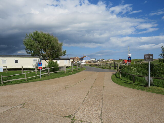
Normans' Bay is a quaint seaside village located along the coast of East Sussex, England. Situated between the towns of Pevensey and Bexhill-on-Sea, this charming bay offers visitors a peaceful and picturesque escape from the hustle and bustle of city life.

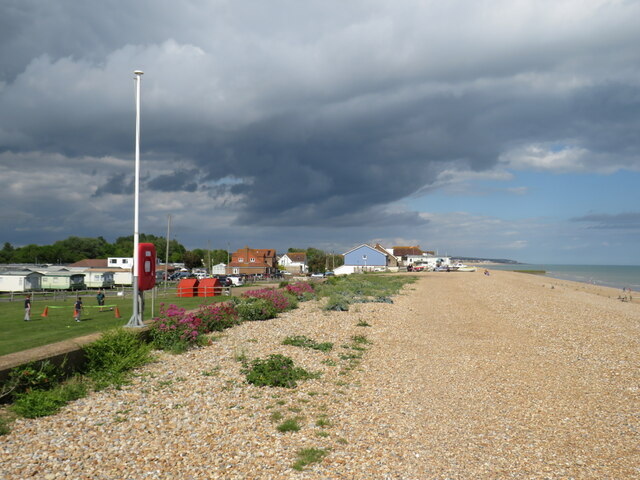
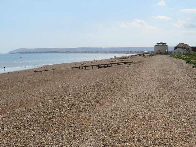
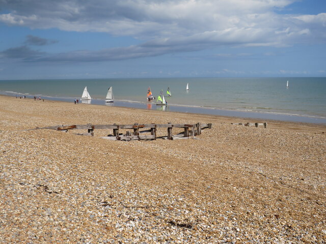
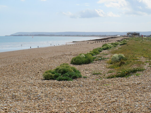
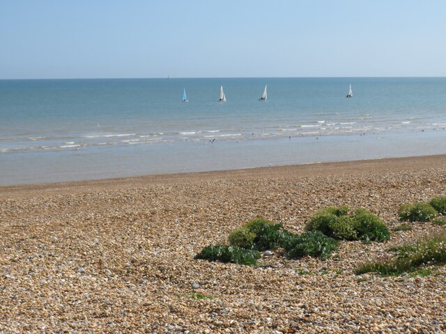
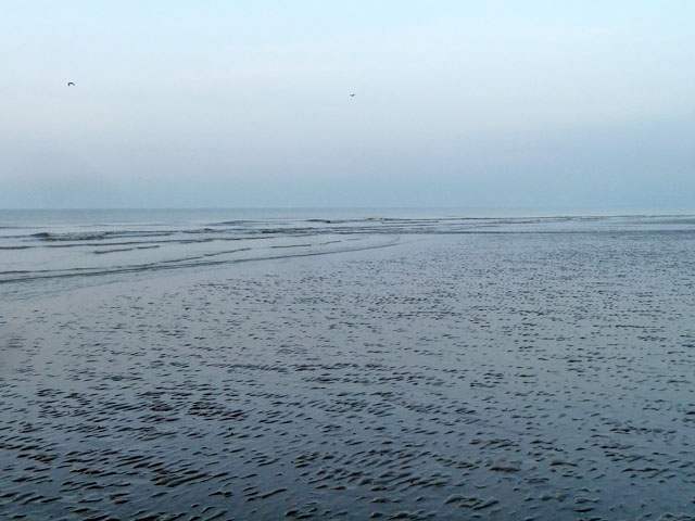
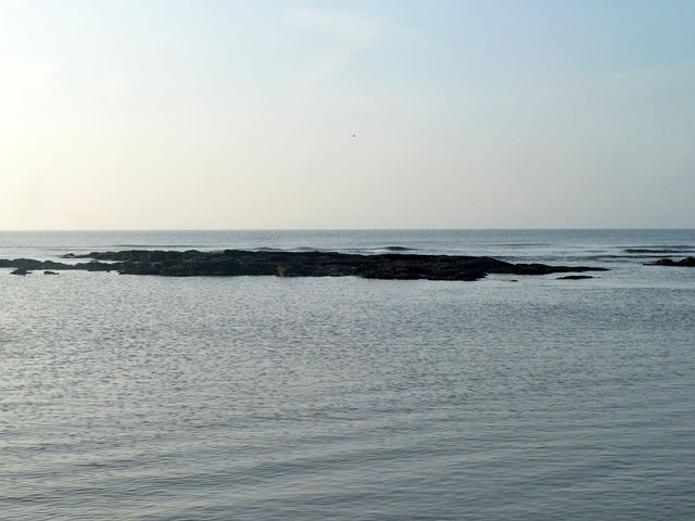
The bay takes its name from the Norman invasion of England in 1066 when William the Conqueror landed his troops here. Today, Normans' Bay is known for its beautiful pebble beach, which stretches for miles and provides a serene setting for leisurely walks and sunbathing. The beach is also popular among anglers, who can often be seen casting their lines into the calm waters in search of a catch.

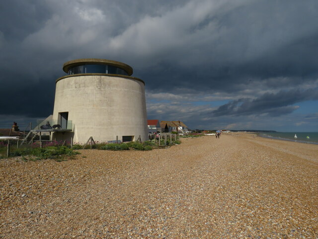
The village itself is small and predominantly residential, with a scattering of charming cottages and a few local amenities. One notable landmark is the Martello Tower, a historic fortification built during the Napoleonic Wars to defend against potential French invasions. The tower now serves as a museum, offering visitors a glimpse into the area's military history.

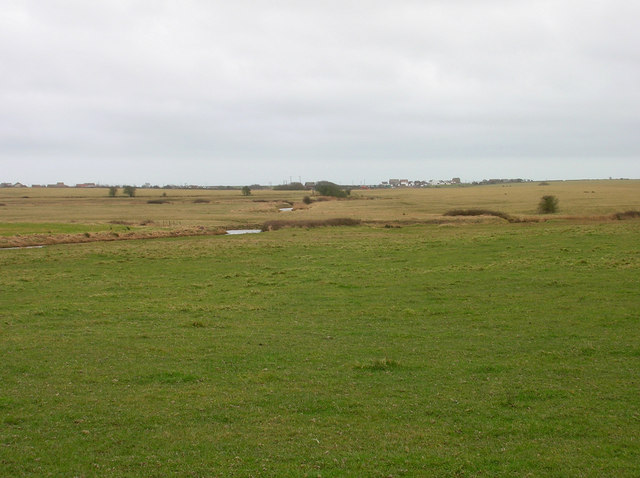
Nature enthusiasts will find plenty to explore in the surrounding countryside. The nearby Pevensey Levels, a wetland nature reserve, is home to a diverse array of wildlife, including rare bird species and unique plant life.

Normans' Bay is a tranquil destination, perfect for those seeking a peaceful seaside retreat. Whether enjoying a relaxing stroll along the beach, exploring the village's historical landmarks, or immersing oneself in nature, visitors to Normans' Bay are sure to find solace in its natural beauty and charming atmosphere.

If you have any feedback on the listing, please let us know in the comments section below.
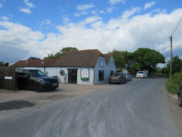
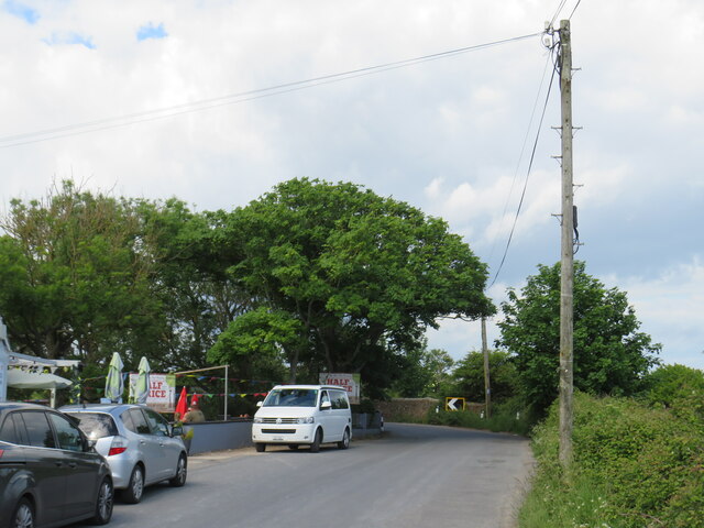
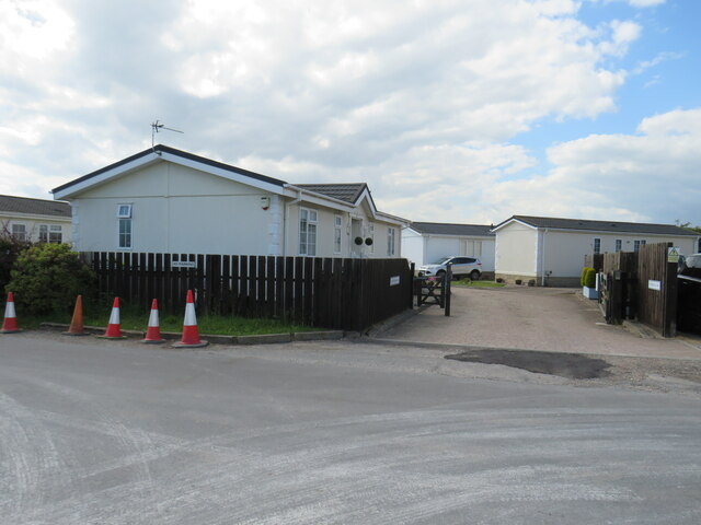
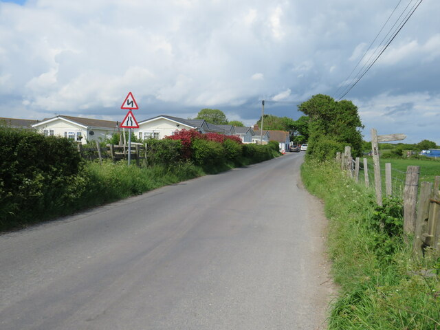
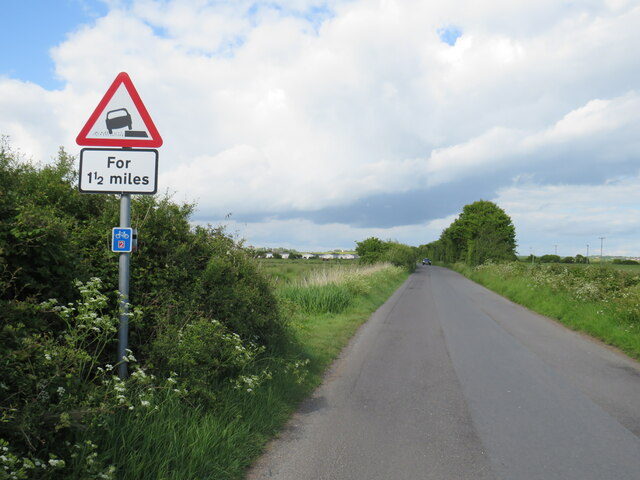
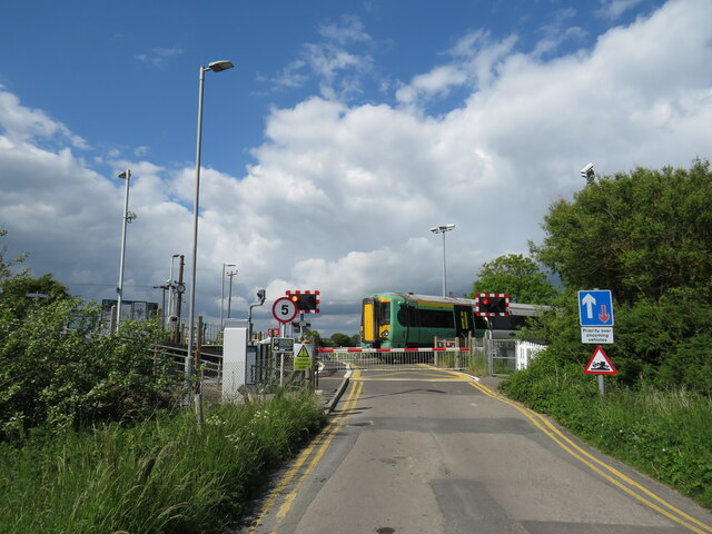
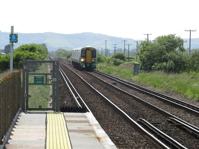
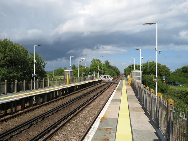
Normans' Bay Images

Images are sourced within 2km of 50.825735/0.39289346 or Grid Reference TQ6805. Thanks to Geograph Open Source API. All images are credited.

The Star Inn, Normans' Bay, near Pevensey The Star Inn is a pub at Normans' Bay, on the Sussex coast.  The building dates from 1402, originally as a sluice house becoming an inn in the late 16th Century.

More information on The Star Inn's website: <span class="nowrap"><a title="https://www.thestarinnnormansbay.co.uk/story" rel="nofollow ugc noopener" href="https://www.thestarinnnormansbay.co.uk/story">Link</a><img style="margin-left:2px;" alt="External link" title="External link - shift click to open in new window" src="https://s1.geograph.org.uk/img/external.png" width="10" height="10"/></span>

The road passing the inn forms part of the route of National Cycle Network route 2.
The Star Inn, Normans' Bay, near Pevensey
The Star Inn is a pub at Normans' Bay, on the Sussex coast. The building dates from 1402, originally as a sluice house becoming an inn in the late 16th Century. More information on The Star Inn's website: LinkExternal link The road passing the inn forms part of the route of National Cycle Network route 2.
Sluice Lane, Normans' Bay, near Pevensey Sluice Lane is a minor road through the hamlet of Normans' Bay on the east Sussex coast.  The road forms part of the route of National Cycle Network route 2.
Sluice Lane, Normans' Bay, near Pevensey
Sluice Lane is a minor road through the hamlet of Normans' Bay on the east Sussex coast. The road forms part of the route of National Cycle Network route 2.
Kingfisher Close, Normans' Bay, near Pevensey Kingfisher Close is a small development of park homes at Normans' Bay on the east Sussex coast.
Kingfisher Close, Normans' Bay, near Pevensey
Kingfisher Close is a small development of park homes at Normans' Bay on the east Sussex coast.
Sluice Lane, Normans' Bay, near Pevensey Sluice Lane is a minor road through the hamlet of Normans' Bay on the east Sussex coast.  The road forms part of the route of National Cycle Network route 2.
Sluice Lane, Normans' Bay, near Pevensey
Sluice Lane is a minor road through the hamlet of Normans' Bay on the east Sussex coast. The road forms part of the route of National Cycle Network route 2.
Sluice Lane, Normans' Bay, near Pevensey Sluice Lane is a minor road through the hamlet of Normans' Bay on the east Sussex coast.  The road forms part of the route of National Cycle Network route 2, indicated by the small blue square sign below the triangular sign which warns of soft verges ahead
Sluice Lane, Normans' Bay, near Pevensey
Sluice Lane is a minor road through the hamlet of Normans' Bay on the east Sussex coast. The road forms part of the route of National Cycle Network route 2, indicated by the small blue square sign below the triangular sign which warns of soft verges ahead
Level crossing at Normans' Bay, near Pevensey A train operated by Southern crosses a minor road on a level crossing at Normans' Bay, on the east Sussex coast.
Level crossing at Normans' Bay, near Pevensey
A train operated by Southern crosses a minor road on a level crossing at Normans' Bay, on the east Sussex coast.
Railway line at Normans' Bay The "East Coastway" railway line from Eastbourne to Hastings passes through Normans' Bay station.  The railway is electrified using the third rail system.

This view looks westwards from the station platform, towards the South Downs ridge.  A Class 377 "Electrostar" electric multiple unit (EMU) operated by Southern is approaching the station.  Not all trains call at Norman's Bay.  This train will pass through the station without stopping.
Railway line at Normans' Bay
The "East Coastway" railway line from Eastbourne to Hastings passes through Normans' Bay station. The railway is electrified using the third rail system. This view looks westwards from the station platform, towards the South Downs ridge. A Class 377 "Electrostar" electric multiple unit (EMU) operated by Southern is approaching the station. Not all trains call at Norman's Bay. This train will pass through the station without stopping.
Normans' Bay station Normans' Bay station on the East Coastway Line between Eastbourne and Hastings.  Just beyond the station is a level crossing.  No trains are approaching, therefore road traffic is able to cross the railway tracks.
Normans' Bay station
Normans' Bay station on the East Coastway Line between Eastbourne and Hastings. Just beyond the station is a level crossing. No trains are approaching, therefore road traffic is able to cross the railway tracks.
Normans' Bay caravan park, near Pevensey The entrance road into Normans' Bay caravan park, on the east Sussex coast.
Normans' Bay caravan park, near Pevensey
The entrance road into Normans' Bay caravan park, on the east Sussex coast.
Beach at Normans' Bay, near Pevensey The shingle beach at Normans' Bay, on the east Sussex coast.
Beach at Normans' Bay, near Pevensey
The shingle beach at Normans' Bay, on the east Sussex coast.
Beach at Normans' Bay, near Pevensey A view westwards along the shingle beach at Normans' Bay, looking towards Beachy Head in the distance.
Beach at Normans' Bay, near Pevensey
A view westwards along the shingle beach at Normans' Bay, looking towards Beachy Head in the distance.
Groyne on Normans' Bay beach A wooden groyne on the beach at Normans' Bay, on the east Sussex coast.
Groyne on Normans' Bay beach
A wooden groyne on the beach at Normans' Bay, on the east Sussex coast.
Martello Tower, Normans' Bay near Pevensey A Martello Tower at Normans' Bay, on the east Sussex coast.
Martello Tower, Normans' Bay near Pevensey
A Martello Tower at Normans' Bay, on the east Sussex coast.
Beach at Normans' Bay, near Pevensey A view westwards along the shingle beach at Normans' Bay, looking towards Beachy Head in the distance.
Beach at Normans' Bay, near Pevensey
A view westwards along the shingle beach at Normans' Bay, looking towards Beachy Head in the distance.
Beach at Normans' Bay, near Pevensey A view of the beach at Normans' Bay, near Pevensey on the east Sussex coast.
Beach at Normans' Bay, near Pevensey
A view of the beach at Normans' Bay, near Pevensey on the east Sussex coast.
Cooden Beach, low tide The steel-tipped sharp end of a wooden pile has made its way here.
Cooden Beach, low tide
The steel-tipped sharp end of a wooden pile has made its way here.
Cooden Beach, low tide A spring tide, below the mean low water level.
Cooden Beach, low tide
A spring tide, below the mean low water level.
Exposed reef, Cooden Beach A low spring tide reveals an extensive outcrop of hard clay covered with seaweed and mussels.
Exposed reef, Cooden Beach
A low spring tide reveals an extensive outcrop of hard clay covered with seaweed and mussels.
Show me another place!

Normans' Bay is located at Grid Ref: TQ6805 (Lat: 50.825735, Lng: 0.39289346)

Administrative County: East Sussex

District: Rother

Police Authority: Sussex

What 3 Words

///passports.gosh.ranking. Near Pevensey Bay, East Sussex

Nearby Locations

Normans' Bay

Related Wikis

Normans Bay

Normans Bay (Normans' Bay on Ordnance Survey maps) is a coastal fishing hamlet in Bexhill-on-Sea, East Sussex, England. The 8th Duke of Devonshire donated...

Normans Bay railway station

Normans Bay railway station serves Normans Bay in East Sussex. It is on the East Coastway Line, and train services are provided by Southern. == History... ==

Northeye

Northeye is the site of an abandoned medieval village known as Hooe Level on the Pevensey Levels, west of Bexhill-on-Sea. The village is mentioned as a...

Cooden Beach railway station

Cooden Beach serves Cooden at the western end of Bexhill in East Sussex. It is on the East Coastway Line, and train services are provided by Southern....

Related Videos

Beautiful Cooden Beach 🏖 with Ozmo

The beautiful Cooden beach in South England, story made by my DJI Ozmo pocket.

Cooden Beach.

Cooden Beach area.

Nearby Amenities

Located within 500m of 50.825735,0.39289346
Source: PGS
Lat/Long: 50.8255484/0.3975782
Source: PGS
Lat/Long: 50.8265197/0.3992846
Havensmouth
Crossing Barrier: full
Crossing Bell: yes
Crossing Light: yes
Railway: level_crossing
Lat/Long: 50.8261294/0.3899149
Normans Bay
Old Name: Pevensey Sluice
Place: hamlet
Start Date: 1860s
Wikidata: Q7053088
Wikipedia: en:Normans Bay
Lat/Long: 50.8257397/0.394083
Crossing: uncontrolled
Crossing Barrier: no
Railway: crossing
Supervised: no
Lat/Long: 50.8271352/0.3951093
Crossing: uncontrolled
Crossing Barrier: no
Railway: crossing
Supervised: no
Lat/Long: 50.8271674/0.3951012
Access: yes
Barrier: stile
Foot: designated
Material: wood
Stile: stepover
Lat/Long: 50.8280865/0.393621
Noexit: yes
Lat/Long: 50.8257506/0.393965
Havensmouth
Crossing Barrier: full
Crossing Bell: yes
Crossing Light: yes
Railway: level_crossing
Lat/Long: 50.8261006/0.3899014
The Smuggling Trail
Addr Place: The Star Inn, Sluice Road
Board Type: history
Description: The Star Inn is ancient, probably dating back to the 15th century. It was on the main highway between Hastings and Pevensey and was a known haunt of smugglers until the early 19th century.
Information: board
Ref: TST5
Source: https://www.discoverbexhill.com/history/smugglers.php
Start Date: 2008-05
Tourism: information
Wikimedia Commons: File:The Smuggling Trail Information Panel 5, Bexhill-on-Sea.jpg
Lat/Long: 50.830022/0.3938093
Access: yes
Entrance: main
Lat/Long: 50.8296909/0.3934563
Access: yes
Barrier: stile
Foot: designated
Material: wood
Stile: stepover
Lat/Long: 50.8301096/0.393899
Passing Place
Passing Place: right
Lat/Long: 50.823767/0.3872761
Passing Place
Passing Place: right
Lat/Long: 50.8241397/0.3885607
Power: pole
Lat/Long: 50.8258487/0.3869462
Power: pole
Lat/Long: 50.8261452/0.3884375
Power: pole
Lat/Long: 50.8263803/0.3897545
Power: pole
Lat/Long: 50.8270728/0.3909172
Power: pole
Lat/Long: 50.8279266/0.3923971
Power: pole
Lat/Long: 50.8282558/0.3929664
Power: pole
Lat/Long: 50.8288979/0.3940513
Power: pole
Lat/Long: 50.8295759/0.3952376
Grit Bin
Addr Street: Coast Road
Lat/Long: 50.8249519/0.3895312
Access: yes
Barrier: swing_gate
Lat/Long: 50.8265094/0.3898905
Defibrillator
Access: customers
Addr Place: Normans Bay Caravan Park
Defibrillator Location: West side of building, entrance to reception.
Emergency: defibrillator
Indoor: no
Operator: Normans Bay Caravan Park
Ref GB The Circuit: A4A76F78-DC7A-4635-BF55-AEA200E586F4
Source: survey
Wikimedia Commons: File:Defibrillator, Normans Bay Caravan Park, Normans Bay, Pevensey.jpg
Lat/Long: 50.8255599/0.391459
Traffic Calming: bump
Lat/Long: 50.8250537/0.3896098
Waste Basket
Lat/Long: 50.8247703/0.3903539
Life Ring
Emergency: life_ring
Lat/Long: 50.824023/0.3886977
Waste Basket
Lat/Long: 50.8237225/0.3872621
Waste Basket
Lat/Long: 50.8240764/0.3885002
Addr Place: Normans Bay Caravan Park
Leisure: pitch
Sport: basketball
Lat/Long: 50.8245584/0.390141
Life Ring
Emergency: life_ring
Lat/Long: 50.8243693/0.3898591
Man Made: flagpole
Lat/Long: 50.8243424/0.3897454
Waste Basket
Waste: dog_excrement
Lat/Long: 50.8243288/0.3897552
Waste Basket
Lat/Long: 50.8244379/0.3896916
Bench
Backrest: yes
Colour: brown
Material: wood
Seats: 2
Lat/Long: 50.8246393/0.3910369
Bench
Backrest: yes
Colour: brown
Material: wood
Seats: 2
Lat/Long: 50.8246323/0.3909973
Grit Bin
Addr Street: Normans Bay Road
Lat/Long: 50.8258182/0.3930516
Waste Basket
Lat/Long: 50.8260672/0.3935022
Board Type: notice
Information: board
Tourism: information
Lat/Long: 50.8260321/0.3936021
Telephone
Addr Street: Normans Bay Road
Booth: K6
Covered: booth
Disused: yes
Man Made: telephone_box
Operator: Bexhill Heritage
Ref GB Uprn: 10025144591
Wikimedia Commons: File:Telephone booth, Normans Bay Road, Normans Bay, Pevensey.jpg
Lat/Long: 50.8261969/0.3948829
Turning Circle
Lat/Long: 50.8269313/0.3949056
Access: yes
Barrier: stile
Foot: designated
Material: wood
Stile: stepover
Lat/Long: 50.8289328/0.3925852
Waste Basket
Lat/Long: 50.8258786/0.3956302
Life Ring
Emergency: life_ring
Lat/Long: 50.8260679/0.3967708
Waste Basket
Lat/Long: 50.8262544/0.3967148
Phone
Emergency: phone
Operator: Network Rail
Lat/Long: 50.8260892/0.3899349
Passing Place
Passing Place: right
Lat/Long: 50.8236929/0.3869836
Post Box
Addr City: Pevensey
Addr Street: Normans Bay Road
Collection Times: Mo-Fr 16:45; Sa 11:00
Operator: Royal Mail
Operator Wikidata: Q638098
Post Box Mounting: brick_pillar
Post Box Type: wall
Ref: BN24 981
Ref GB Uprn: 10015271107
Royal Cypher: VR
Royal Cypher Wikidata: Q33102356
Wikimedia Commons: File:PB Normans Bay Road BN24981.jpg
Lat/Long: 50.8262451/0.3944976
Description: Nbm Nw Support Fb Nw Side Drain Ne Face
Ele: 2.6335
Height: 0.5
Man Made: survey_point
Source: OS_OpenData_Benchmarks
Survey Point Structure: cut
Survey Point Verified Date: 1970
Wikimedia Commons: File:Broken footbridge, near Footpath 75A, Bexhill.jpg
Wikimedia Commons 1: File:Broken footbridge, near Footpath 75A, Bexhill (2).jpg
Lat/Long: 50.8279258/0.3930134
Description: Nbm Cul Se Side Drain Se Face
Ele: 2.7618
Height: 0
Man Made: survey_point
Source: OS_OpenData_Benchmarks
Survey Point Levelling Date: 1969
Survey Point Structure: cut
Survey Point Verified Date: 1989
Wikimedia Commons: File:Culvert, Normans Bay Road, Normans Bay.jpg
Wikimedia Commons 1: File:Culvert, Normans Bay Road, Normans Bay (2).jpg
Lat/Long: 50.8271272/0.3965807
Description: Nbm Cul S Side Rd W Side Drain W Face
Ele: 2.7002
Height: -0.1
Man Made: survey_point
Source: OS_OpenData_Benchmarks
Survey Point Structure: cut
Survey Point Verified Date: 1970
Wikimedia Commons: File:Culvert, Sluice Lane, Normans Bay.jpg
Wikimedia Commons 1: File:Culvert, Sluice Lane, Normans Bay (2).jpg
Lat/Long: 50.8264832/0.386855
Power: pole
Lat/Long: 50.8268762/0.3926607
Power: pole
Lat/Long: 50.8263246/0.3898006
Power: pole
Lat/Long: 50.8257665/0.3869931
Power: pole
Lat/Long: 50.8260613/0.3884657
Power: pole
Lat/Long: 50.8265933/0.3912063
Normans Bay
Naptan AtcoCode: 9100NRMNSBY
Network: National Rail
Network Website: https://www.nationalrail.co.uk/stations/nsb/
Network Wikidata: Q26334
Old Name: Normans Bay Halt
Public Transport: station
Railway: station
Ref GB Uprn: 10090509059
Ref Crs: NSB
Source: NPE
Start Date: 1905-09-11
Train: yes
Wikidata: Q2324161
Wikimedia Commons: File:Normans Bay Railway Station, Normans Bay (aerial).jpg
Wikimedia Commons 1: File:Norman's Bay, Railway Station - geograph.org.uk - 1174747.jpg
Wikipedia: en:Normans Bay railway station
Lat/Long: 50.8260497/0.3895764
Normans Bay
Public Transport: stop_position
Railway: stop
Ref: 1
Train: yes
Lat/Long: 50.8258628/0.3886977
Normans Bay
Public Transport: stop_position
Railway: stop
Ref: 2
Train: yes
Lat/Long: 50.8260957/0.3897446
Generator Method: photovoltaic
Generator Modules: 16
Generator Orientation: 250
Generator Output Electricity: yes
Generator Source: solar
Generator Type: solar_photovoltaic_panel
Location: outdoor
Power: generator
Lat/Long: 50.8265636/0.3978889
Power: pole
Lat/Long: 50.8265145/0.3973069
Power: pole
Lat/Long: 50.8263696/0.3970648
Power: pole
Lat/Long: 50.8262532/0.396696
Power: pole
Lat/Long: 50.8262396/0.3960731
Power: pole
Lat/Long: 50.8261956/0.3954515
Power: pole
Lat/Long: 50.8261714/0.3948792
Power: pole
Lat/Long: 50.8262129/0.3946958
Power: pole
Lat/Long: 50.8261363/0.3942036
Power: pole
Lat/Long: 50.8260837/0.3937979
Power: pole
Lat/Long: 50.826149/0.3935853
Power: pole
Lat/Long: 50.8259529/0.3934264
Power: pole
Lat/Long: 50.8259067/0.3932809
Power: pole
Lat/Long: 50.8257792/0.3927901
Power: pole
Lat/Long: 50.8255106/0.3925326
Power: pole
Lat/Long: 50.8252572/0.392267
Power: pole
Lat/Long: 50.8252282/0.3922182
Power: pole
Lat/Long: 50.8250714/0.391858
Power: pole
Lat/Long: 50.8250871/0.3912116
Power: pole
Lat/Long: 50.8249265/0.390877
Power: pole
Lat/Long: 50.8247198/0.3904089
Power: pole
Lat/Long: 50.8245165/0.3896847
Power: pole
Lat/Long: 50.8275654/0.3927264
Power: pole
Lat/Long: 50.8279682/0.3931475
Power: pole
Lat/Long: 50.8284417/0.3927331
Power: pole
Lat/Long: 50.828692/0.3923515
Power: pole
Lat/Long: 50.8293684/0.3932464
Power: pole
Lat/Long: 50.8295561/0.3935397
Power: pole
Lat/Long: 50.8298021/0.3939562
Telephone
Access: customers
Addr Place: Normans Bay Caravan Park
Booth: K6
Covered: booth
Ref GB Uprn: 10025144591
Lat/Long: 50.8257631/0.3914792
Man Made: outfall
Substance: rainwater
Lat/Long: 50.8253564/0.3979128
Seamark Beacon Special Purpose Category: outfall
Seamark Beacon Special Purpose Shape: pole
Seamark Topmark Colour: red
Seamark Topmark Shape: cylinder
Seamark Type: beacon_special_purpose
Lat/Long: 50.8253682/0.3978998
The data included in this document is from www.openstreetmap.org. The data is made available under ODbL.

Have you been to Normans' Bay?

Leave your review of Normans' Bay below (or comments, questions and feedback).