Nook

Settlement in Yorkshire

England

Nook

Bridgegate
Bridgegate Credit: Alex McGregor

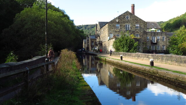
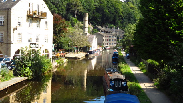
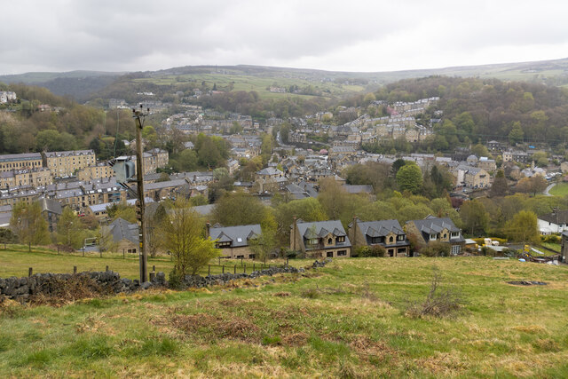
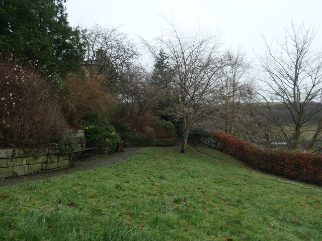
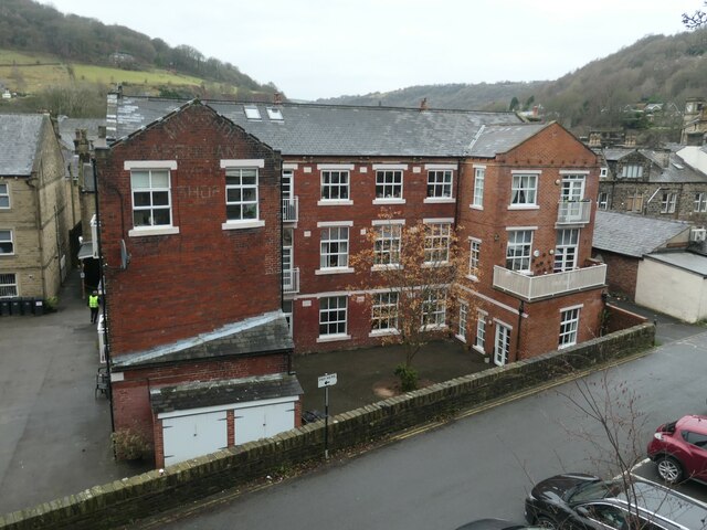
Nook is a small village located in the county of Yorkshire, England. Situated in the southern part of the county, Nook is surrounded by picturesque countryside and rolling hills. The village is characterized by its charming rural atmosphere and is home to a tight-knit community.

Nook has a rich history dating back several centuries. It was originally established as an agricultural settlement, and evidence of this can still be seen in the form of old farmhouses and barns scattered throughout the area. Today, Nook retains its agricultural heritage, with many residents still involved in farming activities.

The village itself is relatively small, with a population of around 500 people. It features a handful of amenities, including a local pub, a small grocery store, and a primary school. Despite its size, Nook has a strong sense of community, with regular events and gatherings that bring residents together.

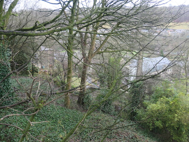
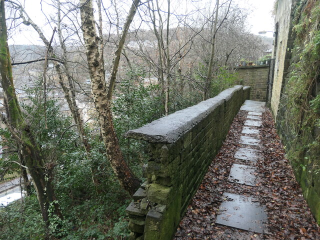
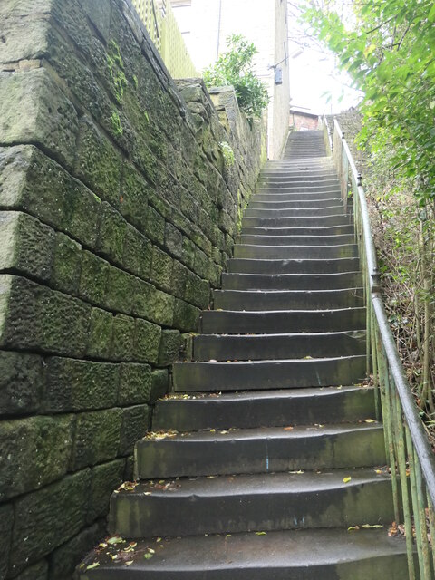
One of the main attractions of Nook is its natural beauty. The surrounding countryside offers stunning views and is ideal for outdoor enthusiasts. There are several walking and cycling routes in the area, allowing visitors to explore the picturesque landscapes at their leisure.

Overall, Nook is a quintessential Yorkshire village, with its idyllic countryside setting and close-knit community. It offers a peaceful retreat from the bustling cities, allowing residents and visitors to enjoy the beauty of rural England.

If you have any feedback on the listing, please let us know in the comments section below.

Nook Images

Images are sourced within 2km of 53.746925/-1.9909709 or Grid Reference SE0027. Thanks to Geograph Open Source API. All images are credited.

Bridgegate
Bridgegate
The White Swan
The White Swan
Shoulder Of Mutton
Shoulder Of Mutton
Canal lock
Canal lock
Canal view
Canal view
The Flying Saucer at Hebden Bridge Cafe and studio in old canal warehouse
The Flying Saucer at Hebden Bridge
Cafe and studio in old canal warehouse
Northgate View along Northgate towards the main village
Northgate
View along Northgate towards the main village
Whitehall Farm archway Archway marking the entrance to Whitehall Farm, inscribed on the lintel are the initials JB standing for John Bentley, once owner of the farm and the date of 1578..
Whitehall Farm archway
Archway marking the entrance to Whitehall Farm, inscribed on the lintel are the initials JB standing for John Bentley, once owner of the farm and the date of 1578..
The aqueduct carrying the Rochdale Canal over the Calder at Hebden Bridge The Rochdale Canal runs for 33 miles between Manchester and Sowerby Bridge in West Yorkshire, UK. In Sowerby Bridge it connects with the Calder and Hebble Navigation. In Manchester it connects with the Ashton and Bridgewater Canals. 

The canal was opened between Sowerby Bridge and Todmorden and from Manchester to Rochdale in 1799 and between Todmorden and Rochdale in 1805. Most of the canal was closed in 1952. Restoration work began in late 1980s and by  1996 the canal was opened to navigation once again between Sowerby Bridge and the summit level. The canal was re-opened to navigation along its entire length in July 2002 and forms part of the South Pennine Ring. 

<span class="nowrap"><a title="http://www.penninewaterways.co.uk/rochdale/index.htm" rel="nofollow ugc noopener" href="http://www.penninewaterways.co.uk/rochdale/index.htm">Link</a><img style="margin-left:2px;" alt="External link" title="External link - shift click to open in new window" src="https://s1.geograph.org.uk/img/external.png" width="10" height="10"/></span>
The aqueduct carrying the Rochdale Canal over the Calder at Hebden Bridge
The Rochdale Canal runs for 33 miles between Manchester and Sowerby Bridge in West Yorkshire, UK. In Sowerby Bridge it connects with the Calder and Hebble Navigation. In Manchester it connects with the Ashton and Bridgewater Canals. The canal was opened between Sowerby Bridge and Todmorden and from Manchester to Rochdale in 1799 and between Todmorden and Rochdale in 1805. Most of the canal was closed in 1952. Restoration work began in late 1980s and by 1996 the canal was opened to navigation once again between Sowerby Bridge and the summit level. The canal was re-opened to navigation along its entire length in July 2002 and forms part of the South Pennine Ring. LinkExternal link
Rochdale Canal at Hebden Bridge
Hebden Bridge viewed from hills to the south west
Warship adoption plaque, Hebden Bridge In the Memorial Gardens. "The plaque marks the adoption by Heben Bridge and Heptonstall of H.M.S. Bradford during Warship Week, 1942. It shows reliefs of the Old Bridge and Heptonstall's ruined Church." Quoted from 'Hebden Bridge Trail', published by Calder Civic Trust Ltd in 1979.
Warship adoption plaque, Hebden Bridge
In the Memorial Gardens. "The plaque marks the adoption by Heben Bridge and Heptonstall of H.M.S. Bradford during Warship Week, 1942. It shows reliefs of the Old Bridge and Heptonstall's ruined Church." Quoted from 'Hebden Bridge Trail', published by Calder Civic Trust Ltd in 1979.
Memorial garden, off Birchcliffe Road, Hebden Bridge A plaque in the north-western corner reads "This garden was opened on 8th June 1961 by Mrs P. K. Griffiths, of Maidenhead, and is the gift of Mrs Lilian Blackburn of Darlington, formerly of Hebden Bridge, in loving and treasured memory of her elder daughter, June Megan Blackburn, who died on 11th February 1932, aged 9 yaars".
Memorial garden, off Birchcliffe Road, Hebden Bridge
A plaque in the north-western corner reads "This garden was opened on 8th June 1961 by Mrs P. K. Griffiths, of Maidenhead, and is the gift of Mrs Lilian Blackburn of Darlington, formerly of Hebden Bridge, in loving and treasured memory of her elder daughter, June Megan Blackburn, who died on 11th February 1932, aged 9 yaars".
The western end of Common Bank Wood, Hebden Bridge High above Commercial Street, but far below Birchcliffe Road.
The western end of Common Bank Wood, Hebden Bridge
High above Commercial Street, but far below Birchcliffe Road.
Hillside path, leading towards Union Street Off Hebden Bridge's 'Hundred Steps'.
Hillside path, leading towards Union Street
Off Hebden Bridge's 'Hundred Steps'.
Steps between Commercial St and Osborne St, Hebden Bridge The top two-thirds of the 'Hundred Steps'. "This flight of steps, providing relatively easy access between Osborne Street and Commercial Street, actually consists of 106 steps altogether. It vividly indicates the local difficulties which Victorian builders had to overcome on this hillside."  Quoted from 'Hebden Bridge Trail', published by Calder Civic Trust Ltd in 1979.
Steps between Commercial St and Osborne St, Hebden Bridge
The top two-thirds of the 'Hundred Steps'. "This flight of steps, providing relatively easy access between Osborne Street and Commercial Street, actually consists of 106 steps altogether. It vividly indicates the local difficulties which Victorian builders had to overcome on this hillside." Quoted from 'Hebden Bridge Trail', published by Calder Civic Trust Ltd in 1979.
The Crofts, Garden Street, Hebden Bridge A former clothing factory, which was converted into nine flats in 2002.
The Crofts, Garden Street, Hebden Bridge
A former clothing factory, which was converted into nine flats in 2002.
Show me another place!

Nook is located at Grid Ref: SE0027 (Lat: 53.746925, Lng: -1.9909709)

Division: West Riding

Unitary Authority: Calderdale

Police Authority: West Yorkshire

What 3 Words

///nozzle.kebab.foot. Near Hebden Bridge, West Yorkshire

Nearby Locations

Nook Little Moor

Related Wikis

Wadsworth, West Yorkshire

Wadsworth is a civil parish in the Metropolitan Borough of Calderdale in West Yorkshire, England. It has a population of 1,456, increasing to 1,603 at...

Chiserley

Chiserley is a hamlet located on a hilltop near the town of Hebden Bridge, in the county of West Yorkshire, England. The Hamlet falls within the Calder...

Old Town, West Yorkshire

Old Town is a village in Calderdale, West Yorkshire, England. It is situated on a hilltop above Hebden Bridge and across the Hebden valley from Heptonstall...

Birchcliffe Baptist Church

Birchcliffe Baptist Church is a redundant Baptist chapel in the town of Hebden Bridge, West Yorkshire, England. It was founded by Daniel Taylor in 1764...

Related Videos

Beautiful Places in Yorkshire | Visit Hebden Bridge & Heptonstall In One Day

Discover two of the most beautiful places in Yorkshire: the popular market town of Hebden Bridge and the ancient village of ...

Hebden Dale Edge, Hardcastle Crag & the Pennine Way, West Yorkshire

The Hebden Dale walk from Heptonstall, proved to be a little more challenging than anticipated. Battling against a fierce wind for ...

Hebden Bridge In England - 5K HDR Walking Tour of the 4th Funkiest Town in the World

Open to Collab with Travel Companies, please send an email. Support my work; https://www.buymeacoffee.com/wasimahmed ...

Hebden Bridge Walk Through #shorts #short

A quite walk through Hebden Bridge Last year #shorts #short #hebdenbridge #yorkshire #travel.

Nearby Amenities

Located within 500m of 53.746925,-1.9909709
Chiserley
Place: village
Wikidata: Q9189835
Lat/Long: 53.7489345/-1.9970016
Barrier: stile
Foot: yes
Lat/Long: 53.7430456/-1.990467
Barrier: stile
Foot: yes
Lat/Long: 53.7435778/-1.9881325
Entrance: yes
Lat/Long: 53.7483883/-1.9935796
Billy Lane
Naptan AtcoCode: 450015858
Naptan Bearing: NW
Naptan BusStopType: CUS
Naptan CommonName: Billy Lane
Naptan Landmark: Unknown
Naptan ShortCommonName: Billy Lane
Naptan Street: Billy Lane
Naptan Verified: no
Source: naptan_import
Lat/Long: 53.7495152/-1.9951776
Bus Stop
Old Town
Local Ref: 45020913
Naptan AtcoCode: 450020913
Naptan Bearing: SE
Naptan CommonName: Old Town
Naptan Crossing: Old Laithe Lane
Naptan Indicator: Stop 45020913
Naptan Landmark: Old Town Primary School
Naptan PlusbusZoneRef: LEEDS
Naptan ShortCommonName: Old Laithe Lane
Naptan Street: Billy Lane
Naptan Verified: no
Source: naptan_import
Lat/Long: 53.7501534/-1.9961633
Bus Stop
Old Town
Local Ref: 45020914
Naptan AtcoCode: 450020914
Naptan Bearing: SE
Naptan CommonName: Old Town
Naptan Crossing: Nr-At Old laithe Lane
Naptan Indicator: Stop 45020914
Naptan Landmark: Nr-Opp Old Town Primary School
Naptan PlusbusZoneRef: LEEDS
Naptan ShortCommonName: Old Town
Naptan Street: Billy Lane
Naptan Verified: no
Source: naptan_import
Lat/Long: 53.7496051/-1.9950563
Billy Lane
Local Ref: 45051051
Naptan AtcoCode: 450051051
Naptan Bearing: NW
Naptan BusStopType: CUS
Naptan CommonName: Billy Lane
Naptan Indicator: Stop 45051051
Naptan PlusbusZoneRef: LEEDS
Naptan ShortCommonName: Old Mill Ridge
Naptan Street: Billy Lane
Naptan Verified: no
Source: naptan_import
Lat/Long: 53.7500815/-1.9962846
Barrier: stile
Foot: yes
Lat/Long: 53.7440944/-1.9881164
Barrier: stile
Foot: yes
Lat/Long: 53.7459336/-1.9863746
Barrier: stile
Foot: yes
Lat/Long: 53.7449646/-1.9852
Cock Hill
Natural: peak
Source: OS 1:25k
Lat/Long: 53.7444167/-1.985754
Barrier: stile
Foot: yes
Lat/Long: 53.7430818/-1.9876735
The data included in this document is from www.openstreetmap.org. The data is made available under ODbL.

Have you been to Nook?

Leave your review of Nook below (or comments, questions and feedback).