Nine Mile Burn

Settlement in Midlothian

Scotland

Nine Mile Burn

Cottages at Nine Mile Burn The nearest cottage has clearly been extended in a manner not entirely consistent with the rest of the row.
Cottages at Nine Mile Burn Credit: Oliver Dixon

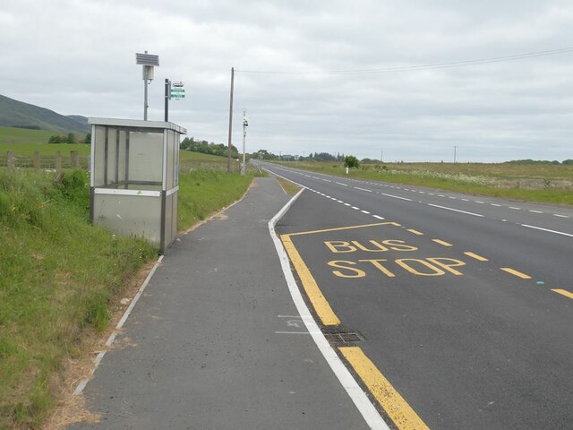
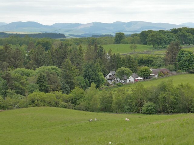
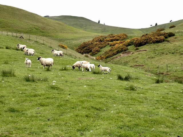
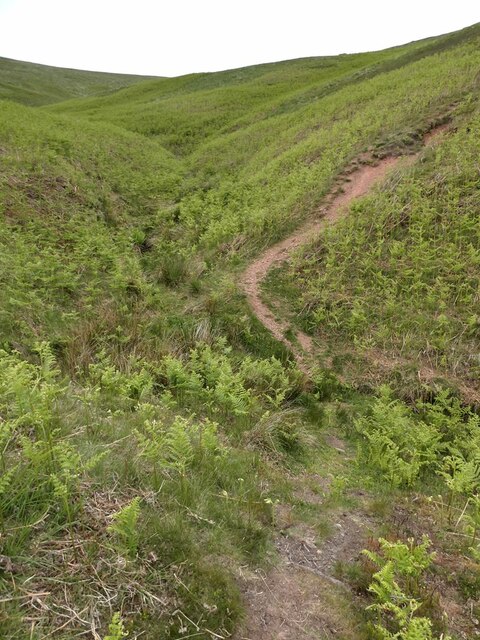
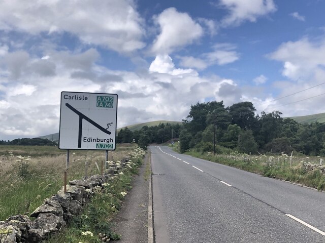
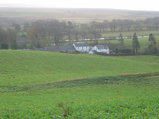
Nine Mile Burn is a small village located in Midlothian, Scotland. The village gets its name from the nine mile distance from Edinburgh along the A702 road. It is situated near the Pentland Hills, offering residents and visitors picturesque views of the surrounding countryside.

Nine Mile Burn is a peaceful and quaint village, with a close-knit community and a range of amenities for its residents. These amenities include a local shop, a pub, and a primary school, providing convenience and essential services to the village's population.

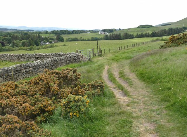
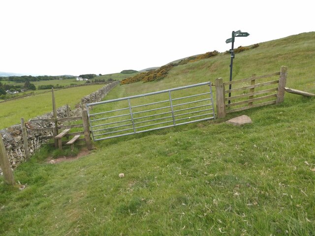
The village is well-connected by road, with easy access to nearby towns such as Penicuik and Edinburgh. It also has access to beautiful walking and cycling routes in the Pentland Hills, making it an ideal location for outdoor enthusiasts.

Overall, Nine Mile Burn is a charming and idyllic village in Midlothian, offering a quiet and serene lifestyle for its residents, while also providing easy access to larger towns and cities for additional amenities and opportunities.

If you have any feedback on the listing, please let us know in the comments section below.

Nine Mile Burn Images

Images are sourced within 2km of 55.803915/-3.3168535 or Grid Reference NT1757. Thanks to Geograph Open Source API. All images are credited.

Cottages at Nine Mile Burn The nearest cottage has clearly been extended in a manner not entirely consistent with the rest of the row.
Cottages at Nine Mile Burn
The nearest cottage has clearly been extended in a manner not entirely consistent with the rest of the row.
Bus stop at Nine Mile Burn On the A702.
Bus stop at Nine Mile Burn
On the A702.
Stile on Scroggy Hill The Pentland Way is a 32 km long-distance path along the length of the Pentland Hills, established in 2015. The section from Nine Mile Burn to West Kip follows a relatively new path up Monk's Rigg (seen here) which does not appear as yet on OS maps.
Stile on Scroggy Hill
The Pentland Way is a 32 km long-distance path along the length of the Pentland Hills, established in 2015. The section from Nine Mile Burn to West Kip follows a relatively new path up Monk's Rigg (seen here) which does not appear as yet on OS maps.
Stile on the Pentland Way Looking across the valley of the Monk's Burn.
Stile on the Pentland Way
Looking across the valley of the Monk's Burn.
Looking down on Nine Mile Burn Hamlet set back from the A702. Moorfoot Hills in the distance.
Looking down on Nine Mile Burn
Hamlet set back from the A702. Moorfoot Hills in the distance.
"The Firs" Houses to the west of Nine Mile Burn. Moorfoot Hills in the distance.
"The Firs"
Houses to the west of Nine Mile Burn. Moorfoot Hills in the distance.
Track above Nine Mile Burn
Gate on track above Nine Mile Burn The signpost points to alternative routes up to the summit of West Kip - Monk's Rigg (to the right) and Braid Law (towards the camera).
Gate on track above Nine Mile Burn
The signpost points to alternative routes up to the summit of West Kip - Monk's Rigg (to the right) and Braid Law (towards the camera).
Wool gathering On a fence above Walstone Farm.
Wool gathering
On a fence above Walstone Farm.
Sheep in the valley of the Walstone Burn Cap Law on the skyline.
Sheep in the valley of the Walstone Burn
Cap Law on the skyline.
Path in the valley  of the Quarrel Burn Heading up Braid Law.
Path in the valley of the Quarrel Burn
Heading up Braid Law.
Path across the Quarrel Burn Quarrel Burn Reservoir in the background.
Path across the Quarrel Burn
Quarrel Burn Reservoir in the background.
West end of the A766 The A766 is a very scenic short road out of Penicuik.  Note the skier on the sign - the Pentland Hills are very popular with skiers in Winter and there is also the all season slope at Hillend, so very appropriate.
West end of the A766
The A766 is a very scenic short road out of Penicuik. Note the skier on the sign - the Pentland Hills are very popular with skiers in Winter and there is also the all season slope at Hillend, so very appropriate.
Walstone Moss Bog and moorland beneath the Pentland Hills.
Walstone Moss
Bog and moorland beneath the Pentland Hills.
Walstone Moss
Walstone Moss
Spittal Hill View from the North Esk Reservoir.
Spittal Hill
View from the North Esk Reservoir.
Old milestone Spotted in the ditch on the north west side of the A702 is this mostly hidden and defaced sandstone milestone.  It is 100m southwest of the B&B sign for Peggyslea.   It is 12 miles from Edinburgh.   There is a benchmark and pin on the top.
Old milestone
Spotted in the ditch on the north west side of the A702 is this mostly hidden and defaced sandstone milestone. It is 100m southwest of the B&B sign for Peggyslea. It is 12 miles from Edinburgh. There is a benchmark and pin on the top.
Old milestone The milestone on the northwest side of the A702 near Peggyslea, slightly dug out.   The 2 of the 12 (miles from Edinburgh) is defaced or eroded away.
Old milestone
The milestone on the northwest side of the A702 near Peggyslea, slightly dug out. The 2 of the 12 (miles from Edinburgh) is defaced or eroded away.
Show me another place!

Nine Mile Burn is located at Grid Ref: NT1757 (Lat: 55.803915, Lng: -3.3168535)

Unitary Authority: Midlothian

Police Authority: The Lothians and Scottish Borders

What 3 Words

///powering.homework.snuggled. Near Penicuik, Midlothian

Nearby Locations

Nine Mile Burn

Related Wikis

Nine Mile Burn

Nine Mile Burn is a hamlet in Midlothian, Scotland, the last in Midlothian when heading south on the A702 road. It is located at the foot of the Pentland...

Carlops

Carlops (Scottish Gaelic: Leum na Caillich) is a small village in the Pentland Hills, within the Scottish Borders area of Scotland, close to the boundary...

Eight Mile Burn

Eight Mile Burn is a small settlement in Midlothian, South East Scotland, at the base of Pentland Hills Regional Park. It is approximately 11 miles from...

Brunstane Castle

Brunstane Castle (alternatively Brunston, Brunstain or Brunstone Castle) is a ruined tower house, dating from the 16th century, around 2 miles (3.2 km...

Nearby Amenities

Located within 500m of 55.803915,-3.3168535
Post Box
Collection Times: Mo-Fr 16:00; Sa 09:30
Ref: EH26 125
Royal Cypher: scottish_crown
Source: survey
Lat/Long: 55.8052216/-3.3106222
Peggyslea
Place: hamlet
Source Name: OS OpenData StreetView
Lat/Long: 55.8013649/-3.3151247
Power: pole
Lat/Long: 55.8023434/-3.3239674
Power: pole
Lat/Long: 55.802874/-3.3231474
Power: pole
Lat/Long: 55.8033773/-3.3223359
Power: pole
Lat/Long: 55.8037401/-3.3217683
Power: pole
Lat/Long: 55.8041702/-3.3211081
Power: pole
Lat/Long: 55.8024309/-3.3099298
Power: pole
Lat/Long: 55.8026081/-3.3108821
Power: pole
Lat/Long: 55.8027913/-3.3118261
Power: pole
Lat/Long: 55.8029815/-3.3128184
Power: pole
Lat/Long: 55.8030524/-3.313815
Material: wood
Power: pole
Lat/Long: 55.8031268/-3.31474
Power: pole
Lat/Long: 55.8032438/-3.3149544
Power: pole
Lat/Long: 55.8033655/-3.3156861
Power: pole
Lat/Long: 55.803492/-3.3164829
Power: pole
Lat/Long: 55.8036562/-3.3174058
Power: pole
Lat/Long: 55.8038382/-3.3187072
Power: pole
Lat/Long: 55.8040201/-3.3199791
Power: pole
Lat/Long: 55.8043616/-3.32242
Power: pole
Lat/Long: 55.8045093/-3.3234901
Power: pole
Lat/Long: 55.804657/-3.324493
Power: pole
Lat/Long: 55.803089/-3.3092402
Power: pole
Lat/Long: 55.8019251/-3.3104575
Power: pole
Lat/Long: 55.8014335/-3.3109662
Power: pole
Lat/Long: 55.8007446/-3.3117735
Bus Stop
Ninemileburn
Bus: yes
Naptan AtcoCode: 6280000040
Naptan Bearing: SW
Naptan CommonName: Ninemileburn
Naptan Indicator: SW-bound
Naptan Landmark: at Mobility Warehouse
Naptan NaptanCode: 64324242
Naptan Street: A702
Public Transport: platform
Ref: 6280000040
Shelter: yes
Source: NaPTAN
Lat/Long: 55.8056658/-3.3098777
Bus Stop
Ninemileburn
Bus: yes
Naptan AtcoCode: 6280325020
Naptan Bearing: NE
Naptan CommonName: Ninemileburn
Naptan Indicator: NE-bound
Naptan Landmark: opp Mobility Warehouse
Naptan NaptanCode: 64324243
Naptan Street: A702
Public Transport: platform
Ref: 6280325020
Shelter: yes
Source: NaPTAN
Lat/Long: 55.8057226/-3.3100482
Barrier: stile
Lat/Long: 55.8083624/-3.3163514
The data included in this document is from www.openstreetmap.org. The data is made available under ODbL.

Have you been to Nine Mile Burn?

Leave your review of Nine Mile Burn below (or comments, questions and feedback).