Newtimber

Settlement in Sussex Mid Sussex

England

Newtimber

View WSW along the South Downs from Wolstonbury Hill
View WSW along the South Downs from Wolstonbury Hill Credit: Ian Cunliffe

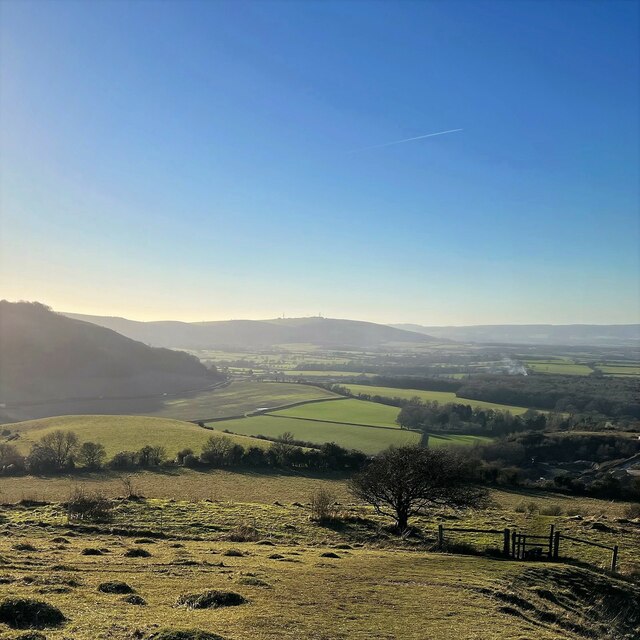
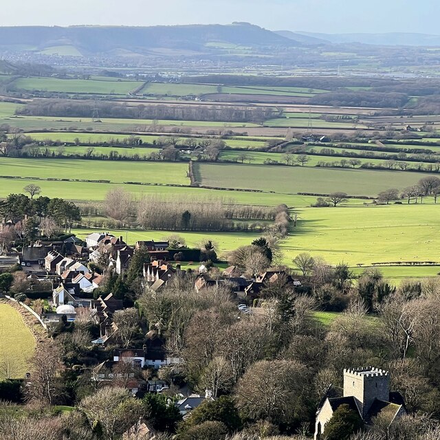
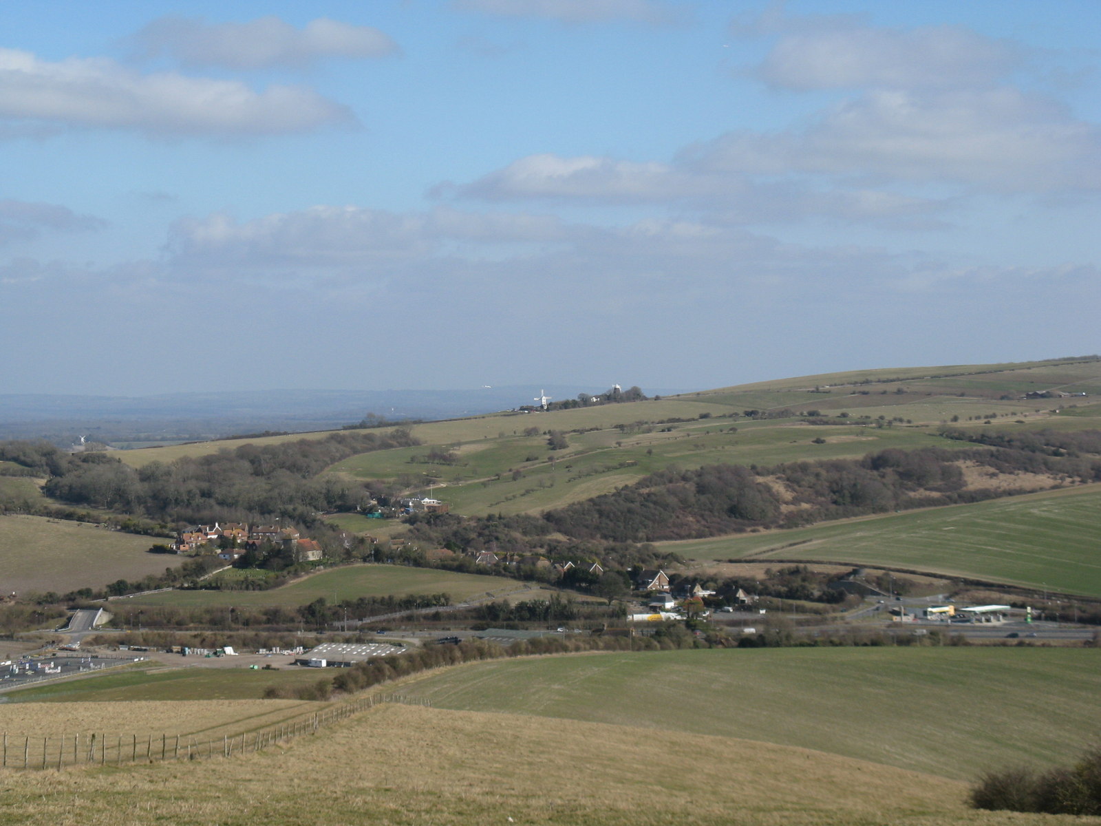
Newtimber is a small rural village located in the county of Sussex, England. Situated amidst the picturesque South Downs National Park, it is known for its stunning natural beauty and tranquil atmosphere. The village is part of the Mid Sussex district and lies approximately 10 miles north of the city of Brighton and Hove.

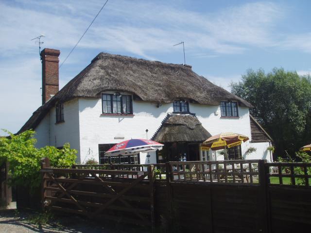
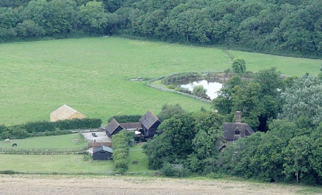
With a population of around 200 residents, Newtimber is a close-knit community that offers a peaceful escape from the hustle and bustle of city life. The village is characterized by its traditional English charm, with its quaint cottages, thatched roofs, and well-maintained gardens. The architecture reflects the village's long history, with some buildings dating back to the 16th century.

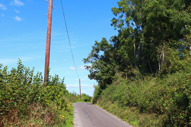
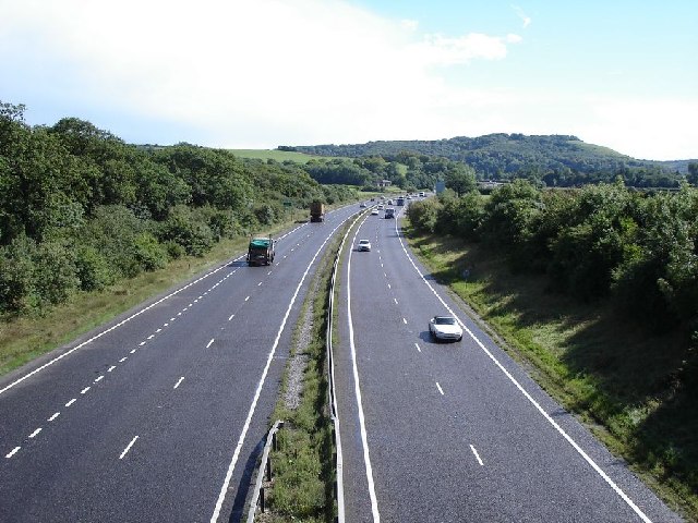
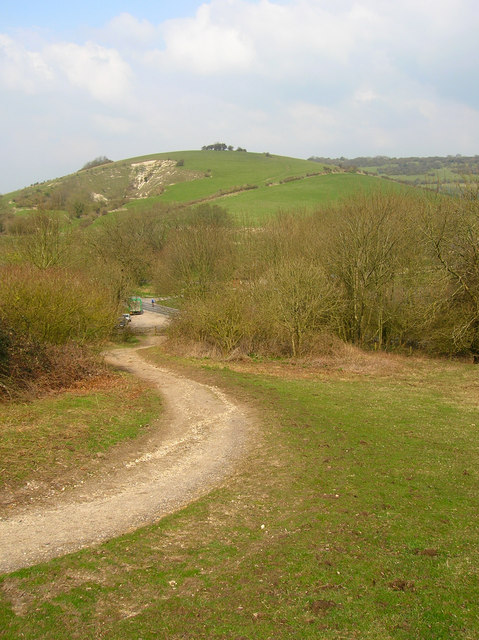
Newtimber is surrounded by rolling green hills and open countryside, making it a haven for outdoor enthusiasts. The area is crisscrossed by numerous walking trails and bridleways, offering ample opportunities for hiking, horse riding, and cycling. One of the highlights of the village is the proximity to Devil's Dyke, a stunning natural valley and viewpoint that attracts visitors from far and wide.

Despite its small size, Newtimber has a vibrant community spirit. The village has a local pub, The Royal Oak, which serves as a gathering place for residents and visitors alike. The nearby St. John the Evangelist Church, a Grade I listed building, provides a focal point for religious and community events.

Overall, Newtimber offers a peaceful and idyllic lifestyle, with its beautiful countryside, historic charm, and strong sense of community. It is a hidden gem within the Sussex countryside, attracting those seeking a slower pace of life and a connection with nature.

If you have any feedback on the listing, please let us know in the comments section below.

Newtimber Images

Images are sourced within 2km of 50.909813/-0.19483405 or Grid Reference TQ2713. Thanks to Geograph Open Source API. All images are credited.

View WSW along the South Downs from Wolstonbury Hill
Forge Garage - old filling-station paraphernalia
Winter trees on Newtimber Hill
View west over Poynings from North Hill Chanctonbury Ring can be seen in the distance.
View west over Poynings from North Hill
Chanctonbury Ring can be seen in the distance.
Wolstonbury Hill Trig point on Wolstonbury Hill.
Wolstonbury Hill
Trig point on Wolstonbury Hill.
Chalk Pit Aggregate extraction near Poynings.
Chalk Pit
Aggregate extraction near Poynings.
St John's Church Church near the village of Poynings.
St John's Church
Church near the village of Poynings.
West Road Bus stop near Poynings.
West Road
Bus stop near Poynings.
Minor Road Road near Poynings.
Minor Road
Road near Poynings.
Shaves Thatch Inn On the junction of B2117 and A281 is this Inn serving real ale and good food.
Shaves Thatch Inn
On the junction of B2117 and A281 is this Inn serving real ale and good food.
Rushfields Garden Centre On the Henfield Road at Poynings
Rushfields Garden Centre
On the Henfield Road at Poynings
Chalk Quarry This chalk quarry is still in use. Looking WSW.
Chalk Quarry
This chalk quarry is still in use. Looking WSW.
Foxhole Cottages Looking NW
Foxhole Cottages
Looking NW
Wolstonbury Hill Trig Point Number on Flush Bracket is S3887. Looking south.
Wolstonbury Hill Trig Point
Number on Flush Bracket is S3887. Looking south.
Danny House and Little Danny Farm A house has existed on this site since the 13th century although Danny House in its present form was built in 1595. It is now used as holiday rental apartments and retirement flats.
Danny House and Little Danny Farm
A house has existed on this site since the 13th century although Danny House in its present form was built in 1595. It is now used as holiday rental apartments and retirement flats.
View to the west from Wolstonbury Hill The communications masts on the top of Truleigh Hill can be seen in the centre of the photograph.
View to the west from Wolstonbury Hill
The communications masts on the top of Truleigh Hill can be seen in the centre of the photograph.
Woodland on the north side of Wolstonbury Hill
Looking south down the A23 This photograph was taken from the bridge carrying the B2117 over the A23.  The South Downs can be seen in the distance.
Looking south down the A23
This photograph was taken from the bridge carrying the B2117 over the A23. The South Downs can be seen in the distance.
Show me another place!

Newtimber is located at Grid Ref: TQ2713 (Lat: 50.909813, Lng: -0.19483405)

Administrative County: West Sussex

District: Mid Sussex

Police Authority: Sussex

What 3 Words

///oppose.bitters.skirting. Near Hassocks, West Sussex

Related Wikis

Newtimber

Newtimber is a small village and civil parish in the Mid Sussex District of West Sussex, England. It is located north-west of Brighton. The parish also...

Newtimber Place

Newtimber Place is a Grade I listed building in the Mid Sussex district of West Sussex, England. The house sits on a D-shaped island in a moat. The oldest...

Wolstonbury Hill

Wolstonbury Hill is a 58.9-hectare (146-acre) biological Site of Special Scientific Interest south-west of in West Sussex. It is owned by the National...

Poynings

Poynings ( or locally ) is a village and civil parish in the Mid Sussex District of West Sussex, England. The parish lies wholly with the South Downs...
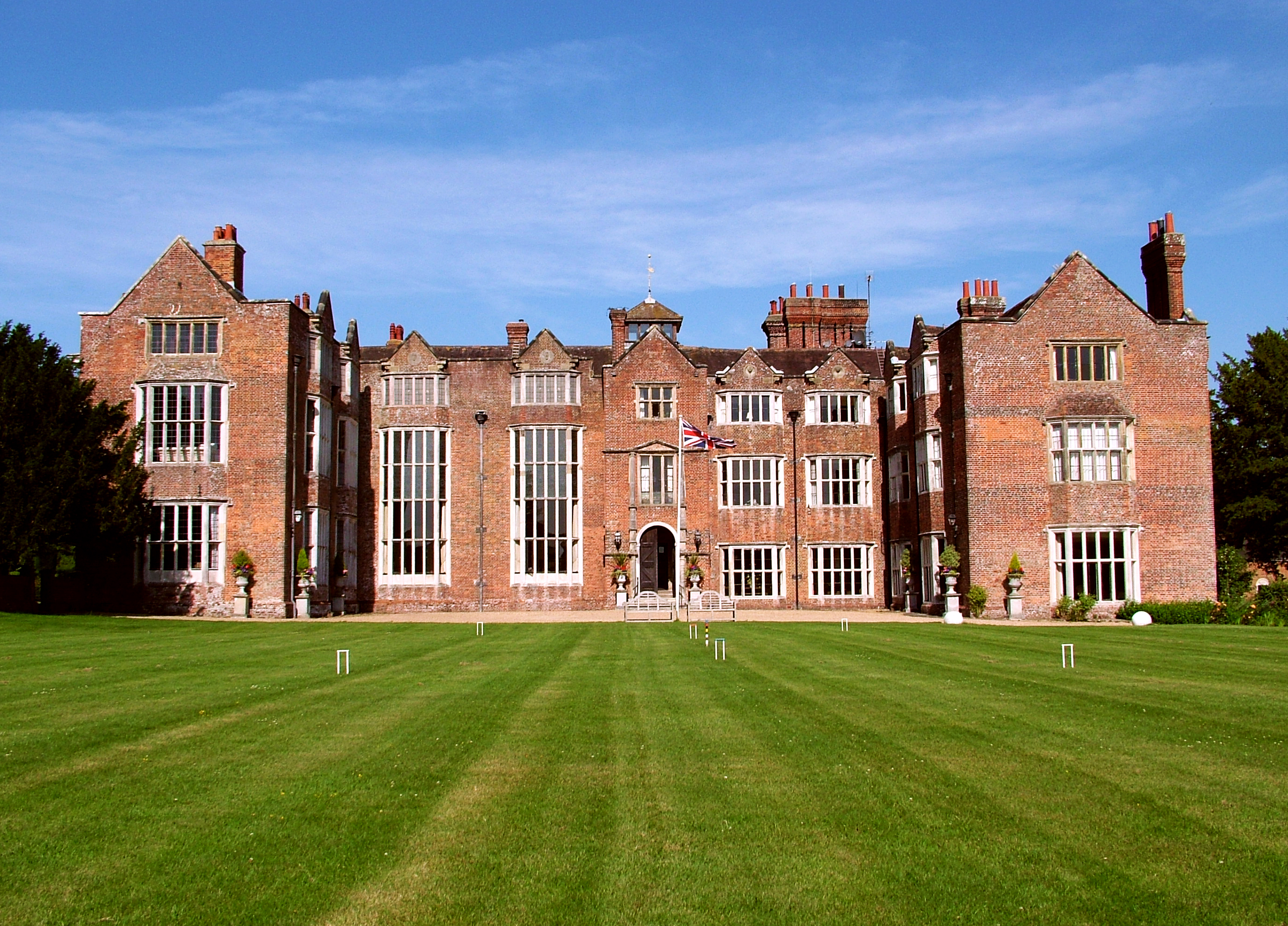
Danny House

Danny House is a Grade I listed Elizabethan red brick mansion near Hurstpierpoint in West Sussex, England. It lies at the northern foot of Wolstonbury...

Saddlescombe Preceptory

Saddlescombe Preceptory was a priory in West Sussex, England. == References == == Further reading == L. F. Salzmann (1907). "Religious Houses: The Preceptory...

Church of the Transfiguration, Pyecombe

The Church of the Transfiguration is the Church of England parish church of the village of Pyecombe, in the Mid Sussex District of West Sussex, England...

Pyecombe

Pyecombe is a village and civil parish in the Mid Sussex District of West Sussex, England. Pyecombe is located 7 miles (11 km) to the north of Brighton...

Nearby Amenities

Located within 500m of 50.909813,-0.19483405
Motorway Junction
Lat/Long: 50.9080141/-0.1896042
Crossing
Bicycle: yes
Crossing: unmarked
Crossing Markings: no
Kerb: flush
Lat/Long: 50.9074632/-0.1893161
Bus Stop
Star Cottage
Bus: yes
Naptan AtcoCode: 4400MS0223
Naptan Bearing: N
Naptan BusStopType: CUS
Naptan CommonName: Star Cottage
Naptan Indicator: northbound
Naptan Landmark: Star Cottage
Naptan NaptanCode: wsxdmdtg
Naptan Street: A23
Naptan Verified: no
Public Transport: platform
Source: naptan_import
Lat/Long: 50.9118097/-0.1926379
Bus Stop
Star Cottage
Bus: yes
Naptan AtcoCode: 4400MS0226
Naptan Bearing: S
Naptan BusStopType: CUS
Naptan CommonName: Star Cottage
Naptan Indicator: southbound
Naptan Landmark: Star Cottage
Naptan NaptanCode: wsxdmdtp
Naptan Street: A23
Naptan Verified: no
Public Transport: platform
Source: naptan_import
Lat/Long: 50.9116701/-0.1920889
Barrier: kissing_gate
Lat/Long: 50.9057326/-0.1931615
Barrier: stile
Foot: yes
Lat/Long: 50.910358/-0.1958134
Barrier: stile
Foot: yes
Lat/Long: 50.9136075/-0.1962418
Barrier: stile
Material: wood
Stile: stepover
Lat/Long: 50.9063773/-0.191191
Newtimber
Place: hamlet
Lat/Long: 50.9065915/-0.1936359
Barrier: block
Bicycle: yes
Foot: yes
Horse: yes
Lat/Long: 50.9096123/-0.1929397
Crossing
Bicycle: yes
Crossing: unmarked
Crossing Island: yes
Crossing Markings: no
Kerb: lowered
Tactile Paving: no
Lat/Long: 50.911876/-0.1924726
Crossing
Bicycle: yes
Crossing: unmarked
Crossing Island: yes
Crossing Markings: no
Kerb: lowered
Tactile Paving: no
Lat/Long: 50.9117492/-0.1922149
Water Point
Lat/Long: 50.9057744/-0.1940962
Bench
Backrest: yes
Seats: 2
Lat/Long: 50.9060673/-0.1937172
Bench
Backrest: yes
Seats: 2
Lat/Long: 50.9062491/-0.1938245
The data included in this document is from www.openstreetmap.org. The data is made available under ODbL.

Have you been to Newtimber?

Leave your review of Newtimber below (or comments, questions and feedback).