New Shildon

Settlement in Durham

England

New Shildon

Train for Bishop Auckland, inside Shildon Tunnel
Train for Bishop Auckland, inside Shildon Tunnel Credit: Roger Cornfoot

New Shildon is a small town located in County Durham, in the northeast of England. Situated approximately 2.5 miles south of Bishop Auckland, it is part of the Shildon and Dene Valley ward. The town has a population of around 9,000 people.

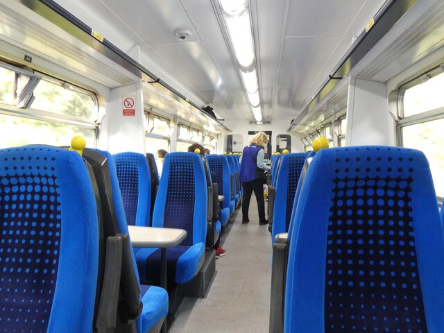
Historically, New Shildon was a prominent industrial area during the 19th and 20th centuries, primarily known for its locomotive manufacturing. The town played a significant role in the development of the railways, and it was home to the famous Shildon Locomotion Works, which opened in 1825. Today, the National Railway Museum in York operates the Locomotion Museum in New Shildon, showcasing the area's rich railway heritage.

The town itself offers a range of amenities and services to its residents and visitors. It has several schools, including primary and secondary options, along with healthcare facilities such as medical centers and pharmacies. The town center features a variety of local businesses, shops, and supermarkets, providing residents with convenient access to daily necessities.

New Shildon's location in County Durham offers easy access to the nearby attractions and scenic countryside. The town is surrounded by beautiful landscapes, including the nearby Bishop Auckland Golf Club and the Hamsterley Forest, which offers opportunities for outdoor activities such as hiking and mountain biking.

In summary, New Shildon is a small town in County Durham with a rich industrial history in locomotive manufacturing. It provides its residents with essential amenities and is situated in a picturesque region with access to outdoor recreational activities.

If you have any feedback on the listing, please let us know in the comments section below.
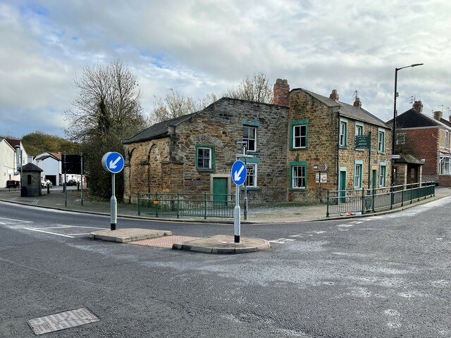
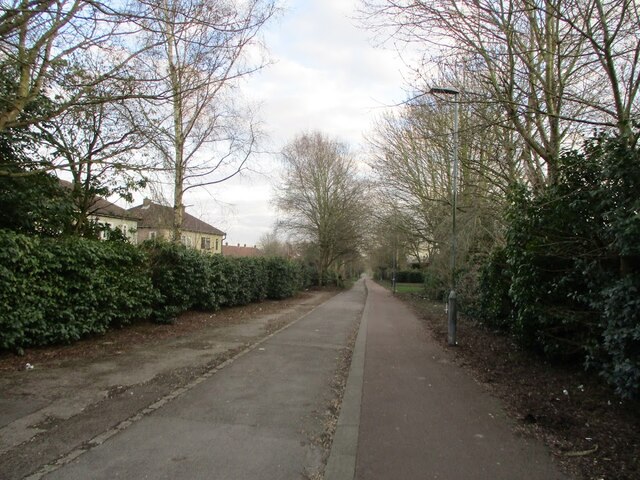
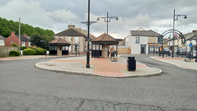
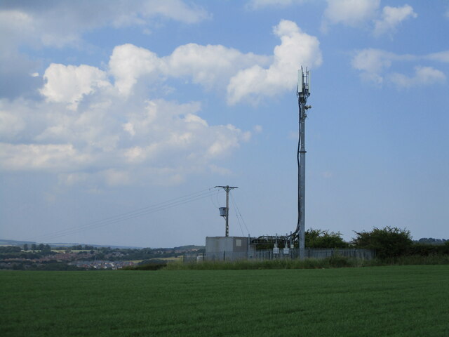
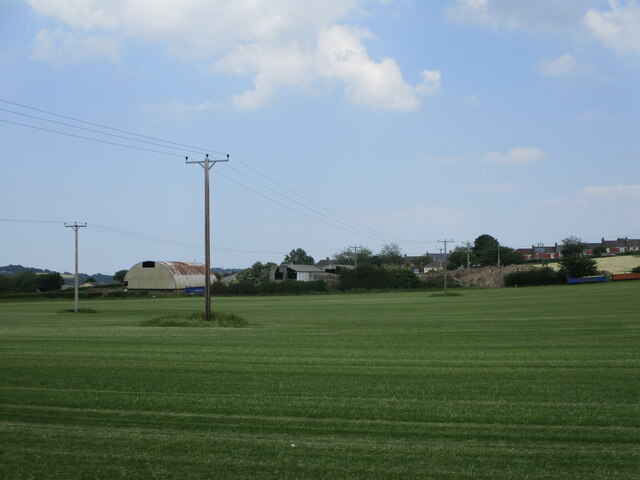
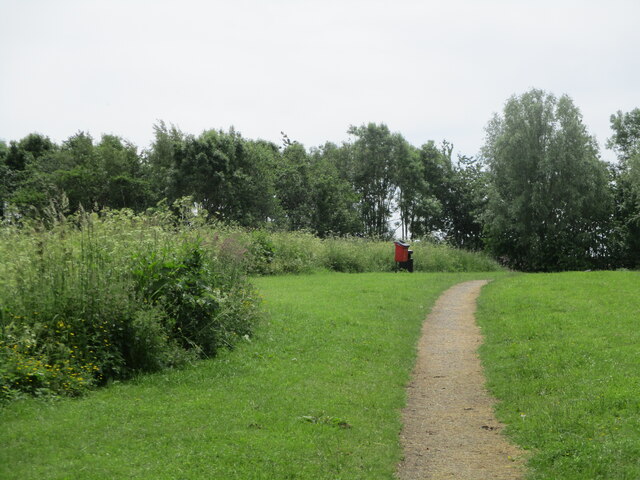
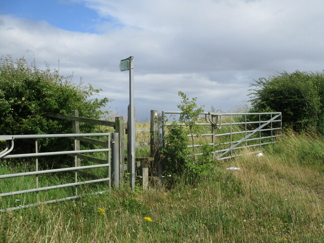
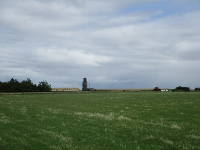
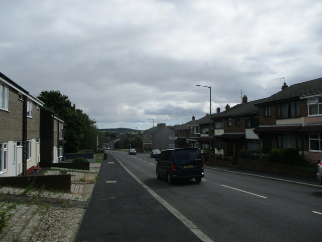
New Shildon Images

Images are sourced within 2km of 54.625115/-1.6466976 or Grid Reference NZ2225. Thanks to Geograph Open Source API. All images are credited.

Train for Bishop Auckland, inside Shildon Tunnel
Shildon 1st railway station (site), County Durham Opened in 1826 by the Stockton & Darlington Railway as the passenger terminus from Stockton via Darlington, this early station closed in 1842 when the current Shildon station opened on the through line to Bishop Auckland.
View east towards Newton Aycliffe and Darlington, from where the tracks crossed the road. The station, probably with minimal facilities, was situated somewhere near the trees, centre right. The former "Masons Arms" public house to the left was also known to be an early booking office. Behind the camera position were the one time Shildon wagon works.
Shildon 1st railway station (site), County Durham
Opened in 1826 by the Stockton & Darlington Railway as the passenger terminus from Stockton via Darlington, this early station closed in 1842 when the current Shildon station opened on the through line to Bishop Auckland. View east towards Newton Aycliffe and Darlington, from where the tracks crossed the road. The station, probably with minimal facilities, was situated somewhere near the trees, centre right. The former "Masons Arms" public house to the left was also known to be an early booking office. Behind the camera position were the one time Shildon wagon works.
Shildon 2nd railway station (site), County Durham Known as "Daniel Adamson's coach house", this is claimed to be the world's first purpose built passenger railway terminus. The arches for the passenger shed can still be clearly made out, although now infilled. A single railway track ran into the building from the far side.
It was a small scale and short lived service dating to c.1832-3. Daniel Adamson ran a private horse-drawn coach along the Surtees railway (now a footpath), which ran onto the Stockton and Darlington Railway near the current Shildon station. However, the S&DR soon took over the running of all services using conventional steam-hauled trains, and this passenger service was abandoned.
Shildon 2nd railway station (site), County Durham
Known as "Daniel Adamson's coach house", this is claimed to be the world's first purpose built passenger railway terminus. The arches for the passenger shed can still be clearly made out, although now infilled. A single railway track ran into the building from the far side. It was a small scale and short lived service dating to c.1832-3. Daniel Adamson ran a private horse-drawn coach along the Surtees railway (now a footpath), which ran onto the Stockton and Darlington Railway near the current Shildon station. However, the S&DR soon took over the running of all services using conventional steam-hauled trains, and this passenger service was abandoned.
Old railway footpath, Shildon A footpath in Shildon where an old railway line used to be.
Old railway footpath, Shildon
A footpath in Shildon where an old railway line used to be.
Soho Engine Shed On the Shildon National Railway Museum Site
Soho Engine Shed
On the Shildon National Railway Museum Site
King William bus stop - Shildon
Parking area near Shildon railway station A small area for parking and works access to the railway
Parking area near Shildon railway station
A small area for parking and works access to the railway
Telephone tower near Shildon A telephone tower in a farm near shildon
Telephone tower near Shildon
A telephone tower in a farm near shildon
Telephone lines going across a farm near Shildon
Millennium green - Shildon
Footpath across the Bishop line railway A footpath heading towards Middridge Grange going over the Bishop line railway
Footpath across the Bishop line railway
A footpath heading towards Middridge Grange going over the Bishop line railway
Field near Shildon A field and some telephone wires on the outskirts of Shildon
Field near Shildon
A field and some telephone wires on the outskirts of Shildon
Footpath along old railway line near Brussleton
Public footpath near Shildon A public footpath on the A6072 which is sadly overgrown by crops and inaccessible
Public footpath near Shildon
A public footpath on the A6072 which is sadly overgrown by crops and inaccessible
Farm near Shildon
Farm near Shildon
Auckland Terrace - Shildon
Footpath leading to Newbiggin farm
Class 71 Locomotive The class 71 was an electric locomotive built for use on British Rail's 3rd rail electrified Southern Region. Though main current pickup was from 750V DC third rail via a pickup shoe, the locomotives also had a pantograph to take current from overhead wires where an electrified ground system was deemed too dangerous, such as areas of marshaling yards with heavy footfall. Built 1958 - 60, the final class member was withdrawn in 1977, with E5001 (71001) the only class member preserved.

Info from Wiki: <span class="nowrap"><a title="https://en.wikipedia.org/wiki/British_Rail_Class_71" rel="nofollow ugc noopener" href="https://en.wikipedia.org/wiki/British_Rail_Class_71">Link</a><img style="margin-left:2px;" alt="External link" title="External link - shift click to open in new window" src="https://s1.geograph.org.uk/img/external.png" width="10" height="10"/></span>
Class 71 Locomotive
The class 71 was an electric locomotive built for use on British Rail's 3rd rail electrified Southern Region. Though main current pickup was from 750V DC third rail via a pickup shoe, the locomotives also had a pantograph to take current from overhead wires where an electrified ground system was deemed too dangerous, such as areas of marshaling yards with heavy footfall. Built 1958 - 60, the final class member was withdrawn in 1977, with E5001 (71001) the only class member preserved. Info from Wiki: LinkExternal link
Show me another place!

New Shildon is located at Grid Ref: NZ2225 (Lat: 54.625115, Lng: -1.6466976)

Unitary Authority: County Durham

Police Authority: Durham

What 3 Words

///trend.farmer.smiles. Near Shildon, Co. Durham

Nearby Locations

New Shildon

Related Wikis

Shildon railway works

Shildon railway works opened in 1833 in the town of Shildon in County Durham, England. Originally built to serve the Stockton and Darlington Railway the...

Shildon

Shildon is a town and civil parish in County Durham, in England. The population taken at the 2011 Census was 9,976. The town has the Locomotion Museum...

Hackworth Park

Hackworth Park (alternately the Recreation Ground) is a park in Shildon, County Durham, England. It was named after Timothy Hackworth, a railway pioneer...

Shildon railway station

Shildon is a railway station serving the town of Shildon in County Durham, England on the Tees Valley Line, between Bishop Auckland and Saltburn via Darlington...

Nearby Amenities

Located within 500m of 54.625115,-1.6466976
Mini Roundabout
Direction: clockwise
Lat/Long: 54.6277929/-1.6443116
Bus Stop
Byerley Road
Naptan AtcoCode: 13006904D
Naptan Bearing: SE
Naptan CommonName: Byerley Road
Naptan Indicator: south east bound
Naptan Landmark: Landmark not known
Naptan NaptanCode: durdtpwg
Naptan Notes: byerley road in front of No 154- shildon
Naptan Street: Byerley Road
Naptan Verified: no
Source: naptan_import
Lat/Long: 54.6283264/-1.6512926
Bus Stop
Byerley Road
Naptan AtcoCode: 13006904H
Naptan Bearing: NW
Naptan CommonName: Byerley Road
Naptan Indicator: north west bound
Naptan Landmark: Landmark not known
Naptan NaptanCode: durdtpwj
Naptan Notes: byerley road in front of No 120- shildon
Naptan Street: Byerley Road
Naptan Verified: no
Source: naptan_import
Lat/Long: 54.6284806/-1.6517715
Bus Stop
Masons Arms
Naptan AtcoCode: 13006905D
Naptan Bearing: SE
Naptan CommonName: Masons Arms
Naptan Indicator: south east bound
Naptan Landmark: Landmark not known
Naptan NaptanCode: durdtpwm
Naptan Notes: byerley road opposite Hackworth house- shildon
Naptan Street: Byerley Road
Naptan Verified: no
Shelter: yes
Source: naptan_import
Lat/Long: 54.6260158/-1.6478429
Bus Stop
Masons Arms
Naptan AtcoCode: 13006905H
Naptan Bearing: NW
Naptan CommonName: Masons Arms
Naptan Indicator: north west bound
Naptan Landmark: Landmark not known
Naptan NaptanCode: durdtpwp
Naptan Notes: byerley road- shildon
Naptan Street: Byerley Road
Naptan Verified: no
Source: naptan_import
Lat/Long: 54.6255201/-1.6473515
Bus Stop
Redworth Road
Naptan AtcoCode: 13006906D
Naptan Bearing: SE
Naptan CommonName: Redworth Road
Naptan Indicator: south east bound
Naptan Landmark: Landmark not known
Naptan NaptanCode: durdtpwt
Naptan Notes: redworth road opposite No 84- shildon
Naptan Street: Redworth Road
Naptan Verified: no
Source: naptan_import
Lat/Long: 54.6238853/-1.6415421
Bus Stop
Redworth Road
Naptan AtcoCode: 13006906H
Naptan Bearing: NW
Naptan CommonName: Redworth Road
Naptan Indicator: north west bound
Naptan Landmark: Landmark not known
Naptan NaptanCode: durdtwad
Naptan Notes: redworth road in front of club- shildon
Naptan Street: Redworth Road
Naptan Verified: no
Source: naptan_import
Lat/Long: 54.6242391/-1.6426386
Bus Stop
Dabble Duck Industrial Estate
Naptan AtcoCode: 13006932C
Naptan Bearing: E
Naptan CommonName: Dabble Duck Industrial Estate
Naptan Indicator: east bound
Naptan Landmark: Landmark not known
Naptan NaptanCode: durdwadj
Naptan Notes: dabble duck industrial estate- shildon
Naptan Street: Dabble Duck Industrial Estate
Naptan Verified: no
Source: naptan_import
Lat/Long: 54.6249041/-1.6426173
Bus Stop
Middleton Road End
Naptan AtcoCode: 13006935B
Naptan Bearing: NE
Naptan CommonName: Middleton Road End
Naptan Indicator: north east bound
Naptan Landmark: Landmark not known
Naptan NaptanCode: durdwaga
Naptan Notes: middleton road in front of garage- shildon
Naptan Street: Middleton Road
Naptan Verified: no
Source: naptan_import
Lat/Long: 54.6269236/-1.6478815
Bus Stop
Middleton Road End
Naptan AtcoCode: 13006935F
Naptan Bearing: SW
Naptan CommonName: Middleton Road End
Naptan Indicator: south west bound
Naptan Landmark: Landmark not known
Naptan NaptanCode: durdwagd
Naptan Notes: middleton road opposite garage- shildon
Naptan Street: Middleton Road
Naptan Verified: no
Source: naptan_import
Lat/Long: 54.6266724/-1.6480385
Bus Stop
Middleton Road (Masonic Hall)
Naptan AtcoCode: 13006936B
Naptan Bearing: NE
Naptan CommonName: Middleton Road (Masonic Hall)
Naptan Indicator: north east bound
Naptan Landmark: Landmark not known
Naptan NaptanCode: durdwagj
Naptan Notes: middleton road next to the hall- shildon
Naptan Street: Middleton Road
Naptan Verified: no
Source: naptan_import
Lat/Long: 54.6276793/-1.6450868
Bus Stop
Middleton Road (Masonic Hall)
Naptan AtcoCode: 13006936F
Naptan Bearing: SW
Naptan CommonName: Middleton Road (Masonic Hall)
Naptan Indicator: south west bound
Naptan Landmark: Landmark not known
Naptan NaptanCode: durdwagm
Naptan Notes: middleton road- shildon
Naptan Street: Middleton Road
Naptan Verified: no
Source: naptan_import
Lat/Long: 54.6275097/-1.645491
Railway: level_crossing
Lat/Long: 54.6262404/-1.6394576
Turning Circle
Lat/Long: 54.6235896/-1.6444273
Shildon Colliery
Fixme: This looks like Shildon Wagon Works - colliery further E?
Historic: mine
Mineral: coal
Source: NPE
Source Name: OS 1:25k
Lat/Long: 54.6241472/-1.652091
Shildon Wagon Works
Historic: yes
Landuse: industrial
Lat/Long: 54.6253454/-1.6525152
Disused Amenity: post_office
Note: Former New Shildon Post Office? https://www.thenorthernecho.co.uk/news/7069723.closure-post-office-big-blow/
Old Name: Shildon Post Office and Store
Source: survey
Lat/Long: 54.6249081/-1.6445945
Shildon Stores
Addr City: Shildon
Addr Housenumber: 18
Addr Postcode: DL4 2JE
Addr Street: Redworth Road
Brand Wikidata: Q107617274
Fhrs Id: 1679392
Fixme: Check whether supermarket tag still appropriate
Old Name: The Co-operative Food
Shop: supermarket
Source: survey
Source Addr: FHRS Open Data
Lat/Long: 54.6250541/-1.6458398
Restaurant
Cape to Cairo
Addr City: Shildon
Addr Housenumber: 223
Addr Postcode: DL4 1HH
Addr Street: Byerley Road
Alt Name: The Crossings
Cuisine: african
Fhrs Id: 1297478
Old Name: Mason's Arms
Source: survey
Takeaway: yes
Website: https://capetakeaway.co.uk/
Lat/Long: 54.6256382/-1.6472553
Cafe
Whistle Stop Cafe
Source: survey
Lat/Long: 54.6249872/-1.6454104
Post Box
Ref: DL4 178
Source: survey
Lat/Long: 54.6249558/-1.6445821
Post Box
Source: survey
Lat/Long: 54.6262418/-1.6484678
Driving Theory Test Bishop Auckland
Addr City: Bishop Auckland
Addr Street: Byerley Road
Fixme: Confirm extant - web link dead Nov 2022
Office: yes
Opening Hours: Mo-Fr 08:00-21:00; Sa-Su 08:00-21:00
Phone: +44 7510 18 55 60
Website: https://www.drivingtheorytestbishopauckland.org/
Lat/Long: 54.6262193/-1.6509111
Description: Site of the starting point of the 1st passenger train in the world on the Stockton & Darlington Railway.
Historic: yes
Source: http://www.railcentre.co.uk/RailHistory/Stockton/Pages/Stockton.html
Lat/Long: 54.6255324/-1.6471874
Generator Method: photovoltaic
Generator Orientation: 170
Generator Output Electricity: yes
Generator Solar Modules: 10
Generator Source: solar
Generator Type: solar_photovoltaic_panel
Location: roof
Power: generator
Lat/Long: 54.6258618/-1.6455899
Generator Method: photovoltaic
Generator Orientation: 170
Generator Output Electricity: yes
Generator Solar Modules: 12
Generator Source: solar
Generator Type: solar_photovoltaic_panel
Location: roof
Power: generator
Lat/Long: 54.6260046/-1.6442703
Generator Method: photovoltaic
Generator Orientation: 170
Generator Output Electricity: yes
Generator Solar Modules: 40
Generator Source: solar
Generator Type: solar_photovoltaic_panel
Location: roof
Power: generator
Lat/Long: 54.6260062/-1.6436373
Generator Method: photovoltaic
Generator Orientation: 90
Generator Output Electricity: yes
Generator Solar Modules: 20
Generator Source: solar
Generator Type: solar_photovoltaic_panel
Location: roof
Power: generator
Lat/Long: 54.624663/-1.6425344
Generator Method: photovoltaic
Generator Orientation: 150
Generator Output Electricity: yes
Generator Solar Modules: 20
Generator Source: solar
Generator Type: solar_photovoltaic_panel
Location: roof
Power: generator
Lat/Long: 54.6246083/-1.6425731
Generator Method: photovoltaic
Generator Orientation: 270
Generator Output Electricity: yes
Generator Solar Modules: 20
Generator Source: solar
Generator Type: solar_photovoltaic_panel
Location: roof
Power: generator
Lat/Long: 54.624678/-1.6427235
Generator Method: photovoltaic
Generator Orientation: 220
Generator Output Electricity: yes
Generator Solar Modules: 14
Generator Source: solar
Generator Type: solar_photovoltaic_panel
Location: roof
Power: generator
Lat/Long: 54.6245984/-1.6426719
Generator Method: photovoltaic
Generator Orientation: 180
Generator Output Electricity: yes
Generator Solar Modules: 500
Generator Source: solar
Generator Type: solar_photovoltaic_panel
Location: roof
Power: generator
Lat/Long: 54.6255711/-1.6405147
Party Time Events UK
Addr City: Shildon
Addr Housename: Party Time Events UK
Addr Postcode: DL4 1QB
Addr Street: Furnace Industrial Estate
Operator: Party Time Events UK
Shop: rental
Website: https://www.partytimeeventsuk.co.uk
Lat/Long: 54.6273845/-1.652399
Goods Shed Platform
Public Transport: stop_position
Railway: stop
Train: yes
Lat/Long: 54.6265552/-1.6414296
New Shildon War Memorial
Historic: memorial
Memorial: war_memorial
Wikidata: Q66478151
Wikimedia Commons: File:War Memorial Redworth Road Shildon - geograph.org.uk - 1404328.jpg
Lat/Long: 54.6242211/-1.6421135
Crossing
Crossing: unmarked
Crossing Island: yes
Lat/Long: 54.625206/-1.646403
Give Way
Direction: backward
Lat/Long: 54.6248705/-1.6473623
Kilburn's Warehouse
Information: board
Tourism: information
Lat/Long: 54.6266619/-1.6408377
Soho House
Board Type: history
Information: board
Tourism: information
Lat/Long: 54.6269714/-1.6415198
Lineside Cabins
Board Type: history
Information: board
Tourism: information
Lat/Long: 54.6263321/-1.6394083
Crossing
Crossing: unmarked
Crossing Island: yes
Lat/Long: 54.6233909/-1.6492233
Crossing
Crossing: unmarked
Crossing Island: yes
Lat/Long: 54.6246868/-1.6475772
Cafe
Name En: Blue Mallard
Lat/Long: 54.6247418/-1.6407945
Bar
Name En: George Samuel Brewery
Lat/Long: 54.6251135/-1.6473424
Crossing
Crossing: unmarked
Crossing Island: yes
Lat/Long: 54.6233792/-1.6490562
Crossing
Crossing: unmarked
Crossing Island: yes
Lat/Long: 54.6252645/-1.6464126
Railway: signal
Lat/Long: 54.6255363/-1.6475955
Information: board
Tourism: information
Lat/Long: 54.6255106/-1.6475418
Furnace Pit
Historic: mine
Operator: Shildon Lodge Colliery
Resource: coal
Lat/Long: 54.6260527/-1.6510713
The data included in this document is from www.openstreetmap.org. The data is made available under ODbL.

Have you been to New Shildon?

Leave your review of New Shildon below (or comments, questions and feedback).