New Pound

Settlement in Kent Tonbridge and Malling

England

New Pound

The Parish Church of St Lawrence, Mereworth Grade I listed

The church was built for the 7th Earl of Westmorland, John Fane, in 1744 to 1746, probably to a design by Roger Morris. It replaced the mediaeval church next to the castle when the castle was enlarged.

The church was designed like a Roman basilica. The ornate tower and spire are similar to several significant town churches, for examples St Martins-in-the-fields. The Palladian-style stone structure has been described as "the outstanding 18th-century church in the county, in scale, ambition and architectural interest"

Mediaeval monuments and 16th and 17th century round glass from the earlier church were incorporated, and there are several 19th-century windows. The Lady Chapel to the south west of the church contains a tomb to Sir Thomas Fane (1510-1598) and his wife Mary, with their sons Francis and George kneeling at the base.

In 2009 the church underwent an extensive program of restoration, the spire was strengthened and the clock and bells were refurbished.
The Parish Church of St Lawrence, Mereworth Credit: PAUL FARMER

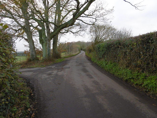
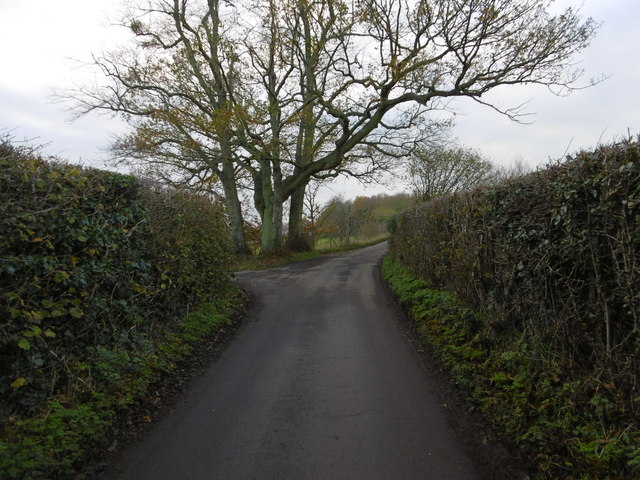
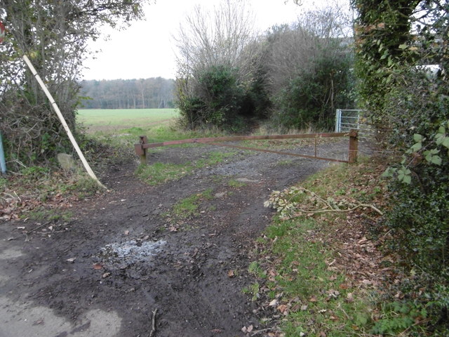
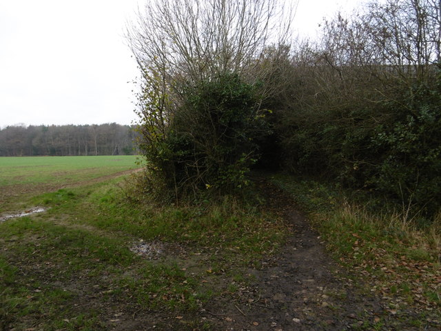
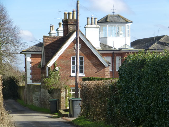
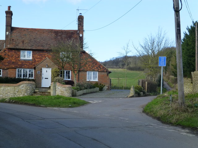
New Pound is a small village located in the county of Kent, in southeastern England. Situated approximately 10 miles southeast of the town of Maidstone, it is part of the borough of Tonbridge and Malling. The village is nestled in the picturesque countryside, surrounded by lush green fields and rolling hills, providing a tranquil and scenic setting.

The origins of New Pound can be traced back to medieval times, with evidence of human settlement in the area dating as far back as the 12th century. The village takes its name from an old livestock pound that was once located in the vicinity.

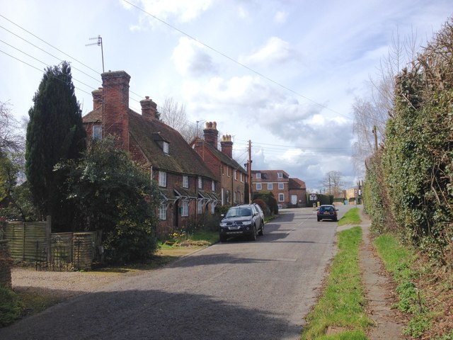
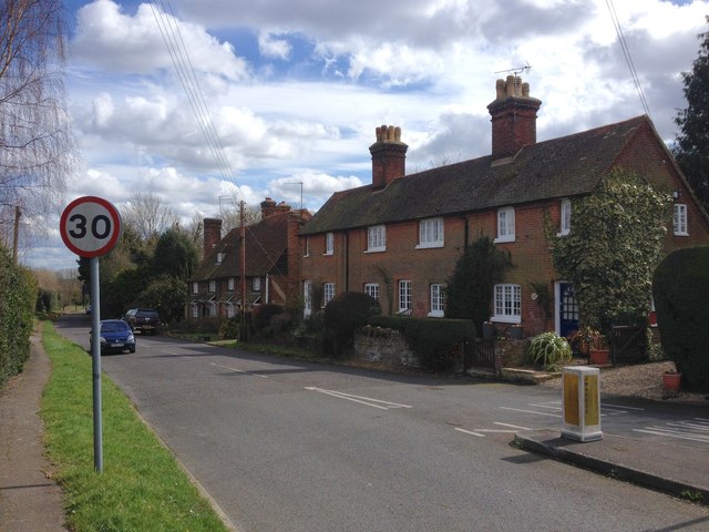
Today, New Pound is a charming and close-knit community with a population of around 500 residents. It is primarily a residential area, characterized by traditional English cottages and houses, giving it a quaint and timeless feel. The village is known for its strong sense of community spirit and active local organizations, such as the village hall committee and sports clubs.

Amenities in New Pound are limited, with a small convenience store providing basic necessities. However, residents benefit from the proximity to nearby towns and villages, where they can access a wider range of services and facilities.

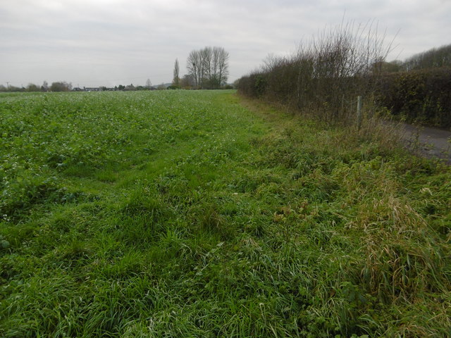
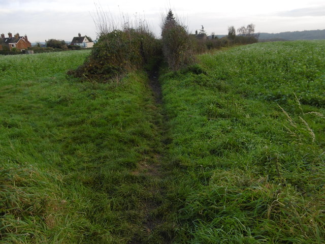
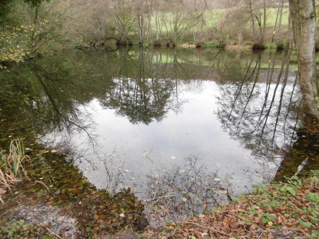
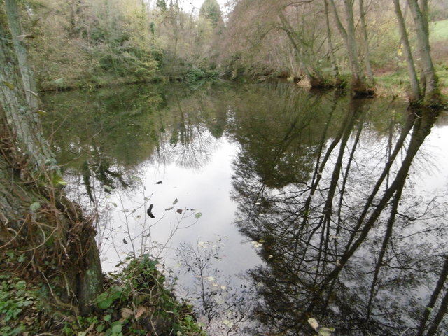
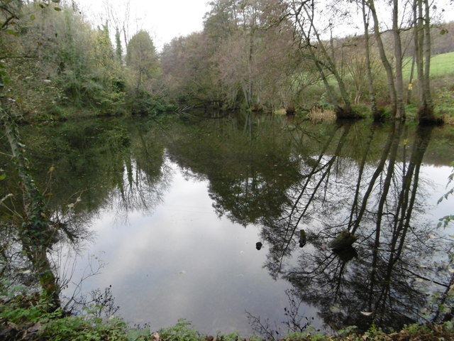
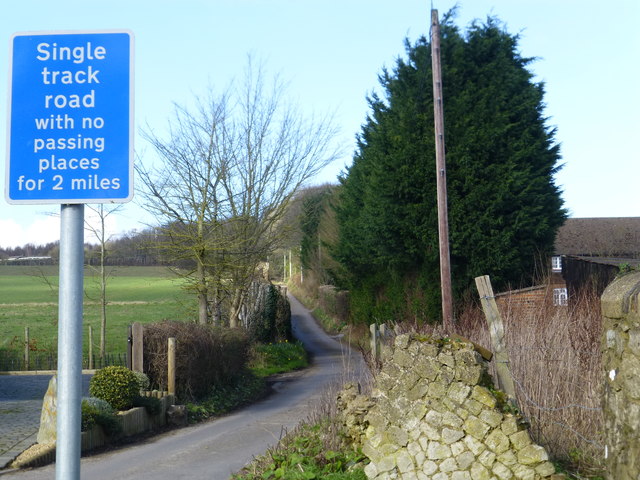
New Pound is a haven for nature lovers and outdoor enthusiasts, with numerous scenic walking trails and cycling routes in the surrounding countryside. The village is also within easy reach of some notable attractions, including Leeds Castle and the Kent Downs, offering residents and visitors alike the opportunity to explore the region's rich history and natural beauty.

In conclusion, New Pound is a tranquil and idyllic village in the heart of the Kentish countryside, offering a peaceful retreat from the hustle and bustle of modern life.

If you have any feedback on the listing, please let us know in the comments section below.
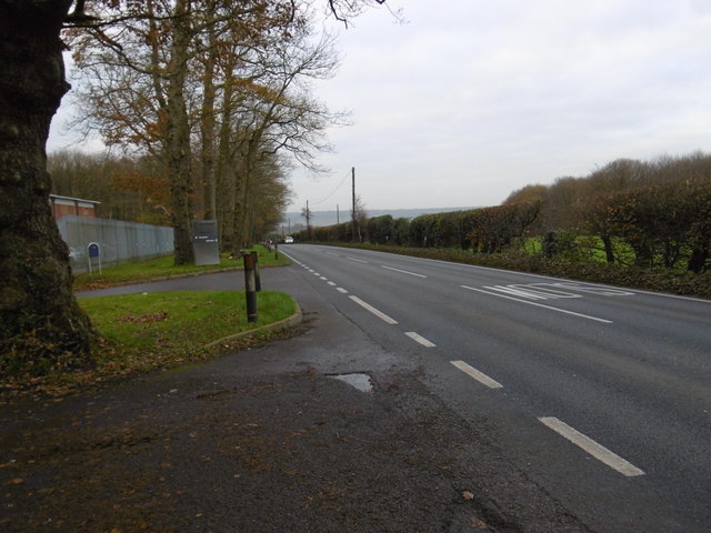
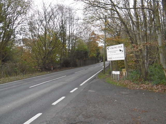
New Pound Images

Images are sourced within 2km of 51.267163/0.36039105 or Grid Reference TQ6454. Thanks to Geograph Open Source API. All images are credited.

The Parish Church of St Lawrence, Mereworth Grade I listed

The church was built for the 7th Earl of Westmorland, John Fane, in 1744 to 1746, probably to a design by Roger Morris. It replaced the mediaeval church next to the castle when the castle was enlarged.

The church was designed like a Roman basilica. The ornate tower and spire are similar to several significant town churches, for examples St Martins-in-the-fields. The Palladian-style stone structure has been described as "the outstanding 18th-century church in the county, in scale, ambition and architectural interest"

Mediaeval monuments and 16th and 17th century round glass from the earlier church were incorporated, and there are several 19th-century windows. The Lady Chapel to the south west of the church contains a tomb to Sir Thomas Fane (1510-1598) and his wife Mary, with their sons Francis and George kneeling at the base.

In 2009 the church underwent an extensive program of restoration, the spire was strengthened and the clock and bells were refurbished.
The Parish Church of St Lawrence, Mereworth
Grade I listed The church was built for the 7th Earl of Westmorland, John Fane, in 1744 to 1746, probably to a design by Roger Morris. It replaced the mediaeval church next to the castle when the castle was enlarged. The church was designed like a Roman basilica. The ornate tower and spire are similar to several significant town churches, for examples St Martins-in-the-fields. The Palladian-style stone structure has been described as "the outstanding 18th-century church in the county, in scale, ambition and architectural interest" Mediaeval monuments and 16th and 17th century round glass from the earlier church were incorporated, and there are several 19th-century windows. The Lady Chapel to the south west of the church contains a tomb to Sir Thomas Fane (1510-1598) and his wife Mary, with their sons Francis and George kneeling at the base. In 2009 the church underwent an extensive program of restoration, the spire was strengthened and the clock and bells were refurbished.
Alongside Beech Road Beech Road is a narrow road leading from the edge of Kings Hill out into countryside.
Alongside Beech Road
Beech Road is a narrow road leading from the edge of Kings Hill out into countryside.
Footpath off Beech Road Beech Road is a narrow road leading from the edge of Kings Hill out into countryside. This short footpath  leads from Beech Road to Kent Street.
Footpath off Beech Road
Beech Road is a narrow road leading from the edge of Kings Hill out into countryside. This short footpath leads from Beech Road to Kent Street.
Looking along Beech Road Beech Road is a narrow road leading from the edge of Kings Hill out into countryside and past Herne Pound. Horns Lane, which meets it on the left here, is even narrower.
Looking along Beech Road
Beech Road is a narrow road leading from the edge of Kings Hill out into countryside and past Herne Pound. Horns Lane, which meets it on the left here, is even narrower.
Beech Road Beech Road is a narrow road leading from the edge of Kings Hill out into countryside and past Herne Pound. Horns Lane, which meets it on the left just ahead, is even narrower.
Beech Road
Beech Road is a narrow road leading from the edge of Kings Hill out into countryside and past Herne Pound. Horns Lane, which meets it on the left just ahead, is even narrower.
View from Beech Road This is the view from Beech Road at New Pound just off Seven Mile Lane. Roadside Wood is in the distance. A path into Mereworth Woods is straight ahead, beyond the barrier.
View from Beech Road
This is the view from Beech Road at New Pound just off Seven Mile Lane. Roadside Wood is in the distance. A path into Mereworth Woods is straight ahead, beyond the barrier.
Path to Mereworth Woods This is the view from Beech Road at New Pound just off Seven Mile Lane. Roadside Wood is in the distance on the left. A path into Mereworth Woods is straight ahead.
Path to Mereworth Woods
This is the view from Beech Road at New Pound just off Seven Mile Lane. Roadside Wood is in the distance on the left. A path into Mereworth Woods is straight ahead.
Fish Pond, Swanton Valley This quiet spot is just on the edge of Mereworth Woods.

The stream which flows into the Fish Pond rises in Hurst Wood and later on downstream forms the lakes in Mereworth Park. It then passes under Pizien Well Road before flowing into the Old Mill Pond at Wateringbury – see <a title="https://www.geograph.org.uk/photo/6314686" href="https://www.geograph.org.uk/photo/6314686">Link</a>  before a short while later it meets the River Medway near Wateringbury Bridge.
Fish Pond, Swanton Valley
This quiet spot is just on the edge of Mereworth Woods. The stream which flows into the Fish Pond rises in Hurst Wood and later on downstream forms the lakes in Mereworth Park. It then passes under Pizien Well Road before flowing into the Old Mill Pond at Wateringbury – see Link before a short while later it meets the River Medway near Wateringbury Bridge.
Fish Pond, Swanton Valley This quiet spot is just on the edge of Mereworth Woods. It is seen here from Swanton Road.

The stream which flows into the Fish Pond rises in Hurst Wood and later on downstream forms the lakes in Mereworth Park. It then passes under Pizien Well Road before flowing into the Old Mill Pond at Wateringbury – see <a title="https://www.geograph.org.uk/photo/6314686" href="https://www.geograph.org.uk/photo/6314686">Link</a>  before a short while later it meets the River Medway near Wateringbury Bridge.
Fish Pond, Swanton Valley
This quiet spot is just on the edge of Mereworth Woods. It is seen here from Swanton Road. The stream which flows into the Fish Pond rises in Hurst Wood and later on downstream forms the lakes in Mereworth Park. It then passes under Pizien Well Road before flowing into the Old Mill Pond at Wateringbury – see Link before a short while later it meets the River Medway near Wateringbury Bridge.
Seven Mile Lane Seven Mile Lane is a long and mostly straight road leading from the A20 at Wrotham Heath to the A26 near Mereworth. This view near the Viking Oak Boarding Kennels and Cattery looks towards Wrotham Heath.
Seven Mile Lane
Seven Mile Lane is a long and mostly straight road leading from the A20 at Wrotham Heath to the A26 near Mereworth. This view near the Viking Oak Boarding Kennels and Cattery looks towards Wrotham Heath.
Seven Mile Lane Seven Mile Lane is a long and mostly straight road leading from the A20 at Wrotham Heath to the A26 near Mereworth. This view by the entrance to the Viking Oak Boarding Kennels and Cattery looks towards Mereworth.
Seven Mile Lane
Seven Mile Lane is a long and mostly straight road leading from the A20 at Wrotham Heath to the A26 near Mereworth. This view by the entrance to the Viking Oak Boarding Kennels and Cattery looks towards Mereworth.
Willow Wents, a lane in Mereworth. This is near the junction with Horns Lane
Willow Wents, a lane in Mereworth.
This is near the junction with Horns Lane
Junction of Forge Lane and Stan Lane, West Peckham
Stan Lane, West Peckham
The Street, Mereworth
Mereworth Village Sign
Show me another place!

New Pound is located at Grid Ref: TQ6454 (Lat: 51.267163, Lng: 0.36039105)

Administrative County: Kent

District: Tonbridge and Malling

Police Authority: Kent

What 3 Words

///clip.onions.rarely. Near Kings Hill, Kent

Nearby Locations

New Pound

Related Wikis

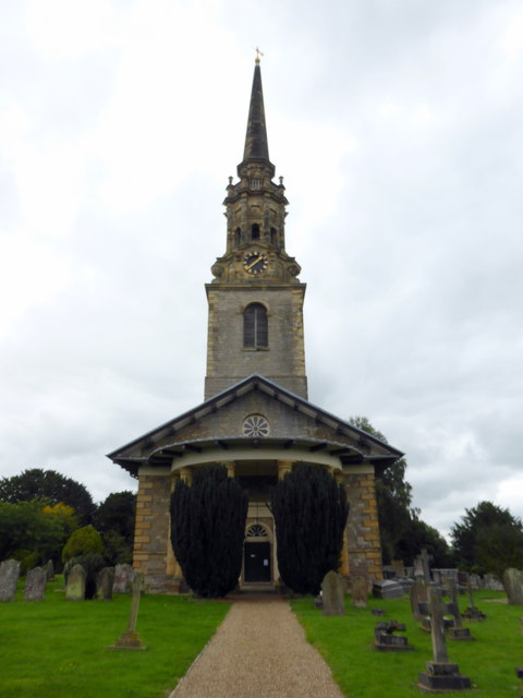
St Lawrence's Church, Mereworth

St Lawrence's Church is an Anglican parish church at Mereworth, Kent, United Kingdom. It is in the deanery of West Malling, the Diocese of Rochester and...

West Peckham Preceptory

West Peckham Preceptory was a preceptory in West Peckham, Kent, England. == History == West Peckham Preceptory was founded circa 1408 by Sir John Culpeper...

Tonbridge and Malling

Tonbridge and Malling is a local government district with borough status in Kent, England. The council is based at Kings Hill. The borough also includes...
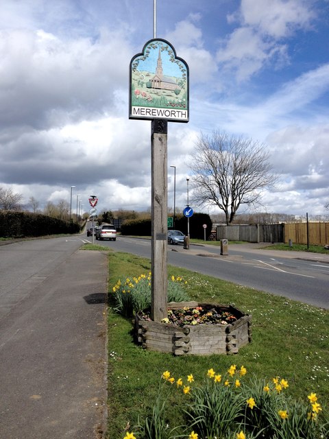
Mereworth

Mereworth is a village and civil parish near the town of Maidstone in Kent, England. The Wateringbury Stream flows through the village and powered a watermill...

Nearby Amenities

Located within 500m of 51.267163,0.36039105
Restaurant
Lat/Long: 51.2666828/0.3599808
Pub
The Moody Mare Pub and Dining
Addr City: Mereworth
Addr Housenumber: 501
Addr Postcode: ME18 5QY
Addr Street: Seven Mile Lane
Opening Hours: We,Th 12:00-15:00,17:00-23:30; Fr,Sa 11:00-23:00; Su 12:00-18:00
Phone: +44 1622 813038
Website: https://www.themoodymare.co.uk/
Lat/Long: 51.267088/0.360283
Post Box
Brand: Royal Mail
Brand Wikidata: Q638098
Operator: Royal Mail
Operator Wikidata: Q638098
Post Box Mounting: pier
Post Box Type: lamp
Ref: ME18 250
Royal Cypher: EIIR
Royal Cypher Wikidata: Q33102113
Lat/Long: 51.266871/0.3605026
The data included in this document is from www.openstreetmap.org. The data is made available under ODbL.

Have you been to New Pound?

Leave your review of New Pound below (or comments, questions and feedback).