Moorclose

Settlement in Cumberland Allerdale

England

Moorclose

Harrington War Memorial Harrington War Memorial is located within the grounds of St. Mary’s Church. The grounds are split in two by the main road.
Harrington War Memorial Credit: Colin Kinnear

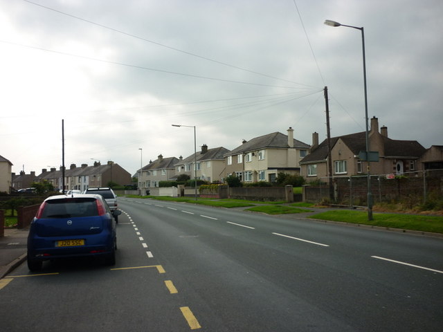
Moorclose is a small village located in the county of Cumberland in the northwest of England. Situated near the town of Workington, Moorclose is nestled in a picturesque rural setting, surrounded by rolling hills and scenic countryside.

The village is known for its close-knit community and friendly atmosphere. With a population of around 1,000 residents, Moorclose offers a peaceful and tranquil environment away from the hustle and bustle of larger towns and cities.

Moorclose is predominantly a residential area, with a mix of traditional stone-built houses and modern developments. The village has a range of amenities to cater to the needs of its residents, including a local shop, a post office, and a pub. There are also several parks and green spaces, providing opportunities for outdoor activities and recreational pursuits.

The village is well-connected to the surrounding areas by road, with easy access to nearby towns and cities. The nearby A596 road provides links to Workington, Carlisle, and other major cities in the region. Additionally, there are regular bus services connecting Moorclose to the wider area.

While Moorclose may be small in size, it benefits from its proximity to larger towns and cities, offering residents a peaceful rural lifestyle with access to a range of amenities and opportunities for employment and leisure.

If you have any feedback on the listing, please let us know in the comments section below.
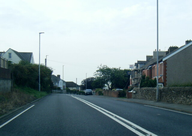
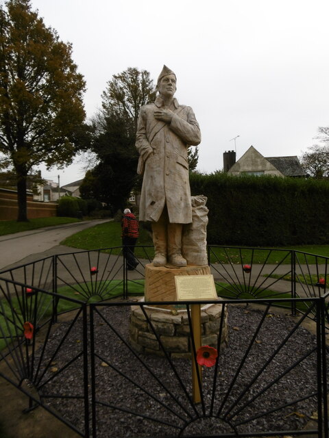
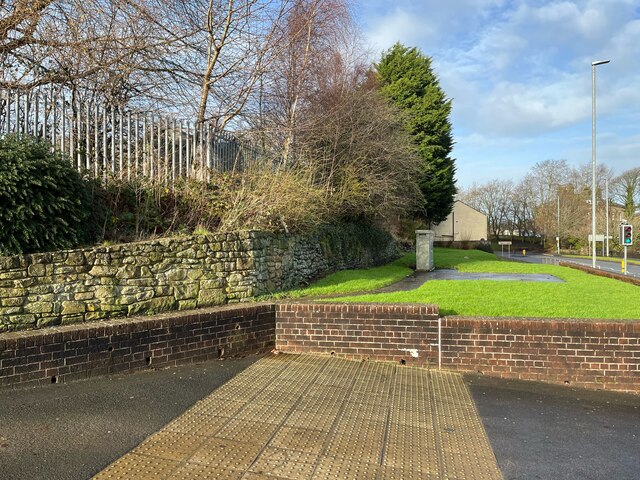
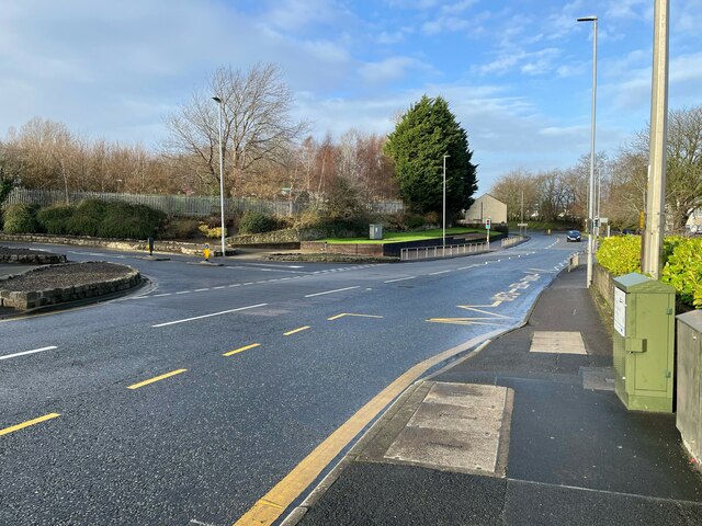
Moorclose Images

Images are sourced within 2km of 54.629217/-3.54409 or Grid Reference NY0027. Thanks to Geograph Open Source API. All images are credited.

Harrington War Memorial Harrington War Memorial is located within the grounds of St. Mary’s Church. The grounds are split in two by the main road.
Harrington War Memorial
Harrington War Memorial is located within the grounds of St. Mary’s Church. The grounds are split in two by the main road.
A596 at Branthwaite Road junction
A596 entering Workington
Hope, War Memorial Memorial to those who gave their lives in World Wars 1 and 2 and all wars since then.
Hope, War Memorial
Memorial to those who gave their lives in World Wars 1 and 2 and all wars since then.
Fence, walls and grass Beside Newlands Lane at the junction with High Street, the palisade fence marks the boundary of Ashfield Infant and Nursery School.
Fence, walls and grass
Beside Newlands Lane at the junction with High Street, the palisade fence marks the boundary of Ashfield Infant and Nursery School.
Junction of High Street and Newlands Lane High Street is the A596 from Distington to Workington.
Junction of High Street and Newlands Lane
High Street is the A596 from Distington to Workington.
Workington Hall (Ruin), Cumbria The present house dates back to around 1404 and was built as a fortified tower house. In 1568, Mary, Queen of Scots wrote a letter from Workington Hall to Queen Elizabeth I of England. After the defeat of her forces at the Battle of Langside and disguised as an ordinary woman, Mary crossed the Solway Firth and landed at Workington. She spent her first night in England as an honoured guest at Workington Hall. On 18 May 1568, Mary was escorted to Carlisle Castle after spending a day at Cockermouth. 

<span class="nowrap"><a title="https://en.wikipedia.org/wiki/Workington_Hall" rel="nofollow ugc noopener" href="https://en.wikipedia.org/wiki/Workington_Hall">Link</a><img style="margin-left:2px;" alt="External link" title="External link - shift click to open in new window" src="https://s1.geograph.org.uk/img/external.png" width="10" height="10"/></span>
Workington Hall (Ruin), Cumbria
The present house dates back to around 1404 and was built as a fortified tower house. In 1568, Mary, Queen of Scots wrote a letter from Workington Hall to Queen Elizabeth I of England. After the defeat of her forces at the Battle of Langside and disguised as an ordinary woman, Mary crossed the Solway Firth and landed at Workington. She spent her first night in England as an honoured guest at Workington Hall. On 18 May 1568, Mary was escorted to Carlisle Castle after spending a day at Cockermouth. LinkExternal link
LMS Ivatt 2MT 2-6-0 at Workington Locomotive Depot Looking remarkably spruce, although over a year old, No. 46459 (built 6/50, withdrawn 9/65) stands in the yard at Workington Depot, ready to a passenger train to Penrith via Cockermouth - on which this class had fairly recently usurped the ex-LNW 0-6-0s that used to dominate the line. In 1950 Workington (coded 12D) had an allocation of 26:- 3 4-4-0, 8 2-6-0, 12 0-6-0 and 3 0-6-0T.
LMS Ivatt 2MT 2-6-0 at Workington Locomotive Depot
Looking remarkably spruce, although over a year old, No. 46459 (built 6/50, withdrawn 9/65) stands in the yard at Workington Depot, ready to a passenger train to Penrith via Cockermouth - on which this class had fairly recently usurped the ex-LNW 0-6-0s that used to dominate the line. In 1950 Workington (coded 12D) had an allocation of 26:- 3 4-4-0, 8 2-6-0, 12 0-6-0 and 3 0-6-0T.
Ex-LNW '18" Goods 2F 0-6-0 at Workington Locomotive Depot No. 58396 (former LMS No. 28512) was one of many Webb 'Cauliflower' 2F 0-6-0s that before Nationalisation had dominated the passenger and freight traffic on the Cockermouth, Keswick & Penrith line; it was one of the last survivors of the 310 (built 1880 - 1902) when withdrawn in 9/53.
Ex-LNW '18" Goods 2F 0-6-0 at Workington Locomotive Depot
No. 58396 (former LMS No. 28512) was one of many Webb 'Cauliflower' 2F 0-6-0s that before Nationalisation had dominated the passenger and freight traffic on the Cockermouth, Keswick & Penrith line; it was one of the last survivors of the 310 (built 1880 - 1902) when withdrawn in 9/53.
British Steel Corporation Moss Bay Works - steam rolling mill engine This was the last reversing rolling mill engine in a British steel works and it was due to be retired within a week or so. So this was a real last ditch effort to see it at work, including overnight bus and rail travel. This duplex engine was built by Davy Bros, Sheffield c1890 and rebuilt by Walker Bros, Wigan in 1944. It produced 1200 horsepower from piston valve cylinders 32" bore by 48" stroke. The reversing gear was Allan straight link and there was a steam reverser on the frame more or less in the centre of the picture.
George Watkins published a picture of this but you are unlikely to see many others.

It appears that this part of the site has now been cleared.
British Steel Corporation Moss Bay Works - steam rolling mill engine
This was the last reversing rolling mill engine in a British steel works and it was due to be retired within a week or so. So this was a real last ditch effort to see it at work, including overnight bus and rail travel. This duplex engine was built by Davy Bros, Sheffield c1890 and rebuilt by Walker Bros, Wigan in 1944. It produced 1200 horsepower from piston valve cylinders 32" bore by 48" stroke. The reversing gear was Allan straight link and there was a steam reverser on the frame more or less in the centre of the picture. George Watkins published a picture of this but you are unlikely to see many others. It appears that this part of the site has now been cleared.
Benchmark at Falcon Street/Station Road junction Ordnance Survey cut mark benchmark described on the Bench Mark Database at <span class="nowrap"><a title="http://www.bench-marks.org.uk/bm43739" rel="nofollow ugc noopener" href="http://www.bench-marks.org.uk/bm43739">Link</a><img style="margin-left:2px;" alt="External link" title="External link - shift click to open in new window" src="https://s1.geograph.org.uk/img/external.png" width="10" height="10"/></span>
Benchmark at Falcon Street/Station Road junction
Ordnance Survey cut mark benchmark described on the Bench Mark Database at LinkExternal link
Former bank at junction of Falcon Street and Station Road There is an OS benchmark <a href="https://www.geograph.org.uk/photo/3026598">NX9928 : Benchmark at Falcon Street/Station Road junction</a> on the front angle of the building.
Former bank at junction of Falcon Street and Station Road
There is an OS benchmark NX9928 : Benchmark at Falcon Street/Station Road junction on the front angle of the building.
St Michael's Church, Workington
Houses on Shore Road, Workington
The entrance to Salterbeck Cemetery
Houses on Salterbeck Road
The Parish Church of St Mary, Harrington
A social club in Harrington
Show me another place!

Moorclose is located at Grid Ref: NY0027 (Lat: 54.629217, Lng: -3.54409)

Administrative County: Cumbria

District: Allerdale

Police Authority: Cumbria

What 3 Words

///steer.record.famous. Near Workington, Cumbria

Nearby Locations

Moorclose

Related Wikis

Harrington Junction

Harrington Junction was a railway junction in Harrington, Cumbria, England. It joined three branches to the Cleator and Workington Junction Railway's...

Salterbeck

Salterbeck is a housing estate on the south side of Workington, Cumbria, England, which was built during the 1930s on farmland for steelworkers and their...

Workington

Workington is a coastal town and civil parish at the mouth of the River Derwent on the west coast in Cumberland, Cumbria, England. At the 2011 census...

Our Lady and St Michael's Church, Workington

Our Lady and St Michael's Church also known as Our Lady Star of the Sea and St Michael's Church is a Roman Catholic Parish church in Workington, Cumbria...

Nearby Amenities

Located within 500m of 54.629217,-3.54409
Bus Stop
Newlands Lane at Glenn Road
Bus: yes
Naptan AtcoCode: 090002590232
Naptan Bearing: S
Naptan CommonName: Newlands Lane at Glenn Road
Naptan Indicator: near
Naptan Landmark: junction with Glenn Road
Naptan NaptanCode: cumajatw
Naptan Street: Newlands Lane
Naptan Verified: no
Public Transport: platform
Source: naptan_import
Lat/Long: 54.6291937/-3.5511368
Bus Stop
Mooreclose Community Centre
Bus: yes
Naptan AtcoCode: 090002590238
Naptan Bearing: W
Naptan CommonName: Sixth Form Centre
Naptan Indicator: opp
Naptan Landmark: Fountains Avenue
Naptan NaptanCode: cumajawp
Naptan Street: Newlands Lane
Naptan Verified: no
Public Transport: platform
Source: naptan_import
Lat/Long: 54.6277255/-3.549981
Bus Stop
Ashfield Road South at Bowness Court
Bus: yes
Naptan AtcoCode: 090002590258
Naptan Bearing: W
Naptan CommonName: Ashfield Road South at Bowness Court
Naptan Indicator: opp
Naptan Landmark: junction with Bowness Court
Naptan NaptanCode: cumajdjp
Naptan Street: Ashfield Road South
Naptan Verified: no
Public Transport: platform
Source: naptan_import
Lat/Long: 54.6290465/-3.5450738
Bus Stop
Ashfield Road South
Bus: yes
Local Ref: AT
Naptan AtcoCode: 090002590260
Naptan Bearing: E
Naptan CommonName: Ashfield Road South
Naptan Indicator: at
Naptan Landmark: junction with Crosthwaite Court
Naptan NaptanCode: cumajdjw
Naptan Street: Ashfield Road South
Naptan Verified: no
Public Transport: platform
Source: naptan_import
Lat/Long: 54.629221/-3.5447861
Bus Stop
Laybourn Court (S bound)
Bus: yes
Naptan AtcoCode: 090002590269
Naptan Bearing: S
Naptan CommonName: Laybourn Court (S bound)
Naptan Indicator: opp
Naptan Landmark: Laybourn House
Naptan NaptanCode: cumajdmw
Naptan Street: Ashfield Road
Naptan Verified: no
Public Transport: platform
Source: naptan_import
Lat/Long: 54.6302846/-3.5417279
Bus Stop
Laybourn House (N bound)
Bus: yes
Naptan AtcoCode: 090002590270
Naptan Bearing: N
Naptan CommonName: Laybourn House (N bound)
Naptan Indicator: opp
Naptan Landmark: junction with Chaucer Road
Naptan NaptanCode: cumajdpa
Naptan Street: Ashfield Road
Naptan Verified: no
Public Transport: platform
Source: naptan_import
Lat/Long: 54.6307717/-3.5415914
Bus Stop
Ashfield Road at Hunday Court
Bus: yes
Naptan AtcoCode: 090002590273
Naptan Bearing: S
Naptan CommonName: Ashfield Road at Hunday Court
Naptan Indicator: opp
Naptan Landmark: Hunday Court
Naptan NaptanCode: cumajdpg
Naptan Street: Ashfield Road South
Naptan Verified: no
Public Transport: platform
Source: naptan_import
Lat/Long: 54.6334225/-3.5416452
Bus Stop
Furness Road at Newlands Lane
Bus: yes
Naptan AtcoCode: 090002593046
Naptan Bearing: SW
Naptan CommonName: Furness Road at Newlands Lane
Naptan Indicator: near
Naptan Landmark: junction with Newlands Lane
Naptan NaptanCode: cumajgaj
Naptan Street: Furness Road
Naptan Verified: no
Public Transport: platform
Source: naptan_import
Lat/Long: 54.629132/-3.5503443
Bus Stop
Edinburgh Avenue
Bus: yes
Naptan AtcoCode: 090002593047
Naptan Bearing: S
Naptan CommonName: Edinburgh Avenue
Naptan Indicator: opp
Naptan Landmark: Ely Close
Naptan NaptanCode: cumajgam
Naptan Street: Edinburgh Avenue
Naptan Verified: no
Public Transport: platform
Source: naptan_import
Lat/Long: 54.6304194/-3.5501764
Noexit: yes
Lat/Long: 54.6324684/-3.5428831
Turning Circle
Lat/Long: 54.629121/-3.5475005
Noexit: yes
Lat/Long: 54.6298601/-3.5433163
Barrier: yes
Lat/Long: 54.6306767/-3.5476162
Fast Food
Cuisine: fish_and_chips
Lat/Long: 54.6294342/-3.5516343
Crossing
Crossing: uncontrolled
Crossing Markings: yes
Lat/Long: 54.6295294/-3.5513196
Barrier: yes
Lat/Long: 54.630136/-3.5499381
Post Box
Ref: CA14 16
Lat/Long: 54.6297312/-3.5427973
Post Box
Ref: CA14 24
Lat/Long: 54.6329909/-3.5477544
Community Centre
Moorclose Community Centre
Lat/Long: 54.6275266/-3.5502859
Generator Method: photovoltaic
Generator Orientation: south_west
Generator Output Electricity: yes
Generator Solar Modules: 15
Generator Source: solar
Generator Type: solar_photovoltaic_panel
Location: roof
Power: generator
Lat/Long: 54.6320917/-3.5492594
Generator Method: photovoltaic
Generator Orientation: south_west
Generator Output Electricity: yes
Generator Solar Modules: 9
Generator Source: solar
Generator Type: solar_photovoltaic_panel
Location: roof
Power: generator
Lat/Long: 54.63086/-3.5477879
Generator Method: photovoltaic
Generator Orientation: south_west
Generator Output Electricity: yes
Generator Solar Modules: 12
Generator Source: solar
Generator Type: solar_photovoltaic_panel
Location: roof
Power: generator
Lat/Long: 54.6308974/-3.5478535
Generator Method: photovoltaic
Generator Orientation: east
Generator Output Electricity: yes
Generator Solar Modules: 10
Generator Source: solar
Generator Type: solar_photovoltaic_panel
Location: roof
Power: generator
Lat/Long: 54.6307672/-3.5504272
Generator Method: photovoltaic
Generator Orientation: west
Generator Output Electricity: yes
Generator Solar Modules: 5
Generator Source: solar
Generator Type: solar_photovoltaic_panel
Location: roof
Power: generator
Lat/Long: 54.6307771/-3.5504849
Generator Method: photovoltaic
Generator Orientation: south_east
Generator Output Electricity: yes
Generator Solar Modules: 15
Generator Source: solar
Generator Type: solar_photovoltaic_panel
Location: roof
Power: generator
Lat/Long: 54.6288992/-3.5506754
Generator Method: photovoltaic
Generator Orientation: south_west
Generator Output Electricity: yes
Generator Solar Modules: 13
Generator Source: solar
Generator Type: solar_photovoltaic_panel
Location: roof
Power: generator
Lat/Long: 54.6280356/-3.5501557
Generator Method: photovoltaic
Generator Orientation: west
Generator Output Electricity: yes
Generator Solar Modules: 9
Generator Source: solar
Generator Type: solar_photovoltaic_panel
Location: roof
Power: generator
Lat/Long: 54.6294193/-3.5452489
Generator Method: photovoltaic
Generator Orientation: east
Generator Output Electricity: yes
Generator Solar Modules: 9
Generator Source: solar
Generator Type: solar_photovoltaic_panel
Location: roof
Power: generator
Lat/Long: 54.6294137/-3.5451628
Generator Method: solar_thermal
Generator Orientation: south
Generator Output Hot Water: yes
Generator Solar Modules: 2
Generator Source: solar
Generator Type: solar_thermal_collector
Location: roof
Power: generator
Lat/Long: 54.630427/-3.5383033
Generator Method: photovoltaic
Generator Orientation: west
Generator Output Electricity: yes
Generator Solar Modules: 16
Generator Source: solar
Generator Type: solar_photovoltaic_panel
Location: roof
Power: generator
Lat/Long: 54.6317956/-3.5383366
Generator Method: photovoltaic
Generator Orientation: south_east
Generator Output Electricity: yes
Generator Solar Modules: 8
Generator Source: solar
Generator Type: solar_photovoltaic_panel
Location: roof
Power: generator
Lat/Long: 54.6321838/-3.5389128
Generator Method: photovoltaic
Generator Orientation: north_west
Generator Output Electricity: yes
Generator Solar Modules: 8
Generator Source: solar
Generator Type: solar_photovoltaic_panel
Location: roof
Power: generator
Lat/Long: 54.6321968/-3.5389446
Turning Circle
Lat/Long: 54.6314122/-3.5387981
Turning Circle
Lat/Long: 54.6315735/-3.5387579
Noexit: yes
Lat/Long: 54.6293303/-3.5408456
Noexit: yes
Lat/Long: 54.6325272/-3.5420287
Noexit: yes
Lat/Long: 54.627225/-3.541173
Noexit: yes
Lat/Long: 54.6288553/-3.5420609
Power: pole
Lat/Long: 54.6286146/-3.5445823
Power: pole
Lat/Long: 54.6280511/-3.5434903
Power: pole
Lat/Long: 54.6274892/-3.5424093
Power: pole
Lat/Long: 54.6269759/-3.5414414
Power: pole
Lat/Long: 54.6270342/-3.5396476
Power: pole
Lat/Long: 54.6279066/-3.538306
Power: pole
Lat/Long: 54.6284118/-3.5375283
Power: pole
Lat/Long: 54.6285451/-3.5446981
Power: pole
Lat/Long: 54.6279768/-3.5436047
Power: pole
Lat/Long: 54.6274181/-3.5425238
Power: pole
Lat/Long: 54.6268841/-3.5415269
Power: pole
Lat/Long: 54.6260373/-3.540501
Bicycle Parking
Bicycle Parking: stands
Capacity: 8
Covered: no
Lat/Long: 54.6295843/-3.5515079
Give Way
Direction: backward
Lat/Long: 54.6300063/-3.54205
Crossing
Crossing: unmarked
Crossing Island: no
Crossing Markings: no
Tactile Paving: yes
Lat/Long: 54.6299942/-3.5420238
The data included in this document is from www.openstreetmap.org. The data is made available under ODbL.

Have you been to Moorclose?

Leave your review of Moorclose below (or comments, questions and feedback).