Marshalswick

Settlement in Hertfordshire St. Albans

England

Marshalswick

The Green Man, Sandridge
The Green Man, Sandridge Credit: David Howard

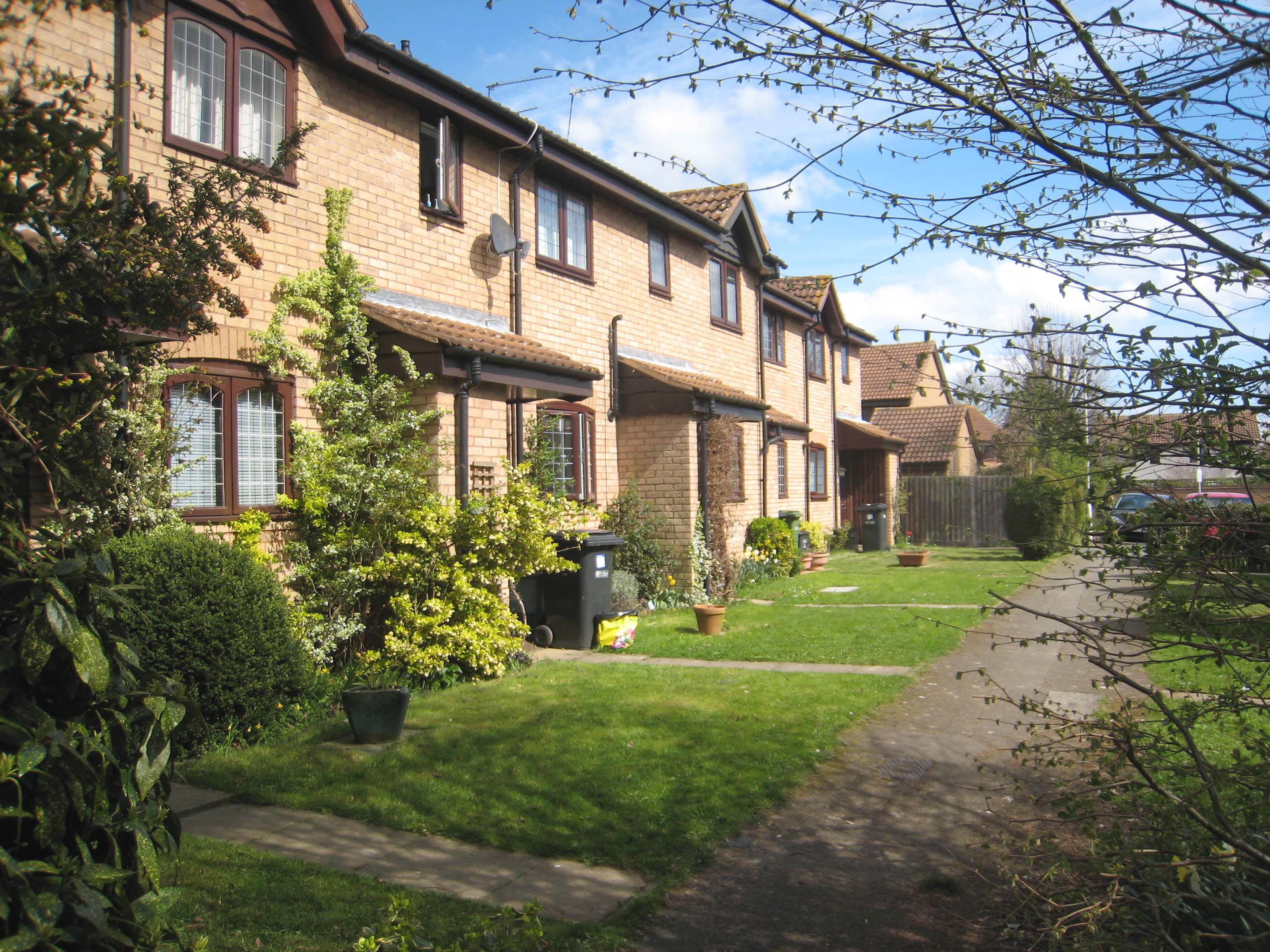
Marshalswick is a suburban area located in the county of Hertfordshire, England. Situated approximately three miles northeast of the city center of St Albans, Marshalswick is a predominantly residential area known for its peaceful atmosphere and family-friendly environment.

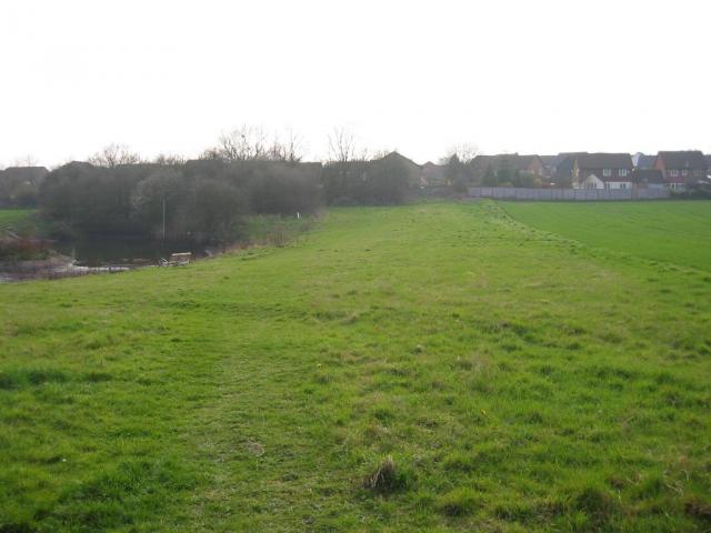
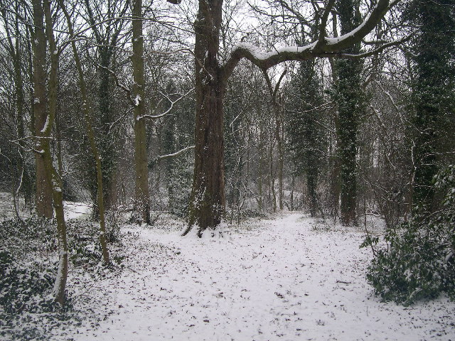
The area is characterized by its leafy streets and well-maintained houses, which range from post-war semi-detached properties to more modern detached homes. Marshalswick benefits from its close proximity to open green spaces, including the picturesque Jersey Farm Woodland Park, which offers residents the opportunity to enjoy outdoor activities and leisurely walks.

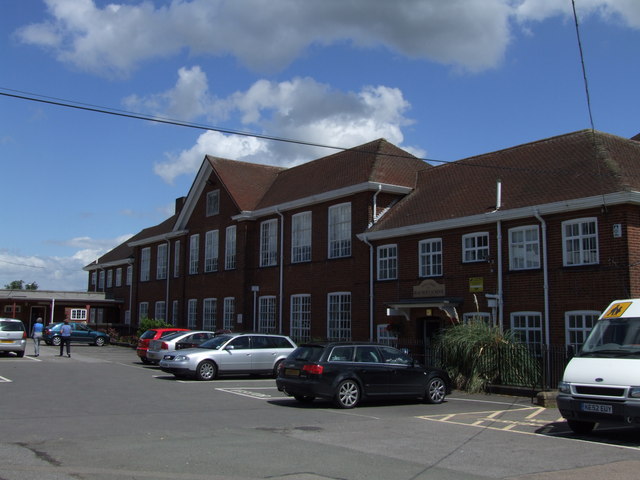
Marshalswick is also home to a range of amenities and facilities that cater to the needs of its residents. The Quadrant shopping center, located nearby, provides a variety of shops, supermarkets, and eateries, ensuring that residents have easy access to everyday essentials. Additionally, there are several schools in the area, including Marshalswick Primary School and Sandringham School, which are highly regarded for their academic achievements.

Transport links in Marshalswick are convenient, with regular bus services connecting the area to St Albans city center and surrounding areas. The nearby M1 and M25 motorways also provide easy access to London and other major cities in the region.

Overall, Marshalswick offers a tranquil and family-oriented lifestyle, with its pleasant surroundings, good schools, and convenient amenities making it an attractive place to live in Hertfordshire.

If you have any feedback on the listing, please let us know in the comments section below.
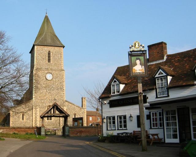
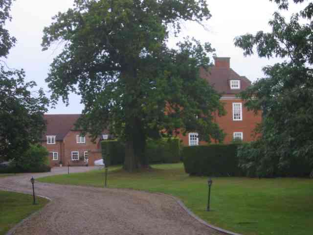
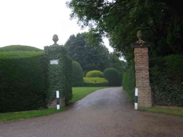
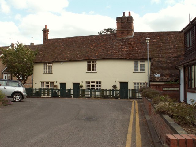
Marshalswick Images

Images are sourced within 2km of 51.764131/-0.30812211 or Grid Reference TL1608. Thanks to Geograph Open Source API. All images are credited.

The Green Man, Sandridge
High Street, Sandridge
Sandridge : "Green Man" public house
Sandridge : village shop Grade II listed - <span class="nowrap"><a title="https://historicengland.org.uk/listing/the-list/list-entry/1308275?section=official-list-entry" rel="nofollow ugc noopener" href="https://historicengland.org.uk/listing/the-list/list-entry/1308275?section=official-list-entry">Link</a><img style="margin-left:2px;" alt="External link" title="External link - shift click to open in new window" src="https://s1.geograph.org.uk/img/external.png" width="10" height="10"/></span>.
Sandridge : village shop
Grade II listed - LinkExternal link.
Sandridge : "Queens Head" public house Grade II listed - <span class="nowrap"><a title="https://historicengland.org.uk/listing/the-list/list-entry/1102874?section=official-list-entry" rel="nofollow ugc noopener" href="https://historicengland.org.uk/listing/the-list/list-entry/1102874?section=official-list-entry">Link</a><img style="margin-left:2px;" alt="External link" title="External link - shift click to open in new window" src="https://s1.geograph.org.uk/img/external.png" width="10" height="10"/></span>.
Sandridge : "Queens Head" public house
Grade II listed - LinkExternal link.
Sandridge : Queens Head and flag
Sandridge : Church of St Leonard Grade II* listed church : description at this <span class="nowrap"><a title="https://historicengland.org.uk/listing/the-list/list-entry/1308298?section=official-list-entry" rel="nofollow ugc noopener" href="https://historicengland.org.uk/listing/the-list/list-entry/1308298?section=official-list-entry">Link</a><img style="margin-left:2px;" alt="External link" title="External link - shift click to open in new window" src="https://s1.geograph.org.uk/img/external.png" width="10" height="10"/></span>.
Sandridge : Church of St Leonard
Grade II* listed church : description at this LinkExternal link.
Sandridge : lych-gate to Church of St Leonard "Built 1920, dedicated as a war memorial 1921" - <span class="nowrap"><a title="https://historicengland.org.uk/listing/the-list/list-entry/1102872?section=official-list-entry" rel="nofollow ugc noopener" href="https://historicengland.org.uk/listing/the-list/list-entry/1102872?section=official-list-entry">Link</a><img style="margin-left:2px;" alt="External link" title="External link - shift click to open in new window" src="https://s1.geograph.org.uk/img/external.png" width="10" height="10"/></span>.
Sandridge : lych-gate to Church of St Leonard
"Built 1920, dedicated as a war memorial 1921" - LinkExternal link.
St Leonard's church, Sandridge Looking East from TL171106 to St Leonard's church (with a steeple).
St Leonard's church, Sandridge
Looking East from TL171106 to St Leonard's church (with a steeple).
Fairshot Court in Woodcockhill Sandridge The gates were shut and barred but with no fence alongside the gate posts.
Fairshot Court in Woodcockhill Sandridge
The gates were shut and barred but with no fence alongside the gate posts.
Entrance gates, Sandridgebury Entrance gate on the lane leading to Sandridgebury Farm, though not the entrance to the farm.
Entrance gates, Sandridgebury
Entrance gate on the lane leading to Sandridgebury Farm, though not the entrance to the farm.
A row of old terraced houses by Sandridge church
Pond on NE fringe of Marshalswick Looking South-Westish across the pond at TL177097 toward the NE fringe of Marshalswick. Road to Sandridge is behind you.
Pond on NE fringe of Marshalswick
Looking South-Westish across the pond at TL177097 toward the NE fringe of Marshalswick. Road to Sandridge is behind you.
View East from Nashe's Farm This is about as exciting as this square km of farmland gets.
Taken looking East-with-a-hint-of-North from the bridleway at TL182096 just South of Nashe's Farm.
Visible at right is the wood (centred at TL187096) and at left the buildings on the map at TL185098.
View East from Nashe's Farm
This is about as exciting as this square km of farmland gets. Taken looking East-with-a-hint-of-North from the bridleway at TL182096 just South of Nashe's Farm. Visible at right is the wood (centred at TL187096) and at left the buildings on the map at TL185098.
Beech Bottom Dyke Iron Age earthwork in the middle of an urban area.
Beech Bottom Dyke
Iron Age earthwork in the middle of an urban area.
Church, now used as art centre The church at TL175068 has been converted into an arts centre / theatre sort of thing.
Church, now used as art centre
The church at TL175068 has been converted into an arts centre / theatre sort of thing.
Oaklands College The main admin building of Oaklands College Smallford campus - just East of St Albans
Oaklands College
The main admin building of Oaklands College Smallford campus - just East of St Albans
RUPP through Bentsley spinney, Marshalswick (Road Used as a Public Path) TL1609 has changed dramatically since the 30s. Post war housing now dominates land use in the SE of the square, newer housing to the SW and W, schools and community open space to the north.

Happily there remain several green spaces, including Bentsley Spinney at the west edge of the square. Bentsey Spinney used to be used for gravel extraction, deressions due to gravel pit existing in the Spinney.

TL1609.. a nice place to live...
RUPP through Bentsley spinney, Marshalswick
(Road Used as a Public Path) TL1609 has changed dramatically since the 30s. Post war housing now dominates land use in the SE of the square, newer housing to the SW and W, schools and community open space to the north. Happily there remain several green spaces, including Bentsley Spinney at the west edge of the square. Bentsey Spinney used to be used for gravel extraction, deressions due to gravel pit existing in the Spinney. TL1609.. a nice place to live...
Show me another place!

Marshalswick is located at Grid Ref: TL1608 (Lat: 51.764131, Lng: -0.30812211)

Administrative County: Hertfordshire

District: St. Albans

Police Authority: Hertfordshire

What 3 Words

///change.parks.mason. Near St Albans, Hertfordshire

Nearby Locations

Marshalswick

Related Wikis

Marshalswick

Marshalswick is a suburb of St Albans in Hertfordshire, England, located around 1.5 miles northeast of the city centre. The area was developed from the...

The Wick Local Nature Reserve

The Wick is a 3.4 hectare Local Nature Reserve in St Albans in Hertfordshire. It is owned and managed by St Albans City Council. It is also designated...

Sandringham School

Sandringham School is a secondary school with academy status in Marshalswick, St Albans, Hertfordshire. It was established in 1988 following a merger of...

Jersey Farm

Jersey Farm is a residential neighbourhood in the civil parish of Sandridge centred 1.5 miles (2.4 km) north-east of the city centre of St Albans. It is...

Verulam School

Verulam School is an 11–18 boys state–funded secondary school with academy status in St Albans, Hertfordshire, England, founded in 1938 as St Albans Boys...

Beaumont School, St Albans

Beaumont School is a coeducational secondary school and sixth form with academy status, located in St Albans, Hertfordshire, England. It was founded in...
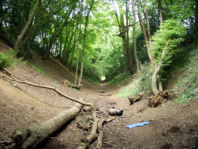
Beech Bottom Dyke

Beech Bottom Dyke, is a large ditch running for almost a mile at the northern edge of St Albans, Hertfordshire flanked by banks on both sides. It is up...

Campaign for Real Ale

The Campaign for Real Ale (CAMRA) is an independent voluntary consumer organisation headquartered in St Albans, England, which promotes real ale, cider...

Nearby Amenities

Located within 500m of 51.764131,-0.30812211
Traffic Signals
Traffic Signals: traffic_lights
Traffic Signals Direction: both
Lat/Long: 51.7598484/-0.3073976
Mini Roundabout
Direction: clockwise
Lat/Long: 51.7634497/-0.3076608
Post Box
Brand: Royal Mail
Brand Wikidata: Q638098
Brand Wikipedia: en:Royal Mail
Collection Times: Mo-Fr 09:00, Sa 07:00
Operator: Royal Mail
Operator Wikidata: Q638098
Post Box Type: pillar
Ref: AL1 139D
Royal Cypher: GR
Royal Cypher Wikidata: Q33102273
Lat/Long: 51.7642294/-0.3124489
Crossing
Crossing: zebra
Crossing Island: no
Tactile Paving: yes
Lat/Long: 51.763473/-0.3064889
Noexit: yes
Lat/Long: 51.762903/-0.3055118
Crossing
Crossing: unmarked
Lat/Long: 51.7638914/-0.3011653
Marshalswick
Place: suburb
Population: 7338
Wikidata: Q6773885
Wikipedia: en:Marshalswick
Lat/Long: 51.7675435/-0.3063565
Traffic Calming: table
Lat/Long: 51.765522/-0.3074475
Mini Roundabout
Direction: clockwise
Lat/Long: 51.7642035/-0.3081493
Fuel
Sainsbury's
Brand: Sainsbury's
Brand Wikidata: Q152096
Brand Wikipedia: en:Sainsbury's
Website: https://stores.sainsburys.co.uk/1513/marshalswick-petrol-station
Lat/Long: 51.7631034/-0.30746
Traffic Calming: table
Lat/Long: 51.7654263/-0.3074932
Traffic Calming: table
Lat/Long: 51.767394/-0.3063119
Post Box
Brand: Royal Mail
Brand Wikidata: Q638098
Brand Wikipedia: en:Royal Mail
Operator: Royal Mail
Operator Wikidata: Q638098
Post Box Type: pillar
Ref: AL4 259
Royal Cypher: EIIR
Royal Cypher Wikidata: Q33102113
Lat/Long: 51.7641897/-0.307165
Post Office
Marshalswick Post Office
Addr Country: GB
Addr Postcode: AL4 9RB
Brand: Post Office
Brand Wikidata: Q1783168
Brand Wikipedia: en:Post Office Ltd
Contact Website: https://www.postoffice.co.uk/branch-finder/1160338/marshalswick
Ref Pol Id: 18832
Lat/Long: 51.7642097/-0.3071422
Pharmacy
Quadrant Pharmacy
Addr City: St Albans
Addr Housenumber: 17
Addr Postcode: AL4 9RB
Addr Street: The Quadrant
Healthcare: pharmacy
Operator: Quadrant Pharmacies
Phone: +44 1727 851013
Website: https://www.quadrantpharmacy.co.uk/
Lat/Long: 51.7644144/-0.3074451
Bicycle Parking
Quadrant Central
Bicycle Parking: stands
Capacity: 6
Covered: no
Lat/Long: 51.7640395/-0.3070906
Bicycle Parking
Quadrant north
Bicycle Parking: stands
Capacity: 6
Covered: no
Lat/Long: 51.7643179/-0.3079637
Recycling
Recycling Cans: yes
Recycling Clothes: yes
Recycling Glass Bottles: yes
Recycling Newspaper: yes
Recycling Paper: yes
Recycling Plastic Bottles: yes
Lat/Long: 51.763149/-0.306341
Bicycle Parking
Quadrant South
Bicycle Parking: stands
Capacity: 6
Covered: no
Lat/Long: 51.7636354/-0.3070104
Budgens
Brand: Budgens
Brand Wikidata: Q4985016
Brand Wikipedia: en:Budgens
Shop: supermarket
Website: https://www.budgens.co.uk/our-stores/st-albans
Lat/Long: 51.7641633/-0.3070055
Fast Food
The Ridgeway Fish Bar
Addr City: St Albans
Addr Housenumber: 7
Addr Postcode: AL4 9RA
Addr Street: The Quadrant
Cuisine: fish_and_chips
Drive Through: no
Fhrs Authority: St Albans City
Fhrs Id: 305984
Lat/Long: 51.7647628/-0.3076167
Bus Stop
Barnfield Road
Bus: yes
Naptan AtcoCode: 210021501980
Naptan Bearing: W
Naptan CommonName: Barnfield Road
Naptan Crossing: opp Hazlemere Road
Naptan Indicator: nr
Naptan Landmark: opp Hazlemere Road
Naptan NaptanCode: hrtdagat
Naptan PlusbusZoneRef: STALBCY
Naptan ShortCommonName: NA
Naptan Street: The Ridgeway
Naptan Verified: no
Public Transport: platform
Source: naptan_import
Lat/Long: 51.7639061/-0.3009132
Bus Stop
The Quadrant
Bench: yes
Bus: yes
Naptan AtcoCode: 210021502000
Naptan Bearing: W
Naptan CommonName: The Quadrant
Naptan Indicator: opp
Naptan Landmark: Unknown
Naptan NaptanCode: hrtdagaw
Naptan PlusbusZoneRef: STALBCY
Naptan ShortCommonName: NA
Naptan Street: The Ridgeway
Naptan Verified: yes
Public Transport: platform
Shelter: yes
Source: naptan_import;survey
Tactile Paving: yes
Lat/Long: 51.7634287/-0.3058439
Bus Stop
Skys Wood Road Terminus
Bench: no
Bus: yes
Naptan AtcoCode: 210021502020
Naptan Bearing: SE
Naptan CommonName: Skys Wood Road Terminus
Naptan Crossing: Sherwood Avenue
Naptan Indicator: adj
Naptan Landmark: Sherwood Avenue
Naptan NaptanCode: hrtdagda
Naptan PlusbusZoneRef: STALBCY
Naptan ShortCommonName: NA
Naptan Street: Skys Wood Road
Naptan Verified: no
Public Transport: platform
Shelter: no
Source: naptan_import
Tactile Paving: no
Lat/Long: 51.7676178/-0.3066292
Bus Stop
Hazelmere Road
Bench: yes
Bus: yes
Local Ref: NR
Naptan AtcoCode: 210021502040
Naptan Bearing: SW
Naptan CommonName: Hazelmere Road
Naptan Crossing: opp Kingshill Avenue
Naptan Indicator: nr
Naptan Landmark: opp Kingshill Avenue
Naptan NaptanCode: hrtdadpw
Naptan PlusbusZoneRef: STALBCY
Naptan ShortCommonName: NA
Naptan Street: Sherwood Ave
Naptan Verified: no
Public Transport: platform
Shelter: yes
Source: naptan_import
Tactile Paving: no
Lat/Long: 51.7660986/-0.3071168
Bus Stop
Kingshill Avenue
Bench: no
Bin: no
Bus: yes
Lit: yes
Naptan AtcoCode: 210021502060
Naptan Bearing: NW
Naptan CommonName: Kingshill Avenue
Naptan Crossing: opp Queens Crescent
Naptan Indicator: W-bound
Naptan Landmark: opp Queens Crescent
Naptan NaptanCode: hrtdadta
Naptan PlusbusZoneRef: STALBCY
Naptan ShortCommonName: NA
Naptan Street: Kingshill Avenue
Naptan Verified: no
Public Transport: platform
Shelter: no
Source: naptan_import
Tactile Paving: no
Lat/Long: 51.7668839/-0.3109899
Bus Stop
Marshalswick Lane
Bench: yes
Bin: no
Bus: yes
Lit: yes
Naptan AtcoCode: 210021502070
Naptan Bearing: S
Naptan CommonName: Marshalswick Lane
Naptan Crossing: Kingshill Avenue
Naptan Indicator: adj
Naptan Landmark: Kingshill Avenue
Naptan NaptanCode: hrtdadtd
Naptan PlusbusZoneRef: STALBCY
Naptan ShortCommonName: NA
Naptan Street: The Ridgeway
Naptan Verified: no
Public Transport: platform
Shelter: yes
Source: naptan_import
Tactile Paving: no
Lat/Long: 51.7667025/-0.3140111
Bus Stop
Sandpit Lane
Bench: no
Bus: yes
Naptan AtcoCode: 210021502155
Naptan Bearing: N
Naptan CommonName: Sandpit Lane
Naptan Crossing: Sandpit Lane
Naptan Indicator: N-bound
Naptan Landmark: Sandpit Lane
Naptan NaptanCode: hrtdadmd
Naptan PlusbusZoneRef: STALBCY
Naptan ShortCommonName: NA
Naptan Street: Marshalswick Lane
Naptan Verified: no
Public Transport: platform
Shelter: no
Source: naptan_import
Tactile Paving: no
Lat/Long: 51.7606286/-0.3076595
Bus Stop
Beechwood Ave
Bench: yes
Bus: yes
Lit: no
Naptan AtcoCode: 210021502160
Naptan Bearing: W
Naptan CommonName: Beechwood Ave
Naptan Crossing: opp Marshalswick Lane
Naptan Indicator: adj
Naptan Landmark: opp Marshalswick Lane
Naptan NaptanCode: hrtdadmg
Naptan PlusbusZoneRef: STALBCY
Naptan ShortCommonName: NA
Naptan Street: Sandpit Lane
Naptan Verified: no
Public Transport: platform
Shelter: yes
Source: naptan_import
Tactile Paving: no
Lat/Long: 51.7597583/-0.3079049
Bus Stop
Beechwood Ave
Bus: yes
Naptan AtcoCode: 210021509650
Naptan Bearing: E
Naptan CommonName: Beechwood Ave
Naptan Crossing: Rose Walk
Naptan Indicator: opp
Naptan Landmark: Rose Walk
Naptan NaptanCode: hrtgtjdg
Naptan PlusbusZoneRef: STALBCY
Naptan ShortCommonName: NA
Naptan Street: Sandpit Lane
Naptan Verified: no
Public Transport: platform
Source: naptan_import
Lat/Long: 51.7599602/-0.3059286
Bus Stop
Pondfield Crescent
Bus: yes
Naptan AtcoCode: 210021509760
Naptan Bearing: NE
Naptan CommonName: Pondfield Crescent
Naptan Crossing: Kingshill Avenue
Naptan Indicator: N-bound
Naptan Landmark: Kingshill Avenue
Naptan NaptanCode: hrtatpam
Naptan PlusbusZoneRef: STALBCY
Naptan ShortCommonName: NA
Naptan Street: Pondfield Crescent
Naptan Verified: no
Public Transport: platform
Source: naptan_import
Lat/Long: 51.7674841/-0.3117254
Bus Stop
The Quadrant
Bench: yes
Bus: yes
Naptan AtcoCode: 210021509800
Naptan Bearing: E
Naptan CommonName: The Quadrant
Naptan Indicator: nr
Naptan Landmark: Unknown
Naptan NaptanCode: hrtatpap
Naptan PlusbusZoneRef: STALBCY
Naptan ShortCommonName: NA
Naptan Street: The Ridgeway
Naptan Verified: yes
Public Transport: platform
Shelter: no
Source: naptan_import;survey
Tactile Paving: yes
Lat/Long: 51.7635359/-0.305603
Bus Stop
Barnfield Road
Bus: yes
Naptan AtcoCode: 210021509820
Naptan Bearing: E
Naptan CommonName: Barnfield Road
Naptan Crossing: Hazelmere Road
Naptan Indicator: opp
Naptan Landmark: Hazelmere Road
Naptan NaptanCode: hrtatpat
Naptan PlusbusZoneRef: STALBCY
Naptan ShortCommonName: NA
Naptan Street: The Ridgeway
Naptan Verified: no
Public Transport: platform
Source: naptan_import
Lat/Long: 51.7637867/-0.3020332
Post Box
Brand: Royal Mail
Brand Wikidata: Q638098
Brand Wikipedia: en:Royal Mail
Collection Times: Mo-Fr 09:00, Sa 07:00
Operator: Royal Mail
Operator Wikidata: Q638098
Post Box Type: pillar
Ref: AL1 94D
Royal Cypher: GR
Royal Cypher Wikidata: Q33102273
Lat/Long: 51.7597489/-0.3088639
Atm
Cash In: no
Drive Through: no
Lat/Long: 51.7629611/-0.3072846
Traffic Calming: hump
Lat/Long: 51.763552/-0.3015308
Traffic Calming: table
Lat/Long: 51.766688/-0.3068605
Fast Food
KFC
Addr City: St Albans
Addr Housenumber: 1
Addr Postcode: AL4 9RA
Addr Street: The Quadrant
Alt Name: Kentucky Fried Chicken
Brand: KFC
Brand Wikidata: Q524757
Brand Wikipedia: en:KFC
Contact Website: https://www.kfc.co.uk/kfc-near-me/marshalswick-quadrant
Cuisine: chicken
Drive Through: no
Fhrs Authority: St Albans City
Fhrs Id: 305976
Takeaway: yes
Lat/Long: 51.7648905/-0.3075445
Traffic Calming: hump
Lat/Long: 51.7682609/-0.305436
Noexit: yes
Lat/Long: 51.763022/-0.3055117
Traffic Calming: island
Lat/Long: 51.7649458/-0.3096296
Crossing
Crossing: marked
Crossing Island: no
Crossing Markings: zebra
Crossing Ref: zebra
Tactile Paving: yes
Lat/Long: 51.7626036/-0.307852
Traffic Calming: island
Lat/Long: 51.7637362/-0.3077424
Crossing
Crossing: marked
Crossing Island: no
Crossing Ref: zebra
Tactile Paving: yes
Lat/Long: 51.7645503/-0.3079122
Barrier: bollard
Bollard: fixed
Lat/Long: 51.7651381/-0.3126627
Barrier: bollard
Bollard: fixed
Lat/Long: 51.765885/-0.3120845
Barrier: bollard
Bollard: fixed
Lat/Long: 51.7645686/-0.3131036
Restaurant
DavVero
Addr City: St Albans
Addr Housenumber: 9
Addr Postcode: AL4 9RA
Addr Street: The Quadrant
Capacity: 50
Cuisine: italian
Fhrs Authority: St Albans City
Fhrs Id: 1111105
Lat/Long: 51.7647146/-0.307639
Phoenix Barber Co.
Description: Barber's Shop
Shop: hairdresser
Lat/Long: 51.7636436/-0.3055955
Fast Food
Subway
Addr City: St Albans
Addr Housenumber: 11
Addr Postcode: AL4 9RB
Addr Street: The Quadrant
Brand: Subway
Brand Wikidata: Q244457
Brand Wikipedia: en:Subway (restaurant)
Contact Website: https://restaurants.subway.com/united-kingdom/en/st-albans/11-12-the-quadrant
Cuisine: sandwich
Fhrs Authority: St Albans City
Fhrs Id: 1253155
Takeaway: yes
Lat/Long: 51.764497/-0.3076927
Communication Mobile Phone: yes
Man Made: mast
Tower Construction: freestanding
Tower Type: communication
Lat/Long: 51.7631118/-0.307125
Communication Mobile Phone: yes
Man Made: mast
Operator: O2
Tower Construction: freestanding
Tower Type: communication
Lat/Long: 51.7640714/-0.3079072
Direction: 205
Generator Method: photovoltaic
Generator Output Electricity: yes
Generator Solar Modules: 16
Generator Source: solar
Generator Type: solar_photovoltaic_panel
Location: roof
Power: generator
Lat/Long: 51.7658024/-0.3123715
Direction: 215
Generator Method: photovoltaic
Generator Output Electricity: yes
Generator Solar Modules: 8
Generator Source: solar
Generator Type: solar_photovoltaic_panel
Location: roof
Power: generator
Lat/Long: 51.7657259/-0.3108682
Argos
Operator: Argos
Shop: outpost
Lat/Long: 51.7628843/-0.3073166
Bench
Lat/Long: 51.763533/-0.3061766
Bench
Lat/Long: 51.7635268/-0.3064603
Bench
Backrest: yes
Lat/Long: 51.763518/-0.3073763
Bench
Backrest: yes
Lat/Long: 51.7635247/-0.3071865
Bicycle Parking
Bicycle Parking: stands
Capacity: 6
Covered: no
Lat/Long: 51.7635101/-0.3070852
Barrier: height_restrictor
Maxheight: 2.1 m
Lat/Long: 51.7635896/-0.3070694
Barrier: height_restrictor
Maxheight: 2.1 m
Lat/Long: 51.7636104/-0.3070393
Bench
Lat/Long: 51.7635434/-0.3056483
Bench
Lat/Long: 51.7635429/-0.3057401
Waste Basket
Waste: trash
Lat/Long: 51.7635918/-0.30571
Veterinary
Marshalswick Veterinary Surgery
Lat/Long: 51.7636471/-0.3055168
The Calling Cobbler
Shop: shoe_repair
Lat/Long: 51.7636438/-0.3056322
Phillips
Shop: funeral_directors
Lat/Long: 51.7636396/-0.3057126
Cafe
Fade to Black
Addr City: St Albans
Addr Housenumber: 65
Addr Postcode: AL4 9RD
Addr Street: The Quadrant
Fhrs Authority: St Albans City
Fhrs Id: 1111104
Lat/Long: 51.7636388/-0.3057938
Eyes on St Albans
Shop: optician
Lat/Long: 51.7636384/-0.3058675
Barrier: height_restrictor
Maxheight: 2.1 m
Lat/Long: 51.7643479/-0.307801
Barrier: height_restrictor
Maxheight: 2.1 m
Lat/Long: 51.7643292/-0.3078394
Bradford and Howley
Office: estate_agent
Lat/Long: 51.7648025/-0.3075855
Crossing
Button Operated: yes
Crossing: traffic_signals
Crossing Island: yes
Tactile Paving: yes
Lat/Long: 51.7597412/-0.3073716
Direction: 205
Generator Method: photovoltaic
Generator Output Electricity: yes
Generator Solar Modules: 6
Generator Source: solar
Generator Type: solar_photovoltaic_panel
Location: roof
Power: generator
Lat/Long: 51.7632409/-0.3119154
Direction: 205
Generator Method: photovoltaic
Generator Output Electricity: yes
Generator Solar Modules: 9
Generator Source: solar
Generator Type: solar_photovoltaic_panel
Location: roof
Power: generator
Lat/Long: 51.7636745/-0.3115733
Direction: 120
Generator Method: photovoltaic
Generator Output Electricity: yes
Generator Solar Modules: 7
Generator Source: solar
Generator Type: solar_photovoltaic_panel
Location: roof
Power: generator
Lat/Long: 51.7620923/-0.3073633
Direction: 210
Generator Method: photovoltaic
Generator Output Electricity: yes
Generator Solar Modules: 16
Generator Source: solar
Generator Type: solar_photovoltaic_panel
Location: roof
Power: generator
Lat/Long: 51.7621102/-0.3074825
Traffic Calming: island
Lat/Long: 51.7623738/-0.3080198
Direction: 210
Generator Method: photovoltaic
Generator Output Electricity: yes
Generator Solar Modules: 15
Generator Source: solar
Generator Type: solar_photovoltaic_panel
Location: roof
Power: generator
Lat/Long: 51.7640634/-0.3140241
Direction: 180
Generator Method: photovoltaic
Generator Output Electricity: yes
Generator Solar Modules: 16
Generator Source: solar
Generator Type: solar_photovoltaic_panel
Location: roof
Power: generator
Lat/Long: 51.7624972/-0.3070186
Direction: 190
Generator Method: photovoltaic
Generator Output Electricity: yes
Generator Solar Modules: 39
Generator Source: solar
Generator Type: solar_photovoltaic_panel
Location: roof
Power: generator
Lat/Long: 51.7631616/-0.3068115
Crossing
Crossing: unmarked
Lat/Long: 51.7634669/-0.306805
Traffic Calming: island
Lat/Long: 51.7641227/-0.30806
Crossing
Crossing: unmarked
Crossing Island: yes
Tactile Paving: yes
Lat/Long: 51.7642703/-0.3080619
Traffic Calming: island
Lat/Long: 51.7645891/-0.3089156
Direction: 210
Generator Method: photovoltaic
Generator Output Electricity: yes
Generator Solar Modules: 14`
Generator Source: solar
Generator Type: solar_photovoltaic_panel
Location: roof
Power: generator
Lat/Long: 51.7653931/-0.3112227
Direction: 210
Generator Method: photovoltaic
Generator Output Electricity: yes
Generator Solar Modules: 20
Generator Source: solar
Generator Type: solar_photovoltaic_panel
Location: roof
Power: generator
Lat/Long: 51.7655152/-0.3115081
Crossing
Crossing: unmarked
Lat/Long: 51.7637484/-0.3019207
Direction: 220
Generator Method: photovoltaic
Generator Output Electricity: yes
Generator Solar Modules: 12
Generator Source: solar
Generator Type: solar_photovoltaic_panel
Location: roof
Power: generator
Lat/Long: 51.766152/-0.309783
Direction: 210
Generator Method: photovoltaic
Generator Output Electricity: yes
Generator Solar Modules: 11
Generator Source: solar
Generator Type: solar_photovoltaic_panel
Location: roof
Power: generator
Lat/Long: 51.7659649/-0.3082917
Direction: 215
Generator Method: photovoltaic
Generator Output Electricity: yes
Generator Solar Modules: 7
Generator Source: solar
Generator Type: solar_photovoltaic_panel
Location: roof
Power: generator
Lat/Long: 51.76603/-0.3084645
Direction: 125
Generator Method: photovoltaic
Generator Output Electricity: yes
Generator Solar Modules: 7
Generator Source: solar
Generator Type: solar_photovoltaic_panel
Location: roof
Power: generator
Lat/Long: 51.7660399/-0.3083839
Direction: 195
Generator Method: photovoltaic
Generator Output Electricity: yes
Generator Solar Modules: 60
Generator Source: solar
Generator Type: solar_photovoltaic_panel
Location: roof
Power: generator
Lat/Long: 51.7654126/-0.3071378
Direction: 210
Generator Method: photovoltaic
Generator Output Electricity: yes
Generator Solar Modules: 9
Generator Source: solar
Generator Type: solar_photovoltaic_panel
Location: roof
Power: generator
Lat/Long: 51.7666241/-0.308283
Direction: 210
Generator Method: photovoltaic
Generator Output Electricity: yes
Generator Solar Modules: 9
Generator Source: solar
Generator Type: solar_photovoltaic_panel
Location: roof
Power: generator
Lat/Long: 51.7666538/-0.3088665
Direction: 210
Generator Method: photovoltaic
Generator Output Electricity: yes
Generator Solar Modules: 9
Generator Source: solar
Generator Type: solar_photovoltaic_panel
Location: roof
Power: generator
Lat/Long: 51.7684172/-0.3085465
Generator Method: photovoltaic
Generator Output Electricity: yes
Generator Solar Modules: 9
Generator Source: solar
Generator Type: solar_photovoltaic_panel
Location: roof
Power: generator
Tilted: no
Lat/Long: 51.7683882/-0.3085664
Direction: 210
Generator Method: photovoltaic
Generator Output Electricity: yes
Generator Solar Modules: 9
Generator Source: solar
Generator Type: solar_photovoltaic_panel
Location: roof
Power: generator
Lat/Long: 51.768254/-0.308076
Direction: 210
Generator Method: photovoltaic
Generator Output Electricity: yes
Generator Solar Modules: 7
Generator Source: solar
Generator Type: solar_photovoltaic_panel
Location: roof
Power: generator
Lat/Long: 51.7681569/-0.3078376
Direction: 120
Generator Method: photovoltaic
Generator Output Electricity: yes
Generator Solar Modules: 14
Generator Source: solar
Generator Type: solar_photovoltaic_panel
Location: roof
Power: generator
Lat/Long: 51.7661054/-0.3074016
Turning Circle
Lat/Long: 51.7676206/-0.3045783
Direction: 210
Generator Method: photovoltaic
Generator Output Electricity: yes
Generator Solar Modules: 910
Generator Source: solar
Generator Type: solar_photovoltaic_panel
Location: roof
Power: generator
Lat/Long: 51.7663669/-0.3042918
Direction: 200
Generator Method: photovoltaic
Generator Output Electricity: yes
Generator Solar Modules: 4
Generator Source: solar
Generator Type: solar_photovoltaic_panel
Location: roof
Power: generator
Lat/Long: 51.7622275/-0.3054725
Direction: 20
Generator Method: photovoltaic
Generator Output Electricity: yes
Generator Solar Modules: 12
Generator Source: solar
Generator Type: solar_photovoltaic_panel
Location: roof
Power: generator
Lat/Long: 51.7622599/-0.3054553
Direction: 110
Generator Method: photovoltaic
Generator Output Electricity: yes
Generator Solar Modules: 8
Generator Source: solar
Generator Type: solar_photovoltaic_panel
Location: roof
Power: generator
Lat/Long: 51.7623006/-0.3054604
Direction: 260
Generator Method: photovoltaic
Generator Output Electricity: yes
Generator Solar Modules: 8
Generator Source: solar
Generator Type: solar_photovoltaic_panel
Location: roof
Power: generator
Lat/Long: 51.762259/-0.3036795
Direction: 80
Generator Method: photovoltaic
Generator Output Electricity: yes
Generator Solar Modules: 8
Generator Source: solar
Generator Type: solar_photovoltaic_panel
Location: roof
Power: generator
Lat/Long: 51.7622652/-0.3036112
Direction: 260
Generator Method: photovoltaic
Generator Output Electricity: yes
Generator Solar Modules: 17
Generator Source: solar
Generator Type: solar_photovoltaic_panel
Location: roof
Power: generator
Lat/Long: 51.7625019/-0.302244
Direction: 270
Generator Method: photovoltaic
Generator Output Electricity: yes
Generator Solar Modules: 21
Generator Source: solar
Generator Type: solar_photovoltaic_panel
Location: roof
Power: generator
Lat/Long: 51.7615447/-0.303399
Library
Marshalswick Library
Addr Postcode: AL4 9TU
Wikidata: Q55111270
Lat/Long: 51.7631222/-0.3058024
Crossing
Crossing: unmarked
Crossing Island: no
Kerb: lowered
Tactile Paving: yes
Lat/Long: 51.7665489/-0.3141195
Crossing
Crossing Island: yes
Tactile Paving: yes
Lat/Long: 51.7634566/-0.307401
Crossing
Button Operated: yes
Crossing: traffic_signals
Crossing Island: no
Tactile Paving: yes
Lat/Long: 51.7598589/-0.3071984
Crossing
Button Operated: yes
Crossing: traffic_signals
Crossing Island: yes
Tactile Paving: yes
Lat/Long: 51.7599658/-0.3074227
Crossing
Button Operated: yes
Crossing: traffic_signals
Crossing Island: yes
Tactile Paving: yes
Lat/Long: 51.7598343/-0.3075879
Bus Stop
Jersey Lane
Bench: no
Bus: yes
Departures Board: timetable
Naptan AtcoCode: 210021509645
Naptan Bearing: S
Naptan BusStopType: MKD
Naptan CommonName: Jersey Lane
Naptan Indicator: nr
Naptan Landmark: Unknown
Naptan NaptanCode: hrtjajwp
Naptan PlusbusZoneRef: STALBCY
Naptan ShortCommonName: NA
Naptan Street: Marshalswick Lane
Naptan Verified: yes
Public Transport: platform
Shelter: no
Source: naptan_import;survey
Tactile Paving: no
Lat/Long: 51.7617945/-0.3077025
Barrier: bollard
Bollard: fixed
Colour: Black
Material: metal
Motor Vehicle: no
Lat/Long: 51.7625397/-0.3048034
The data included in this document is from www.openstreetmap.org. The data is made available under ODbL.

Have you been to Marshalswick?

Leave your review of Marshalswick below (or comments, questions and feedback).